
|
|
IBEXtrax.com - Olympic Mountains of Washington State
|
|
|
I guess it all started many years ago with the numerous family camping trips. Car camping, then tent camping, and then boat camping; it got me all involved in the outdoor scene. The next dose came from the Boy Scout experience. There were early trips up Mount Si near North Bend. Then there was the almost yearly pilgrimage to Deep Lake and then the traverse of the Olympic Mountains. This obsession with the mountains got so bad that I spent nearly every spare moment involving myself in gathering information or planning for my next trip. I educated myself by reading all the books on mountaineering that the local library had. But, the most remembered learning came from the School of Hard Knocks.
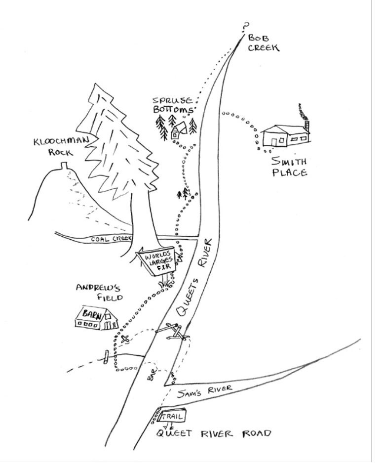
- High on the South Ridge of Kloochman Rock. - I peeked out from under my hail spattered rain poncho and looked up the wooded slope. In the heavy downpour I strained to possibly capture a view of Kloochman Rock through the sleet. I knew we must be close. But, Chris H, Shawn C and Lewis G were all for going back down. They had each edged away from me in hopes of not being persuaded to go up any higher. I took on the form of a contagious disease that wanted to bag this Olympic Mountains summit at any cost. They huddled together around Lewis' sputtering stove, trying their best to fight off the hypothermia. I thought, if only the weather would let up a little bit, we could go a little higher so I could see the summit rocks. But, such is the weather on the west side of the Olympic Mountains in the spring, or for that matter, any time of the year.
- A week before the Queets trip. - When Chris said he was going up the Queets River, I was overwhelmed with jealousy. I fought to maintain my composure while he told me of the excursion. As he explained how he and Shawn were leaving in a few days, I could see that he knew that I couldn't get the time off until the weekend. Chris saw that he was starting to get to me, so he let up with the torture a bit. But, I was a "Mountain Addict"; so I pelted him with questions to keep the conversation alive. The more we talked the more jealous I became. Then finally, with a need to be part of the trip, I half jokingly said that I would meet him at Bob Creek Shelter. Chris simply said O.K. and left. Later, while going over my maps, I discovered that it would take a long day to hike over fourteen miles up the Queets River to reach Bob Creek Shelter.
- Friday night: Queets River Road. - The trusty old Cortina jolted as it splashed through the first of many potholes. A short distance down the road Lewis was jolted awake were the pavement ended. Lewis had been dozing since we left the Kingston ferry, over one hundred miles ago. But now, wide awake and to his horror, Lewis looked past the fast beating windshield wipers to observe the jerky swerving method I was using to navigate the Cortina around the seemingly bottomless mud holes that flashed by in the headlights. I thought the method was working quite well. We were making good time. In some places the road was flooded. But, that was common along the Queets Corridor this time of year. Soon we arrived at the trailhead camp ground. Lewis and I worked together to set up the tent and cook dinner. It was after midnight when we finally crawled into our sleeping bags. The pitter-patter of rain on the tent roof quickly put us to sleep.
In the morning we had salty zoom and Astro eggs for breakfast. The rain had stopped, but a heavy mist still hung in the air. When the packs were packed, we pulled the car up to the trail sign and shouldered our packs. Just beyond the Trail Head sign, the bank fell away to the swift and muddy Sam's River. Two hundred yards downstream left, the Sam's and Queets rivers merged. We spotted a trail marker on the far side of the Queets. I noticed a fisherman in hip boots over by the marker. We watched as he came across the Queets and then the Sam's. Well, we didn't have hip boots. But, I remembered what I had read in Freedom of the Hills. It said something about stowing your boots and pants in your pack to keep them dry. I stowed my pants and socks, but I put my boots back on.
 I found a sturdy staff and started across the Sam's River. I picked a crossing place that was about fifty to sixty feet wide. The chilling water was knee deep and fairly swift. Because of the swiftness, knee deep became thigh deep. Halfway across, my sense of balance was being harassed by the fast moving water. Using the staff to form a tripod with my legs, I moved one appendage at a time. The cold water made my legs ache. When finally I was across, I hobbled around for a few moments trying to decide if I was ever going to walk again. I collapsed on a log and massaged some color back into my legs. When I noticed Lewis, he was in the middle, and looking very unsteady. I instructed him to look up to maintain his balance. When he surfaced to the bank where I sat, I remarked on the temperature of the water.
Well, one river down and one river to go. We limped over to the bank of the Queets River. I looked for the shallow spot and tried to remember what the fisherman had said about slanting across, so as to travel on the gravel bar where the water was most shallow. Lewis and I challenged and dared each other. But, all these preliminaries were mainly stall maneuvers. Neither of us wanted to go back into the water. But, it all came down to going ahead across the Queets River or re-crossing the swift moving Sam's River. My stalling was suddenly interrupted by Lewis, who charged off into the icy cold water. Not to be out done, I quickly followed.
The Queets River at this point in its journey to the Pacific Ocean is over one hundred feet wide. But, our oblique traverse across the river bar would double that distance. The depth on the bar was less than that of the Queets River proper. But, the foot placement needed to be exact, due to low adhesion of the wet hiking boot soles. The assortment of boulders under the surface made slow progress of our crossing. Halfway up the bar I had overtaken Lewis. Due to the doubt of my ability to withstand the numbing water, I hurried on. My feet were completely numb, due to there complete exposure, but my knees ached from nerve ends resisting to be subdued by the chilling water. The further I went the more doubtful I became. I was becoming frustrated because the river bank was only twenty feet to my left, but to keep in the shallow water I must travel double the distance. Finally I gave in and headed straight for the bank. The water level rose and I started to feel buoyant. For a brief moment I thought I would be swept away and felt sure I wouldn't make it. But, my self-preservation instinct overcame mere mortal fear. I limped out of the water and collapsed on the river bank .
I set aside my own worrisome adventures to view my companion, who had given in to the same fretting I had been overcome by. For Lewis had undertaken a path that would perhaps double my deep water crossing. Heroically struggling, he overcame his predicament and joined me on the river bank. As we "de-numbed" together, we discussed our crossing with gigantic accomplishment. Lewis was truly astounded by the fact that he had even attempted the crossing of the Queets River. As the life returned to my legs, I was taken to say that I enjoyed crossing rivers, perhaps for the same reason one would climb a mountain, or swing on a large trapeze out over a lake. I put back on my dry pants, thanking that I had read Freedom of the Hills. But, I put on my socks only to regret that they were quickly wetted from my boots. I vowed to bring other footwear next time I felt like conquering a river.
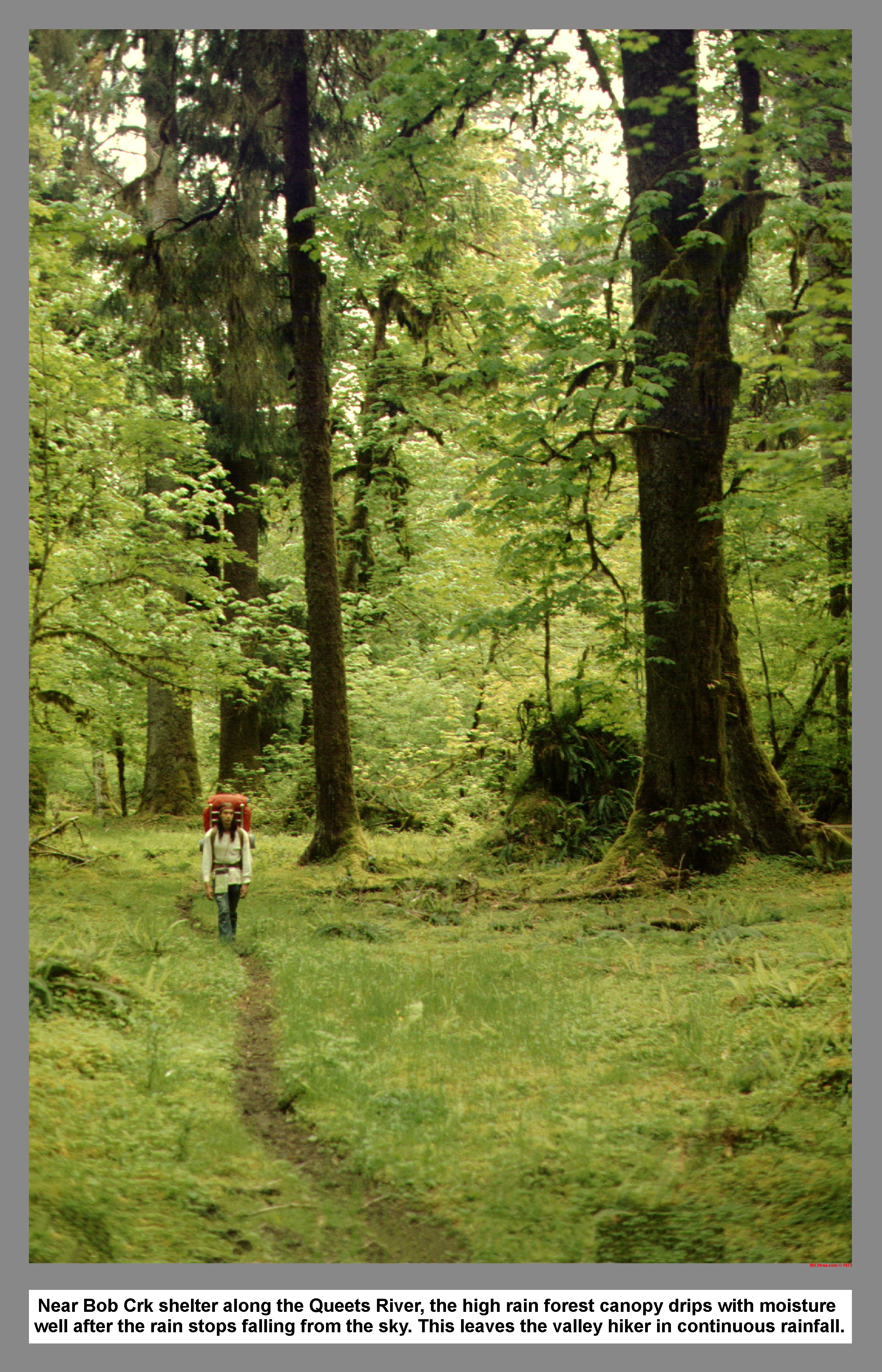
The mist had thickened as we hiked upstream from the crossing. So shortly after we left the river bank, we had to stop and put on our rain ponchos. The huge trees surrounding us were covered with thick moss and ferns. The hanging veil of lush vegetation collect moisture like a sponge, only to bombard the earth, or whatever was below, with large droplets. As we hiked on, our raingear was soon a shine with moisture.
After a quarter of a mile or so, we came upon another crossing of a lesser dimension. There was a creek of sorts that was bridged with a slimy log about seven feet long and a diameter of seven inches. I picked up a staff for support and stepped cautiously onto the log. I was astounded at the depth at which my staff sank into the muddy bottom. I reached the far side without incident, unlike my unlucky partner. Upon first setting foot on the slimy log, my warning was too late, for Lewis instantly slipped off, filling his boots with muddy water. From that moment on, Lewis was committed. So, he quickly sloshed across to keep from sinking deeper. After a change of socks, we continued toward our predetermined meeting with Chris.
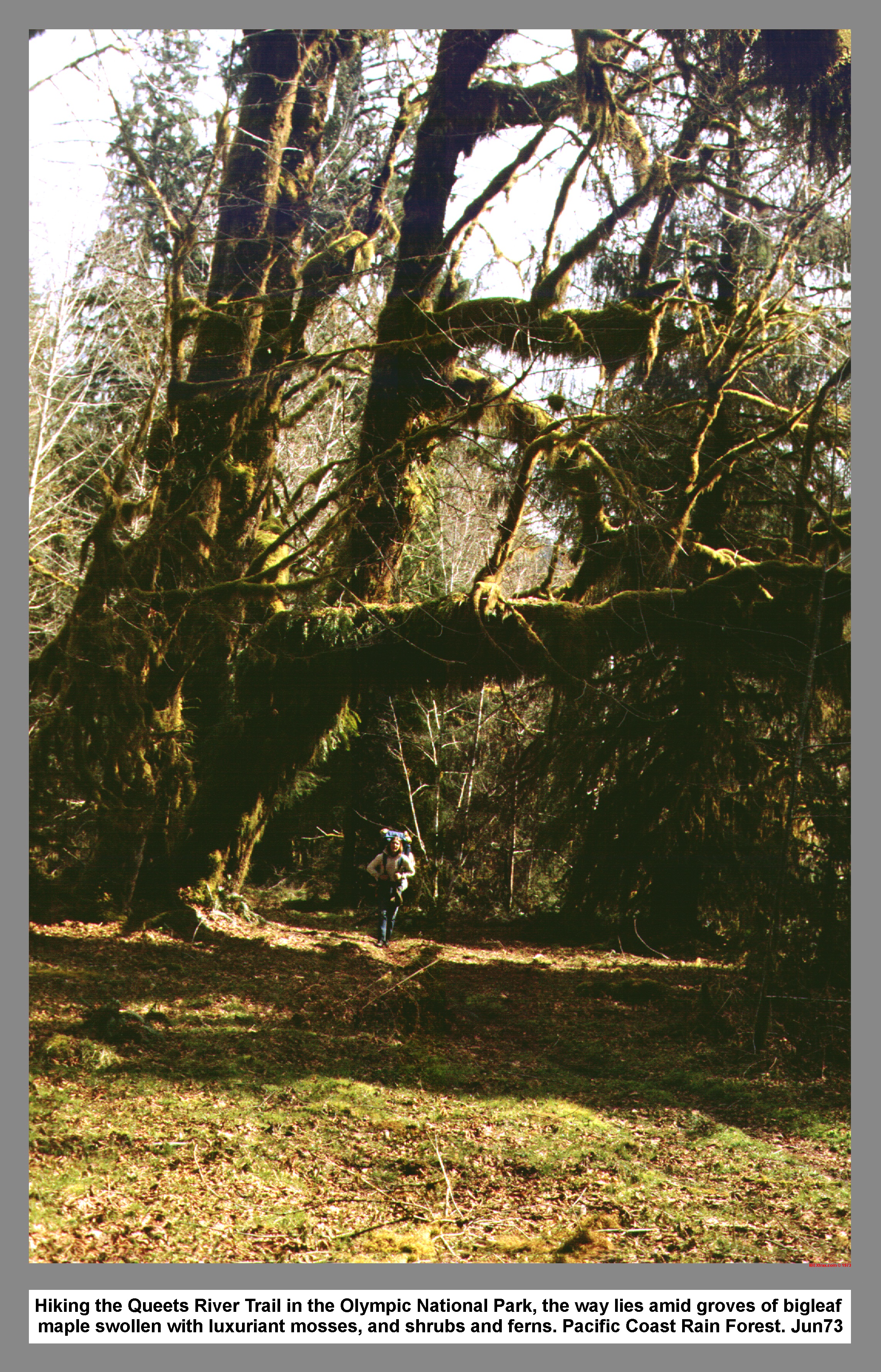
After an hour, and two more uneventful stream crossings, we came to an old wooden sign with the numeral two on it. Through past experience I knew that this meant, at one time, the distance between this sign and the trailhead was approximately two miles. The trail was relatively good, with only a few perilous mud ponds. While hiking one was constantly dodging and weaving due to the abundance of mud puddles. We passed through numerous groves of Big Leaf Maple. The trees were huge and covered with hanging moss. The moss was so thick that there would be small shrubs growing from the large clumps that hung from the trees. Where there was space for sunlight to filter through the high canopy of the larger trees above, the under brush was thick. The overcast sky and sections of thick second growth timber made the rain forest dark and gloomy.
The light started to grow, and soon we found ourselves in a large pasture. In the middle of the pasture sat an ageing barn. We followed the winding path up to the barn and stepped in, out of the rain. I sat down and rested in the hay, and Lewis explored the barn. I sipped from my Polly bottle and listened to the loft door creak. Outside, nailed to the barn, was a sign that announced Andrew's Field. Below the title it read Spruce Bottom three point seven miles. We decided to wait and eat lunch at Spruce Bottom Shelter. The Shelter would be the halfway point on the way to Bob Creek where we planned to meet Chris. We left Andrew's Field and hiked back into the gloom.
After passing through Upper Andrew's Field, the next stop was Coal Creek. We found a splintered sign and a trail to the left. We stashed and covered our packs out of sight of the trail and then went up the trail in search of the big fur described on the sign. With out the packs, we quickly covered the distance to the big tree. It was a big one alright and the sign attested: Largest recorded Douglas fur; Diameter seventeen feet; height two hundred twenty one feet. We went back to the packs and then hiked on toward Spruce Bottom. At the next fork in the trail, we picked the left fork trail to Spruce Bottom. The right path went to the lower crossing. About an hour later we arrived at the Spruce Bottom Shelter.
 Lewis and I ate a quick lunch and were packing up to leave when a young man with stringy blond hair came around the corner. He stopped dead in his tracks and looked surprised. I told him that he could have the shelter because we were just leaving. He responded by looking even more surprised. A seemingly long awkward moment passed until the stranger looked past me and said. "Hey Lewis, it's me, Shawn." Lewis, who had been strangely quiet until now, erupted into assorted inaudible sounds of greeting. I didn't feel too bad, not recognizing Shawn, since I had never been introduced to Chris's hiking partner before. I was interested where Chris was, so Shawn went on with a long complicated story about how he and Chris had been at the car earlier today. He seemed surprised because he thought Chris was at the shelter. He told us about the log jam about one mile above the Sam's-Queets junction. Shawn explained the he and Chris had left from Spruce Bottom that morning to meet Lewis and I at the Trail Head. They had taken the log jam going down, but they were separated when they saw the Cortina. Chris favored the bar crossing, and Shawn went back to the log jam. I asked about what time they were at the car and found that they had missed us by only half an hour. We had only one problem; where was Chris? We decided to wait for a half hour, and then go back to find Chris. I told Shawn of my plans to meet Chris at Bob Creek, but Shawn said that he was too tired to hike anymore that day.
 We waited for Chris for a time and then headed back down the trail to look for him. Fifteen minutes later we came across a lonely hiker, slowly waddling along. His hands were in his pockets and his hair was dripping wet. He didn't look up until we were nearly upon him. It was Chris, but it didn't look like Chris. We asked were he had been. He shrugged his shoulders and said that he had just been hiking. We walked back to the shelter at a fast pace. Lewis was in the lead. When we reached the shelter I dreaded the decision making. I was for going on to Bob Creek, Shawn was tired, and Lewis would do anything. When I asked Chris, there was a long discussion of questions, but few answers; The result was we would spend the night at Spruce Bottom. We sat around for a few hours doing nothing. Lewis and I cooked a delicious supper. Then we watched the flames die in the fire. Chris said that they had spent the last three nights at the shelter. He told us of their trip over to the Smith Place, on the other side of the river. He explained the upper crossing, the trail crew they had met, the pot belly stove, and the comfortable spring sleeping bunks. Chris said that when he was at the Smith Place it was the only time he was warm, except for the time he and Shawn spent the day sunbathing at the barn. We went to sleep to the sound of the river and the droplets bombarding the roof of the shelter at Spruce Bottom.
The next day when I awoke, the sun was shining through a slot in the clouds. I crawled out of my sleeping bag and went outside to admire the day. From down by the river, the view back toward the shelter revealed the reason why this place was called Spruce Bottom. The huge towering spruce trees hung there bluish tipped branches out over the small flat that sat between the shelter and the river. I washed the sleep from my face with the cold Queets River water and then went back to the shelter to hustles up some breakfast. Lewis put to much water in the pancake mix and the cakes ended up the consistency of rubber. I made some lemonade syrup that you would have to develop a taste for. While we ate the chewy lemon flavored breakfast we joked about marketing new lemonade flavored gum. I casually threw out my idea of climbing Kloochman Rock on our way back to the trailhead. The suggestion was answered with assorted grumbles that sounded like someone talking with rubber in their mouth.
On the way back down the trail, we took a brief side trip on the trail to the lower crossing. We found a good campsite that overlooked the Queets River. The river was slow moving and it looked peaceful. Upon reaching Coal Creek, we went right and hiked to the Big Fur. We secured our packs under Lewis' tarp and then headed for Kloochman Rock with rucksacks. The trail paralleled the creek for awhile, and then went down to cross the creek on a log. We took on water and then continued. After a short distance the trail started to climb, slowly at first, and then came numerous switchbacks. The spider webs were uncomfortable on my sweaty face, so I let Chris pass me. Soon he found the webs and then Shawn led for a time. We traded the lead as we climbed; making sure that everyone got a taste of the spider webs.
When we reach the two thousand foot mark, we began to find snow patches. Then it began to rain. The snow patches became more frequent until we were slipping along the trail. There were large detours due to massive wind fallen trees, and a few times we lost the trail. With everyone behind me and Lewis calling to wait, it began to sleet. We stopped just below the ridge crest for lunch. Lewis brought his stove and I heated water over a chemical fire. The wind blew and the hail fell.
The weather remained foul, so after eating, we headed back down for the Big Fur. We left at a quick pace, trying to keep warm. Halfway down we were running, and then I noticed that the sun was getting low. When we reached the Big Fur the last rays of the sun were slanting through the trees. We quickly packed and trotted off down the trail in the gathering dusk. When we reentered the woods after Andrew's Field, it was hard to see to dodge the mud puddles. By the time we reached the river crossing the moonlight was on the water. We sat on the bank and prepared to cross. I decided to wear my pants and socks, so I grabbed a long stick and then started out into the ice cold water. It was easier to cross going down stream on the bar. I looked back and noticed that Chris was having trouble trying to coax Shawn along. Then I remembered that this was Shawn's first crossing. I went back and offered my staff less hand for support. Chris, Shawn and I crossed together; arm in arm in the moonlight. Lewis was already on the other side when we arrived. After crossing the Sam's river, we left our poles near the trail sign, for the next hikers to use. We piled ourselves and all our wet gear into the Cortina, and then drove through the night down the Queets Corridor. The water splashed from the mud puddles and I turned the windshield wipers up to high.
The following year my brother Paul and I returned to the Queets River. With river crossing tennis shoes and higher goals in mind; we slept in the spring bunks at the Smith Place; had a long but pleasant hike up to Bob Creek; and even encountered some unseasonably clear weather to view the Queets River Valley from the top of Kloochman Rock.
03 136 Mt Anderson above Anderson Pass ONP (255k)
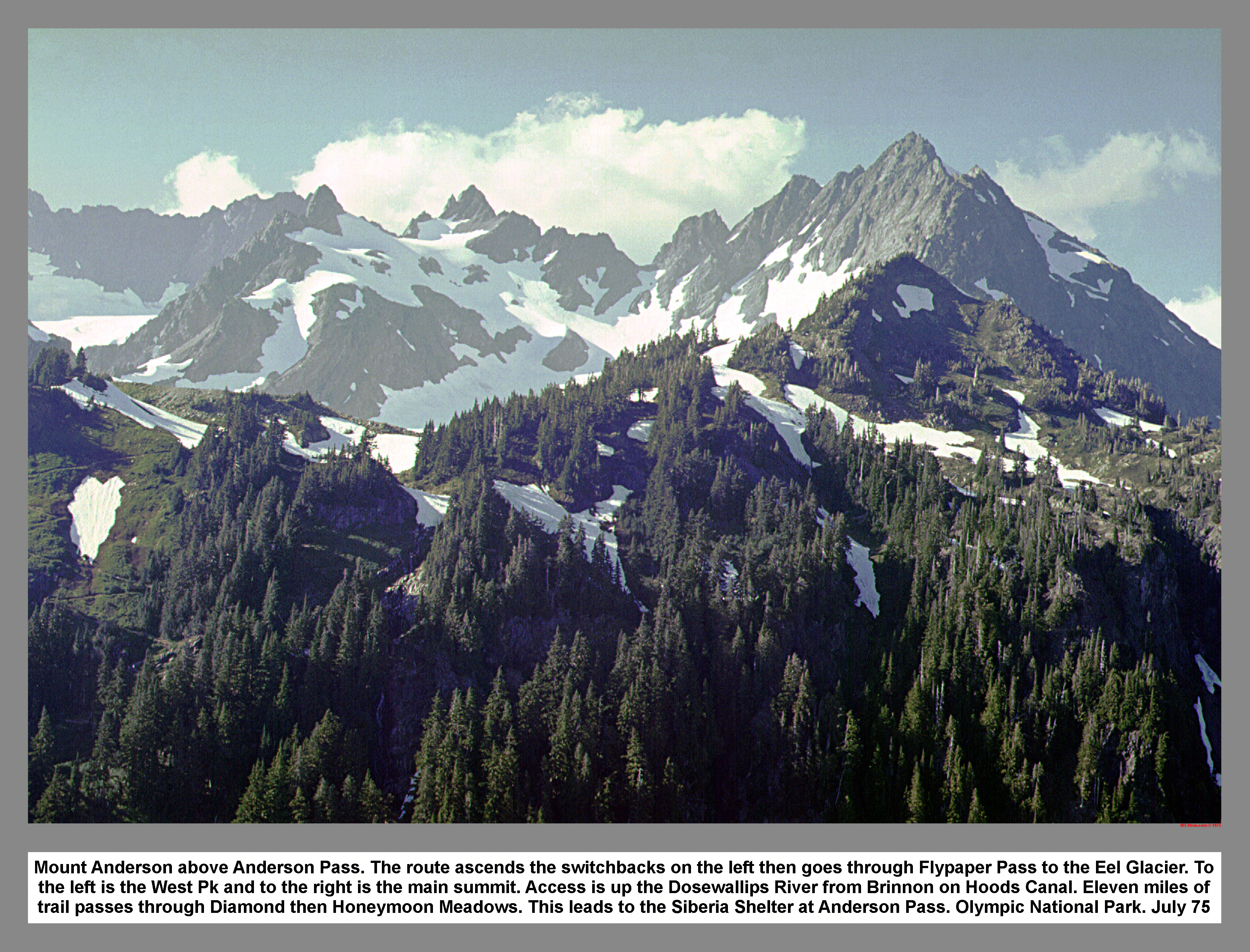
Mount Anderson above Anderson Pass. The route ascends the switchbacks on the left then goes through Flypaper Pass to the Eel Glacier. To the left is the West Pk and to the right is the main summit. Access is up the Dosewallips River from Brinnon on Hoods Canal. Eleven miles of trail passes through Diamond then Honeymoon Meadows. This leads to the Siberia Shelter at Anderson Pass. Olympic National Park. July 75
06 079 Skokomish shelter in Olympic National Park (340k)
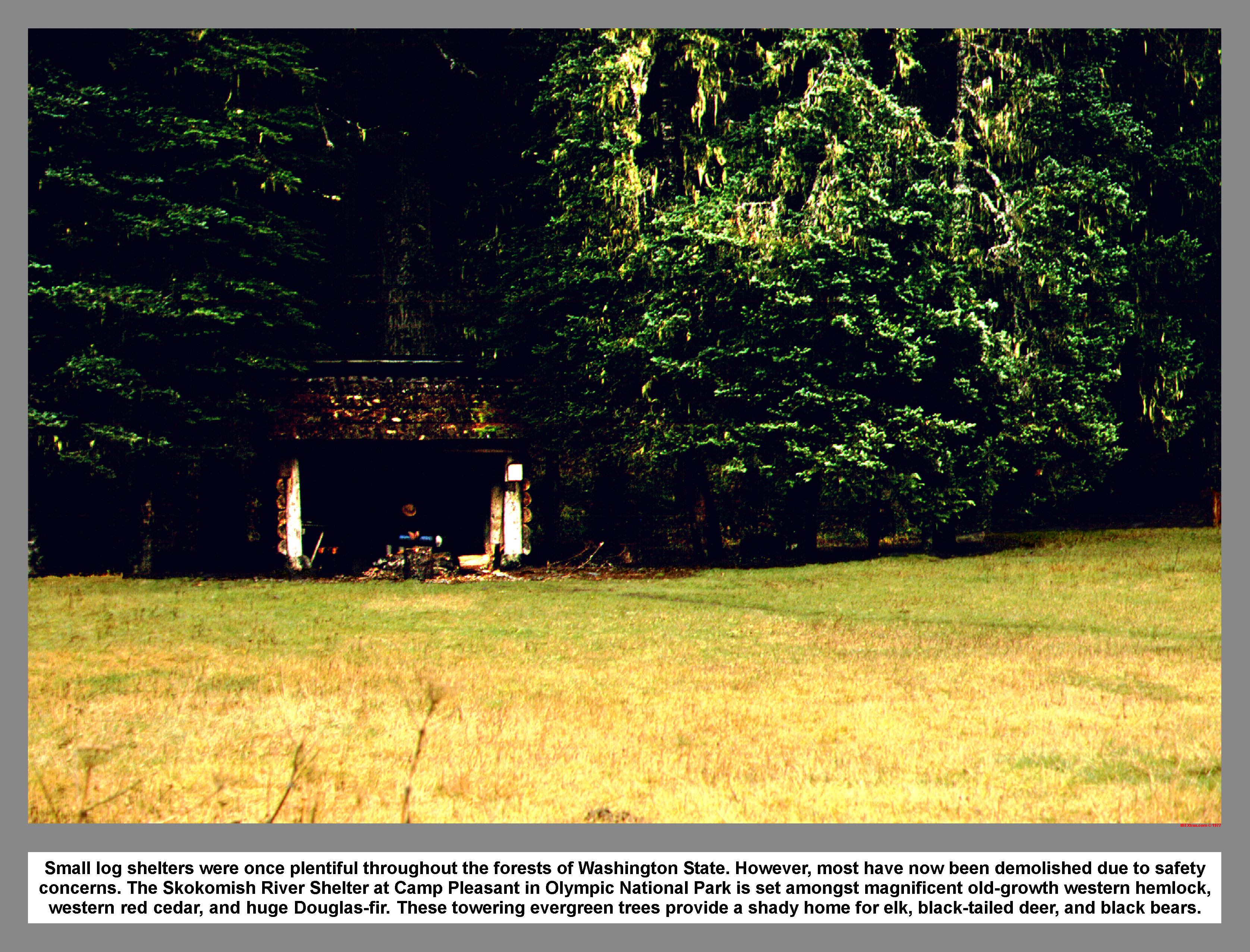
Small log shelters were once plentiful throughout the forests of Washington State. However, most have now been demolished due to safety concerns. The Skokomish River Shelter at Camp Pleasant in Olympic National Park is set amongst magnificent old-growth western hemlock, western red cedar, and huge Douglas-fir. These towering evergreen trees provide a shady home for elk, black-tailed deer, and black bears.
|
|
|
|
|
|
This site created and maintained by THE IBEX - Page last revised:
|
|