
|
|
IBEXtrax.com - Cascade Mountains of Washington State
|
|
|
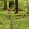
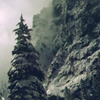
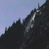
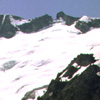
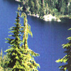
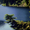
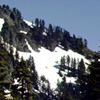
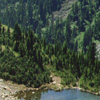
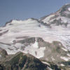
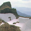
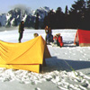
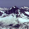
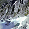
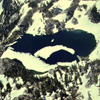
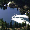
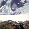
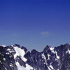
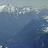
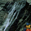
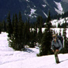
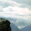
01 001 Olympic traverse Grand Valley (200k)
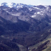
This photograph taken in July of 1961 is looking south into the heart of Olympic National Park and taken near Obstruction Peak on the east end of Hurricane Ridge. This view can see Grand Lake at the foot of the Grand Valley were the troop had been earlier that morning. At the head of the Valley is Cameron Pass and beyond is Sentinel Peak. Beneath the peak flows the Dosewallips River there the traverse started.
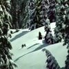
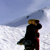
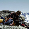
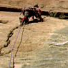
01 002 Olympic traverse rest stop (227k)
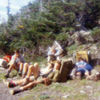
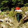
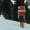
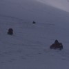
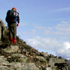
One thing this troop had perfected near the end of the Olympic Mountain traverse was how to do a rest stop. Most of these scouts are well on their way to earning the wilderness napping merit badge. It is interesting to note the 1960s foot wear and the backpacks. How many pair of Wolverine high-top work boots and how many wood frame Trapper Nelson pack boards can you count in this fuzzy Kodak Instamatic photo?
03 011 Shawn C along Queets River in Olympic rainforest (303k)
Hiking the Queets River Trail in the Olympic National Park, the way lies amid groves of bigleaf maple swollen with luxuriant mosses, and shrubs and ferns. Pacific Coast Rain Forest. Jun73
03 012 Chris H near Bob Ck shelter along the Queets R (270k)
Near Bob Ck shelter along the Queets River, the high rain forest canopy drips with moisture well after the rain stops falling from the sky. This leaves the valley hiker in continuous rainfall.
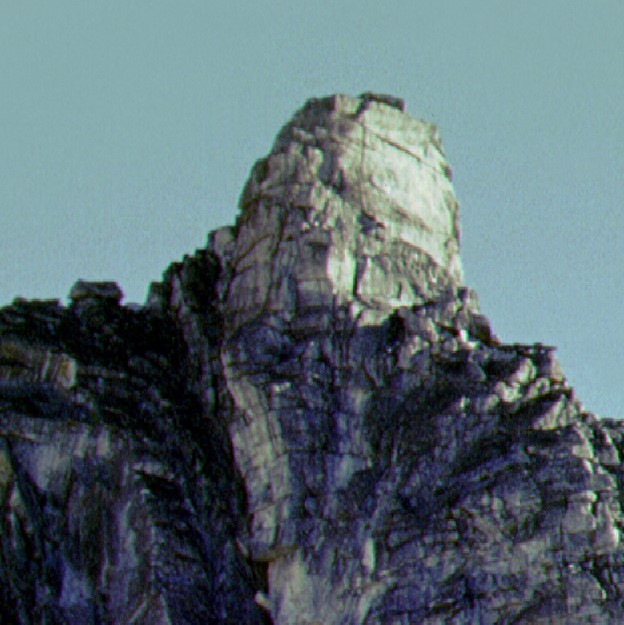
03 136 Mt Anderson above Anderson Pass ONP.TIF (255k)
Mount Anderson above Anderson Pass. The route ascends the switchbacks on the left then goes through Flypaper Pass to the Eel Glacier. To the left is the West Pk and to the right is the main summit. Access is up the Dosewallips River from Brinnon on Hoods Canal. Eleven miles of trail passes through Diamond then Honeymoon Meadows. This leads to the Siberia Shelter at Anderson Pass. Olympic National Park. July 75
06 079 Skokomish River shelter in Olympic National Park (sizek)
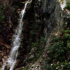
01 081 Looking up at Wallace Falls State Park (149k)
Wallace Falls honors Skykomish Indian Sarah "Kwayaylsh"; a homesteader near the town of Startup (called Wallace until 1901) where rail workers added engines to "Startup" the pass.
01 106 Winter day hiking near Lk Serene (218k)
On this Winter day hike to Lake Serene, we drove all the way to the shaft at the Honeymoon Mine. Since then the road has washed out and added a mile to the route. The old trail that climbed up the West side of Bridal Veil Creek was notoriously renowned for its muddy roots that passed for a trail. Now, the new route East of the Falls is a long monotonous series of wooden staircases. Skykomish Ranger District. 1972
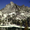
01 107 Snowy Philadelphia Mtn above Lk Serene (291k)
Snowy Philadelphia Mtn above Lake Serene. This rare sunny day near Mount Index typifies the winter wonder in a range that averages only nine sunny days during the winter season.
01 108 Fisherman at Lake Serene (167k)
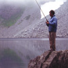
Picturesque Lake Serene is not know for its good fishing. This deep, snow-fed, fifty three acre lake is located northeast of Mt Index and less than three miles south of the community of Index. The lake is secluded in a deep mountain pocket and surrounded by talus slopes. In 1890, Mount Index was named by A D Gunn when he bought out a nearby squatter's rights. He thought the sharp spires looked like index fingers.
01 120 Snoqualmie Falls (192k)
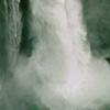
Snoqualmie Falls, located between the towns of Snoqualmie and Fall City, is the natural barrier that separated the salmon-culture Indians from the venison hunters of the forest.
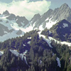
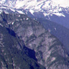
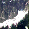
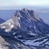
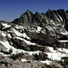
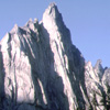
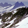
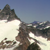
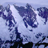
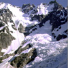
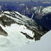
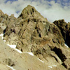
01 049 Mt Buckner Ripsaw Ridge and the Boston Gl (146k)
When the novice North Cascades traveler takes those first steps to explore the wilderness and they decide to "go into the mountains", they soon find they have to first "go into the valleys". The western valleys of the Pacific Northwest are mostly covered with dense, dark, dank and dreary evergreen forests. These bastions of thick brush and heavy moss rarely reveal teasing glimpses. North Cascade National Park. June 71
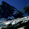
02 003 Up Thunder Ck to Mt Buckner and Boston Gl (247k)
On the return to Thunder Ck in the North Cascades National Park, we went straight to the good view spots like this one near the designated camp named Tricouni. The National Parks Service limits overnight trailside camping to developed sites and only if the party obtains a back- country permit. The permits are still free. But, the quantity is finite. Mount Buckner and the Boston Glacier are at the head of the valley. 1972
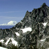
02 013 Boston Peak Sharkfin Tower and Boston Gl (135k)
Boston Peak and Sharkfin Tower at the head of Skagit Queen Creek. John Russner and two others crossed through Sharkfin Col (center) in 1892 and made the dangerous crossing of the Boston Glacier. The reward was a green ore ledge at the 7500ft level, found to be rich in silver. M.E. Field hauled a mill over Park Ck Pass, with one piece weighing 450 lbs. Operations folded by 1913, yet relics are still found along the Ck.
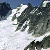
02 019 Mt Buckner Ripsaw Ridge and the Boston Glaciers (197k)
Mount Buckner (or Buckner Mtn), Ripsaw Ridge and the Boston Glacier. The Mountain is named after Henry F. Buckner, who was manager of the mining company which located claims and mined in upper Horseshoe Basin in the early 1900s. In the winter of 1909 Henry F. Buckner had a crew of 30 who worked "buried" under snow in Horseshoe Basin. Probably the Davenport Group of claims. North Cascades Park. July 1972.
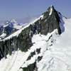
02 020 Forbidden Peak and the Boston Glacier (169k)
Forbidden Pk and the Boston Gl. The remarkable ridges on Forbidden are so quintessentially perfect, and its setting so grandiose the Peak has special status in the Cascade Pass area. 72
02 024 Mt Garfield and the Middle Fork Snoqualmie River (288k)
Mount Garfield from along the Middle Fork of the Snoqualmie. Garfield is a hazardous enigma. A history of accidents has included a fatal slip from the "key-ledge" in 1965 and a double fatality on the No.1 Gully's steep snow in May 1972. The routes to the summit are long, due to low altitude starts; they are strenuous masochistic undertakings because of brush, windfalls, slabs and loose rock gullies. North Bend District. '72
02 026 Down the Taylor River Valley from Otter Falls (255k)
Looking down the Taylor River Valley toward Quartz Mountain. On this trip in 1972, the CCC road extended all the way past Big Creek to within two miles of Snoqualmie Lake. When the Taylor River bridge washed out near Quartz Creek, six miles were added to the approach. Even with the added miles, the slopping slabs of Otter Falls and its quaint pool called Lipsy Lake are still very popular on sunny summer days. MBSNF.
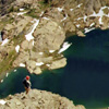
02 037 Deer Lk and Peaks to the south (241k)
Deer Lake is just one of the nearly 700 small mountain lakes nestled like jewels among the high rock peaks and timbered valleys of the Alpine Lakes Wilderness Area. Alpine Lakes was created when Congress passed the 1976 Alpine Lakes Wilderness Act to protect the area in its unique natural state. Within a one-hour drive of over half of the states population, the Area receives close to 150,000 visitors per year. July '72
02 039 Lake Dorothy in the Alpine Lakes Wilderness (281k)
2-mile-long Lake Dorothy was once so remote only the sturdiest Scout and fishermen could visit on a weekend. Then logging roads pushed so far up the Miller River Valley that Dorothy was a mere 1½ miles from the car. There were even plans for a Lake Dorothy Highway that would have skirted all the shores! The 1976 Alpine Lakes Wilderness Act saved the lake shore. But, the 1½ mile trail is still a very popular day-hike.
02 040 Wild Goat Pk from the Lake Dorothy overlook (178k)
Looking up the Miller River drainage above Lake Dorothy. This view from the Lake Dorothy overlook shows the dark pyramid summit of Wild Goat Peak (center) and the West face of Camp Robber Peak (left). The descriptively named Camp Robber is a Robin-sized bird that is known to stock hikers in the woods; prepared to swoop-in at the first opportunity and perpetuate its thieving reputation. Alpine Lakes Wilderness. 7/72
02 041 Looking down on Toto Islands in Lake Dorothy (359k)
Looking down on the "Toto" Islands nestled in the arms of Lake Dorothy. Contrary to the unofficial reference to Oz, most notable lakes in the upper Miller River drainage are sir names that remember offspring of 1890 Sultan homesteader Robert P Miller. A few miles upriver from Sky- komish the whistle-stop of Berlin sprang to served rail men and prospectors in the early 1900s. During WWI it was renamed Miller River. ALW
02 046 Snoqualmie Lake from the outlet (234k)
Some might say that Snoqualmie Lake is the source of the Snoqualmie River. But technically, this lake empties into the Taylor River that then flows into the Middle Fork of the Snoqualmie River. Like most Western Washington rivers, the Snoqualmie is named after the Native American tribe that lived along its banks. The Puget Sound Salish language translation is "People of Moon the Transformer". Alpine Lakes Wilderness.
02 049 Paul B at Mt Margaret trailhead (294k)
For the extremely hazardous ascent of the mighty Mount Margaret, the climbers had their brand new MSR ice axes. And of course, the proper attire for the two day assault. This climb was made possible by purchases from the prominent Northwest Outfitter: Saint Vincent De Paul; The definitive expedition source for scratchy wool pants, outlandish print shirts and silk top hats. Rabbits come extra. Wenatchee National Forest.
02 066 Hibox Mtn from Lillian overlook (207k)
High above Box Canyon Creek is Hibox Mountain, ironically the high point on Box Ridge. Due to the threatening skies, the climbers decided not to attempt the treacherous slopes of Mount Margaret. Instead, they focused their attention on the ramparts of Rampart Ridge. The skilled climbers had to chop steps in the near vertical ice to gain the false summit. Wenatchee National Forest - Cle Elum Ranger District. July 1972
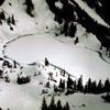
02 068 Lake Lillian from Lillian overlook (231k)
Lake Lillian near Snoqualmie Pass. The Snoqualmie tribe was always peaceful - perhaps too peaceful. In the 1850s, Chief Patkanim sided with the settlers against warrior tribes and signed away the tribes lands at Pt Elliott in 1855. In return, the Americans never repaid the Snoqualmie peoples and never gave them their own reservation. Many of the Snoqualmie ended up living in poverty on land that was once theirs. July 72
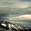
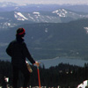
02 077 looking S toward Mt Rainier from Mt Margaret (161k)
Looking south toward Mount Rainier from Mount Margaret summit reveals the checkerboard of clear cuts dating back to the "Big Steal", the Northern Pacific Land Grant. This area South of Snoqualmie Pass is so heavily scalped of trees it looks as if it had a bad case of the mange. Here logging roads are built at the whim of private owners, the heirs of the thieves. Wenatchee National Forest; Cle Elum Ranger District. '72
02 081 Hikers on the Perry Ck trail Don B and Paul B (368k)
Climbers carry loads up the Perry Creek Trail. The stream received its name by 1894, in honor of local miner Robert Perry, who operated a restaurant in the mining town of Monte Cristo. '72
02 082 Hall Peak stands at the foot of Perry Ck (174k)
Hall Peak stands at the foot of Perry Creek. The peak was named in 1891 after prospector George Hall of Anacortes, who staked several claims at Silver/Anacortes gulches in May of 91. On the North ridge (right skyline) in May 1962, Steve Skubi (age 15) was killed in an avalanche during an attempt on this ridge. The class 5 North Ridge is now called Skubi Ridge. Darrington District; Mountain Loop Hiway; Monte Cristo area. '72
02 087 Paul B glissades near Stillaguamish Pk (145k)
Glissade practice on an avalanche cone near Stillaguamish Peak. The Peak and the nearby river remember the Stillaguamish Indians (a term signifying "River People") who once inhabited the lowlands region between Stanwood and Arlington. The tribe population in 1844 was 195 persons. But, by 1855, after the smallpox decimation, too few Stillaguamish remained to be represented at the Pt Elliott Treaty ceremony. '72
02 091 Mt Forgotten from the southwest (215k)
Mount Forgotten from the southwest. Mt Forgotten lives well up to its name, in that the peak was named by Forest Service personnel some-time during 1919-1935 for reasons that have been forgotten. The name may date back to 1928 when a trail crew may have forgotten some item or piece of equipment along the trail. The names of the persons who made the first ascent, sometime during 1927-1960 are also unknown. '72
02 092 Glacier Pk from Forgotten Meadow Don B (233k)
High above Monte Cristo Lake is Forgotten Meadow and an excellent view of Glacier Peak. The Sauk Indians referred to Monte Cristo Lake as "Stubshadad", meaning "Skeleton People". The legend goes that the victorious Sauk warriors tossed the corpses of an invading Wenatchee Indian war party into the lake, where their bones are now represented by sunken logs and submerged tree stumps. Mt Baker National Forest.
02 094 Looking up the N fork Sawk to Glacier Peak (166k)
Looking up the North Fork of the Sawk River to Glacier Peak. Just below the North Fork Falls at Sauk Forks is the Bedal town site, named for early settler James Bedal (1863-1932). July 72
02 095 Mt Baker and Mt Shuksan from Mt Forgotten (126k)
Mount Baker and Mt Shuksan guard the northern horizon on this hazy summer afternoon on the Mount Forgotten summit. Here in the fore-ground, the Sauk Rivers flows around some Cascade Range foothills with names like Gold Mountain, Prairie Mountain and North Mountain. The acreage along the Sauk Prairie was prime and sought by many homesteaders. Land disputes were common and sometimes violent. 7/72.
02 096 Monte Cristo Peaks SE from Mt Forgotten (206k)
Some Monte Cristo area peaks as seen to the Southeast from Mount Forgotten summit. The craggy bulk with the rugged appearance on the left skyline is Del Campo Peak. The white pyramid in the center is Morning Star Peak. Center right is the dark sharp spire of Sperry Peak. On the right skyline is the rounded massif of Vesper Peak. The flattish summit, right front is Mount Dickerman. Darrington Ranger District. 7/72.
02 097 Glacier Peak from Mount Forgotten (222k)
Looking up the North fork of the Sauk River toward Glacier Peak from the summit of Mount Forgotten. When the logging roads pushed into the North Fork Valley in 1951, the logging companies gained access to the ancient clumps of Western Red Cedar that lined the river bottoms. The District Ranger at the time had the foresight to save one group of the massive sentinels. The grove above the falls now bears his name. Harold J Engles Memorial Cedars Trail
02 098 Big Four Mtn and Hall Peak from Mt Forgotten (156k)
Big Four Mountain and Hall Peak from Mount Forgotten summit. The origin of the Big Four name is not entirely clear. An early source dates back to 1891 when prospectors saw four humps or summits (there are actually five) when viewed from Marble Pass. Others say that the snow-field high on the East face melts down to form the number four. Another claim is that the peak is named after four mining brothers. July 1972.
02 099 On Mt Forgotten with Glacier Peak distant (183k)
Summit photo on Mount Forgotten with Glacier Peak in the distance. The fabric of the day was an Orlon/Wool mix that held an odor like a safe and was slightly better that cotton. Ski pants were modified with a large cargo pocket to hold trail mix(glorp). The map case and contents were more for locating distant landmarks than route finding. Army surplus glacier goggles, suspenders and bright red bandanna toped off the look.
02 101 Big Four Mtn from Forgotten Meadow (245k)
Big Four Mountain as seen from Forgotten Meadow at the head of the Perry Creek trail. In 1920 the Rucker brothers had acquired the P.L.Trout homestead at the base of Big Four and started construction of a 50-room hotel with tennis courts and a 9-hole golf course. By 1924 with some 6000 guests catered at the Inn, the Forest Service was persuaded to open up and maintain the Perry Creek trail to Forgotten Meadow. July '72.
02 102 South face of Mt Forgotten (271k)
Mount Forgotten is a small but outstanding peak located 2½ miles west of Sauk Forks, near the Bedal townsite. Surface rock is predominantly loose volcanic breccia called the Barlow Pass Volcanics (a well-exposed series of rock with local interbeds of sedimentary rock). Some early settlers thought the peak resembled a hooded woman and called it "Lady of the Mountains;" maps once termed it "Castle Peak." Unprotected.
02 104 Mt Baker Mt Shuksan from Forgotten (242k)
The Mount Baker-Snoqualmie National Forest extends over 140 miles along the west slope of the Cascade Mountain Range from the Canadian border to the northern boundary of Mt Rainier National Park. Nearly five million people in the Puget Sound region are within one hour west of the forest. The four major mountain passes that cross the Mt Baker-Snoqualmie National Forest make it one of the most visible in the country.
02 119 Big Snow Mountain from Myrtle Lk
Big Snow Mtn from Myrtle Lake. Big Snow is well named for large late season snowfield that lingers on the gentle Northern slope of the mountain. The summit view is truly remarkable, showing to great advantage most of the widely scattered summits in the North-Central Cascades. Access is up the Middle Fork of the Snoqualmie River then 5½ mile trail along Dingford Creek to Myrtle Lake. North Bend RD.
02 122 Mt Pugh S slope from Mt Forgotten (199k)
Across the Sauk River Valley from Mt Forgotten is the bulky quartz diorite of Mt Pugh. The Indian name for the lofty Pugh was "Da Klagwats". Popular usage is Mount Pugh, but maps refer to it as Pugh Mtn. Named after William R Pugh who settled at its base by 1892. In 1903 he was employed as a laborer at Goat Lk by the Penn Mining Co. The summit lookout station was completed in 1919, but has long since disappeared.
02 130 Whitechuck Mtn from Stujack Pass (193k)
White Chuck Mountain as seen from Stujack Pass. This outstanding peak is a solitary craggy massif with a steep South face. The name is a combination of English and Chinook for "glacial (white) water;" the Sauk Indian name for the peak is said to be "Hi Khead", meaning "reach-ing high or long neck". The first ascent was made by a USGS party including Albert H Sylvester and others on July 28, 1897. Darrington RD.
02 131 Upper slopes of Mt Pugh from Stujack Pass (220k)
The Upper slopes of Mount Pugh from Stujack Pass. Nels Bruseth made the first ascent in 1916, and for several years he maintained a summit tent as a lookout station; during one period of his summit service he carried on a courtship at Bedal by running down the mountain after work and returning by morning. As an aid to climb on steep snow and heather he used a cut down garden rake. Mt Baker-Snoqualmie NF. Aug 1972
02 135 Sloan Pk Monte Cristo Peaks and Mt Rainier (206k)
The arrowhead spire of Sloan Pk, the jumbled mass of the Monte Cristo Peaks and distant bulk of Mt Rainier fill out the view to the Southeast from Mount Pugh. This side of Sloan Peak is Bedal Peak with its snow covered North slope. A row of clear cut logging slashes line the slopes above the Sauk River. Right center are the near identical summits of Gemini Pk. The low gap in the center is Ida Pass. Darrington District. 8/72
02 136 Doug H on Mt Pugh with Glacier Peak (241k)
A triumphant pose on top of Mt Pugh with Glacier Peak beyond. Professor William D Lyman, in an eloquent passage, captured Glacier Peak's magnificent image: "It can be seen in all its snowy vastness, ten thousand feet high, and bearing upon its broad shoulders miles and miles of rivers of ice, the most beautiful and significant of all the poems of nature". Indians once called it "DaKobed" meaning "Great Parent". Aug '72
03 006 Glacier Lake shelter below Surprise Mtn (149k)
Snowbound Glacier Lake shelter survives another winter at the foot of Surprise Mtn. A relic of the Civilian Conservation Corps (CCC), the shelter endures as a reminders of FDR's New Deal.
03 007 Mt Daniel Cathedral Rock from Surprise Mtn (176k)
Looking South from Surprise Mtn summit is the expansive Mount Daniel massif. Being the highest point in King County in Washington State, this snow clad upland dwarfs the pointed andesitic plug of Cathedral Rock on the left. The religious tone to names in the area, stems from the flamboyant presents of a one-legged preacher who retired on the shores of the small tarn at the base of Cathedral Rock; Peggy's Pond. May73
03 010 Chris H on Surprise Mountain with Mount Stuart (143k)
Climber on the summit of Surprise Mountain. Looking Southeast toward the Stuart Range with Cashmere Mountain on the left skyline. Typical Seventies outfit included canvass rucksack, wool shirt and trailing an 60 foot length of light nylon line. This Avalanche Cord provided a slight comfort that your partner could quickly find you in the event of an avalanche. Alpine Lakes Wilderness: Skykomish Ranger District. May 1973.
03 013 North Wall of Tinkham Peak from PCT (201k)
The short, broad Northeast Wall of Tinkham Peak as seen from Pacific Crest Trail above Twin Lakes. Named for early railroad surveyor Abiel W. Tinkham, this is a small but well-known Crest peak located one mile Southeast of Silver Peak. The highest point is on the West end of the flat summit ridge. Tinkham Peak must have been one of the earliest climbs in the region, and even was ascended on skis in the early 1900s.
03 014 Mount Rainier beyond Abiel Peak from Silver Peak (192k)
The rounded fir clad slopes of the South Central Cascades extend South from Snoqualmie Pass in a rolling sea of green. The undulating ever-green carpet that stretches out to the glacier draped cone of Mount Rainier is all too often interrupted with clear cut logging slashes. These unsightly brown rectangles give testament to the controversial commercialism that dominates this section of the Cascade Mountain Range.
03 015 Snoqualmie Pass Peaks from Silver Peak (222k)
Captain George B McClellan probably gave the first description of the "Snoqualmie Peaks" from near Naches Pass in 1853, when he wrote "to the northward there is a vast sea of bare, jagged, snow-crowned ranges as far as the eye can reach". McClellan sent Lt. Abiel W Tinkham into the area in the winter of 1854 to measure snow depths and railroad practicability, thus making the first known Cascade crossing in the region.
03 016 Chris H on Tinkham Pk with Silver Pk Kaleetan Pk (204k)
From the summit of Tinkham Peak a climber looks Northwest over Silver Peak and on to the pointed arrow of Kaleetan Peak. When McClellan and Tinkham came looking for a railroad route in 1853, they asked the local natives about a feasibility of using Snoqualmie Pass. With all the wind blown timber blocking the way, the wise Indians told the young Army officers that the route was impractical for horses. North Bend RD.
03 017 Red Mtn Pond camp above Commonwealth Basin (246k)
From near the Red/Lundin pass along the Cascade Crest Trail, this view is down past Red Mtn Pond to Commonwealth Basin and on to the treeless ski slopes at Snoqualmie Pass. The trail was later renamed the Pacific Crest Trail and rerouted to the East along the steep slopes of Kendall Peak. Skiing here dates back to 1937 when the Milwaukee Ski Bowl opened. Now it's an inflated mega-plex, fixed by foreign interests.
03 018 Mount Thompson above Gravel Lk from Red Mtn (219k)
From atop Red Mountain looking Northeast are the summits along the Cascade crest that stand North of Snoqualmie Pass. Dominating this clear view is the bell-shaped tower of Mount Thompson. The peak is named for Seattle city engineer, R H Thomson, who is not remembered by a correct spelling. Scanning right along the crest are Chimney Rock, Lemah Mtn, and the smallish but solitary point of Chikamin Peak.
03 021 Snoqualmie Mtn Chair P Kaleetan P from Lundin Pk (146k)
Looking West from the summit of Lundin Peak. Lundin was once known as "Little Sister" (of Snoqualmie), then renamed to honor one of the pioneer forest rangers in the district. The light colored granite on the left extends over the Snow Dome and on to the top of Mt Snoqualmie. In the center is the recliner facing South called Chair Pk. Next is the pyramid of Kaleetan Peak and then the small rocky peaks of Mt. Roosevelt.
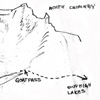
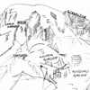
03 022 Red Mtn Lundin Pk sketch (114k)
03 023 Keekwulee Falls along the Denny Creek trail (274k)
Denny Creek drops over Keekwulee(Chinook for "below" since they are the falls below Snow-shoe Falls)Falls from the Melakwa(Chinook Jargon for "mosquito")Lake Trail. North Bend RD
03 025 Mt Roosevelt Chair Peak Lk from Melakwa Pass (201k)
From Melakwa Pass looking North are the steep rugged peaks of Mount Roosevelt. At its base is snow covered Chair Peak Lake. Access is 5mi on the Denny Creek Trail and 3000ft vertical.
03 028 Kaleetan Peak the Arrow Mt Rainier the Monarch (149k)
Kaleetan the Arrow and Mount Rainier the Monarch fill the Southern view from the summit of Mt Roosevelt. Kaleetan Pk. was once called The Matterhorn. But, a name of more distinct Northwest flavor was bestowed on the pointed rock horn when the USGS Committee on Place Names changed the name to the Chinook Jargon term for arrow. Derived from the original Chinook word "tklaitan". Alpine Lakes Wilderness. July 73.
03 029 Chikamin Pk Lemah Mtn Chimney Rock fr Cooper (207k)
The distinctive peaks that stand on the Cascade crests North of Snoqualmie Pass as seen from the East along the now abandon logging road above Cooper Lake. From the left to right are the knob of Chikamin Peak, the five summits of Lemah Mountain, and the dark walls of Chimney Rock. From this vantage on the Southern slope of Polallie Ridge, it shows the round wooded foreground bulk of Island Mountain. El Elum RD.
03 035 Mount Rainier from Tamanos Mountain (209k)
The Northeast flank of Mount Rainier holds the massive Emmons Glacier. Together with the Winthrop Glacier, they easily form the largest ice mass in the conterminous U.S.. Samuel Emmons, for whom the glacier is now named, called it the White River Glacier. This view from the top of Tamanos Mtn near Owyhigh Lake also shows the descriptively named Fryingpan Glacier that sits in the hollow East slope of Little Tahoma.
03 036 South from Tamanos Mountain with Mount Adams (202k)
South of Owyhigh Lakes are the high alpine meadows at the headwaters of Kotsuck Creek. Further South beyond the twin summits of Double Peak are the snowy crests of Goat Rocks Wilderness. Still farther South are the Glacial clad heights of Mount Adams. This seldom visited area around The Cowlitz Chimneys in Mount Rainier National Park commonly sees large flocks of Mountain Goats numbering fifty or more. Aug 73.
03 037 Cowlitz Chimneys sketch (118k)
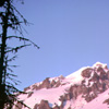
03 049 Mount Rainier at sunset from the top of Iron Mtn (274k)
From the summit of Iron Mountain, Mt. Rainier displays a misty pink evening gown at sunset. This remote Southwest quadrant of the majestic sleeping volcano is a maze of crumbling cleavers and treacherous headwalls. The South Tahoma Headwall sweeps up in one gigantic step of nearly 4000' to culminate at Point Success. At its base, the S Tahoma Glacier still entombs 32 honored Marines of the tragic 1946 plane crash.
03 038 Cathedral Rock from the PCT Chris H (222k)
Nearing the top of Cathedral Ridge, the climbers make an early season approach to Peggy's Pond. Some say the ponds name remembers the wife of a miner who's cabins remains can be found South of its shores. The other more romantic story tells of a lengthy recovery from a mine accident where the miner lost a leg. The loyal wife nursed him back from the brink of death and lovingly called her one legged spouse Peggy.
03 040 Venus Lake and Spade Lk from East Pk Mt Daniel (170k)
Along the Southeast Ridge route near the East Peak of Mount Daniel, the alpine wonders of Venus Lake and Spade Lake are visible to the South. Mount Rainier Looms in the distance.
03 044 Pea Soup Lake and Lynch Glacier from Mt Daniel (217k)
Flowing down the North side of Mount Daniel is the Lynch Glacier. Originating just below the West Summit at nearly eight thousand feet, the steep ice tumbles almost two thousand feet in a series of huge, gaping crevasses. The glacier terminates in Lynch Draw to feed the descrip-tively named Pea Soup Lake. The green color of the sallow lake reflects the late summer algae bloom that tints the water with its unique hue.
03 043 7500 footers south of Mount Daniel ALW (228k)
Looking South from the summit of Mount Daniel are the seventy five hundred footers that line the Cascade crest in the Alpine Lakes Wilder-ness Area. The elongated rocky, alpine massif immediately South of Mount Daniel is Bears Breast Mountain with its numerous individual crags and spires. When viewed from the Waptus Lake side, Bears Breast gives the appearance of a bear standing on its hind legs. Aug 73.
03 045 Circle Lk and The Citadel from SE ridge Mt Daniel (155k)
Looking South from the SE Ridge of Mt Daniel is the isolated rock outcrop of The Citadel. The peak is strangely boxed-in by four alpine lakes: Vicente, Spade, Venus, & Circle shown here.
03 046 Cathedral Rock in Late Summer 25Aug73 (268k)
Over the millenniums the Cascade Range has witnessed a variety of volcanic activity. Along the periphery of the Columbia Basin basalt beds, numerous volcanic vents were born. As tectonic disturbance shifted West, the cinder cones cooled and their throats were filled with the more resilient andisite rock. Eons of weathering and the ebb and flow of glacial scouring leaves only the towering andesitic plug of Cathedral Rock.
03 056 Loo-Wit-Lat-Kla is a Maiden Called Mt St Helens (204k)
In the Bridge of the Gods legend as told by both the Multnomah and Klickitat tribes, Loo-Wit-Lat-Kla(Mt St Helens shown here) was the young, beautiful maiden. The competing chiefs Pa-teo(Mt Adams) and Wy-est(Mt Hood) grew jealous of each other and fought fiercely. Some say they quarreled even after the spirit Sahale turned them into mountains. Loo-wit had the final say in May 1980 with great explosion of rocks and ash.
03 057 Chris H carries to base camp on Mt St Helens (204k)
During the spring of '74, the climbers could be found carrying loads up to base camp on the North slope of Mount Saint Helens. Interesting to ote the equipment included a full size two-burner stove and a ten inch iron skillet. Luckily the camp was located only a few hundred yards up from the Timberline parking lot. The route was over the Dog's Head to the left of the Forsyth Glacier. These features disintegrated in May 1980.
03 065 Tatoosh Range Sunrise from Paradise Camp (211k)
On an early summer morning in Mount Rainier National Park the climbers awoke to a crystal clear sunrise and prepared for a summit attempt on Mt Rainier. From this camp near Glacier Vista, the view across the Paradise Valley shows the majestic summits of the Tatoosh Range. To the left is the blocking top of The Castle, followed by Pinnacle Pk and the pyramid of Plummer Pk. Next is Denman, Lane and Wahpenayo Pks.
03 066 Rudi M ascends Wapowety Clever below the Castle (193k)
On a clear day from high on the South slope of Mount Rainier one sees Mount Adams on the horizon. A billowing but friendly cumulus cloud shades Paradise Park that lies beyond the Nisqually Glacier. As the afternoon shadows lengthen, the climbers near high camp on Wapowety Cleaver. Its name remembers the Indian guide that lead Lt August Kautz and party up the Nisqually R. on the nearly successful climb of 1857.
03 067 Castle Camp on Wapowety Clever 9500ft Jun74 (239k)
The climbers set high camp at 9500ft on Wapowety Cleaver with a view of Mount Adams and Mt Hood. They named the site Castle Camp due to the angular rock formation nearby. This location on the South side of Mt Rainier provides a good staging point to climb the Fuhrer Finger route. The name remembers two popular Swiss guide-brothers Hans and Heinie Fuhrer who made the first ascent of the Finger in July 1920.
03 068 View up Wapowety Clever on Mount Rainier (199k)
During the decent of Wapowety Cleaver, the lengthening shadows highlight the windswept slopes and darken the Wilson Glacier on the right. Fed by accumulations from Fuhrer Finger, the glacier commemorates topographer A D Wilson who with renowned geologist Samuel Franklin Emmons made the 2nd ascent of Mount Rainier in October 1870. They followed the Gibraltar Ledge route shown here near the right skyline.
03 064 Mount Rainier; Fuhrer Finger sketch (111k)
03 063 Camp Hazard sketch (135k)
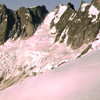
03 069 Glacier Peak in Her Pink Evening gown (158k)
On the approach to Glacier Pk, the secretive napping volcano poses in a pink evening gown. The high, glacierized and eroded cone is the only remaining wilderness volcano in the state.
03 070 Chris H Taking a brake above Kennedy Ridge (229k)
On Glacier Ridge during the approach to climb Glacier Peak, the climbers take a rest stop near Kennedy Ridge. This view across the valley of the Whitechuck River sees the unnamed points along Camp Creek Ridge and the snow covered Black Pk that rise out of the Fir and Hemlock forests that surround the Kennedy Hot Springs area. Glacier Peak Wilderness Area; Mt Baker-Snoqualmie National Forest; Darrington Dist. 74
03 071 Base camp at 7500ft on Glacier Peak (194k)
The climbers made high camp at the 7200ft level on Glacier Ridge just below Kennedy Peak. The camp provided good access to the Frostbite Ridge route on the North side of Glacier Pk. Frostbite Ridge culminates at Rabbit Ears Rocks, shown here left of the summit. This prominent crest leads from Kennedy Peak SSE between the Kennedy and Ermine Glaciers. It has also been called Pumice Ridge and the North Cleaver.
03 072 Shawn C climbing the South Rim on Glacier Peak (176k)
On the final steep icy slope during the ascent of Glacier Peak, the crampon clad climbers kicked steps up the south rim of the summit crater. The ¼ mile wide crater was blown out on the East side by an explosive eruption of about 12,000 years ago. Immense blankets of volcanic ash drifted E and NE by prevailing winds. Glacier's trademark yellow pumice can be found in a wide swath extending into Alberta & Saskatchewan
03 073 Glacier Peak summit photo Shawn C Warren Chris H (177k)
The triumphant trio of Cascade volcano climbers (Shawn C, J Warren B and Chris H) posed on the cold snow covered summit of Glacier Peak. This late spring morning in June 1974 had a clear unobstructed view 100 miles South to Mount Rainier. Clad in coated nylon in preparation of a sitting glissade descent, the climbers had applied ClownWhite grease paint to protect uncovered flesh from the high altitude rays of the sun.
03 075 Glacier Peak Base Camp the morning after Chris H (263k)
At the Glacier Peak Base Camp the morning after, the climbers pack-up for the descent back down to Darrington. The town of Darrington was first named Barrington, but the "B" was changed to a "D" by a postal department error. The town was originally called "The Portage" because the Sauk Indians used this area as a portage between the north fork of the Stillaguamish River and the Sauk R. Glacier Peak Wilderness Area.
03 074 Glacier Peak map (499k)
03 076 Glacier Peak sketch (140k)
03 077 Glacier Peak sketch north routes (133k)
03 078 Glacier Peak sketch west routes (155k)
03 051 The Tooth sketch (158k)
03 052 Chair Peak sketch (128k)
03 053 Chris H Reclining on the summit of Chair Peak (197k)
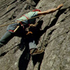
After a successful ascent of the Southeast route, the climbers recline in the afternoon sun on the summit of Chair Peak. Looking to the West from Chair Peak is Kaleetan Peak. Chair Pk is among the highest and best-known of the "Snoqualmie Peaks", and is the culmination of the crest of summits beginning with Denny Peak. The name Chair Peak is derived from the resemblance to an armchair, as seen from Kaleetan.
03 079 Frozen Chris H on Midway Crux Castle Rock (320k)
In the middle of July during 1974 the climbers thought they were ready for the Leavenworth Rock Climbing Scene. They had worked their way through all the West side sport climbing areas and now, they had graduated East to the excellent granite found in Tumwater Canyon. Shown here on the Midway "step-across"; Hemp rope, Piton hammer and Mountaineering Boots were the gear of the day. Wenatchee National Forest.
03 084 High Priest Sketch (84k)
03 085 Stark Enchantments Map (288k)
I was privileged enough to get a Stark Map in person from Bill and Peg the first time I walked over the dam at Snow Lakes. That was back in sixty something. By the third or forth hiking trip up Sylvester's High Route into the Enchantments, that poor map was in the final stages of disintegration. So I copied all the Stark Enchantment Theme names of the lakes and then updated with some of the Beckey crag handles.
03 086 Snowy Enchantment basin from The High Priest (220k)
A wide angle view of the snowy Enchantment Lakes Basin from the summit of The High Priest. The Priest is a prominent peak along Temple Ridge and towers above the more popular and most photographed Prusik Peak shown here on the right. Although being well into mid July during this visit, Lake Viviane in the center-left foreground is only half melted-out. This evening climb produced an unplanned bivouac. '74.
03 087 Chris H on East Dragontail from Littletail (236k)
The solitary climber is dwarfed by the huge granite blocks that make up the summit of East Dragontail Peak. East Dragontail at 8760'+ would be an outstanding summit in its own right. But, it blends into obscurity amongst all the other eight thousand footers that ring the Valkyrie Lks (Upper Enchantments) area. In the background looking East is the aired vast flatness of Eastern Washington. Alpine Lakes Wilderness. 1974.
03 088 The Witches Tower with Temple Ridge beyond (248k)
Beyond the class 4 parallel chimneys of the blocky monolith of Witches Tower is the mythical and wondrous Enchantment Lakes area; the undisputed jewel of the Alpine Lakes Wilderness.
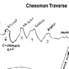
03 090 Chessman Traverse Sketch (65k)
03 091 The Black Dwarves above Sprite Lakelet (233k)
The needle-like spires named the Black Dwarves stand in profile on the skyline; overlooking curious nooks of Tamarack and Heather set amongst bright granite blocks near Sprite Lakelet.
03 092 The Chessmen on McMillan Ridge Rudi M (259k)
Standing guard along the Southern rim of the Lower Enchantment Lakes are a string of seven individual granite towers called The Chessmen. The climbers made a traverse from right to left. The first tower (Western) with a blocky castle shape they called the Rook. Towers four and five stand close together like King and Queen. Between Five and Six is Chessmen notch. Tower six was named "Bishop" by Staley & Beckey in 52.
03 093 Temple Ridge and the lower Enchantment Lakes (292k)
This wide-angle view from the gentle rib just above a small tarn called Troll Sink looks Northeast across the Lower Enchantment Lakes Basin toward the jagged crest of Temple Ridge. Noted 1940s climber Ralph Widrig, who compiled numerous first ascents in the "Cashmere Crags" area, described the pointed towers as "tall threatening spires that streak skyward like Dantesque flames". Wenatchee National Forest. July 74.
03 094 Rainier Horizontal Spire the Flagpole Pennant Peak (266k)
Looking South from The Chessmen approach one sees Mount Rainier, Horizontal Spire, Flagpole Needle, Pennant Peak and Little Annapurna. Three years later in 1977 the climbers returned to do the South face (near vertical left skyline) of Little Annapurna. The exciting twist was that the climb started on the summit and included multiple rappels down to reach the base of the South Face route. The Enchantments - July 1974.
03 095 Rudi M climbs on The Knight on Chessman traverse (296k)
The term "Leavenworth Rock Rat" describes a particular personality that displays unusual traits like: Carrying heavy equipment that is never all used; Spending the whole day in the open without water, food or shade; Following dead end trails; Wearing off their finger prints on sharp abrasive rock; Wearing uncomfortably tight, smooth soled and then jamming their feet into cracks; Climbing up rock they can't climb down.
03 096 High Priest from Hepzibah Blop on Temple Ridge (235k)
The High Priest leans attentively eastward; like a guardian high above the Lower Enchantment Lakes Basin. The caricature appears to be the result of giant's play with building blocks. ALW.
03 099 Mist Pond and Aasgard Pass from Witches Tower (253k)
From the top of the Witches Tower, this view sees Mist Pond on the brink of The Aasgard. The backdoor approach to the Enchantments; The route climbs nearly 4400ft most in the last mile.
03 100 Black Dwarves Sketch (54k)
03 104 Chris H on W Ridge of Prusik Peak Enchantments (275k)
A fitting end to this Enchantments trip in 1974, with the help from a Canadian Outward Bound Guide, the climbers did the classic West Ridge route on the fabled Prusik Peak. Alpine Lakes.
03 106 Lk Viviane and McClellan Ridge from Prusik Peak (240k)
This is the view of Lk Viviane and McClellan Peak from the summit of Prusik Pk. The climbers noticed that after the one week stay in the Enchantments, Lk Viviane is now nearly free of ice.
03 107 Prusik Peak from near Gnome Tarn Sept 64 (175k)
This is the classic view of Prusik Peak from near Gnome Tarn. It was during this first trip to the Enchantments Lakes Basin 1964 that I met Bill Stark and bought one of his maps. Of all the Enchantment theme names that Stark had used and Beckey later published, only a few have been formally adopted by the U.S. Geological Survey(USGS), Geographic Names Information System(GNIS) or the U.S. Board on Geographic Names
03 108 Prusik Peak from Lake Viviane June 74 (250k)
Prusik Peak and The Boxtop rise above the shores of Lk Viviane. The light color of the granite gives the precipices and crags a seemingly white color when seen from a distance. June1974.
03 109 Chris H hikes out Biforst Arm below Temple Ridge (286k)
The Enchantments exit is over Biforst Arm at the top of Sylvester's high route. A. H. Sylvester was Wenatchee Forest Supervisor from 1908 to 1931 and named many features in the area. 74
03 110 Malachite Peak from Purvis Lake SW Peak to right (200k)
From the shores of Purvis Lake one sees the Northwest face of Peak. This small but interesting rock peak is named for the presence of malachite ore, a carbonate of copper. 1974
03 111 Purvis Lake from Malachite Peak (200k)
Purvis Lake rests in the Northwest cirque of Malachite Pk. From the outlet its waters drop to the Miller River that flow out to meet the Skykomish River at the once named Berlin townsite.
05 037 Rudi M and Tony go for water at Purvis Lk (167k)
A pair of snowshoers, with cook pots in hand, head for the outlet of Purvis Lake to get water. The lake is tucked under the NW face of Malachite Pk, 3500ft and only 2mi above the Miller R.
05 038 Automatic Wilderness Can Opener (220k)
As the Cascade Mountain alpine traveler gains more and more experience, they quickly learn the importance of carrying equipment that can be used for more than one purpose. One such item that easily conforms to the multi-use strategy is the ice axe. With an ice axe you can dig a cat hole to plant a loaf; chop steps going up and use it as a brake going down. And of course, the Automatic Alpine Wilderness Can Opener.
05 043 Malachite Peak reviled between rain showers (247k)
For a brief moment during a spring time rain shower, Malachite Peak is revealed between the ominous clouds. From this view on the shores of Purvis Lake, one sees the Northwest Face of the Peak. This small but interesting rock peak is named for the presence of malachite ore, a carbonate of copper. Malachite Peak had been climbed in August of '74. But, avalanche conditions were too high for an attempt on this day.
05 045 The Observatory near Purvis Lake (176k)
Closely west of Purvis Pass is an interesting rock outcrop that looked to have a half open domed roof. The climbers first thought it looked like "Pac Man". But, they eventually named it "The Observatory". The rock is located on the southern end of Maloney Ridge that is named for John Maloney who discovered limestone near the summit in 1890. A cable tramway once carried the limestone product to a cement plant at Grotto.
05 046 Two Face near Purvis Lake (224k)
On the east flank of Purvis Pass the climbers summitted and then named "Two Face" Rock; an extension of Maloney Ridge. John Maloney first came to the area as a railroad surveyor. He took up a land claim in 1890 at the mouth of the creek that bares his name and later opened the first store in Skykomish in 1893. John Maloney's General Store still stands today as part of the Skykomish Historic Commercial District.
03 112 Rampart Lakes and HiBox Mtn from Rampart Ridge (212k)
Rampart Lakes and Hibox Mountain as seen from the slopes of Rampart Ridge. The extremely popular approach trail by Rachel Lake, commonly sees over 100 hikers during a weekend day.
03 113 Rachel Lake Alta Mtn and HiBox Mtn (278k)
Alta Mtn, Three Queens and HiBox Ridge form a backdrop for the aqua blue Rachel Lake. HiBox Mtn is named for Box Canyon, which parallels the ridge line on the south. Forest officers use the name High Box Mountain. Early railroad explorers looking for a way to cross the Cascades were boxed in by Rampart Ridge to the Northwest and Keechelus Ridge to the South. The next canyon to the West leads to Snoqualmie Pass.
03 114 Lake Lillian from the Rampart Ridge Lillian overlook (236k)
The distinctive kidney shaped shore line of Lake Lillian is shown here from Rampart Ridge overlook. This popular destination lake is tucked into the side of the ridge that separates Keechelus Lake and Lake Kachess. Both names originate from Yakima words describing the fishing. Keechelus means few fish or less fish; probably due to the many rapid of the upper Yakima River. Kachess, in contrast, means many fish. 74
03 115 Rampart Lakes and Mount Thompson (221k)
It is said of the high country around Rampart Lakes to be a heaven of rock-bowl lakelets and ponds, scattered gardens of heather and blue blossoms, and ridges and nooks for prowling.
03 116 Lila Lake and HiBox Mtn from Alta Ridge (209k)
HiBox Mtn stands guard over the ponds of Lila Lake that rest in the highland of the Rampart Lakes region. This area with its short drive from Snoqualmie Pass is mobbed on weekends.
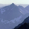
03 119 Looking south over Mount Ross NCNP (231k)1975
Looking South over the top Mount Ross that honors James D Ross, long the supervisor of the Skagit's Seattle City Light operation. Some pioneers called the peak Goodell Mountain. Beyond the Skagit River Valley and Newhalem are the pointed summits of the Snowfield Peak area. Distant right is Eldorado Peak. View from the Mount Ross approach for the Picket Traverse. North Cascades National Park. July 1975
03 121 Southern Picket Range is the Terror Group NCNP (217k)
The Southern Picket Range is the Terror Group. The likeness to a picket fence, not Captain George E Pickett of Fort Bellingham 1856, is the origin of the range's name. From right to left: McMillan Spires; Inspiration Peak; The Pyramid; Mount Degenhardt and The Barrier surround the Terror Glacier. This photo is taken along the Mount Ross approach for the Picket Range Traverse. North Cascades National Park. July 75
03 122 Mount Triumph across Goodell Creek valley (178k)
Thornton Peak and Mount Triumph stands across the Goodell Creek drainage. The creek is named after N.E. Goodell, who built a roadhouse and trading post in 1879 at the confluence of Goodell Creek and the Skagit River (near present Newhalem). The first known alpine ascents in the Picket Range were made from Goodell Creek in 1931 by William Degenhardt and V. Standberg. North Cascades National Park. July 1975
03 123 Camp 2 on the Mt Ross approach Picket Traverse (215k)
Camp Two on the Mt Ross approach during a solo traverse to Picket Pass. Located 2.7 mi W of Davis Peak and closely N of The Roost. The peak is named for local homesteader Mrs. Lucinda Davis who ran a roadhouse near Stetattle Creek in 1906. The Cedar Bar became a popular rest stop for tired prospectors who traveled along the upper Skagit River. A relative, Glee Davis, climbed in the area as early as 1905. July 75
03 124 Mt Despair Mt Baker & Mt Shuksan. Chopping Block (208k)
Looking West across Goodell Creek at Mount Despair, Mount Baker and Mount Shuksan. The Chopping Block in the foreground is officially named Pinnacle Peak. But, because there are two other summits called Pinnacle in Washington State, the new provisional name is proposed. Local residents once called the flat topped peak Babcock's Chopping Block and also Stump Mountain. North Cascades National Park. 7/75
03 125 McMillan Spires from P7000 Pickett Traverse (162k)
The McMillan Spires, named for early Skagit trapper John McMillan, stand as sentinels, guarding the Southwest corner of the Picket Range. North Cascades National Park. 7/75
03 126 Azure Lake from the Terror-Azure Col NCNP (190k)
Its two thousand feet down to ice clad Azure Lake from the Terror-Azure Col. For the next mile South on the Mount Ross approach, the exposure is unrelenting. North Cascades Natl Park.75
03 127 The Hanging Ice of McMillan Cirque NCNP (264k)
The hanging ice of the McMillan Cirque exudes a powerful presents. Typical of all steep slope glaciers in the North Cascades, the McMillan Glacier is continually grinding its way down the North wall of the Terror Group. Occasionally large chucks of ice calve off the glaciers edge and fall with a rumbling boom into the valley. The route to Picket Pass crosses directly below this menacing mass of jumbled ice. July 75.
03 128 McMillan Spires from Camp 3 Picket Traverse (236k)
Because of the rugged topography and its vast remoteness, the Picket Range has remained the least traveled and the wildest area in the North Cascades region. The expected peace and tranquility from solitude is broken by the occasional loud report of crashing ice and the continual roar of thundering water falls that ring the head of McMillan Cirque. McMillan Spires and McMillan Glacier; North Cascades National Park. 6/75
03 129 Ribbon of Ice on Mt Terror from Picket Pass (189k)
The Degenhardt Glacier falls in a ribbon of ice into McMillan Cirque. Grinding down slope like a continuous rock conveyor it hones the North wall of Mt Terror. View from Picket Pass. NCNP
04 004 Three Queens from camp east of Chimney Rock (247k) 1976
The Three Queens from the Silver Snag Route on the Lemah-Chimney Creek divide. Within the Wenatchee National Forest, east of the crest, fires are not allowed above five thousand feet. This protects the interesting and picturesque silver snags that continue on with their life-after-death existence. Access is Cle Elum River, Cooper Lake and Pete Lake trail #1323. Wenatchee National Forest; Alpine Lakes Wilderness. 7/76
04 005 Rest on Lemah Chimney Divide with Pete Lake (239k)
Rest stop on Lemah Creek-Chimney Creek Divide. The outlet of Pete Lake flows away into the Cooper River and on to Salmon La Sac. The old Trailhead was at the Tired Creek clear-cut on the south slope of Polallie Ridge. Its now moved back to Cooper Lake. Polallie in Chinook Indian jargon is dusty sand or powder. The fine grain soil found along the ridge crest is Polallie. Wenatchee National Forest; Cle Elum Dist. July 1976
04 006 John B Rests near the Chimney Glacier Icefall (169k)
The climber waits for the photographer near the Chimney Glacier Icefall. The East Face Route ascends to the left of the Icefall. Wenatchee National Forest; Alpine Lakes Wilderness. July 76
04 010 The Three Queens and John B on the L-C Divide (234k)
A successful climber knows when to turn around. They safely return to the Lemah-Chimney Divide after an unsuccessful attempt on the East Face of Chimney Rock. The Three Queens heckled the Climbers from across Delate Creek. The Climbers know there will be another day. The annoying Three Queens were once called Mineral Mountain. The Climbers longed for the old days. Alpine Lakes Wilderness Area. July 1976
04 011 Clouds Form Smoke signals on N Peak Chimney Rk (178k)
The wispy clouds around the North Peak of Chimney Rock form smoke signals at the end of the day. To the left of the North Peak is the Finger of Fate, and further south is the Main Peak, and then the South Peak. Chimney Rock, with its two principal summits striking a sharp pattern in the sky, is perhaps the most distinctive peak in the region. Wenatchee National Forest; Cle Elum Dist; Alpine Lakes Wilderness Area. July 76.
04 012 John B nears Chimney Rock east face Chimney Gl (168k)
Rejuvenated by bright sunny skies, the Climbers retrace their steps across the Chimney Gl. The East Face Direct goes up the center. Alpine Lakes Wilderness. Bicentennial Climb. 7/76
04 014 Escaping the Bicentennial on Chimney Rk (281k)
A good way to escape the Bicentennial celebration. On this ascent of Chimney Rock, the Climbers used Hex centric Chocks and sticky-soled climbing shoes. In 1930 during the first ascent, they too used rubber-soled shoes since their hob-nailed boots proved useless. The first climb was no doubt the hardest rock climb done in the Cascades to that time. Wenatchee National Forest; Alpine Lakes Wilderness Area. July 1976
04 018 John B on Chimney Rk Three Queen and HiBox (223k)
On the summit of Chimney Rock. Hibox Mountain is off in the center and The Four Brothers are behind the Summiteer. The now quieted Three Queens stand silently to the left on the other side of Delate Creek. Delate is Chinook Indian jargon meaning straight creek. The climbers had planned to hike out this day. But, the thirteen rappel decent would use up all the remaining daylight. Alpine Lakes Wilderness Area. July 1976
04 019 Chikamin Peak and Lemah Thumb from Pete Lake (146k)
From left to right is Chikamin Pk and Lemah Thumb from Pete Lk. The Indian word Chikamin means money and Lemah is the term for fingers. Wenatchee National Forest; Alpine Lakes.
04 022 Crimson clouds at sunset over Mt Despair (171k)
Crimson clouds paint the sky as the sun sets over Mt Despair. "…Red at night climbers delight" is an adapted Norwegian fisherman's saying, were the weather rolls in from the ocean to a mild maritime climate. Likewise in the Pacific Northwest, when there is clearing out over the Pacific Ocean, the setting sun illuminates the bottom of the clouds to announce that good weather is on its way. North Cascades Park. 7/76
04 034 John B near Water Falls in Pansy Cirque NCNP (196k)
Between the neck raking heights and rumbling ice of the Terror Group and the stark cliffs of the Fury Group, the climbers found peaceful Water Falls. They called it Pansy Cirque. NCNP
04 035 Red Heather is Phyllodoce Enpetriformis (388k)
Red Heather is Phyllodoce Enpetriformis. This hardy plant is common to mountain slopes in temperate regions throughout the world. Many species have attractive bell-shaped blossoms and are consequently popular as cultivated ornamentals. Characterized by needle-like leaves with white, rose, or yellow flowers this is a True Heathis (genus Erica). It takes five years to grow a palm sized woody plant. NCNP July 1976
04 036 Pansy Peak and Glacier on Picket Traverse (160k)
The SW Pk of Mt Fury holds a hanging glacier on its SE slope. This area of gentle Alps was in contrast to Mt Terror to the S and Mt Fury to the N. The name Pansy Peak seemed fitting. NCNP
04 037 Up the steep out of Pansy Cirque McMillan Gl (228k)
The Climbers haul out of Pansy Cirque, and near the halfway point on the Picket Traverse. Across the valley is the McMillan Gl. The occasional booming report of crashing ice reminded the climbers of their wild and remote location. The traverse route they followed dropped diagonally from Stetattle Pass in the upper left, across the fresh rock slide, along the sloping ledges below the ice, and down the avalanche fan. NCNP 76
04 040 Luna Peak and Mt Prophet at sunset (175k)
The dark silhouette of Luna Peak skewers the evening sky. This rocky isolated peak is offset to the East and separated from the rest of the Picket Range, and yet connected with a high crescent shaped ridge. The crescent ridge and satellite position of Luna Peak makes its name especially appropriate. Twin Spires (Mox Peaks) and Mount Spickard are off in the distance to the Northeast. North Cascades National Park.
04 041 Moonshine on the southern Pickets Terror Group (231k)
As the moon rose over Luna Pk from their camp on the crescent ridge, the Climbers watched the moonshine illuminate the serrated crest of the Southern Pickets Range. The Terror Group from left to right: McMillan Spires; Inspiration Towers and Inspiration Peak; The Pyramid; Mt Degenhardt, Mt Terror; The Rake (The Blob); Twin Needles; Himmelhorn; and the Mustard Glacier. North Cascades National Park. July 1976
04 042 Warren Smiles in the Morning sun with Mt Fury (197k)
Camp was made at seven thousand feet on the crescent ridge between Luna Peak and Mount Fury (background). After a candlelight dinner, the late show was a spectacular and lengthy display of the Aurora Borealis. The Northern Lights danced through the night above the heights of Mt Redoubt. At dawn the fifth day during the Picket Traverse, it was difficult to get out of the sleeping bag. North Cascades National Park.
04 043 Southern Pickets in the morning sun (264k)
McMillan Spires lean into the morning sun. The slanting rays reveal the intricate crevasse system in the McMillan Glaciers that hang on the north side of the Terror Group. The clear cool morning air extends visibility south to Glacier Peak, some fifty miles distant. The view is from camp on the crescent ridge between Luna Peak and Mount Fury. Picket Traverse - Southern Picket Range - North Cascades National Park.
04 044 Crescent Ck Spires Mt Despair Pansy Pk (232k)
The pointed crests of the Crescent Creek Spires pierce the clear morning sky. The Rake (The Blob), The Twin Needles, Himmelhorn, Ottohorn and The Frenzel Spitz stand above the hanging ice of the Mustard Glacier. To the right is the Southeast Peak of Mount Fury (aka Outrigger Pk). Between is the gap of Picket Pass with the double summits of Mt Despair in the distance. Picket Range; North Cascades National Park. July 76
04 046 Crooked Thumb Mt Challenger Luna Cirque Gl (234k)
The dark walls of the Northern Picket Range rise abruptly above the hanging ice of the Luna Cirque Glacier. To the right is the broad summit of Mt Challenger with its ice sheet blanketing Challenger Arm. Left center is Crooked Thumb Pk and Phantom Pk further left. The first known explorations of the Luna Creek headwaters occurred in the summer of 1937 by Bill Cox and Will F Thompson. North Cascades National Park.
04 048 Picket Range Terror Grp McMillan Cirque P1 (264k)
It is understandable why the Picket Range remained unexplored for so long, even on foot. Even the notoriously fearless prospectors made no claim to visits in this extremely rugged area. It was not until 1963 that the first recorded alpine traverse was made of the Picket Range when Alex Bertulis and Half Zantop came in from the south on a harrowing 10-day trek. Southern Picket Range; North Cascades National Park. 7/76
04 049 Picket Range from Luna Pk Mt Fury Pan2 (258k)
From the summit of Luna Peak, Mount Fury and Outrigger Pk fuse with the rugged topography in the center of the Picket Range. In the distant center is the dominant rounded hulk of Mount Blum. The Mt Blum was once called "Old Baldy" or "Baldy", and then was later formally named for John Blum, a Forest Service fire patrol pilot who was killed in a tragic crashed near Snoqualmie Pass in 1931. North Cascade Park. July 76.
04 050 Mt Baker and Mt Shuksan Luna Cirque Pan3 (284k)
From the false summit (West Point) of Luna Peak, Mount Baker and Mt Shuksan frame Crooked Thumb Peak beyond Luna Cirque. While near New Dungeness on April 29, 1792, Joseph Baker, an officer with Captain George Vancouver, first sighted the white-hued volcano. Vancouver named the mountain for him. To the Lummi tribe of Puget Sound, the glacial clad cone was Koma Kulshan. North Cascade National Park. 7/76.
04 051 Luna High Route Big Beaver and Jack's Mtn (209k)
Looking out the Luna High Route from the summit of Luna Peak. This view East is down Big Beaver Creek. Jack's Mtn is in the distance on the far side of Ross Lake. North Cascades 7/76
04 052 Warren at Snaffle Hound Pass McMillan Spires (227k)
After the ascent of Luna Peak, the climbers returned to the low point on the crescent ridge. They had left their gear airing-out in the sun during the climb and upon returning, they found the cache had been disturbed. The surprisingly bold thief was still at work dragging away a sleeping bag. The climbers fought back and the intruder put up a fierce struggle for each garment. The Snaffle Hound was all of eight inches long. 7/76.
04 053 Ice Cold bubbly melt water is great Warren (188k)
The climbers had been drinking gas-stove-melted-snow for the past two days. Here they took a lengthy break to guzzle cup after cup of the ice cold bubbly melt water. It is habit forming. 7/76
04 055 Snow covered Luna Lake (250k)
Perched high on an alp-slope closely West of Luna Peak, snow covered Luna Lake occupies a pocket carved out by a now extinct Pleistocene glacier. The route to Challenger Arm exits left to cross numerous avalanche fans and then picks up the right sloping ramp on the other side of Luna Cirque. Though here visited in the middle of July, Luna Lake is still firmly in the grips of the past winters snow. North Cascade Park. 7/76
04 056 Warren at Luna Falls glissade route (232k)
The descent to Luna Lake was a boot glissade. Like skiing without skies. The climbers had to choose the route through the cliffs above the lake. The route would be a poor choice. 7/76
04 058 Crooked Thumb Mt Challenger Luna Cirque (234k)
Crooked Thumb Peak and Mount Challenger are the northern hinge of a splendid continuity of hanging glaciers that ring the head of the Luna Creek cirque. Mt Challenger, with its provocative name, consists of a series of quartz diorite rock-horn summits that anchor the jagged Picket Range on the Northwest. The Mt Challenger first ascent on September 7,1936 was one of the earliest regional climbs in the North Cascades.76
04 059 Traversing below an Icefall John B (259k)
Traveling in a remote mountain range and days away from the nearest road, the climbers assume a certain level of uncontrollable risk. Some of the risk can be minimized by using common sense and by following a few simple rules. One important rule is to recognize areas prone to avalanche and adjust your route accordingly. By quickly passing through danger zones and not stopping for photos is also sound advice. 76
04 060 Lousy Lake is the source of Luna Ck (241k)
The very symmetrical nineteenth century moraine in Luna Cirque is said to be one of the most perfect in the North Cascades. The flattish area behind the moraine dam and above the small "Lousy Lake" is underlain by stagnant glacial ice. The ice is protected from melting by a layer of rock debris. In the distance at the foot of Luna Ck is Mount Prophet. It is named for early prospector and religious fanatic Tommy Rowland. 76
04 061 Mt Fury with crevasses of Luna Glacier (219k)
The West Peak of Mount Fury above the heavily crevassed Luna Creek Glacier. More than any other peak, Fury epitomizes the grand alpine wilderness of the amazing Picket Range. NCNP
04 066 Bug free breakfast on Challenger Arm Warren (171k)
The mosquitoes of the North Cascades are notorious for their size and quantity. It is said that the only effective repellent is to use your ice axe to beat them off and to keep from being carried away. For breakfast at Challenger Arm camp the climbers had dry cereal, reconstituted milk and a square yard of mosquito netting. If you dare to increase the protein in the meal, just lift the netting. North Cascades National Park. 7/76
04 067 Challenger Arm Camp and Peaks of Luna Cirque(195k)
On the morning of the sixth day North of Newhalem, the climbers awoke from the bivouac on Challenger Arm. They were a little stiff and sore, but they were ready to except the challenge.
04 068 Mount Fury and Phantom Peak John B (277k)
Mt Fury and its North buttress are on the left. The West Peak of Fury is in the left center. The nearly level-topped summit in the center right is Swiss Peak, distinctive because of its 1,900ft Northeast face above the glacier in the Luna Creek cirque. The first ascent in July 1968 followed the central pillar on the deeply pleated Northeast face. The second climb came in the summer of 1980; four years after this photo was taken.
04 069 Warren leads on the Challenger Glacier (180k)
The principal feature of Mount Challenger is that it holds the largest glacier in this area of the North Cascades. The broad glacier, on the North slope of the summit crest (4 km wide), is a result of a high sloping N-facing rock plateau in a heavy snow belt. Henry Custer's journal from the First International Boundary survey in 1859, describes a large glacier wall of solid pure ice on a mountain the Indians called "Wailagonahoist".
04 073 Warren on the summit of Mt Challenger (152k)
The summit of Mt Challenger is the culmination of an impressive cliff structure that climbs in crescendo from Phantom Peak. Some have called it the Northern Bastion of the Picket Range.
04 074 Crooked Thumb with Mt Baker Mt Shuksan Mt Ruth (227k)
From the summit of Mount Challenger, the view to the West is over the top of Crooked Thumb Pk, and beyond to the cone of Mt Baker and the blocky massif of Mount Shuksan. Mt Shuksan has no equal in the Cascade Range when one considers the structural beauty of its four major faces and five ridges. There is no other sample in the American West of great icefall glaciers derived from a high plateau. North Cascades 7/76
04 075 John B raps off Mt Challenger Mt Baker Mt Shuksan (165k)
After the successful ascent of Mount Challenger, the Climbers descended by means of repel. The repel was set on the shear North Face of the summit spire by looping nylon webbing around the rock horn at the top. The climbing rope was threaded through the sling to double the rope and a figure eight friction device or break is used on the descent. In the end, the rope is pulled through, leaving the nylon sling on the summit.
04 076 John B on Challenger Gl Wiley Lk High Route beyond (246k)
On the descent of the Challenger Glacier and the return to Challenger Arm, the Climbers paused to check out the Wiley Lake High Route. The plan was to use the Wiley Lk High Route as an exit route from the Picket Range. This most common approach for Mount Challenger and the Northern Pickets, extending from near Beaver Pass and affords the easiest going on bench and meadow South (right) of the crest. NCNP 7/76
04 077 Crooked Thumb Mt Challenger above Challenger Arm (168k)
The serrated crest of the Northern Picket Range ascends from the South to culminate at the needle-like summit of Mount Challenger. The peak with the long snow patch on its East face is Phantom Pk and the summit with the tilted tower on the top is Crooked Thumb Pk. The point just South of Crooked Thumb Peak is Ghost Peak. The alp-slope of Challenger Arm (foreground) splits the Challenger Glacier ice flow. NCNP 7/76
04 078 Phantom Crooked Thumb above Luna Cirque at sunrise (245k)
On the morning of the seventh day during the Picket Traverse, the Climbers awoke to a glorious sunrise that highlighted the chaotic jumble of hanging ice in Luna cirque. All the jagged summits of the Northern Picket Range stood tinged in pink from the morning sun as to bid farewell. Ahead lay the Wiley Lake High Route for 5.5 miles to Beaver Pass. Then 8 miles down Big Beaver Creek trail to 39-mile Camp outside the Park.
04 080 Warren & Mt Redoubt on the Wiley Lk High Route (211k)
The climbers head out the Wiley Lake High Route. The view to the North is dominated by Mt Redoubt. Explorer Henry Custer, while surveying North of Depot Creek on August 2, 1859, wrote of "sharp, frightful, fantastic" peaks, which included Mt Redoubt as the center of his attention. First ascent of Mount Redoubt was made by Canadian climbers Jimmie Cherry and Bob Ross in 1930. North Cascades National Park. July 76.
04 082 Luna Cirque and John B on Wiley Lk High Route (274k)
The bench-meadow area along the Wiley Lk High Route has wondrous views of Luna Cirque and the Northern Picket Range. When combined as a loop with the Luna Pk High Route, it is said to reveal the "Frosting of the North Cascades". When Cox and Thompson first explored Luna Creek area in 1936 they found no sign of human visitation and it has remained the wildest and least explored region in all the Cascade Range.
04 087 Ice Cliff Hilton on North ridge Mt Stuart (293k)
In August of 1976 we find the climbers camped at the foot of Mt Stuart's North ridge. Nearby the camp is the Ice Cliff Glacier with its constant creaking, grinding, and occasional booming serenade. The creature comforts of the small camp site were not overwhelming. But, compared to the arduous approach or the strenuous climbing above, it became a welcome retreat for rest and hot food. They called it the Ice Cliff Hilton.
04 088 19th century moraine below the Ice Cliff Hilton (227k)
The balcony view at the Ice Cliff Hilton extends down past a nineteenth century moraine and then on to the hanging valley of the Leaf-berry patch that drops down into Mountaineer Creek.
04 091 False Barry Bush on upper Mountaineer Ck (260k)
The northern approach to Mount Stuart is by way of Icicle Creek out of Leavenworth. Eight Mile road turns south from The Icicle at mile 9 and climbs 4 miles to the Stuart Lk Trail. Leave the trail at 3.5mi just past the swamp at 4600ft. A faint path crosses open forest along Mountaineer Creek and then climbs steeply up its west fork. At 5400ft you find the False-Berry Bushes, and then it is only 1000 feet up to the Ice Cliff Hilton.
04 093 Argonaut Pk Sherpa Pass on L Stuart trail (261k)
Argonaut Peak and Sherpa Pass are at the head of Mountaineer Creek; as seen here along the Lake Stuart trail. The Argonauts of Greek Myth-ology were a crew of heroes who sailed on the vessel Argo to search for the Golden Fleece. The Argonauts navigated between rocky towers & managed to avoid the fatal allure of the Sirens. Appropriately, Argonaut Peak stands safely between the allure of Mt Stuart and Dragontail Pk.
04 095 John B and Mares Tails at Ice Cliff Hilton (158k)
From the top floor of the Ice Cliff Hilton, the climbers watched wispy clouds swirl like mares tails off the summit of Mount Stuart. Even though the little clouds were slowly drifting north, they foretold of the prevailing southwesterly that would eventually bring rain up from the south. For now, the weather was fine and the climbers decided to go on with the climb at first light. North Ridge route - Mount Stuart - Alpine Lakes Area.
04 096 Macramé at Balay Station on lower North Ridge (187k)
Macramé (the art of tying knots in a decorative or entertaining pattern) is a highly developed skill amongst high angle rock campers. Here the climbers a hauling up all that camping gear.
04 097 Chris H on lower west side N Ridge Mt Stuart (248k)
On the way up the lower west side of Mt Stuart's North Ridge route, the climbers found some exciting and challenging route finding. Noted geologist and prolific Cascade Range explorer Professor I C Russell once wrote "on the north side of Mt Stuart and 1000 ft below its summit there are three small glaciers situated in steep gorges or clefs in granite and sheltered by outstanding cliffs." Alpine Lakes Wilderness. 8/76
04 100 Warren sews at Mid-Ridge Notch Mt Stuart (179k)
"Big Wall Climbing" covers multi-day ascents of routes that climb thousands of vertical feet & include perilous bivouacs in harsh conditions. These climbers favor "Big Wall Camping". ALW
04 101 Campers on the North Ridge of Mt Stuart (207k)
The key defining factor when engaged in "Big Wall Camping" is to always carry way more stuff than your will ever be comfortable with: Tent, stove, pots & pans and a great big food bag. 8/76
04 105 John B on the snow above Stuart Lk (207k)
On the descent of the Stuart Gl, the climbers carved turns with a boot glissade. The route went down between Mountaineer Ridge and Axis Peak to meet the trail on the far side of Stuart Lake.
03 117 South side on Mount Stuart from Longs Pass (355k)
The South flank of Mt Stuart as seen from Long's Pass is corrugated by gullies leading at intervals to the summit ridges. They are separated and interspersed by complicated merging precipitous sub-ridges and headwalls. Because of its height and alpine nature, Mount Stuart has dangers unique to peaks in the Wenatchee Mtns. Early mountaineer C.E. Rusk aptly alluded to it as the mountain "with a thousand thrills."
04 110 Warren leads south face Direct on Ingalls Peak (255k)
On the first climb out of Headlight Basin near Ingalls Lake, the climbers went up the South Face Direct Route on the North Pk of Ingalls Peak. The rock on the technical route was a contrasting mix of exposed reddish serpentine,Swauk sandstone and other colorful metamorphic rocks. The rocks had been cooked by the nearby Stuart Batholith and then injected with heavy metals. Relics from the early miners still litter the area.
04 112 Looking north from Ingalls Peak North summit (199k)
Looking north from the summit of Ingalls Main Peak (North Peak) the climber could see deep into the Alpine Lakes Wilderness Area. The Jack Creek drainage trails off to the right to meet Icicle Creek. Harding Mountain with its prominent South Gully stands beyond Solomon Ck on the left. The volcanic cone of Glacier Pk can be seen on the skyline right and inline with Sloan Pk to the left one can see the very top of Mt Baker.
04 113 Climbers on Dogtooth Crag near Lk Ingalls (316k)
Rooted between the North Ingalls Peak and the South Ingalls Peak is the Dogtooth Crag. This narrow pointed cone composed Swauk Sandstone was climbed via its broken South Face. '76
04 115 Mt Stuart and Lake Ingalls at sunset (202k)
Mount Stuart fades to gold in the setting sun, and paints its reflection behind a small iceberg that drifts across wind rippled waters of Lake Ingalls. Alpine Lakes Wilderness Area. Aug 1976.
04 116 East Peak of Ingalls Peak (285k)
The East Face of the East Peak of Ingalls Peak rises nearly one thousand feet above the shores of Lake Ingalls. On this trip in late August of Seventy Six the climbers went up the Dike Chimney and East Ridge Route. The route enters the snow filled slot on the right and then ends on the East Ridge on the right sky line. The huge piles of rubble at the base of the East Pk tell of the poor quality of the crumbly sandstone rock.
04 118 Down the Dike Chimney above Lake Ingalls (192k)
Dike Chimney is a vertical igneous intrusion that cuts through a weakness in the surrounding rock. Due to differential weathering the result is a deep gash in the side of East Ingalls Peak.
04 120 Lake Ingalls from the East Peak John B (258k)
From high on the East Ridge of Ingalls East Pk, Lake Ingalls lays nearly 1000 feet below. The last pitch on the East Ridge is the hardest. This crux of the climb is not strenuous. However, the lack of protection placements makes upper ridge a mental strain; more a head game than technical climbing. The route climbs a wall of marbles where you move up on small pebbles that are questionably attached in the sandstone.
04 121 Ingalls South Peak and Mt Rainier (239k)
Mt Rainier peeks over the East Ridge of the South Pk of Ingalls Pk. This view from the Ingalls East Peak summit shows the route the climbers used. They strolled up the right sky line to the rounded South Peak summit. The lake and peaks are named for Capt Benjamin Ingalls who led a party of surveyors and guards, over 100 in all, into the Wenatchee Mtns in about 1855. Reportedly he is the first to discover gold in this area.
04 122 John B at Lake Ingalls camp (279k)
On this trip in 1976 the climbers camped on the shore of Lake Ingalls. Numerous choice alpine tent sites are sprinkled around the lake shore. Each camp is tucked away between polished brown rocks that isolate the visitors and enhances the sense of lonesomeness. Being near the climbing and water, and with an unsurpassed view of Mt Stuart, it was inevitable that the Forest Service would close the lake area to camping.
04 126 Stuart & Mountaineers Ridge on Cannon Mtn (281k)
The infamous north side of Mount Stuart and the steep meadows of Mountaineer Ridge rise above the wooded west slopes of Cannon Mtn. The Cannon Mountain approach to the Enchantments was conceived by drawing a straight line between the Mountaineer Creek trail head (3400 ft) and Shield Lake (6700 ft). The line measures less than 3 miles. The hitch is that you have to go over the top of Cannon Mtn (8638 ft).
04 127 Mt Stuart and John B on the Shroom (158k)
On the strenuous Cannon Mountain approach to the Enchantment Lakes Basin, the climbers paused to do some bouldering and take in the breathtaking view. The north ridge on Cannon Mountain has a few interesting rock formations like this teetering boulder they called "The Shroom". The massive granite hulk of Mount Stuart, its smaller companion Sherpa Peak and Stuart Lk provide a backdrop to the southwest.
04 128 Coney Lk and Cannon Mtn (220k)
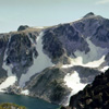
The 1200' North Face of Cannon Mtn rises from the rocky shores of isolated and seldom visited Coney Lake. The high flat area closely east of the summit is the Druid Plateau. Though surrounded by evidence of Ice Age glaciers that sculpted the area into sharp crags and deep troughs, these ancient preglacial upland surfaces like The Druid are an intriguing geological paradox. Alpine Lakes Wilderness. Leavenworth District.
04 131 Shield Lake and Three Musketeers Ridge (285k)
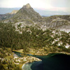
From the Larch Tree covered bench just above Lorelei Lakelets, the view east stretches beyond Shield Lk to polished slabs of Musky Pass and the pyramid shape of Three Musketeers Ridge.
04 136 Shield Lk and Earl Lk from Prusik Peak (358k)
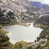
From the summit of Prusik Peak, Shield Lake empties away to the north into Earl Lake, and then into Mesa Lake. This high plateau has a mean Altitude of nearly seven thousand feet. In the misty distance the flow drops over five thousand feet down Rat Creek to merge with Icicle Creek. Some call this northern part of the Enchantment Lakes Basin the Lost World Plateau. Fishermen call it heaven, but only to their closest mates.
04 140 Toketie Lk and Three Musketeers Ridge (273k)
A trio of feathered fedoras grace the crest of Three Musketeers Ridge, reveling its descriptive name. This view is along the shore of Toketie Lk. Toketie is a Kalepuya Indian name for pretty.
05 004 Rudi M John B Moraine Park sunrise Mt Rainier (223k) 1977
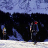
The lack of snow in the winter of 1976-1977 provided a unique opportunity for Cascade Mountain climbers to get a few Winter Ascents to their credit. So, in early February of 1977 the climbers were found approaching the north side of Mount Rainier for a winter ascent of Liberty Ridge. Seen here from Moraine Park, the Liberty Ridge route goes directly up the center of the face. They made high camp 1 at 7500' on Curtis Ridge.
05 007 John B & Rudi M on upper Carbon Glacier (185k)
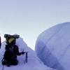
The route across the Carbon Glacier was a maze of huge ice blocks and interlaced crevasses. The climbers first tried to climb over the tops of the blocks. But, they ended up route finding along the questionable floors of the cold deep crevasses. Occasionally they would have to climb out to get their bearings and may times they found dead ends. It took most of the day just to reach the foot of Liberty Ridge. Mt. Rainier Park.
05 010 Thumb Rock camp on Liberty Ridge Mt Rainier (213k)
Precariously perched on the narrow crest of Liberty Ridge is the isolated oasis of Thumb Rock. With barely enough room for a tent, the 10,775ft camp is the only level spot on the ridge route.
05 015 Mt Rainier from upper Moraine Park (227k)
A foot of fresh snow covers the north side of Mt Rainier after a twenty four hour snowstorm in early February of 1977. The decent from Thumb Rk on Liberty Ridge was a hair raising route; down climbing while surrounded by seemingly continuous avalanches. Once across the heavily crevassed Carbon Gl, the hardest part was getting through the snow covered ice patches without injuring yourself during the inevitable falls.
05 020 Snowshoes & shirtsleeves in Necklace Valley (228k)
Wearing sleeveless shirts and snowshoes, the climbers break out above timber line and leave the Necklace Valley far below. The Necklace Valley is located east of the main alpine lakes but still in the heart of the Alpine Lakes Wilderness Area. The narrow valley holds no less than nine picturesque, high mountain lakes and most bear necklace theme names like Jewel, Locket, Jade, Emerald and Opal. Skykomish District.
05 022 Rudi M climbs into the sun near Tank Lks (122k)
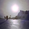
Nearing the ridge crest just south of Otter Pt, the climbers ascend into the afternoon sun. In a normal snow year, to reach this backcountry location, plan on 12 miles of deep, soft snow. '77
05 023 Rudi M and Tony near Tank Lks La Bon Pk (262k)
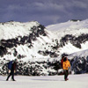
From the flats near Foehn Lake, this view is looking east across the Necklace Valley to Mount Hinman 's 7492ft summit. The uniquely gentle peak is named for Dr Harry B Hinman; a member of the Mountaineers climbing club and a dentist residing in Everett. The peak was named for him in 1934. The Hinman Gl is part of the largest field of glaciers to be found in King County or any locale between Glacier Pk and Mt Rainier.
05 024 Summit Chief Chimney Rock Overcoat Pk (192k)
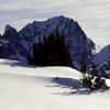
The view looking south from the Tank Lakes area shows the high peaks along the Cascade crest. The rocky bulk on the left is Summit Chief Mountain. In the center are the twin prongs of Chimney Rock. The rocky castellated summit on the right is Overcoat Peak. The first ascent of Overcoat (route unknown) was made by A H Sylvester about 1893; he named the peak after the overcoat he left on the top during surveying.
05 026 Summit Chief Chimney Rk Overcoat Pk (232k)
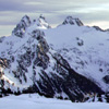
To the south of Tank Lakes are Summit Chief Mtn, Chimney Rk and Overcoat Pk. Overcoat was named by A H Sylvester when he left his coat on top during a 1897 surveying trip. It is said that Sylvester left the coat on purpose. He built a cairn atop the peak and buttoned around it the coat he had worn on the climb. The coat was casually discarded in this manner because it had proved to be too small for comfortable wear.
05 029 Steve Warren Tony John Rudi anoraks (195k)
Steve, Warren, Tony, John and Rudi pose in Earl E Winters Anoraks near the camp a Tank Lks. Steve was the biggest of our group & invented the World Famous Sheller Cookie. You would want to be extra nice to Steve so he would want to give you one of his huge cookies. The recipe was similar to a Tall house but they included Wheat Germ and M&Ms. You would only need one per trip, for each weighed nearly a half pound.
05 034 Randy L Rattlesnake Rock Tumwater Canyon (214k)
Rock climbing in the Tumwater Canyon near Leavenworth is like visiting a different planet. The whole scene is an ever evolving culture that is driven by the fad of the day & latest techno aids.
05 051 LeeAnn follows John B on summit Chief Mtn (192k)
In the spring of seventy seven we find the climbers on the ascent of Summit Chief Mtn. This largest of the "Chief" formation is located 1.5 mi SW of Dutch Miller Gap. Dutch Miller Gap is at the crest of the Cascades near Summit Lake in NE King County. It is at the head of the Mid-Fork of the Snoqualmie River and was named for Andrew Jackson Miller, who was nicknamed Dutch and who located the Dutch Miller Mine nearby.
05 052 LeeAnn shows Warren the Cascades on summit Chief (160k)
Next to the cairn on top of Summit Chief Mtn, the climbers play name that peak. The experienced climber nods silently as the attractive young student recites the names of distant northern mountains. Off to the east is the dark pyramid of Mt Stuart. Summit Chief Mountain was climbed during a 1925 Mountaineers outing and upon reaching the top, they found no evidence of an earlier ascent. Alpine Lakes Wilderness Area. '77
05 055 Three Queens from summit Chief Pass (177k)
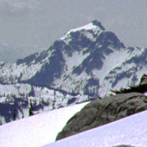
On the descent of Summit Chief Mountain the climbers looked south to see The Three Queens. They had quietly snagged another summit from under the vigilant gaze of the trio of watchers.
05 058 Summit Chief Mtn near Vista Lks (257k)
This view near snow covered Vista Lakes shows Summit Chief Mountain peeking through the trees. The fragile alpines zone around Summit Chief Pass had long been a secret secluded haunt for the few who ventured off trail and braved the brushy climb out of either the Waptus or Cooper River drainages. That changed in the late 70s when the Pacific Crest Trail was rerouted through the pass and forever scaring the land.
05 061 Warren on Trigger Finger Peshastin Pinnacles (146k)
Between Leavenworth and Wenatchee in eastern Washington State are the sandstone crags of Peshastin Pinnacles. Every spring the climbers arrive to hone their skills and test their courage. For many years the signature climb at Peshastin was the narrow spire named Trigger Finger. Then one spring when the climbers arrived for the season, they found that Trigger Finger had not survived the winter and an era had ended.
05 064 John B on Winter Solstice Castle Rock (265k)
Of the many practice rock climbing areas in Tumwater Canyon, Castle Rock has become the most popular due to its close proximity to the highway, excellent diorite rock and wide variety of routes. These climbers are on the oldest and most popular route called Midway. The 1965 climbing guide calls for 4 piton and 2 hours to complete the climb. Midway has now been climbed in 10 min, also at night, and descended.
05 066 North face route on Dragontail Peak (260k)
The large granite massif of Dragontail Peak is the second-highest summit in the Stuart Range. The name originates from the miniature "tails" or rock needles on the thin crest southeast of the summit. Shown here, the expansive three thousand foot northwest face, rising above the moraines and ice of Colchuck Glacier, is one of the finest walls in all the Cascade Range. The North Face route climbs straight up the center.
05 067 John B on the N face of Dragontail Pk (194k)
Climbing the North Face route on Dragontail Peak, the climbers pause to gather water from a small snow patch. The milky blue lake is Colchuck Lake in the Alpine Lakes Wilderness. 1977
05 071 John B Rudi M & John P Dragontail Peak (257k)
Climbing together, but on separated rope teams, the red rope and blue rope climb onto The Fin near the top of Dragontail's North Face route. Most of the first ascents of Dragontail Peak from the Colchuck side came over a short period of time during the early 1970s. The first route to fall was the NE Couloir followed by Backbone Ridge, Hidden Couloir, North Face direct, and then NE Buttress; all FA made by different teams.
05 076 Rudi M & John P ascend Colchuck Gl (248k)
Tucked under the Northwest Wall of Dragontail Peak and rising steeply from the south shore of Colchuck Lake is the Colchuck Glacier. One of the last dwindling remnants of a once massive ice sheet that filled Icicle Canyon with a 2000 foot thick glacier. As the glacier slowly retreats to its head at Banshee Pass, the milky blue waters twenty five hundred feet below still proclaim its active existence with powdery glacial till. 6/77
05 077 Mt Stuart & Sherpa Peak from Colchuck Pk (222k)
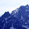
West from the summit of Colchuck Peak are the rugged northeast flanks of Sherpa Pk and Mount Stuart. The climbing history of these shear walls and precipitous ridges has a reoccurring theme, that being, Dave Mahre and the Prater brothers; Gene and Bill. Most of the first ascents on these northeast exposures occurred in the mid to late 1950s and included all or parts of the noted climbing trio. Alpine Lakes Wilderness.
05 079 Climbers on Bull Durham with Rooster Finch (181k)
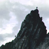
In the summer of 1977 we find the climbers in a feeding frenzy amongst the excellent granite towers of the wild and rugged Stuart Range. Here the climbers are on Bull Durham Tower with Rooster Finch Tower above; both located on the jagged Southwest Ridge of Dragontail Pk. These easy rock towers were both first climbed in Aug of '63 by J Wickwire and F Stanley. Leavenworth Ranger District, Wenatchee National Forest.
05 081 Warren near Mist Pond & Aasgard Pass (207k)
Perched on a shard of granite, high above Mist Pond near Aasgard Pass, this climber displays a confidence of balance gained through many days bouldering and sport climbing. In such an environment were any slip could be your last, the climbers acclimatize to the exposure by sharply tuning their concentration level so no other distracting thought clouds their mind. This mental cleansing provides a euphoric escape.
05 083 Mt Stuart in the clouds (145)
In the north central Cascade Range east of the crest, Mount Stuart with its massive granite bulk, dominates the land from many distant points. Yet the mighty Stuart bows to the weather with its wind and rain and snow. Over the eons of time, the elements of the weather will slowly chip away at the mountain until all that remains is a powdery dust. Not Stuart; but the weather rules the mountains. And the sun drives the weather.
05 088 Rudi nears the Witches Tower (207k)
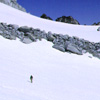
At 8520+feet The Witches Tower is a steep, rounded rock crag that stands to the north of the Dragontail Plateau and splits the small dwindling fragments of the Snow Creek Glaciers. The slow growing, hardy plant that darkens the light colored granite is called Lichen. It takes hundreds of years for a palm size patch of Lichen to grow. As seen here from the lack of Lichen, the Snow Creek Glaciers are into a century of retreat. 77
05 094 Zig zag on S face of Little Annapurna (192k)
On the final pitch of Little Annapurna, the climbers weave a line up the South Face. This unique climb started from the top with three 150 foot rappels and the courage to pull the rope through.
05 098 Rudi M on Prusik Pk with Little Annapurna (188k)
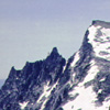
On the familiar West Ridge route of Prusik Pk, the climbers feel more & more at home as they scamper around the sharp granite towers and casually scoff at the threatening vertical walls.
05 099 Rudi M & John P at Camp near Gnome Tarn (294k)
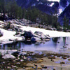
The climbers pack their gear to move camp from this picturesque spot near Gnome Tarn to an equally amazing camp near Tamarack Meadow. The true wonder of the Enchantment Lakes Basin is the complexity of detail. Everywhere you turn is a surprising little nook with dwarf trees and bright clumps of miniature flowers. These inviting personal spaces are bordered with white rock walls and soft floors of crystal-like sand.
05 100 Prusik Pk S face from Gnome Tarnv (301k)
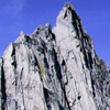
The signature view of Prusik Pk's south face from Gnome Tarn, shown here in full sun light, is the most popular image that graces the pages of numerous guide and travel books. Two main routes climb the south face: Beckey-Davis and Burgner-Stanley. Our overly confident climbers were thwarted on the Beckey and Davis Route and were humbled enough to retreat by rappel from a high point within 100 feet of the summit.
05 101 McClellan Chessmen from near Lk Viviane (299k)
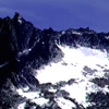
naration
05 103 John P in Tamarack Meadows The High Priest (259k)
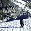
naration
05 108 Warren belay on N face High Priest (329k)
naration
05 109 Rudi Mallant watches John P rappel High Priest (277k)
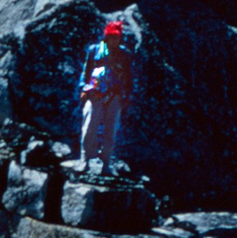
naration
 05 113 Rudi M & John P near Musky Pass Temple Ridge (xxxk)
naration
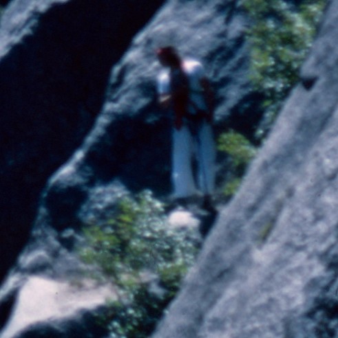 05 117 Rudi M on Outer Space Snow Creek Wall (xxxk)
naration
 05 121 Napeequa Valley below Little Giant Pass (xxxk)
naration
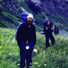 05 123 Randy L and LeeAnn H in the Napeequa Valley (xxxk)
naration
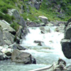 05 124 LeeAnn at Napeequa R Tom B Randy L (xxxk)
naration
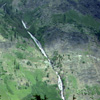 05 127 W slope of Buck Mtn from Butterfly Butte (xxxk)
naration
 05 128 Clark Mtn Sheep Corral on butterfly Butte (xxxk)
naration
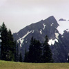 05 129 Clark Mtn Sheep Corral on butterfly Butte (xxxk)
naration
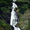 05 131 Buck Mtn cascades in the Napeequa Valley (xxxk)
naration
 05 136 Tom B near Boulder Pass above Napeequa Valley (xxxk)
naration
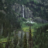 06 003 Lemah Ck headwall and Lemah Pk
On the approach to Lemah Mtn, the climbers where stopped cold in their tracks and unable to
proceed. The delay was due solely to the breathtaking view of the upper Lemah Creek Valley.
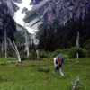 06 004 Tom B crosses the swampy Lemah Valley (xxxk)
naration
 06 010 Lemah Lounge from the Lemah Glacier (xxxk)
naration
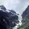 06 015 Northern Ice Couloir of the Lemah Glacier (xxxk)
naration
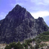 06 022 The Steeple The Spinster of Bachelor Meadows (xxxk)
naration
 06 024 Warren step on The Spinster of Bachelor Meadows (xxxk)
naration
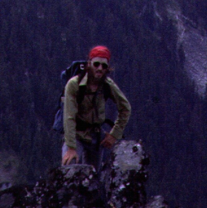 06 026 Warren on The Steeple with Glacier Pk (xxxk)
naration
 06 027 Tom B on The Steeple with Spire Gl (xxxk)
naration
 06 028 Across Spire Ck to Eldorado Johannesburg Formidable (xxxk)
naration
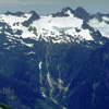 06 029 Tom B descends with Mt Buckindy area (xxxk)
naration
 06 033 Randy L on Bachelor Creek trail (xxxk)
naration
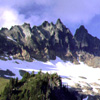 06 034 Spire Point from Bachelor Meadows (xxxk)
naration
 06 036 Randy L at Mule Lake camp (xxxk)
naration
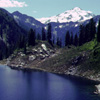 06 037 Glacier Peak beyond Cub Lake (xxxk)
naration
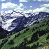 06 038 Across Downey Ck to Buckindy area (xxxk)
naration
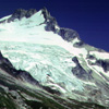 06 039 Dome Pk & Glacier from Bachelor Meadows (xxxk)
naration
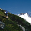 06 040 Randy L to Spire Point camp Dome Pk (xxxk)
naration
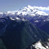 06 041 Bath Lake Peaks DaKobed Range & Glacier Peak (xxxk)
naration
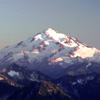 06 042 Glacier Peak from Spire Pt high camp at sunset (xxxk)
naration
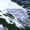 06 044 Dome Pk & the Dome Glacier from Spire Point (xxxk)
naration
 06 047 Metamorphic rock and ice axe (xxxk)
naration
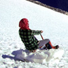 06 049 Warren shows how to glissade (xxxk)
naration/P>
 03 137 Looking down Weden Ck on the Gothic Basin trail (210k)
Looking down Weden Creek into the mist filled Sauk River Valley. O. D. Weedon settled NW of Mt Pugh in 1896. Then during a land dispute in 1910, he killed three men and then shot himself. Sheep Mtn is on the skyline right. Viewed from the Gothic Basin Trail #724 in the Monte Cristo area. Accessed along the Mountain Loop Scenic Byway at Barlow Pass from the town of Granite Falls. MBS National Forest: Unprotected area.
|
|
|
|
|
|
Created and maintained by THE IBEX
- Revised 08 MAR 2002 Images For Sale: High resolution (25meg) TIFF files (25 per CD) and 8.5X11 prints available for PURCHASE |
|