
|
|
IBEXtrax.com - Cascade Mountains of Washington StateGlacier Peak Wilderness |
|
|
02 122 Mt Pugh S slope from Mt Forgotten
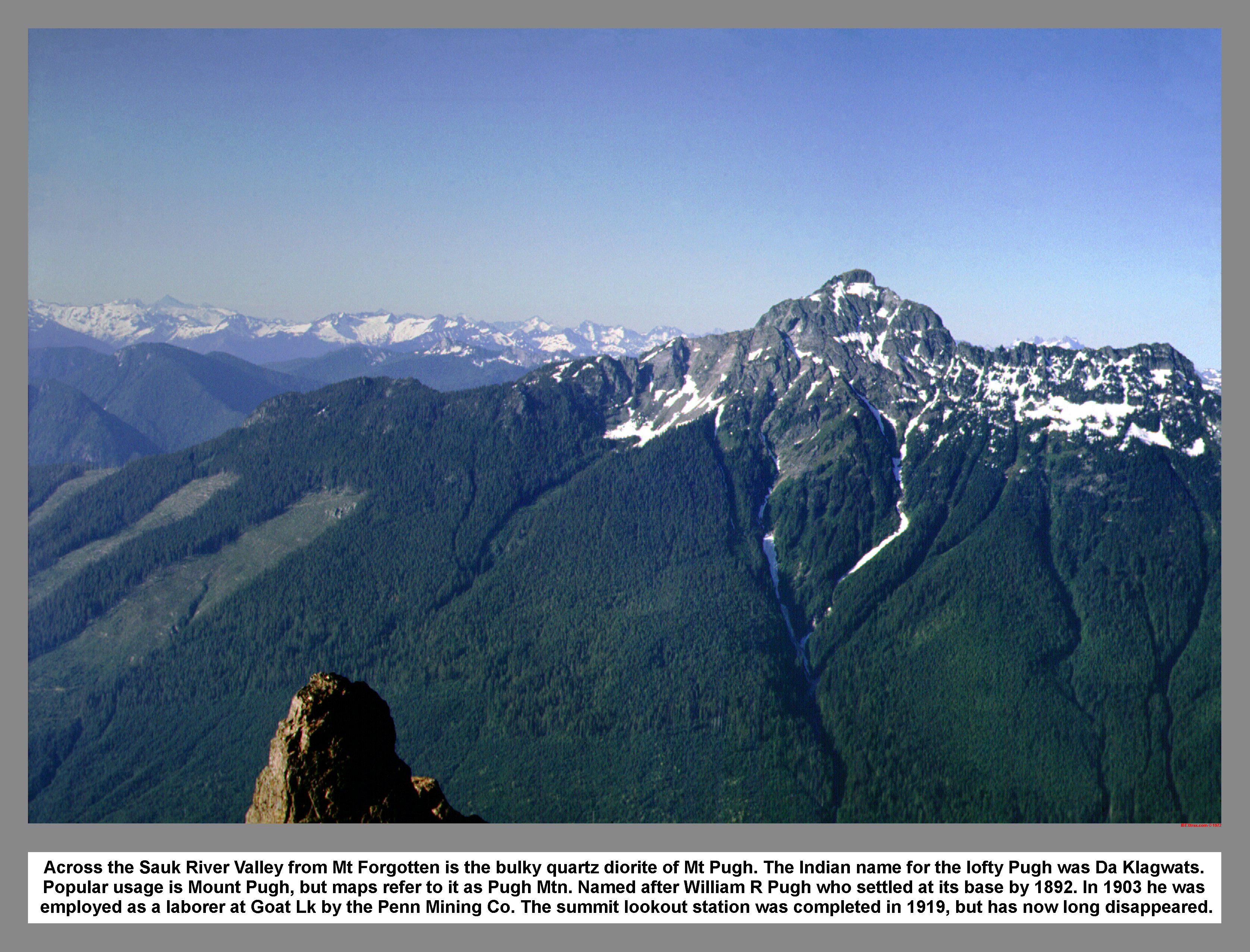
Across the Sauk River Valley from Mt Forgotten is the bulky quartz diorite of Mt Pugh. The Indian name for the lofty Pugh was "Da Klagwats". Popular usage is Mount Pugh, but maps refer to it as Pugh Mtn. Named after William R Pugh who settled at its base by 1892. In 1903 he was employed as a laborer at Goat Lk by the Penn Mining Co. The summit lookout station was completed in 1919, but has long since disappeared.
02 124 Mount Pugh from the lower trail
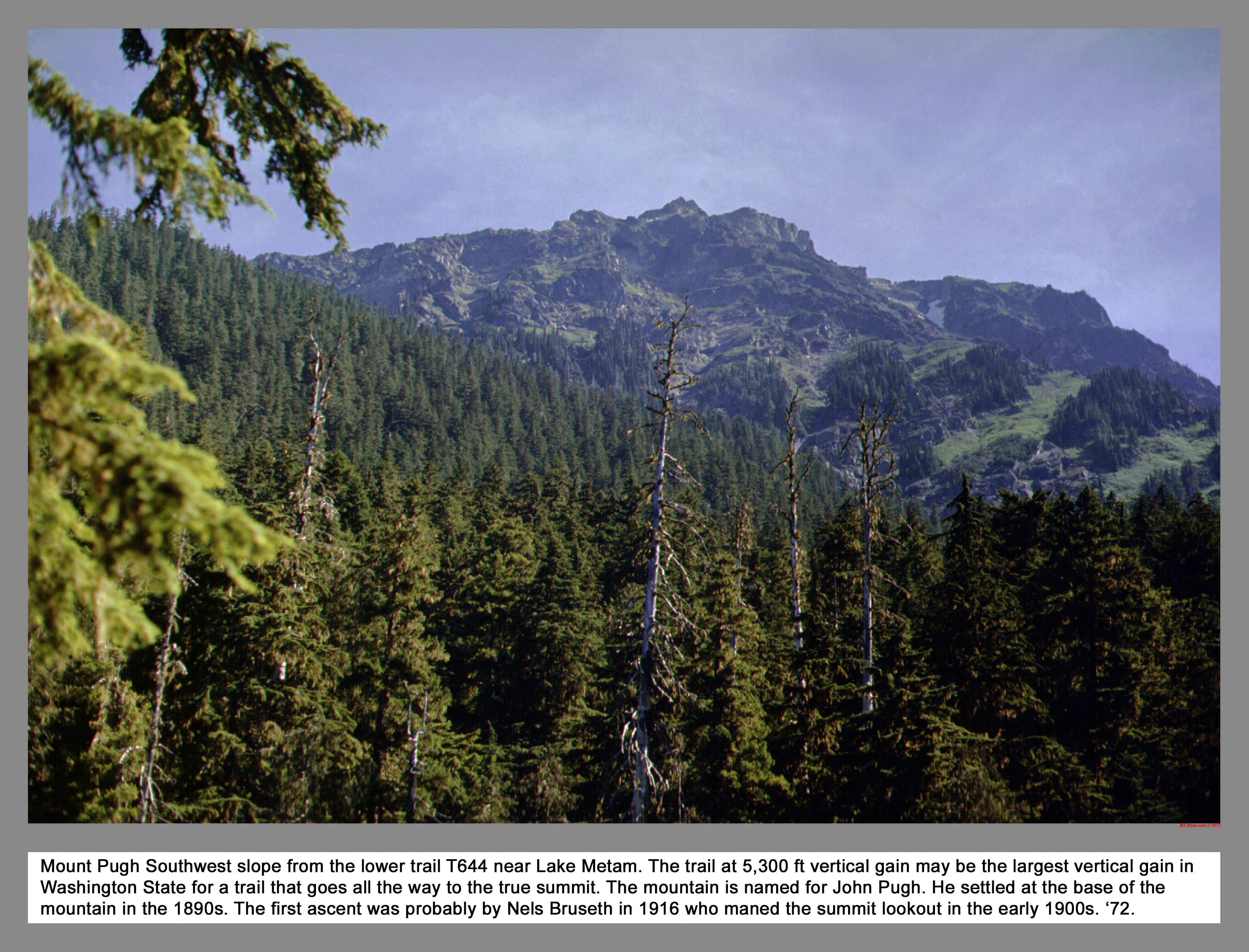
Mount Pugh Southwest slope from the lower trail T644 near Lake Metam. The trail at 5,300 ft vertical gain may be the largest vertical gain in Washington State for a trail that goes all the way to the true summit. The mountain is named for John Pugh. He settled at the base of the mountain in the 1890s. The first ascent was probably by Nels Bruseth in 1916 who maned the summit lookout in the early 1900s. '72.
02 128 Three Fingers Whitehorse from Stujack
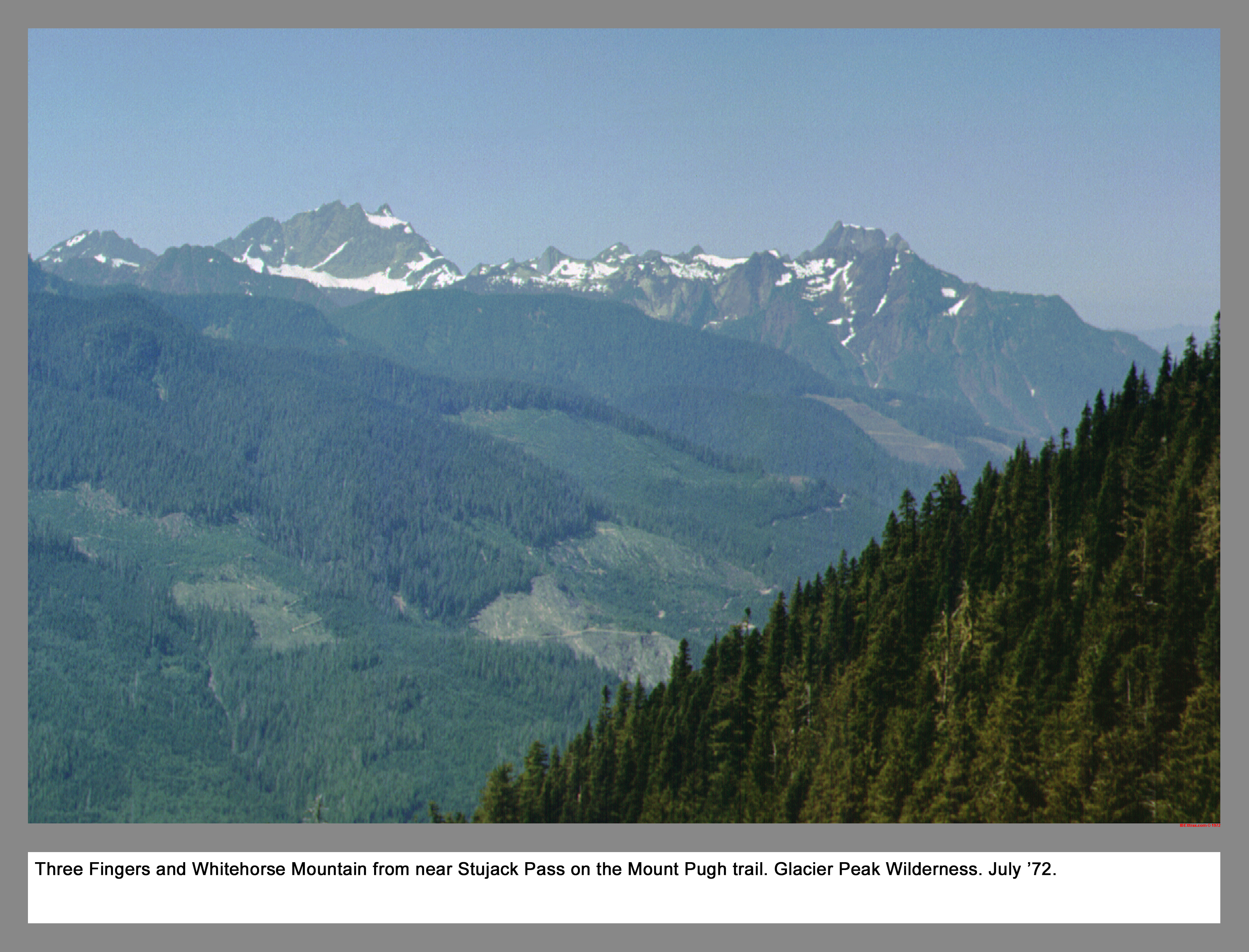
Three Fingers and Whitehorse Mountain from near Stujack Pass on the Mount Pugh trail. Glacier Peak Wilderness. July '72.
02 129 Sloan Peak from Stujack switchback
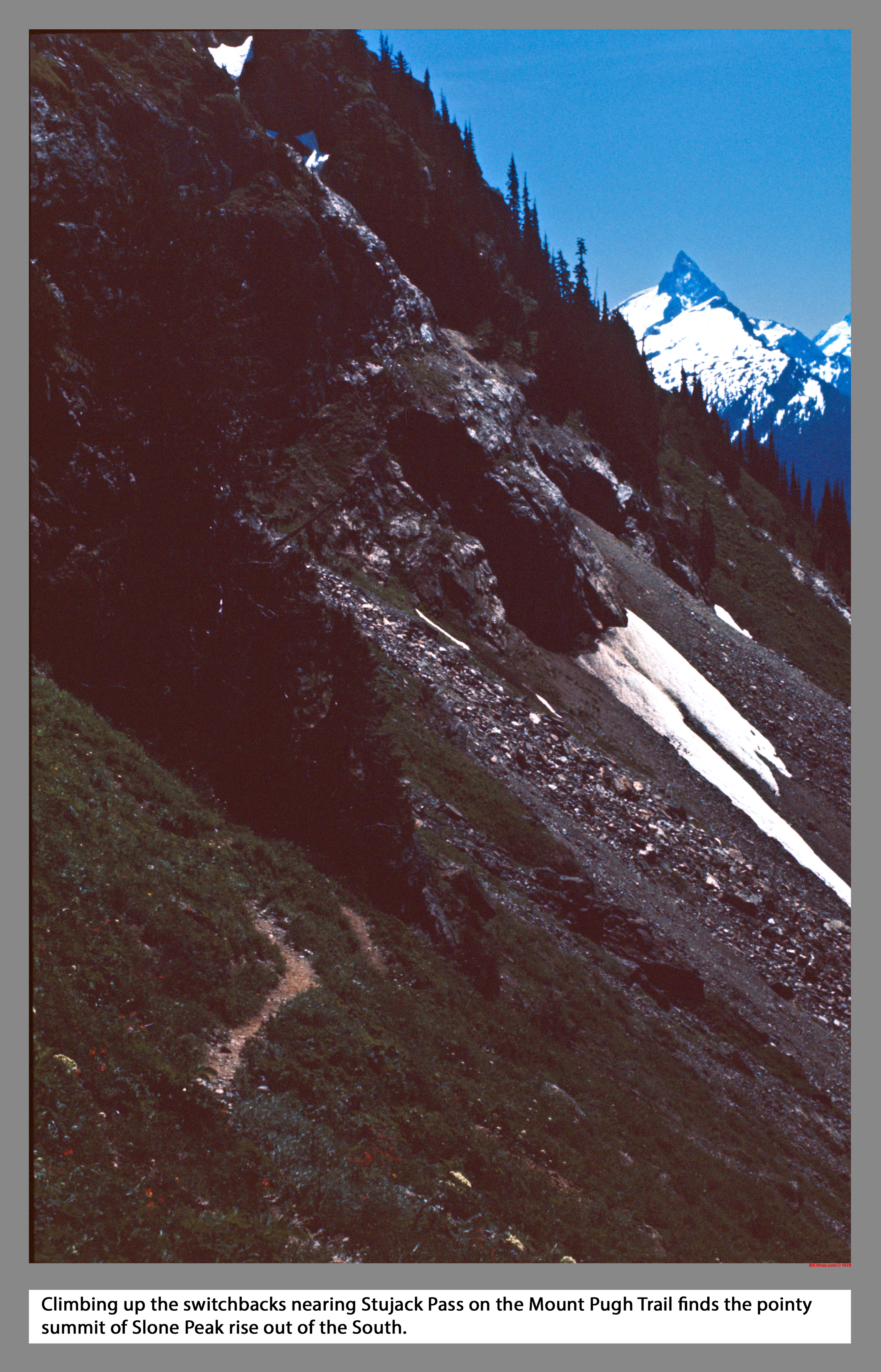
Climbing up the switchbacks nearing Stujack Pass on the Mount Pugh Trail finds the pointy summit of Slone Peak rise out of the South.
02 130 Whitechuck Mtn from Stujack Pass
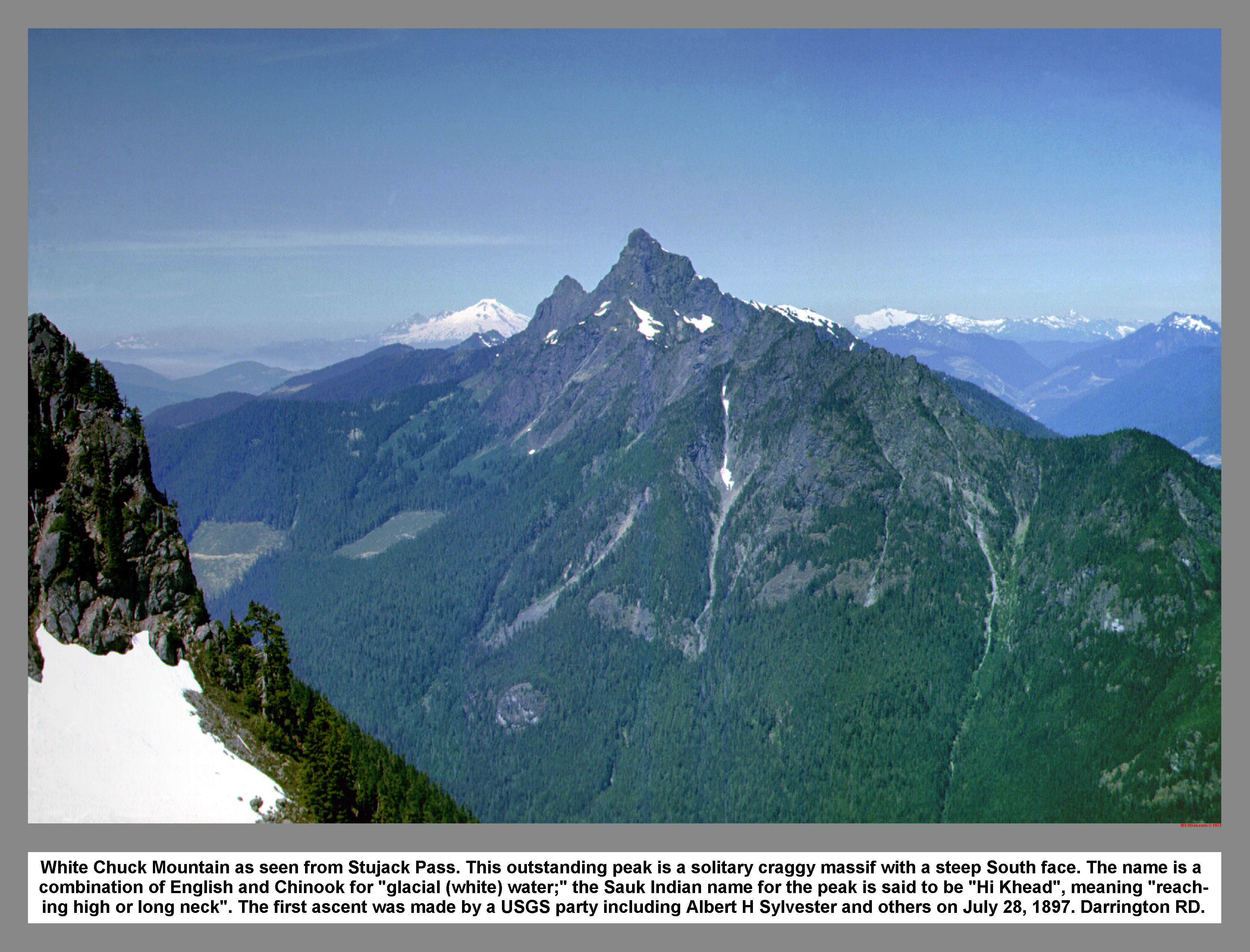
White Chuck Mountain as seen from Stujack Pass. This outstanding peak is a solitary craggy massif with a steep South face. The name is a combination of English and Chinook for "glacial (white) water;" the Sauk Indian name for the peak is said to be "Hi Khead", meaning "reach-ing high or long neck". The first ascent was made by a USGS party including Albert H Sylvester and others on July 28, 1897. Darrington RD.
02 131 Upper slopes of Mt Pugh from Stujack Pass
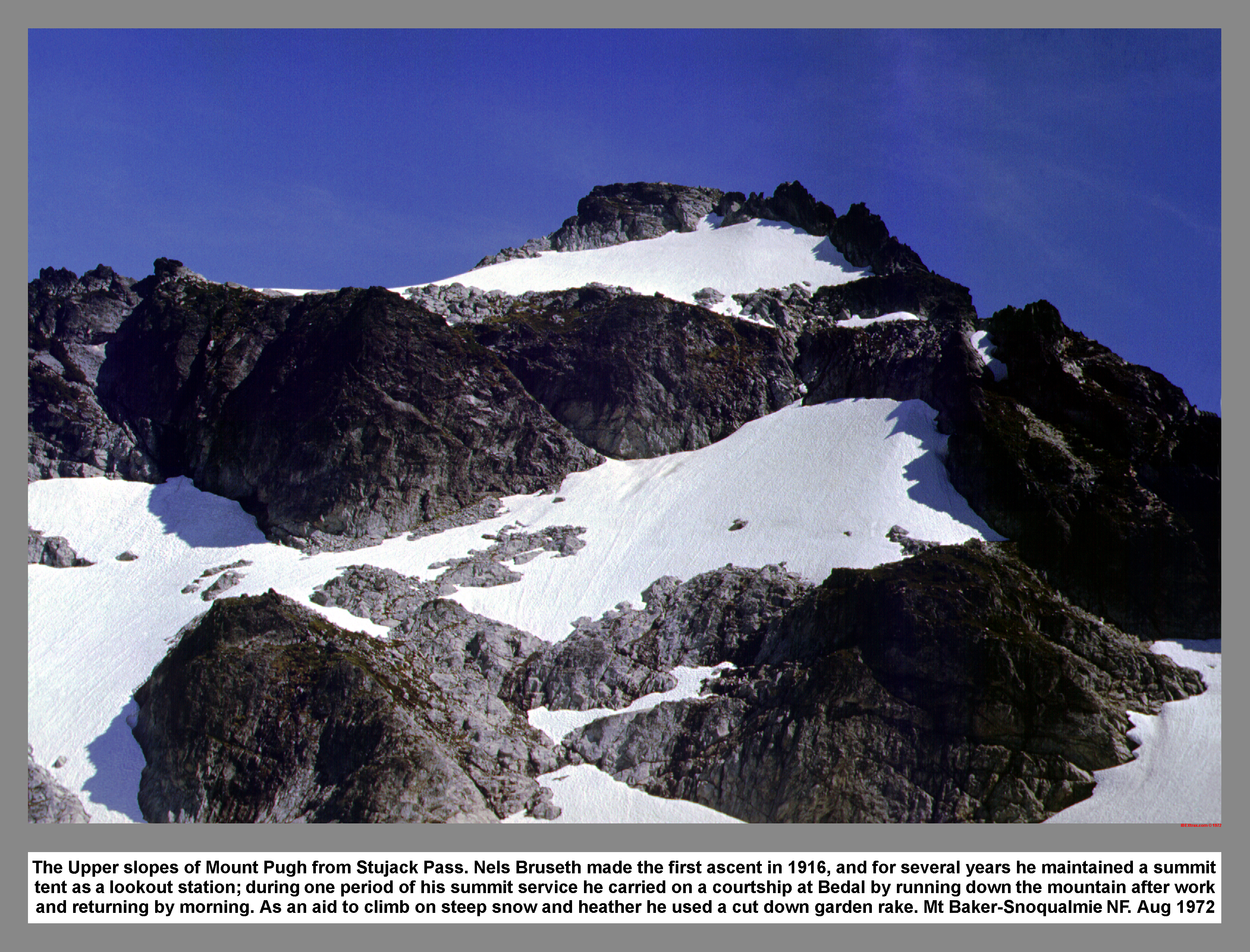
The Upper slopes of Mount Pugh from Stujack Pass. Nels Bruseth made the first ascent in 1916, and for several years he maintained a summit tent as a lookout station; during one period of his summit service he carried on a courtship at Bedal by running down the mountain after work and returning by morning. As an aid to climb on steep snow and heather he used a cut down garden rake. Mt Baker-Snoqualmie NF. Aug 1972
02 132 Doug H on upper slopes of Mount Pugh
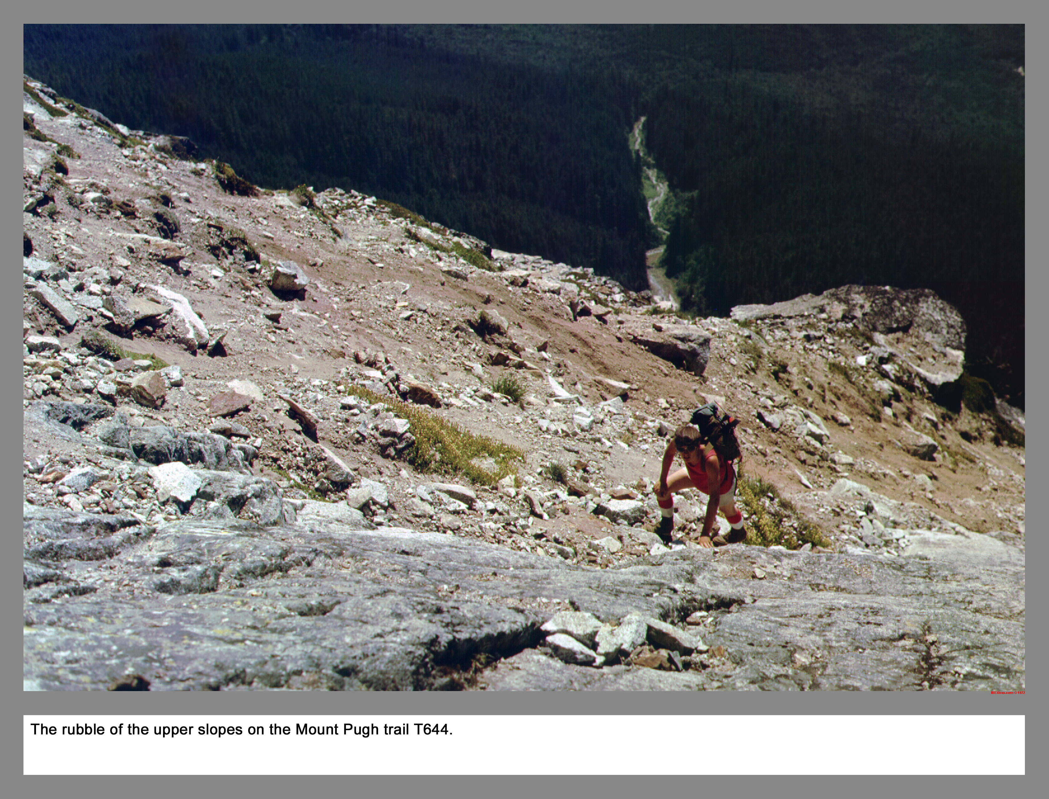
The loose rubble affectionally called choss adorns the upper slopes on the Mount Pugh trail number T644.
02 134 Forgotten Twin Hall Big 4 Vesper
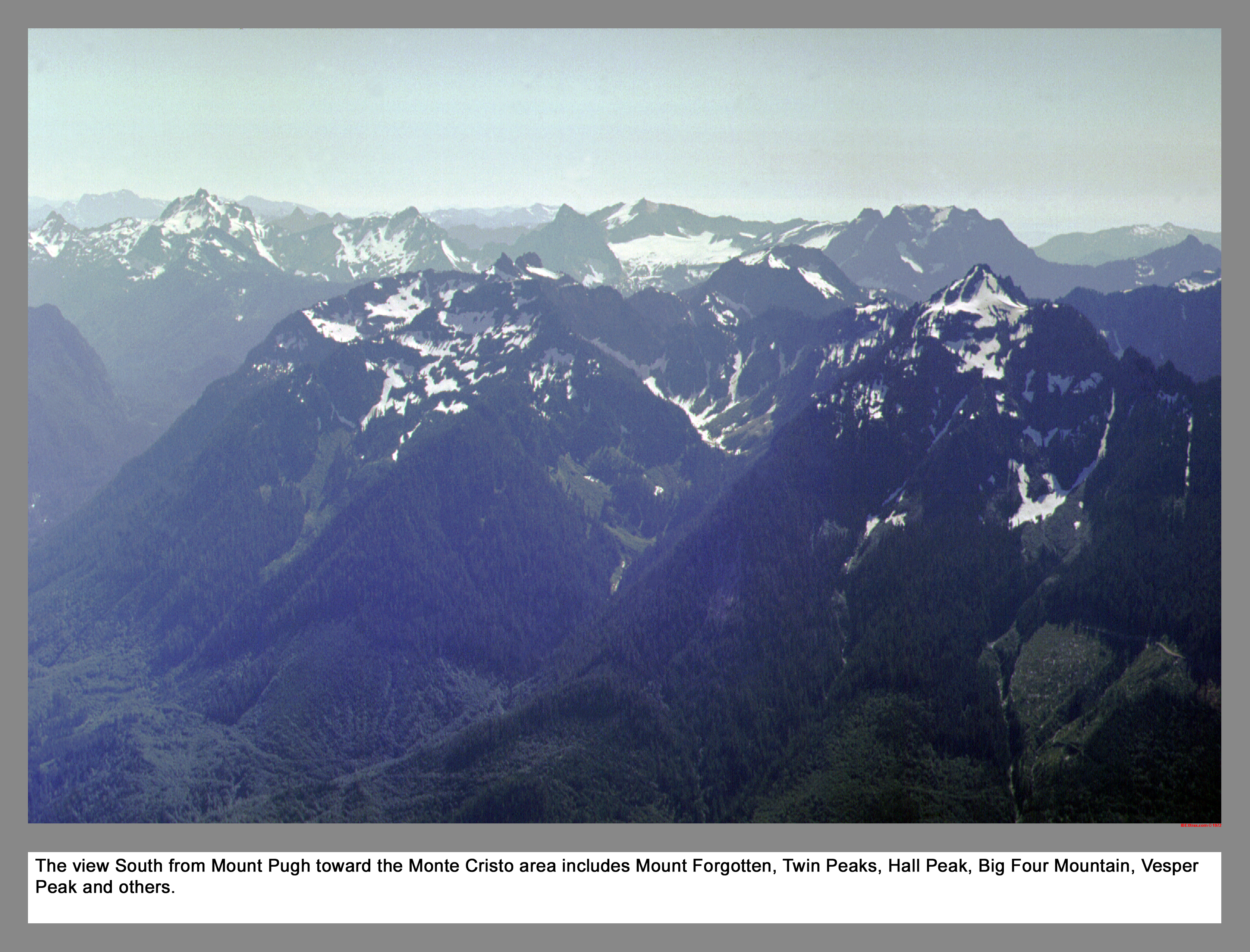
The view South from Mount Pugh toward the Monte Cristo area includes Mount Forgotten, Twin Peaks, Hall Peak, Big Four Mountain, Vesper Peak and others.
02 135 Sloan Pk Monte Cristo Peaks and Mt Rainier
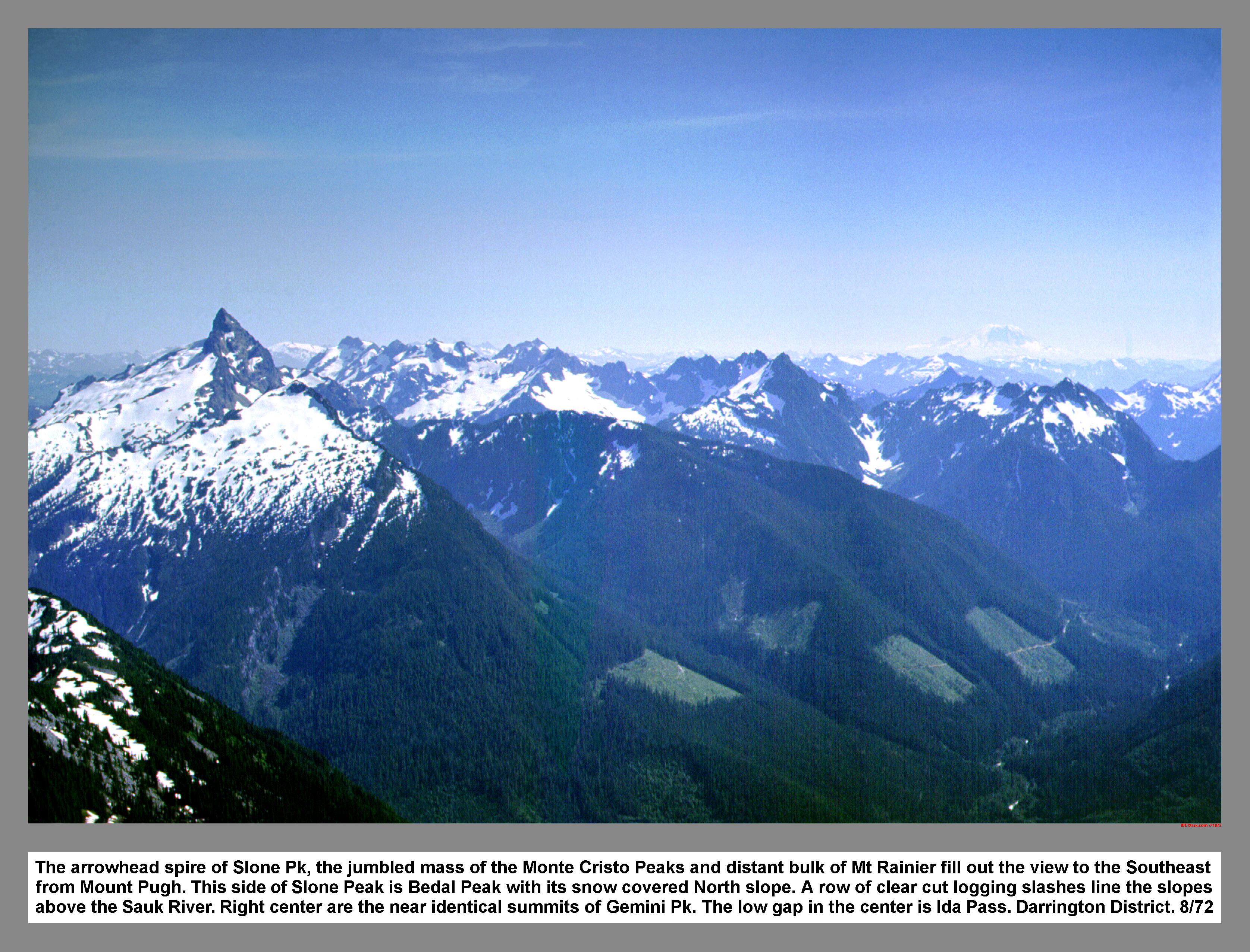
The arrowhead spire of Sloan Pk, the jumbled mass of the Monte Cristo Peaks and distant bulk of Mt Rainier fill out the view to the Southeast from Mount Pugh. This side of Sloan Peak is Bedal Peak with its snow covered North slope. A row of clear cut logging slashes line the slopes above the Sauk River. Right center are the near identical summits of Gemini Pk. The low gap in the center is Ida Pass. Darrington District. 8/72
02 136 Doug H on Mt Pugh with Glacier Peak
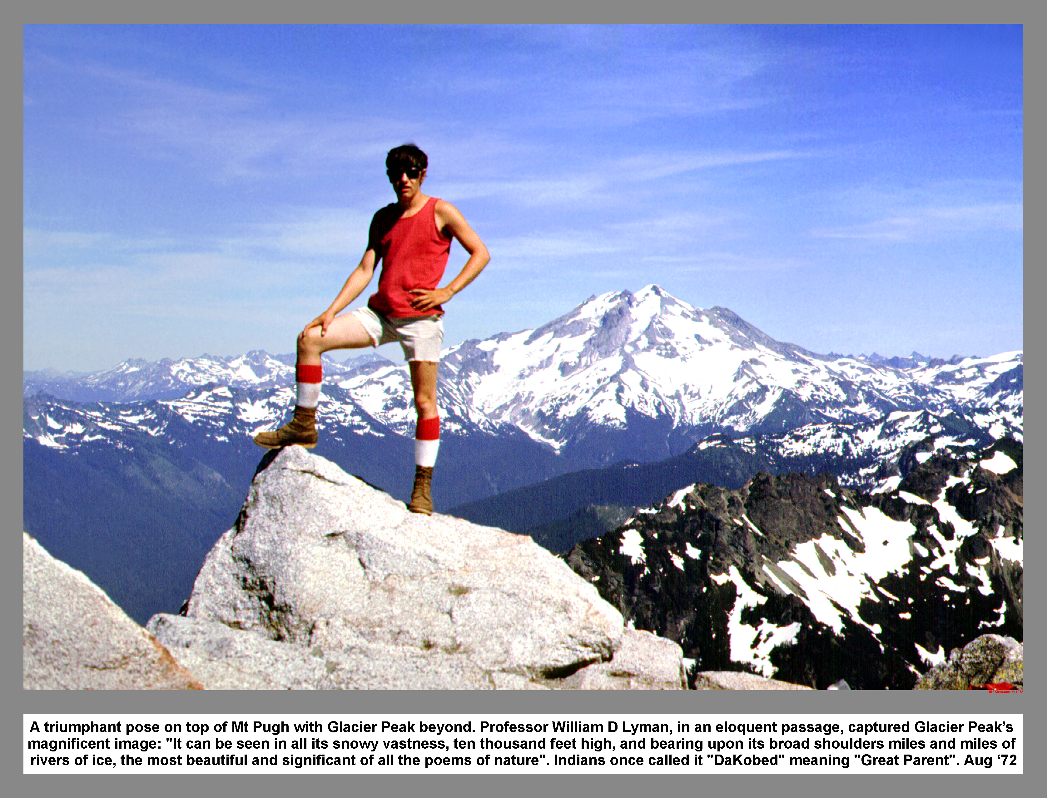
A triumphant pose on top of Mt Pugh with Glacier Peak beyond. Professor William D Lyman, in an eloquent passage, captured Glacier Peak's magnificent image: "It can be seen in all its snowy vastness, ten thousand feet high, and bearing upon its broad shoulders miles and miles of rivers of ice, the most beautiful and significant of all the poems of nature". Indians once called it "DaKobed" meaning "Great Parent". Aug '72
02 137 Warren on Mt Pugh with Mt Baker
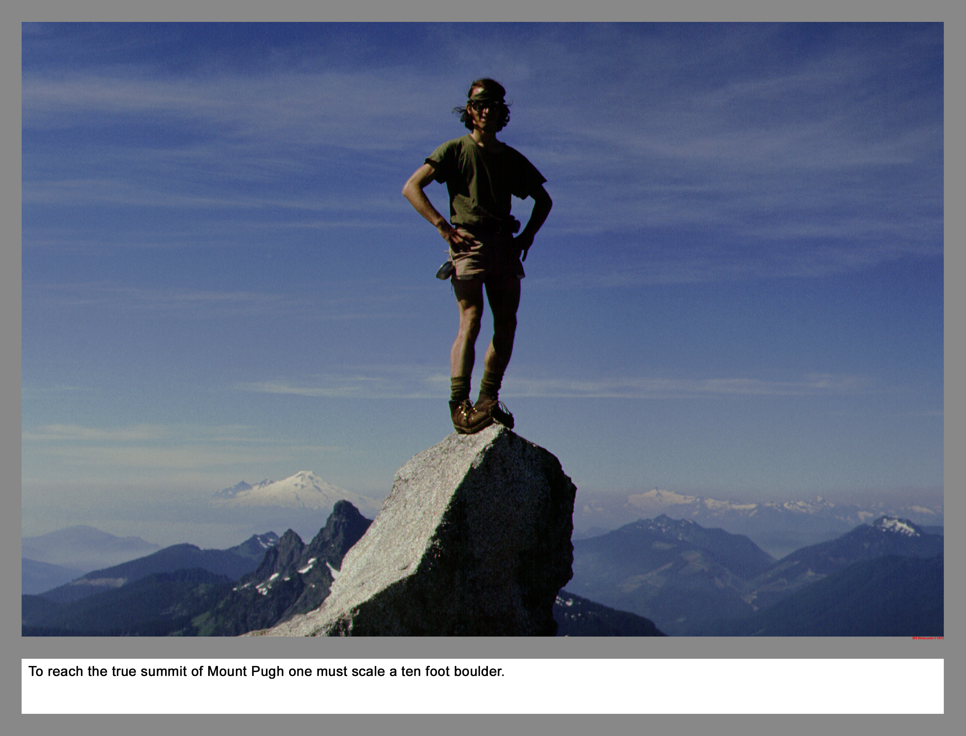
To reach the true summit of Mount Pugh you must scale a ten foot boulder.
02 138 Example of a poor self-arrest Doug H
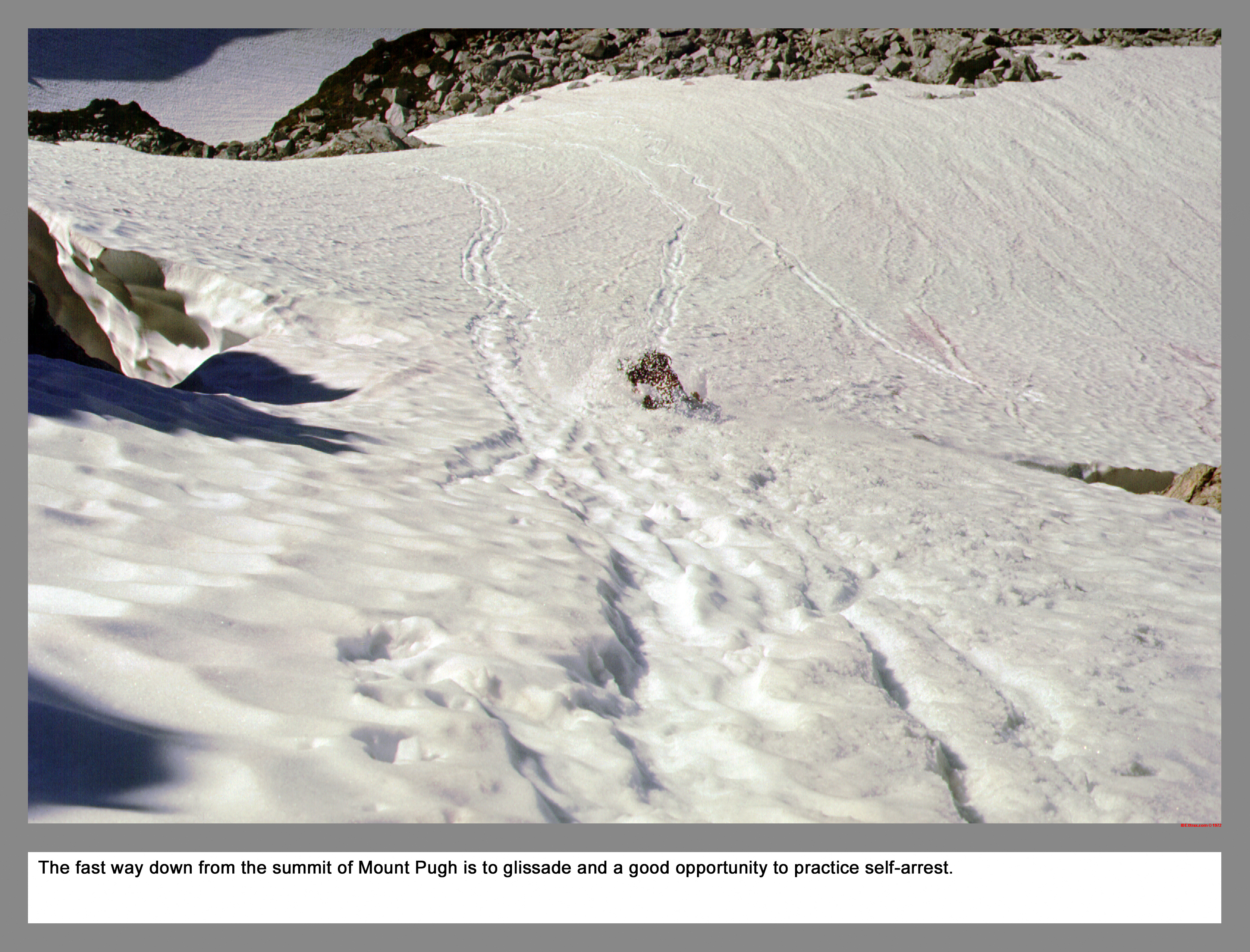
The fast way down from the summit of Mount Pugh is to glissade and a good opportunity to practice self-arrest.
02 139 Doug H on Switchbacks below Stujack Pass

The Mount Pugh trail switchbacks below Stujack Pass are of a comfortable grade and this allows one to glide down the trail without too much brake. This gliding saves your thigh muscles to reach the trailhead without too much pain and to climb another day.
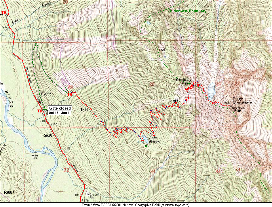
02 139m Pugh Mountain Stujack Pass Map
|
|
|
|
| This site created and maintained by THE IBEX - Page last revised:
|
|