
|
|
IBEXtrax.com - Cascade Mountains of Washington StateBoulder River Adj Roadless Area, Mt Baker-Snoqualmie Forest |
|
|
02 081 Hikers on the Perry Ck trail Don B and Paul B
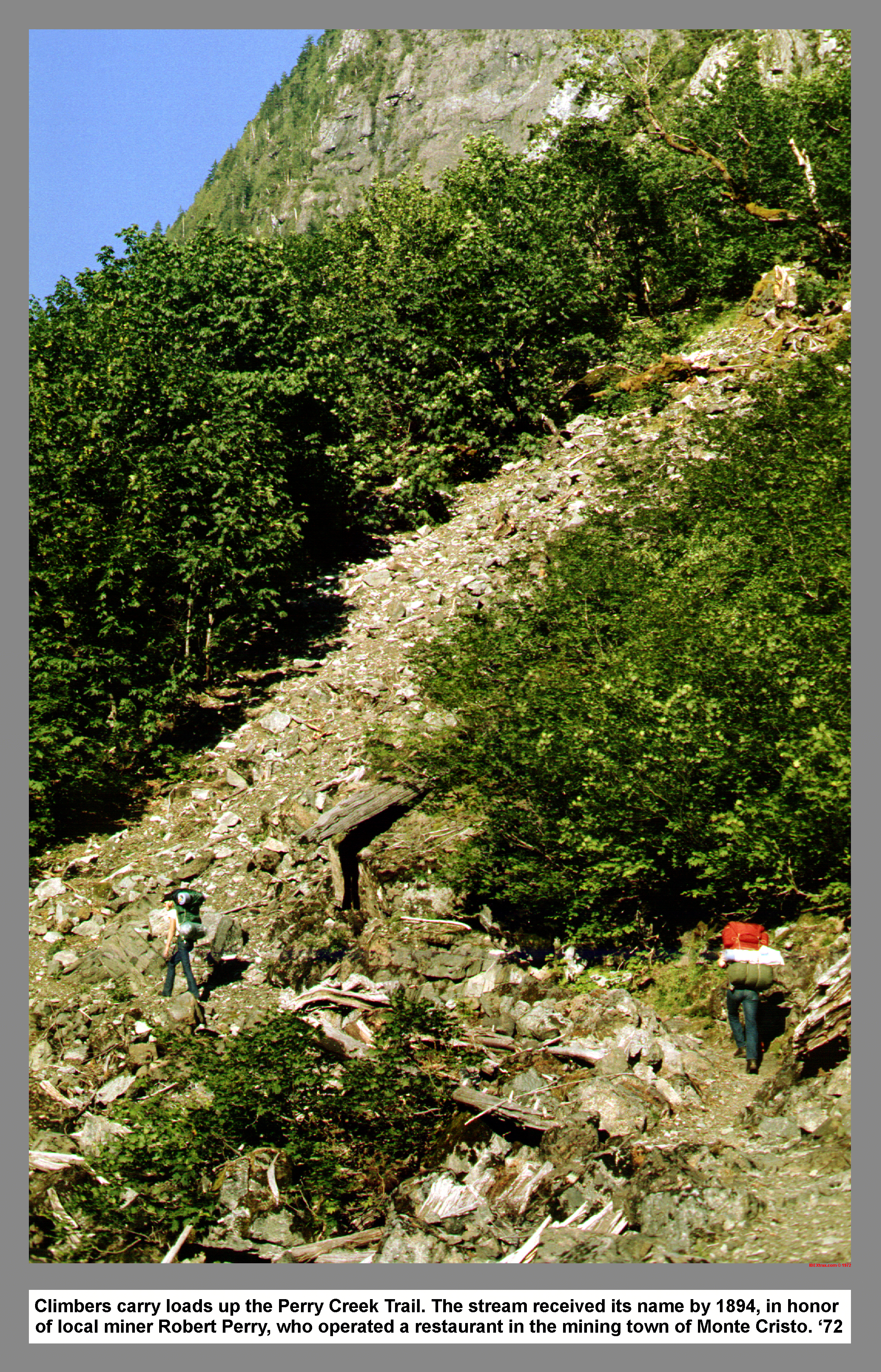
Climbers carry loads up the Perry Creek Trail. The stream received its name by 1894, in honor of local miner Robert Perry, who operated a restaurant in the mining town of Monte Cristo.
02 082 Hall Peak stands at the foot of Perry Ck
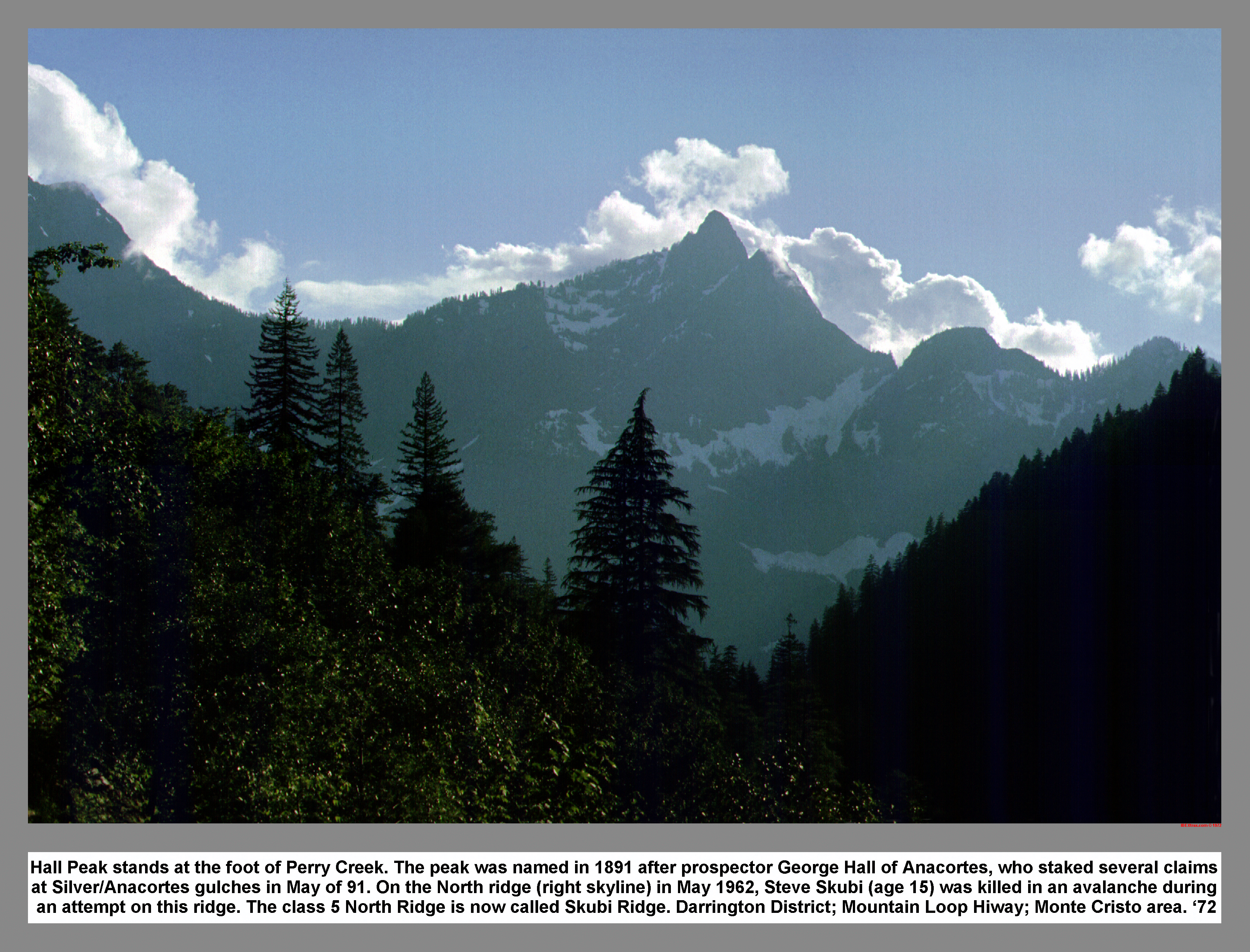
Hall Peak stands at the foot of Perry Creek. The peak was named in 1891 after prospector George Hall of Anacortes, who staked several claims at Silver/Anacortes gulches in May of 91. On the North ridge (right skyline) in May 1962, Steve Skubi (age 15) was killed in an avalanche during an attempt on this ridge. The class 5 North Ridge is now called Skubi Ridge. Darrington District; Mountain Loop Hiway; Monte Cristo area.
02 083 Stillaguamish Trail climbs up right to ridge top
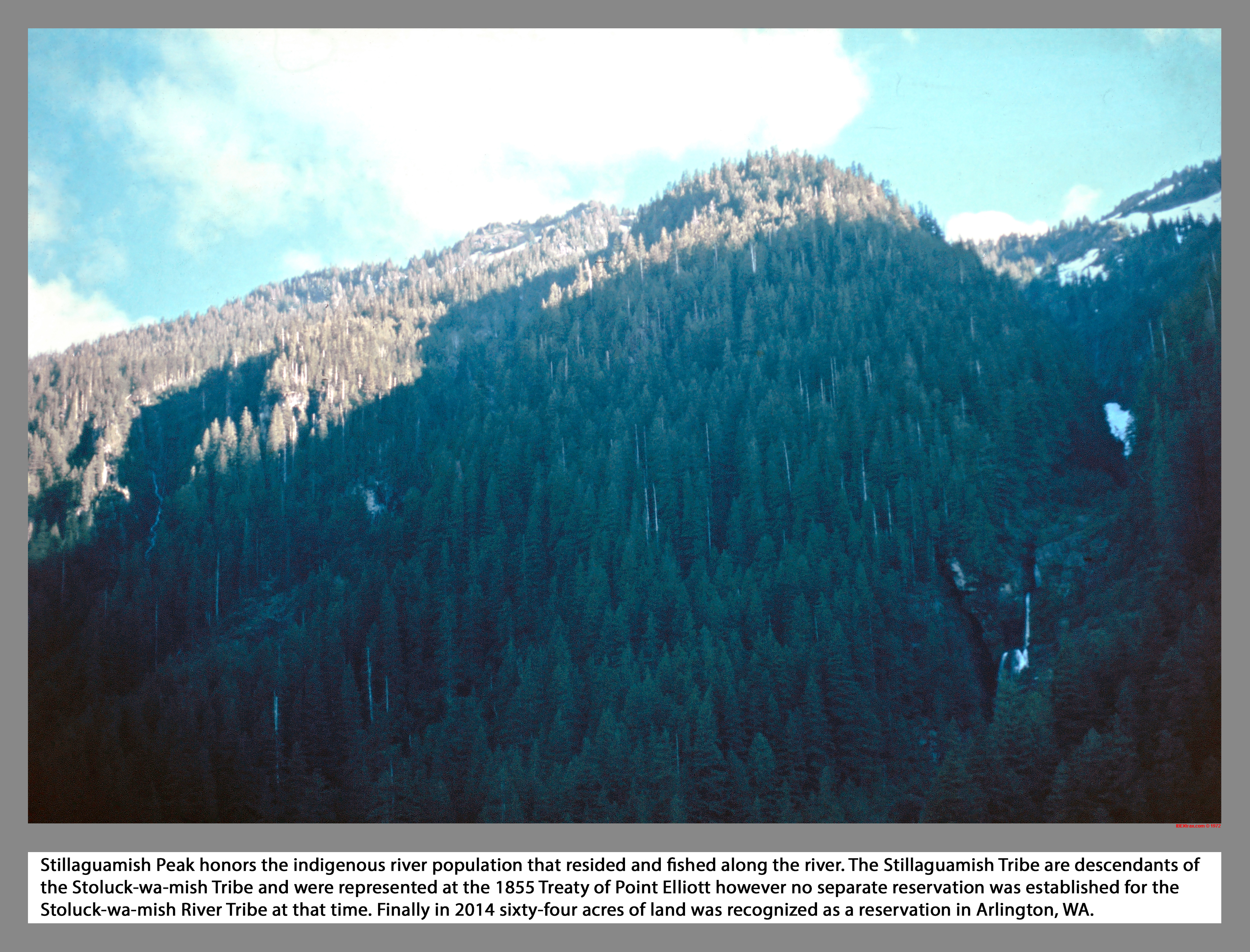
Stillaguamish Peak honors the indigenous river population that resided and fished along the river. The Stillaguamish Tribe are descendants of the Stoluck-wa-mish Tribe and were represented at the 1855 Treaty of Point Elliott however no separate reservation was established for the Stoluck-wa-mish River Tribe at that time. Finally in 2014 sixty-four acres of land was recognized as a reservation in Arlington, WA.
02 086 Cascade on Mount Dickerman
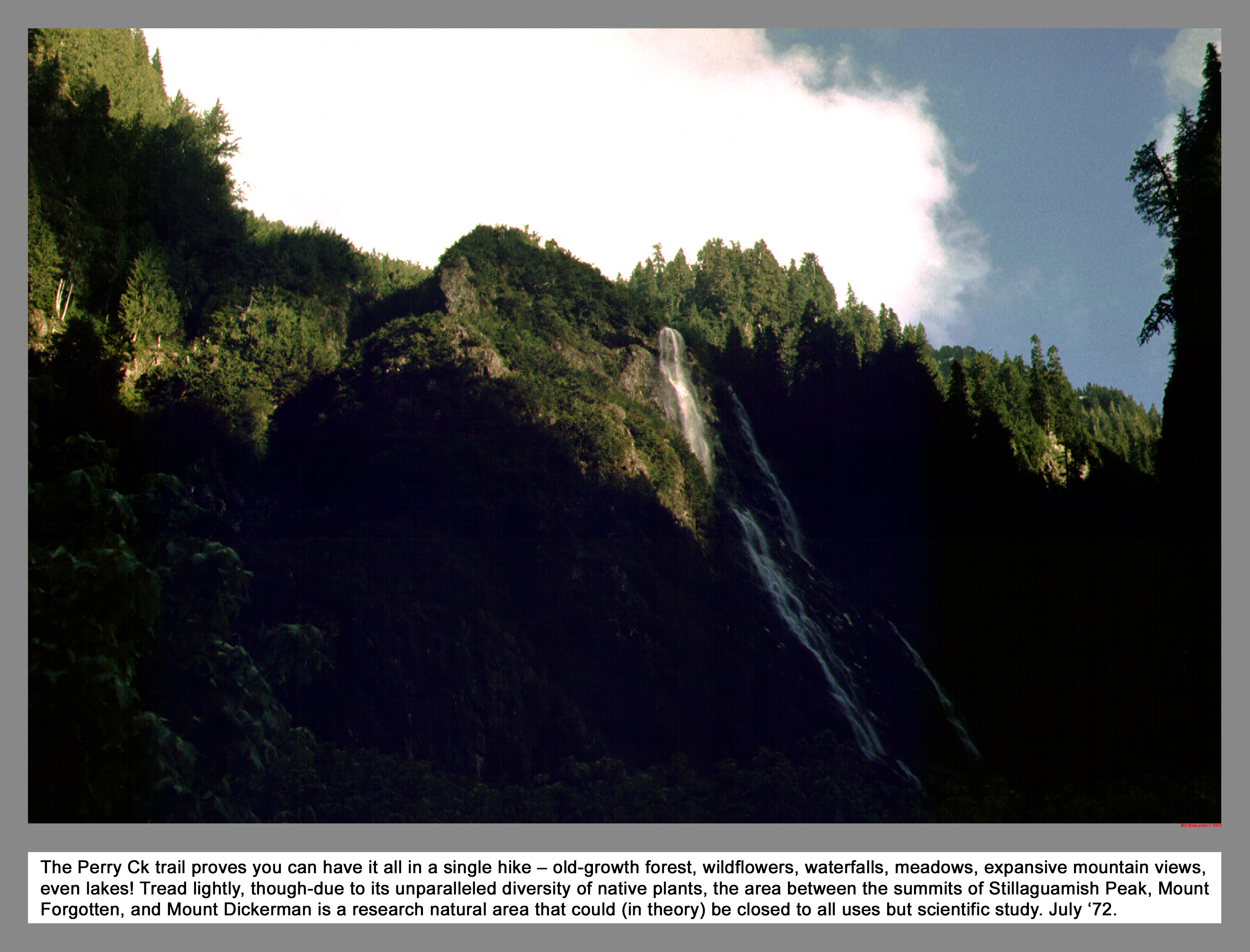
Perry Ck trail proves you can have it all in a single hike - old-growth forest, wildflowers, waterfalls, meadows, expansive mountain views, even lakes! Tread lightly, though-due to its unparalleled diversity of native plants, the area between the summits of Stillaguamish Peak, Mount Forgotten, and Mount Dickerman is a research natural area that could (in theory) be closed to all uses but scientific study.
02 087 Paul B glissades near Stillaguamish Pk
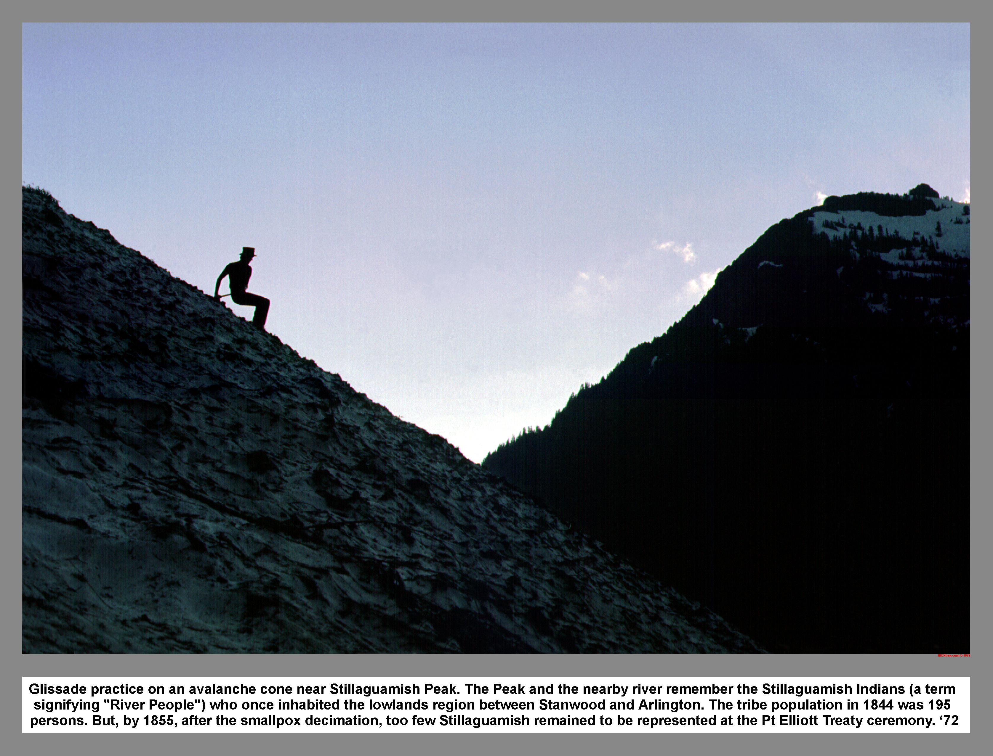
Glissade practice on an avalanche cone near Stillaguamish Peak. The Peak and the nearby river remember the Stillaguamish Indians (a term signifying "River People") who once inhabited the lowlands region between Stanwood and Arlington. The tribe population in 1844 was 195 persons. But, by 1855, after the smallpox decimation, too few Stillaguamish remained to be represented at the Pt Elliott Treaty ceremony.
02 090 Don Paul B at switchback water stop
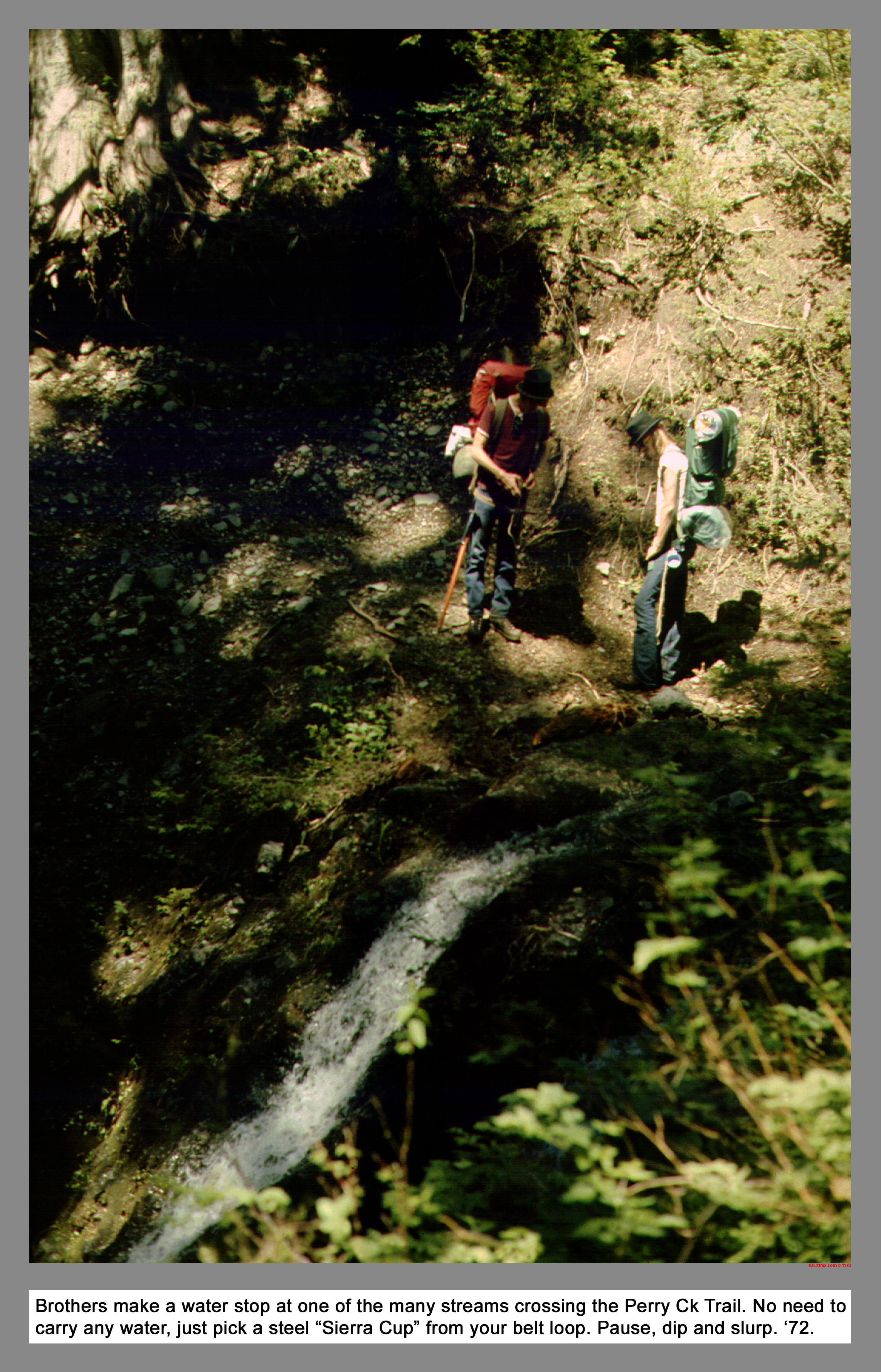
The Brothers make a water stop at one of the many streams crossing the Perry Creek Trail. No need to carry any water, just hang a shallow steel "Sierra Cup" from your belt loop. Pause, dip and slurp.
02 091 Mt Forgotten from the southwest
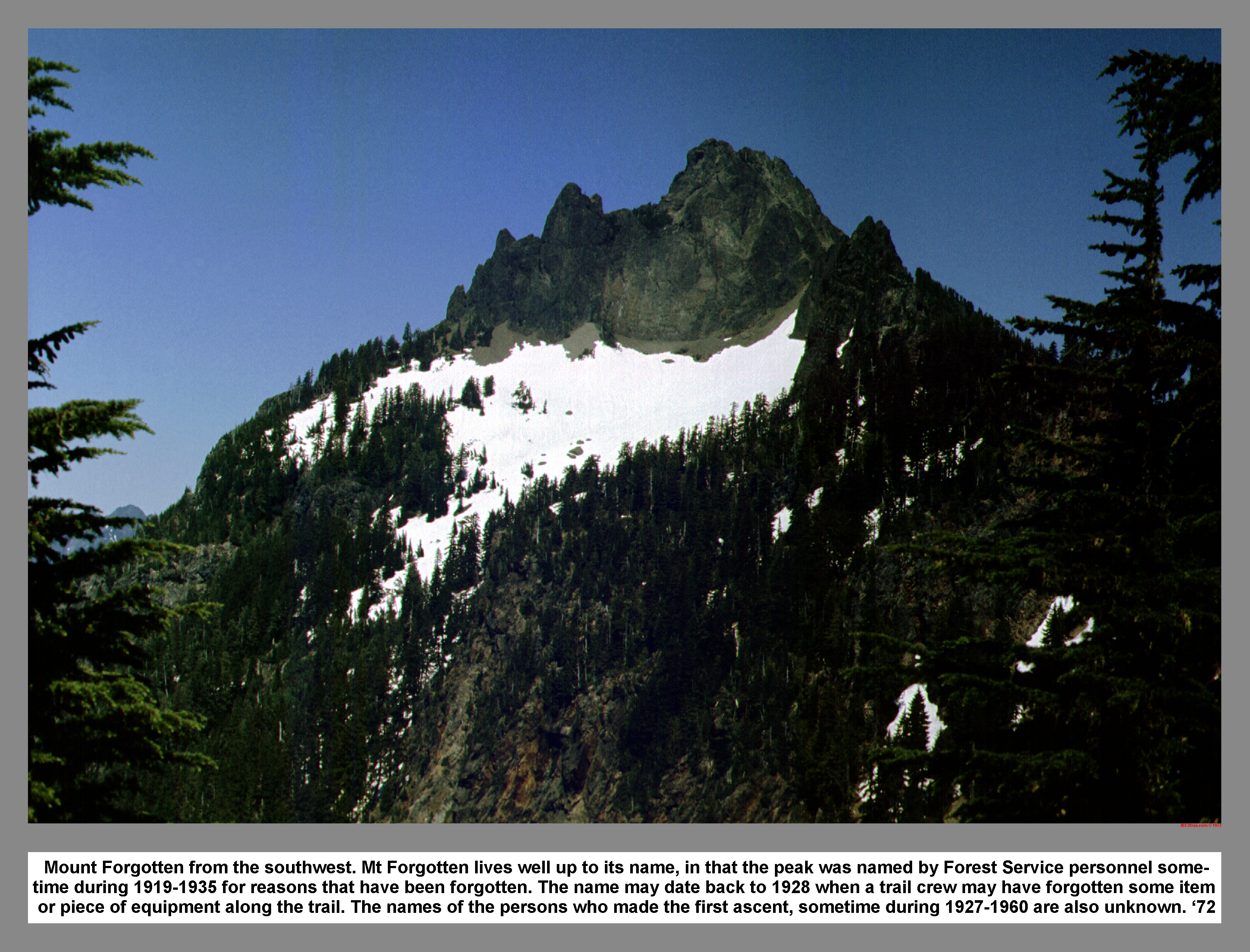
Mount Forgotten from the southwest. Mt Forgotten lives well up to its name, in that the peak was named by Forest Service personnel some-time during 1919-1935 for reasons that have been forgotten. The name may date back to 1928 when a trail crew may have forgotten some item or piece of equipment along the trail. The names of the persons who made the first ascent, sometime during 1927-1960 are also unknown.
02 092 Glacier Pk from Forgotten Meadow Don B
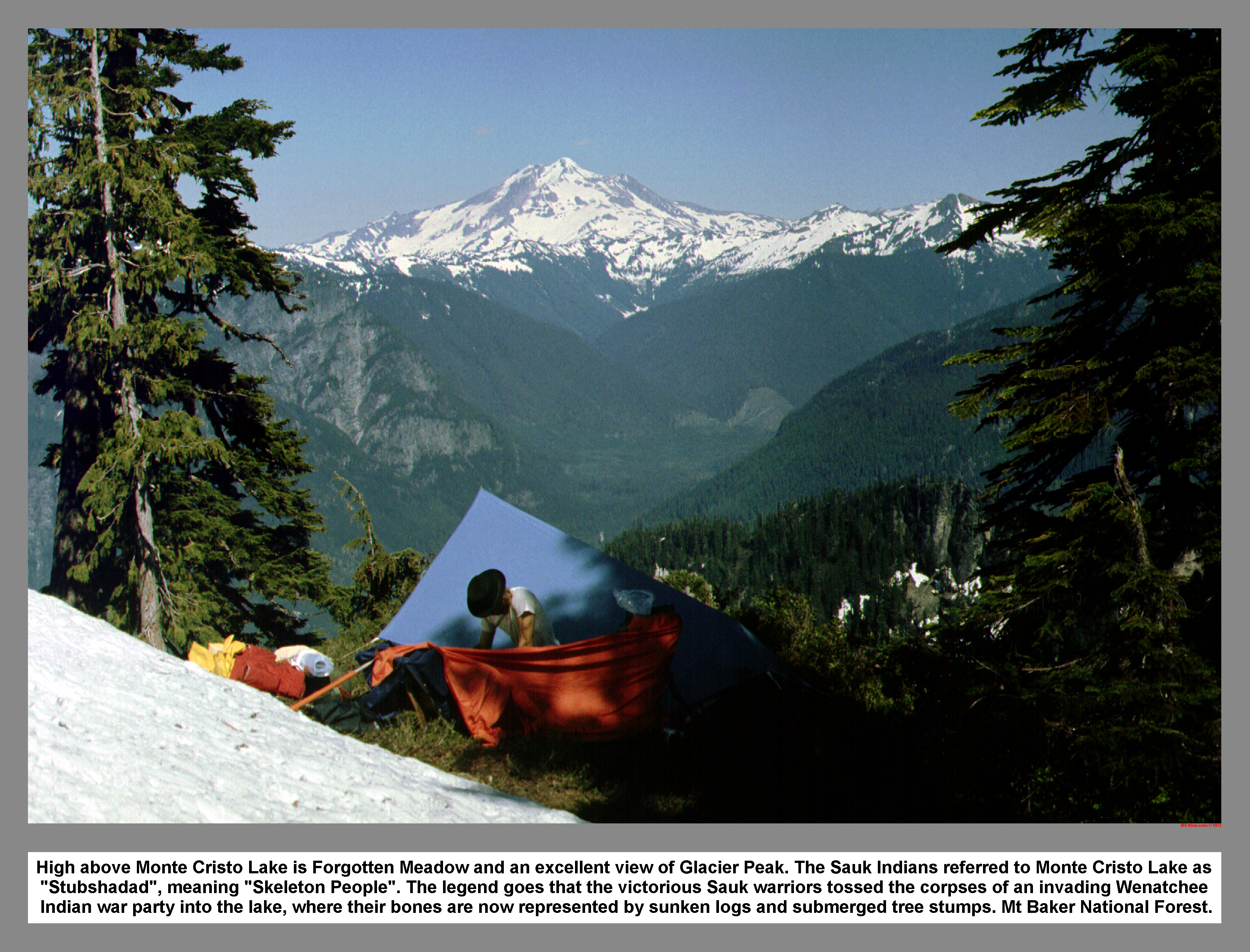
High above Monte Cristo Lake is Forgotten Meadow and an excellent view of Glacier Peak. The Sauk Indians referred to Monte Cristo Lake as "Stubshadad", meaning "Skeleton People". The legend goes that the victorious Sauk warriors tossed the corpses of an invading Wenatchee Indian war party into the lake, where their bones are now represented by sunken logs and submerged tree stumps. Mt Baker Forest.
02 093 Paul B Don B snows of Mt Forgotten
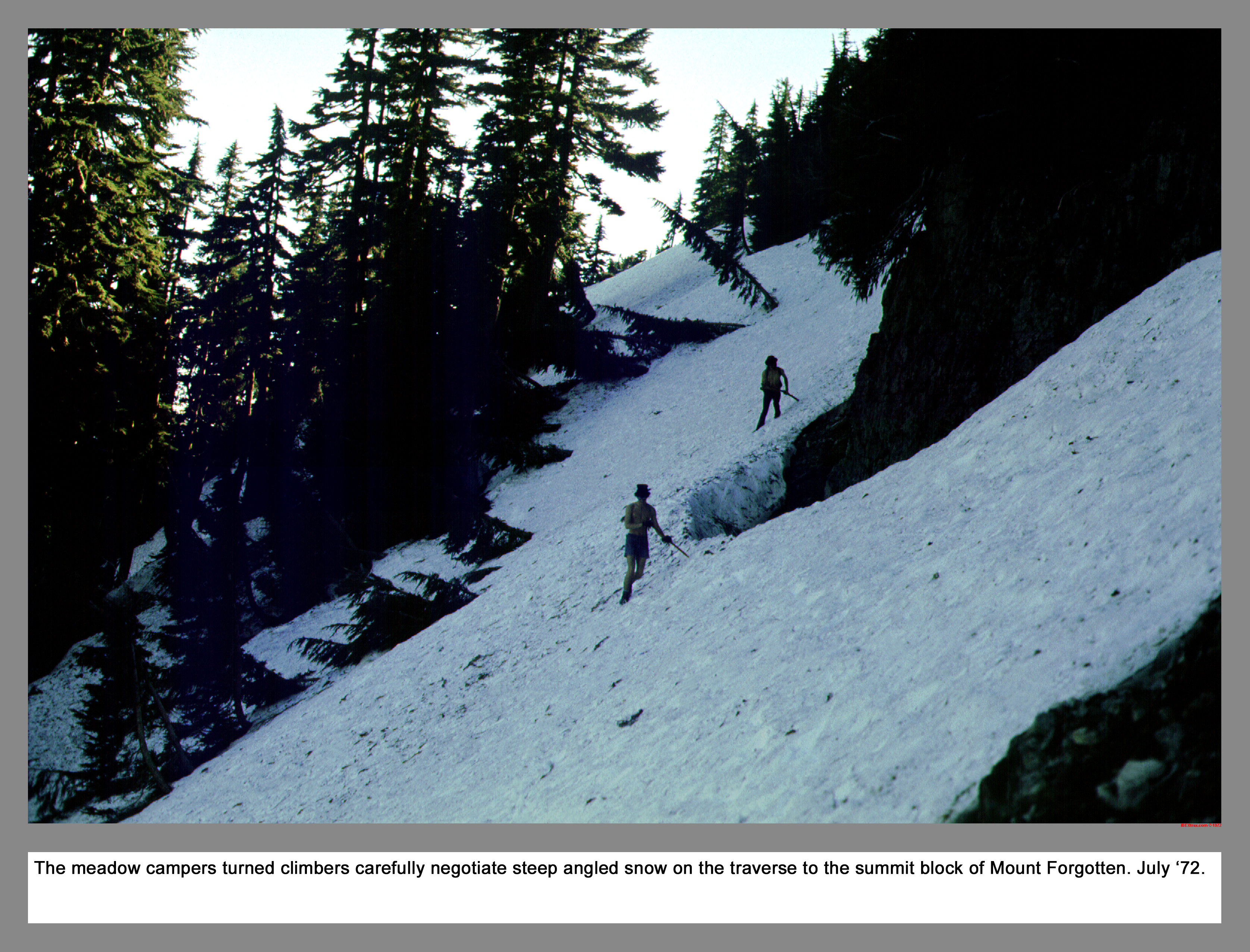
The meadow campers turned climbers carefully negotiate steep angled snow on the traverse to the summit block of Mount Forgotten.
02 094 Looking up the N fork Sawk to Glacier Peak
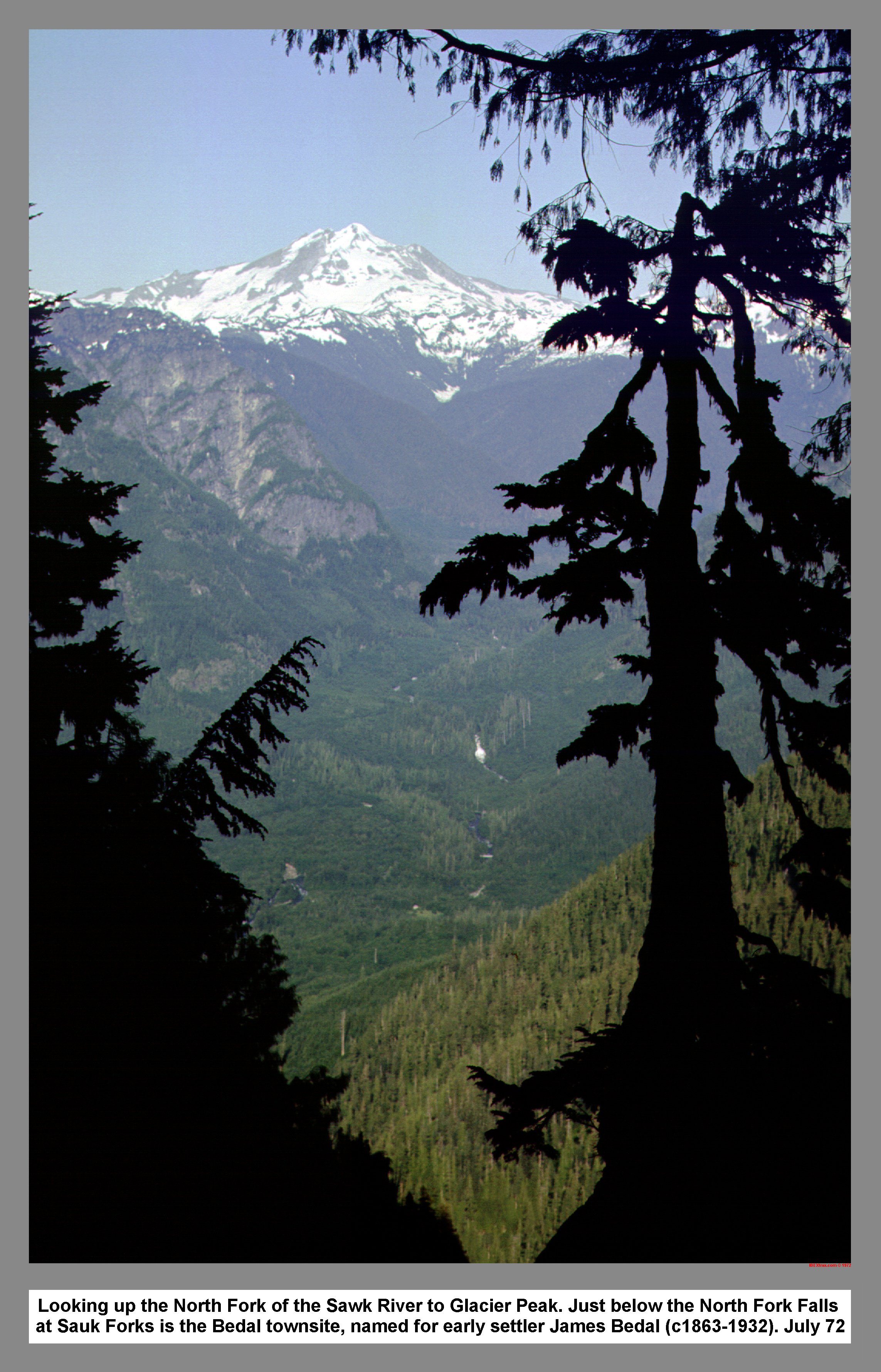
Looking up the North Fork of the Sawk River to Glacier Peak. Just below the North Fork Falls at Sauk Forks is the Bedal town site, named for early settler James Bedal (1863-1932).
02 095 Mt Baker and Mt Shuksan from Mt Forgotten
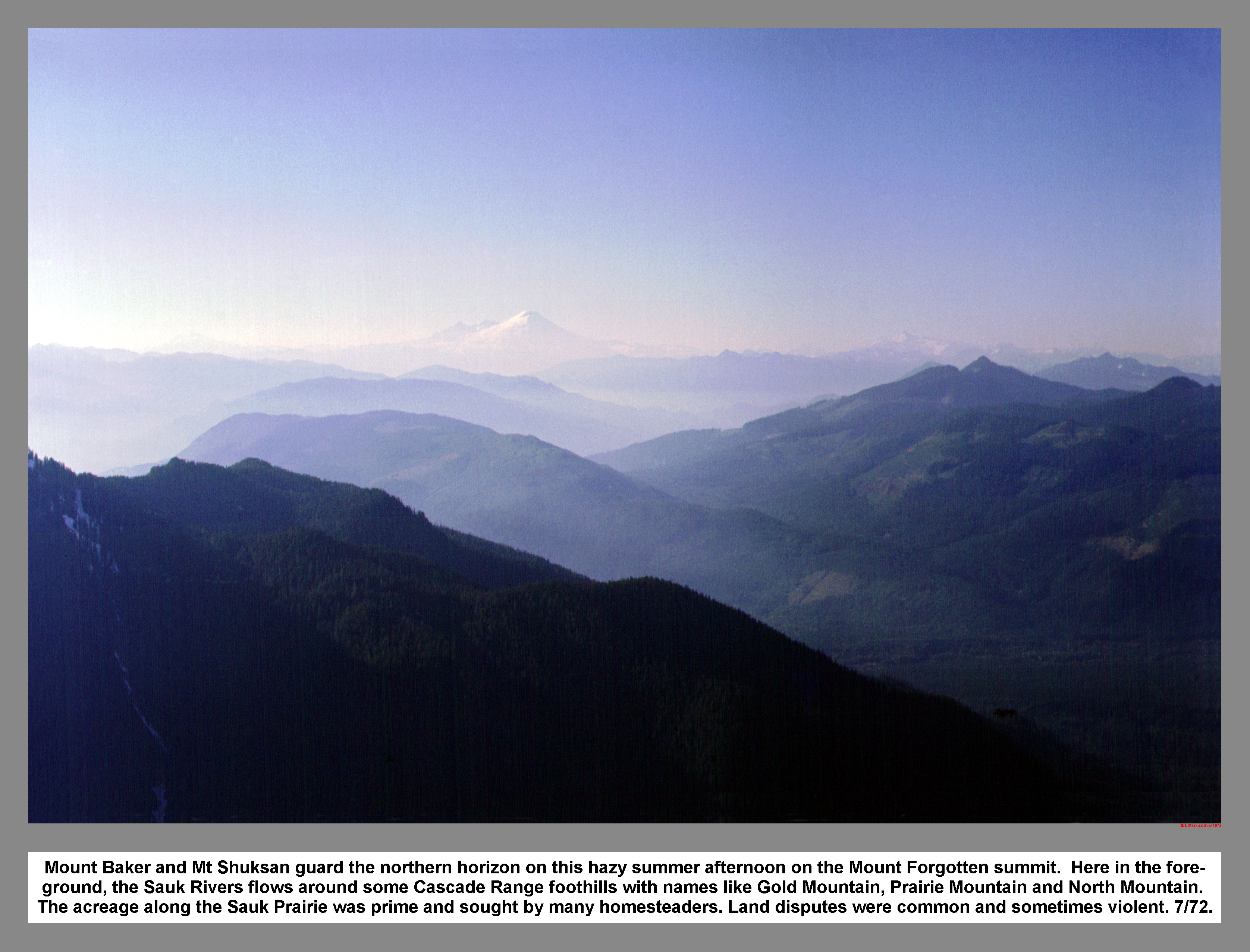
Mount Baker and Mt Shuksan guard the northern horizon on this hazy summer afternoon on the Mount Forgotten summit. Here in the fore-ground, the Sauk Rivers flows around some Cascade Range foothills with names like Gold Mountain, Prairie Mountain and North Mountain. The acreage along the Sauk Prairie was prime and sought by many homesteaders. Land disputes were common and sometimes violent.
02 096 Monte Cristo Peaks SE from Mt Forgotten
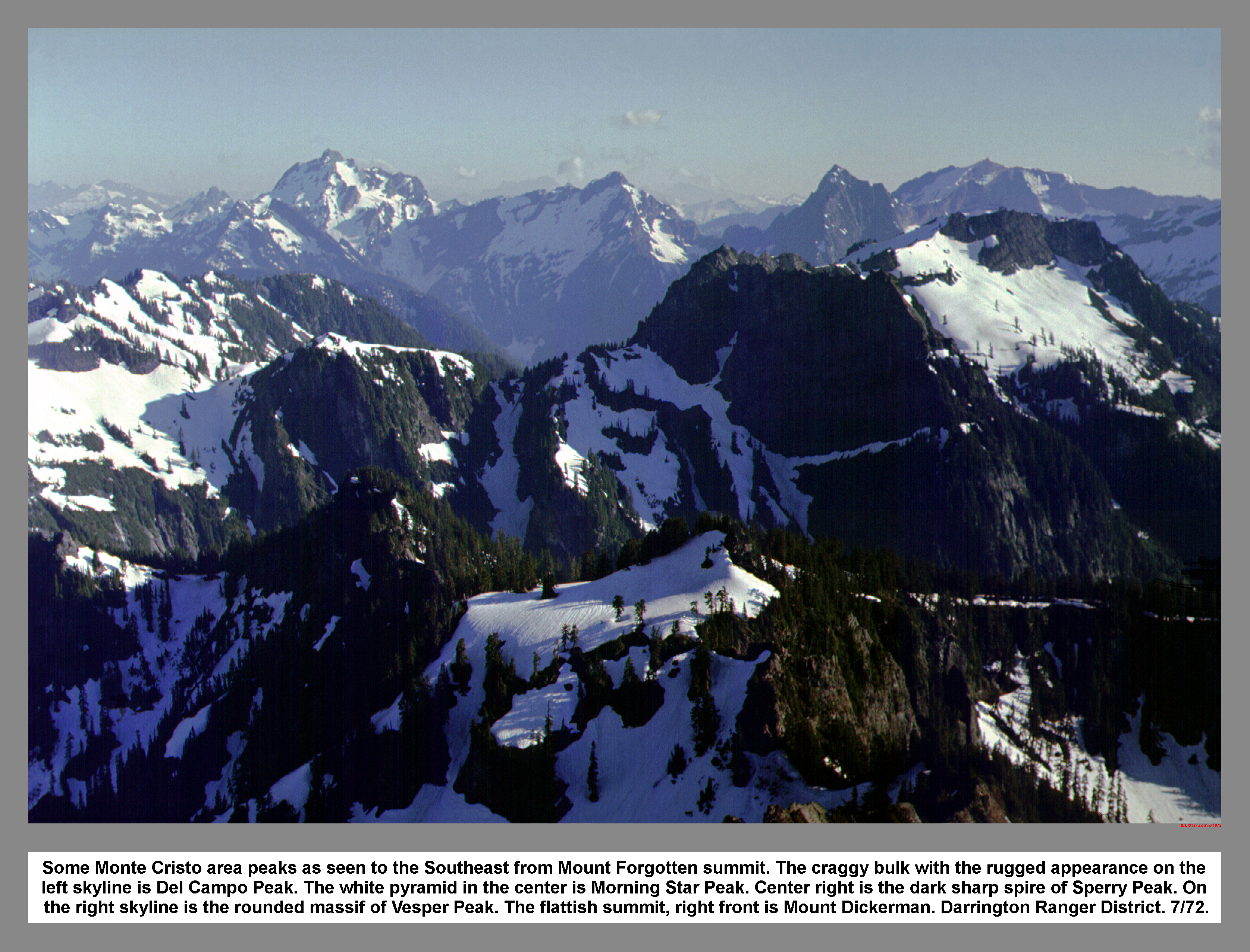
Some Monte Cristo area peaks as seen to the Southeast from Mount Forgotten summit. The craggy bulk with the rugged appearance on the left skyline is Del Campo Peak. The white pyramid in the center is Morning Star Peak. Center right is the dark sharp spire of Sperry Peak. On the right skyline is the rounded massif of Vesper Peak. The flattish summit, right front is Mount Dickerman. Darrington Ranger District.
02 097 Glacier Peak from Mount Forgotten
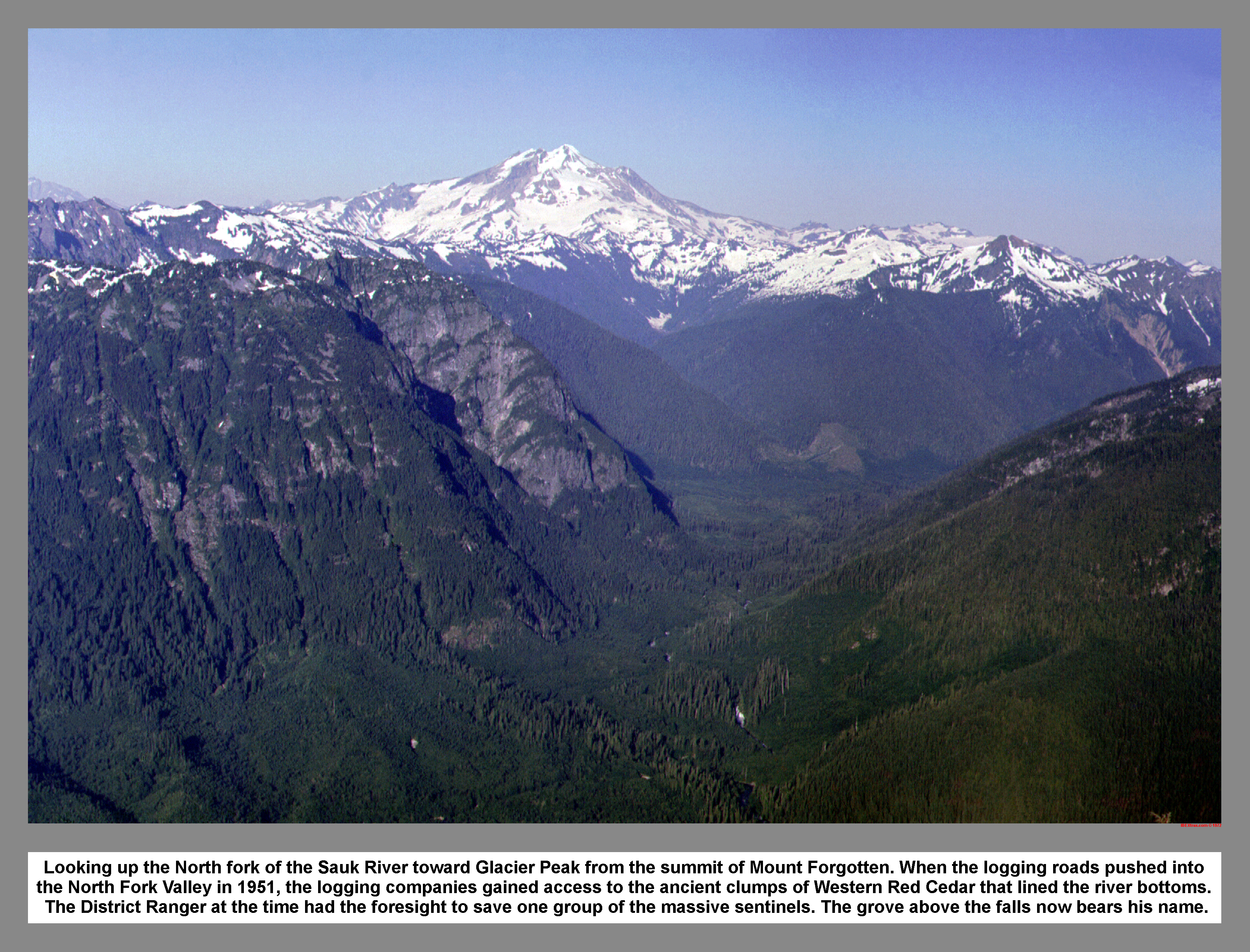
Looking up the North fork of the Sauk River toward Glacier Peak from the summit of Mount Forgotten. When the logging roads pushed into the North Fork Valley in 1951, the logging companies gained access to the ancient clumps of Western Red Cedar that lined the river bottoms. The District Ranger at the time had the foresight to save one group of the massive sentinels. The grove above the falls now bears his name. Harold J Engles Memorial Cedars Trail
02 098 Big Four Mtn and Hall Peak from Mt Forgotten
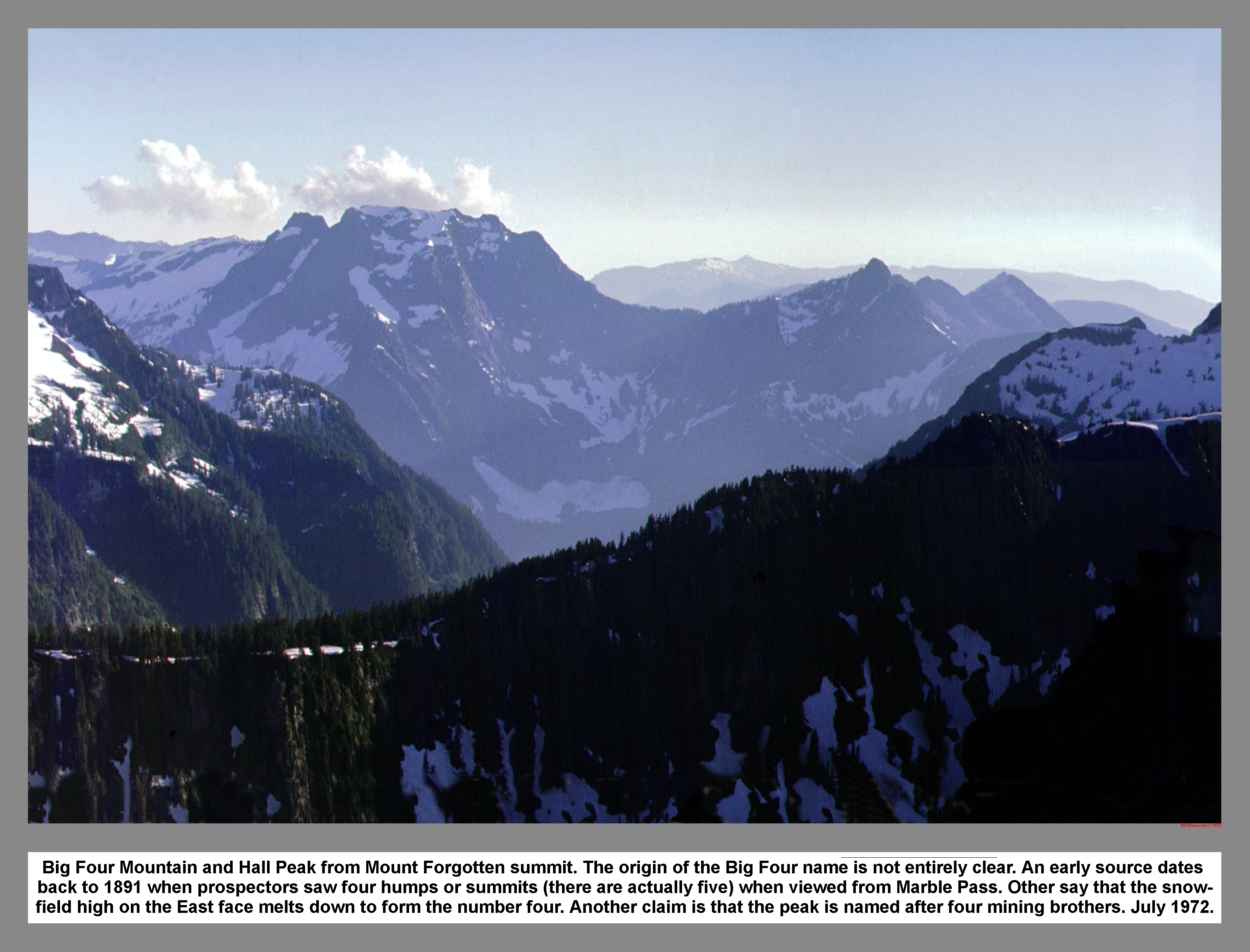
Big Four Mountain and Hall Peak from Mount Forgotten summit. The origin of the Big Four name is not entirely clear. An early source dates back to 1891 when prospectors saw four humps or summits (there are actually five) when viewed from Marble Pass. Others say that the snow-field high on the East face melts down to form the number four. Another claim is that the peak is named after four mining brothers.
02 099 On Mt Forgotten with Glacier Peak distant
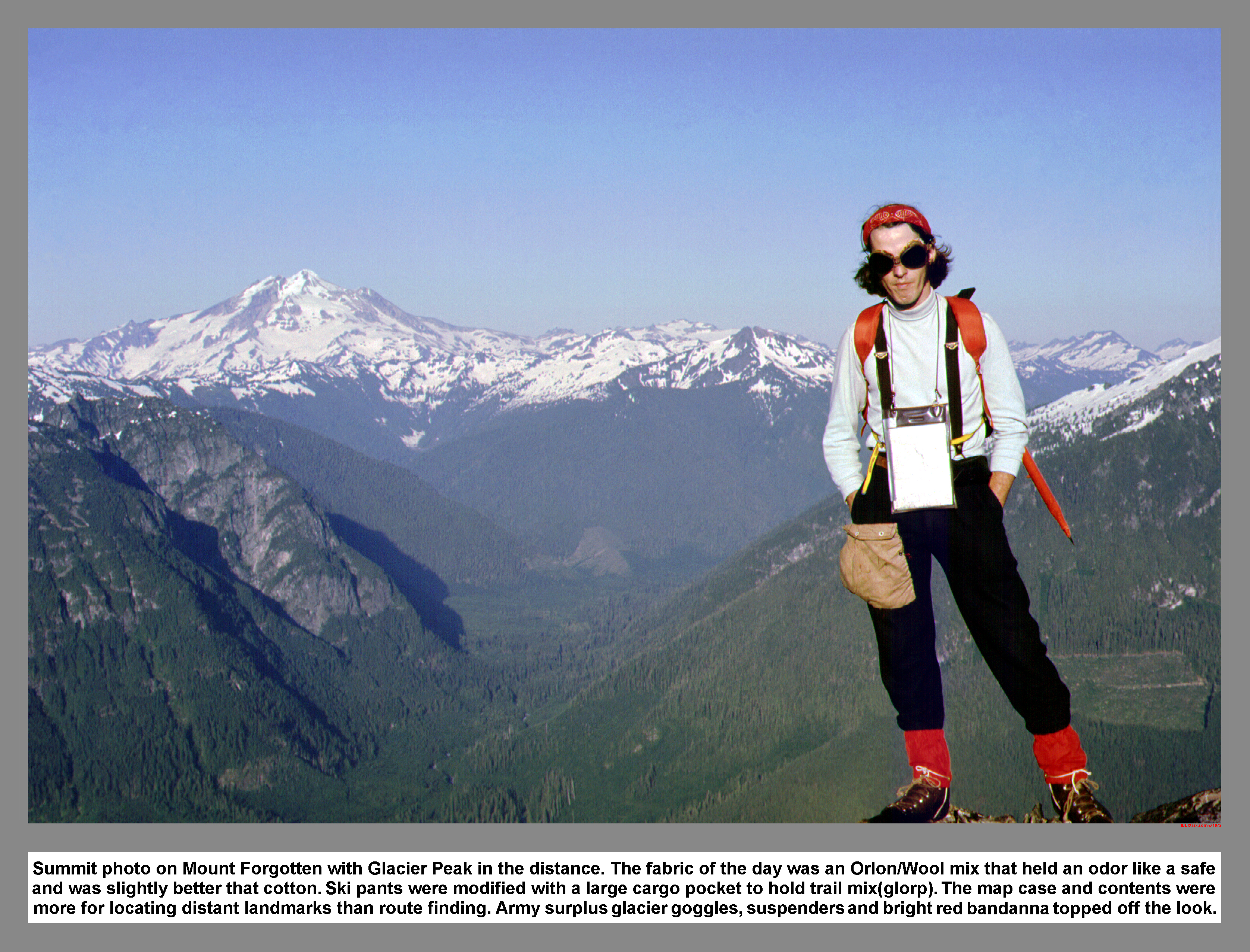
Summit photo on Mount Forgotten with Glacier Peak in the distance. The fabric of the day was an Orlon/Wool mix that held an odor like a safe and was slightly better that cotton. Ski pants were modified with a large cargo pocket to hold trail mix(glorp). The map case and contents were more for locating distant landmarks than route finding. Army surplus glacier goggles, suspenders and bright red bandanna toped off the look.
02 100 Paul B silhouetted on Mt Forgotten
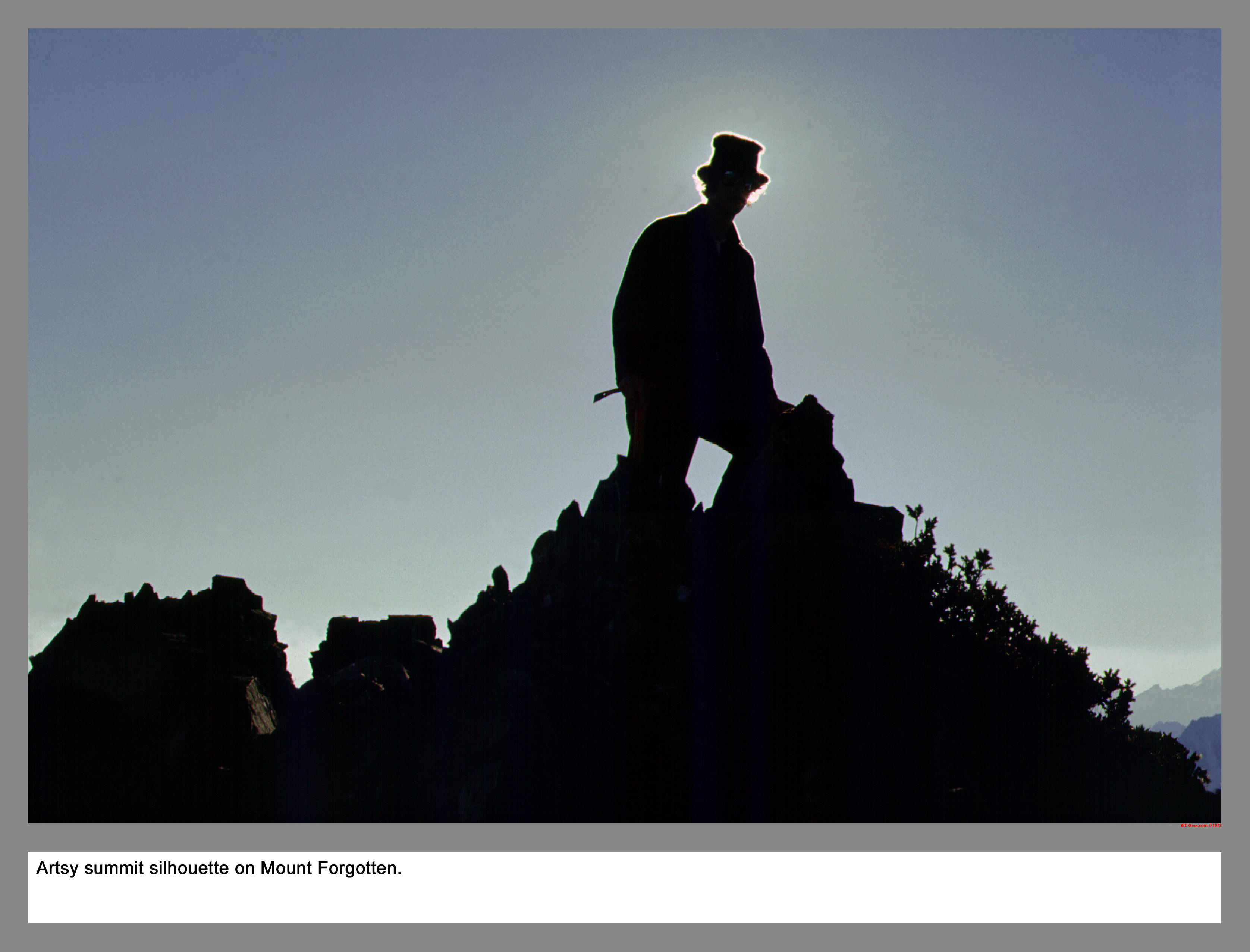
Artsy summit silhouette on top of Mount Forgotten, Boulder River Adj Roadless Area, Darrington Ranger district, Mt Baker-Snoqualmie Forest.
02 101 Big Four Mtn from Forgotten Meadow
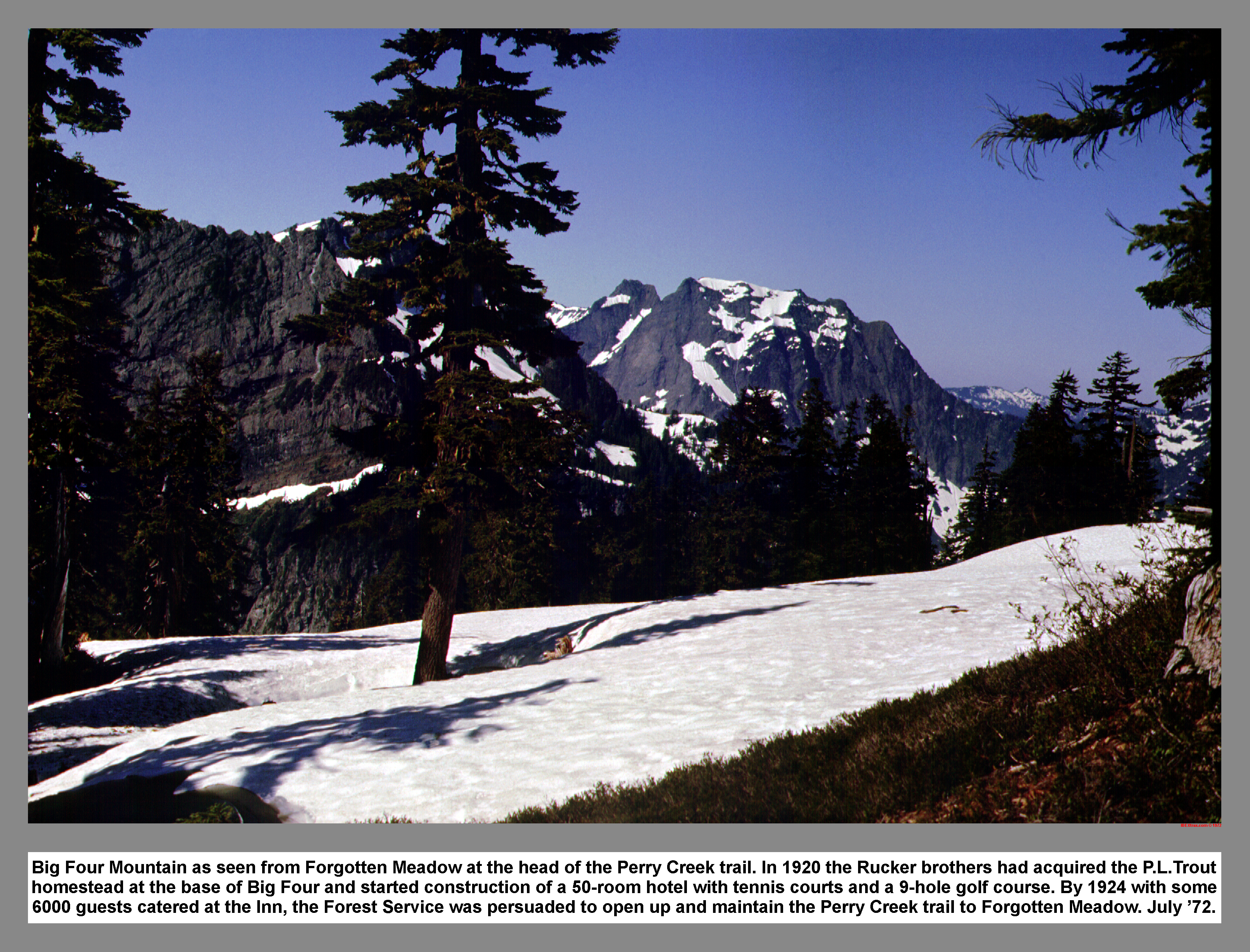
Big Four Mountain as seen from Forgotten Meadow at the head of the Perry Creek trail. In 1920 the Rucker brothers had acquired the P.L.Trout homestead at the base of Big Four and started construction of a 50-room hotel with tennis courts and a 9-hole golf course. By 1924 with some 6000 guests catered at the Inn, the Forest Service was persuaded to open up and maintain the Perry Creek trail to Forgotten Meadow.
02 102 South face of Mt Forgotten
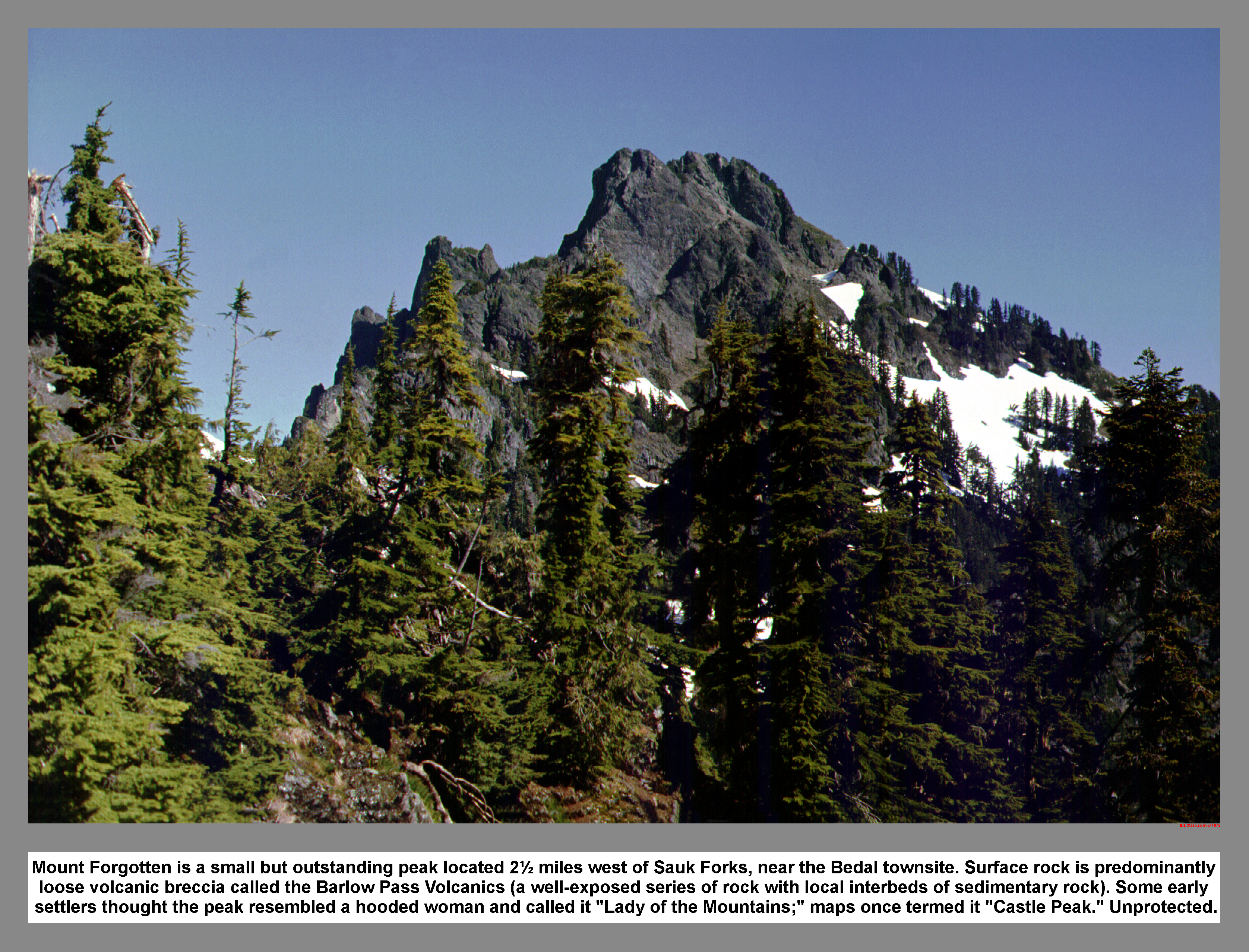
Mount Forgotten is a small but outstanding peak located 2.5 miles west of Sauk Forks, near the Bedal townsite. Surface rock is predominantly loose volcanic breccia called the Barlow Pass Volcanics (a well-exposed series of rock with local interbeds of sedimentary rock). Some early settlers thought the peak resembled a hooded woman and called it "Lady of the Mountains;" maps once termed it "Castle Peak." Unprotected.
02 103 Looking down from Forgotten Meadow camp
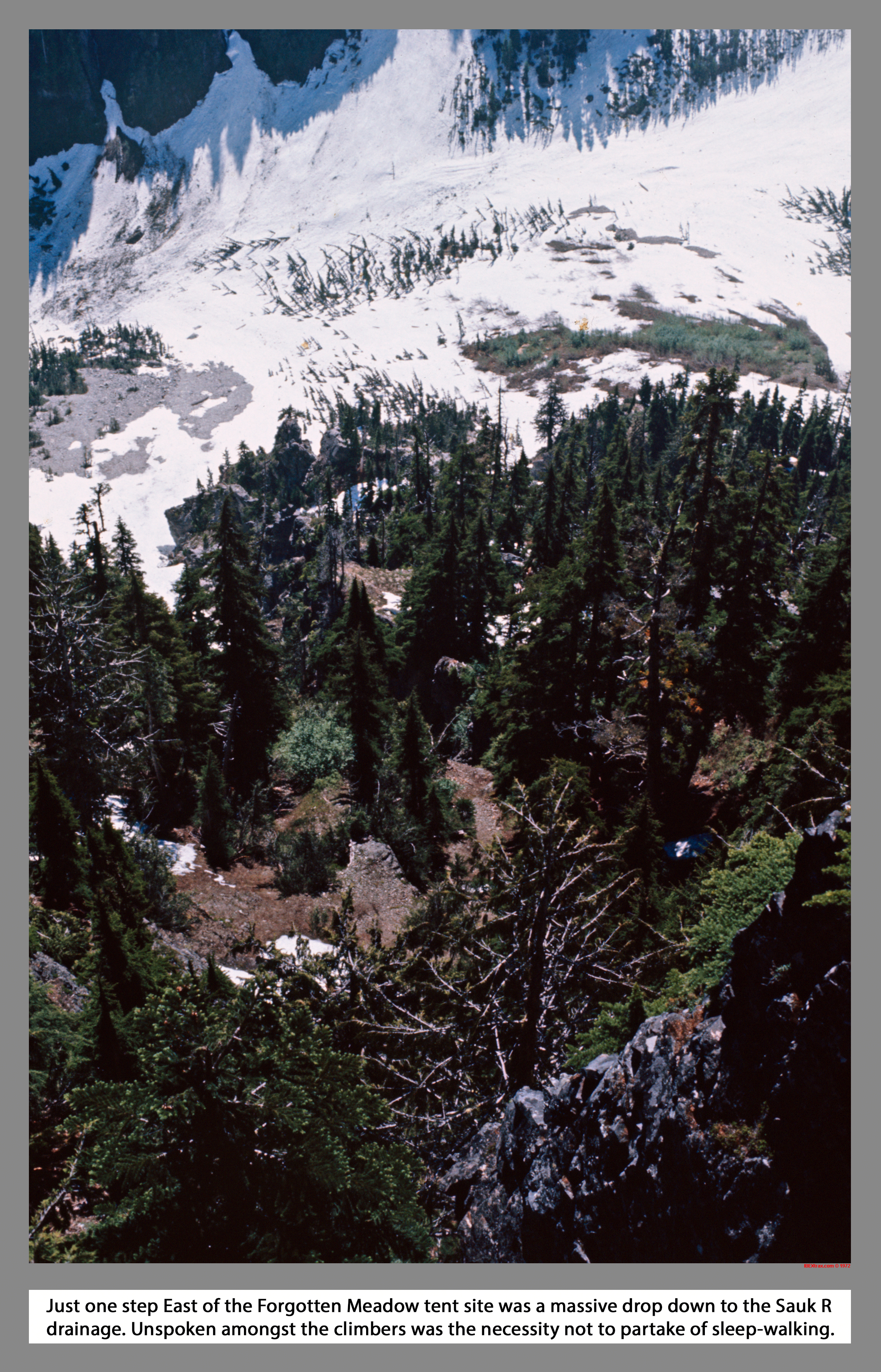
Just one step East of the Forgotten Meadow tent site was a massive drop down to the Sauk River drainage. Unspoken amongst the climbers was the necessity not to partake of sleep-walking.
02 104 Mt Baker Mt Shuksan from Forgotten
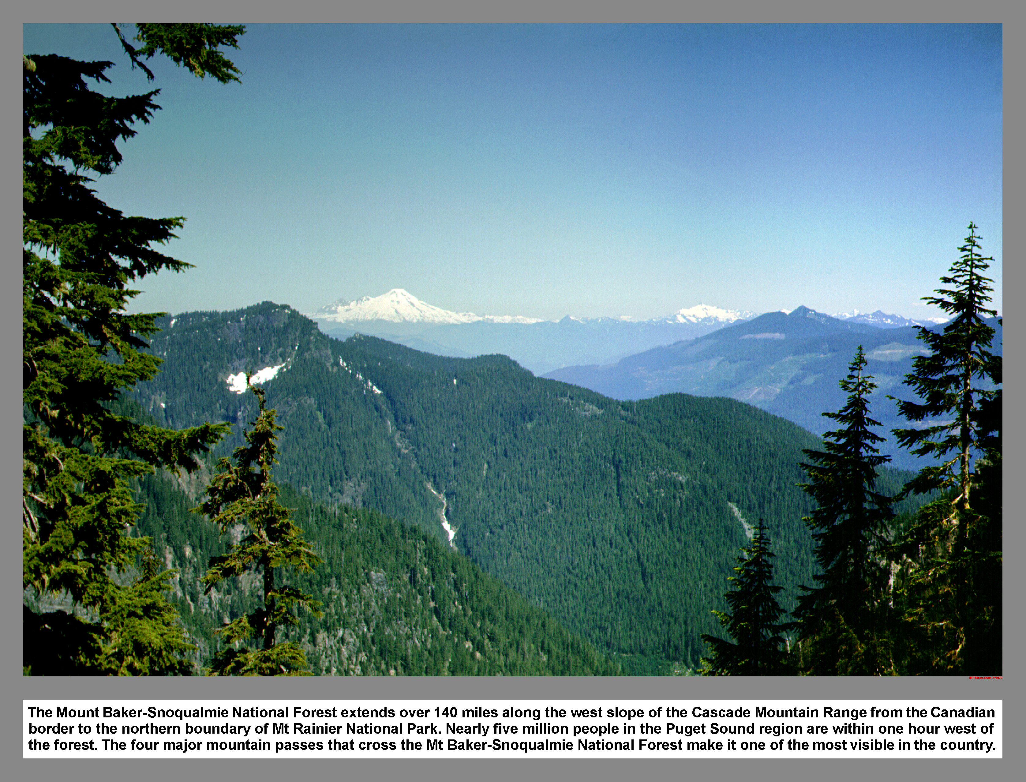
The Mount Baker-Snoqualmie Forest extends over 140 miles along the west slope of the Cascade Mountain Range from the Canadian border to the northern boundary of Mt Rainier National Park. Nearly five million people in the Puget Sound region are within one hour west of the forest. The four major mountain passes that cross the Mt Baker-Snoqualmie Forest make it one of the most visible in the country.
02 106 Paul B and Don B at Perry Falls
Paul B and Don B at Perry Creek Falls
02 109 Down Perry Ck trail toward Hall Pk
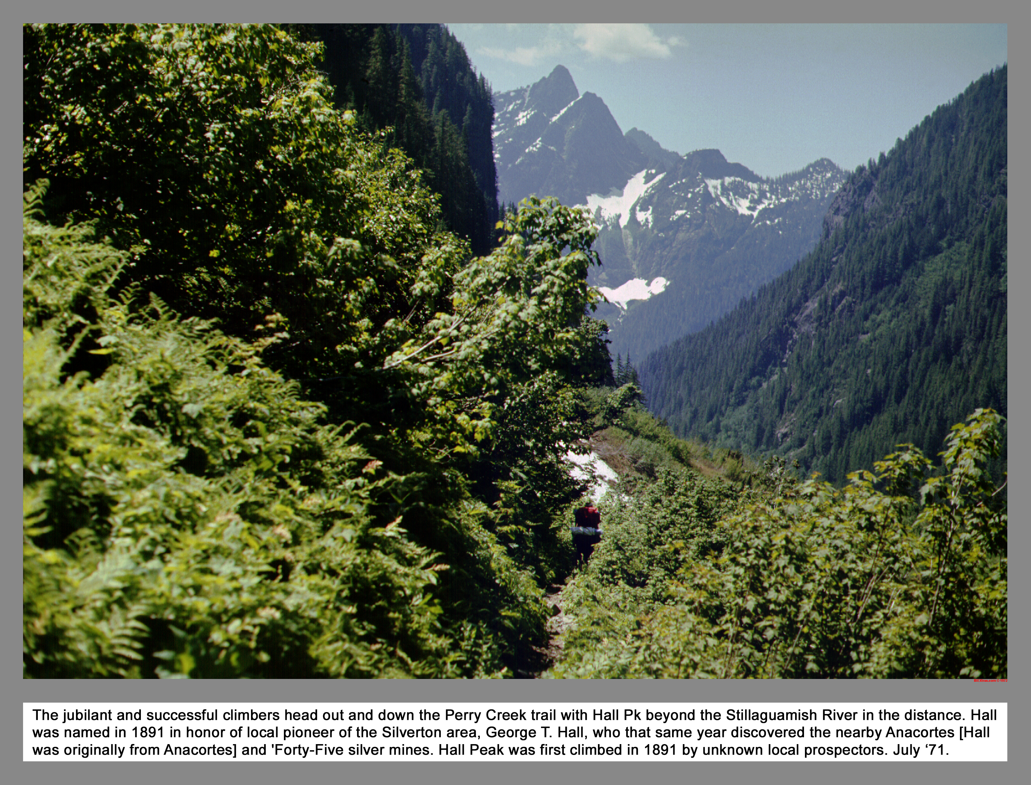
The jubilant and successful climbers head out and down the Perry Creek trail with Hall Pk beyond the Stillaguamish River in the distance. Hall was named in 1891 in honor of local pioneer prospector of the Silverton area, George T. Hall, who that same year discovered the nearby Anacortes [Hall was from Anacortes] and 'Forty-Five mines. Hall Peak was first climbed in 1891 by unknown local prospectors.
02 110 Paul B Cone Falls on Stillaguamish Pk
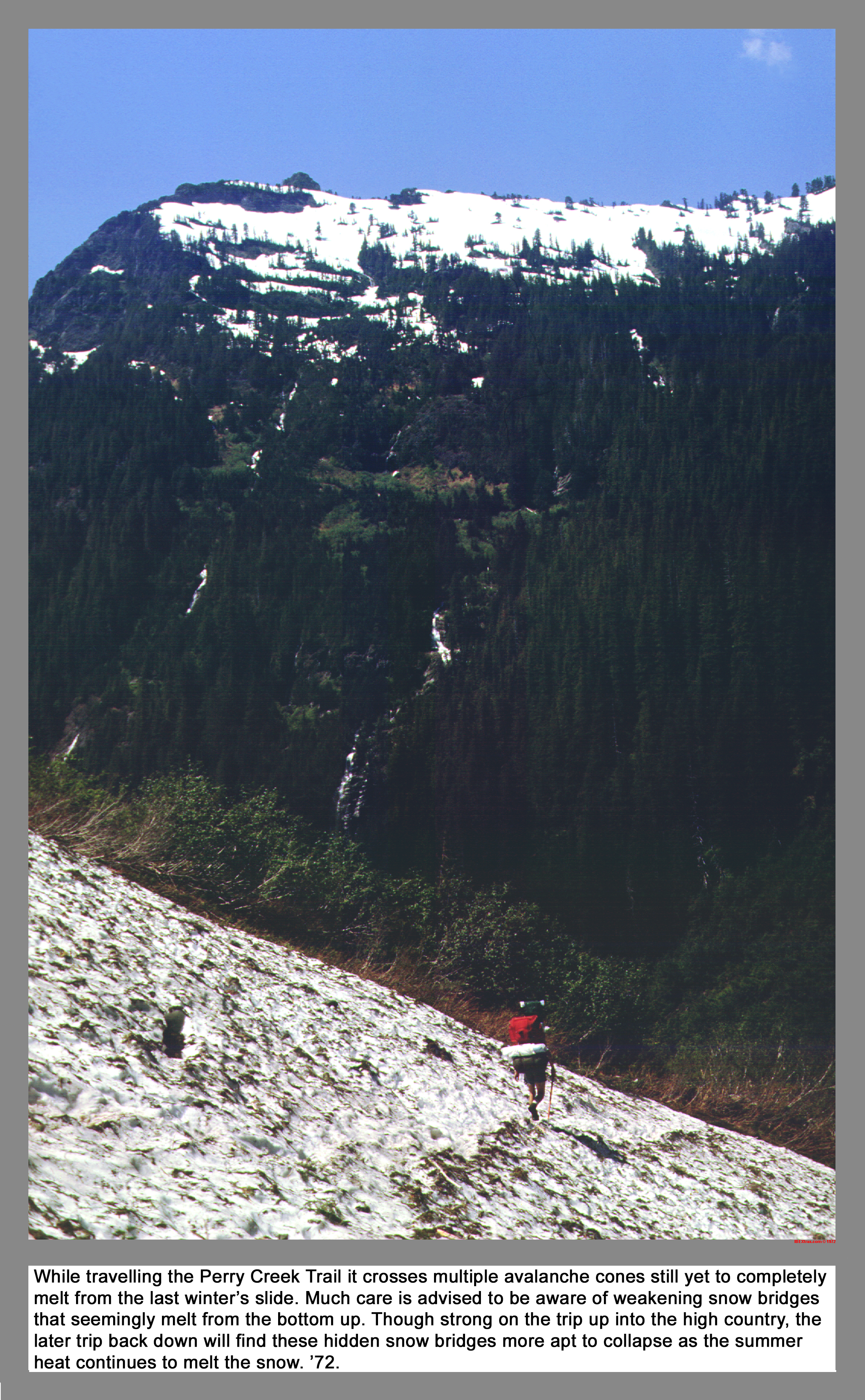
While travelling the Perry Creek Trail it crosses multiple avalanche cones still yet to completely melt from the last winter's slide. Much care is advised to be aware of weakening snow bridges that seemingly melt from the bottom up. Though holding strong on the trip up into the high country, the later return trip back down will find these hidden snow bridges more apt to collapse as the summer heat continues. '72.
02 111 Don B and Pauls Valiant at Perry Ck TH
When the climbers first arrived at the 711 trailhead mid-week for the four-day trip, no other cars were parked at the end of forest road F4063. See here upon their return, parked cars stretched well down the road. Notice how our white Valiant transportation is strategically pointed downhill in case of a compression start. F4063 is now closed and a "Trail Park" lot was built down on the Mountain Loop Highway. '72.
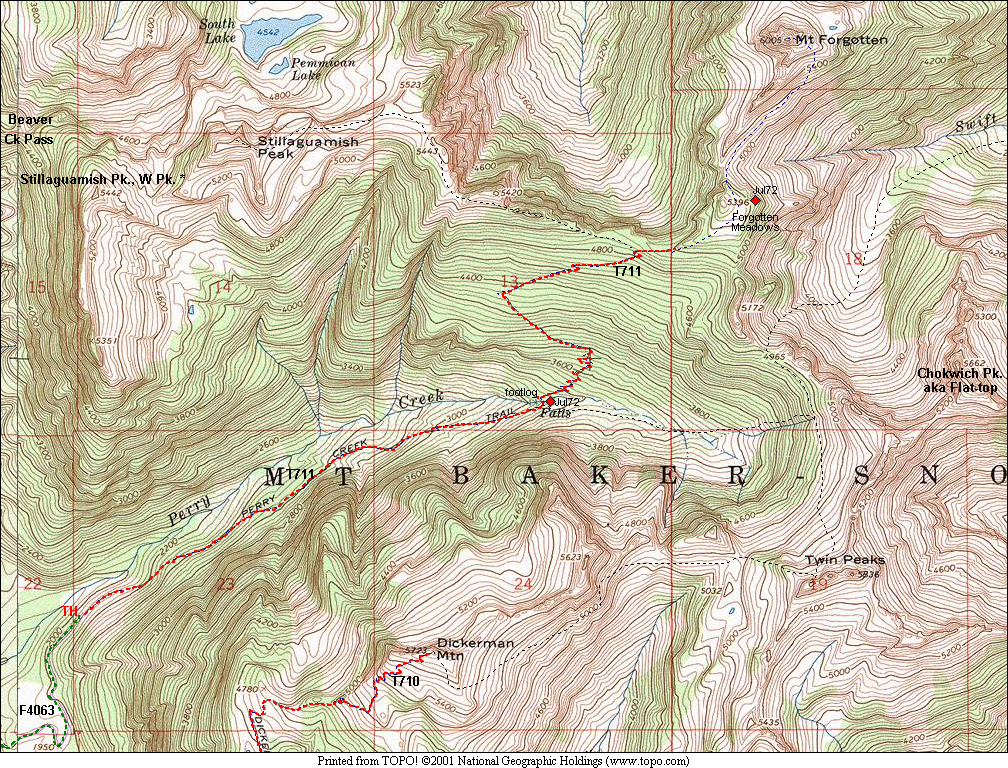
02 111m Mt Forgotten Stillaguamish Pk Map
|
|
|
|
| This site created and maintained by THE IBEX - Page last revised:
|
|