
|
|
IBEXtrax.com - Cascade Mountains of Washington StateNorth Cascades Park |
|
|
01 018 Sawk Mtn and Skagit R from near Concrete
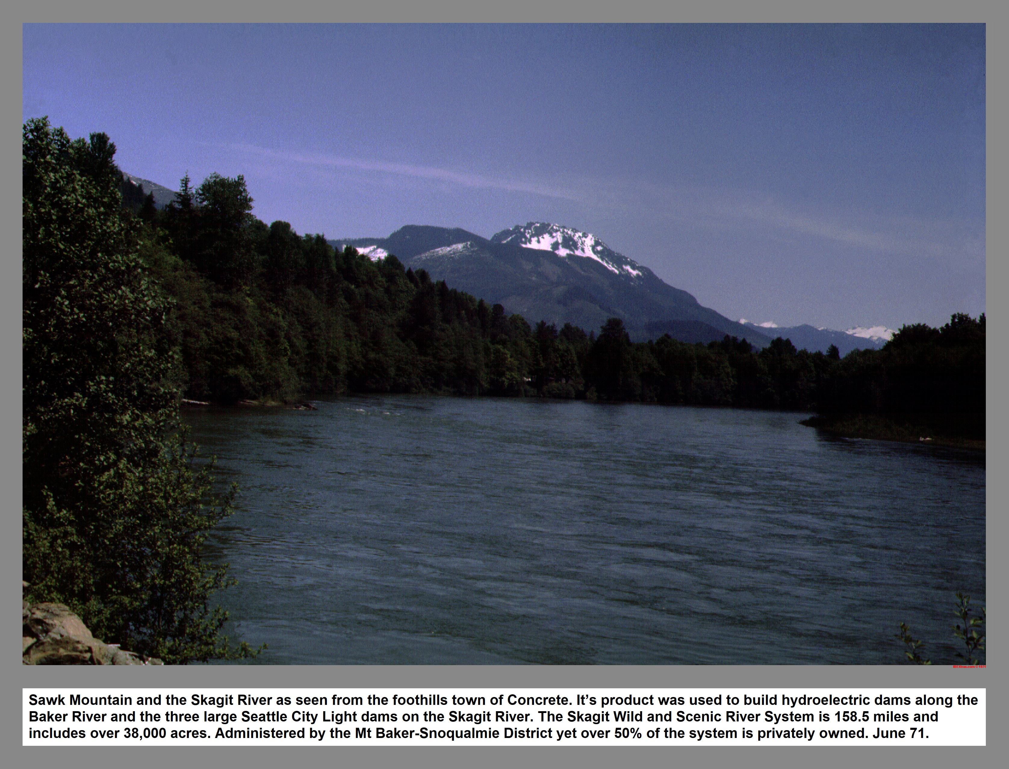
Sawk Mountain and the Skagit River as seen from the foothill's town of Concrete. Its product was used to build hydroelectric dams along the Baker River and the three large Seattle City Light dams on the Skagit River. The Skagit Wild and Scenic River System is 158.5 miles and includes over 38,000 acres. Administered by the Mt Baker-Snoqualmie yet over 50% of the system is privately owned. June 71.
01 049 Mt Buckner Ripsaw Ridge and the Boston Gl
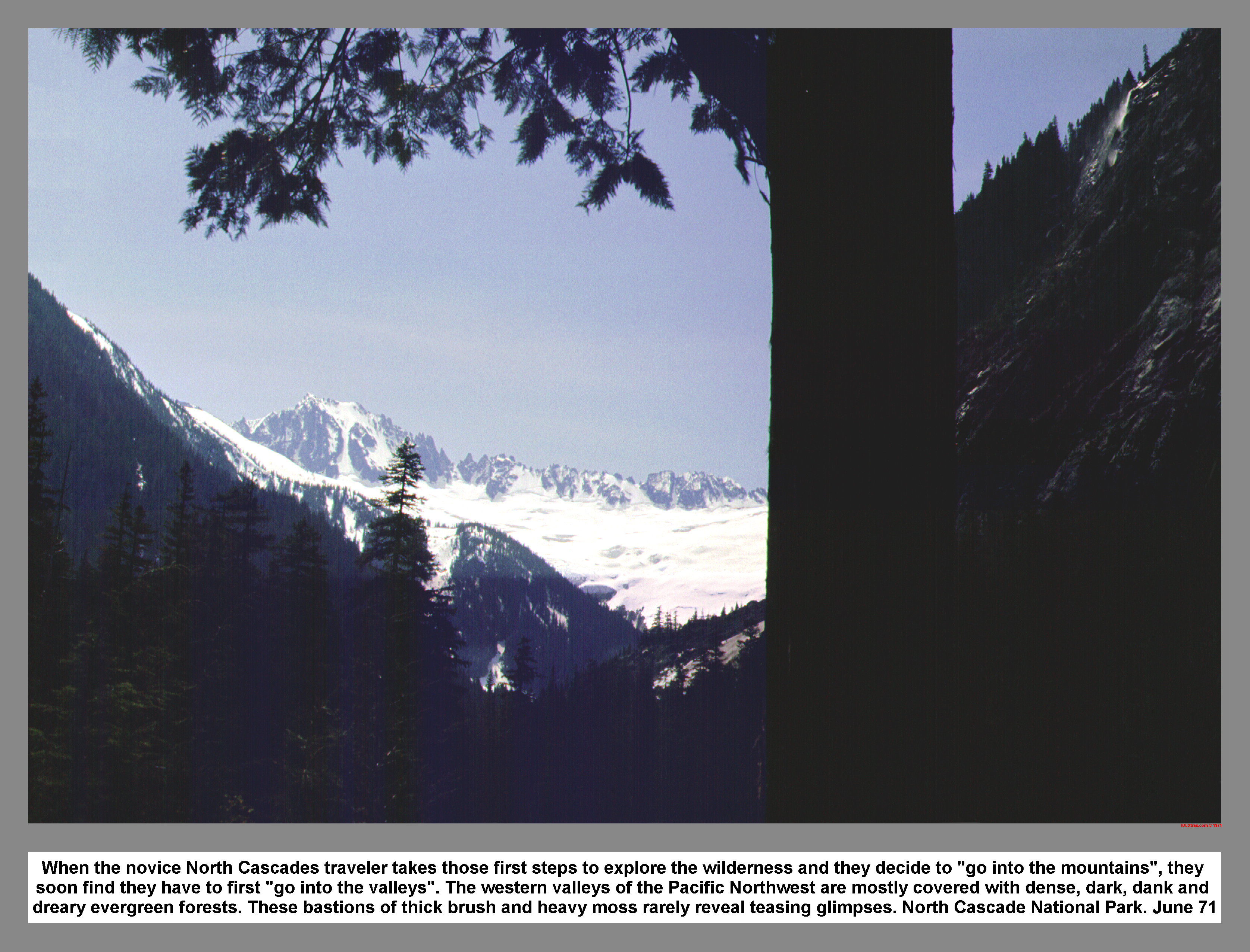
When the novice North Cascades traveler takes those first steps to explore the wilderness and they decide to "go into the mountains", they soon find they have to first "go into the valleys". The western valleys of the Pacific Northwest are mostly covered with dense, dark, dank and dreary evergreen forests. These bastions of thick brush and heavy moss rarely reveal teasing glimpses. North Cascade National Park. June 71
01 055 Boston Glacier view Mt Buckner Ripsaw Ridge.
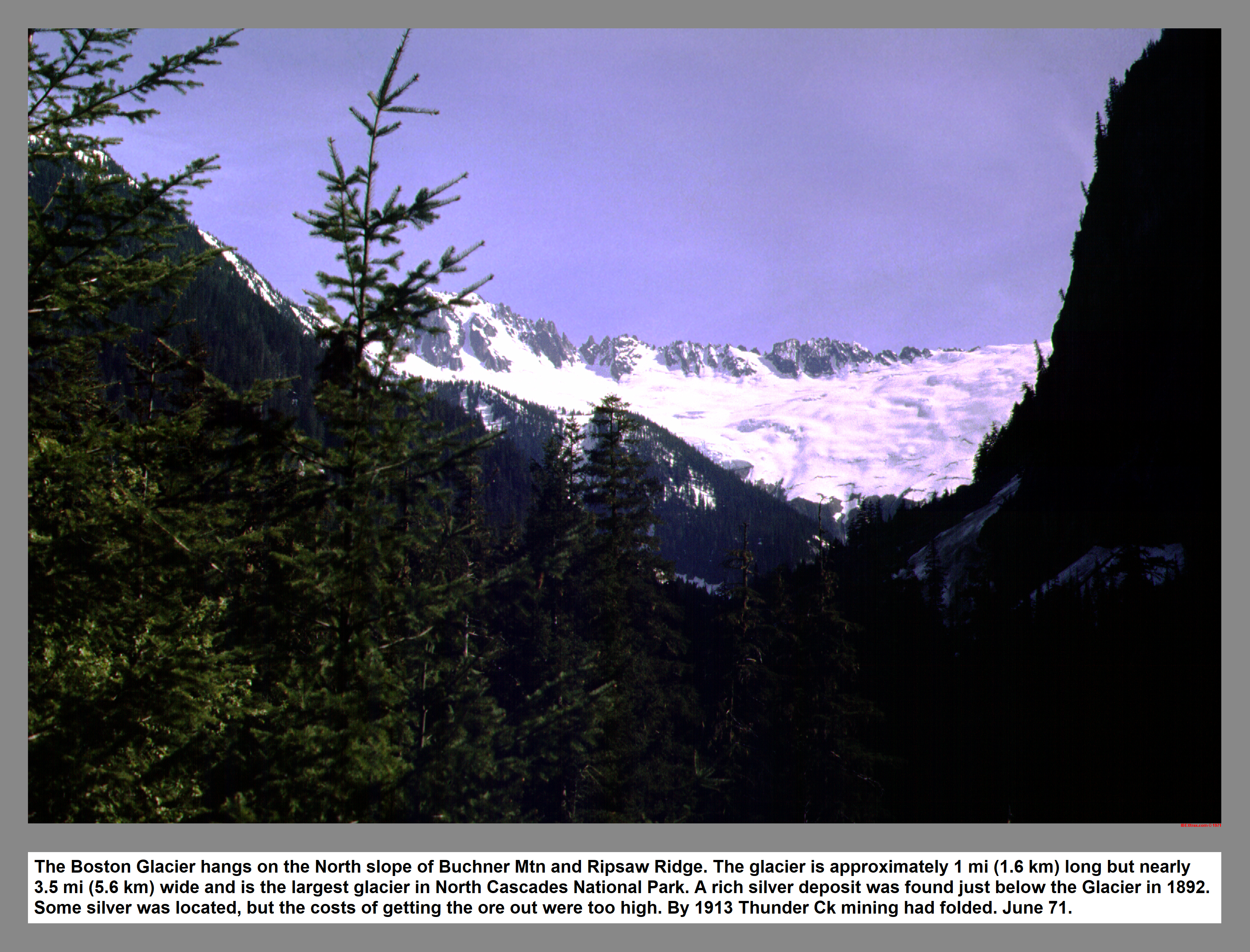
The Boston Glacier hangs on the North slope of Mount Buchner and Ripsaw Ridge. The glacier is approximately 1 mi (1.6 km) long but nearly 3.5 mi (5.6 km) wide and is the largest glacier in North Cascades National Park. A rich silver deposit was found just below the Glacier in 1892. Some silver was located, but the costs of getting the ore out were too high. By 1913 Thunder Ck mining had folded. June 71.
01 056 Buckner, Ripsaw Ridge and Boston Peak Glacier.
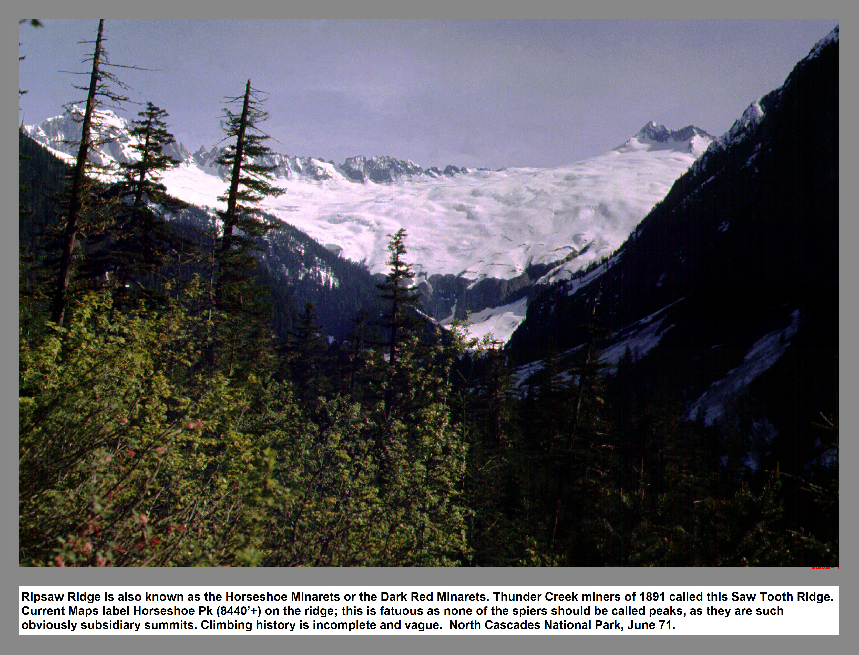
Ripsaw Ridge is also known as the Horseshoe Minarets or the Dark Red Minarets. Thunder Creek miners of 1891 called this Saw Tooth Ridge. Current Maps label Horseshoe Pk (8440'+) on the ridge; this is fatuous as none of the spiers should be called peaks, as they are such obviously subsidiary summits. Climbing history is incomplete and vague. North Cascades National Park, June 71.
02 003 Up Thunder Ck to Mt Buckner and Boston Gl
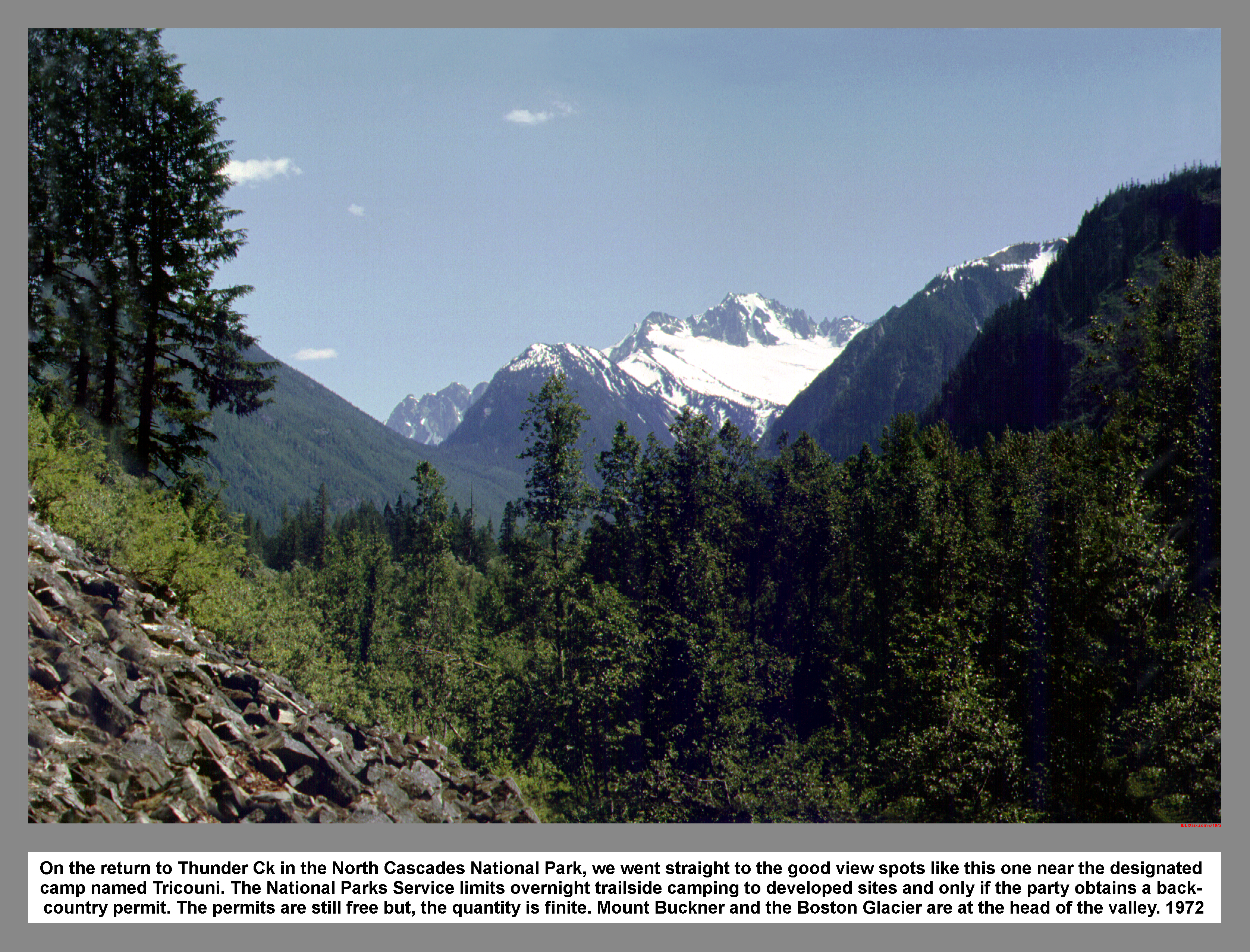
On the return to Thunder Ck in the North Cascades National Park, we went straight to the good view spots like this one near the designated camp named Tricouni. The National Parks Service limits overnight trailside camping to developed sites and only if the party obtains a back- country permit. The permits are still free. But, the quantity is finite. Mount Buckner and the Boston Glacier are at the head of the valley. 1972
02 013 Boston Peak Sharkfin Tower and Boston Gl
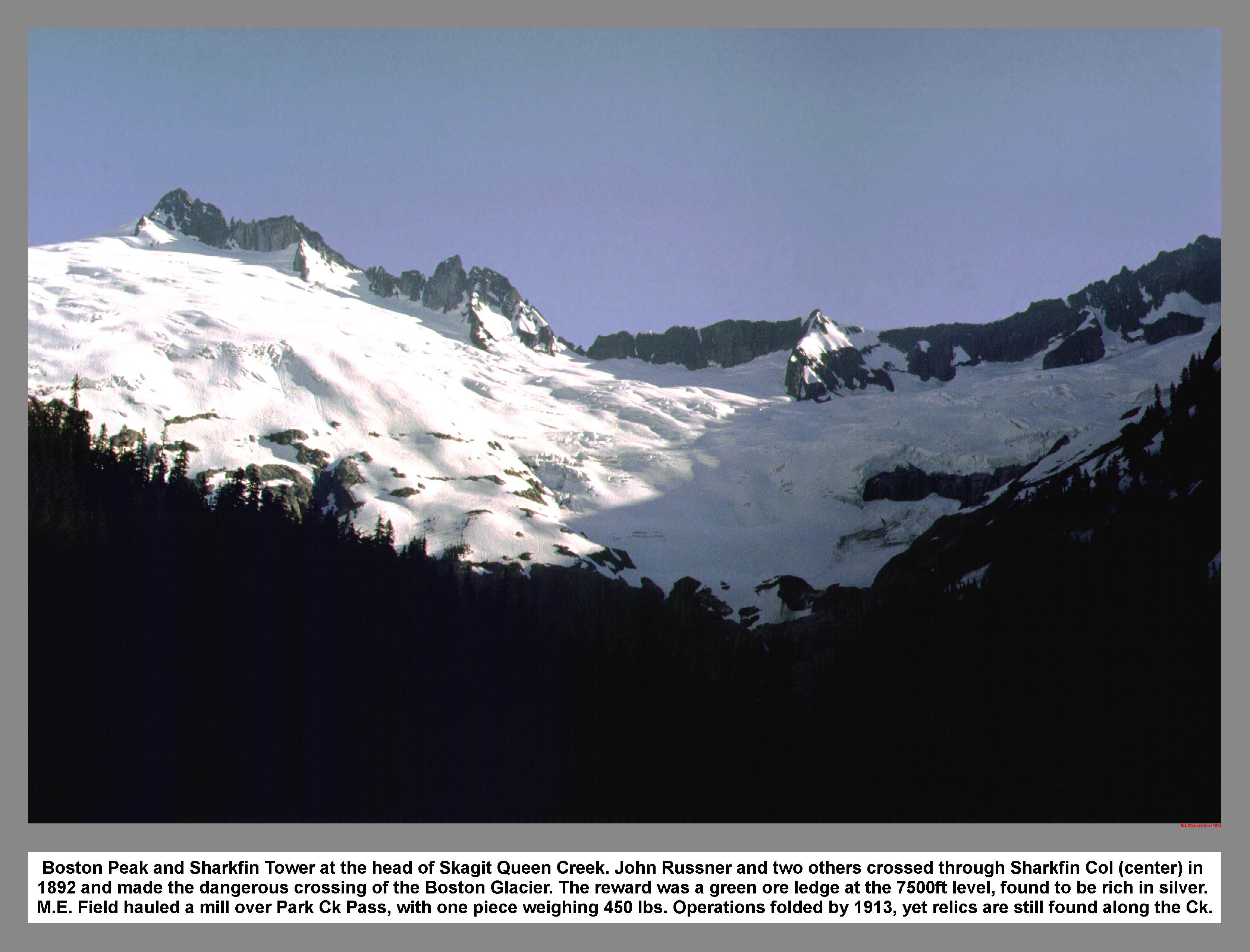
Boston Peak and Sharkfin Tower at the head of Skagit Queen Creek. John Russner and two others crossed through Sharkfin Col (center) in 1892 and made the dangerous crossing of the Boston Glacier. The reward was a green ore ledge at the 7500ft level, found to be rich in silver. M.E. Field hauled a mill over Park Ck Pass, with one piece weighing 450 lbs. Operations folded by 1913, yet relics are still found along the Ck.
02 015 Forbidden Peak and the Boston Glacier
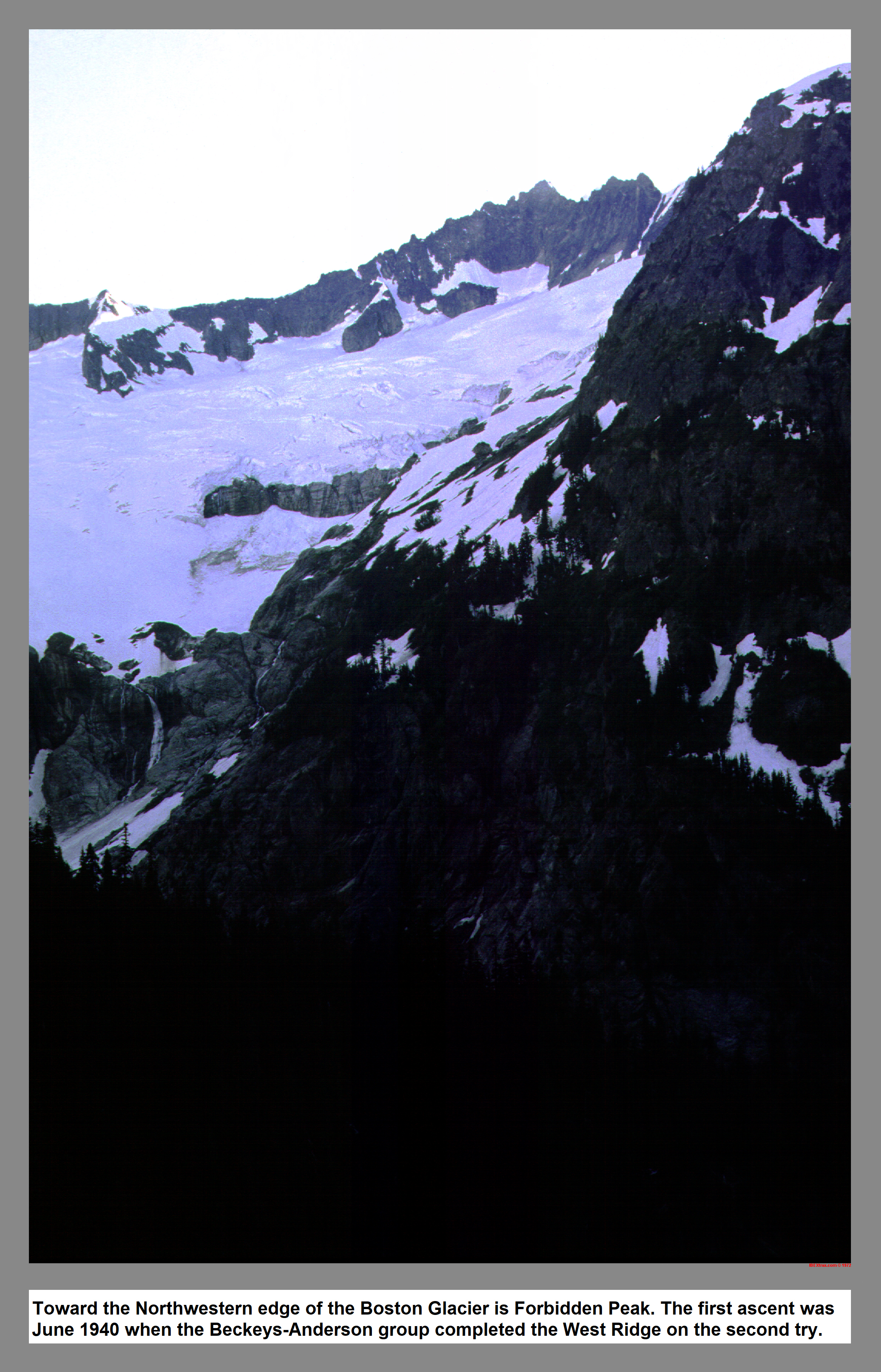
02 015 Toward the Northwestern edge of the Boston Glacier is Forbidden Peak. The first ascent came on 1940 when the Beckeys-Anderson team came up the West Ridge.
02 019 Mt Buckner Ripsaw Ridge and the Boston Glaciers
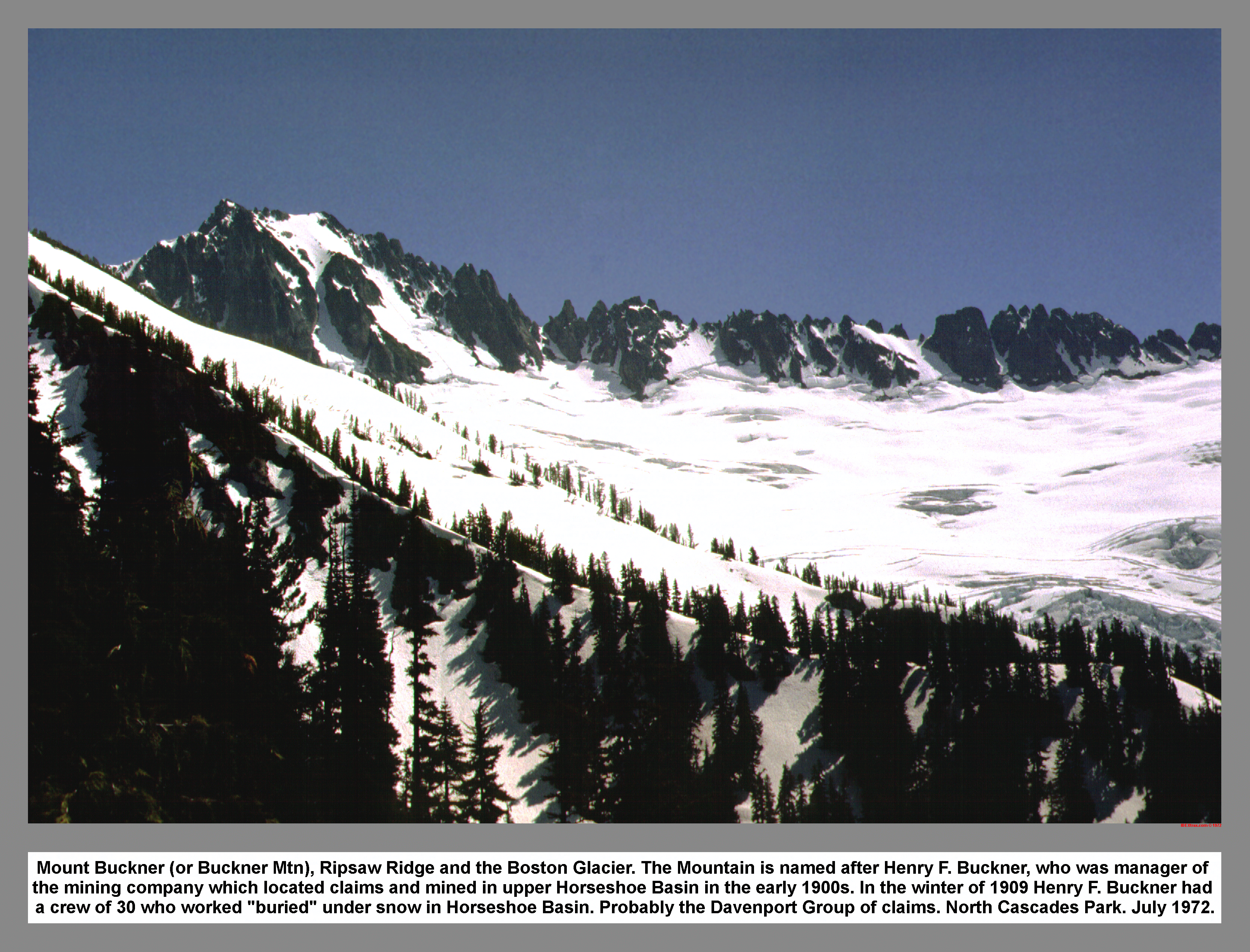
Mount Buckner (or Buckner Mtn), Ripsaw Ridge and the Boston Glacier. The Mountain is named after Henry F. Buckner, who was manager of the mining company which located claims and mined in upper Horseshoe Basin in the early 1900s. In the winter of 1909 Henry F. Buckner had a crew of 30 who worked "buried" under snow in Horseshoe Basin. Probably the Davenport Group of claims. North Cascades Park. July 1972.
02 020 Forbidden Peak and the Boston Glacier
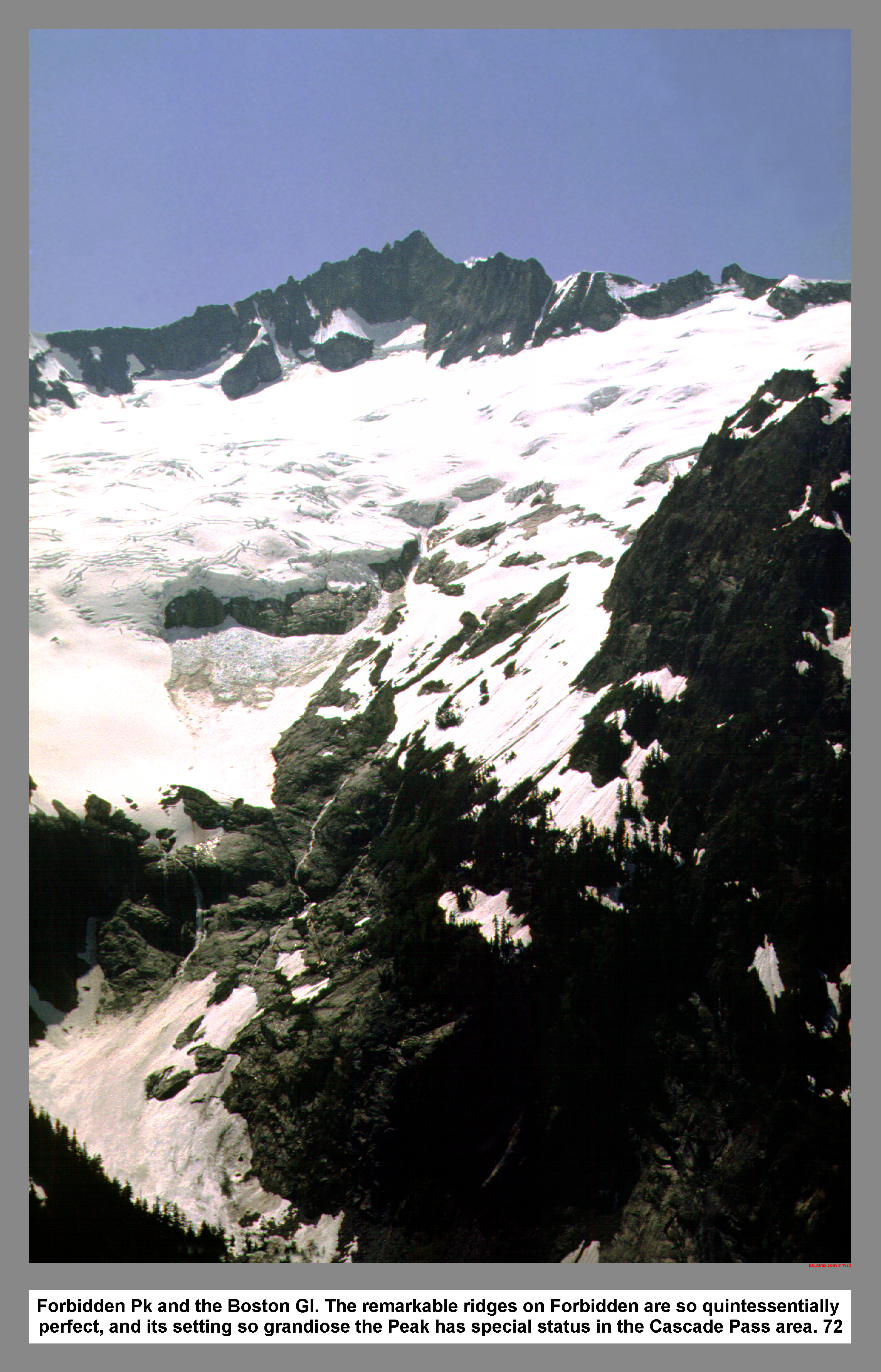
Forbidden Pk and the Boston Gl. The remarkable ridges on Forbidden are so quintessentially perfect, and its setting so grandiose the Peak has special status in the Cascade Pass area. 72
02 021 Boston Pk, Sharkfin Tower and Boston Gl
Both Boston Peak's and Sharkfin Tower's dark pointed summits pierce the clear skies above the brilliant expanse of the Boston Glacier. The glacier once called the Silver Basin Glacier by early miners. The peak was first climbed in July 1938. First ascent of the tower came in August 1947 by the East face. Sharkfin now has at least six different established routes. North Cascades National Park, July 72.
02 022 Looking North and Down Thunder Creek
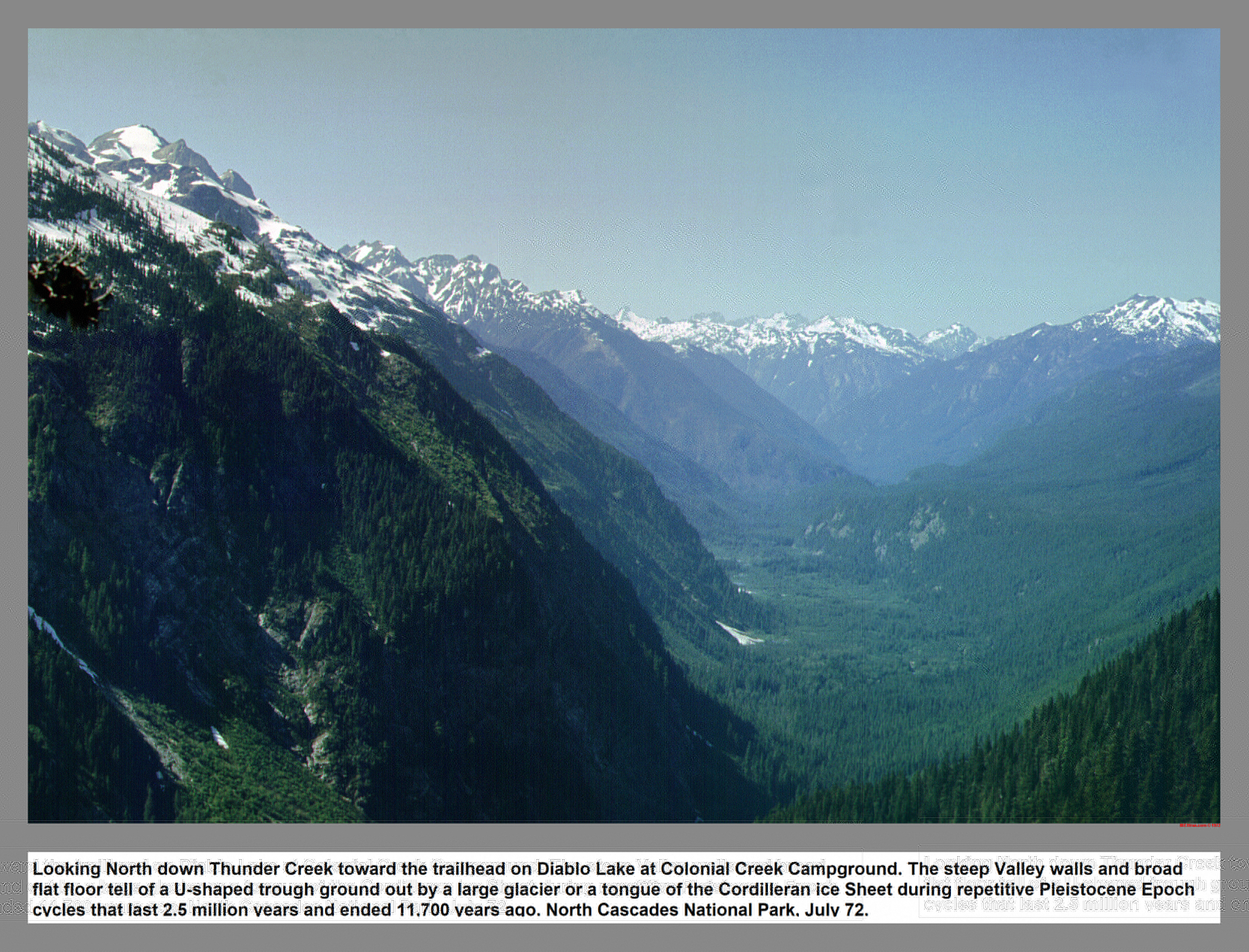
Looking North down Thunder Creek toward the trailhead on Diablo Lake at Colonial Creek Campground. The steep Valley walls and broad flat floor tell of a U-shaped trough ground out by a large glacier or a tongue of the Cordilleran ice Sheet during repetitive Pleistocene Epoch cycles that last 2.5 million years and ended 11,700 years ago. North Cascades National Park, July 72.
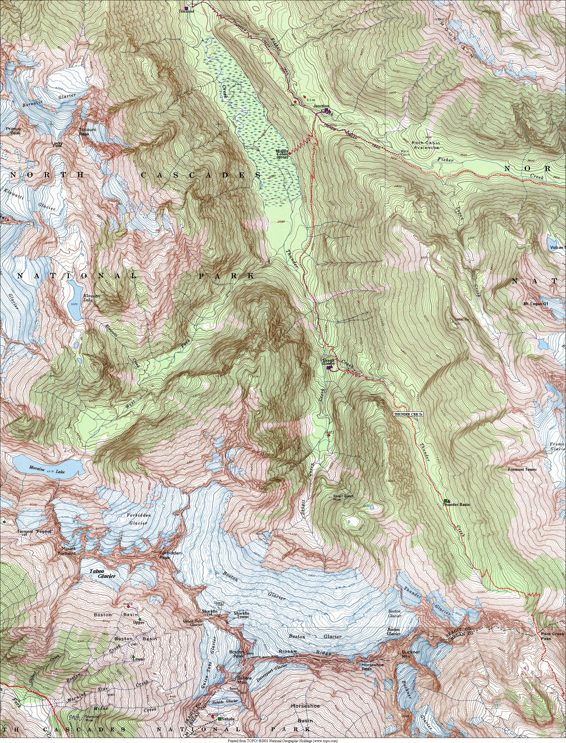
01 056m Thunder Crk Skagit Queen Map.
|
|
|
|
| This site created and maintained by THE IBEX - Page last revised:
|
|