
|
|
IBEXtrax.com - Cascade Mountains of Washington StateAlpine Lakes Wilderness |
|
|
03 037 Chris H on Deep Lk trail near Cathedral Pass
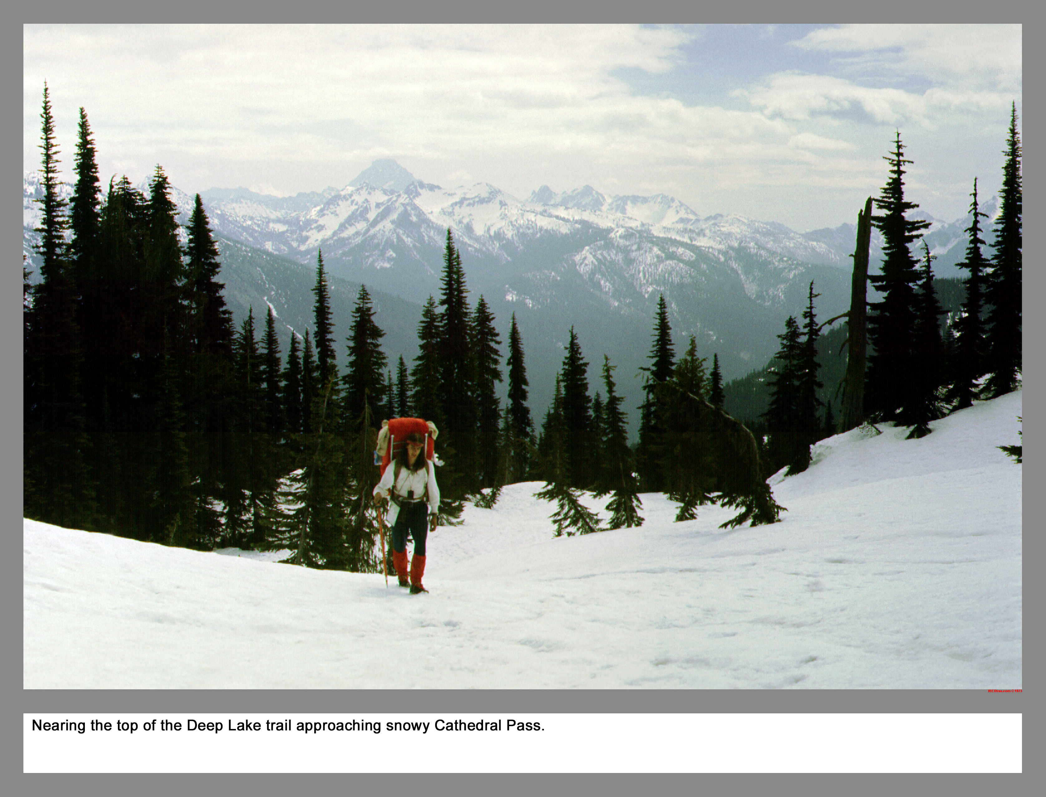
Nearing the top of the Deep Lake trail approaching snowy Cathedral Pass.
03 038 Cathedral Rock from the PCT Chris H
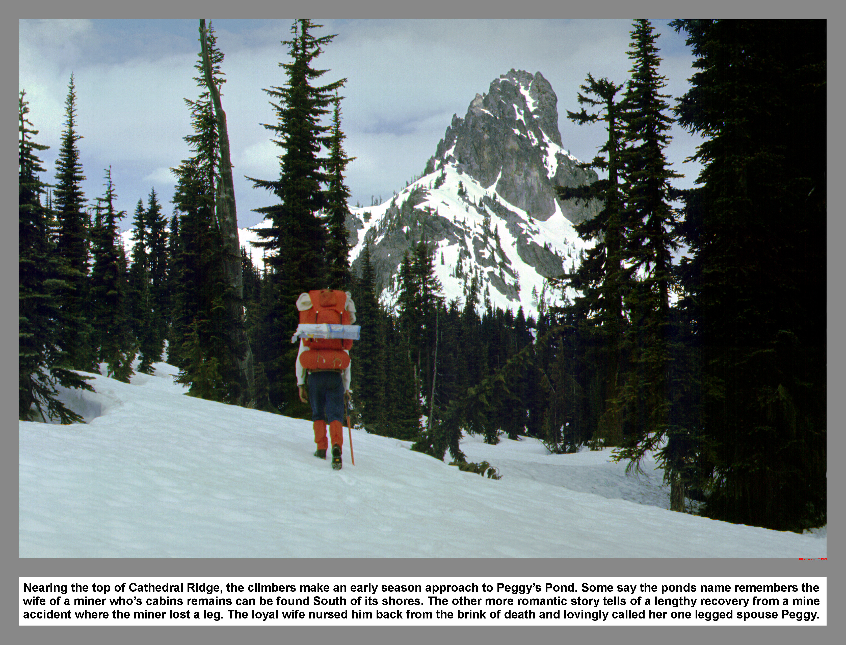
Nearing the top of Cathedral Ridge, the climbers make an early season approach to Peggy's Pond. Some say the ponds name remembers the wife of a miner who's cabins remains can be found South of its shores. The other more romantic story tells of a lengthy recovery from a mine accident where the miner lost a leg. The loyal wife nursed him back from the brink of death and lovingly called her one legged spouse Peggy.
03 039 Peggy's Pond Camp after Snow
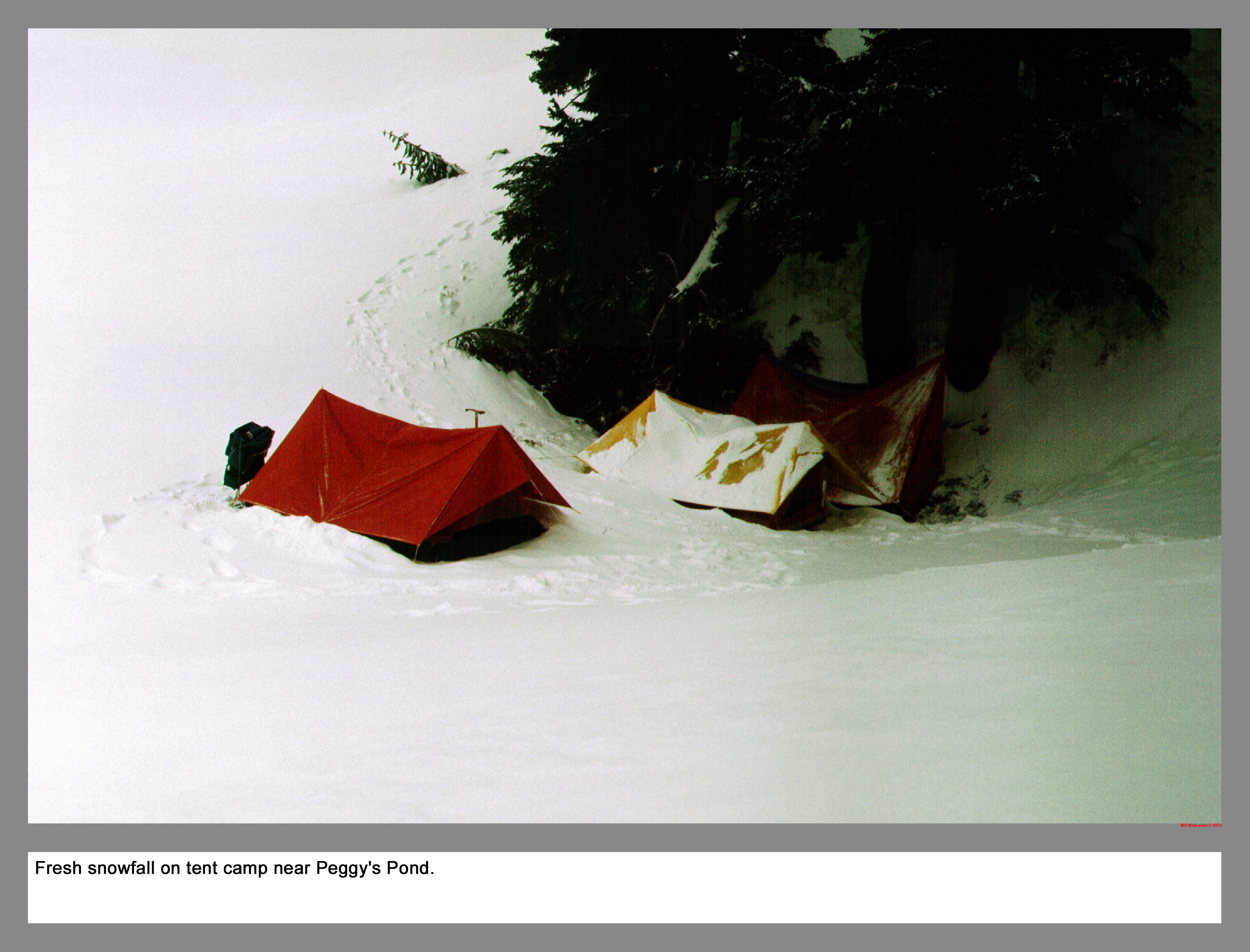
Fresh snowfall on tent camp near Peggy's Pond.
03 040 Venus Lake and Spade Lk from East Pk Mt Daniel
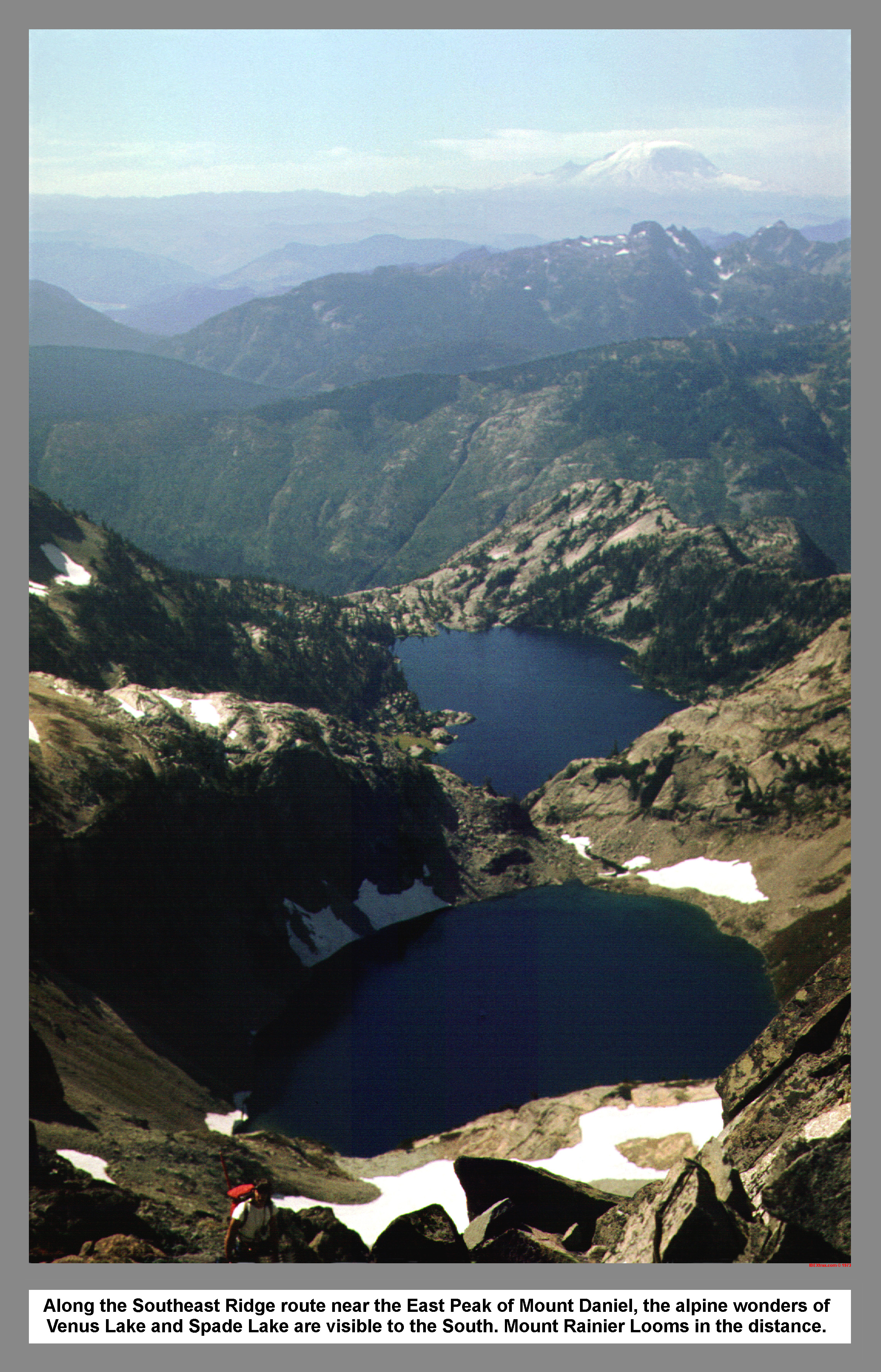
Along the Southeast Ridge route near the East Peak of Mount Daniel, the alpine wonders of Venus Lake and Spade Lake are visible to the South. Mount Rainier Looms in the distance.
03 044 Pea Soup Lake and Lynch Glacier from Mt Daniel
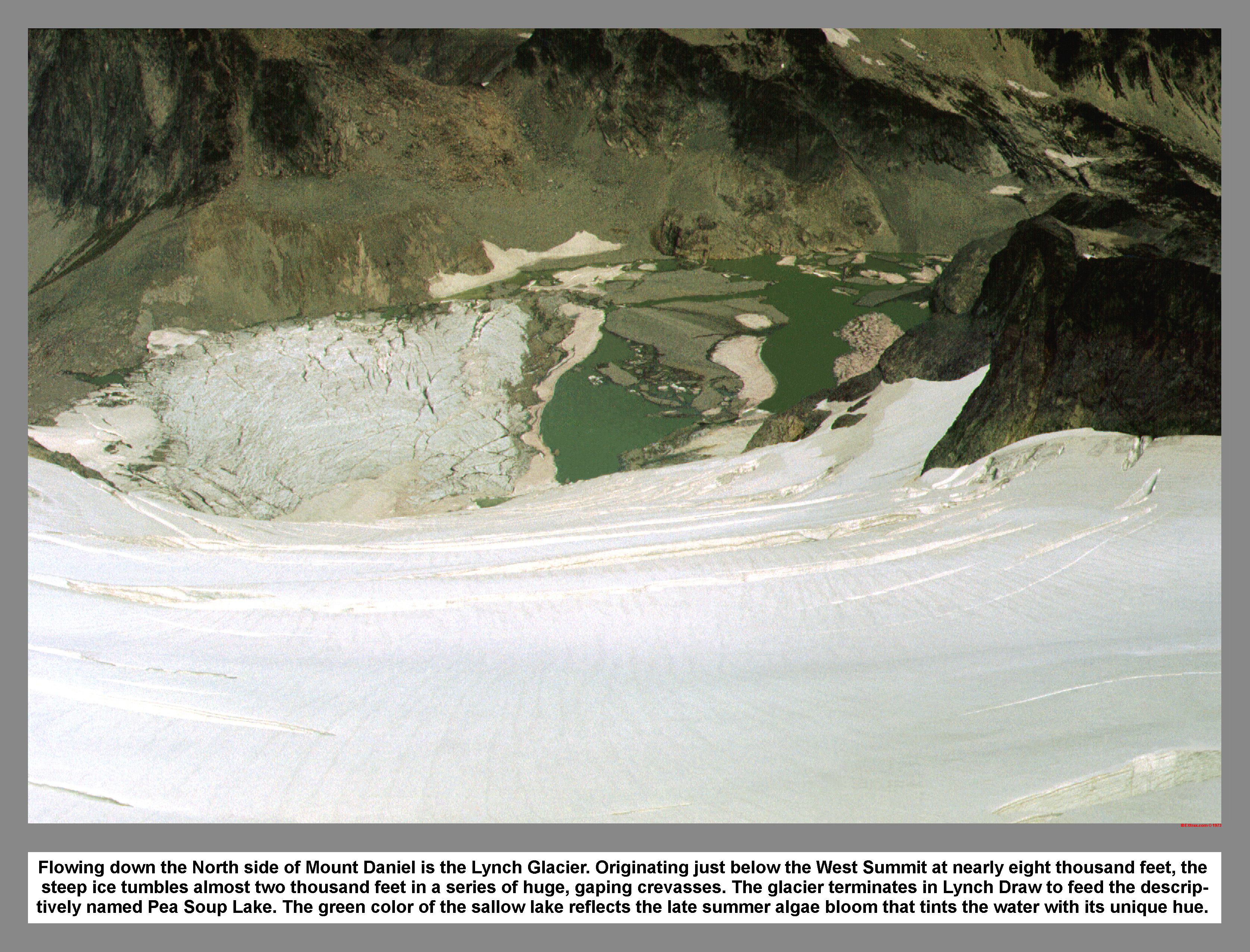
Flowing down the North side of Mount Daniel is the Lynch Glacier. Originating just below the West Summit at nearly eight thousand feet, the steep ice tumbles almost two thousand feet in a series of huge, gaping crevasses. The glacier terminates in Lynch Draw to feed the descrip-tively named Pea Soup Lake. The green color of the sallow lake reflects the late summer algae bloom that tints the water with its unique hue.
03 041 Middle Peak West Peak of Mt Daniel
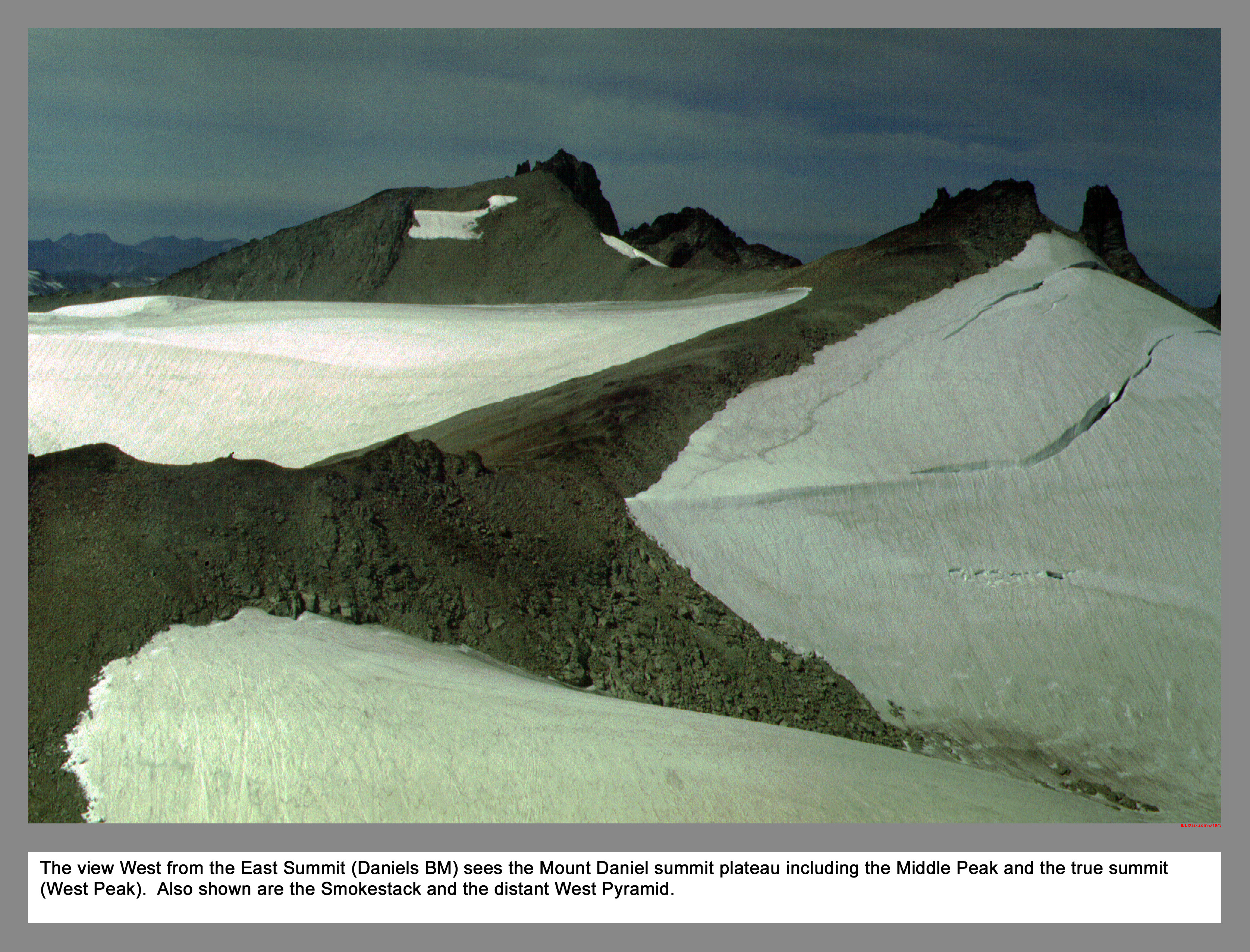
The view West from the East Summit (Daniels BM) sees the Mount Daniel summit plateau including the Middle Peak and the true summit (West Peak). Also shown are the Smokestack and the distant West Pyramid.
03 042 Chris on Summit Rocks on Mt Daniel
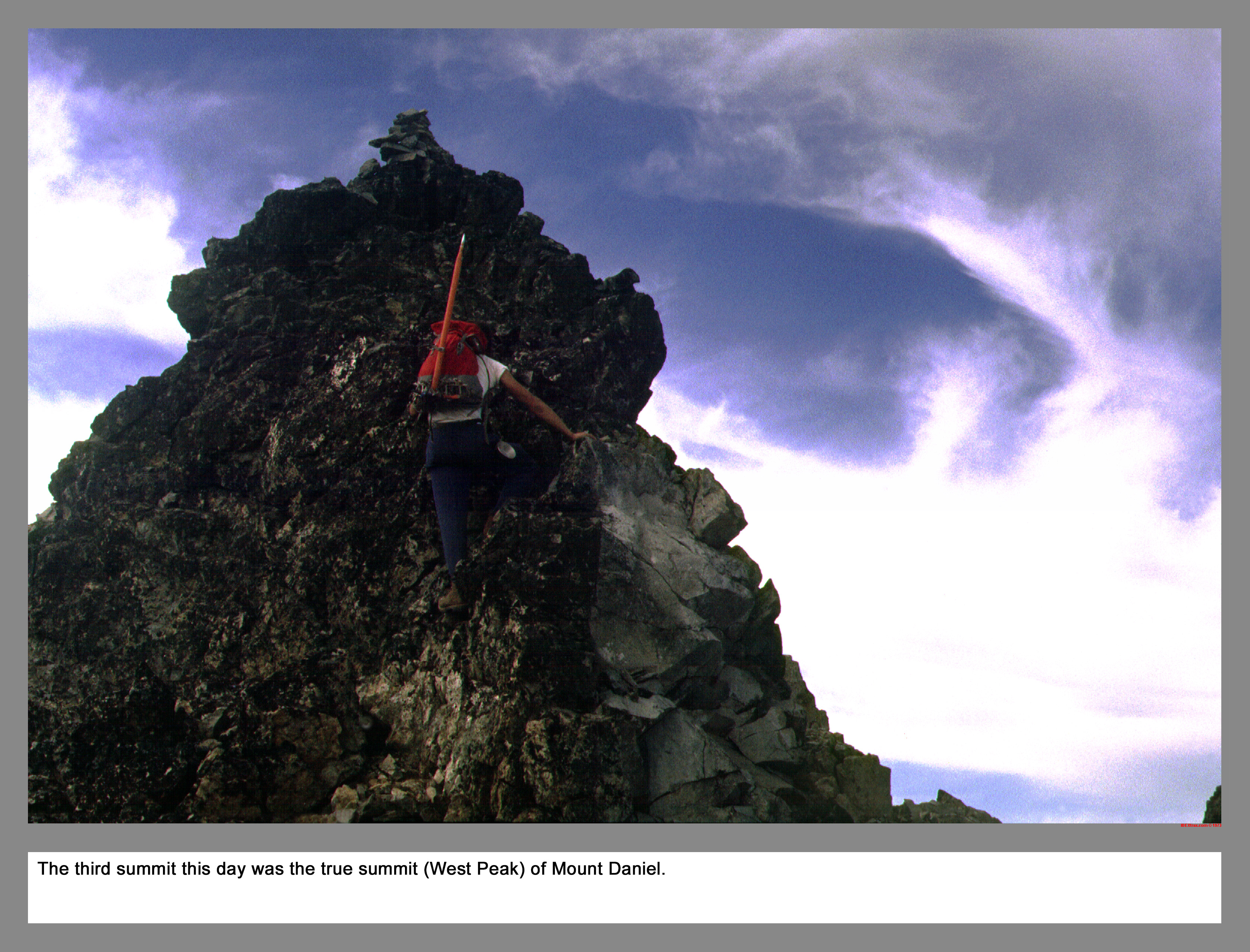
The third summit this day was the true summit of Mount Daniel.
03 043 7500 footers south of Mount Daniel ALW
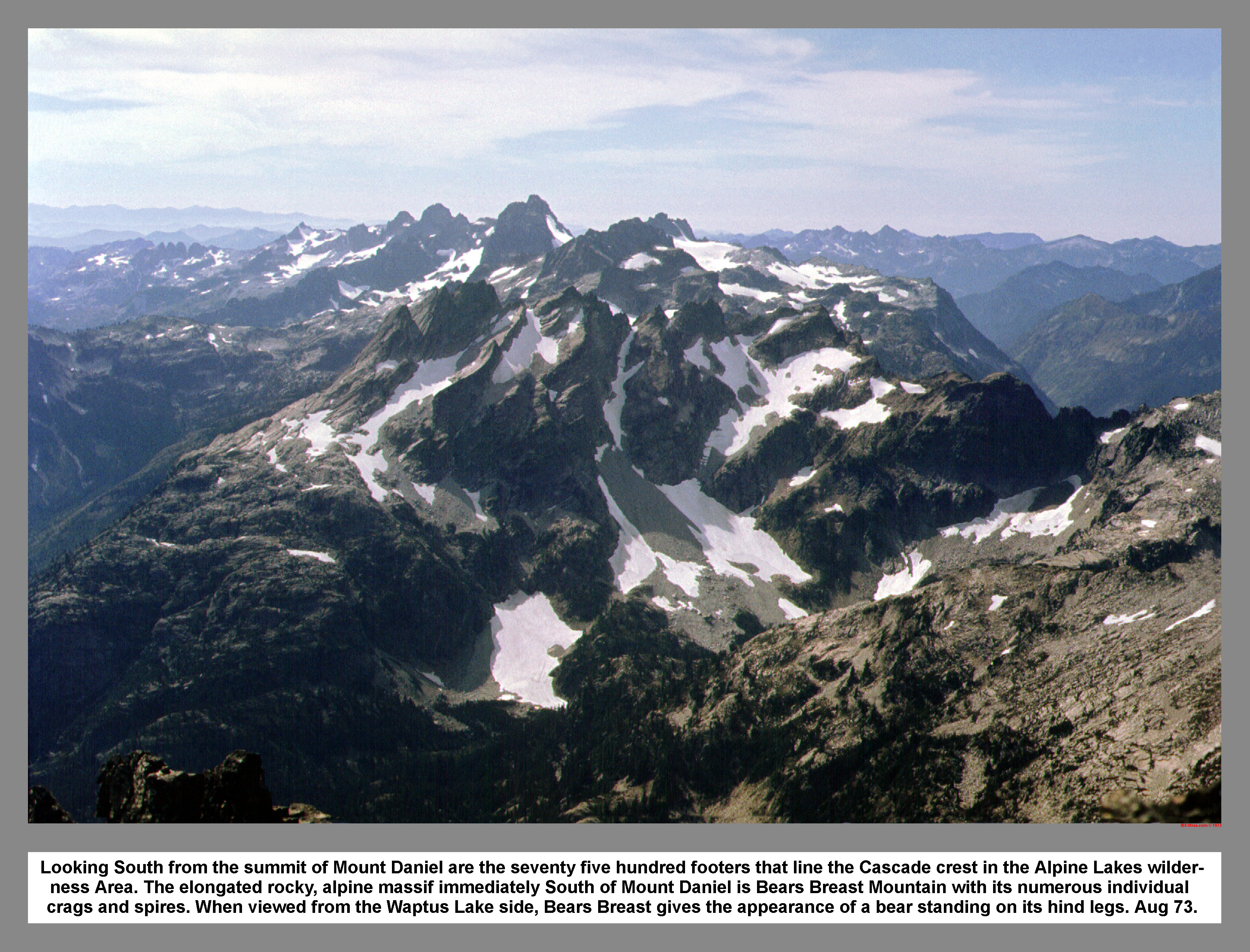
Looking South from the summit of Mount Daniel are the seventy five hundred footers that line the Cascade crest in the Alpine Lakes Wilder-ness Area. The elongated rocky, alpine massif immediately South of Mount Daniel is Bears Breast Mountain with its numerous individual crags and spires. When viewed from the Waptus Lake side, Bears Breast gives the appearance of a bear standing on its hind legs. Aug 73.
03 045 Circle Lk and The Citadel from SE ridge Mt Daniel
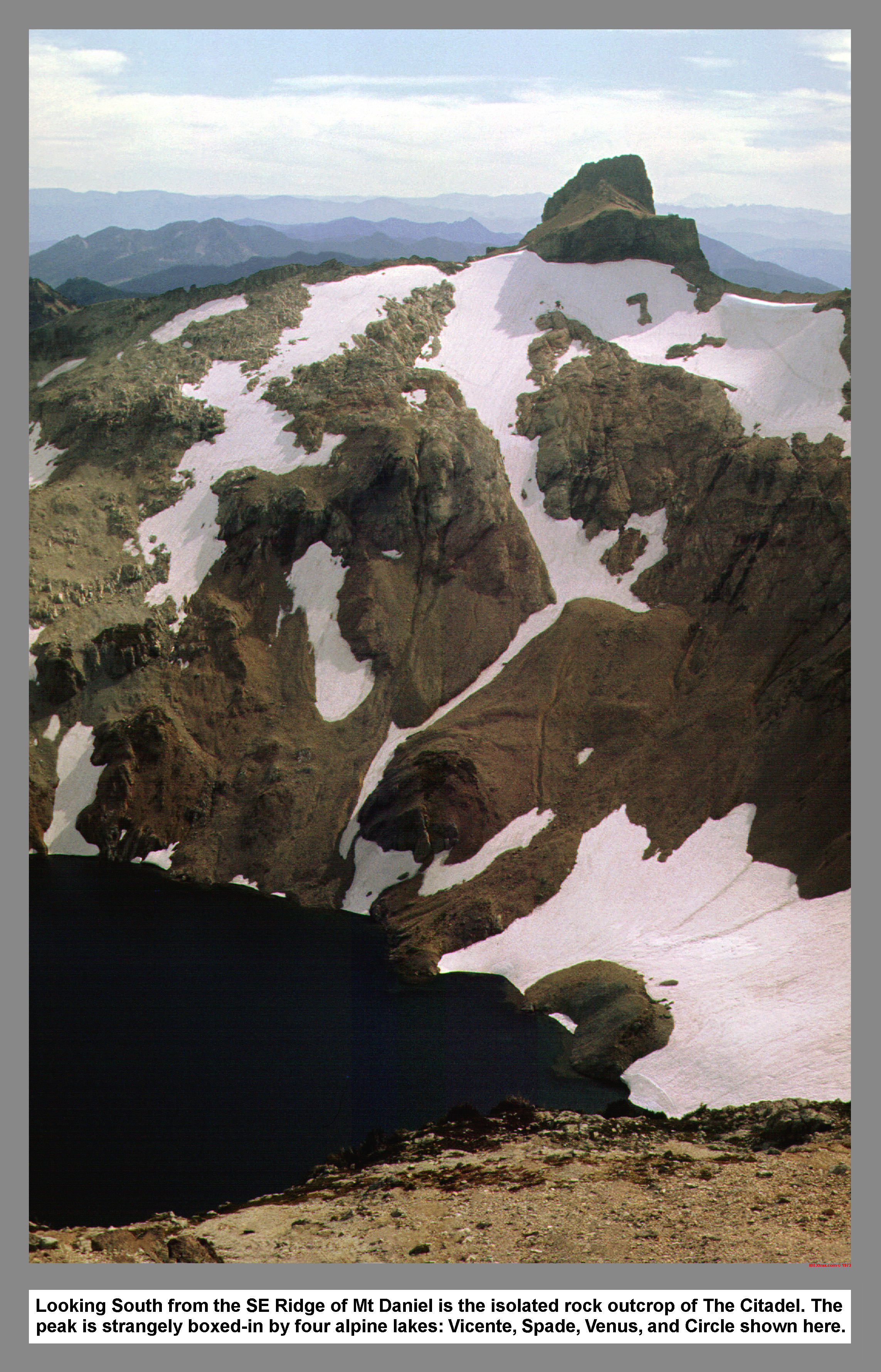
Looking South from the SE Ridge of Mt Daniel is the isolated rock outcrop of The Citadel. The peak is strangely boxed-in by four alpine lakes: Vicente, Spade, Venus, & Circle shown here.
03 046 Cathedral Rock in Late Summer 25Aug73
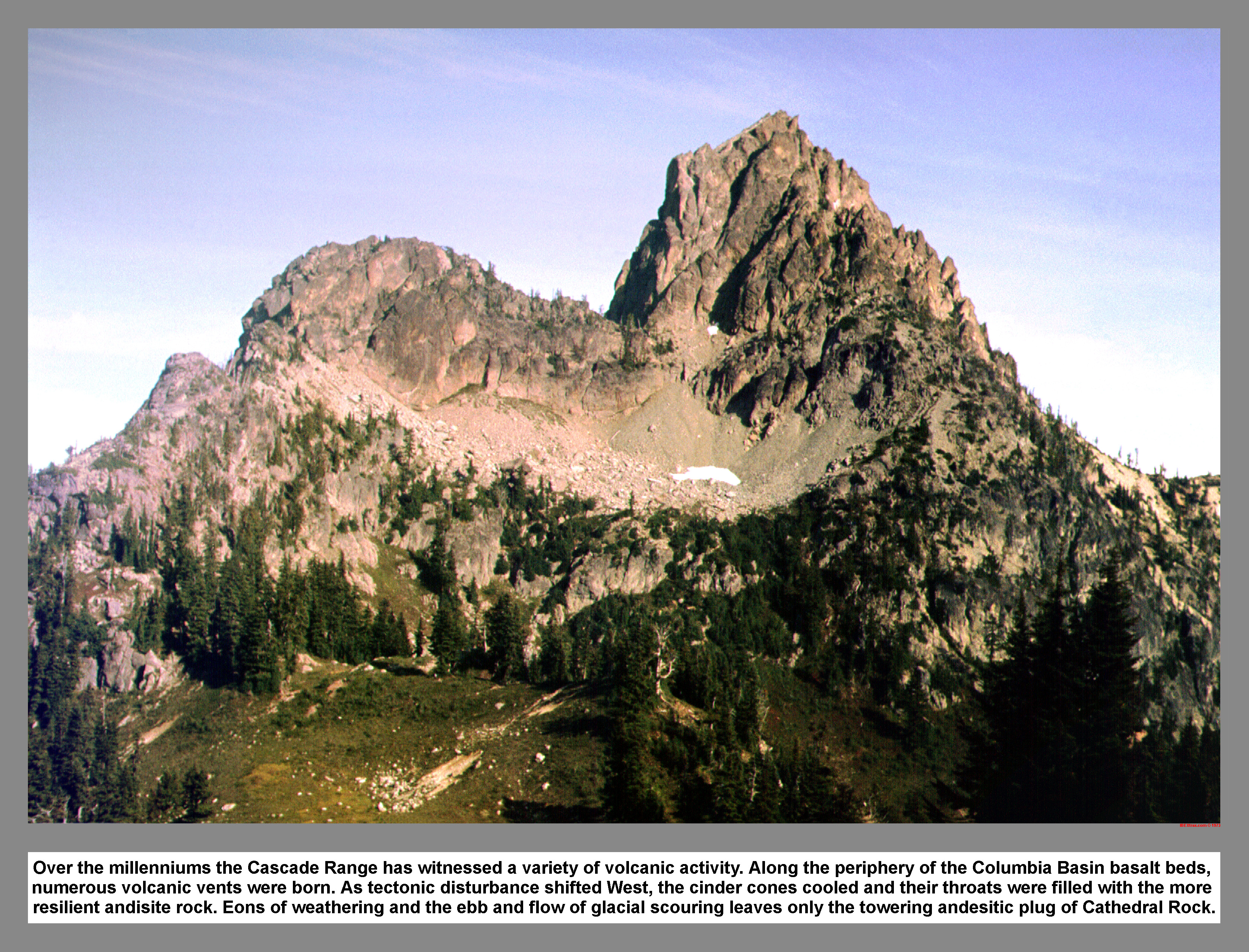
Over the millenniums the Cascade Range has witnessed a variety of volcanic activity. Along the periphery of the Columbia Basin basalt beds, numerous volcanic vents were born. As tectonic disturbance shifted West, the cinder cones cooled and their throats were filled with the more resilient andisite rock. Eons of weathering and the ebb and flow of glacial scouring leaves only the towering andesitic plug of Cathedral Rock.
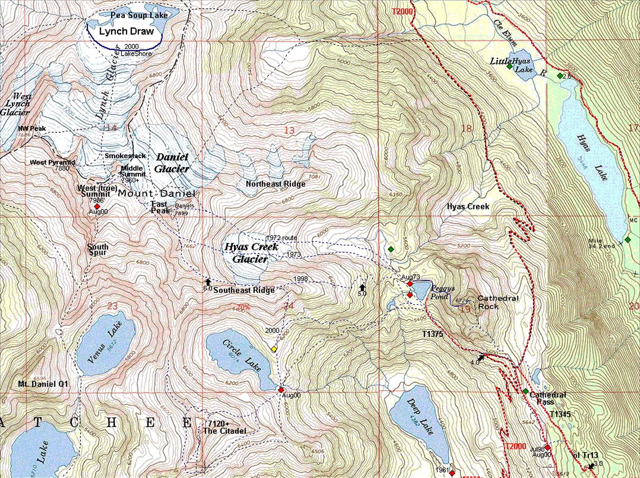
03 046m Mt Daniel Cathedral Rk Citadel Map
|
|
|
|
|
|
This site created and maintained by THE IBEX - Page last revised:
|
|