
|
|
IBEXtrax.com - Cascade Mountains of Washington StateWhite Chuck Roadless, Mt Baker-Snoqualmie Forest |
|
|
06 072 White Chuck River From Rat Trap Pass
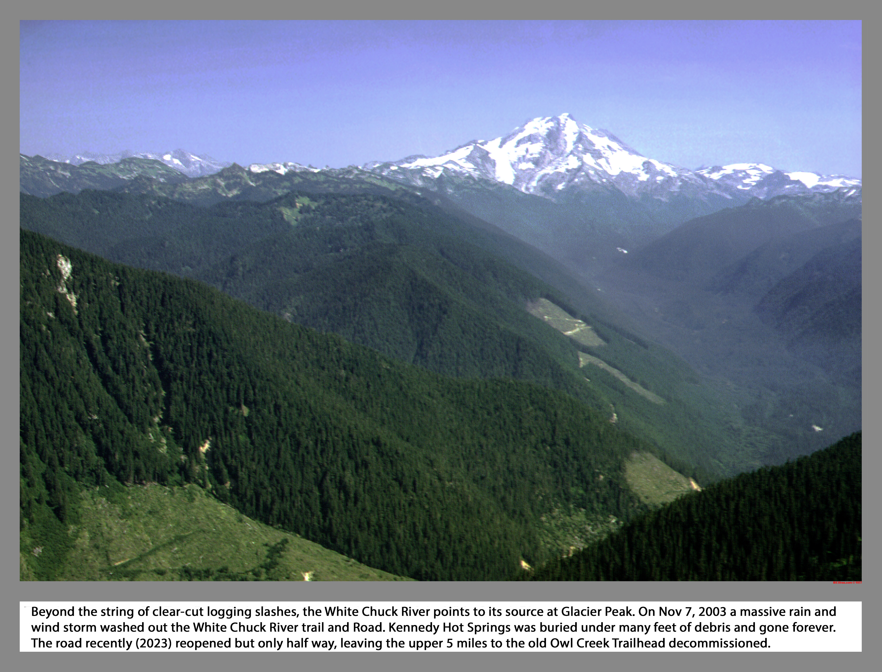
Beyond the string of clear-cut logging slash patches, the White Chuck River points to its source at Glacier Peak. On November 7, 2003 a massive rain and wind storm pummeled the White Chuck River and Road. Kennedy Hot Springs was buried under many feet of debris and gone forever. The road recently (2023) reopened but only half way, leaving the upper 5 miles to Owl Creek Trailhead decommissioned.
06 073 Pugh Mountain Slone Pk from Whitechuck (173k)
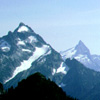
Aligned as if giant fence posts, Pugh Mountain, Slone Peak and Whitechuck Mountain stand in a row just east of the Straight Creek Fault. In the North Cascades, movement along several faults, the Straight Creek Fault in particular, was at one time similar to that of along the San Andreas Fault. Unlike the San Andreas, movement has not occurred along the Straight Creek Fault in Washington for some 35 million years.
06 074 East face of White Chuck Mountain (265k)
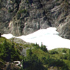
The East Face of White Chuck Mountain loomed above us with a neck raking height. The obvious crease that slashed across the shear facing walls looked doable and was rated five eight. However, before we could get at the broken rock of the couloir, we had to deal with the moat. The moat was an eight to ten foot gap between the steep rock wall and the icy hard late season snow. White Chuck Roadless. Darrington district.
|
|
|
|
|
|
This site created and maintained by THE IBEX - Page last revised:
|
|