
|
|
IBEXtrax.com - Cascade Mountains of Washington StateGlacier Peak Wilderness, Mt Baker-Snoqualmie Forest |
|
|
06 031 Bachelor Creek trail Mt Misch Randy L
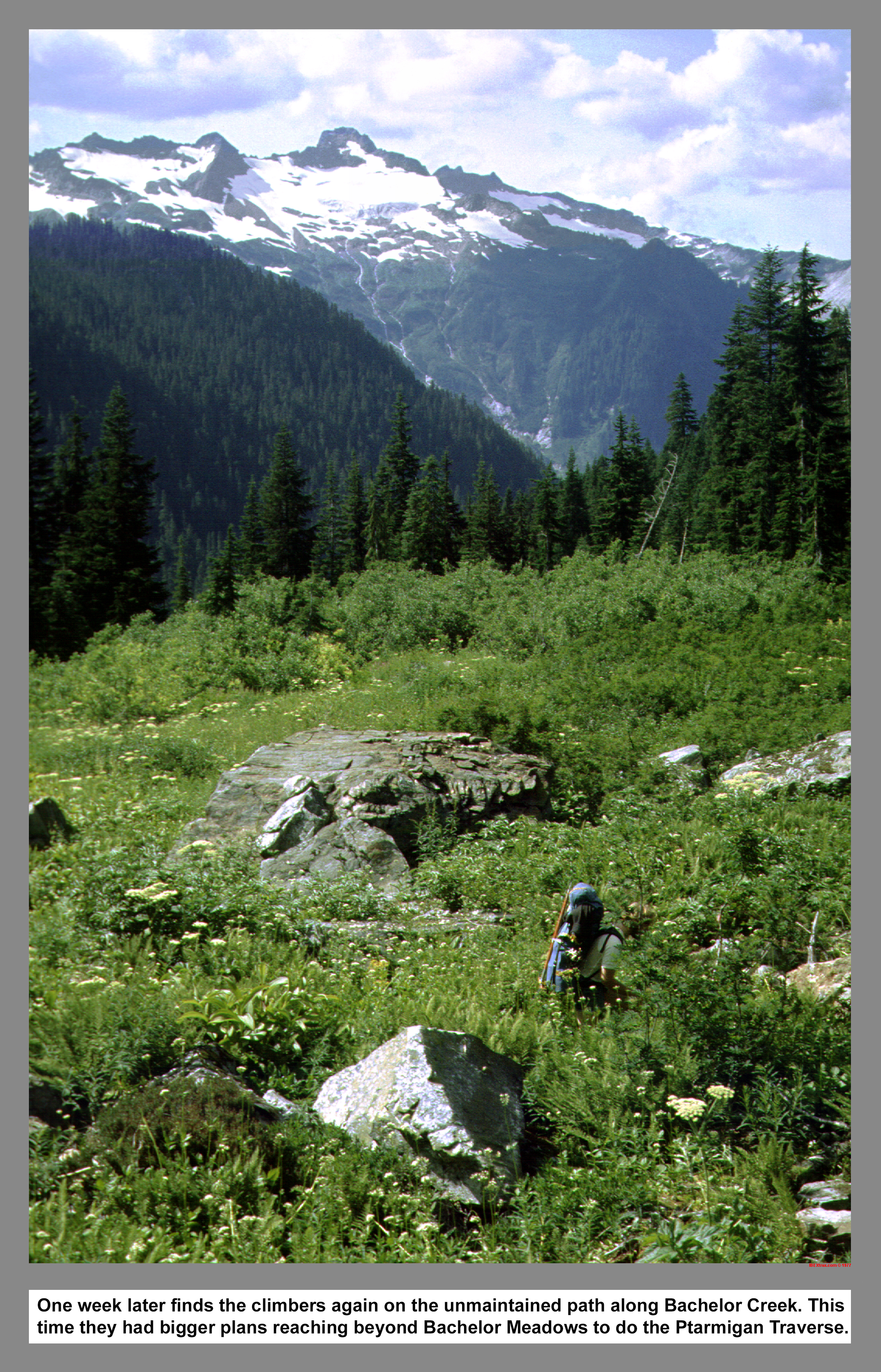
One week after the first Bachelor Meadows trip to bag The Steeple summit, finds the climbers again on the unmaintained path along Bachelor Creek. This time they had bigger plans to reach beyond Bachelor Meadows and do the Ptarmigan Traverse.
06 032 Bachelor Ck trail The Steeple Randy L
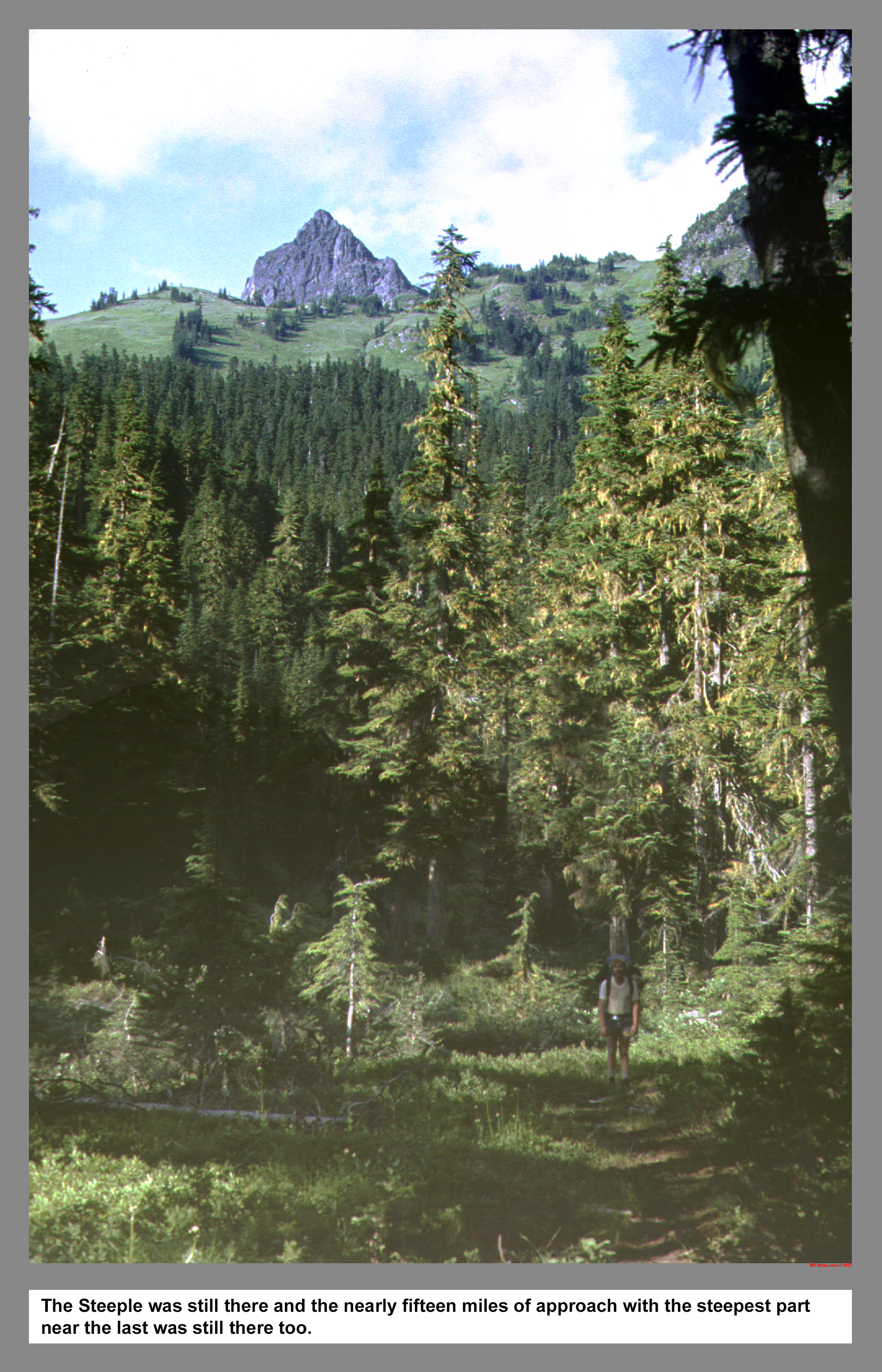
The Steeple was still there. The nearly fifteen miles of approach was still there. And the energy draining steepness near the last was still there too.
06 033 Randy L on Bachelor Creek trail.
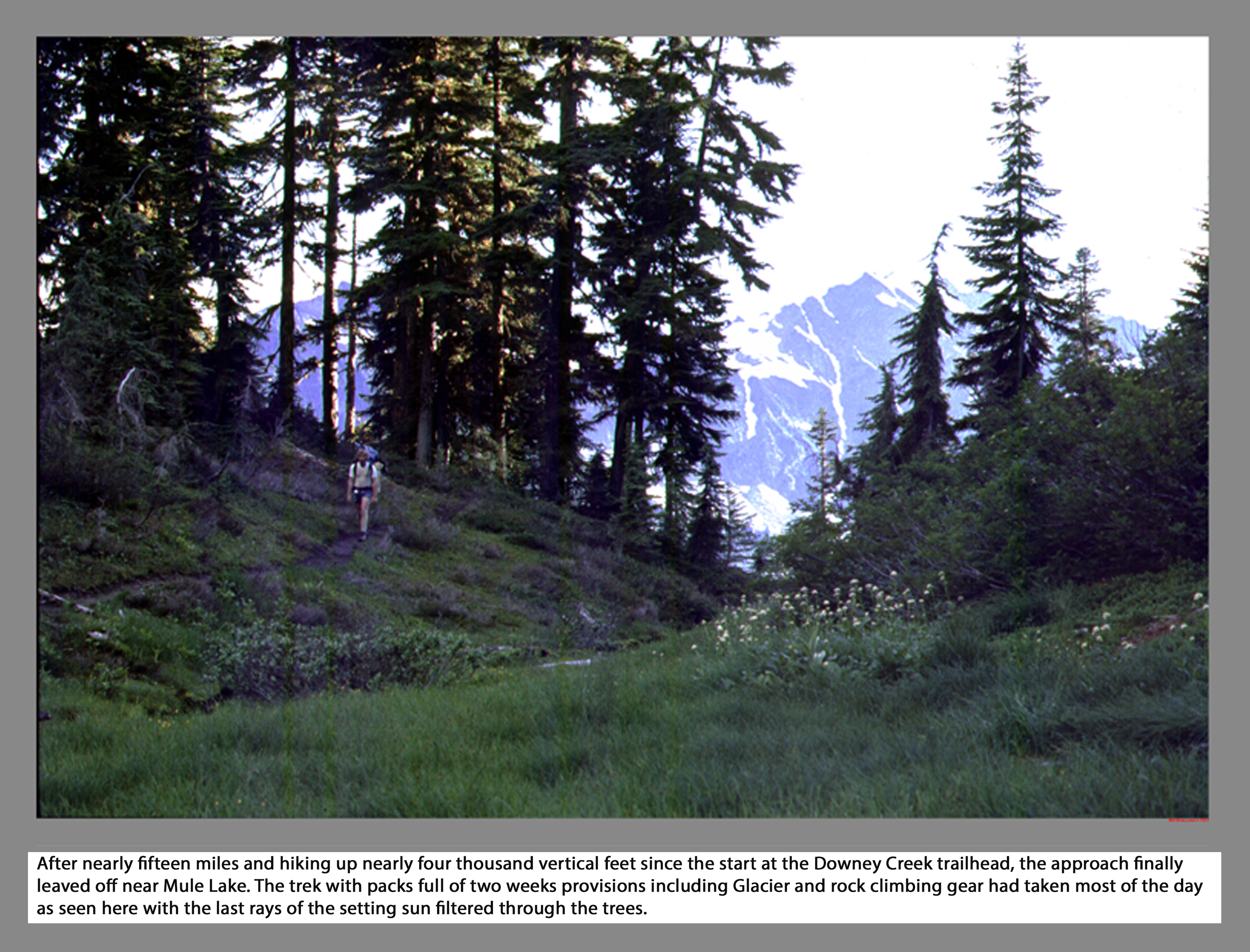
After nearly fifteen miles and hiking up nearly four thousand vertical feet since the start at the Downey Creek trailhead, the approach finally leaved off near Mule Lake. The trek with packs full of two weeks provisions including Glacier and rock climbing gear had taken most of the day as seen here with the last rays of the setting sun filtered through the trees.
06 034 Spire Point from Bachelor Meadows
 From the ridge line west of Cub Lake, this view is looking northeast at Spire Point and the shrinking West Spire Glacier. The Point was earlier shown on the 1922 Forest Service map as Spire Peak. The twin summits of Spire Point have the interesting geologic distinction of being split down the middle by a contact between metamorphic gneiss on the lesser West Point (left) and igneous granite on the taller East Point (Right).
06 036 Randy L at Mule Lake camp
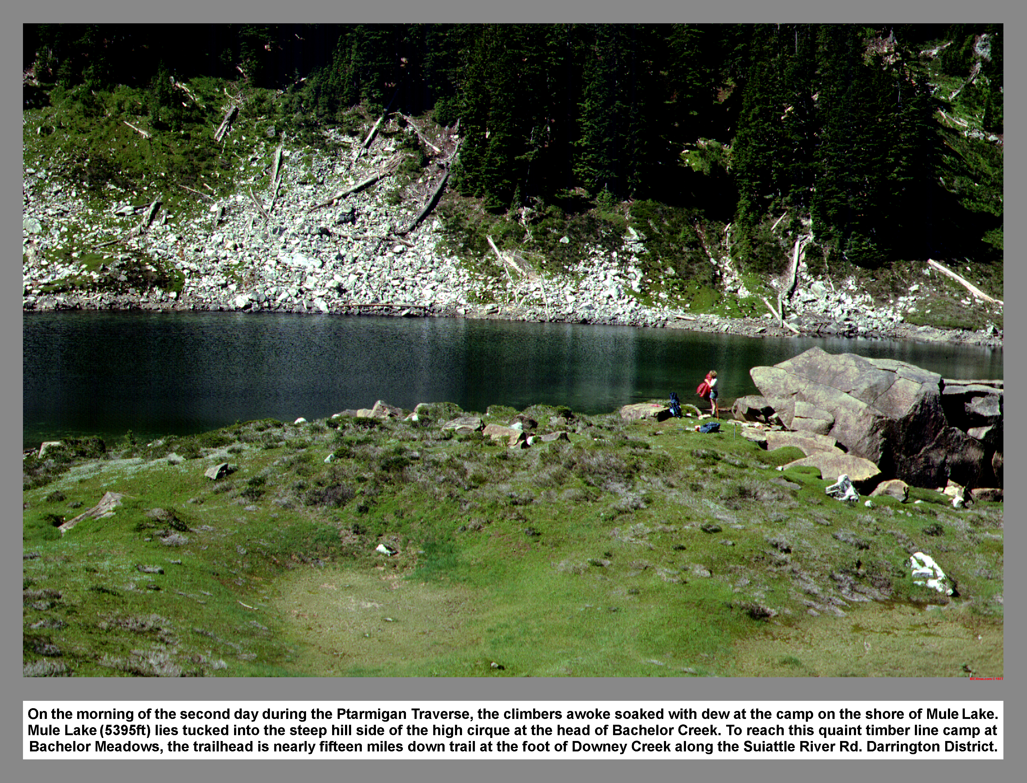 On the morning of the second day during the Ptarmigan Traverse, the climbers awoke soaked with dew at the camp on the shore of Mule Lake. Mule Lake (5395ft) lies tucked into the steep hill side of the high cirque at the head of Bachelor Creek. To reach this quaint timber line camp at Bachelor Meadows, the trailhead is nearly fifteen miles down trail at the foot of Downey Creek along the Suiattle River Rd. Darrington District.
06 037 Glacier Peak beyond Cub Lake
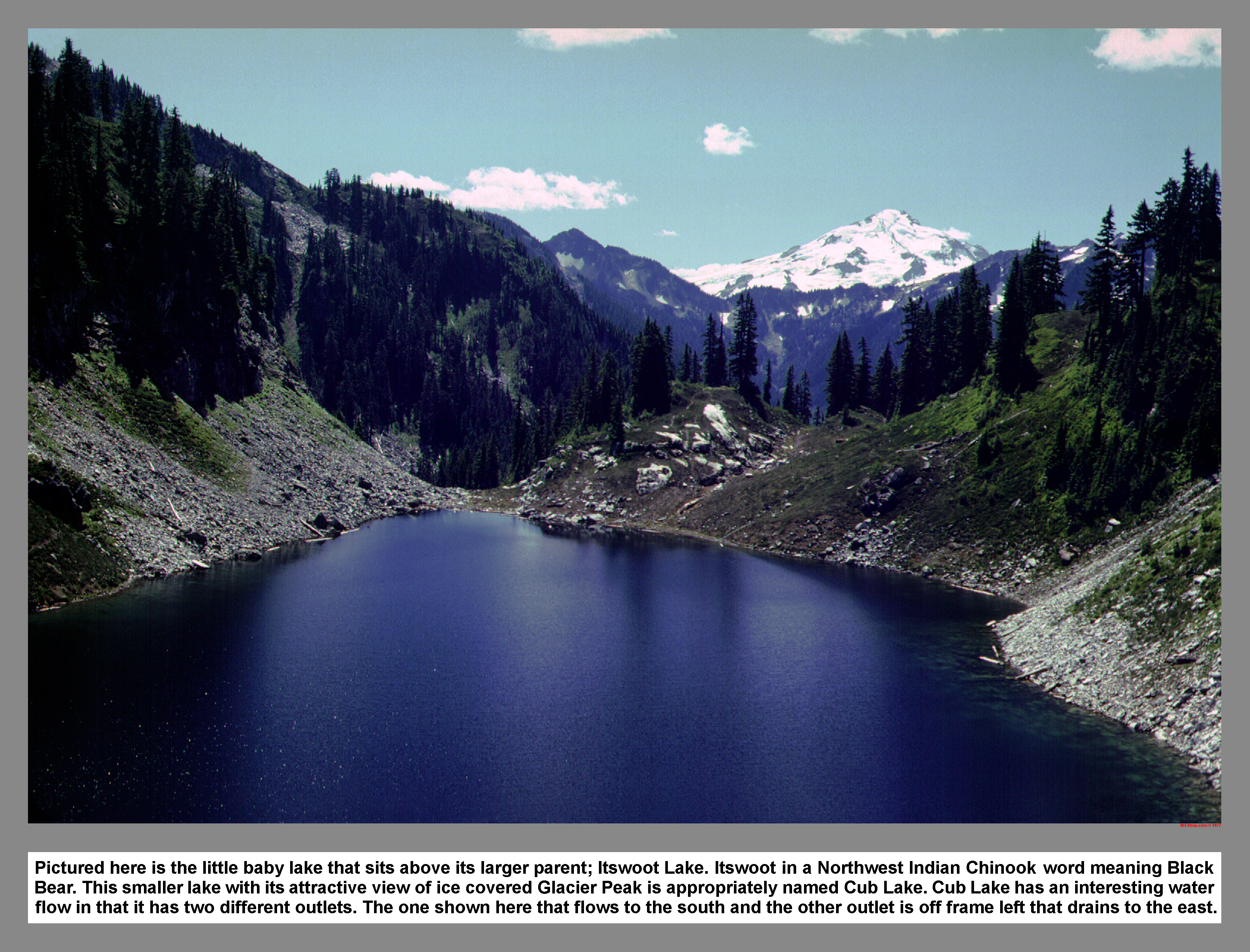 Pictured here is the little baby lake that sits above its larger parent; Itswoot Lake. Itswoot in a Northwest Indian Chinook word meaning Black Bear. This smaller lake with its attractive view of ice covered Glacier Peak is appropriately named Cub Lake. Cub Lake has an interesting water flow in that it has two different outlets. The one shown here that flows to the south and the other outlet is off frame left that drains to the east.
06 038 Across Downey Ck to Buckindy area
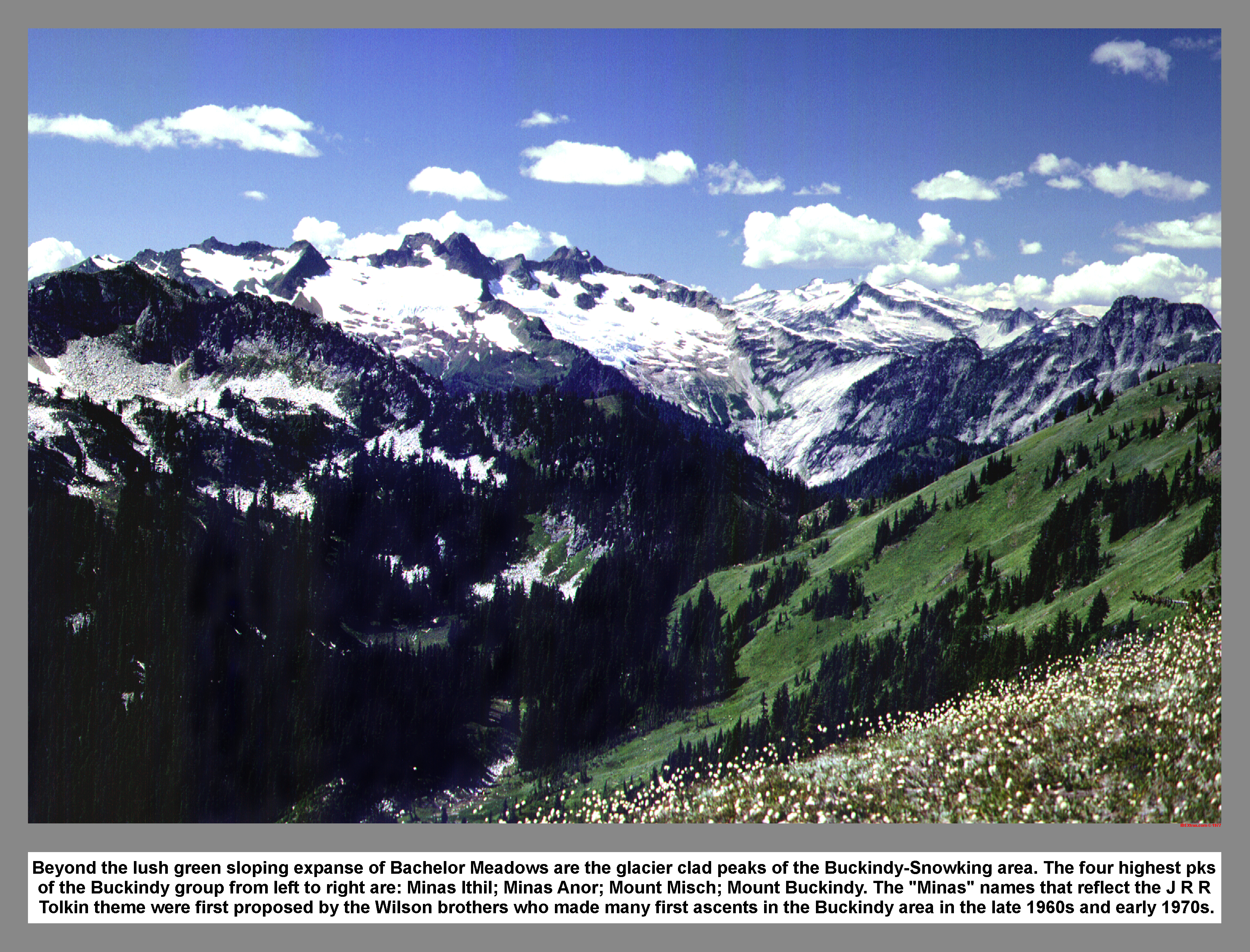 Beyond the lush green sloping expanse of Bachelor Meadows are the glacier clad peaks of the Buckindy-Snowking area. The four highest pks of the Buckindy group from left to right are: Minas Ithil; Minas Anor; Mount Misch; Mount Buckindy. The "Minas" names that reflect the J R R Tolkin theme were first proposed by the Wilson brothers who made many first ascents in the Buckindy area in the late 1960s and early 1970s.
06 039 Dome Pk & Glacier from Bachelor Meadows
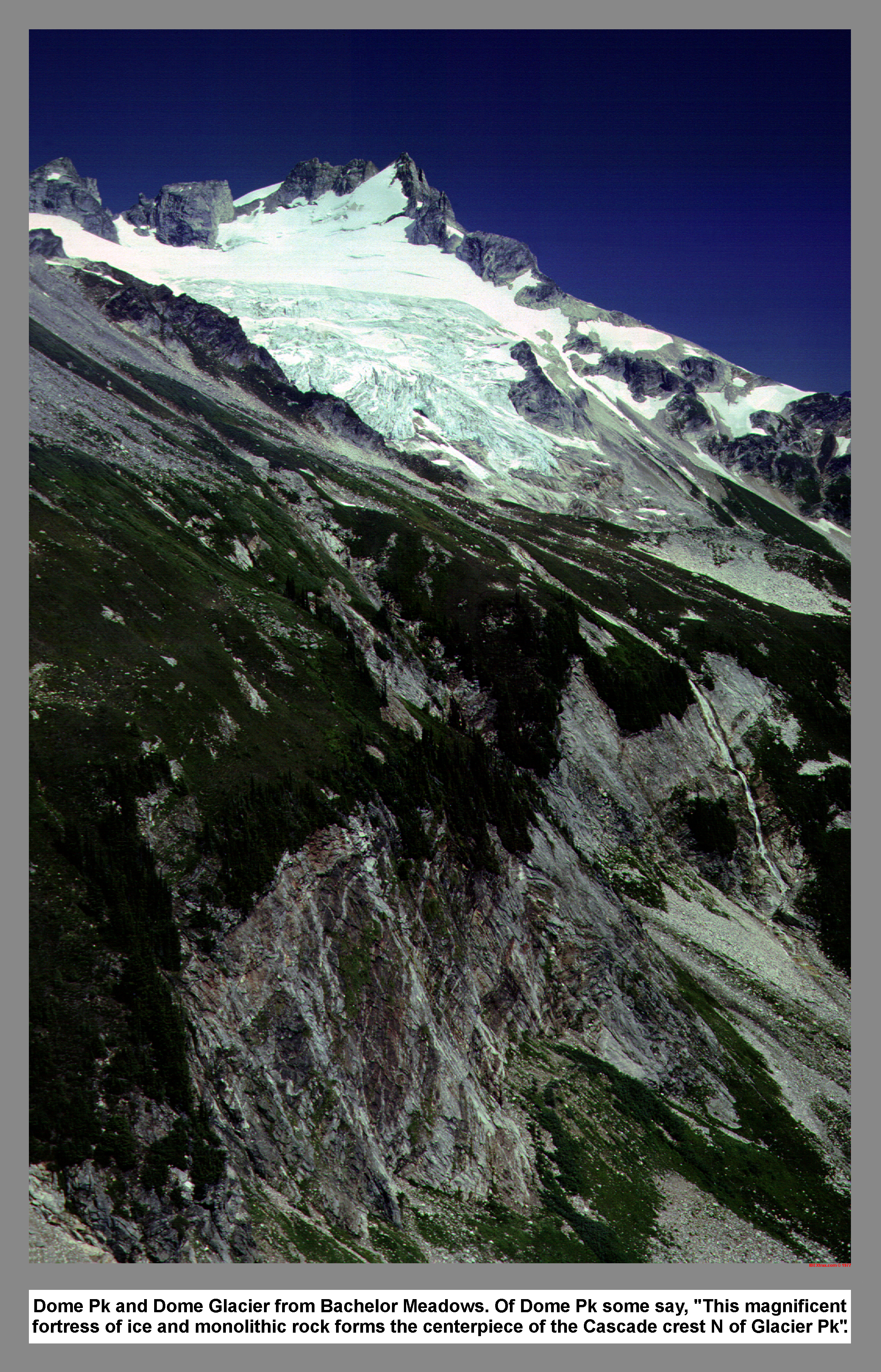
Dome Pk and Dome Glacier from Bachelor Meadows. Of Dome Pk some say, "This magnificent fortress of ice and monolithic rock forms the centerpiece of the Cascade crest N of Glacier Pk".
06 040 Randy L to Spire Point camp Dome Pk
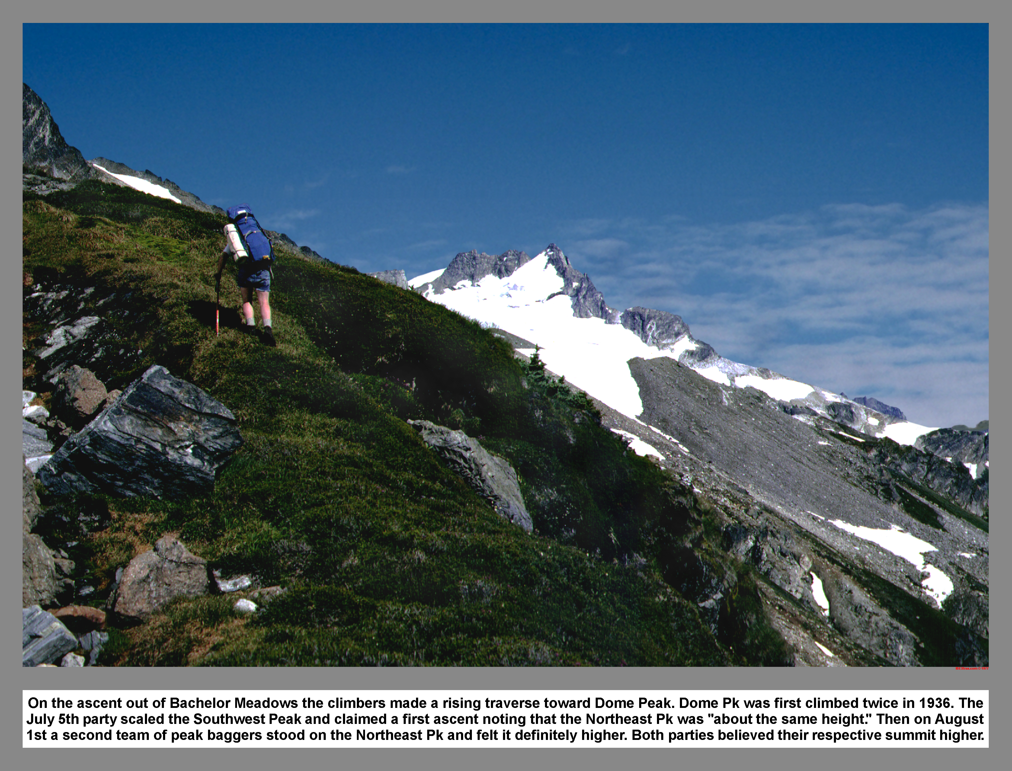 On the ascent out of Bachelor Meadows the climbers made a rising traverse toward Dome Peak. Dome Pk was first climbed twice in 1936. The July 5th party scaled the Southwest Peak and claimed a first ascent noting that the Northeast Pk was "about the same height." Then on August 1st a second team of peak baggers stood on the Northeast Pk and felt it definitely higher. Both parties believed their respective summit higher.
06 041 Bath Lake Peaks DaKobed Range & Glacier Peak
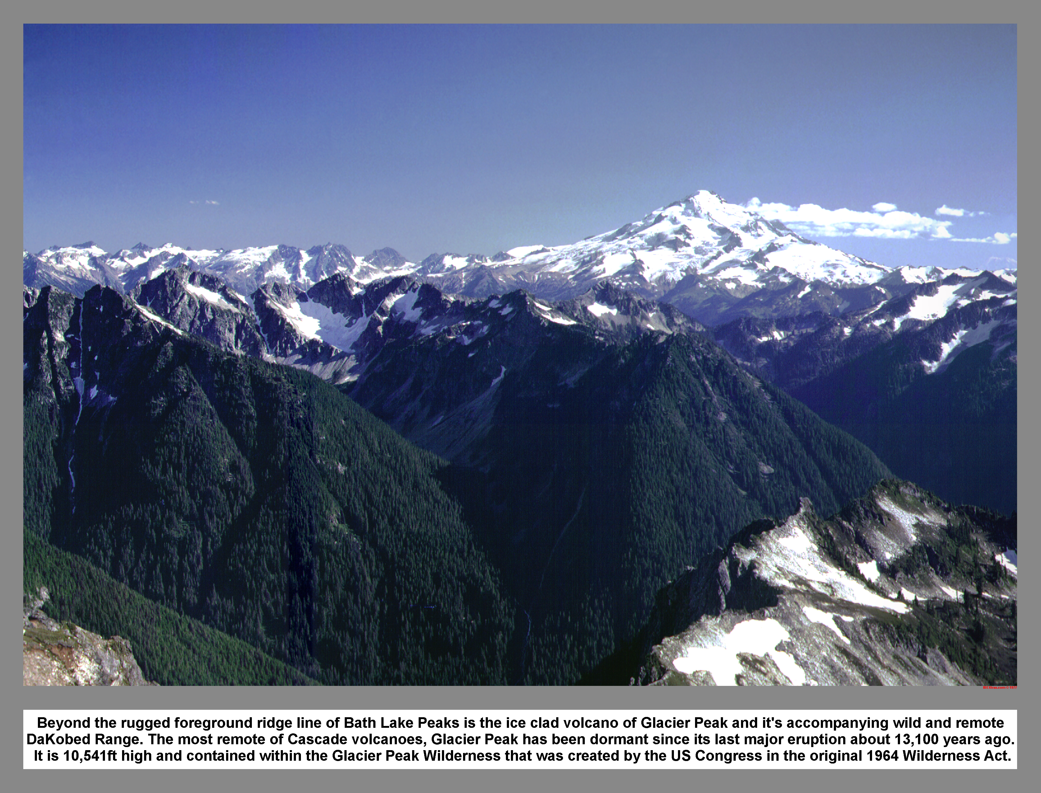 Beyond the rugged foreground ridge line of Bath Lake Peaks is the ice clad volcano of Glacier Peak and it's accompanying wild and remote DaKobed Range. The most remote of Cascade volcanoes, Glacier Peak has been dormant since its last major eruption about 13,100 years ago. It is 10,541ft high and contained within the Glacier Peak Wilderness that was created by the US Congress in the original 1964 Wilderness Act.
06 042 Glacier Peak from Spire Pt high camp at sunset
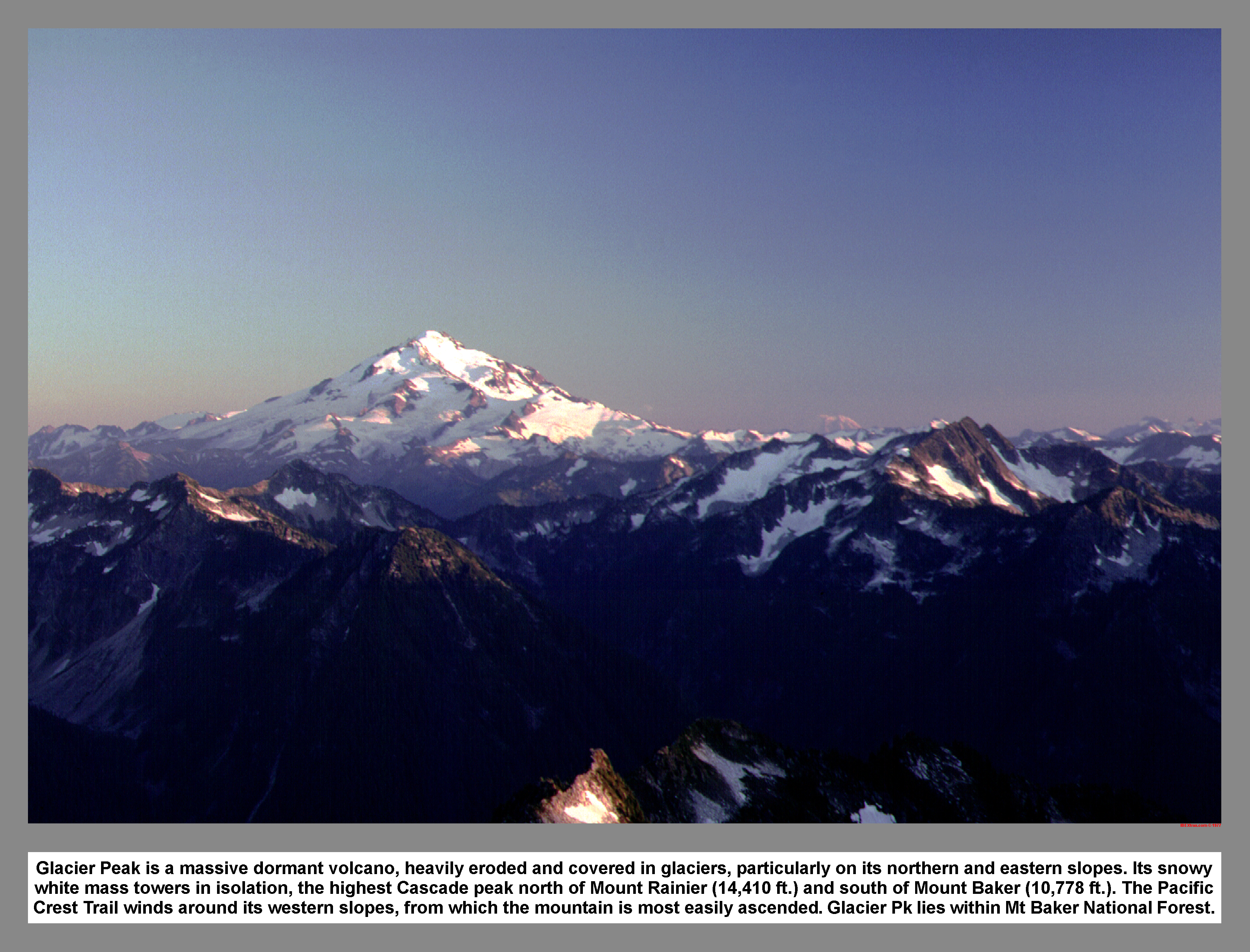 Glacier Peak is a massive dormant volcano, heavily eroded and covered in glaciers, particularly on its northern and eastern slopes. Its snowy white mass towers in isolation, the highest Cascade peak north of Mount Rainier (14,410 ft.) and south of Mount Baker (10,778 ft.). The Pacific Crest Trail winds around its western slopes, from which the mountain is most easily ascended. Glacier Pk lies within Mt Baker National Forest.
06 043 Near Spire Pt Dome Pk Randy L
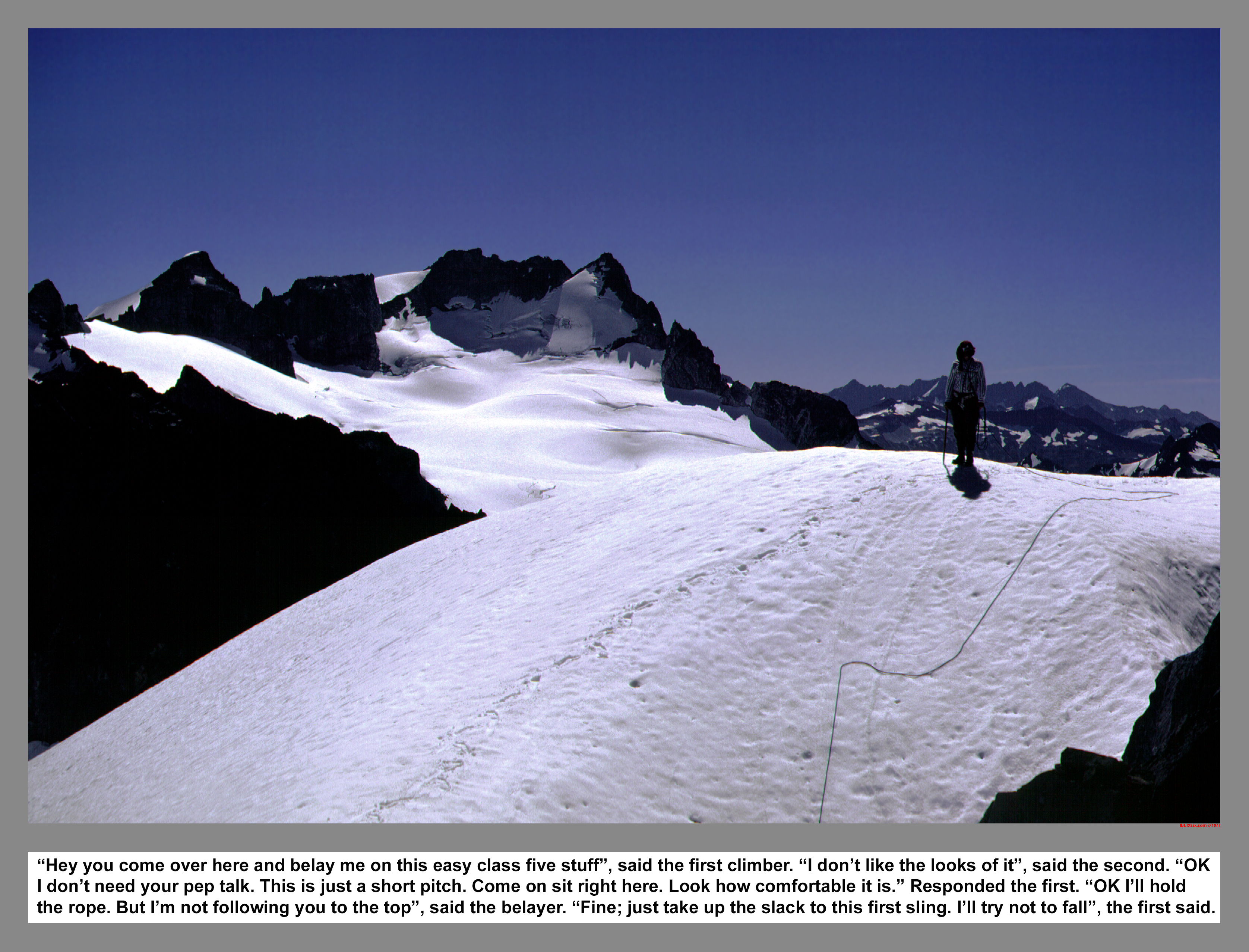
"Hey you come over here and belay me on this easy class five stuff", said the first climber. "I don't like the looks of it", said the second. "Now I don't need your pep talk. This is just a short pitch. Come on sit right here. Look how comfortable it is." Responded the first. "OK I'll hold the rope. But I'm not following you to the top", said the belayer. "Fine; just take up the slack from this first sling. I'll try not to fall", the first said.
06 044 Dome Pk & the Dome Glacier from Spire Point
 This view from the top of Spire Point looking east is of Dome Peak and Dome Glacier. The Ptarmigan Traverse foursome who scaled Dome Pk in July 1938 traversed both SE and NW Peaks from right to left as seen here. The climb from Sulphur Ck to the meadows southwest of Dome took an arduous 7.5 hours. After climbing both summits the foursome moved onto the Chickamin Glacier and crossed the ice col on the Dana Glacier.
06 045 Spire Point Above High Camp
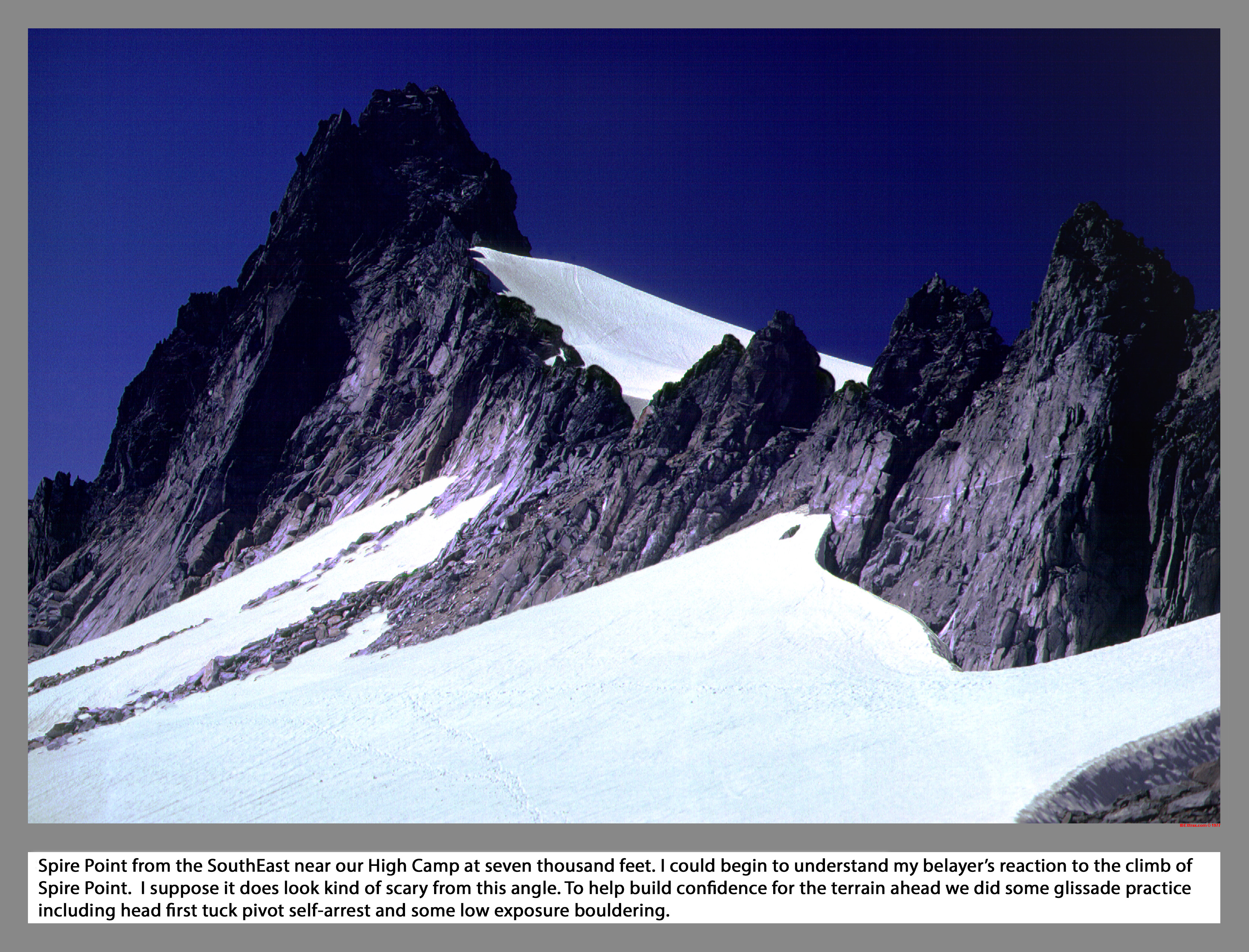
Spire Point from the SouthEast near our High Camp at seven thousand feet. I could begin to understand my belayer's reaction to the climb of Spire Point. I suppose it does look kind of scary from this angle. To help build confidence for the terrain ahead we did some glissade practice including head first tuck pivot self-arrest and some low exposure bouldering.
06 046 Randy L glissade practice near Spire Pt
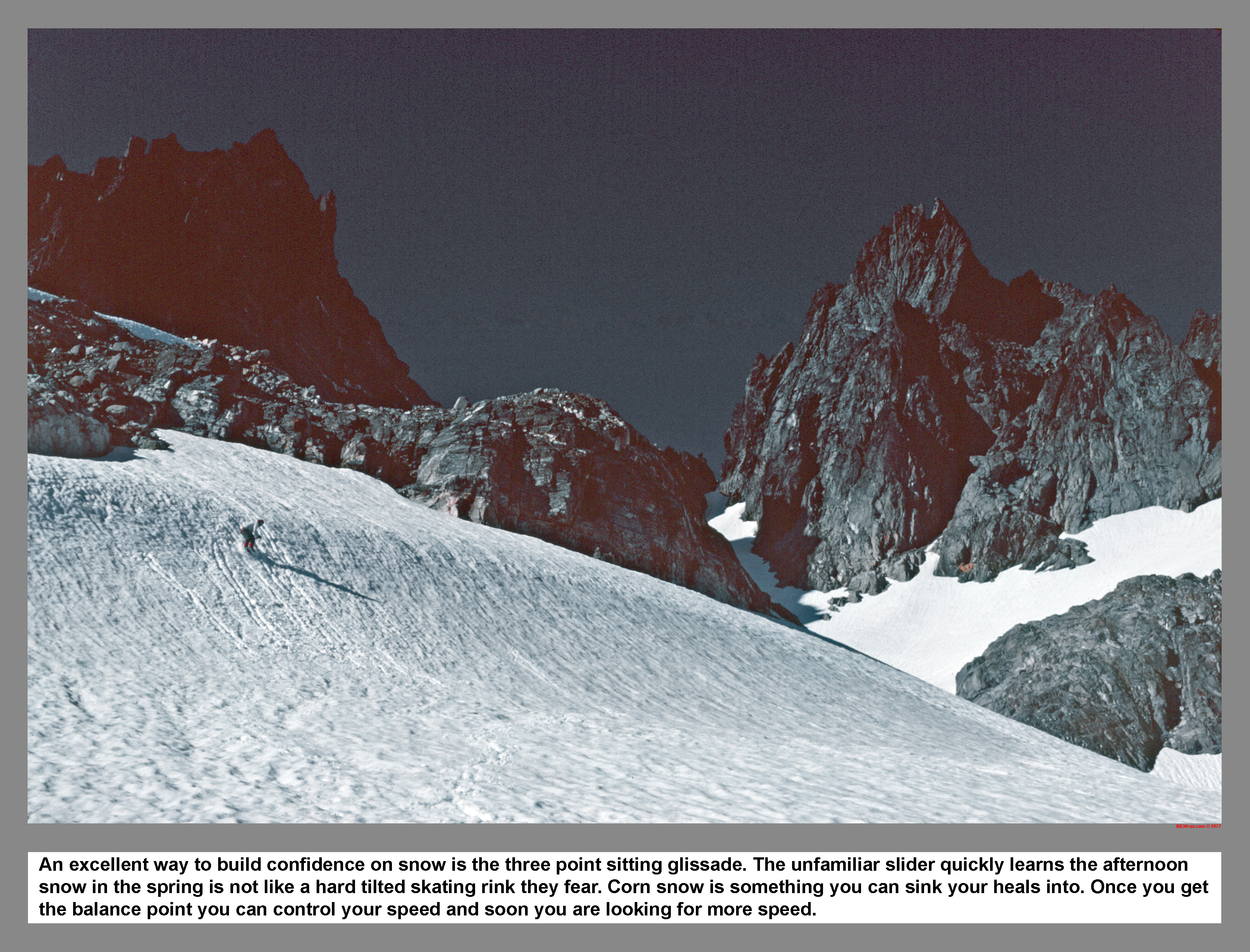
An excellent way to build confidence on snow is the three point sitting glissade. The unfamiliar slider quickly learns the afternoon snow in the spring is not like a hard tilted skating rink they fear. Corn snow is something you can sink your heals into. Once you get the balance point you can control your speed and soon you are looking for more speed.
06 047 Metamorphic rock and ice axe
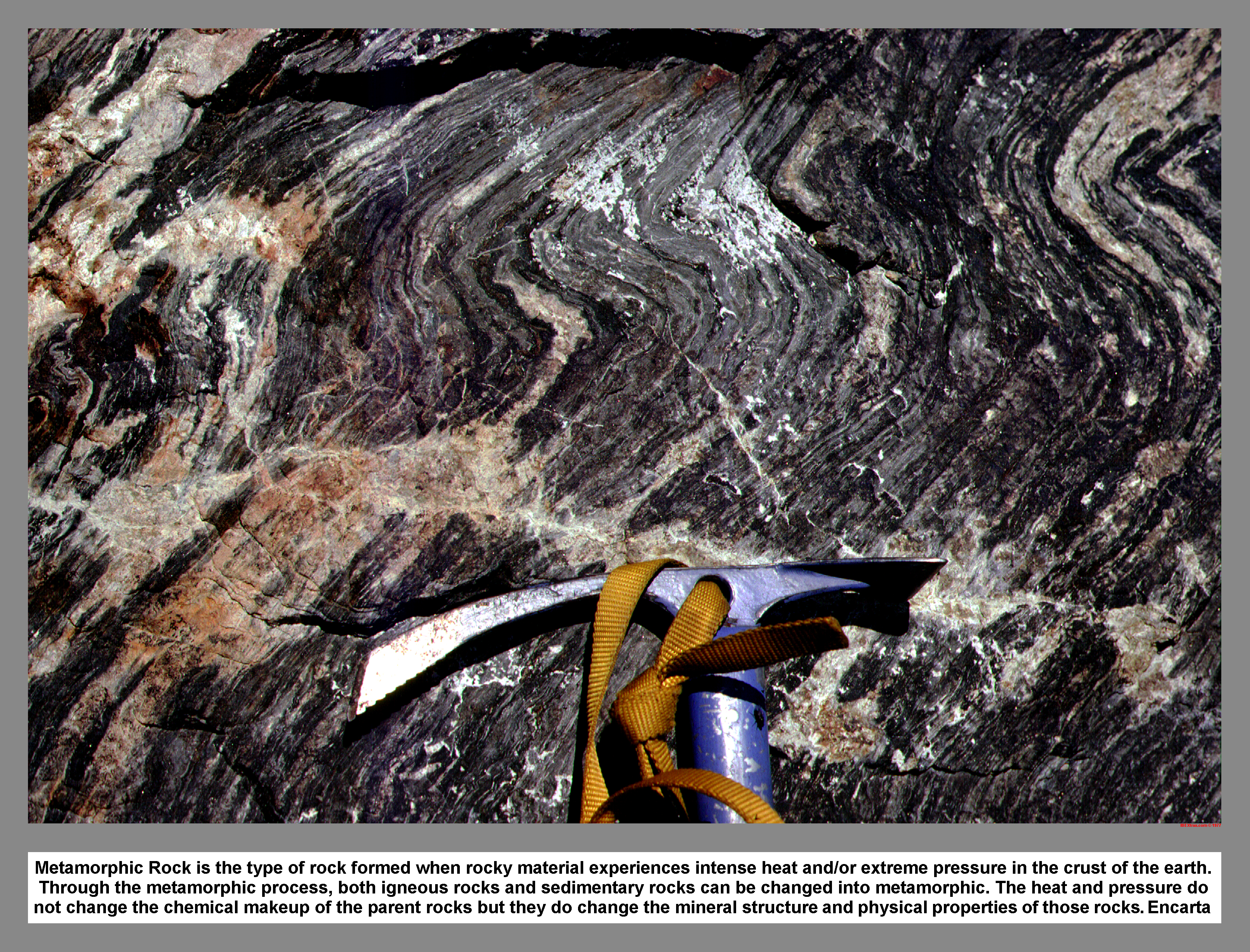 Metamorphic Rock is the type of rock formed when rocky material experiences intense heat and/or extreme pressure in the crust of the earth. Through the metamorphic process, both igneous rocks and sedimentary rocks can be changed into metamorphic. The heat and pressure do not change the chemical makeup of the parent rocks but they do change the mineral structure and physical properties of those rocks. Encarta
06 048 Randy L boulders near Spire Pt high camp

Randy L practice bouldering moves near Spire Point High Camp. Obviously, the strata is tilted and twisted so its hard to figure out how steep this climbing pitch really is. This could be a trick flick.
06 049 Warren shows how to glissade
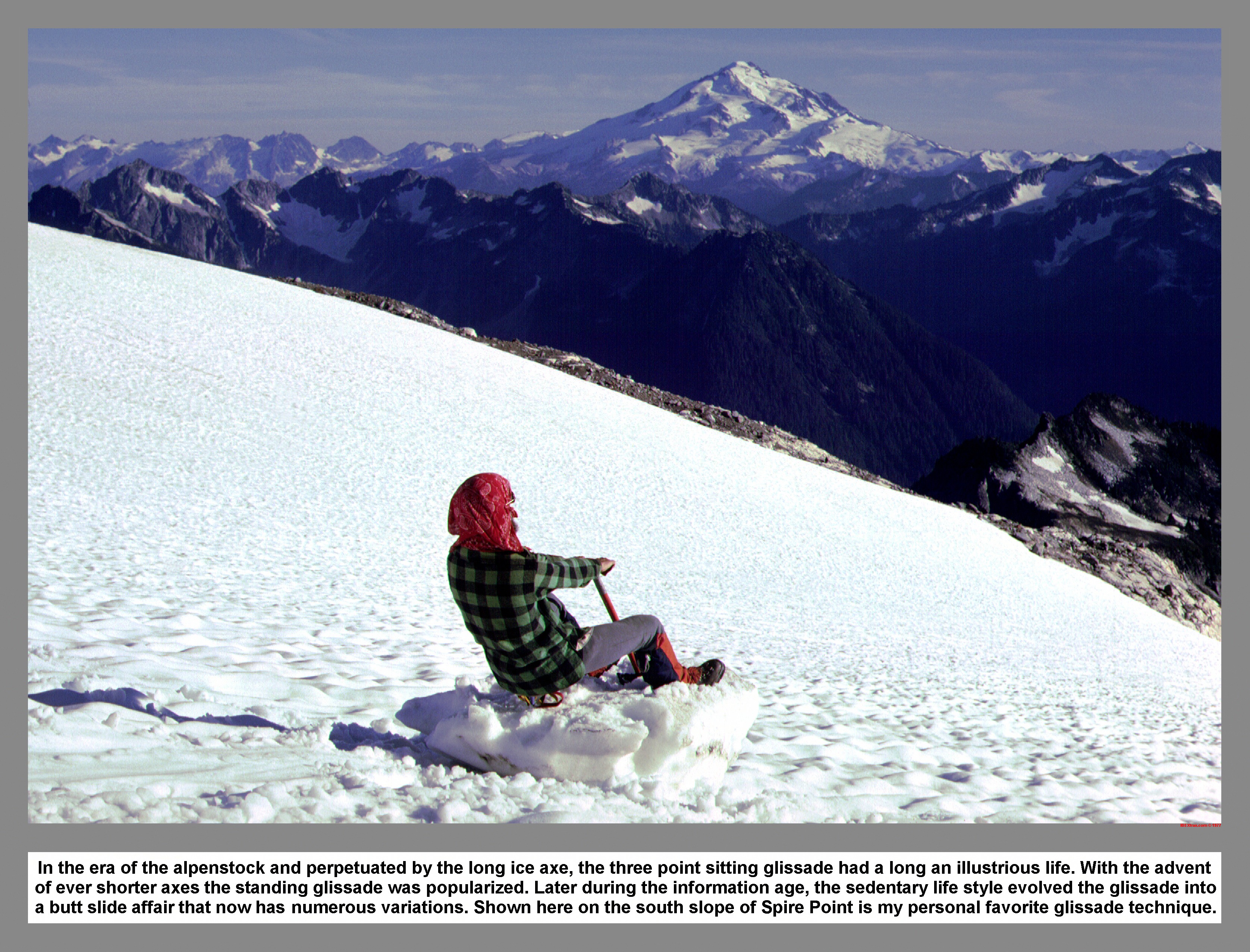 In the era of the alpenstock and perpetuated by the long ice axe, the three point sitting glissade had a long an illustrious life. With the advent of ever shorter axes the standing glissade was popularized. Later during the information age, the sedentary life style evolved the glissade into a butt slide affair that now had numerous variations. Shown here on the south slope of Spire Point is my personal favorite glissade technique.
06 050 Climbers in clown white headbands
 High on the treeless alpine slope just south of Spire Point the climbers spread out their bivouac sacks and made camp at the seven thousand foot level. With their faces painted with a thick coat of Clown White grease paint and decked out in matching red handkerchiefs, they relaxed away the afternoon and took in the expansive view to the south that included the majestic volcanic cone of Glacier Peak. Ptarmigan Traverse.
06 051 Randy L near the summit of Dome Peak
On Dome Peak's rocky summit, the Climbers coiled the glacier rope and then scrambled along the slabby crest. The high point along the ridge was atop a large precariously balanced rock.
06 051a True summit of Dome Peak
When I made it to the top of Dome Peak in 1977, I didn't stand on top of the boulder. I just placed my hand on the top of the boulder to tag the summit. The boulder on the summit was gone by 1986
06 052 West from the summit of Dome Pk
 Directly west of Dome Peak's high summit are the sharp dark towers of Spire Point. Surrounded by a spotted maze of jumbled ice and snow, the barren rocky peaks reach skyward with staccato jagged form. Trailing off in the hazy distance are the Buckindy Peaks, the light colored granite of Snowking Mountain and the classic white volcanic shape of Mount Baker. Glacier Peak Wilderness Area, Darrington Ranger District.
06 053 East from the summit of Dome Pk
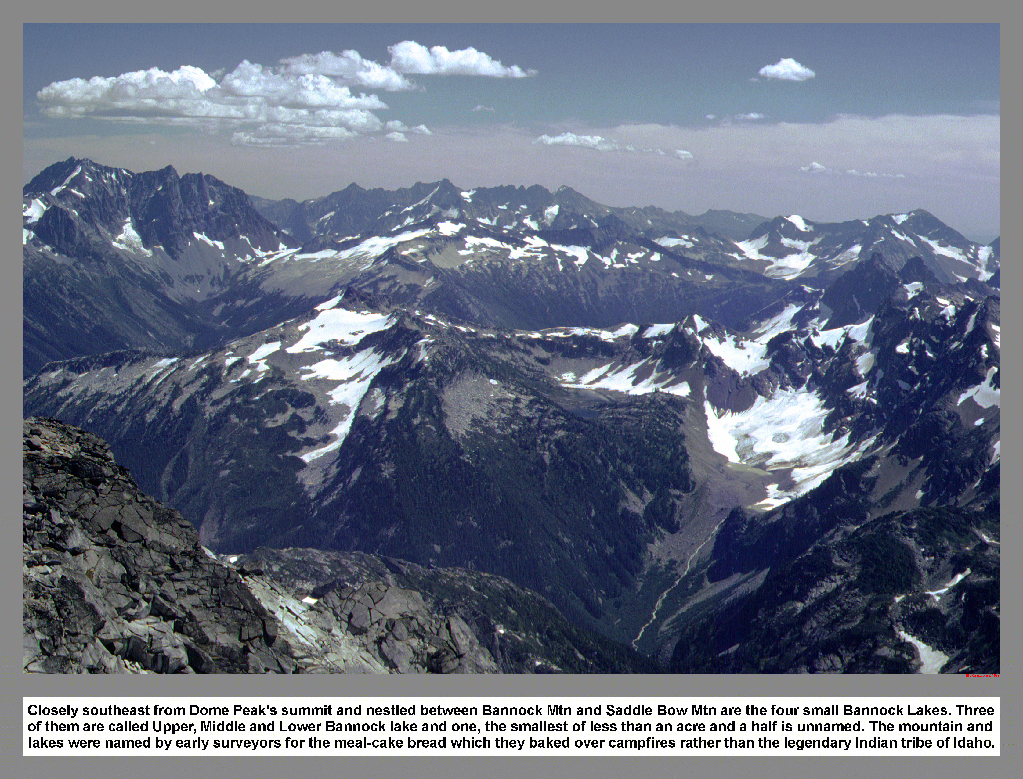 Closely southeast from Dome Peak's summit and nestled between Bannock Mtn and Saddle Bow Mtn are the four small Bannock Lakes. Three of them are called Upper, Middle and Lower Bannock lake and one, the smallest of less than an acre and a half is unnamed. The mountain and lakes were named by early surveyors for the meal-cake bread which they baked over campfires rather than the legendary Indian tribe of Idaho.
06 054 Ptarmigan traverse country from Dome Pk
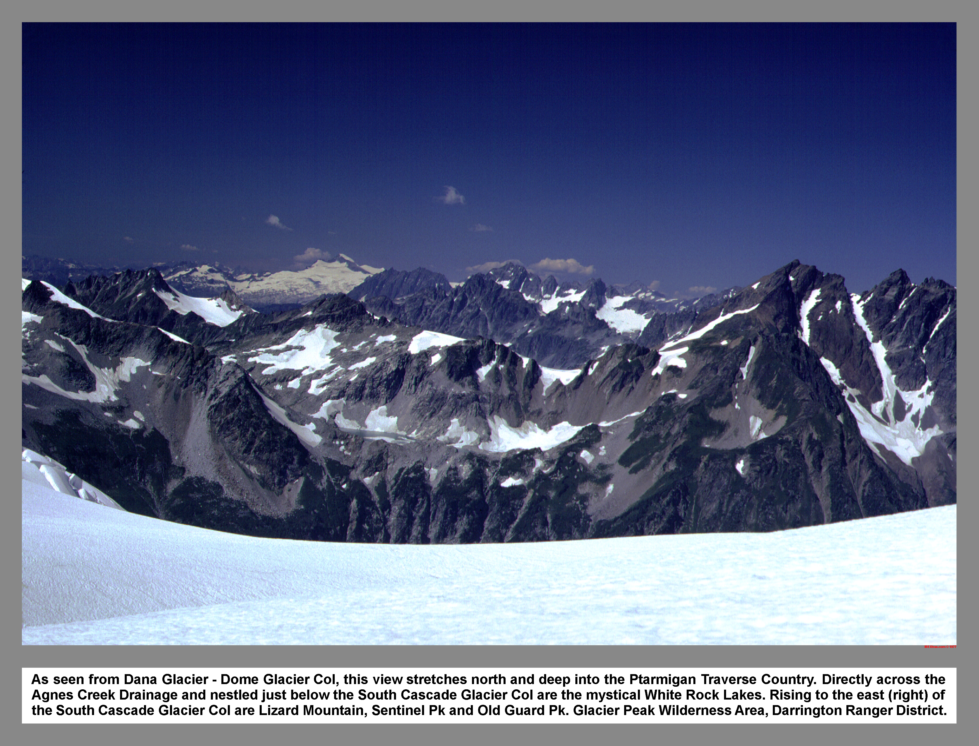 As seen from Dana Glacier - Dome Glacier Col, this view stretches north and deep into the Ptarmigan Traverse Country. Directly across the Agnes Creek Drainage and nestled just below the South Cascade Glacier Col are the mystical White Rock Lakes. Rising to the east (right) of the South Cascade Glacier Col are Lizard Mountain, Sentinel Pk and Old Guard Pk. Glacier Peak Wilderness Area, Darrington Ranger District.
06 055 Dome Pk Glacier from Itswoot Ridge

Dome Peak is remote, majestic and situated in an area of the Cascades where eyes are seldom cast and much less traveled on foot. Offering little in the way of technical difficulties, the journey to Dome Peak takes the climber through rare old-growth forests, beside clear alpine lakes stocked with fish and through scenic sub-alpine meadows. Tales of nightmarish bushwhacking along Bachelor Creek are largely exaggerated.
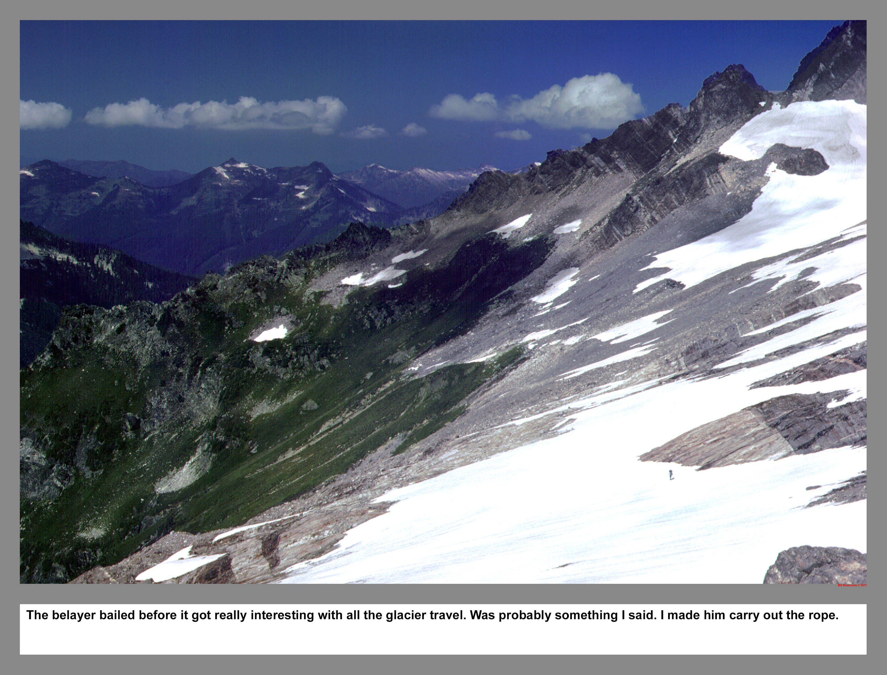
My belayer's threats to bail-out on the more interesting parts of the Ptarmigan Traverse were finally realized when he got a good wiff of the big crevasses of the Dana Glacier. Even I had bulging eyes seeing the big cracks down the route to White Rock Lakes. On the fourth day out he was initially happy to lighten his food bag and leave for the car. This was all before I made him carry out the rope and the climbing gear.
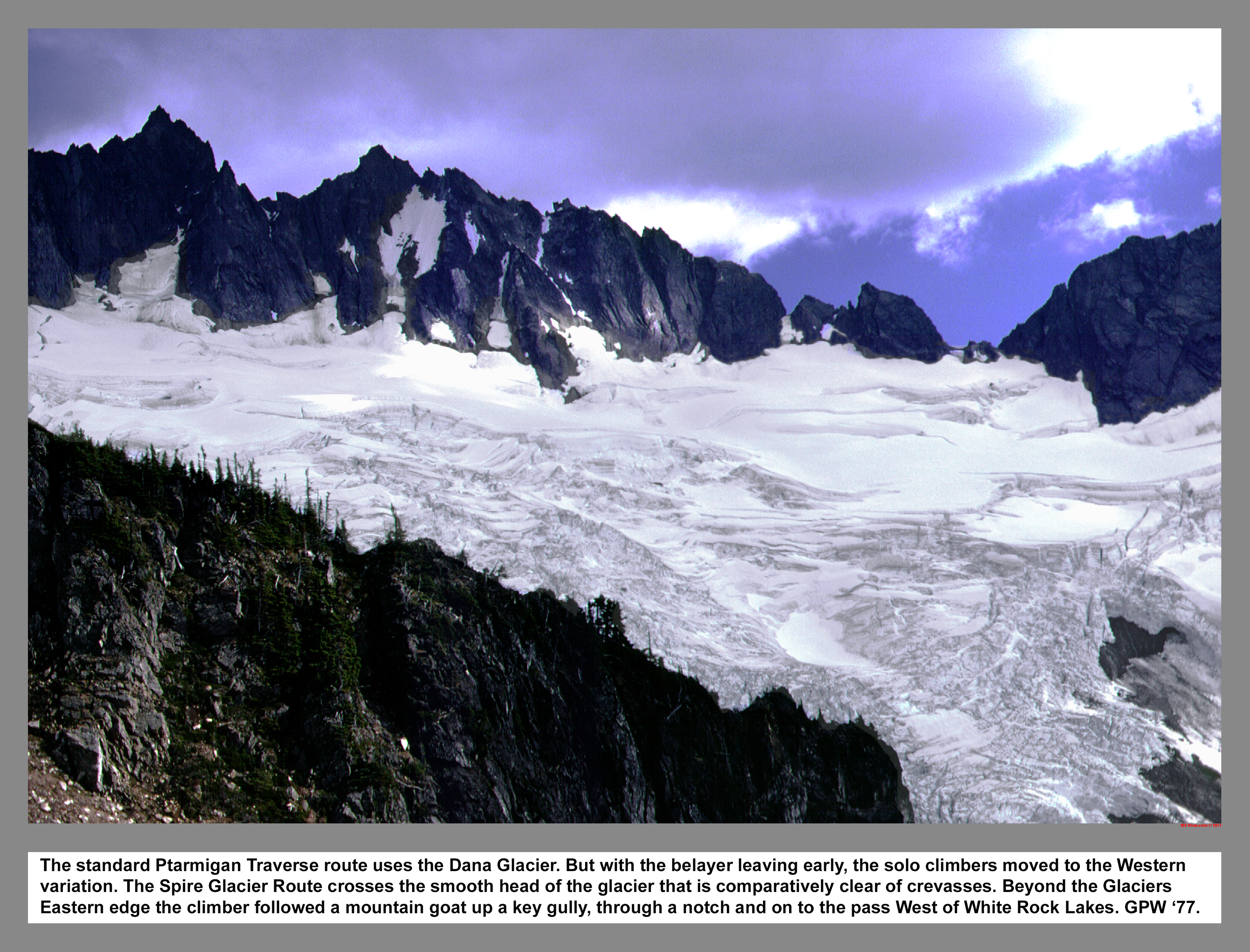
The standard Ptarmigan Traverse route uses the Dana Glacier. But with my belayer leaving early, the solo climbers moved to the Western variation. The Spire Glacier Route crosses the smooth head of the glacier that is comparatively clear of crevasses. Beyond the Glaciers Eastern edge the climber followed a mountain goat up a key gully, through a notch and on to the pass West of White Rock Lakes. Easy Peazy.
06 058 Glaciers rise to Dome Pk from Lizard Mtn
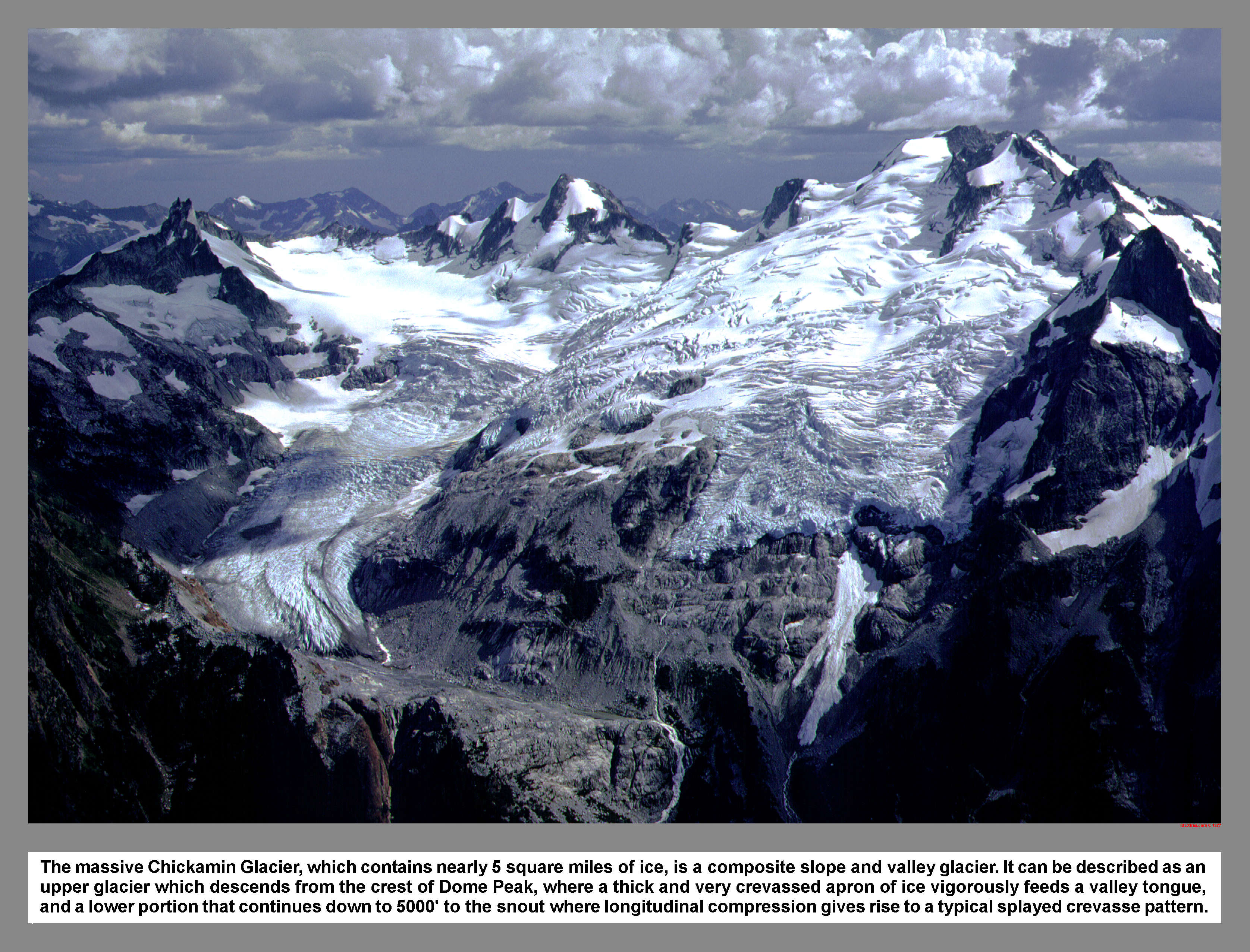
From the summit of Lizard Mountain shows the massive Chickamin Glacier, which contains nearly 5 square miles of ice, is a composite slope and valley glacier. It can be described as an upper glacier which descends from the crest of Dome Peak, where a thick and very crevassed apron of ice vigorously feeds a valley tongue, and a lower portion that continues down to 5000' to the snout where longitudinal compression gives rise to a typical splayed crevasse pattern.
06 059 Dome Peak Dana Gl thunder head
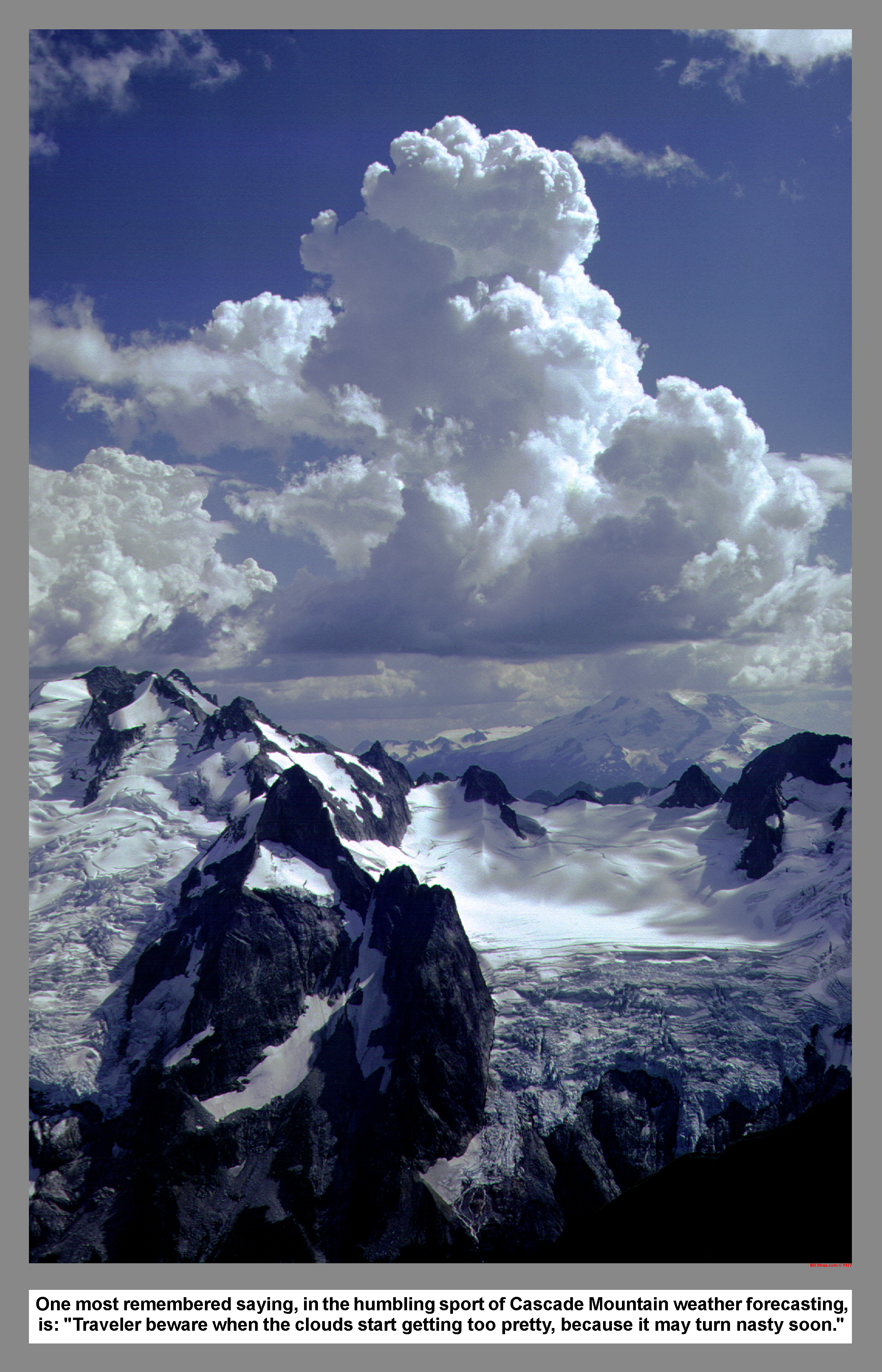
One most remembered saying, in the humbling sport of Cascade Mountain weather forecasting, is: "Traveler beware when the clouds start getting too pretty, because things are about to turn nasty."
06 060 Gunsight Chickamin Gl White Rock Lks
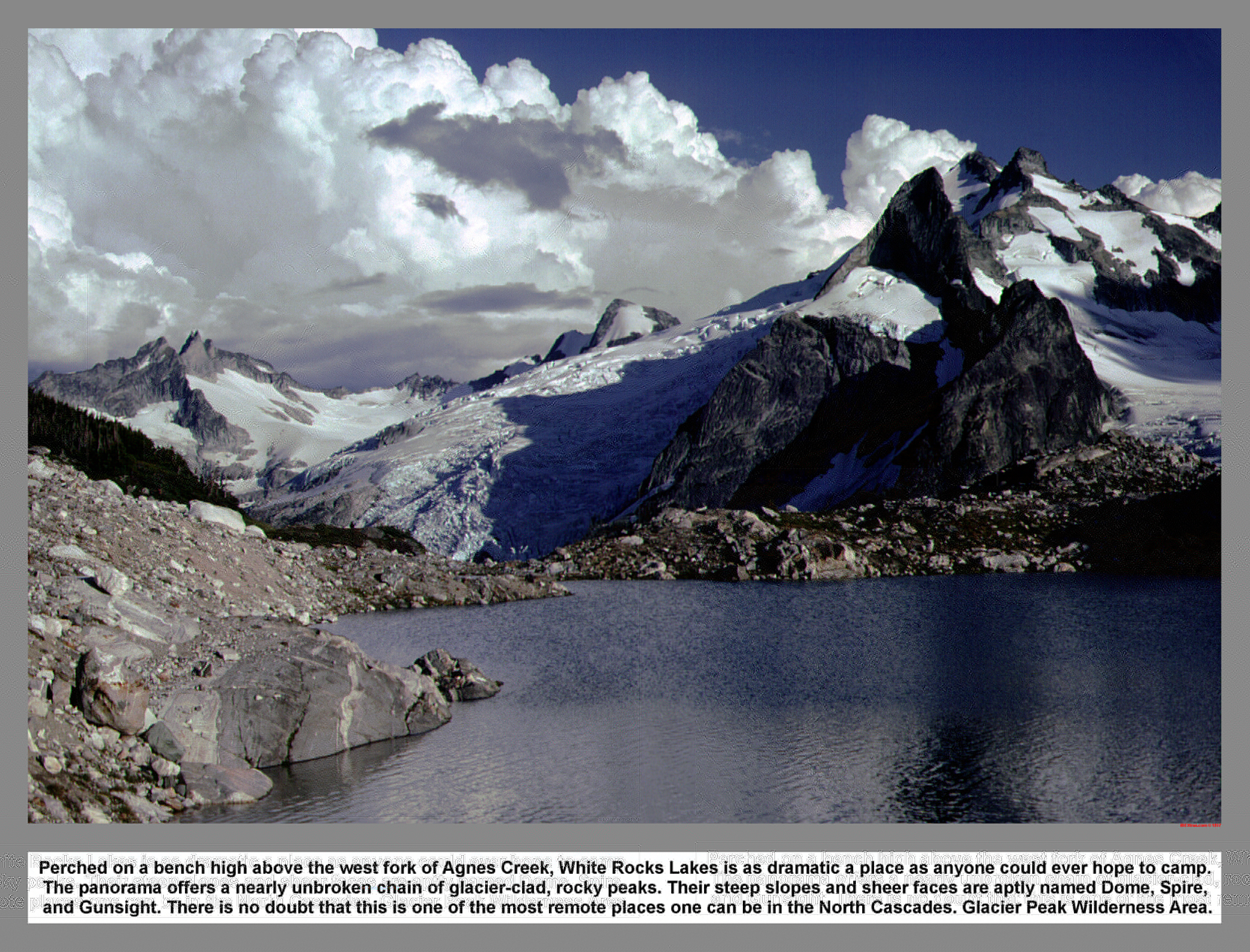
Perched on a bench high above the west fork of Agnes Creek, White Rocks Lakes is as dramatic a place as anyone could ever hope to camp. The panorama offers a nearly unbroken chain of glacier-clad, rocky peaks. Their steep slopes and sheer faces are aptly named Dome, Spire, and Gunsight. There is no doubt that this is one of the most remote places one can be in the North Cascades. Glacier Peak Wilderness Area.
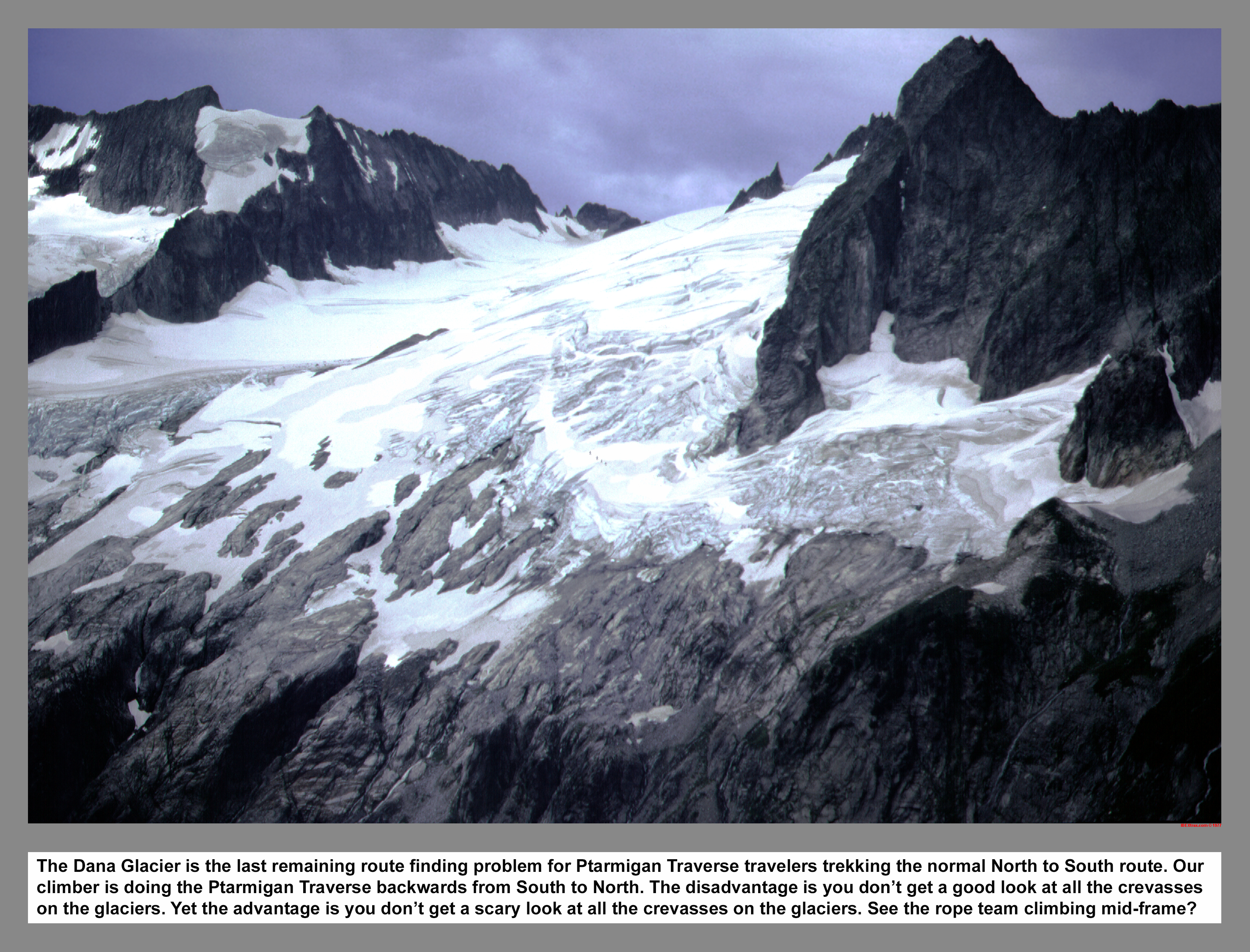
The Dana Glacier is the last remaining route finding problem for Ptarmigan Traverse travelers trekking the normal North to South route. Our climber is doing the Ptarmigan Traverse backwards from South to North. The disadvantage is you don't get a good look at all the crevasses on the glaciers. Yet the advantage is you don't get a scary look at all the crevasses on the glaciers. See the rope team climbing mid-frame?
06 062 Drying at Red Rk Inn at White Rk Lks
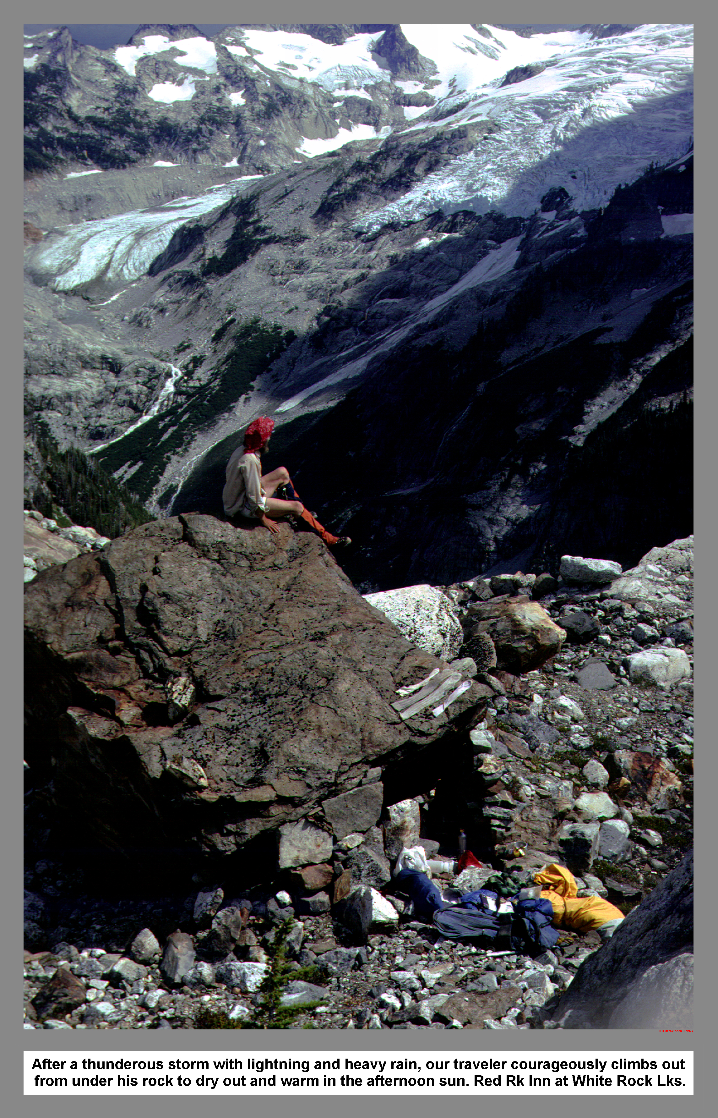
After a thunderous storm with lightning and heavy rain, our traveler courageously climbs out from under his rock to dry out and warm in the afternoon sun. Red Rk Inn at White Rock Lks.
06 063 Yang Yang Lakes and the Spider Glacier
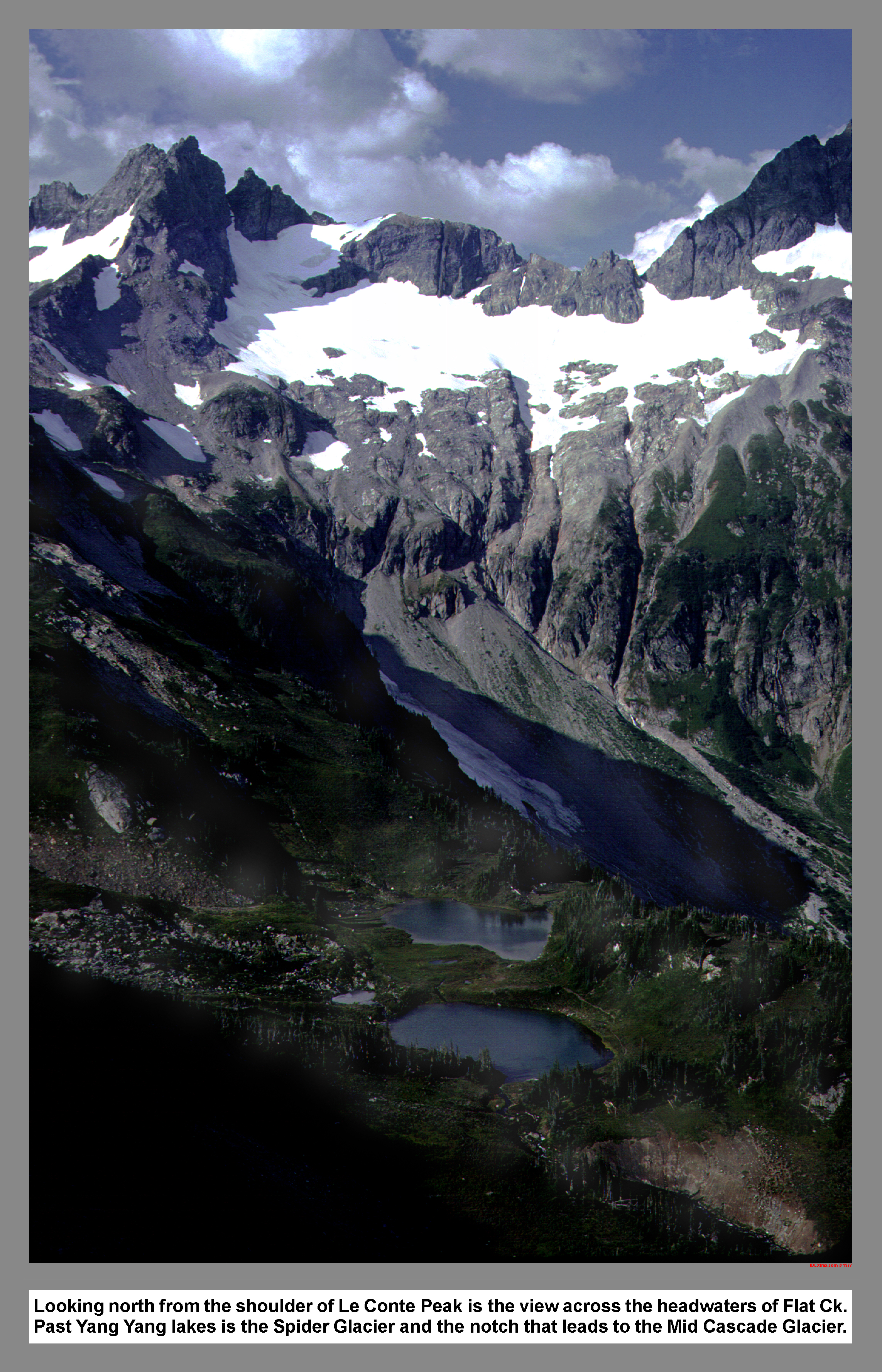
Looking north from the shoulder of Le Conte Peak is the view across the headwaters of Flat Ck. Past Yang Yang lakes is the Spider Glacier and the notch that leads to the Mid Cascade Glacier.
06 064 Le Conte Gl Dome Spire from Formidable
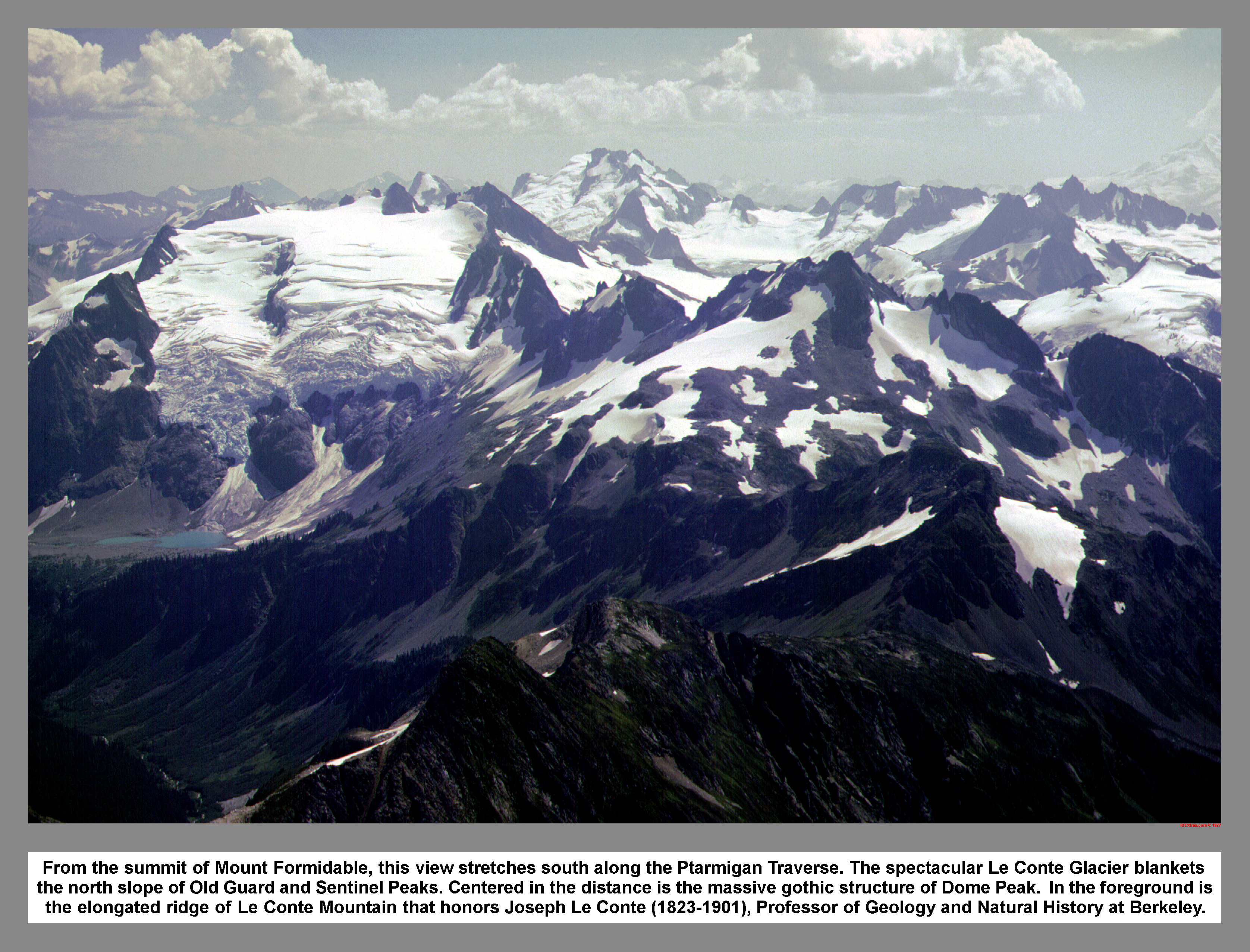
From the summit of Mount Formidable, this view stretches south along the Ptarmigan Traverse. The spectacular Le Conte Glacier blankets the north slope of Old Guard and Sentinel Peaks. Centered in the distance is the massive gothic structure of Dome Peak. In the foreground is the elongated ridge of Le Conte Mountain that honors Joseph Le Conte (1823-1901), Professor of Geology and Natural History at Berkeley.
06 065 North to Cascade Pass from Mt Formidable
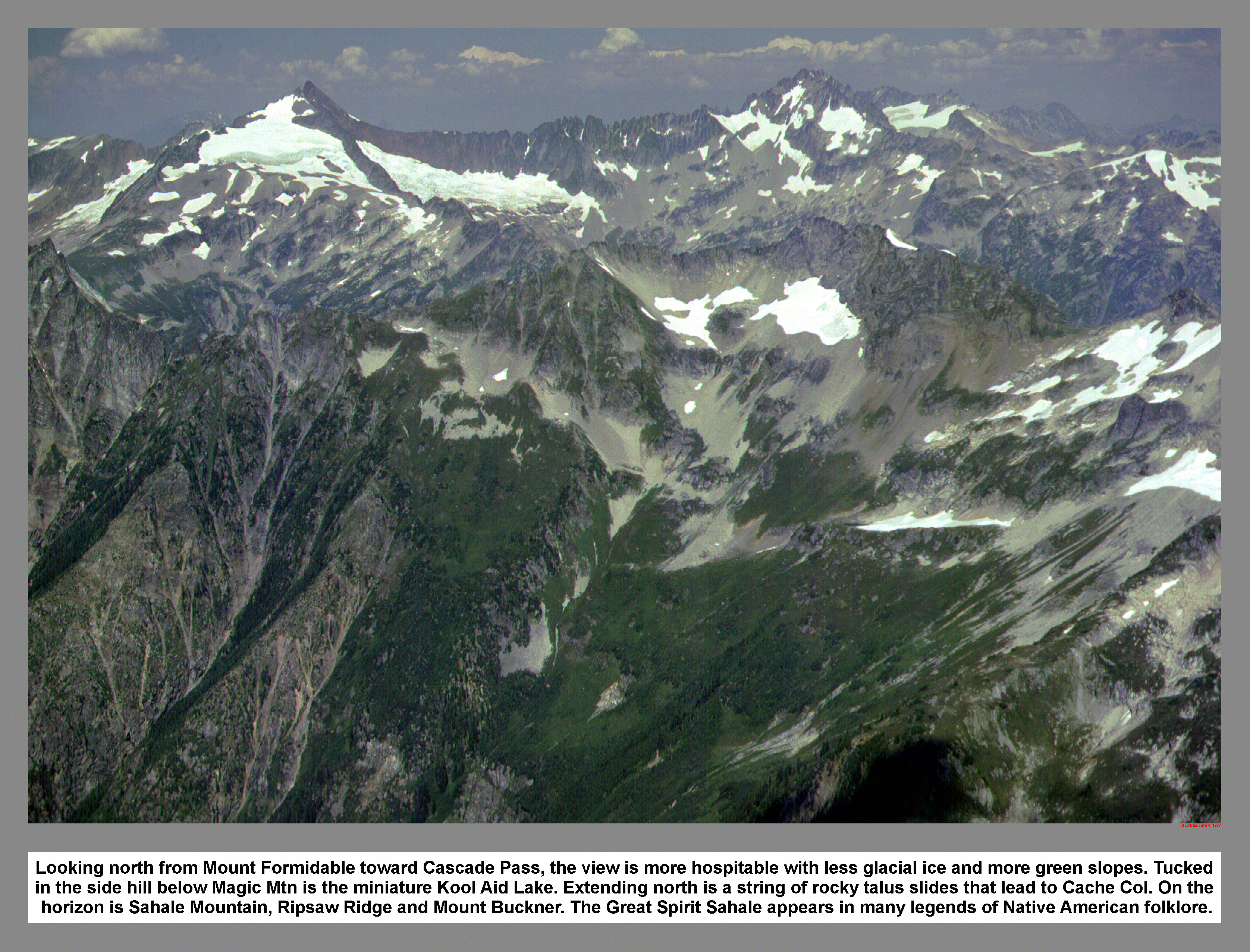
Looking north from Mount Formidable toward Cascade Pass, the view is more hospitable with less glacial ice and more green slopes. Tucked in the side hill below Magic Mtn is the miniature Kool Aid Lake. Extending north is a string of rocky talus slides that lead to Cache Col. On the horizon is Sahale Mountain, Ripsaw Ridge and Mount Buckner. The Great Spirit Sahale appears in many legends of Native American folklore.
06 066 Yang Yang Old Guard Sentinel Le Conte Gl
After a climb of Mount Formidable and as they descend to Yang Yang Lakes, the climbers are greeted with a thunderous boom of falling Ice. A huge block cracks off the Le Conte Glacier and the echoing crash reverberates around the Flat Creek Valley. Ancient Asian cultures say: Yang stands for peace and serenity; Yin stands for confusion and turmoil. The quiet calm after the ice fall is so peaceful, it is double Yang.
06 067 Johannesburg Eldorado Mixup from Spider
From the Summit of Spider Mountain, the view north is a marked contrast between the steep dark rock of Johannesburg Mountain and the icy white slopes of Eldorado Peak. The name Johannesburg (which first appeared in print in 1934) is incorrectly derived from the Johnsberg mining claims. The precious metals were discovered on the north face of the mountain by 3 men named John; hence the name Johnsberg.
06 068 Old Guard Pk Sentinel Pk Le Conte Gl
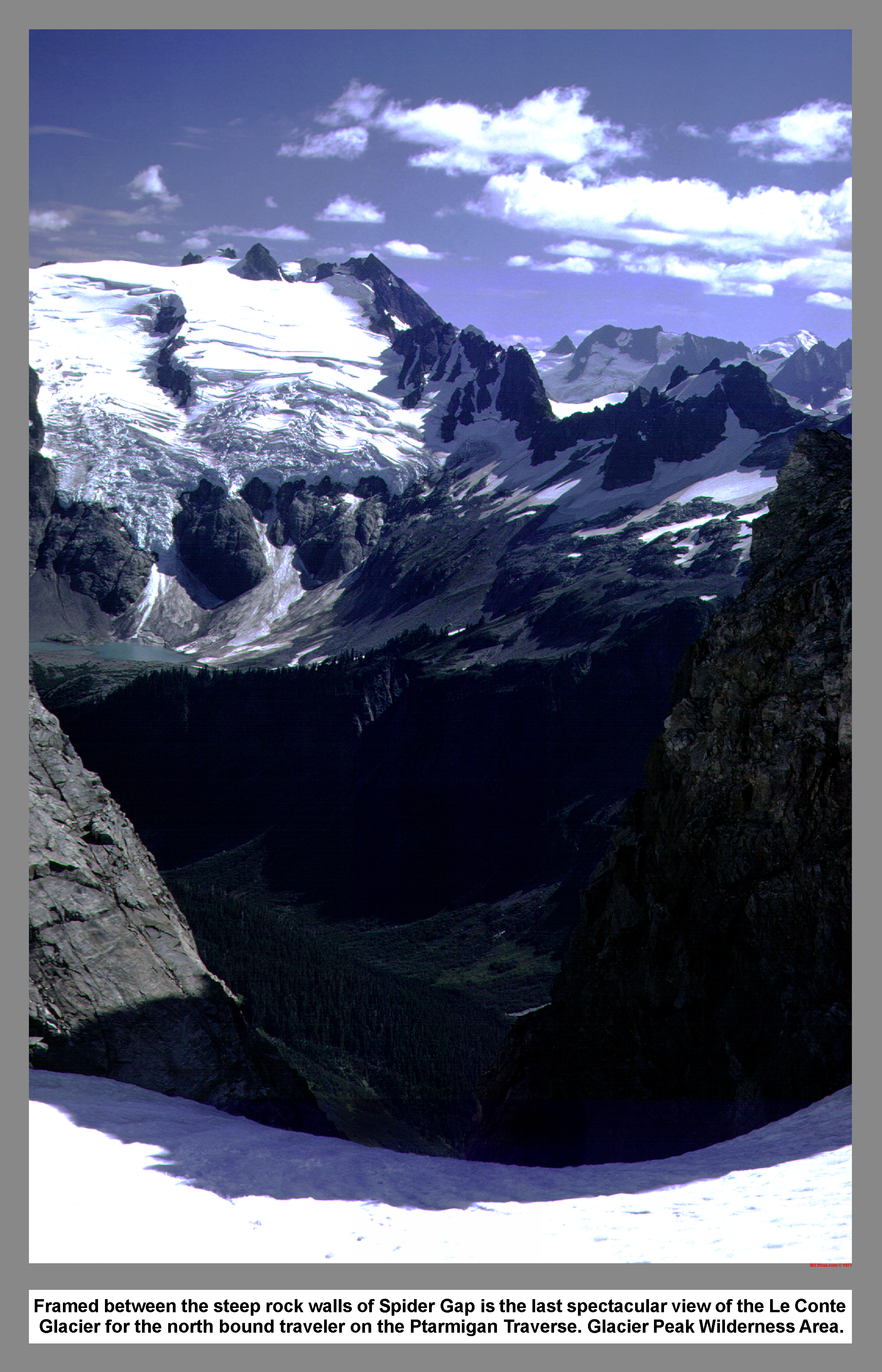
Framed between the steep rock walls of Spider Gap is the last spectacular view of the Le Conte Glacier for the north bound traveler on the Ptarmigan Traverse. Glacier Peak Wilderness Area.
06 069 Johannesburg Cache Col from Magic Mtn
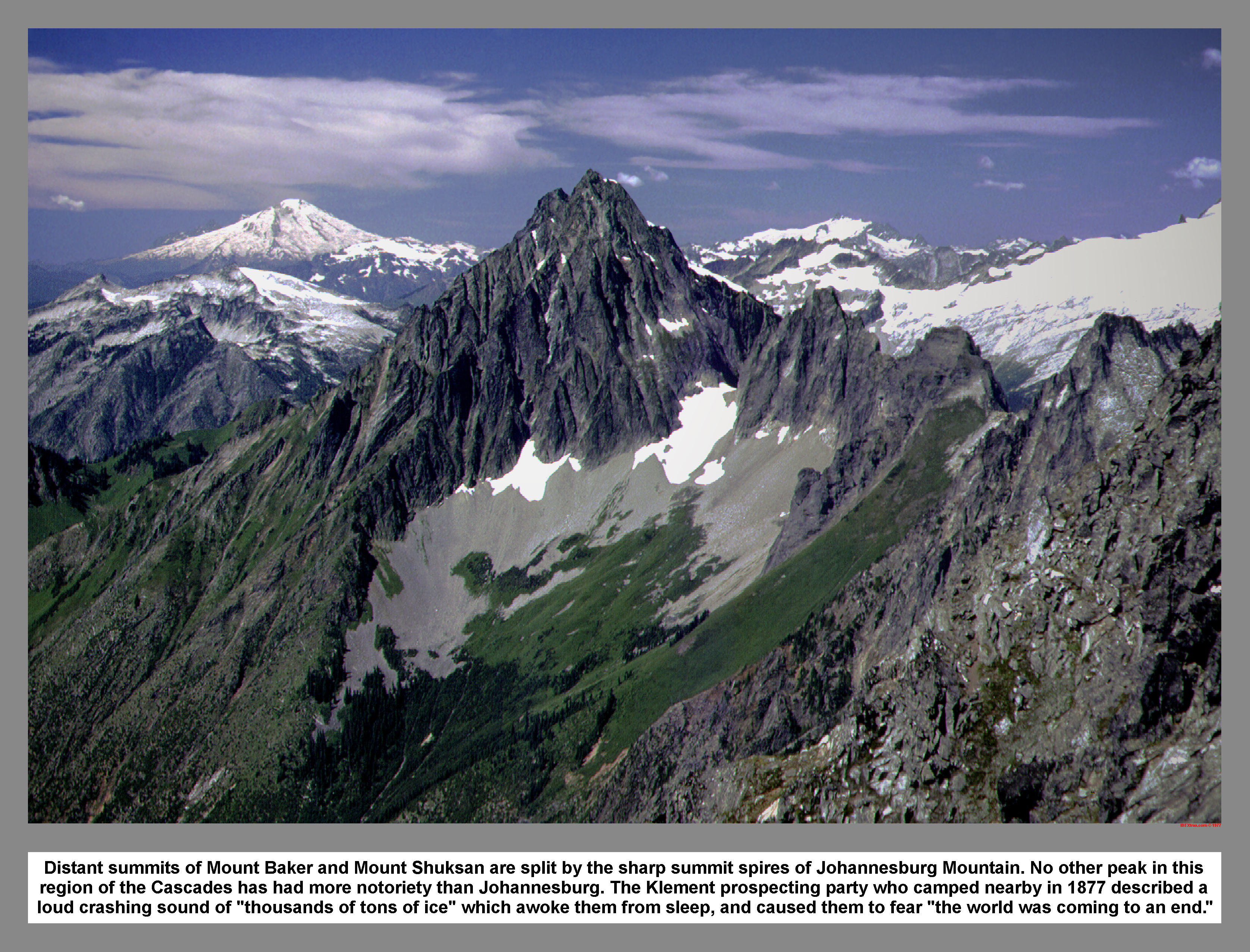
Distant summits of Mount Baker and Mount Shuksan are split by the sharp summit spires of Johannesburg Mountain. No other peak in this region of the Cascades has had more notoriety than Johannesburg. The Klement prospecting party who camped nearby in 1877 described a loud crashing sound of "thousands of tons of ice" which awoke them from sleep, and caused them to fear "the world was coming to an end."
06 070 Mid Cascade Gl Formidable from Magic Mtn
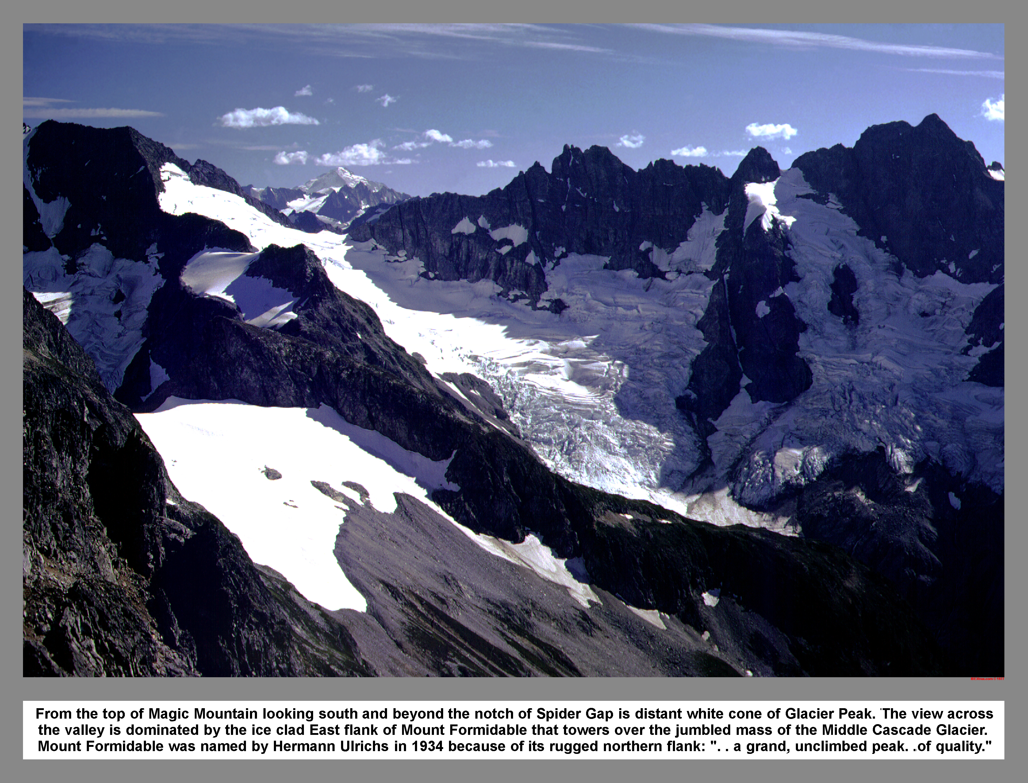
From the top of Magic Mountain looking south and beyond the notch of Spider Gap is distant white cone of Glacier Peak. The view across the valley is dominated by the ice clad East flank of Mount Formidable that towers over the jumbled mass of the Middle Cascade Glacier. Mount Formidable was named by Hermann Ulrichs in 1934 because of its rugged northern flank: ". . a grand, unclimbed peak. .of quality."
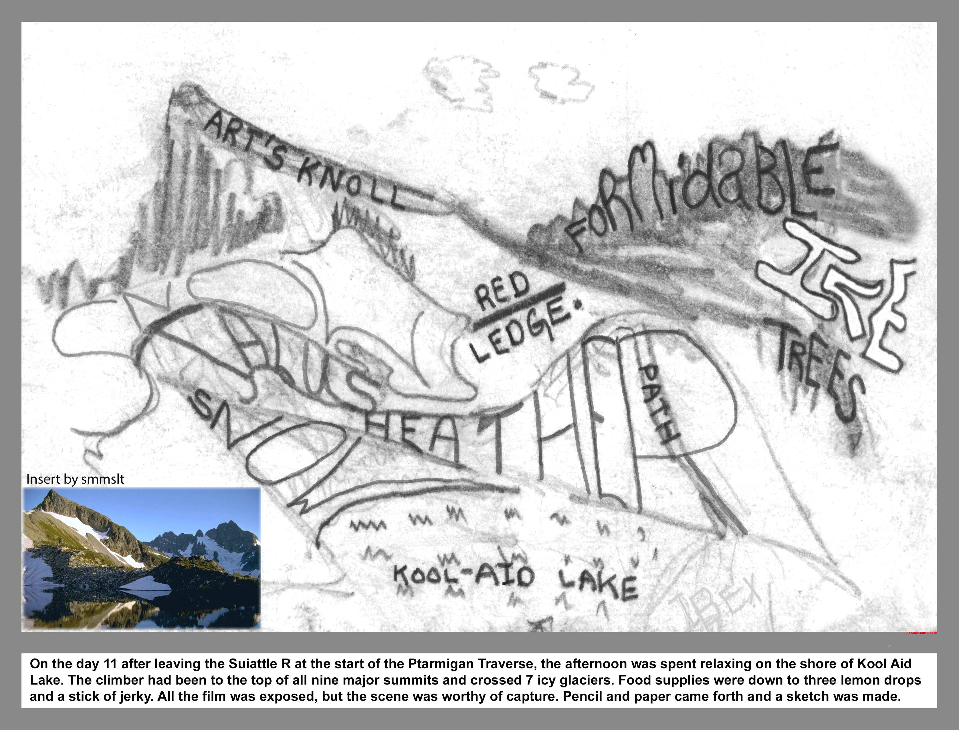
On the eleventh day after leaving the Suiattle River at the start of the Ptarmigan Traverse, the afternoon was spent relaxing on the shores of little Kool Aid Lake. The climber had been to the top of all nine major summits and crossed 7 icy glaciers. Food supplies were down to three lemon drops and a stick of jerky. All the film was exposed, but the scene was worthy of capture. A stuby golf Pencil and a scrap of paper came forth and a sketch was made.
06 071 Johannesburg Ice Cliff Cascade Pass
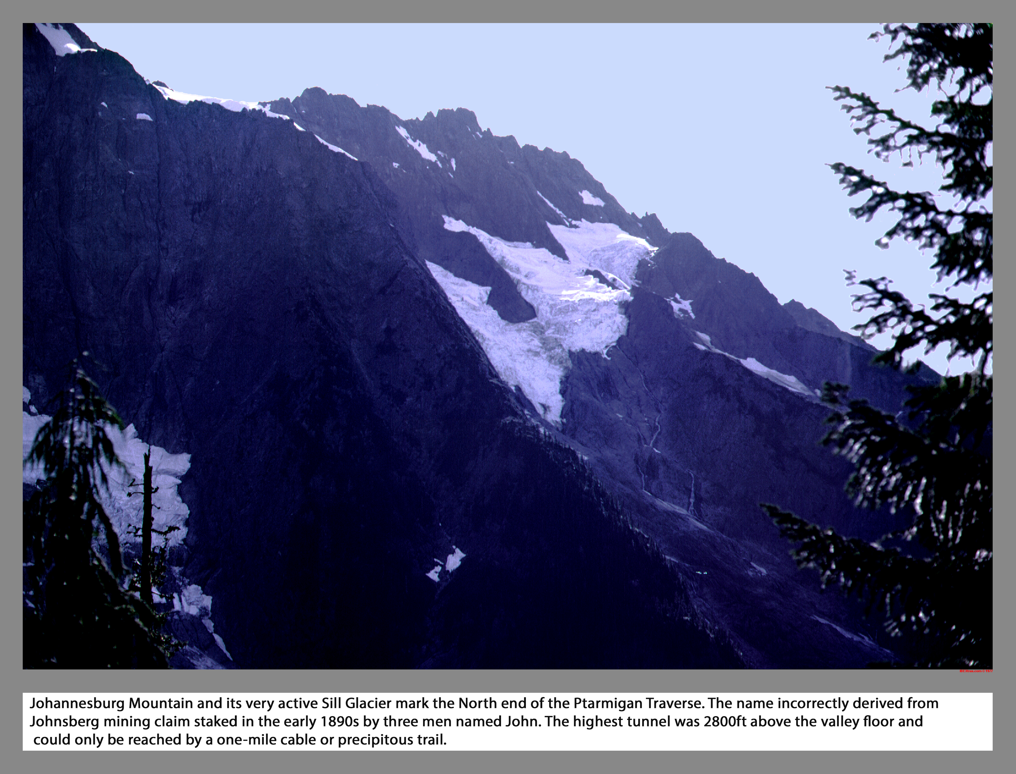
Johannesburg Mountain and its very active Sill Glacier mark the North end of the Ptarmigan Traverse. The name incorrectly derived from Johnsberg mining claim staked in the early 1890s by three men named John. The highest tunnel was 2800ft above the valley floor and could only be reached by a one-mile cable or precipitous trail.
|
|
|
|
|
|
This site created and maintained by THE IBEX - Page last revised:
|
|