
|
|
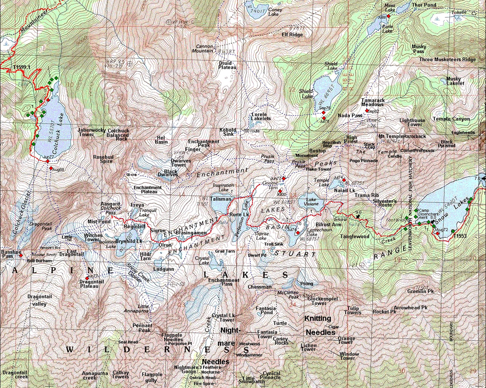
IBEXtrax.com - Cascade Mountains of Washington StateAlpine Lakes Wilderness, Wenatchee Forest |
|
|
05 032 Rudi M The Chisel in Tumwater Canyon

Near the entrance to Tumwater Canyon out of Leavenworth is the bouldering (practice climbing) face called The Chisel.Near the entrance to Tumwater Canyon out of Leavenworth is the bouldering (practice climbing) face called The Chisel. The solid moderate angle face provides good holds and convenient cracks for placement of nuts and stopper protection. A gain in confidence and to acclimatize to the exposure can be had with these easy access practice areas.
05 033 scan Randy L on Dinosaur Rk at Pashastine
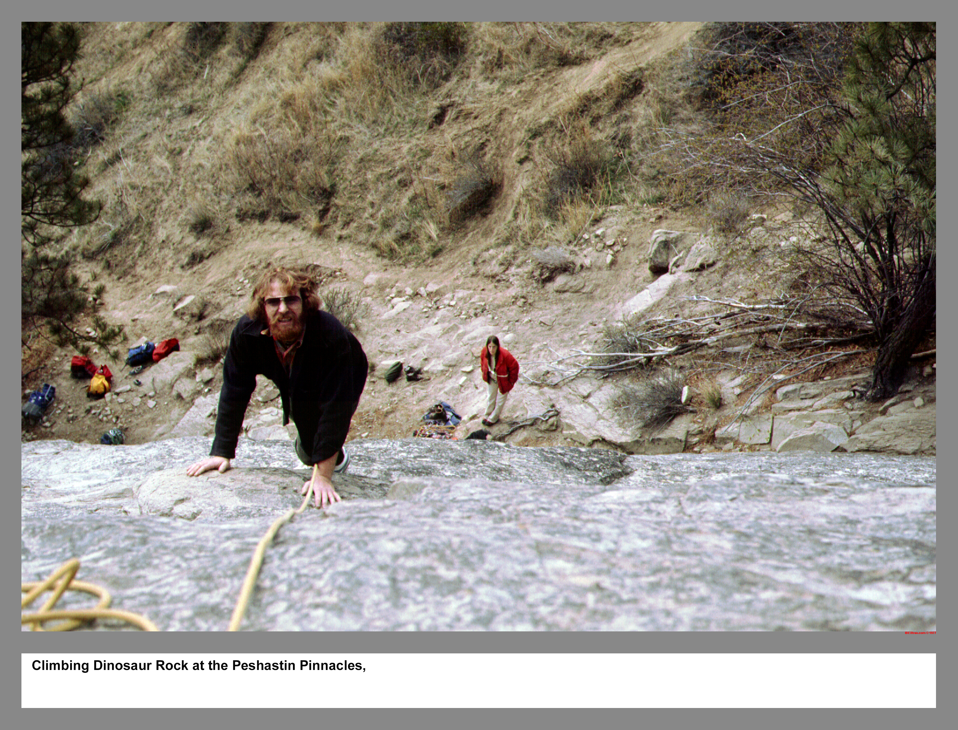
Climbing Dinosaur Rock at the Peshastin Pinnacles.
06 099 Rock climbing Around Leavenworth John B
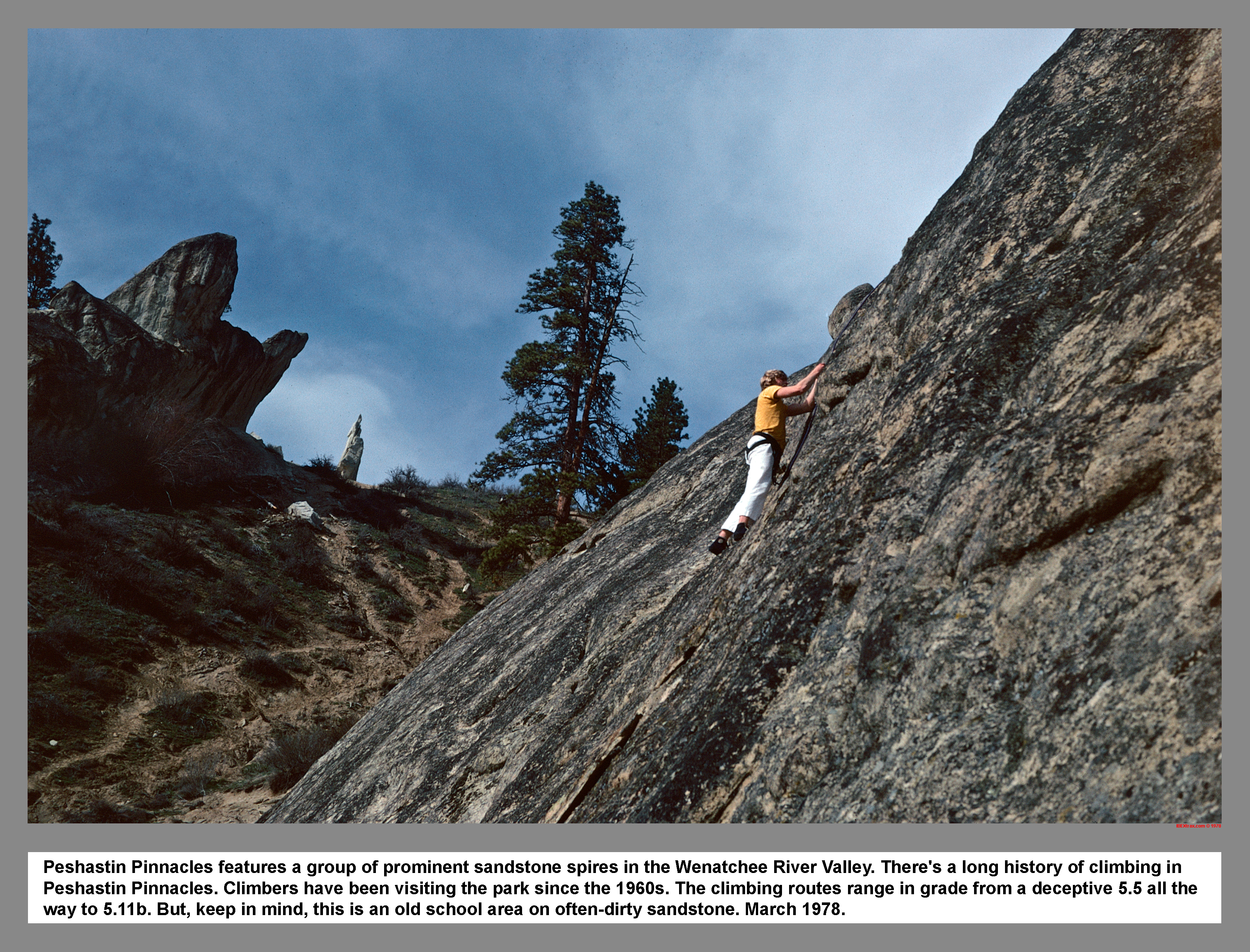
Peshastin Pinnacles features a group of prominent sandstone spires in the Wenatchee River Valley. There's a long history of climbing in Peshastin Pinnacles. Climbers have been visiting the park since the 1960s. The climbing routes range in grade from a deceptive 5.5 all the way to 5.11b. But, keep in mind, this is an old school area on often-dirty sandstone. March 1978.
05 034 Randy L Rattlesnake Rock Tumwater Canyon
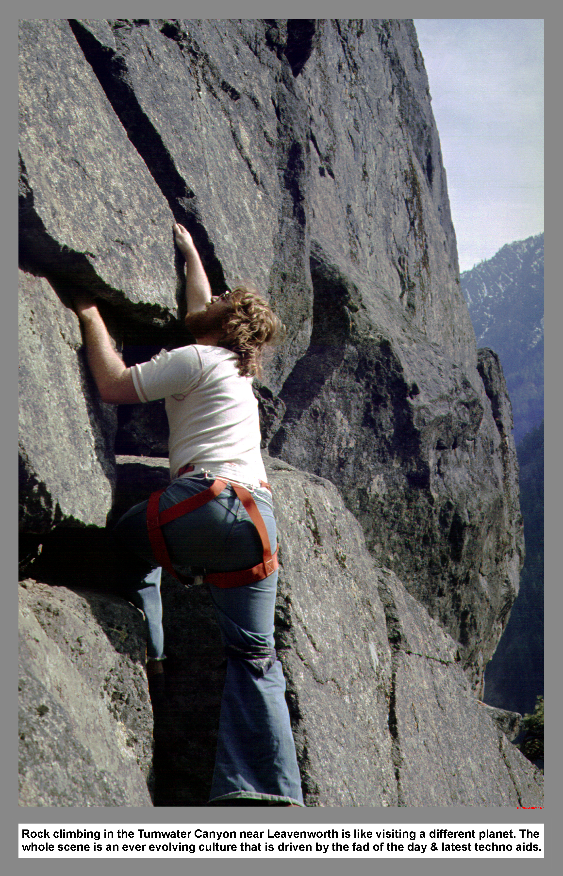
Rock climbing in the Tumwater Canyon near Leavenworth is like visiting a different planet. The whole scene is an ever evolving culture that is driven by the fad of the day & latest techno aids.
05 060 North Face Tents at 8 Mile Camp. (296k)
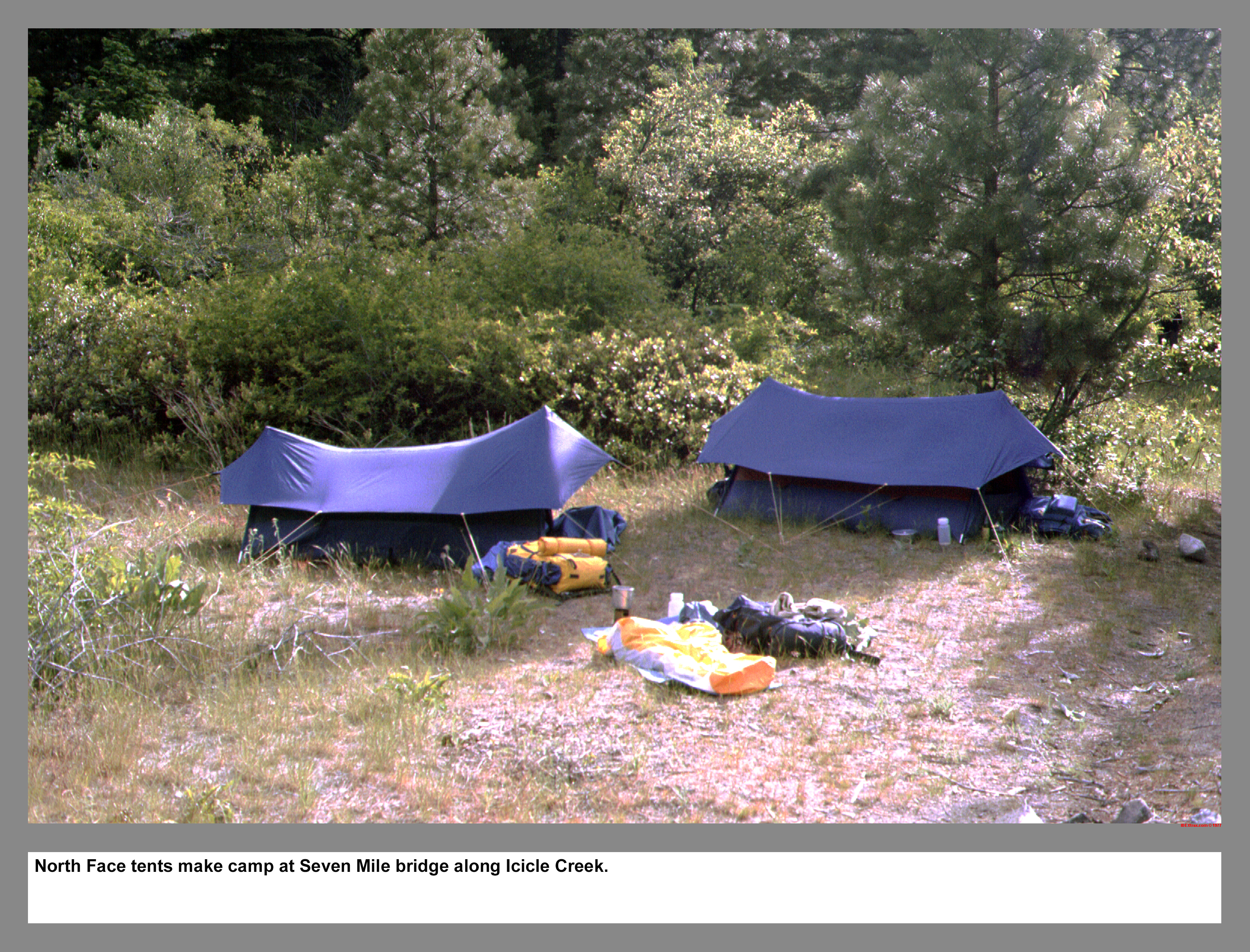
North Face tents make camp at Seven Mile bridge along Icicle Creek.
05 061 Warren on Trigger Finger Peshastin Pinnacles
Between Leavenworth and Wenatchee in eastern Washington State are the sandstone crags of Peshastin Pinnacles. Every spring the climbers arrive to hone their skills and test their courage. For many years the signature climb at Peshastin was the narrow spire named Trigger Finger. Then one spring when the climbers arrived for the season, they found that Trigger Finger had not survived the winter and an era had ended.
05 062 Grand Central Tower Peshastin John P
Climbing Grand Central Tower at the Peshastin Pinnacles.
05 063 Warren Hands After Classic Crack
After ripping out of Classic Crack on Bruce's Boulder along the Icicle Creek on multiple attempts, a hand jam tape job was employed.
05 064 John B on Winter Solstice Castle Rock
Of the many practice rock climbing areas in Tumwater Canyon, Castle Rock has become the most popular due to its close proximity to the highway, excellent diorite rock and wide variety of routes. These climbers are on the oldest and most popular route called Midway. The 1965 climbing guide calls for 4 piton and 2 hours to complete the climb. Midway has now been climbed in 10 min, also at night, and descended.
05 066 North face route on Dragontail Peak
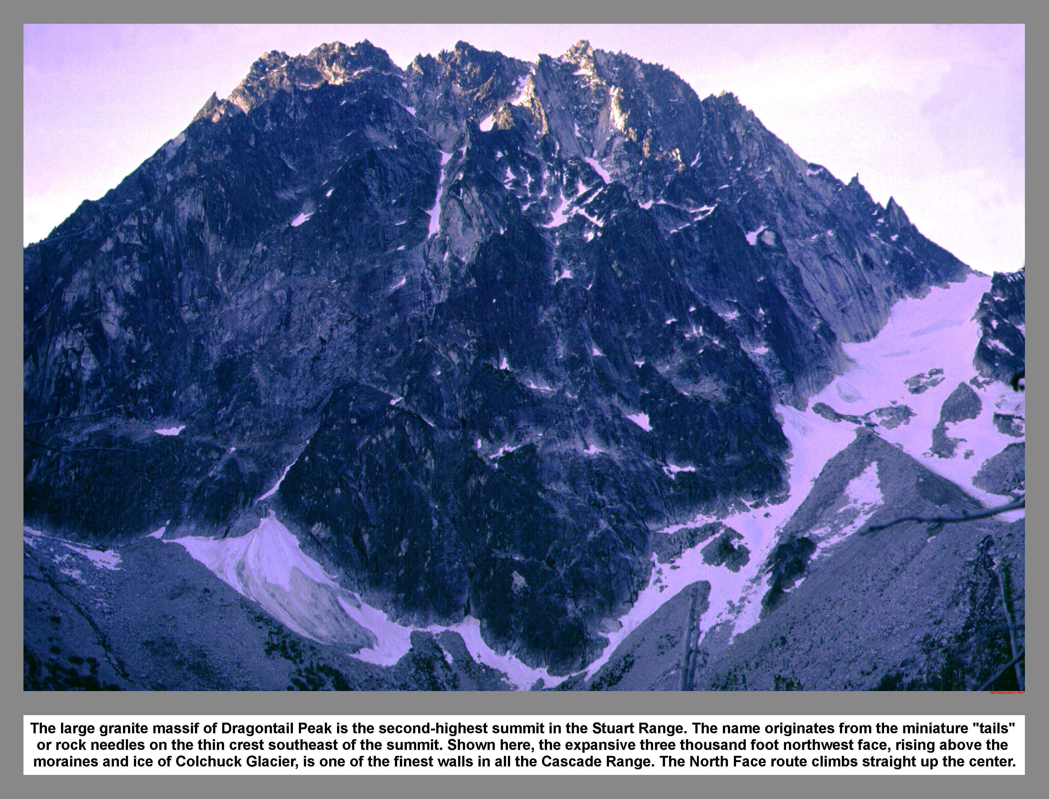
The large granite massif of Dragontail Peak is the second-highest summit in the Stuart Range. The name originates from the miniature "tails" or rock needles on the thin crest southeast of the summit. Shown here, the expansive three thousand foot northwest face, rising above the moraines and ice of Colchuck Glacier, is one of the finest walls in all the Cascade Range. The North Face route climbs straight up the center.
05 067 John B on the N face of Dragontail Pk
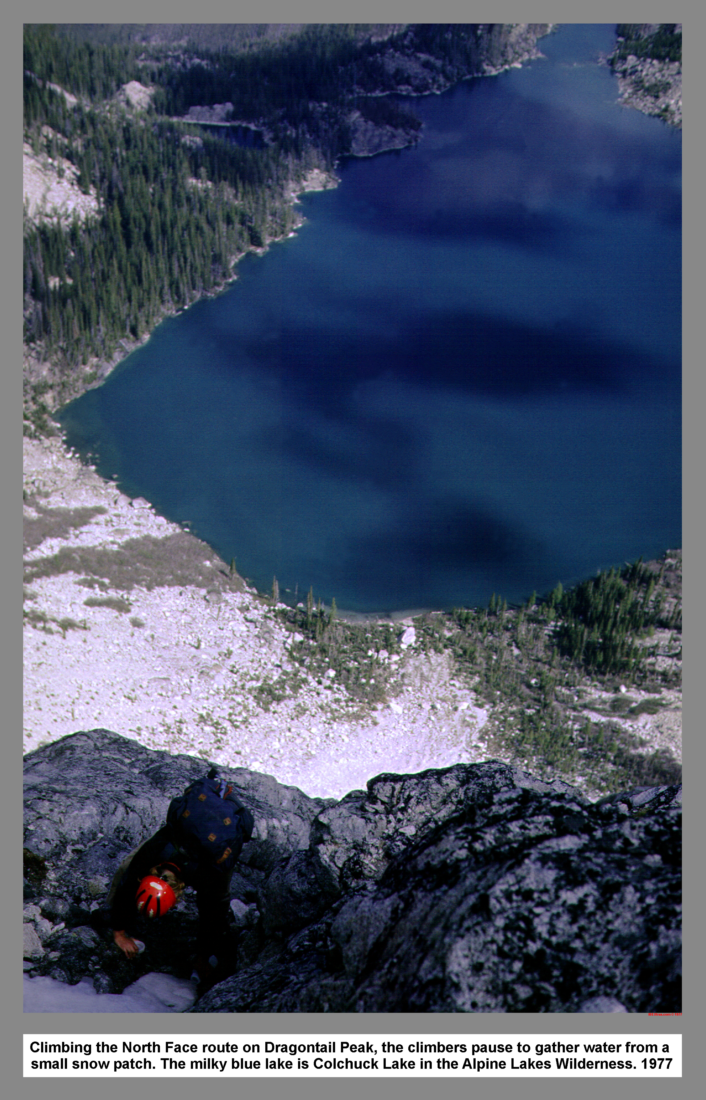
Climbing the North Face route on Dragontail Peak, the climbers pause to gather water from a small snow patch. The milky blue lake is Colchuck Lake in the Alpine Lakes Wilderness. 1977
05 068 Rudi M on Dragontail Peak
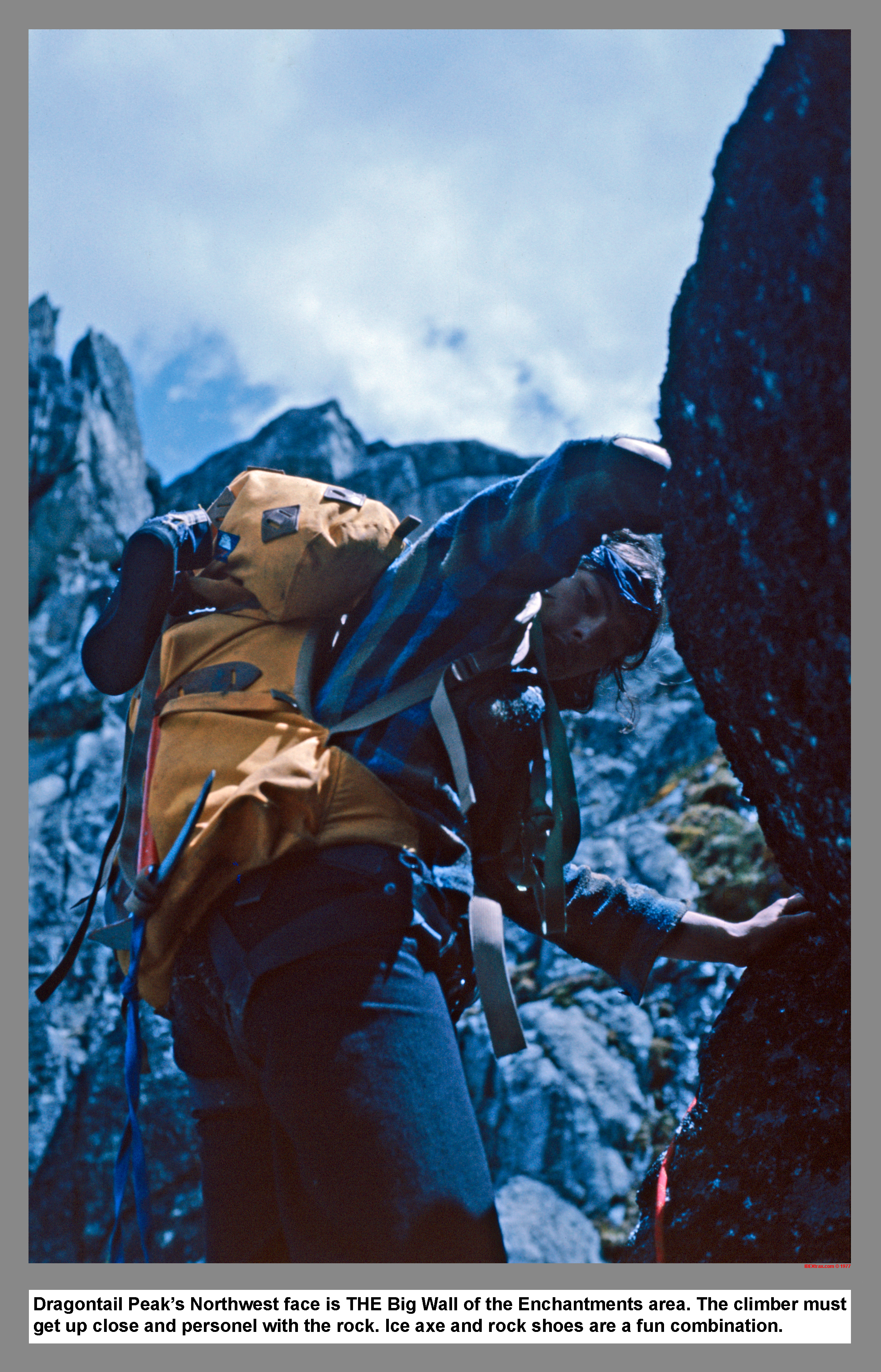
Dragontail Peak's Northwest face is THE Big Wall of the Enchantments area. The climber must get up close and personel with the rock. Ice axe and rock shoes are a fun combination.
05 069 John P ascends the upper Coral on Dragontail
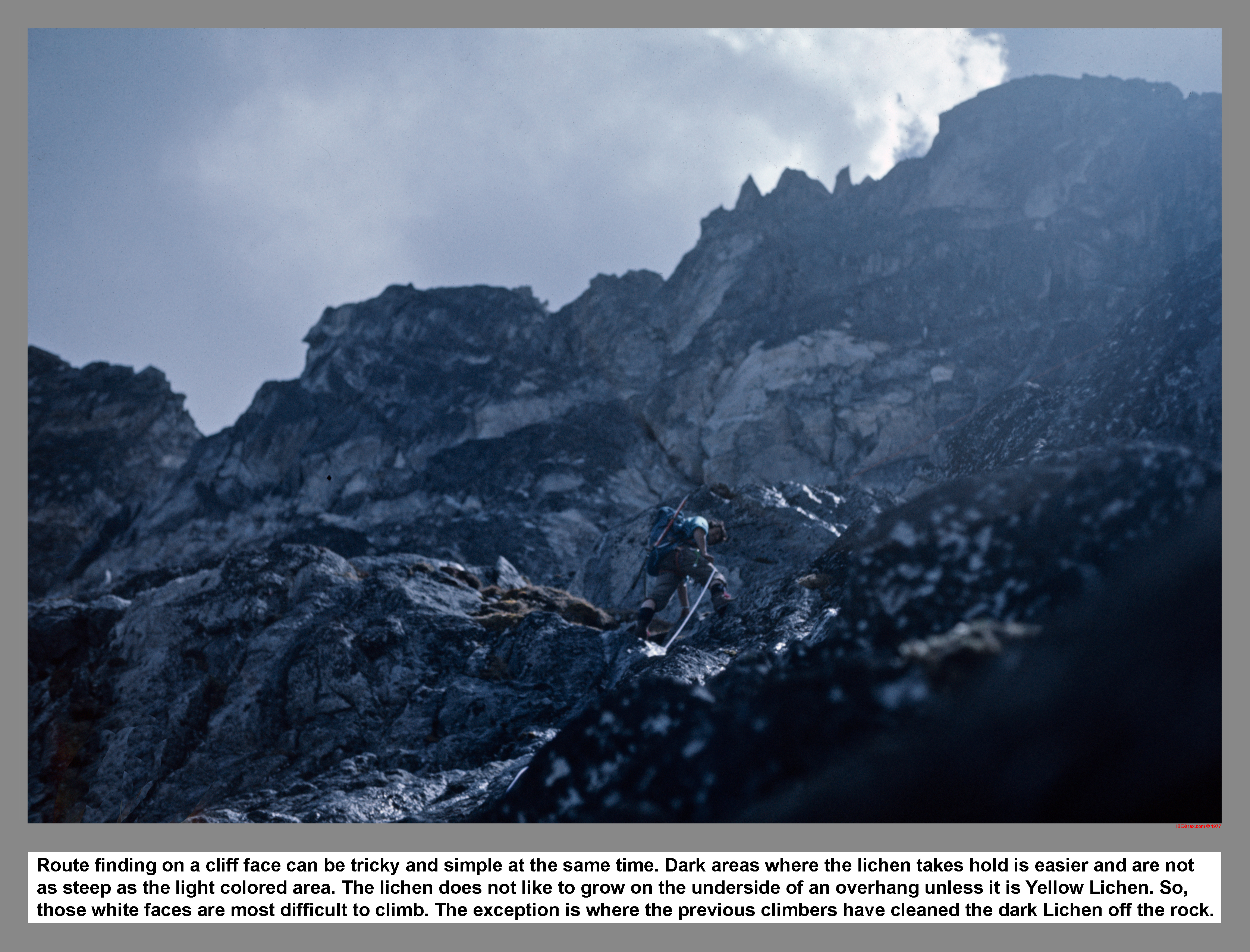
Route finding on a cliff face can be tricky and simple at the same time. Dark areas where the lichen takes hold is easier and is not as steep as the light colored area. The lichen does not like to grow on the underside of an overhang unless it is Yellow Lichen. So, those white faces are most difficult to climb. The exception is where the previous climbers have cleaned of the Lichen off the rock.
05 070 John B John P Others on Dragontail
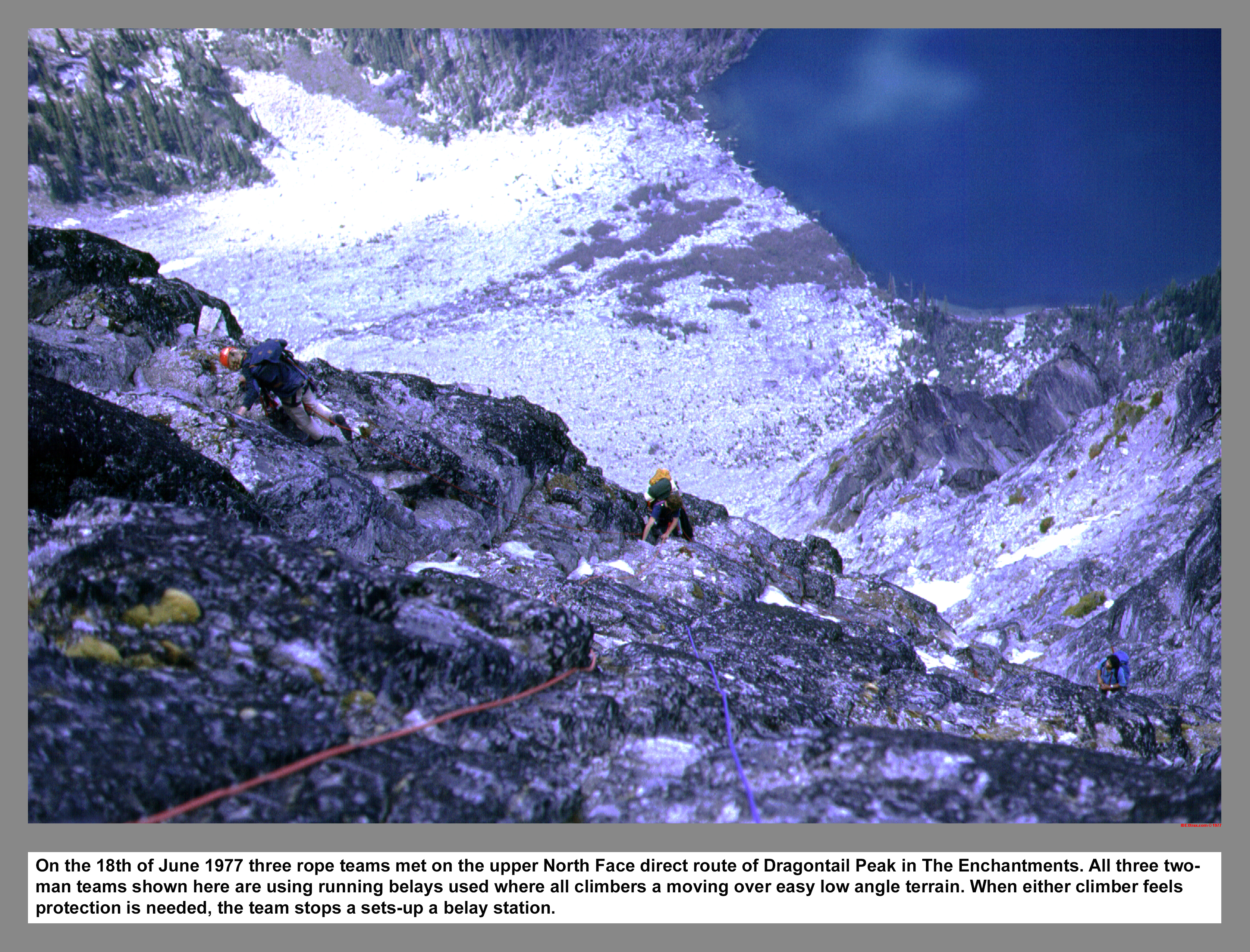
On the 18th of June 1977 three rope teams met on the upper North Face direct route of Dragontail Peak in The Enchantments. All three two-man teams shown here are using running belays. These running belays are used where all climbers are moving over easy low angle terrain. When either climber feels protection is needed, the team stops and sets-up a belay station.
05 071 John B Rudi M & John P Dragontail Peak
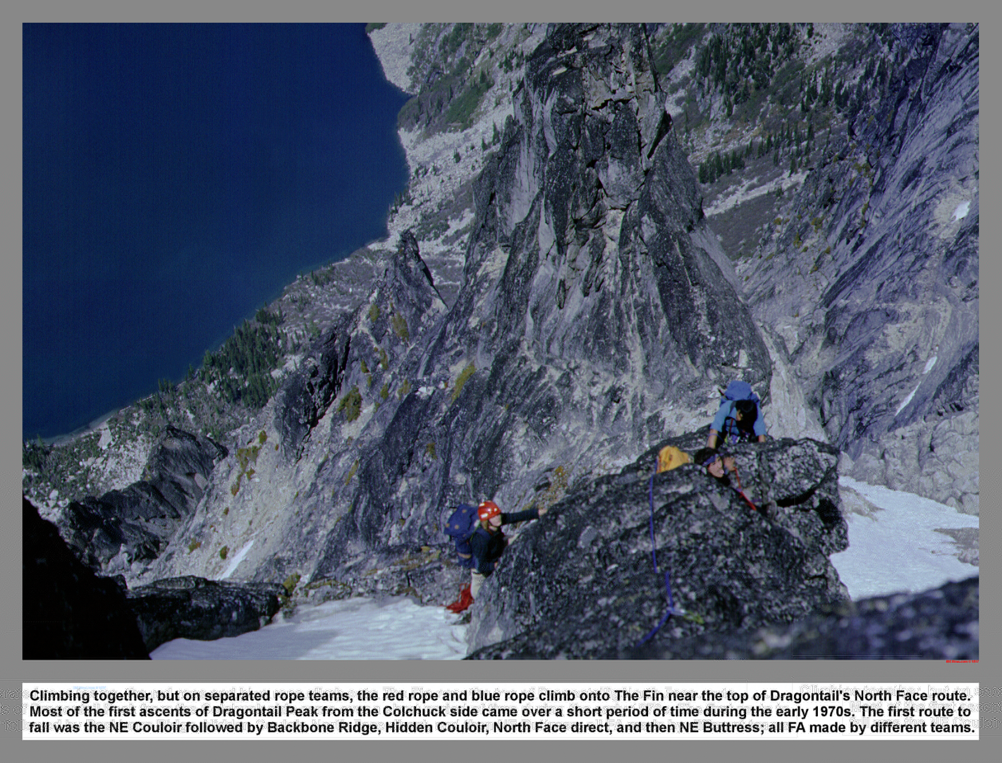
Climbing together, but on separated rope teams, the red rope and blue rope climb onto The Fin near the top of Dragontail's North Face route. Most of the first ascents of Dragontail Peak from the Colchuck side came over a short period of time during the early 1970s. The first route to fall was the NE Couloir followed by Backbone Ridge, Hidden Couloir, North Face direct, and then NE Buttress; all first ascents were made by different teams.
05 072 John P Near Summit of Dragontail

The last pitch on the Dragontail North Face Direct route is done by climbing a snow finger. For this last section near the top, the mountaineering boots came out of the pack and replaced the smooth sole rock shoes.
05 073 John B John P Rudi M Dragontail summit
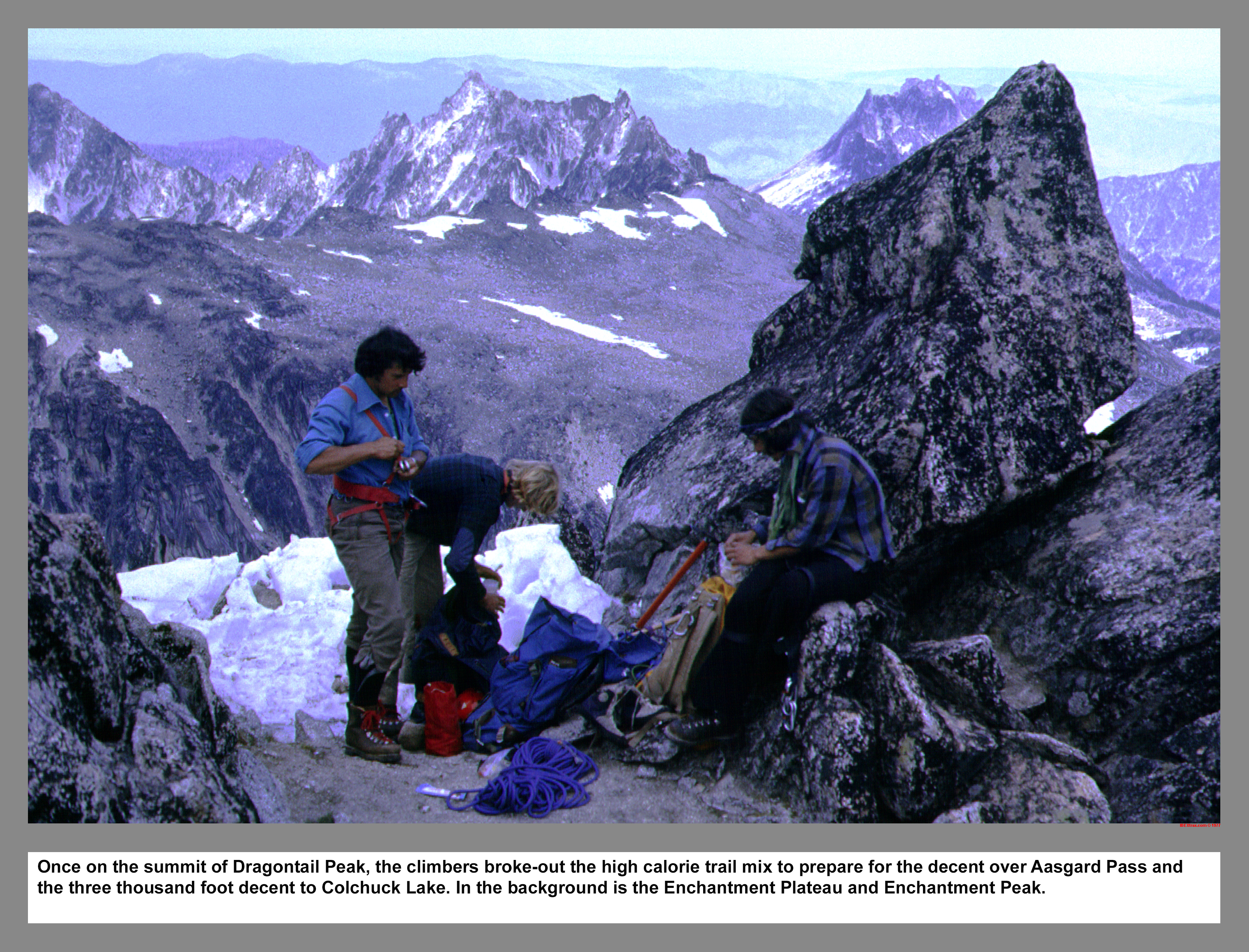
Once on the summit of Dragontail Peak, the climbers broke-out the high calorie trail mix to prepare for the decent over Aasgard Pass and the three thousand foot decent to Colchuck Lake. In the background is the Enchantment Plateau and Enchantment Peak.
05 074 North Face Dragontail Peak
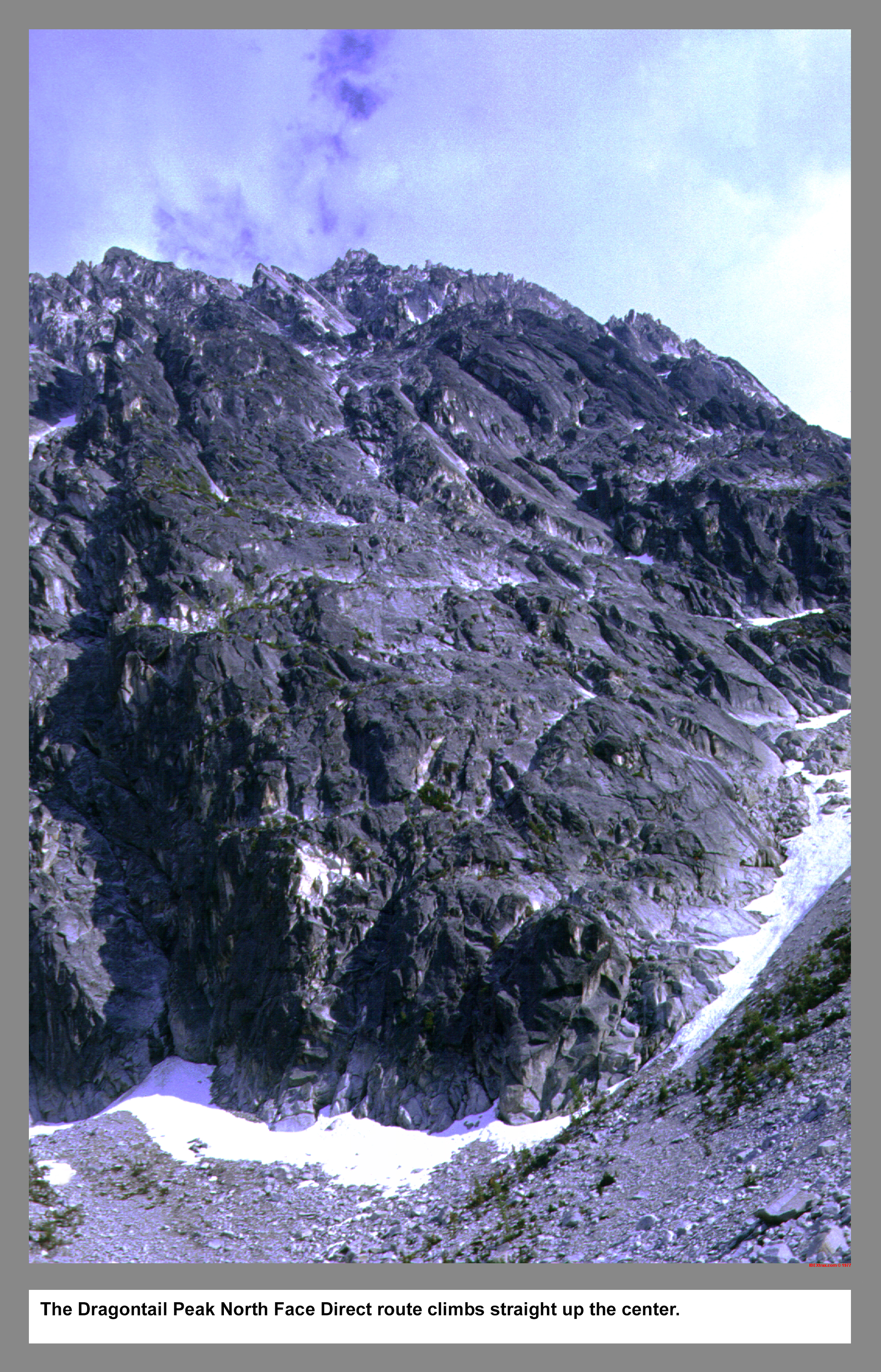
The Dragontail Peak North Face Direct route climbs straight up the center.
05 075 Both Johns at Mosquito Rock on Colchuck Lk
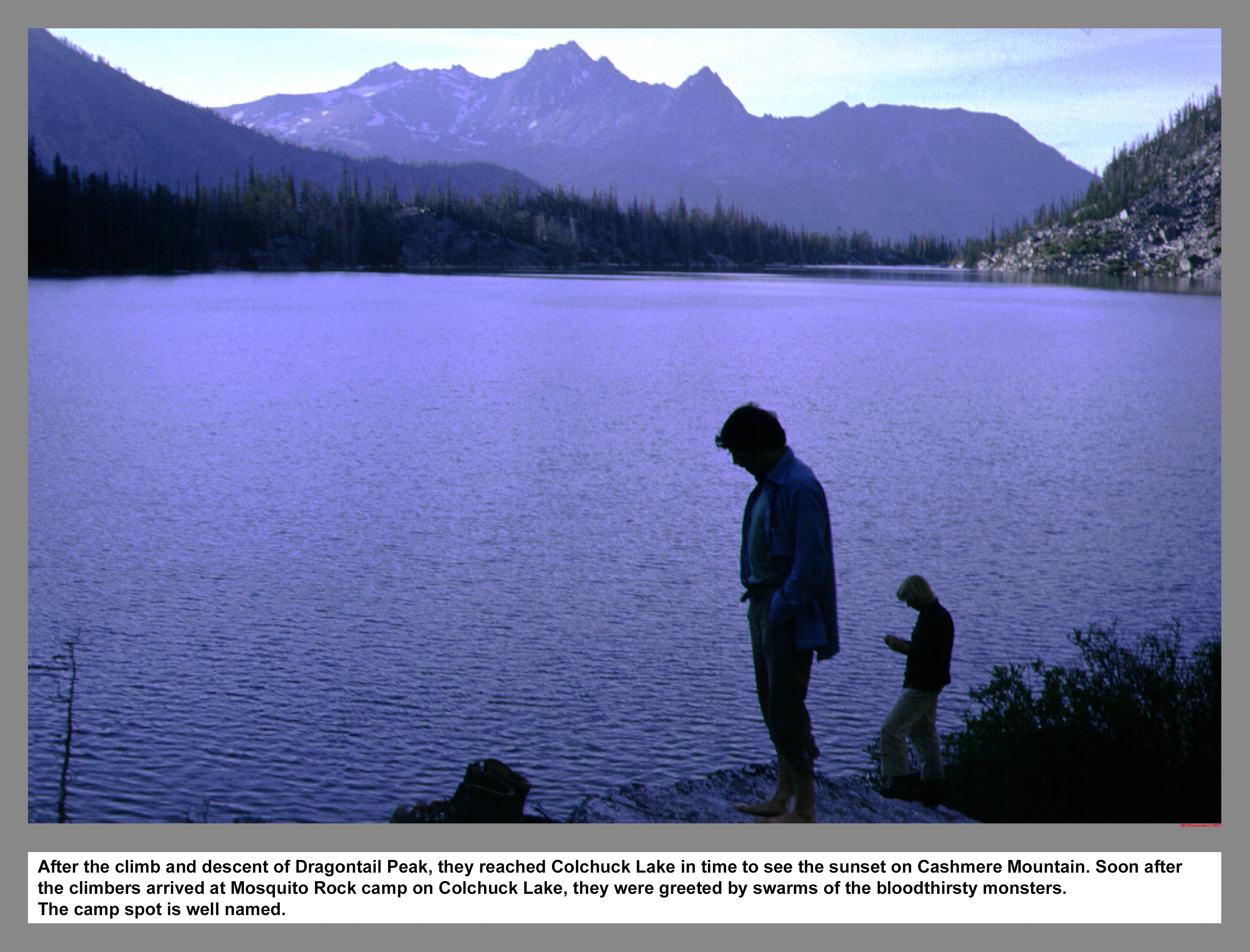
After the climb and descent of Dragontail Peak, they reached Colchuck Lake in time to see the sunset on Cashmere Mountain. Soon after the climbers arrived at Mosquito Rock camp on Colchuck Lake, they were greeted by swarms of the bloodthirsty monsters. The camp spot is well named.
05 076 Rudi M & John P ascend Colchuck Gl
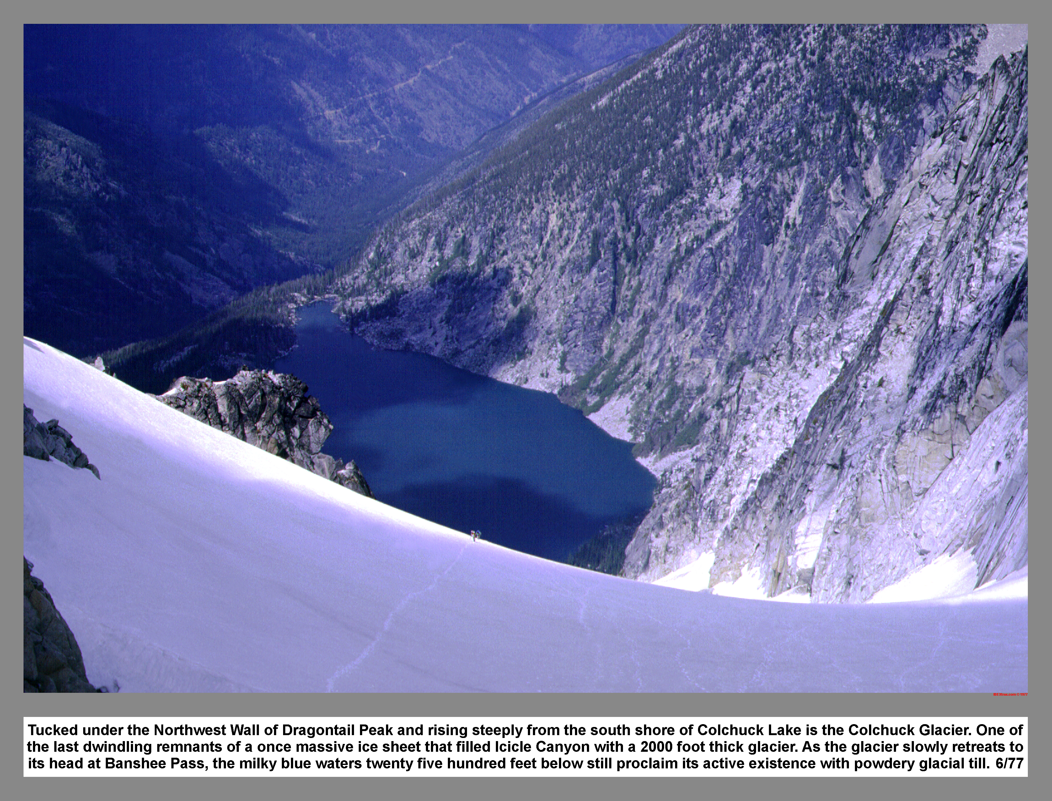
Tucked under the Northwest Wall of Dragontail Peak and rising steeply from the south shore of Colchuck Lake is the Colchuck Glacier. One of the last dwindling remnants of a once massive ice sheet that filled Icicle Canyon with a 2000 foot thick glacier. As the glacier slowly retreats to its head at Banshee Pass, the milky blue waters twenty five hundred feet below still proclaim its active existence with powdery glacial till. 6/77
05 077 Mt Stuart & Sherpa Peak from Colchuck Pk
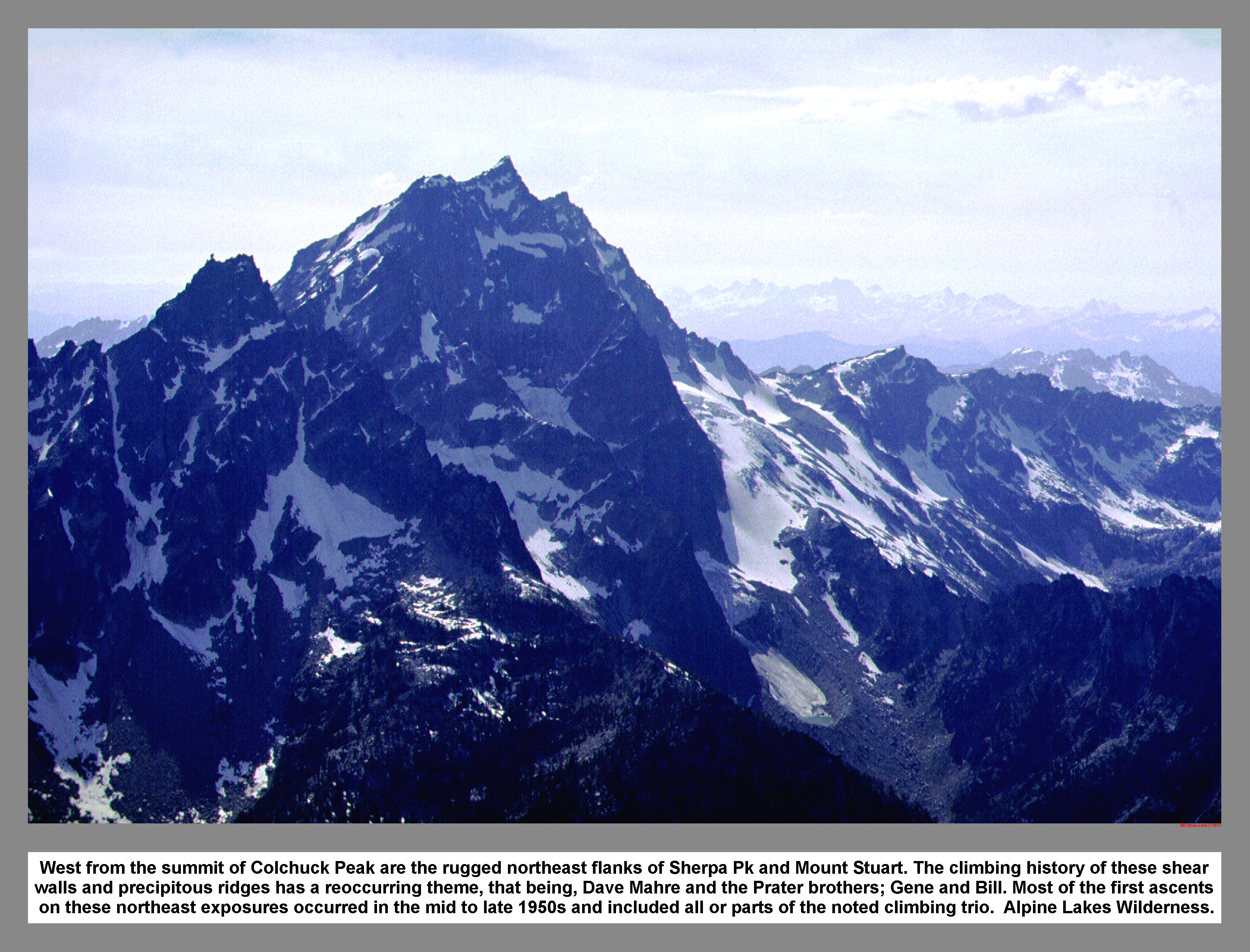
West from the summit of Colchuck Peak are the rugged northeast flanks of Sherpa Pk and Mount Stuart. The climbing history of these shear walls and precipitous ridges has a reoccurring theme, that being, Dave Mahre and the Prater brothers; Gene and Bill. Most of the first ascents on these northeast exposures occurred in the mid to late 1950s and included all or parts of the noted climbing trio. Alpine Lakes Wilderness.
05 078 Rudi M John P up Bull Durham Tower
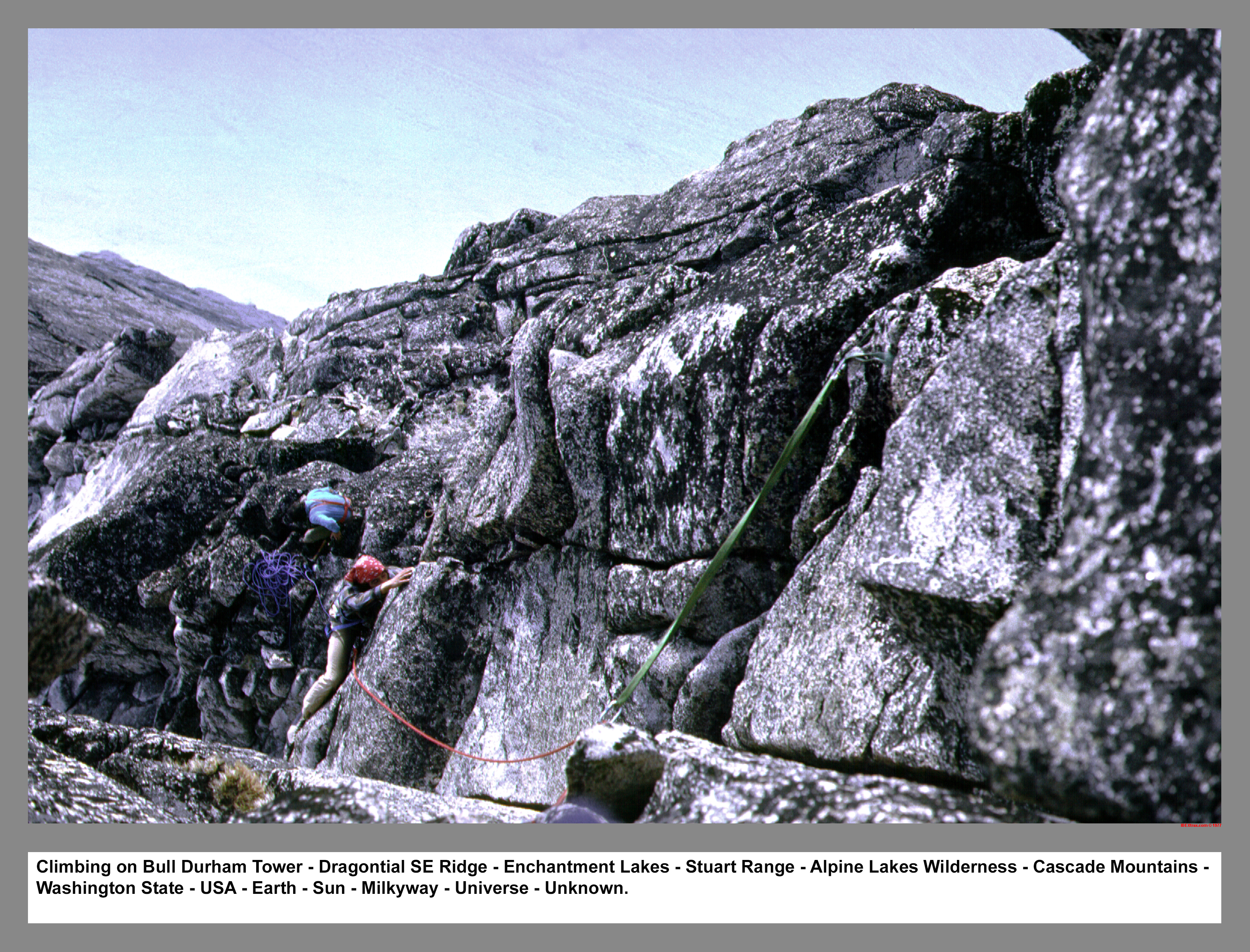
Climbing on Bull Durham Tower - Dragontial SE Ridge - Enchantments - Stuart Range - Alpine Lakes Wilderness - Cascade Mountains - Washington State - USA - Earth - Sun - Milkyway - Universe - Unknown.
05 079 Climbers on Bull Durham with Rooster Finch
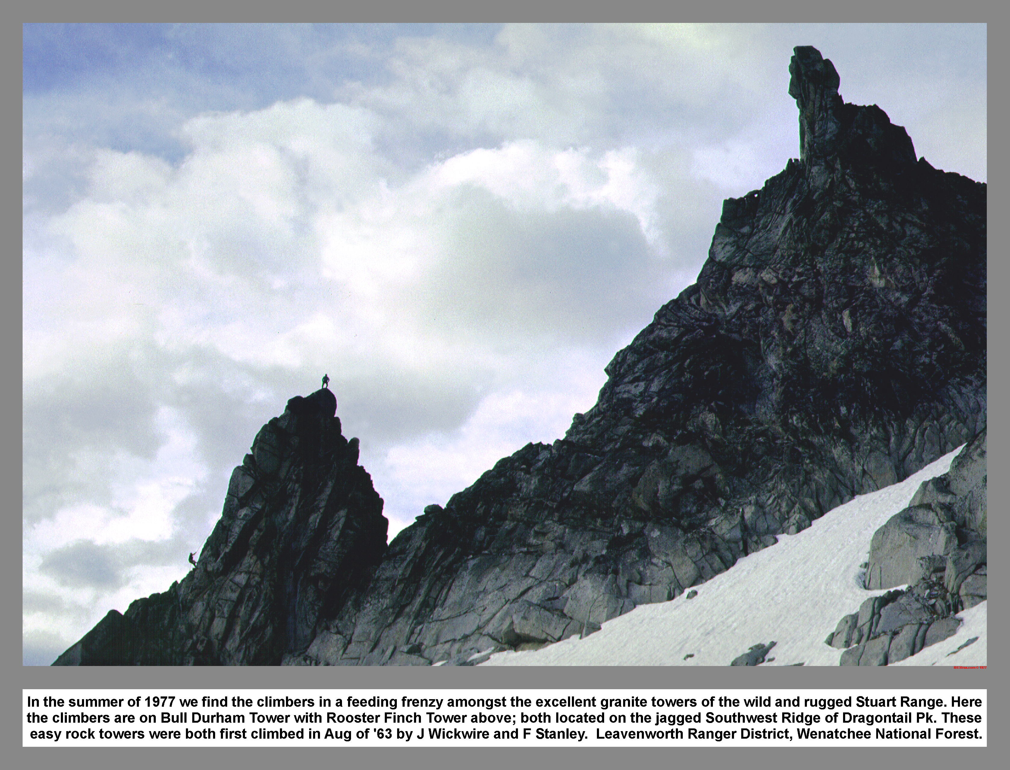
In the summer of 1977 we find the climbers in a feeding frenzy amongst the excellent granite towers of the wild and rugged Stuart Range. Here the climbers are on Bull Durham Tower with Rooster Finch Tower above; both located on the jagged Southwest Ridge of Dragontail Pk. These easy rock towers were both first climbed in Aug of '63 by J Wickwire and F Stanley. Leavenworth Ranger District, Wenatchee Forest.
05 080 Rooster Finch Tower Rudi M Warren
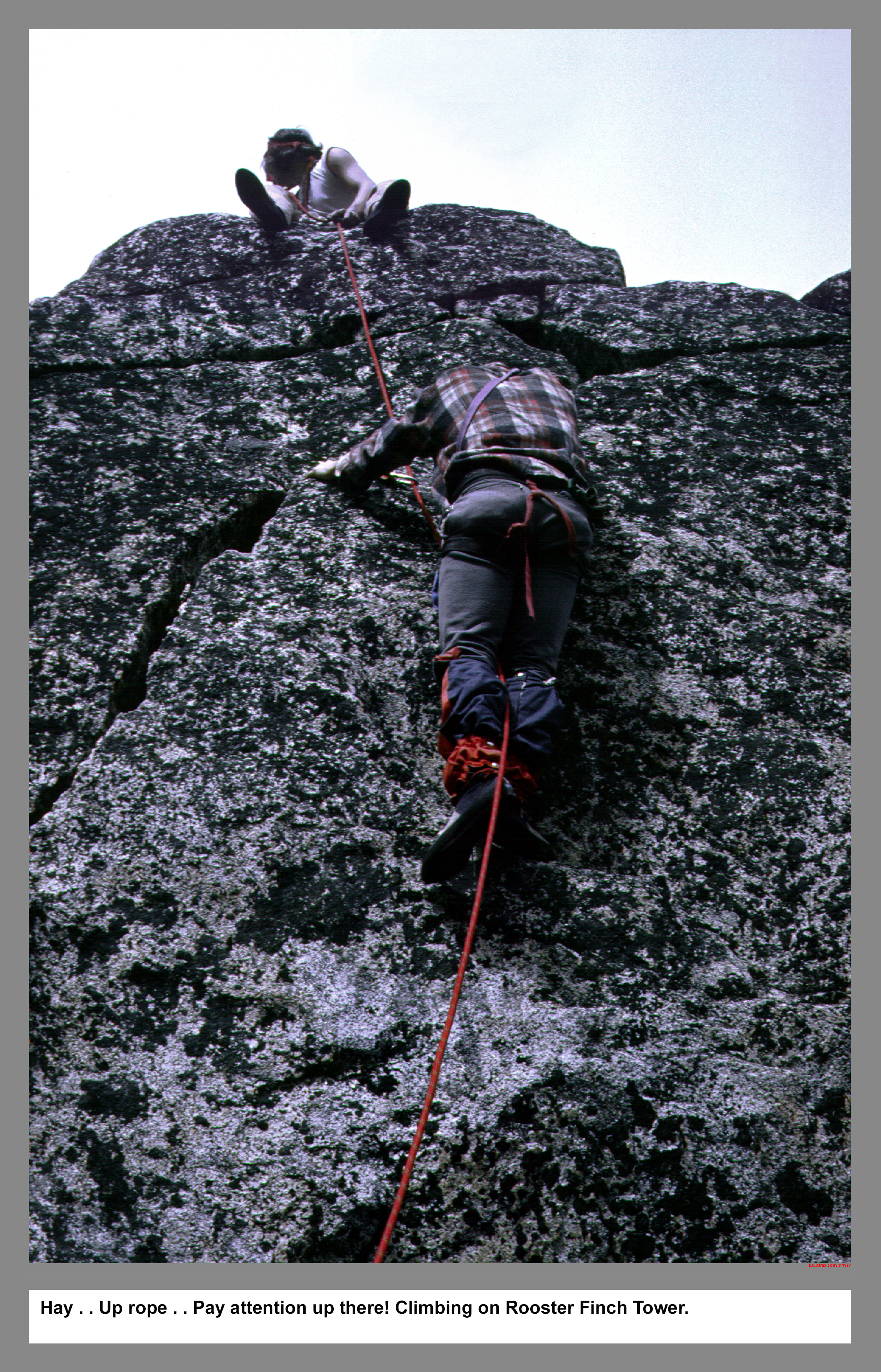
Hey . . Up rope . . Pay attention up there! Climbing on Rooster Finch Tower.
05 081 Warren near Mist Pond & Aasgard Pass
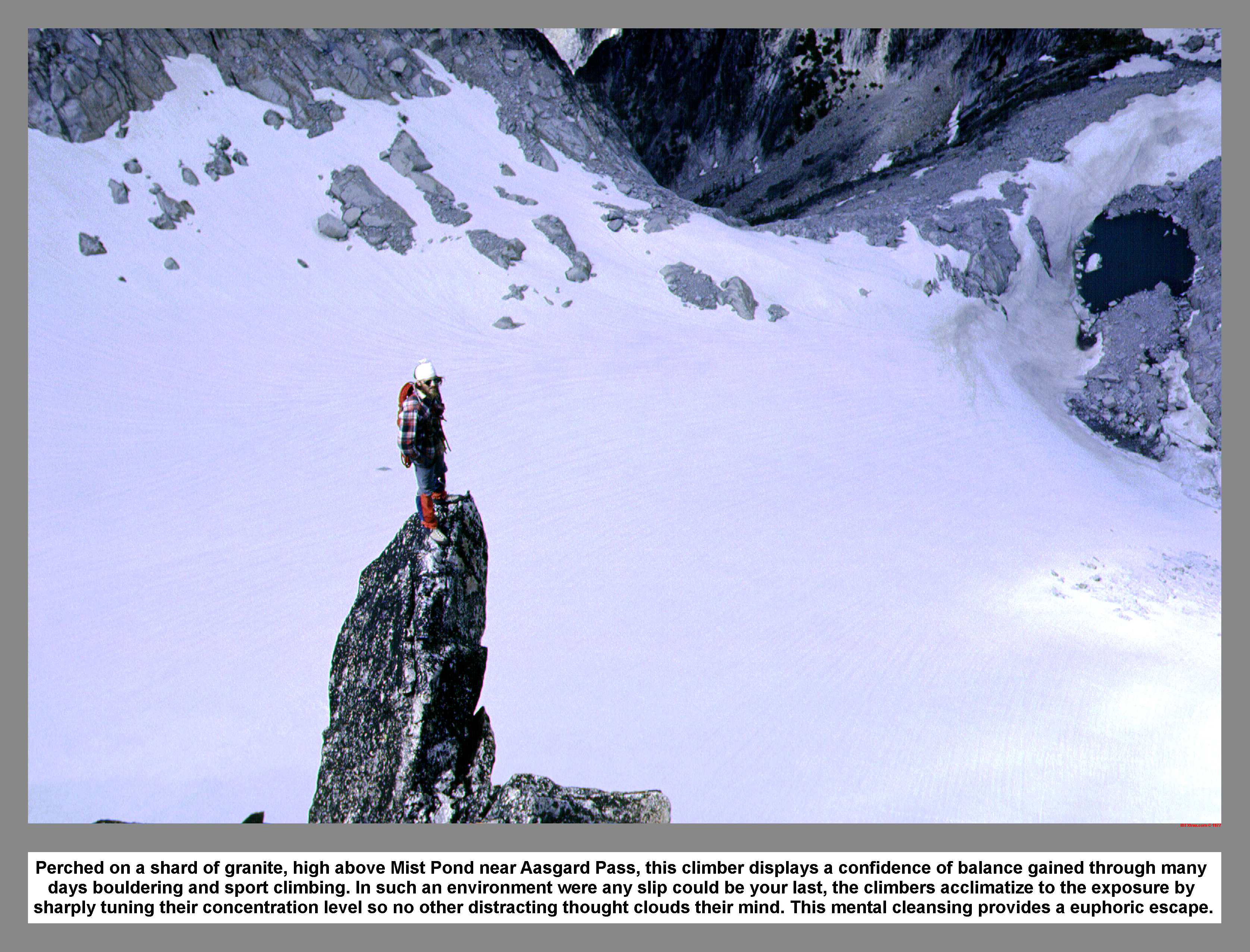
Perched on a shard of granite, high above Mist Pond near Aasgard Pass, this climber displays a confidence of balance gained through many days bouldering and sport climbing. In such an environment were any slip could be your last, the climbers acclimatize to the exposure by sharply tuning their concentration level so no other distracting thought clouds their mind. This mental cleansing provides a euphoric escape.
The Dragontail Plateau. For scale and to gauge the size of the haphazardly strewn erratics, see the climbers on the righthand edge.
05 083 Mt Stuart in the clouds
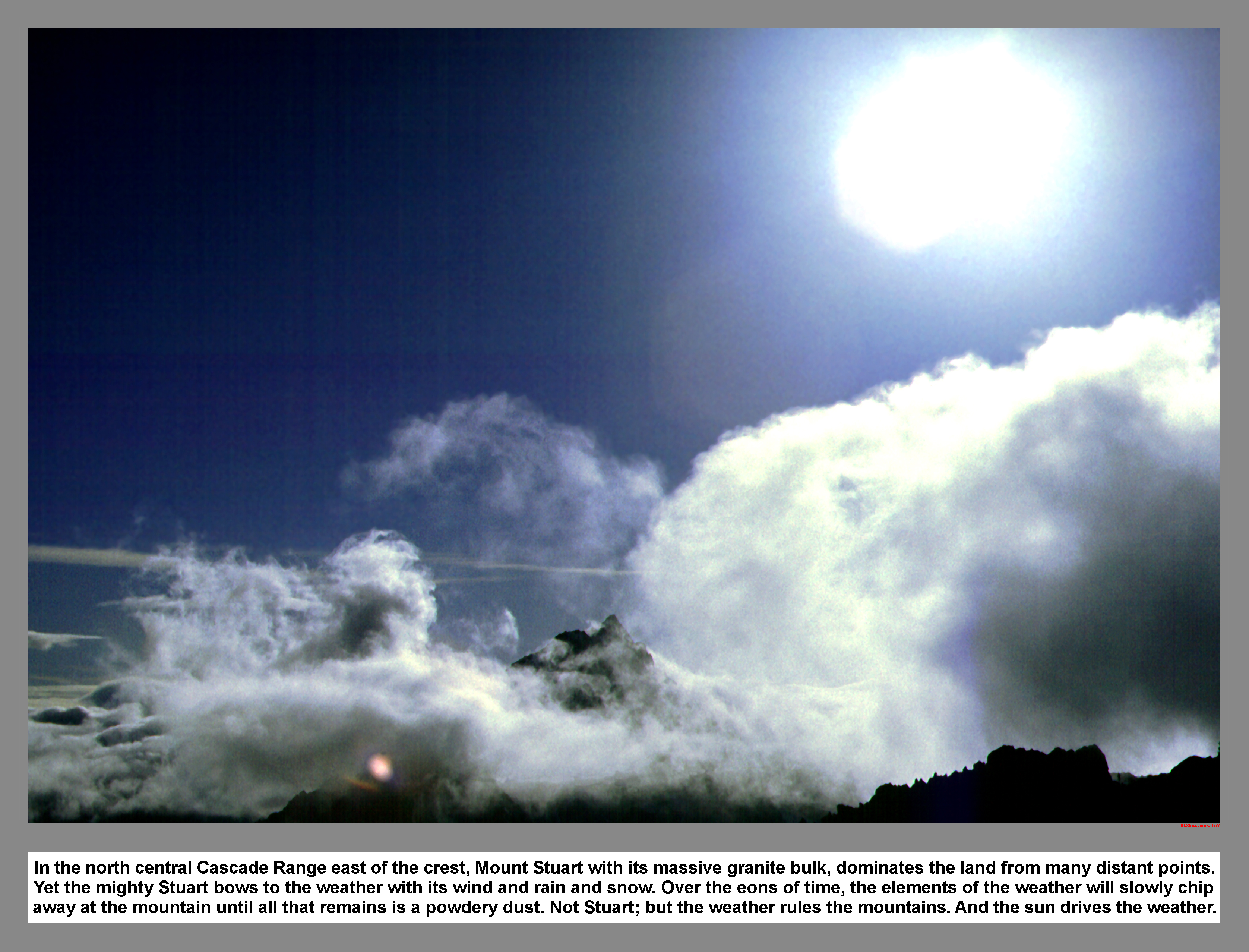
In the north central Cascade Range east of the crest, Mount Stuart with its massive granite bulk, dominates the land from many distant points. Yet the mighty Stuart bows to the weather with its wind and rain and snow. Over the eons of time, the elements of the weather will slowly chip away at the mountain until all that remains is a powdery dust. Not Stuart; but the weather rules the mountains. And the sun drives the weather.
05 087 Little Annapurna and Pennant Peak
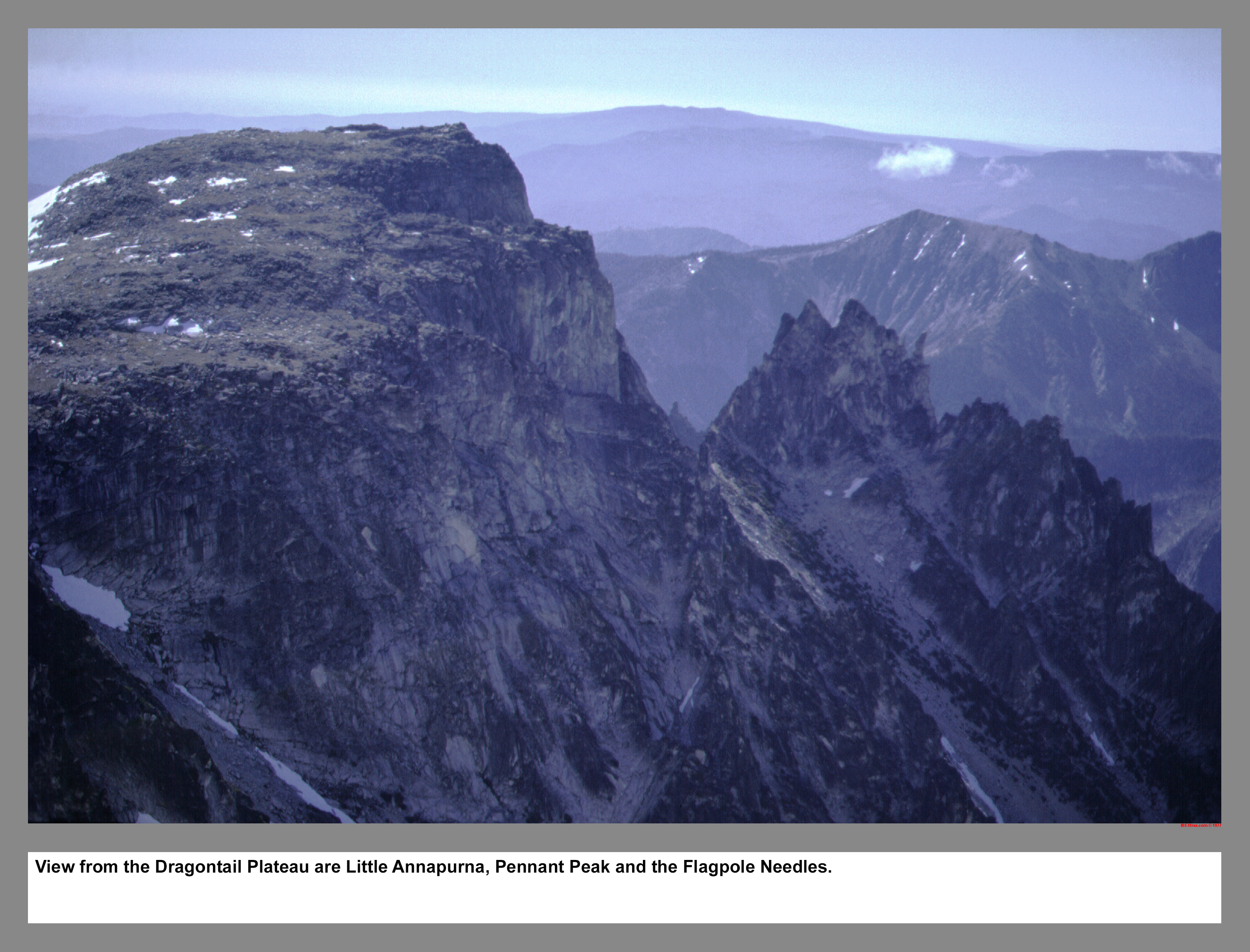
From the Dragontail Plateau are Little Annapurna, Pennant Peak and the Flagpole Needles.
05 088 Rudi nears the Witches Tower

At 8520+feet The Witches Tower is a steep, rounded rock crag that stands to the north of the Dragontail Plateau and splits the small dwindling fragments of the Snow Creek Glaciers. The slow growing, hardy plant that darkens the light colored granite is called Lichen. It takes hundreds of years for a palm size patch of Lichen to grow. As seen here from the lack of Lichen, the Snow Creek Glaciers are into a century of retreat. 77
05 090 Warren Rudi M John P Witchs Tower
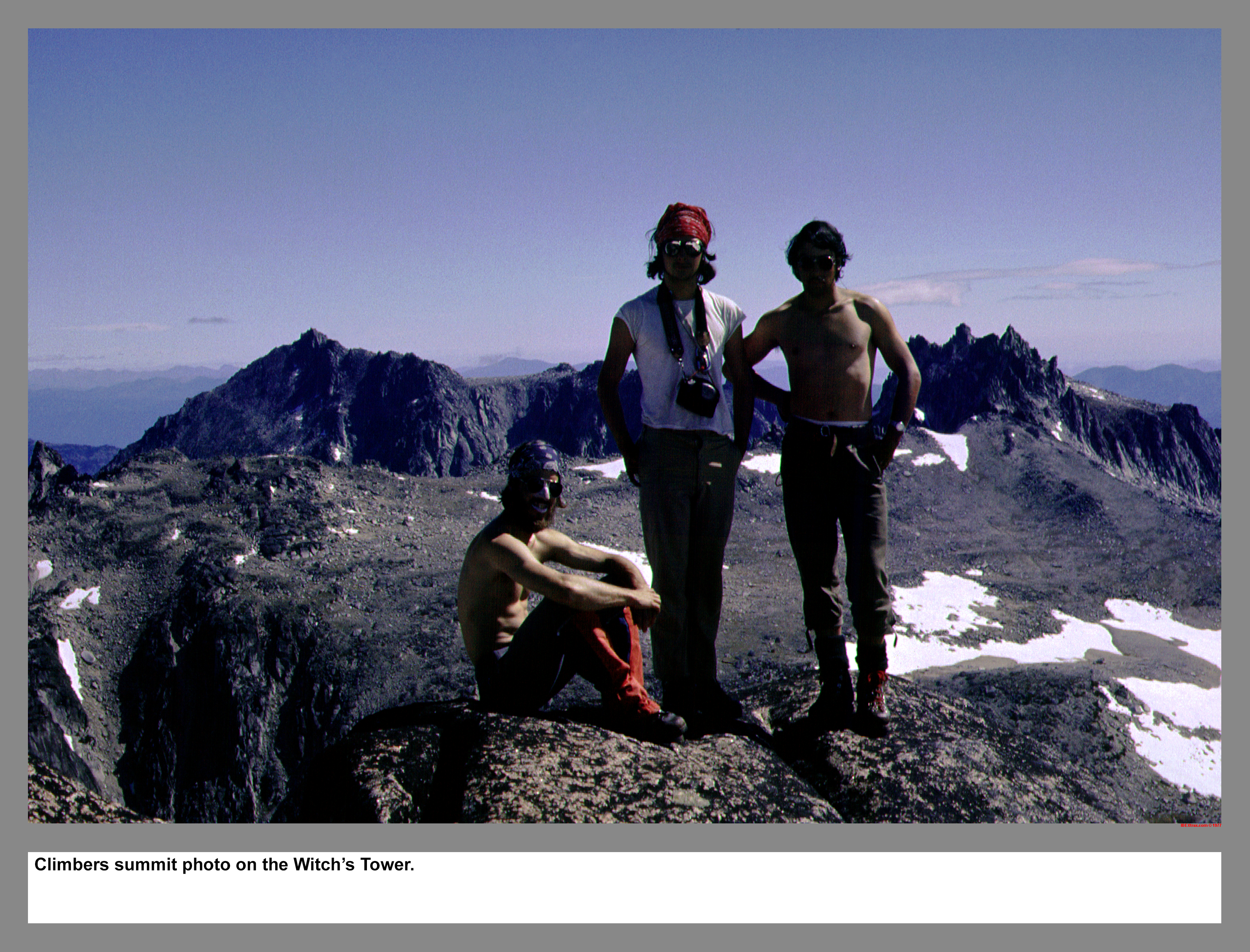
Climbers summit photo on the Witch's Tower.
05 091 John P Rappels S Face Little Annapurna
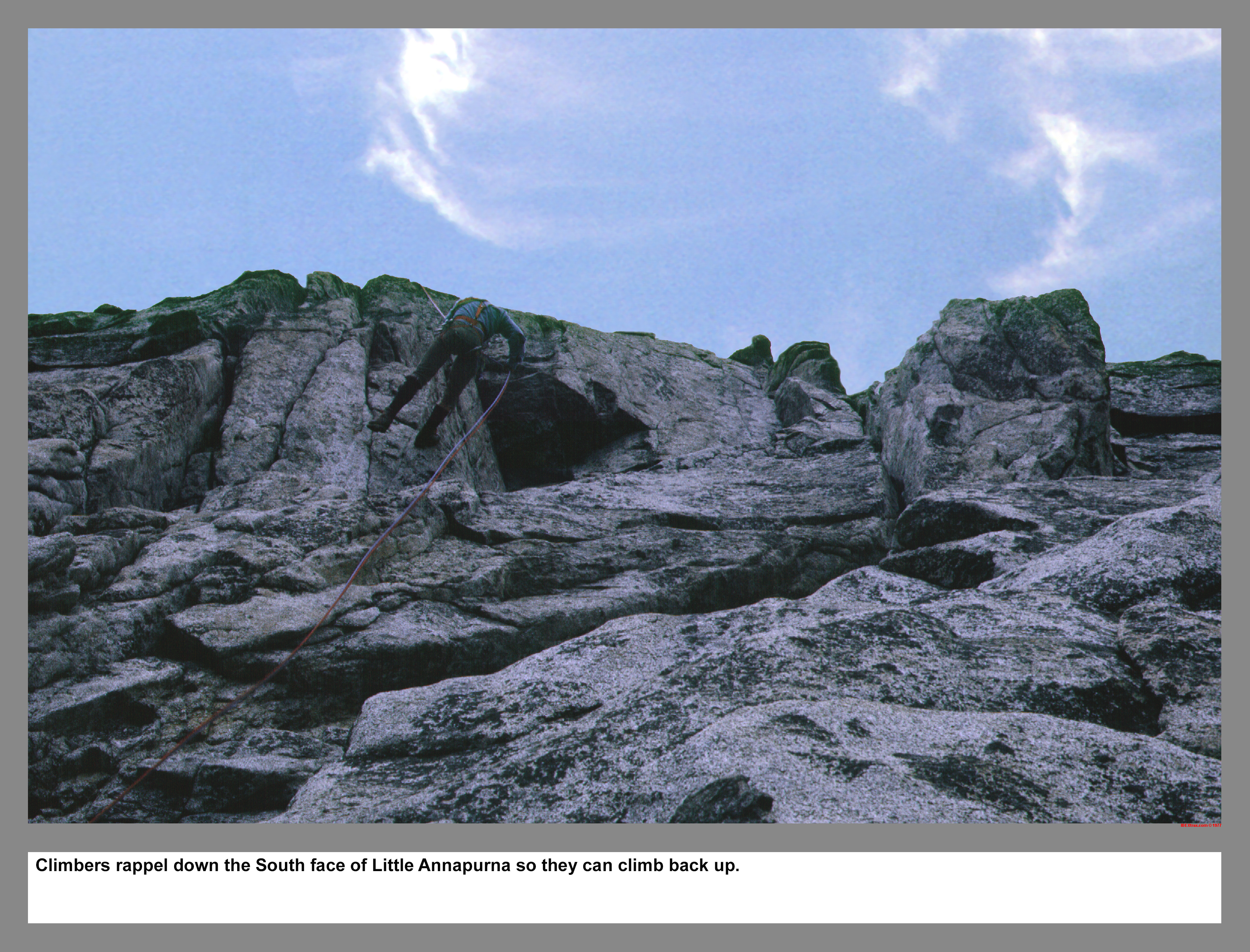
Climbers rappel down the South face of Little Annapurna so they can climb back up. /P>
05 093 John P Leads S Face Little Annapurna
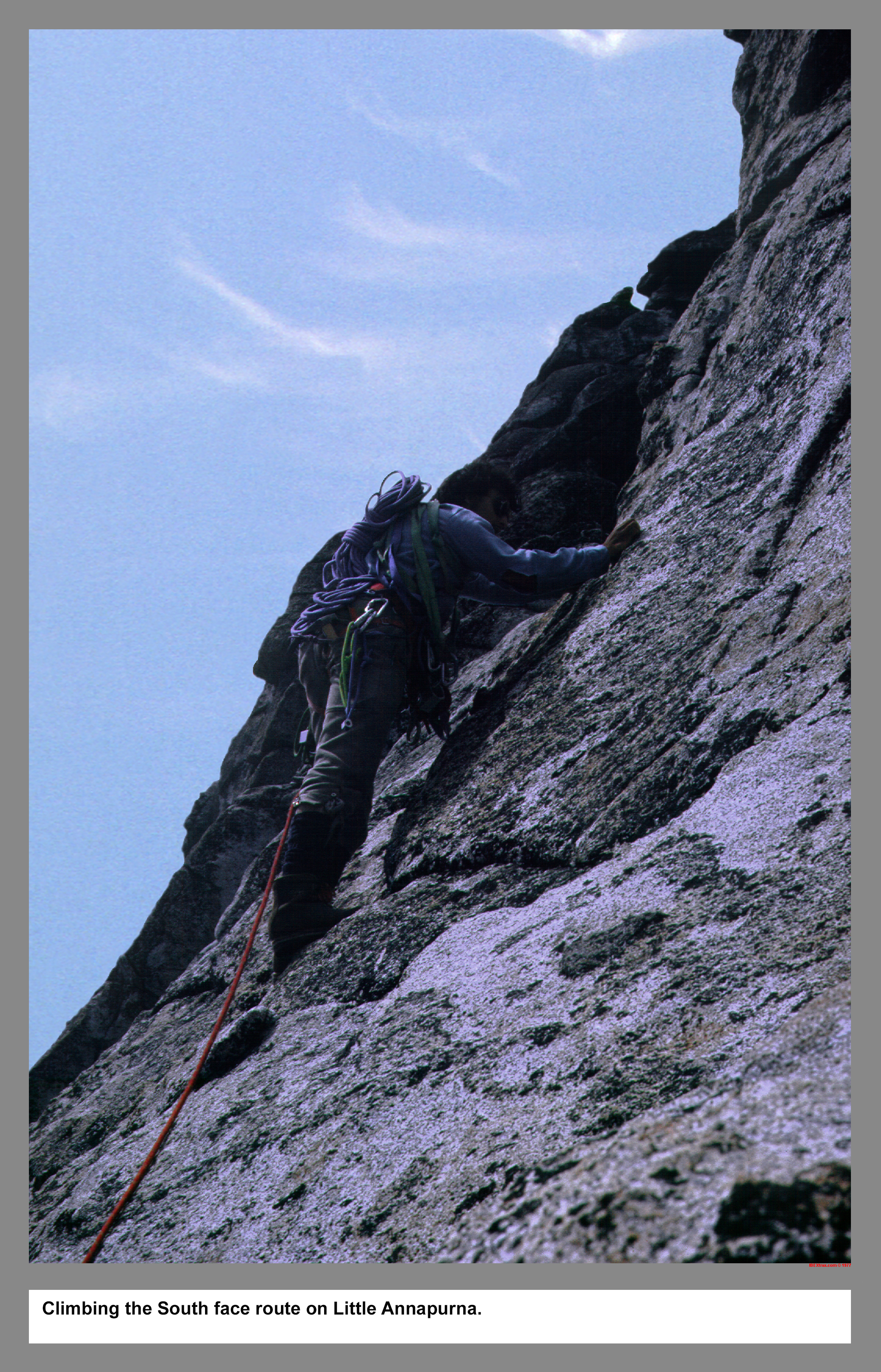
Climbing the South face route on Little Annapurna.
05 094 Zig zag on S face of Little Annapurna
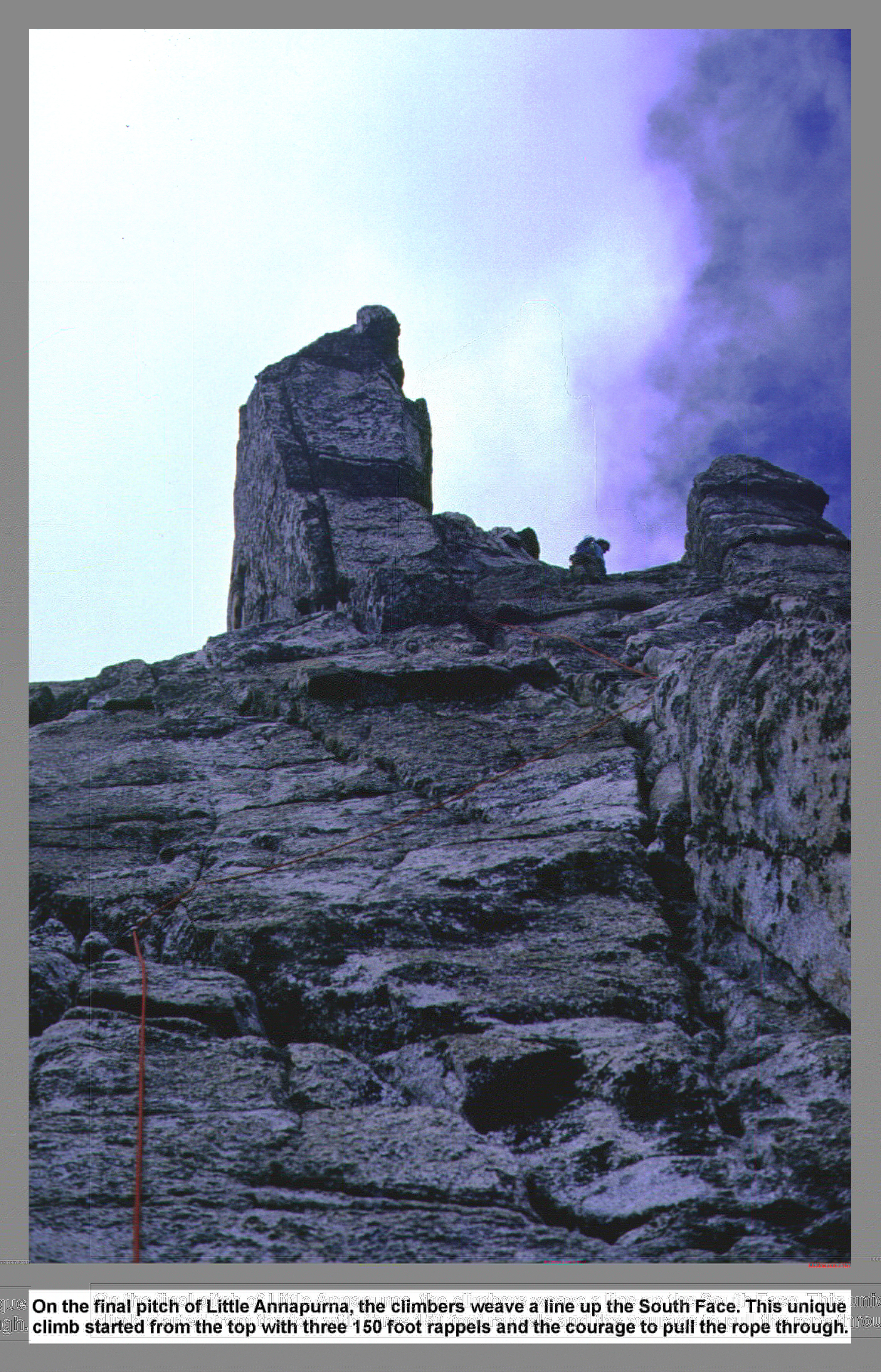
On the final pitch of Little Annapurna, the climbers weave a line up the South Face. This unique climb started from the top with three 150 foot rappels and the courage to pull the rope through.
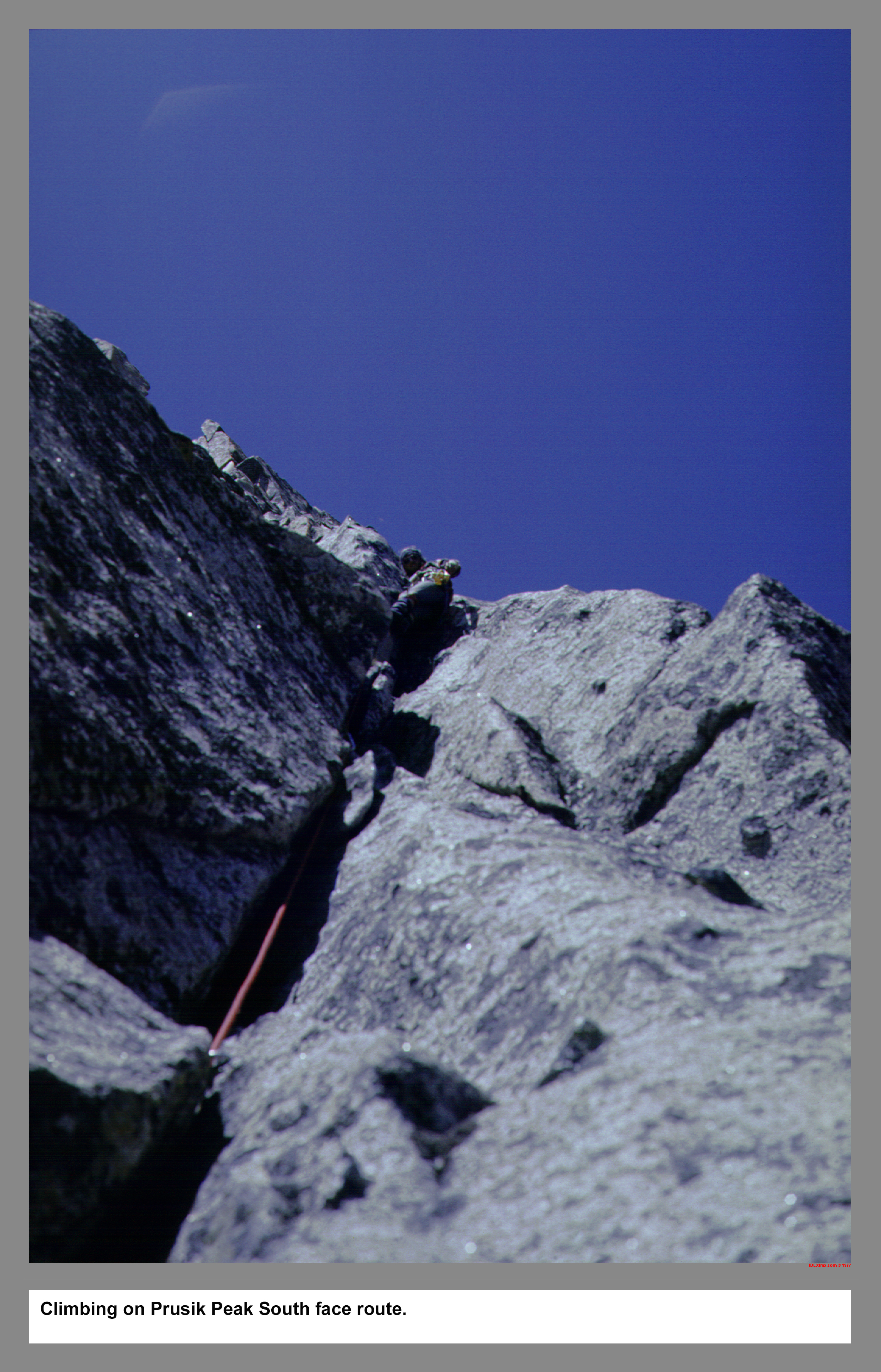
05 095 Warren lead Prusik Pk S face route
Climbing on Prusik Peak South face route.
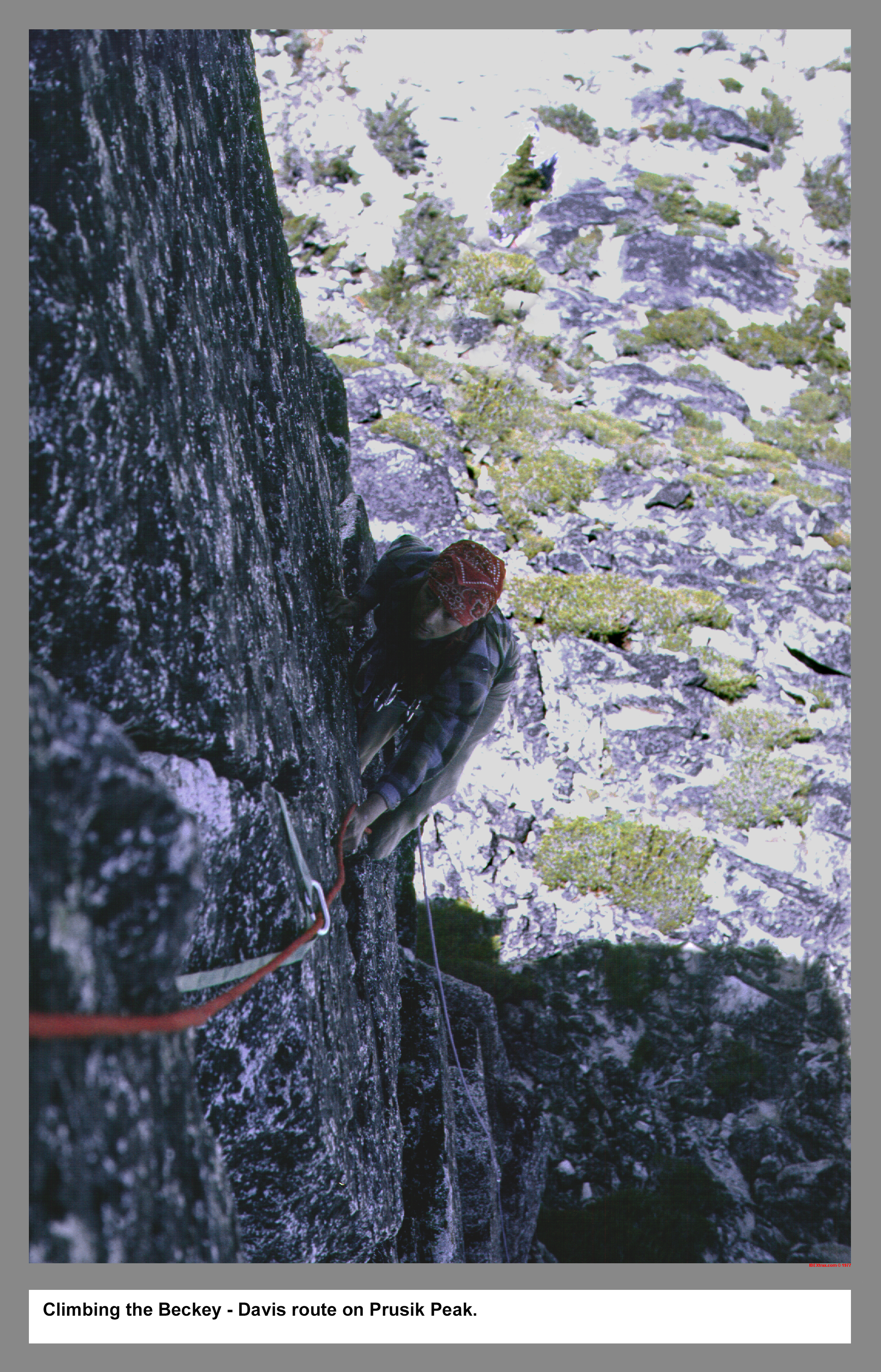
05 096 Beckey Davis Prusik Pk Rudi M
Climbing the Beckey - Davis route on Prusik Peak.
05 097 Rudi M on upper W ridge of Prusik
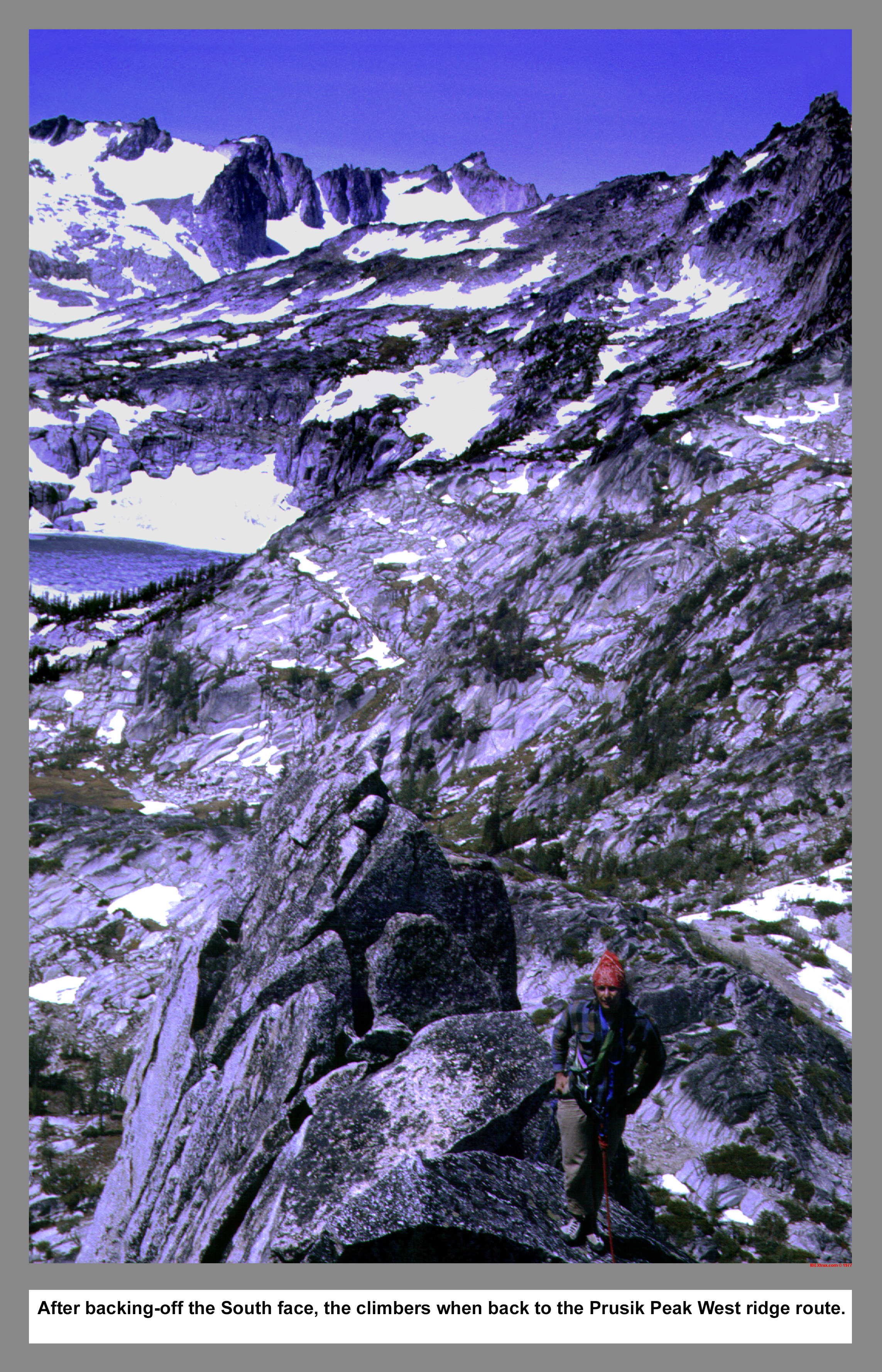
After backing-off the Beckey - Davis route, the climbers when back to the Prusik Peak West ridge route.
05 098 Rudi M on Prusik Pk with Little Annapurna
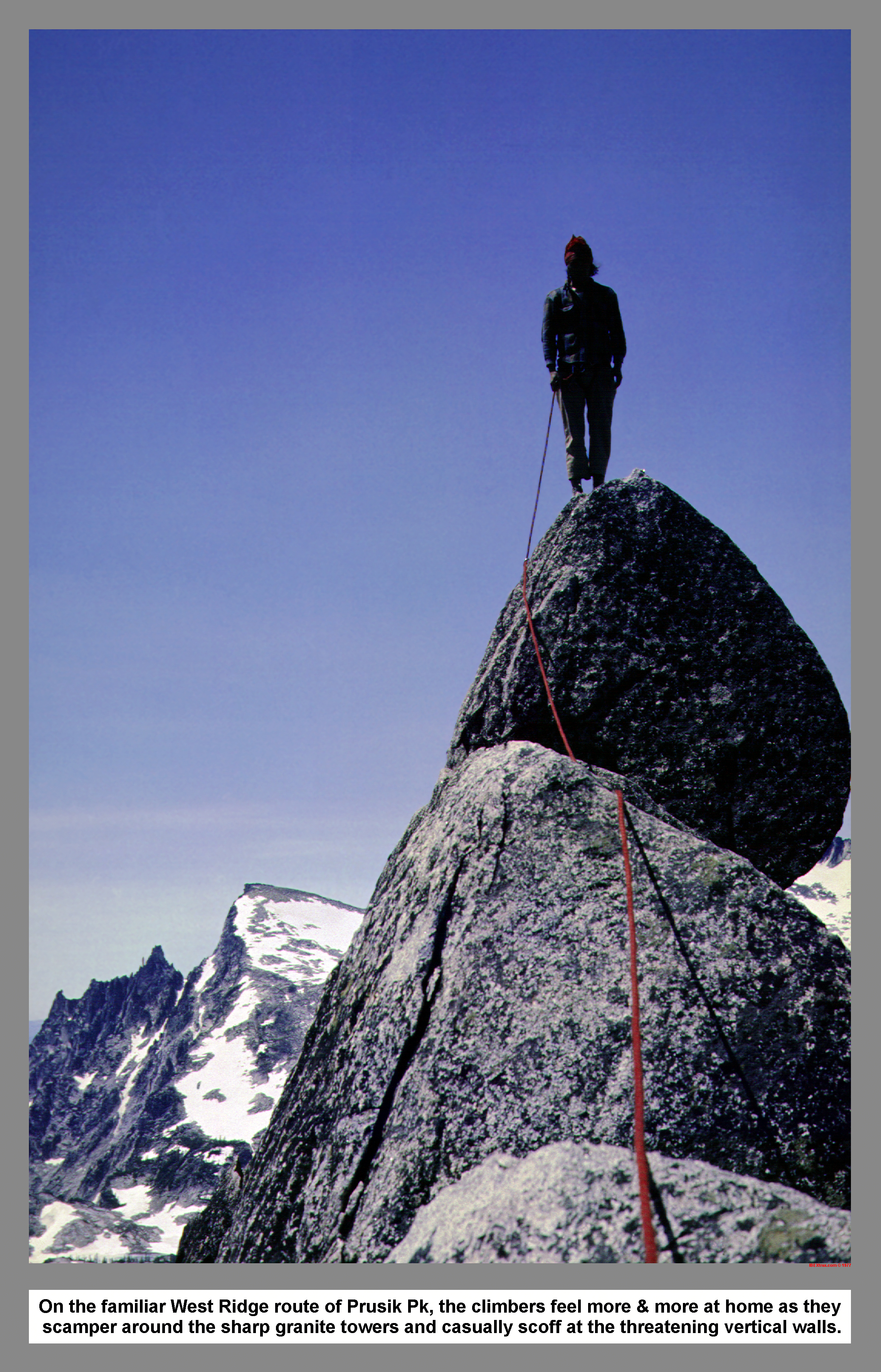
On the familiar West Ridge route of Prusik Pk, the climbers feel more & more at home as they scamper around the sharp granite towers and casually scoff at the threatening vertical walls.
05 099 Rudi M & John P at Camp near Gnome Tarn
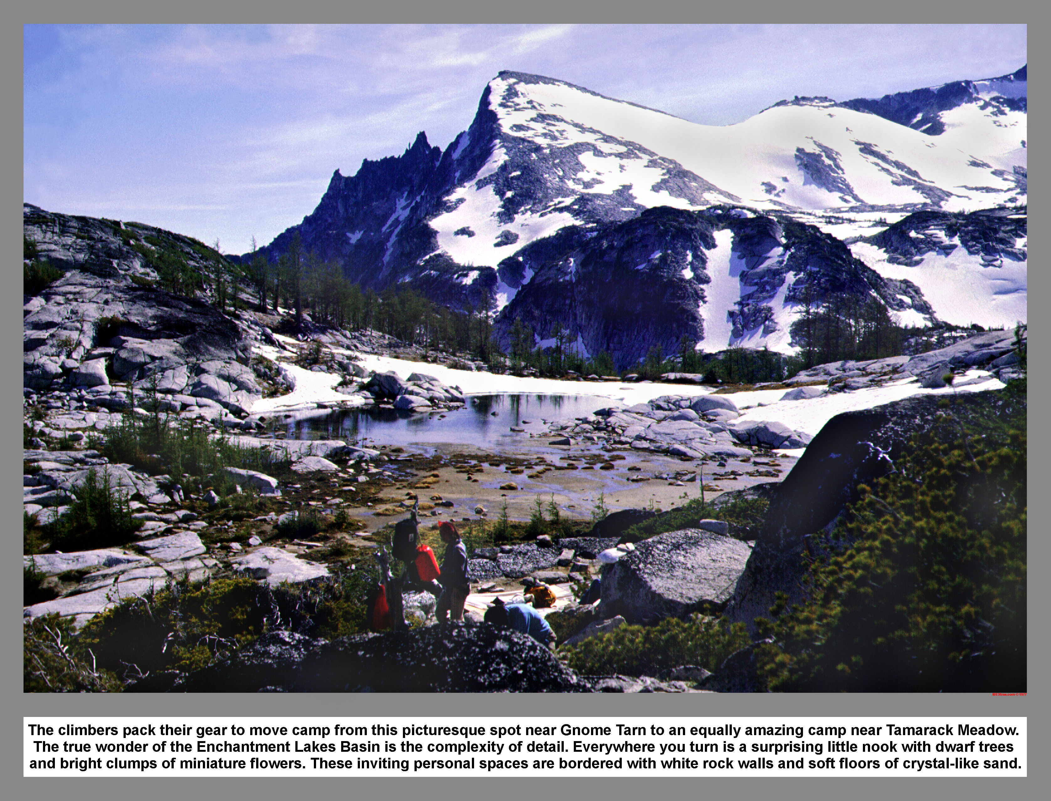
The climbers pack their gear to move camp from this picturesque spot near Gnome Tarn to an equally amazing camp near Tamarack Meadow. The true wonder of the Enchantment Lakes Basin is the complexity of detail. Everywhere you turn is a surprising little nook with dwarf trees and bright clumps of miniature flowers. These inviting personal spaces are bordered with white rock walls and soft floors of crystal-like sand.
05 100 Prusik Pk S face from Gnome Tarn
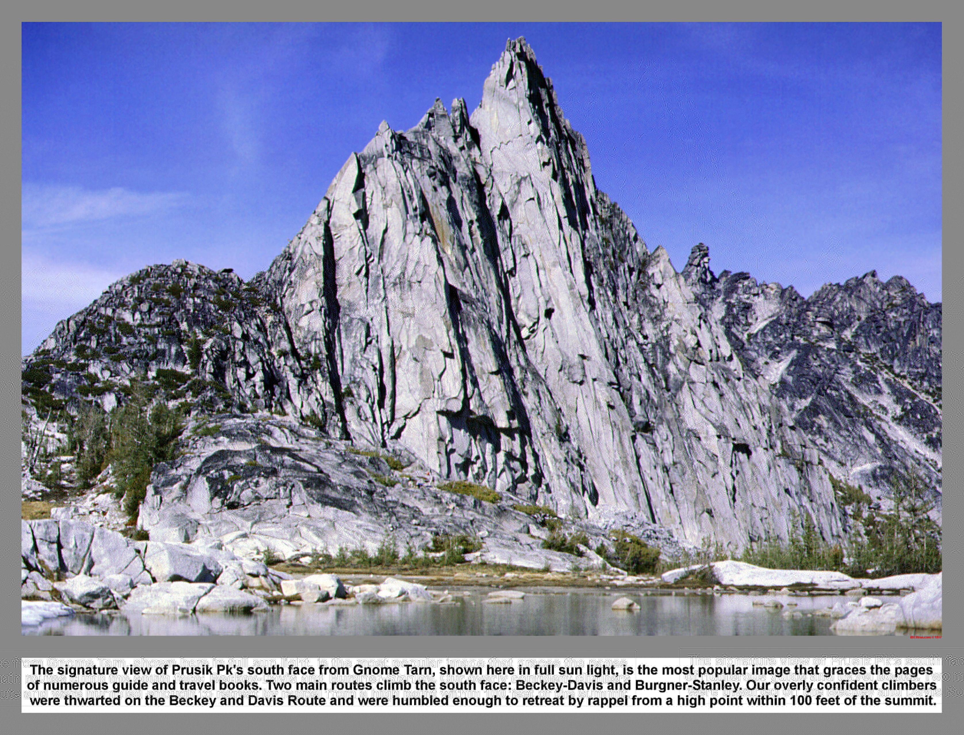
The signature view of Prusik Pk's south face from Gnome Tarn, shown here in full sun light, is the most popular image that graces the pages of numerous guide and travel books. Two main routes climb the south face: Beckey-Davis and Burgner-Stanley. Our overly confident climbers were thwarted on the Beckey and Davis Route and were humbled enough to retreat by rappel from a high point within 100 feet of the summit.
05 101 McClellan Chessmen from near Lk Viviane
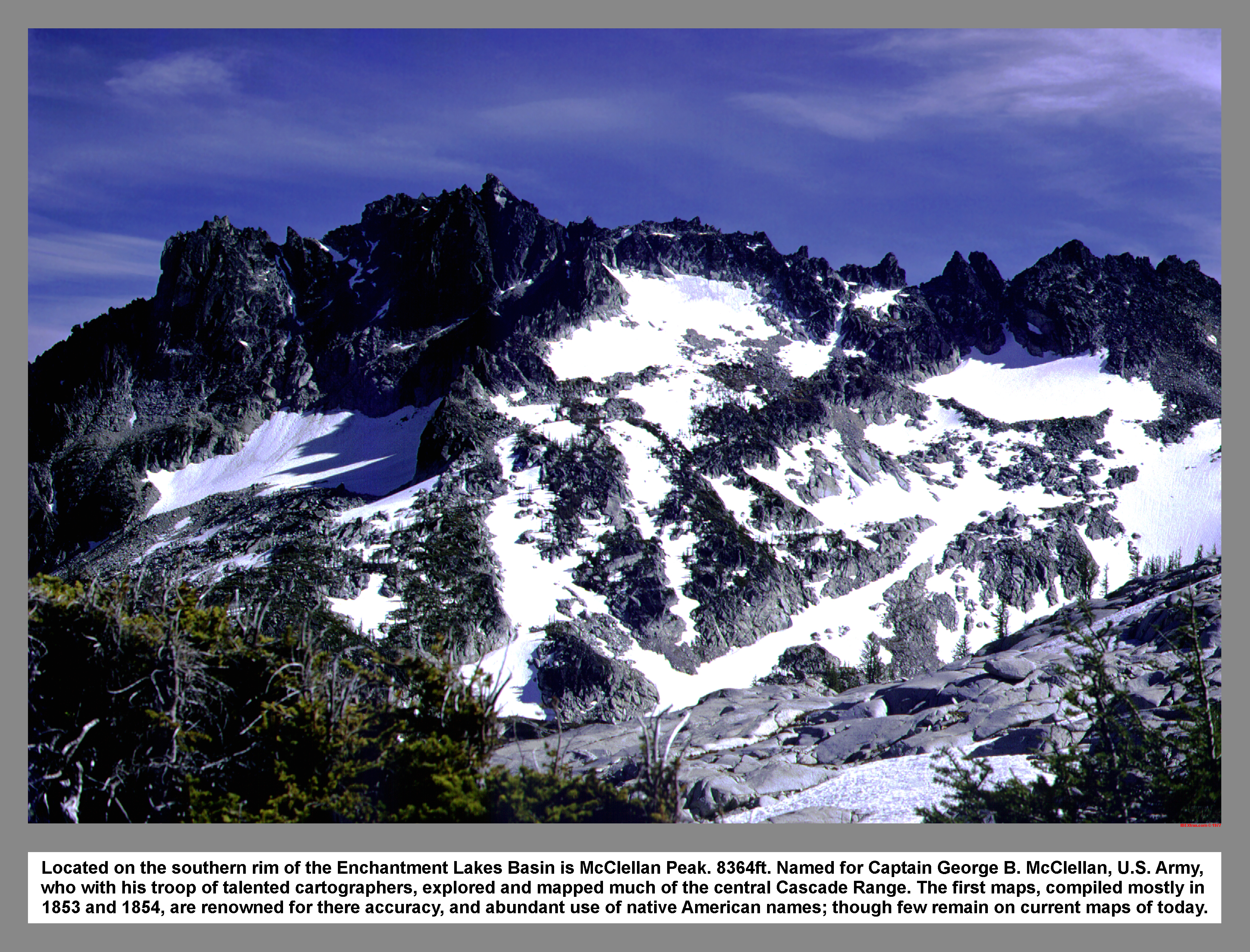
Located on the southern rim of the Enchantment Lakes Basin is McClellan Peak. 8364ft. Named for Captain George B. McClellan, U.S. Army, who with his troop of talented cartographers, explored and mapped much of the central Cascade Range. The first maps, compiled mostly in 1853 and 1854, are renowned for there accuracy, and abundant use of native American names; though few remain on current maps of today.
05 102 Tamarack Trees Shield Lk John P
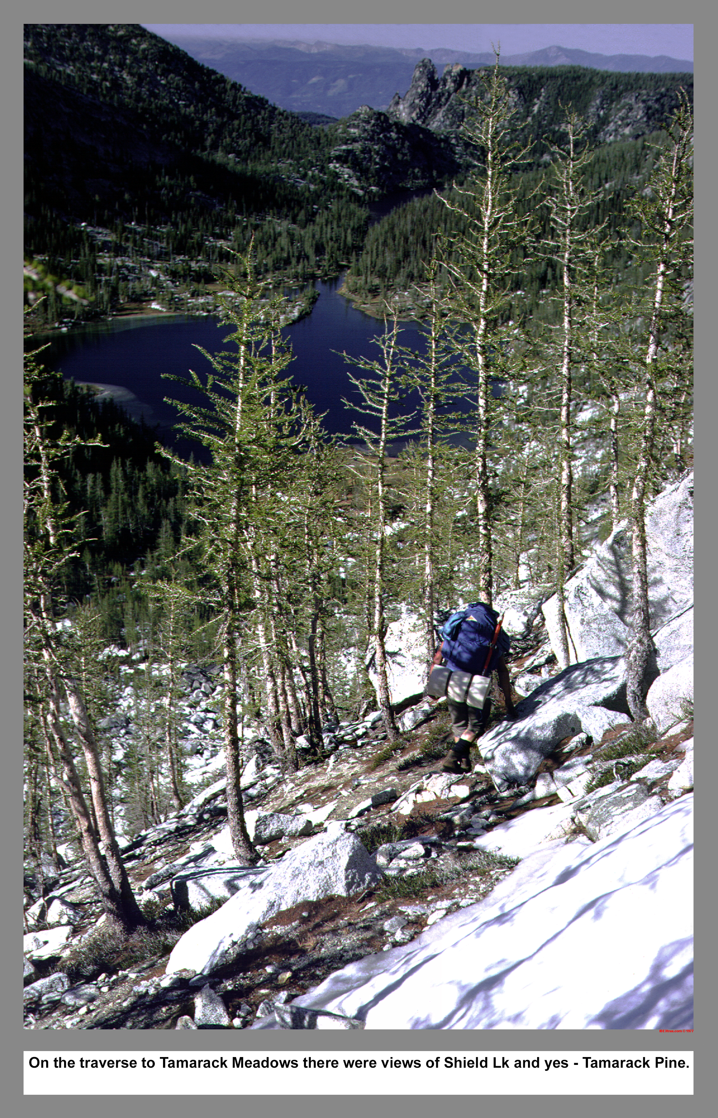
On the traverse to Tamarack Meadows there were views of Shield Lake and yes . . Tamarack Pine.
05 103 John P in Tamarack Meadows The High Priest
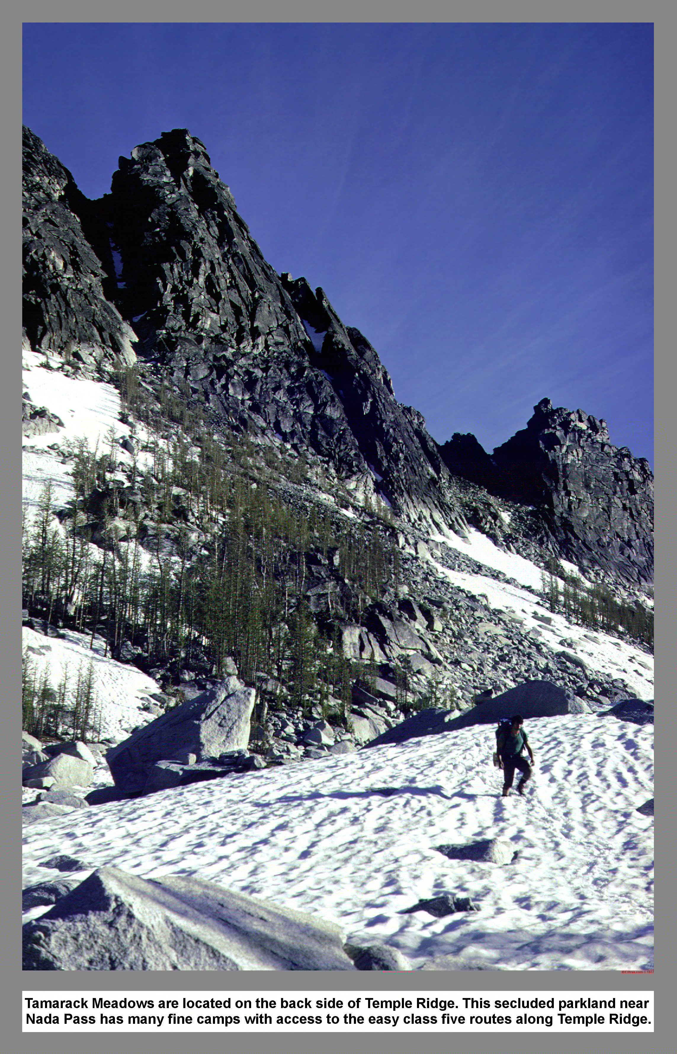
Tamarack Meadows are located on the back side of Temple Ridge. This secluded parkland near Nada Pass has many fine camps with access to the easy class five routes along Temple Ridge.
05 108 Warren belay on N face High Priest
THE CASCADE ALPINE GUIDE Climbing and high routes: Fred Becky; First edition 1974; the route description reads: THE HIGH PRIEST est. 8240' (W Pk of Mt Temple) North Face Route: First ascent by Richard McGowan, Don (Claunch) Gordon, and two others in 1954. Begin directly above Tamarack Meadows, where there is a rock rib from the face. The route is on broken, sound rock; Class 4 with several protection pitons.
05 109 Rudi M watches John P rappel High Priest
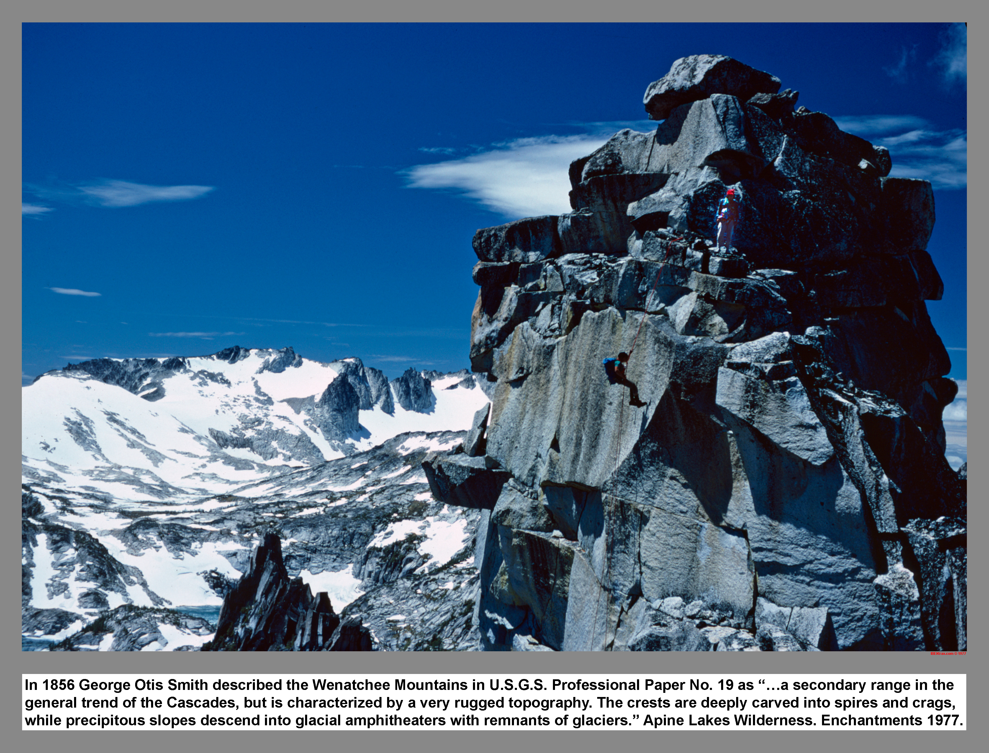
In 1856 George Otis Smith described the Wenatchee Mountains in U.S.G.S. Professional Paper No. 19 as "�a secondary range in the general trend of the Cascades, but are characterized by the same rugged topography. The mountains crests are deeply carved into spires and crags, while precipitous slopes descend into glacial amphitheaters where remnants of glaciers still persist." Alpine Lks Wilderness; Enchantments
05 110 McClellan Ridge Little Annapurna from Temple Ridge
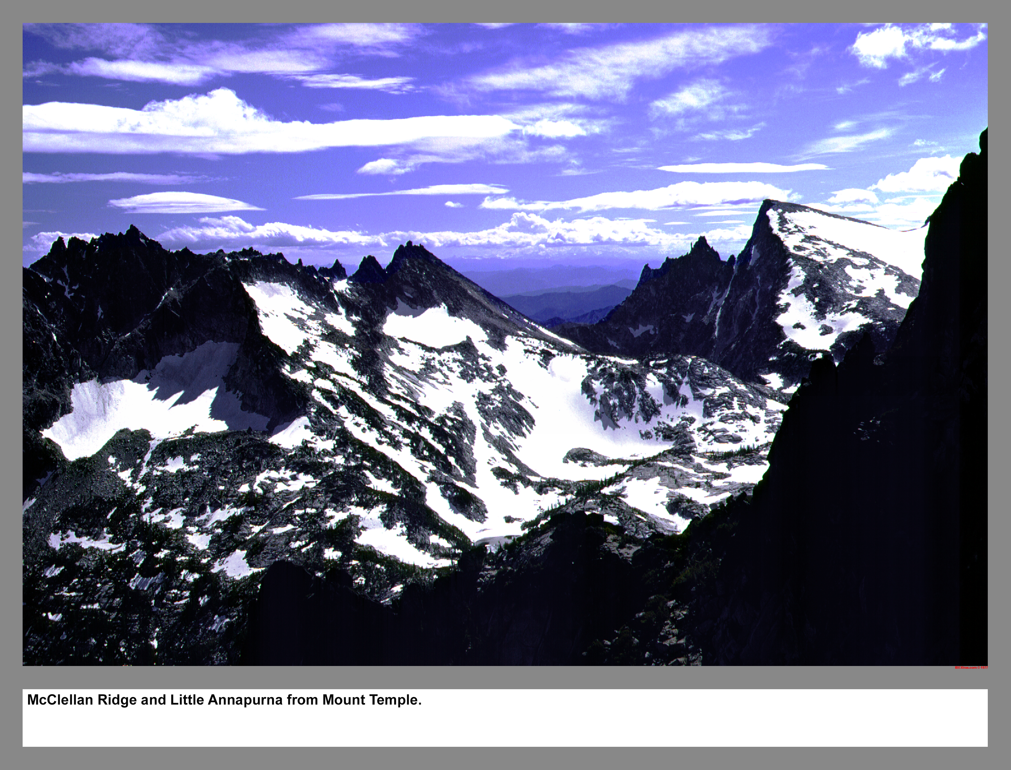
McClellan Ridge and Little Annapurna from Mount Temple.
05 111 Tamarack Meadows below The High Priest
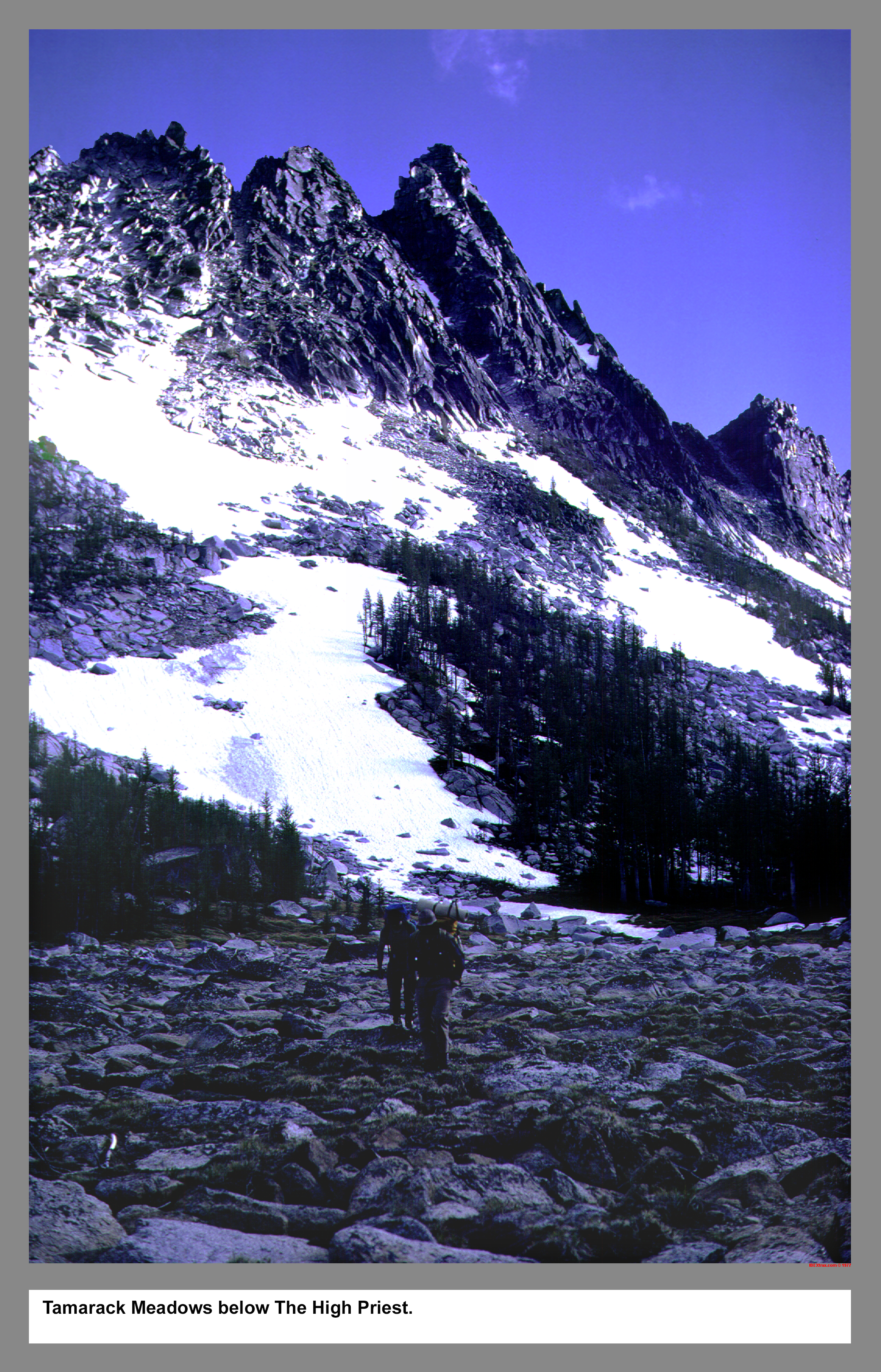
Tamarack Meadows below The High Priest.
05 112 Musky Pass Temple Ridge John P
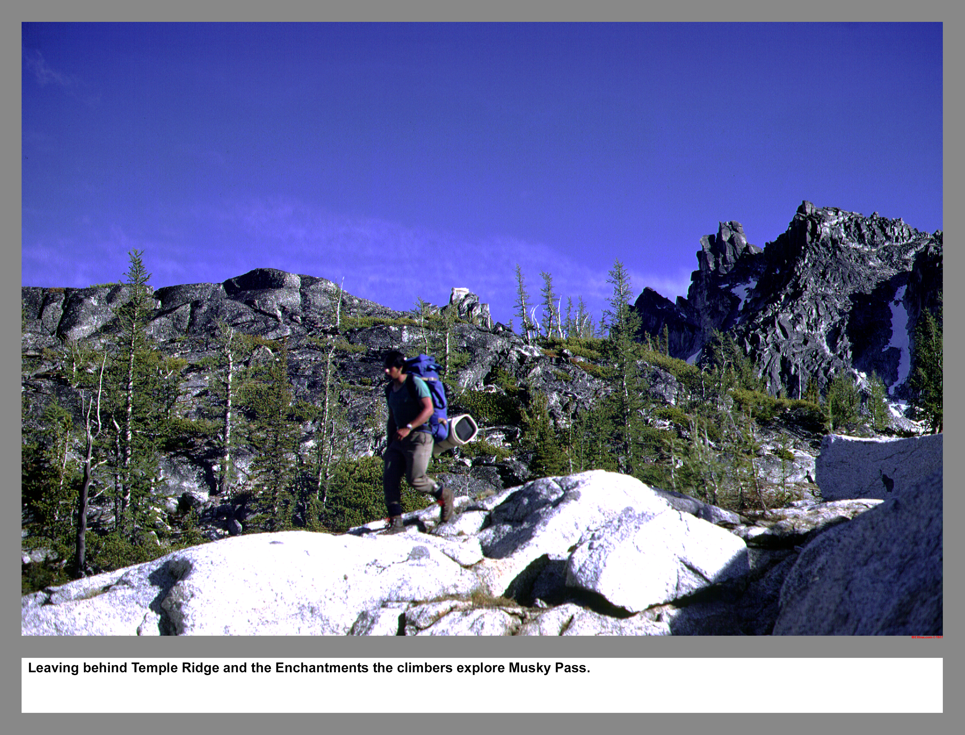
Leaving behind Temple Ridge and the Enchantments the climbers explore Musky Pass.
05 113 Rudi M and John P near Musky Pass Temple Ridge
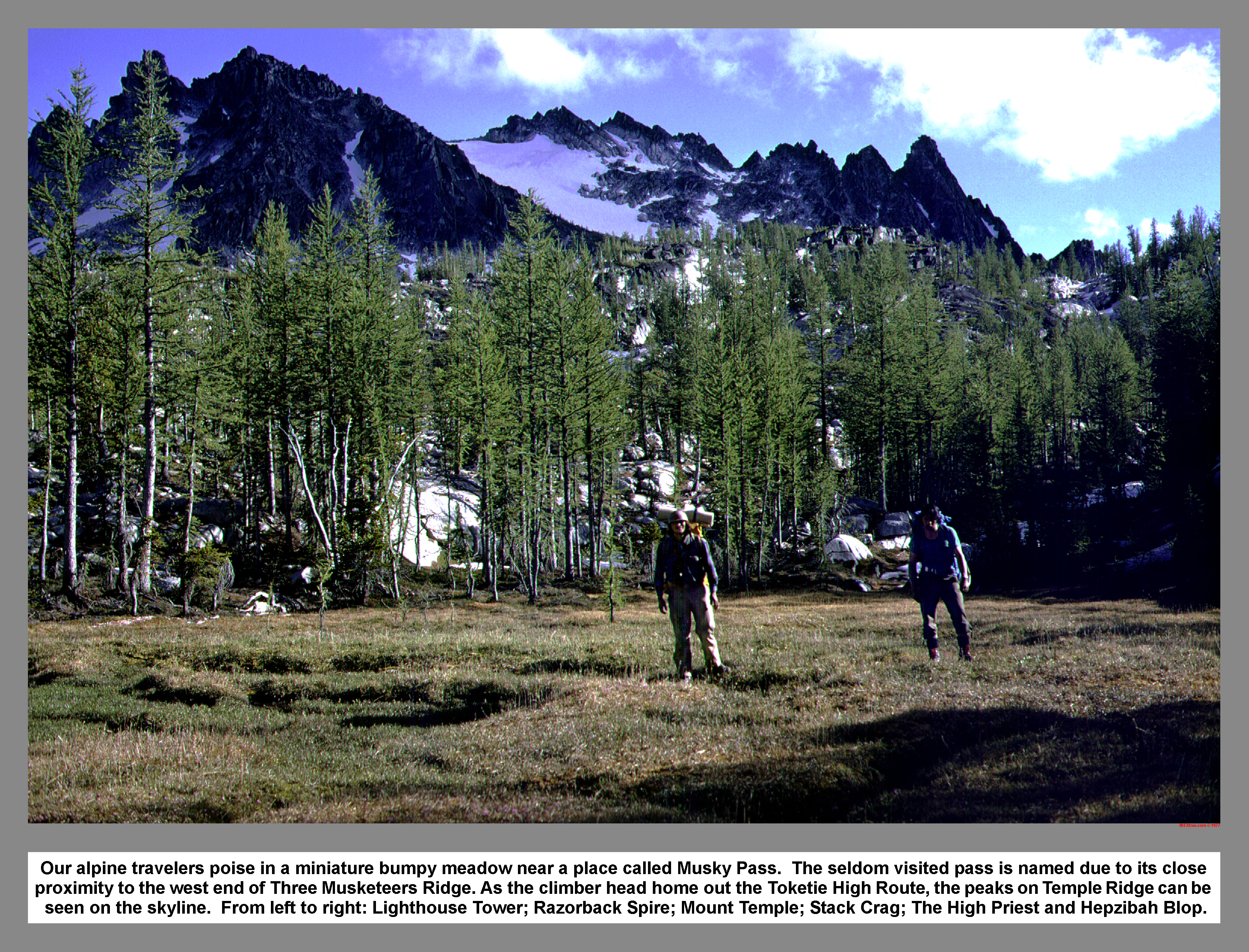 Our alpine travelers poise in a miniature bumpy meadow near a place called Musky Pass. The seldom visited pass is named due to its close proximity to the west end of Three Musketeers Ridge. As the climbers head home out the Toketie High Route, the peaks on Temple ridge can be seen on the skyline. From left to right: Lighthouse Tower; Razorback Spire; The Temple; Stack Crag; The High Priest and Hepzibah Blop.
05 114 looking down the Toketie Pond route
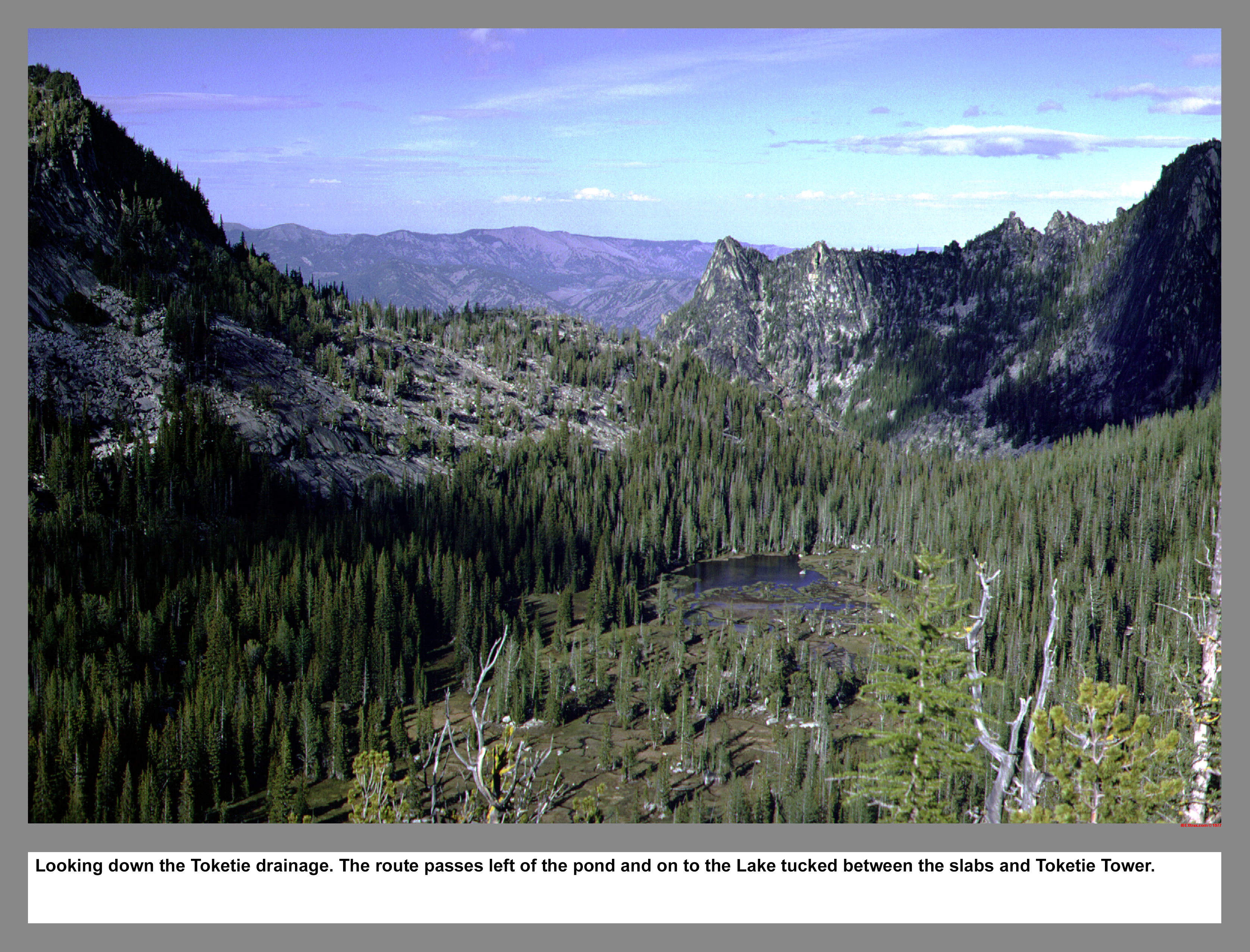
Looking down the Toketie drainage. The route passes left of the pond and on to the Lake tucked between the slabs and Toketie Tower.
05 115 Toketie Lk Three Musketeers Tower
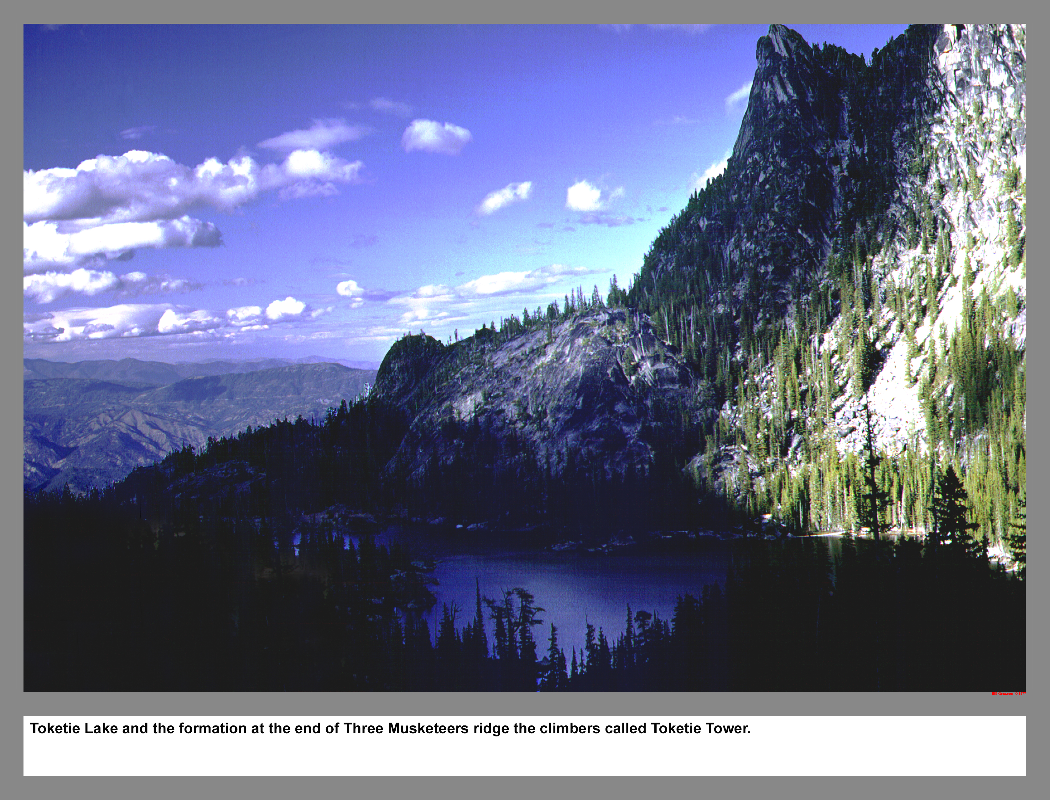
Toketie Lake and the formation at the end of Three Musketeers ridge the climbers called Toketie Tower.
05 117 Rudi M on Outer Space Route on Snow Creek Wall
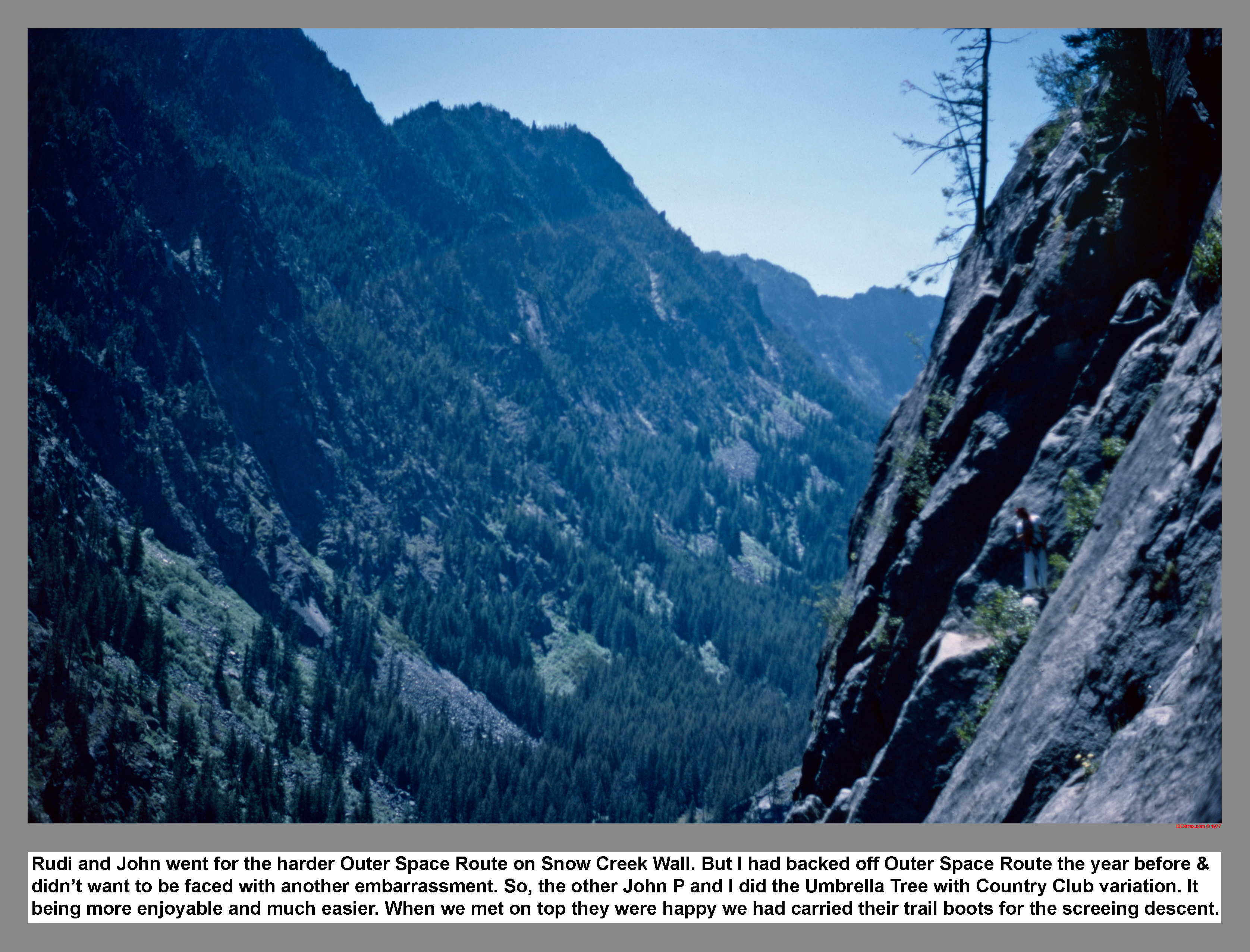
Rudi and John went for the harder Outer Space Route on Snow Creek Wall. But I had backed off Outer Space Route the year before and didn't want to be faced with another embarrassment. So, the other John P and I did the Umbrella Tree with Country Club variation. It being more enjoyable and much easier. When we met on top they were happy we had brought their trail boots for the South wall screeing descent.
|
|
|
|
|
|
This site created and maintained by THE IBEX - Page last revised:
|
|