
|
|
IBEXtrax.com - Cascade Mountains of Washington StateMount Rainier Park |
|
|
05 001 Carbon Glacier John B Rudi M
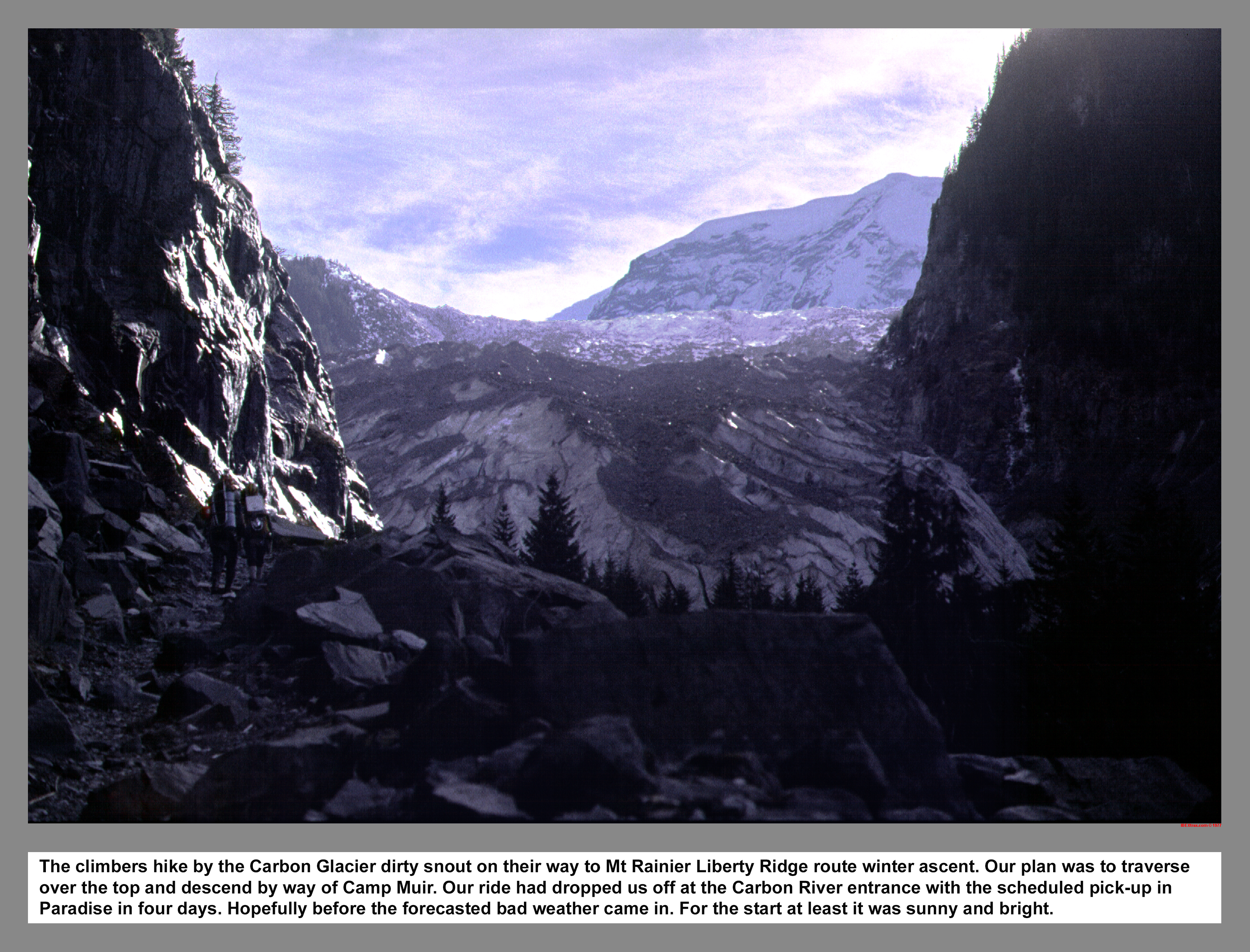
The climbers hike by the Carbon Glacier dirty snout on their way to Mount Rainier Liberty Ridge route winter ascent. Our plan was to traverse over the top and descend by way of Camp Muir. Our ride dropped us off at the Carbon River entrance with the scheduled pick-up at Paradise in four days before the forecasted weather turned.
05 002 Liberty Ridge route Mt Rainier John B
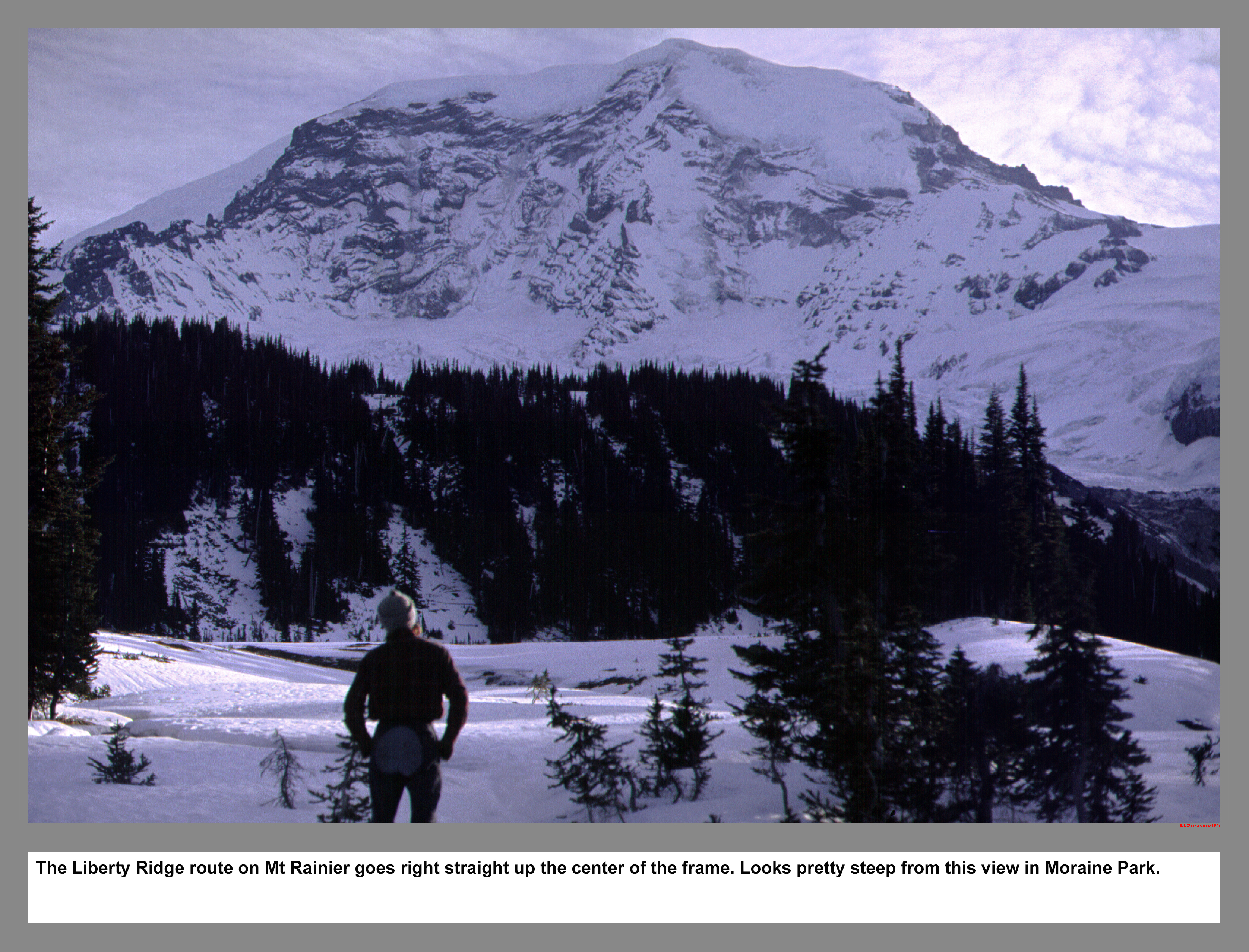
The Liberty Ridge route on Mt Rainier goes right straight up the center of the frame. Looks pretty steep from this view in Moraine Park.
05 003 OP Dusk Moraine Park Mt Rainier John B
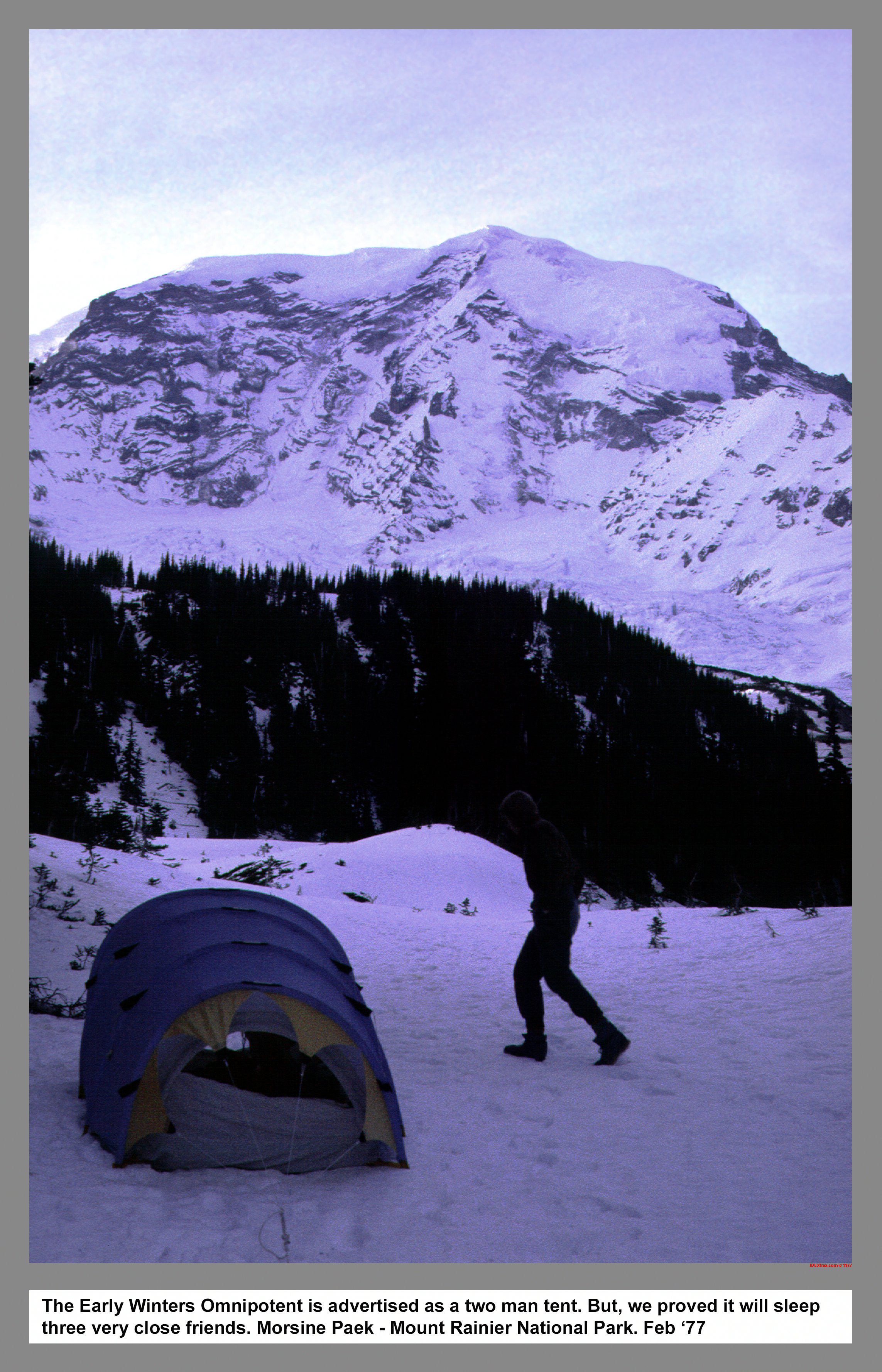
The Early Winters Omnipotent is advertised as a two man tent. But, we proved it will sleep three very close friends.
05 004 Rudi M John B Moraine Park sunrise Mt Rainier 1977
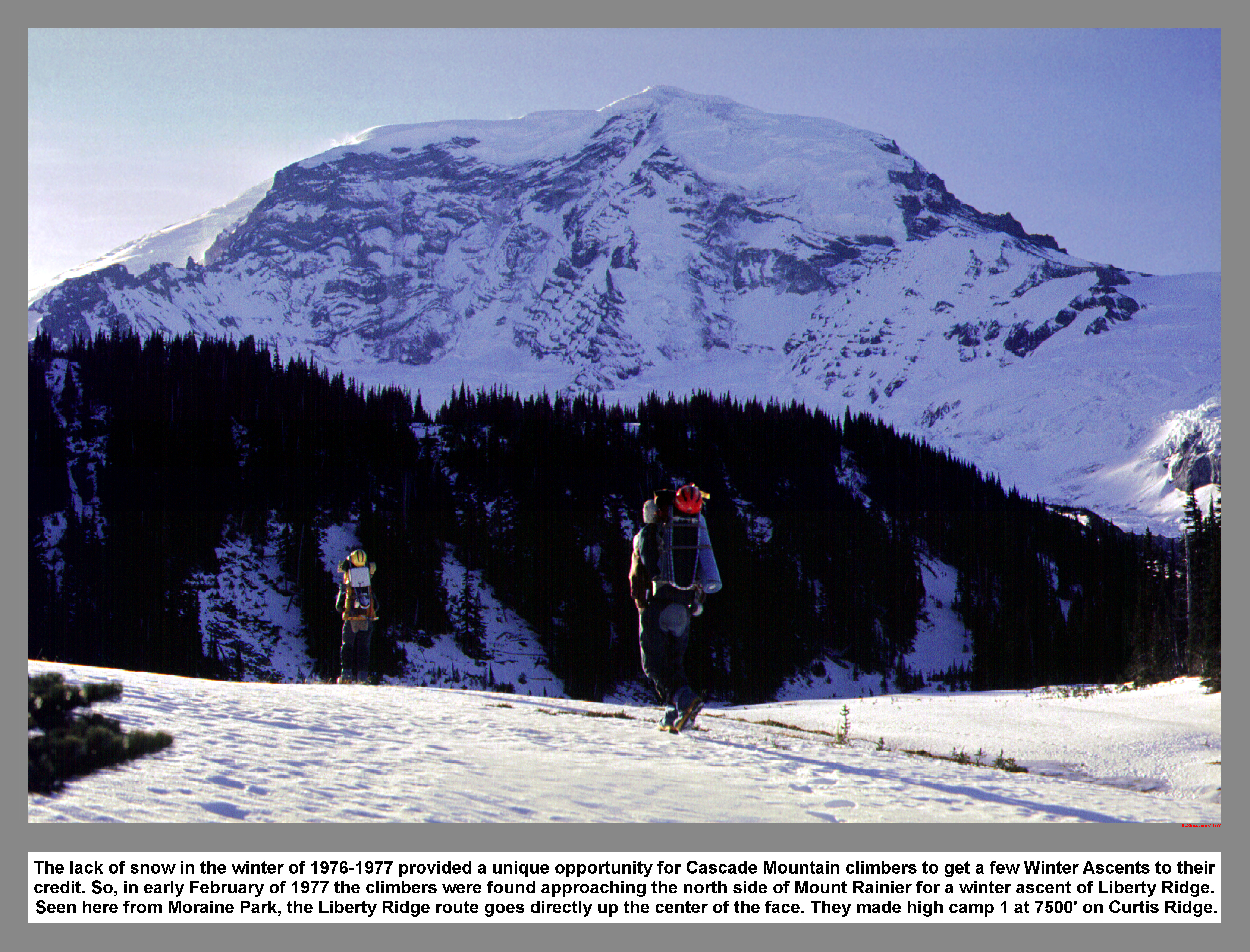
The lack of snow in the winter of 1976-1977 provided a unique opportunity for Cascade Mountain climbers to get a few Winter Ascents to their credit. So, in early February of 1977 the climbers were found approaching the north side of Mount Rainier for a winter ascent of Liberty Ridge. Seen here from Moraine Park, the Liberty Ridge route goes directly up the center of the face. They made high camp 1 at 7500' on Curtis Ridge.
05 006 Carbon Glacier Serac John B Rudi M
The Carbon Glacier and a volcanic dike are having a fight near pt7783 on Curtis Ridge. For now, the Dike is making the Glacier rise up into huge Serac blocks. But, for as long as snow slides down off Willis Wall, eventually the Glacier will win and grind down the Dike into dust.
05 007 John B & Rudi M on upper Carbon Glacier
The route across the Carbon Glacier was a maze of huge ice blocks and interlaced crevasses. The climbers first tried to climb over the tops of the blocks. But, they ended up route finding along the questionable floors of the cold deep crevasses. Occasionally they would have to climb out to get their bearings and may times they found dead ends. It took most of the day just to reach the foot of Liberty Ridge. Mt. Rainier Park.
05 008 John B demonstrates the Pussy Foot method in crevasses
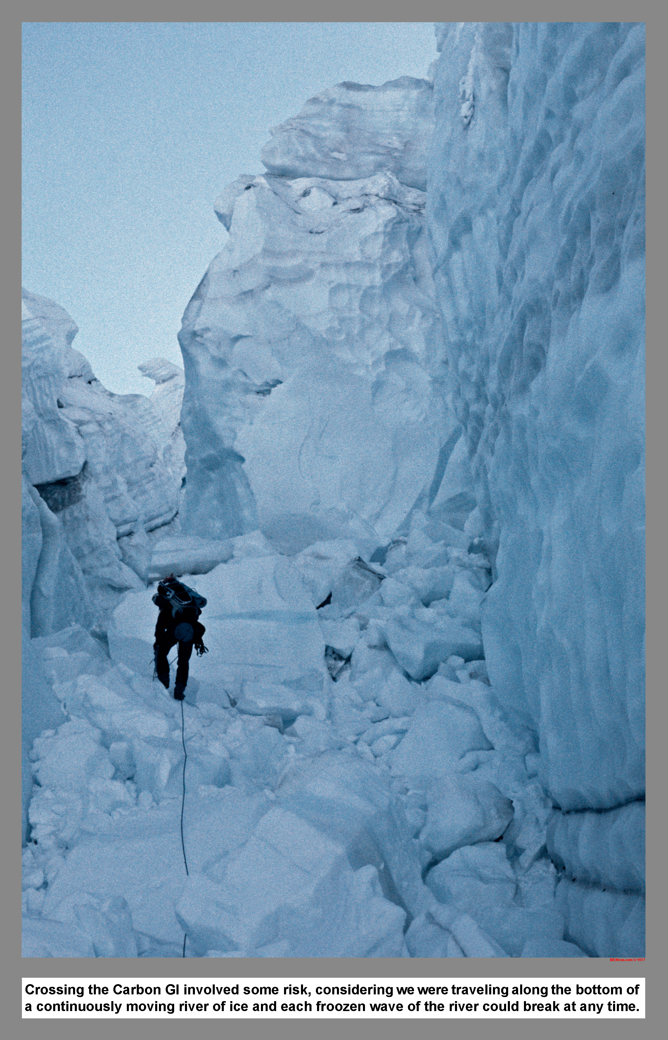
Crossing the Carbon Glacier involved some risk, considering we were traveling along the questionable bottom of a continuously moving river of ice and each froozen wave of the river could break at any time.
05 009 A crumbly rock buttress on Liberty Ridge at dusk
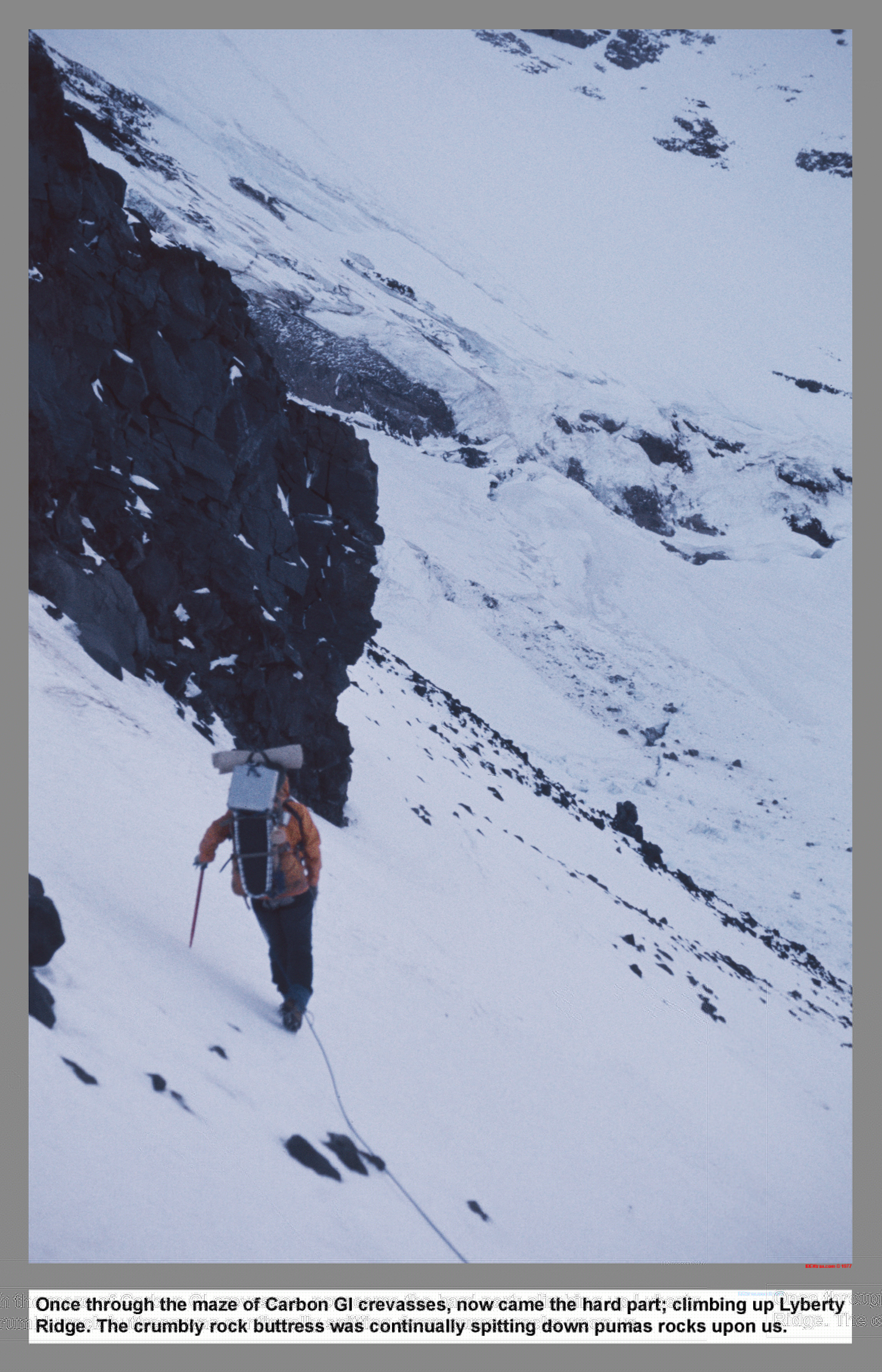
Once through the maze of Carbon Glacier crevasses, now came the hard part; climbing up Lyberty Ridge. The crumbly rock buttress was continually spitting down pumice rocks upon us.
05 010 Thumb Rock camp on Liberty Ridge Mt Rainier
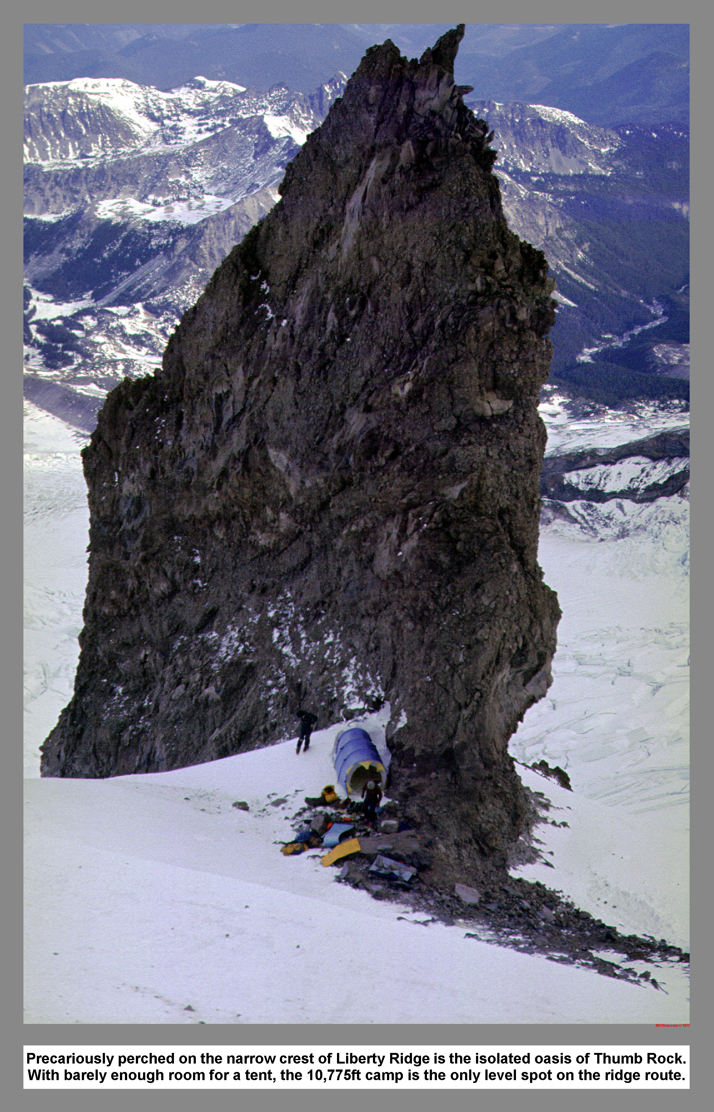
Precariously perched on the narrow crest of Liberty Ridge is the isolated oasis of Thumb Rock. With barely enough room for a tent, the 10,775ft camp is the only level spot on the ridge route.
05 013 John B chess shark smile snowstorm
After bailing from 12,000 ft on Liberty Ridge due to the approaching storm or maybe it was another unspoken reason that sounded rather chickenish, the climbers were sequestered to the confines of the tent while the snowstorm passed. Lessons learned while waiting out the storm: first don't eat lentils and don't bet against the one that brings the chess set. That would be the one with the chess shark smile.
05 015 Mt Rainier from upper Moraine Park
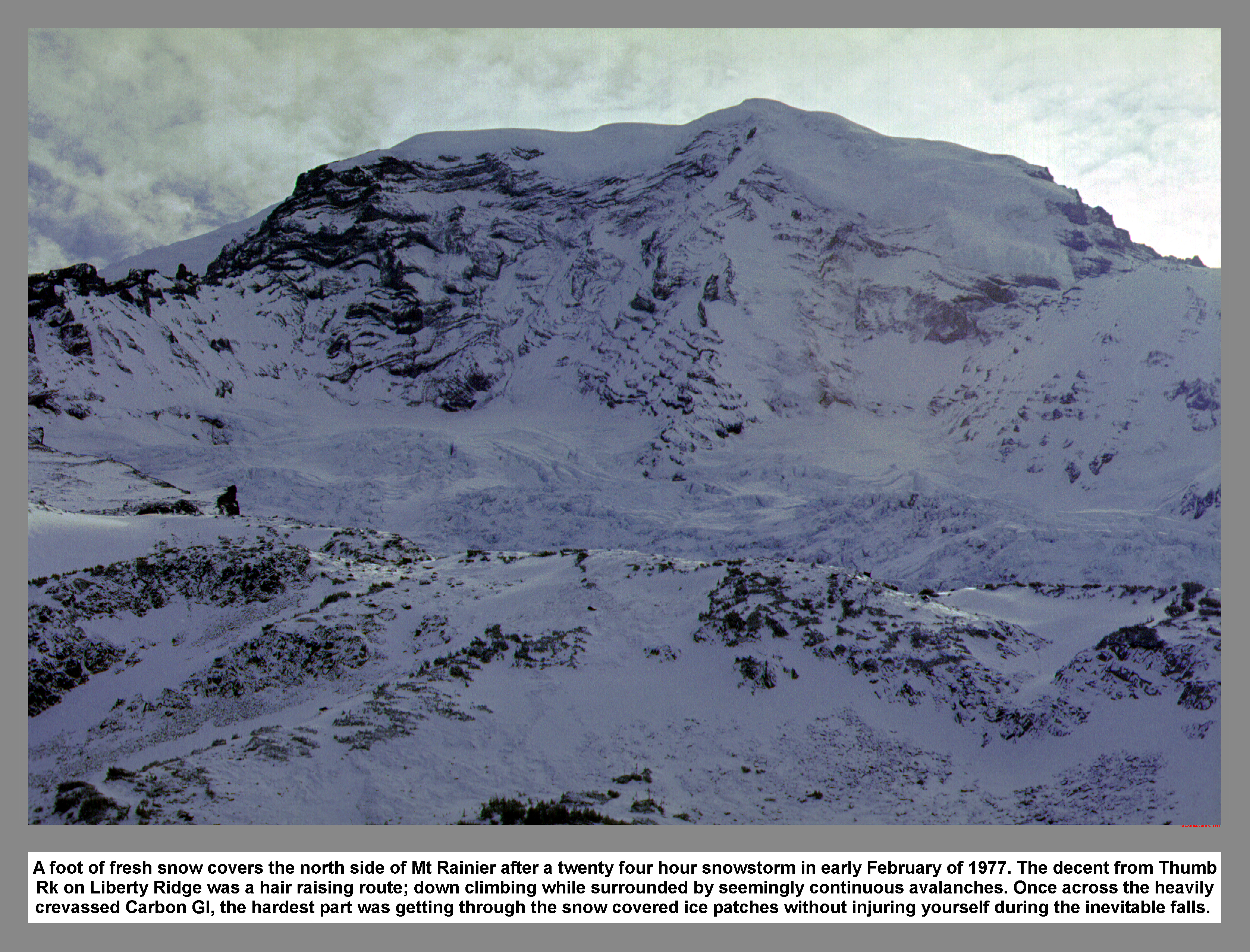
A foot of fresh snow covers the north side of Mt Rainier after a twenty four hour snowstorm in early February of 1977. The decent from Thumb Rk on Liberty Ridge was a hair raising route; down climbing while surrounded by seemingly continuous avalanches. Once across the heavily crevassed Carbon Gl, the hardest part was getting through the snow covered ice patches without injuring yourself during the inevitable falls.
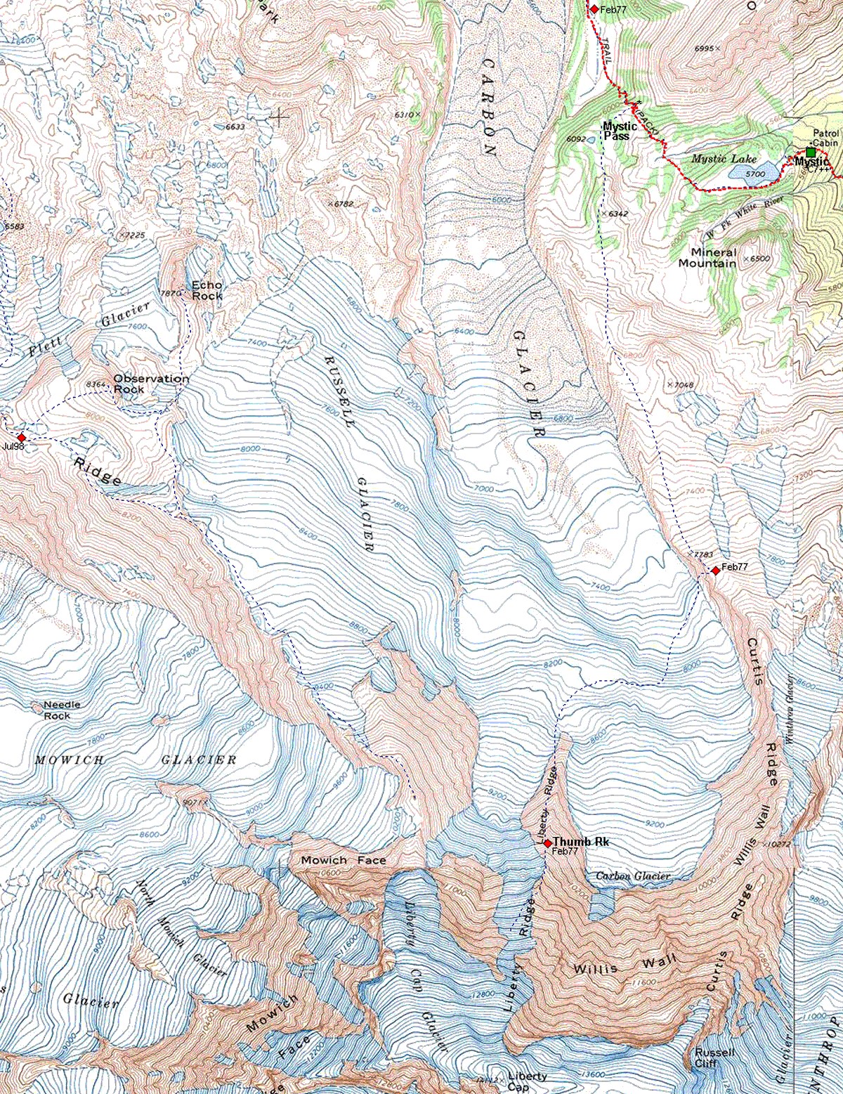
05 015m Mt Rainier Liberty Ridge Map
|
|
|
|
|
|
This site created and maintained by THE IBEX - Page last revised:
|
|