
|
|
IBEXtrax.com - Cascade Mountains of Washington StateAlpine Lakes Wilderness, Wenatchee Forest |
|
|
04 125 Road to Cannon Mtn John B
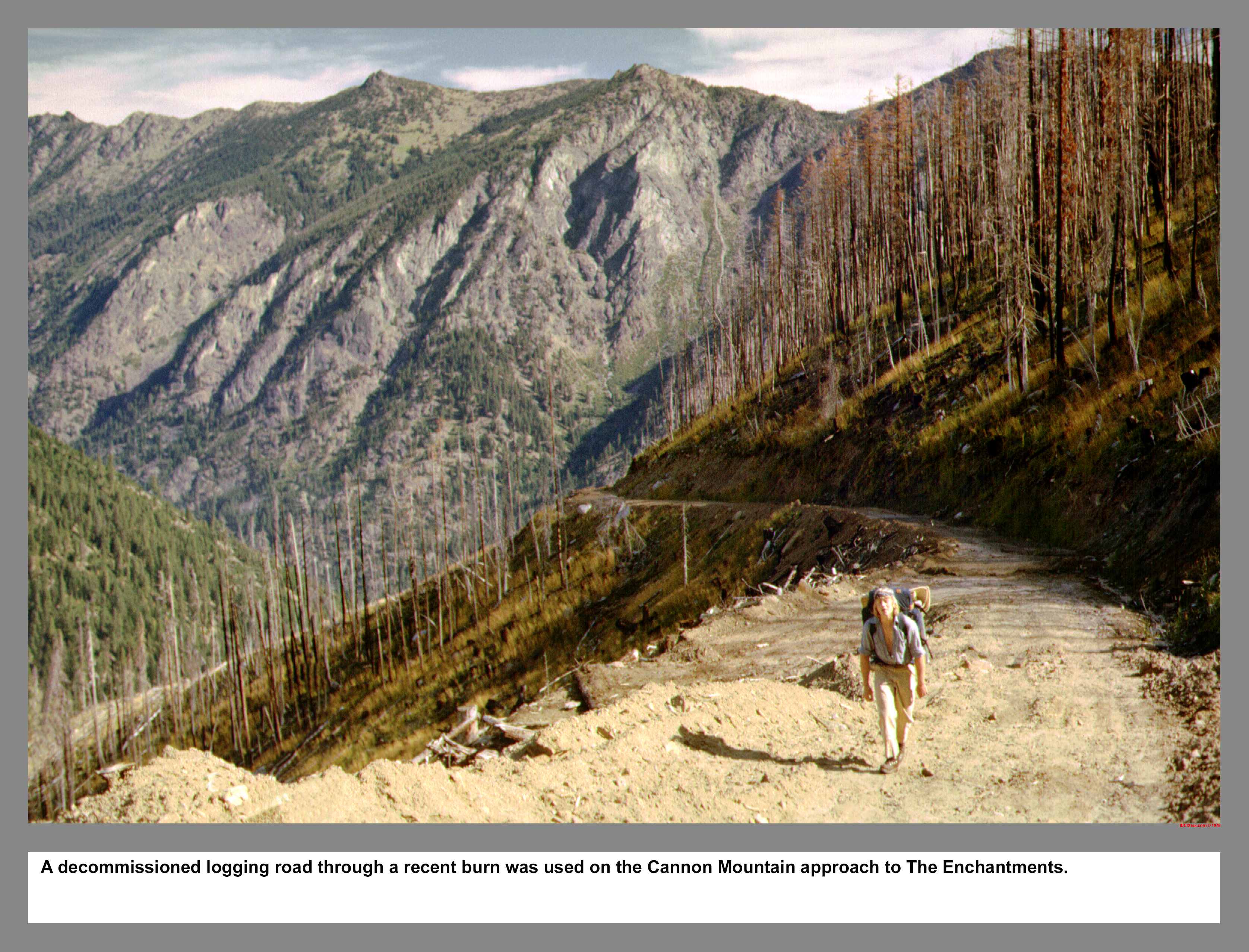
A decommissioned logging road through a recent burn was used on the Cannon Mountain approach to The Enchantments.
04 126 Stuart & Mountaineers Ridge on Cannon Mtn
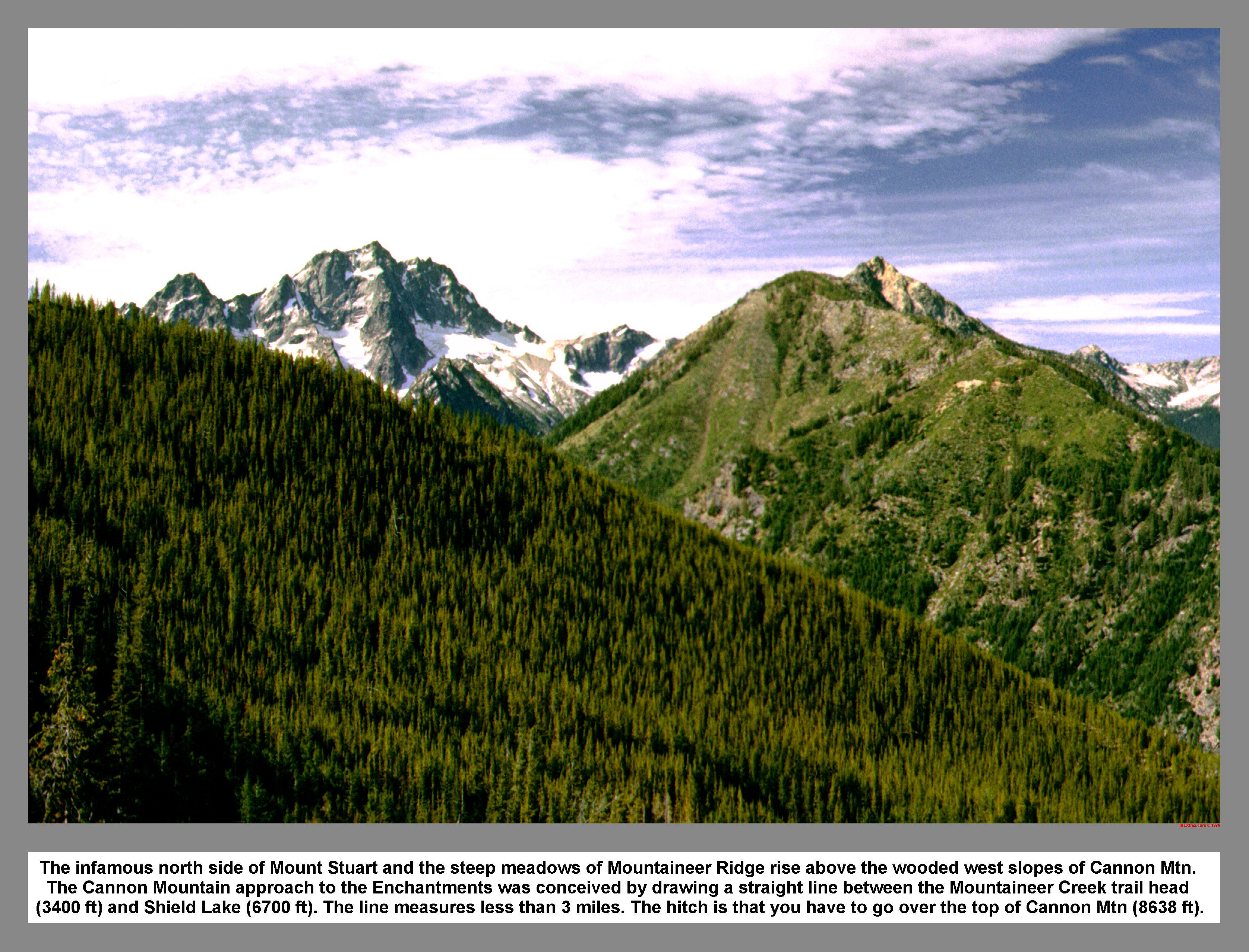
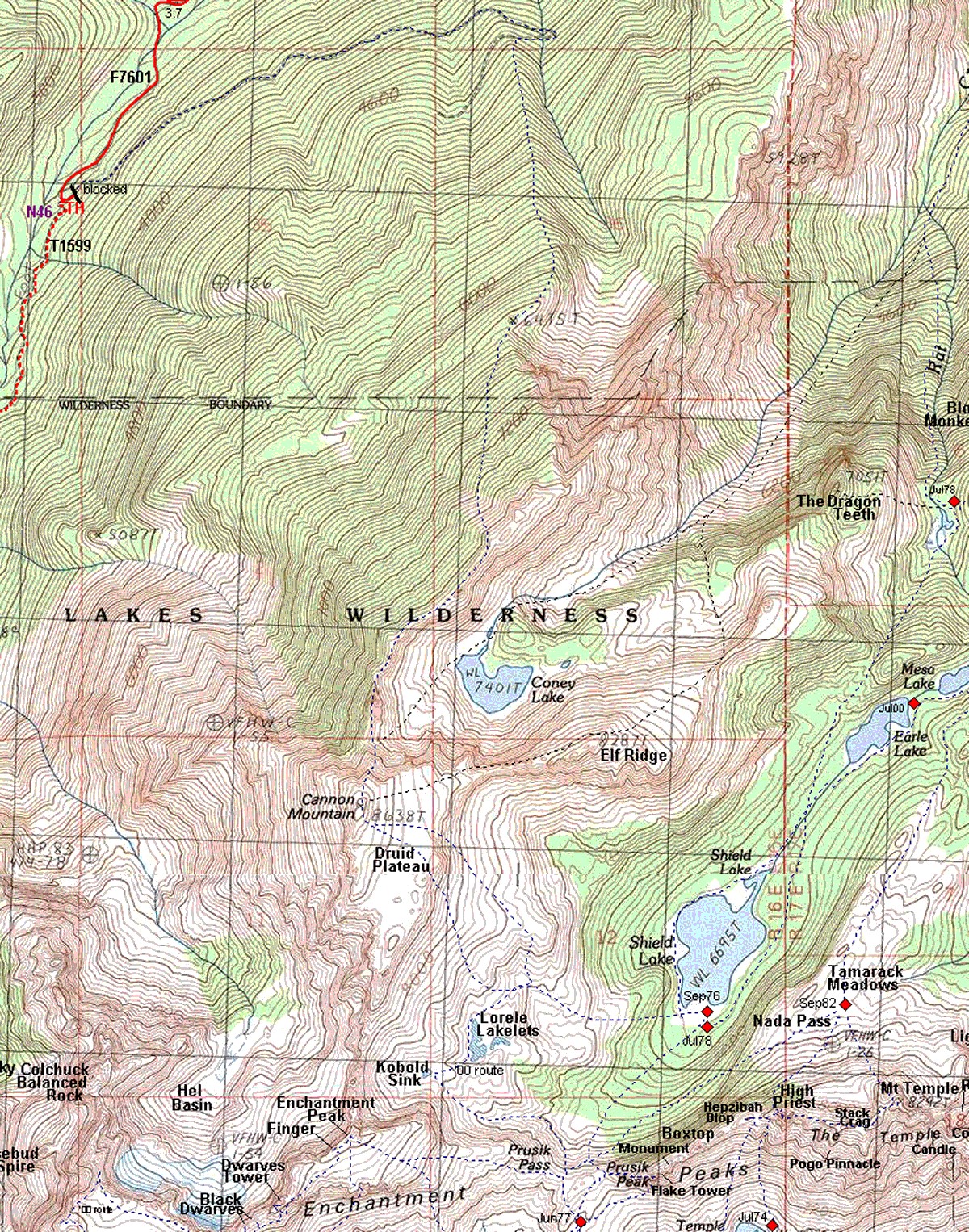
The infamous north side of Mount Stuart and the steep meadows of Mountaineer Ridge rise above the wooded west slopes of Cannon Mtn. The Cannon Mountain approach to the Enchantments was conceived by drawing a straight line between the Mountaineer Creek trail head (3400 ft) and Shield Lake (6700 ft). The line measures less than 3 miles. The hitch is that you have to go over the top of Cannon Mtn (8638 ft).
04 127 Mt Stuart and John B on the Shroom
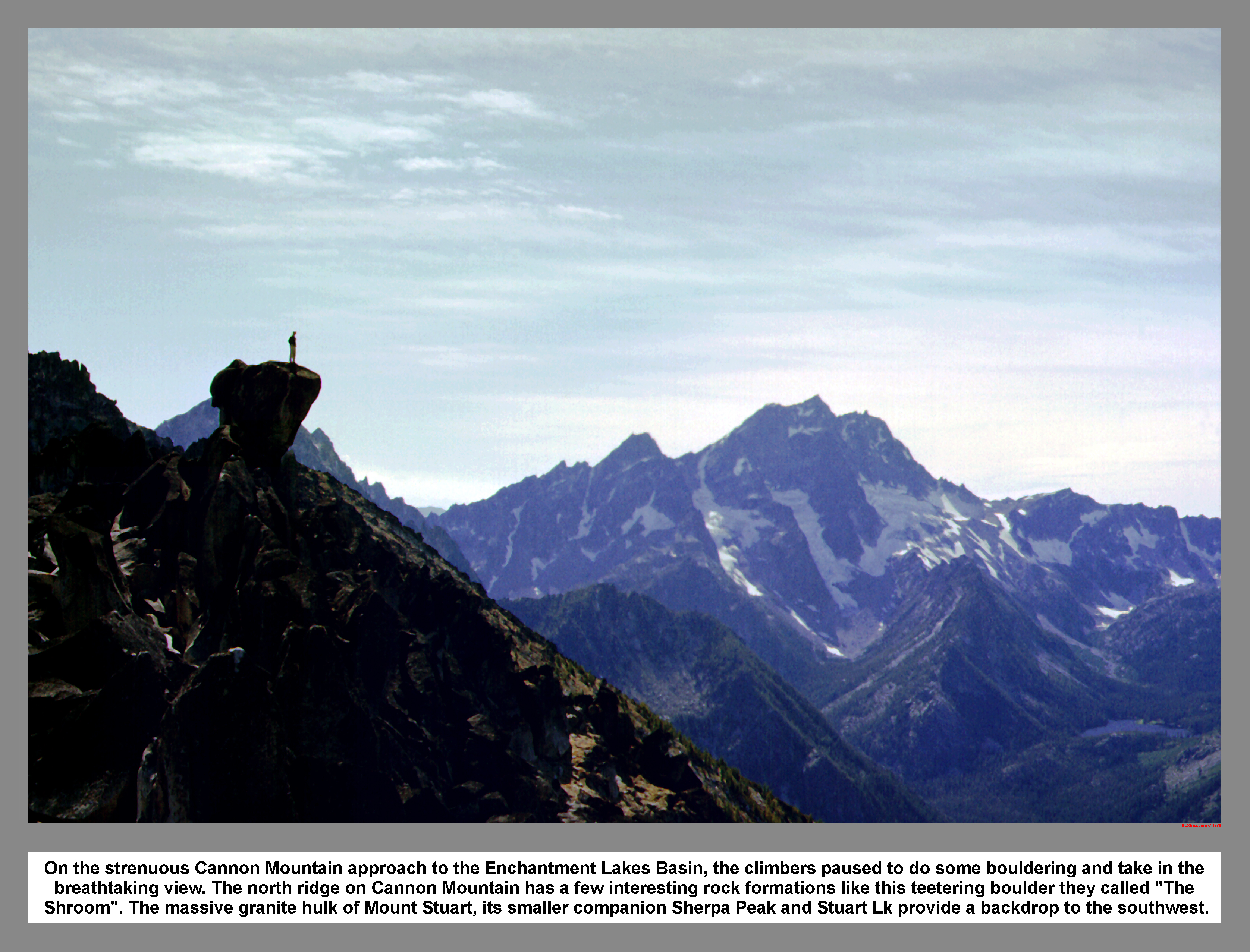
On the strenuous Cannon Mountain approach to the Enchantment Lakes Basin, the climbers paused to do some bouldering and take in the breathtaking view. The north ridge on Cannon Mountain has a few interesting rock formations like this teetering boulder they called "The Shroom". The massive granite hulk of Mount Stuart, its smaller companion Sherpa Peak and Stuart Lk provide a backdrop to the southwest.
04 128 Coney Lk and Cannon Mtn
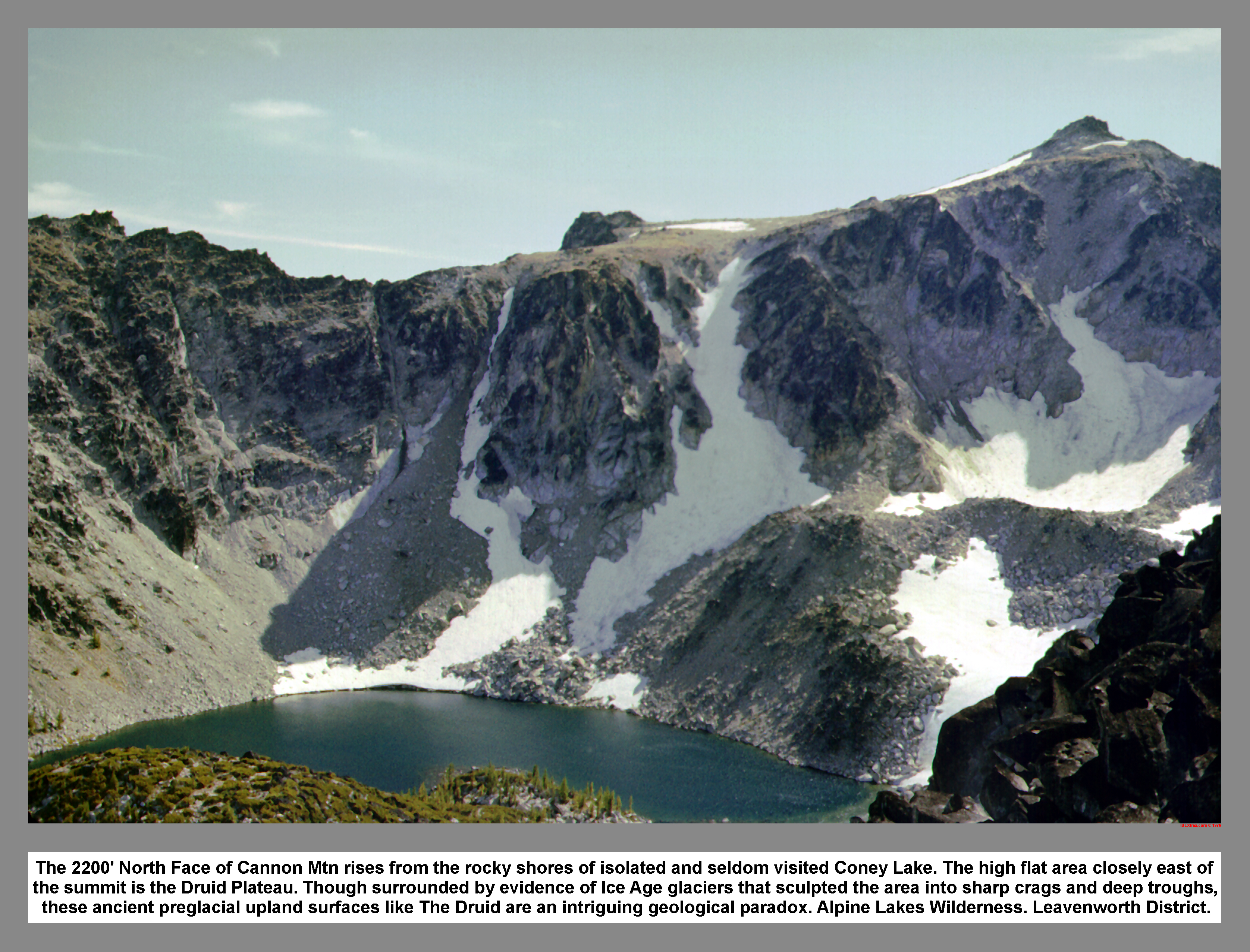
The 1200' North Face of Cannon Mtn rises from the rocky shores of isolated and seldom visited Coney Lake. The high flat area closely east of the summit is the Druid Plateau. Though surrounded by evidence of Ice Age glaciers that sculpted the area into sharp crags and deep troughs, these ancient preglacial upland surfaces like The Druid are an intriguing geological paradox. Alpine Lakes Wilderness. Leavenworth District.
04 129 Sun Across Druid Plateau John B
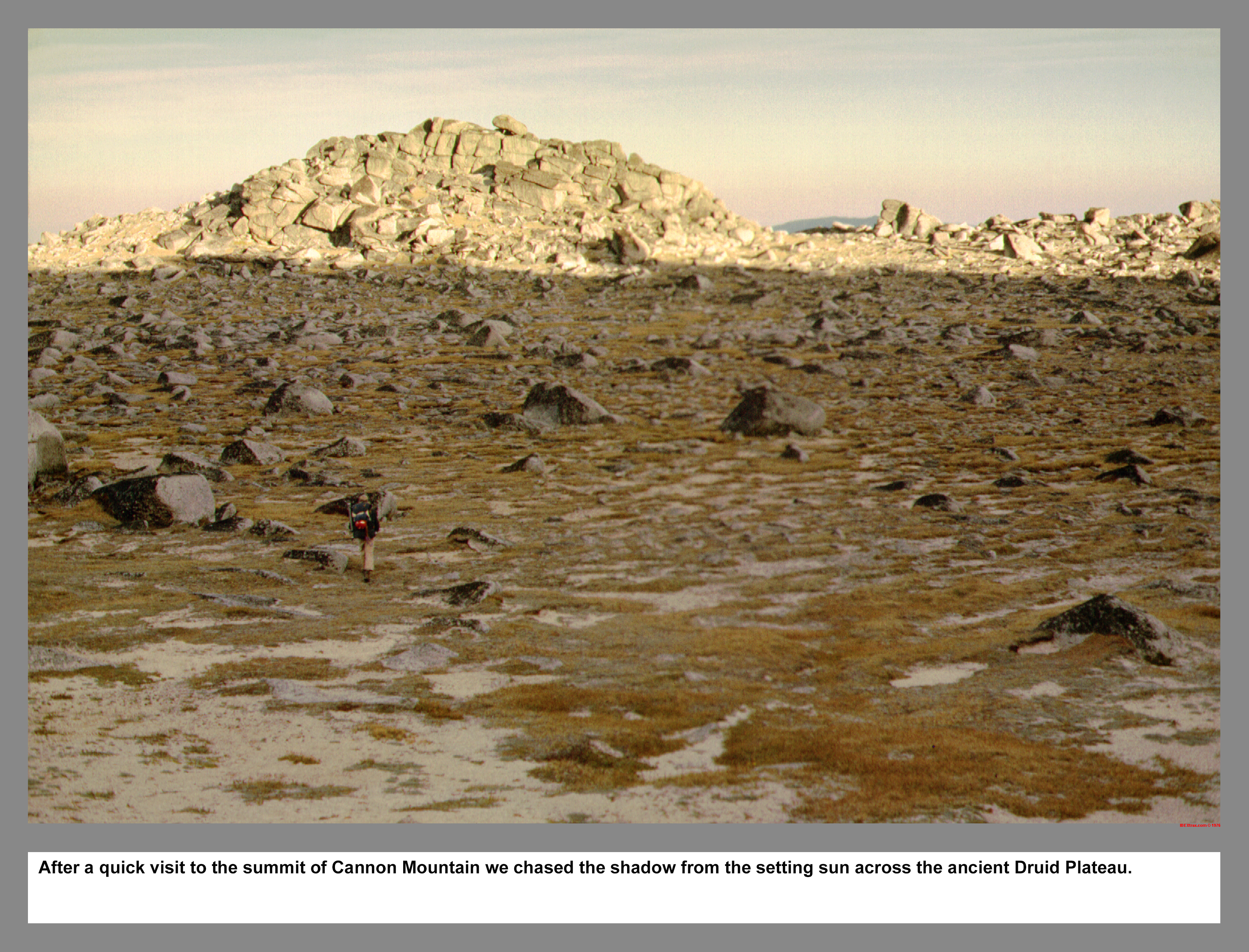
After a quick visit to the summit of Cannon Mountain we chased the shadow from the setting sun across the ancient Druid Plateau.
04 130 Sunset on Temple Ridge from Druid
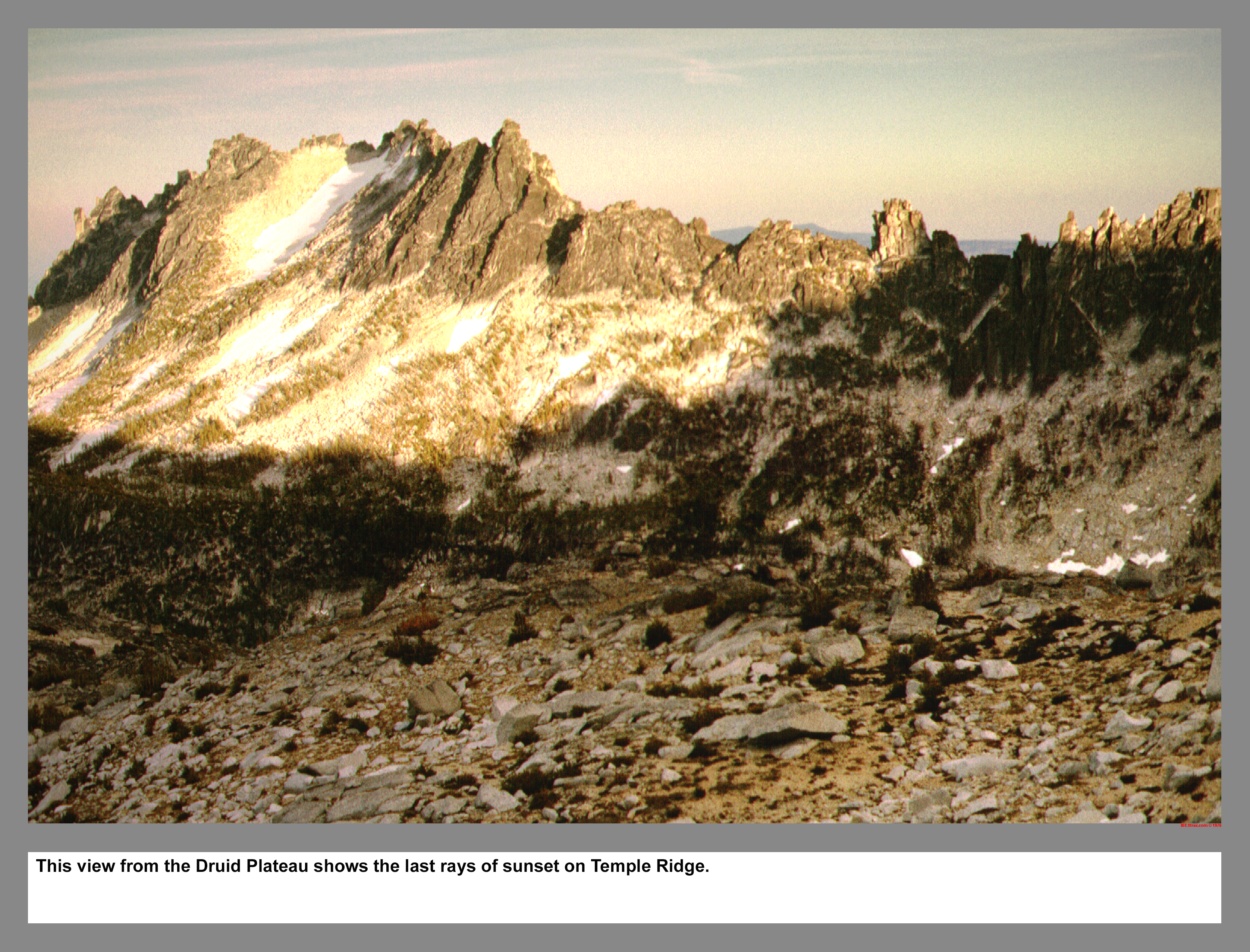
This view from the Druid Plateau shows the last rays of sunset on Temple Ridge.
04 131 Shield Lake and Three Musketeers Ridge
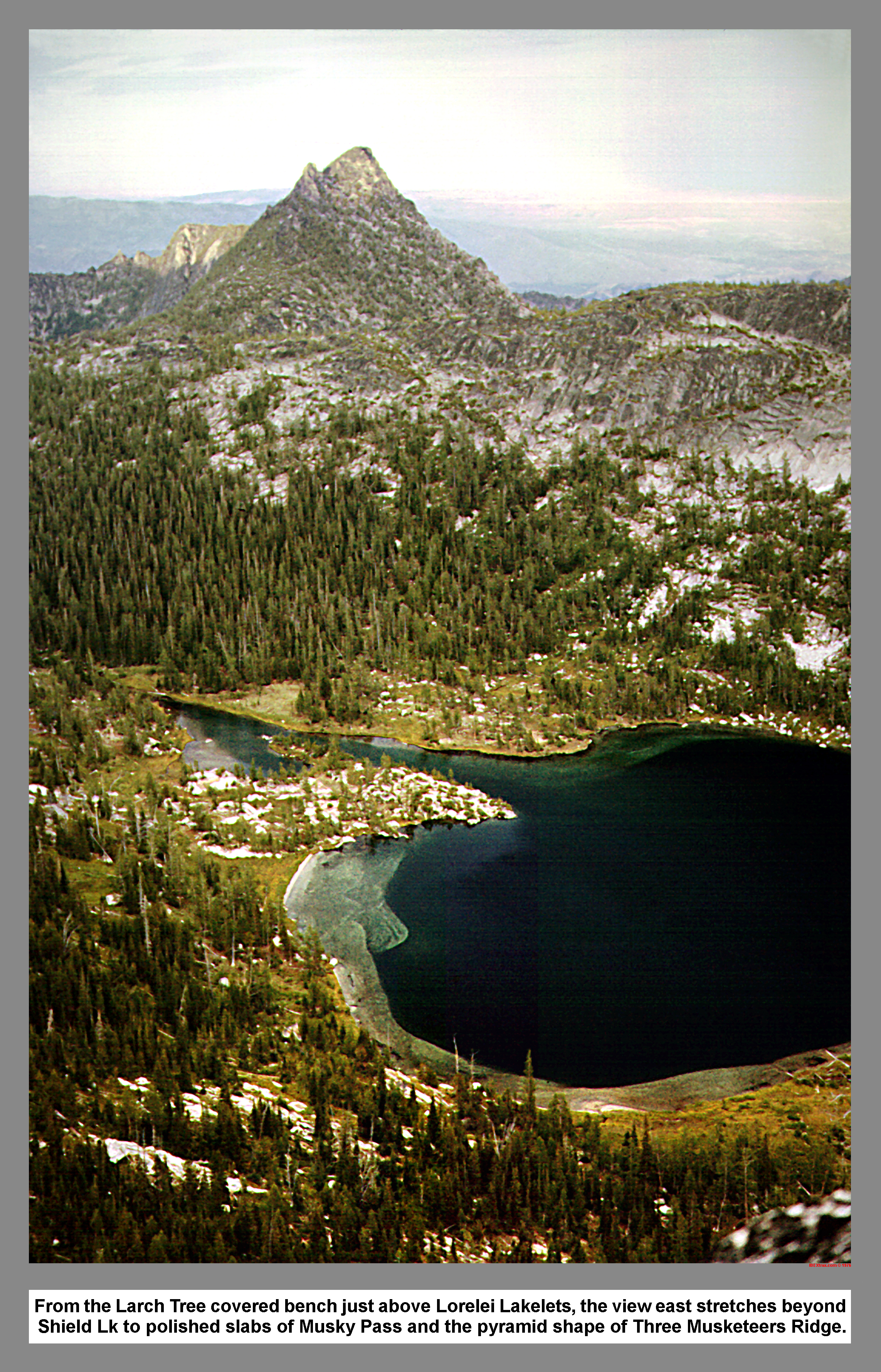
From the Larch Tree covered bench just above Lorelei Lakelets, the view east stretches beyond Shield Lk to polished slabs of Musky Pass and the pyramid shape of Three Musketeers Ridge.
04 134 West Ridge of Prusik Peak John B
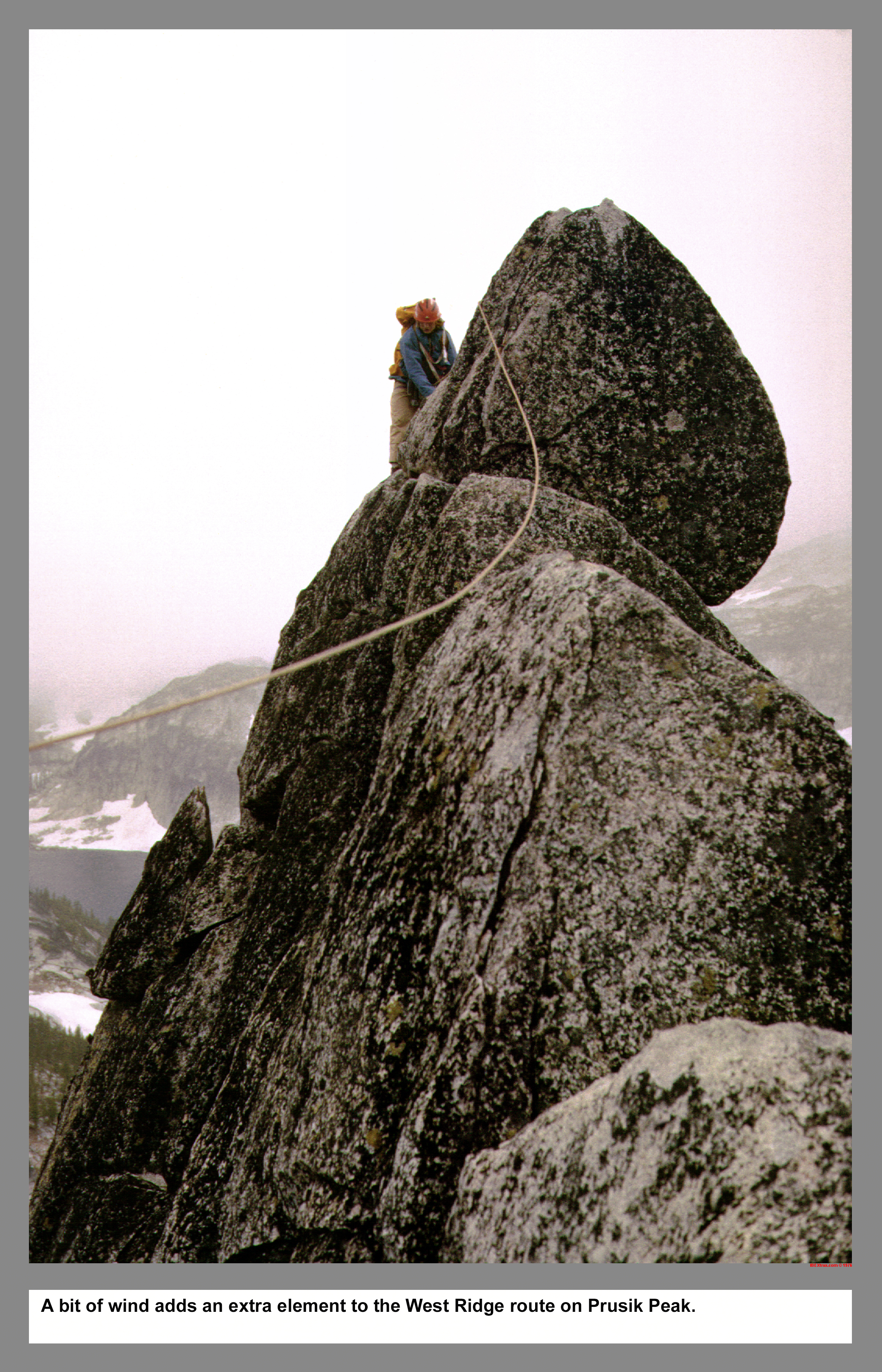
A bit of wind adds an extra element to the West Ridge route on Prusik Peak.
04 135 Rudi M rappels off Prusik Peak
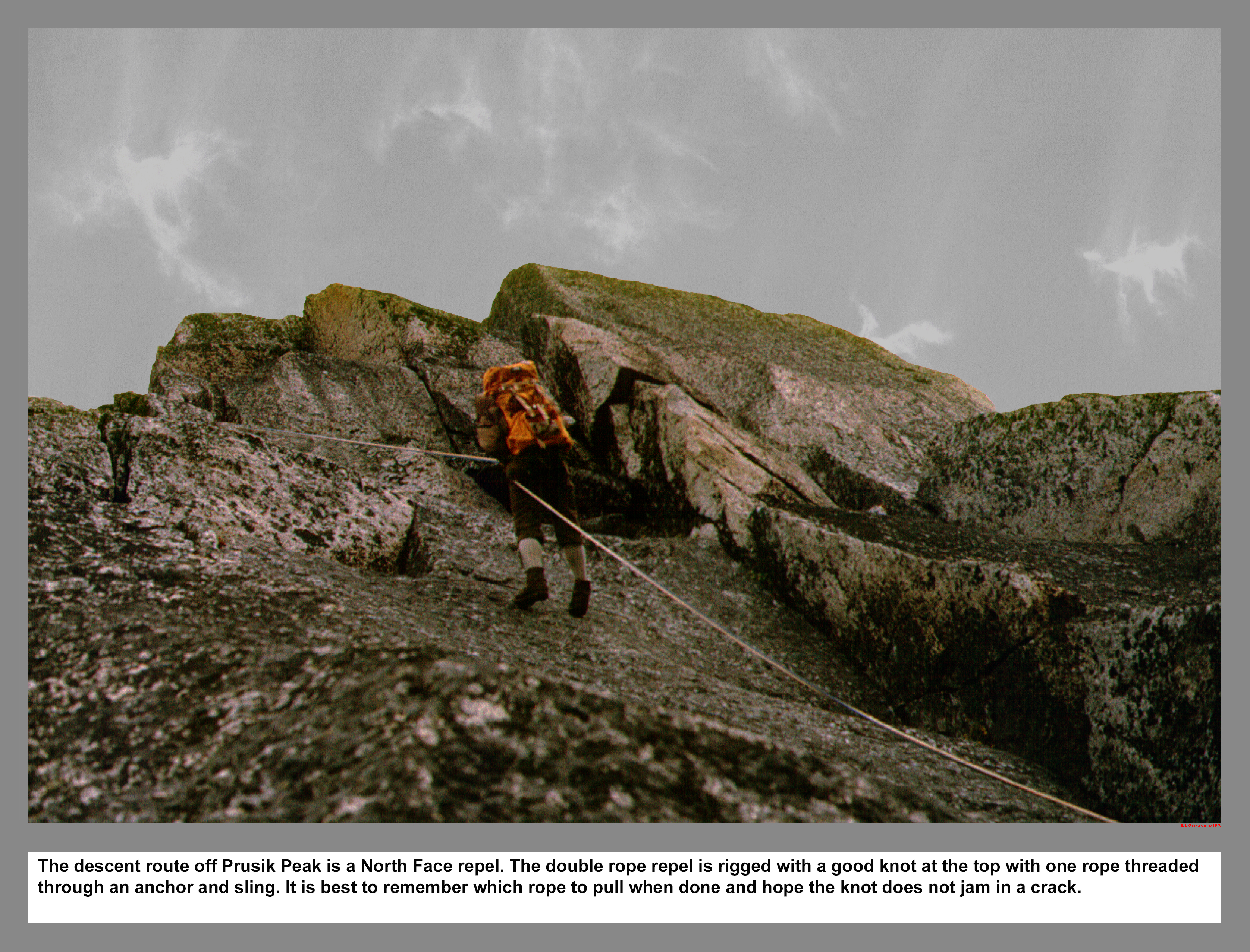
The descent route off Prusik Peak is a North Face repel. The double rope repel is rigged with a good knot at the top with one rope threaded through an anchor and sling. It is best to remember which rope to pull when done and hope the knot does not jam in a crack.
04 136 Shield Lk and Earle Lk from Prusik Peak
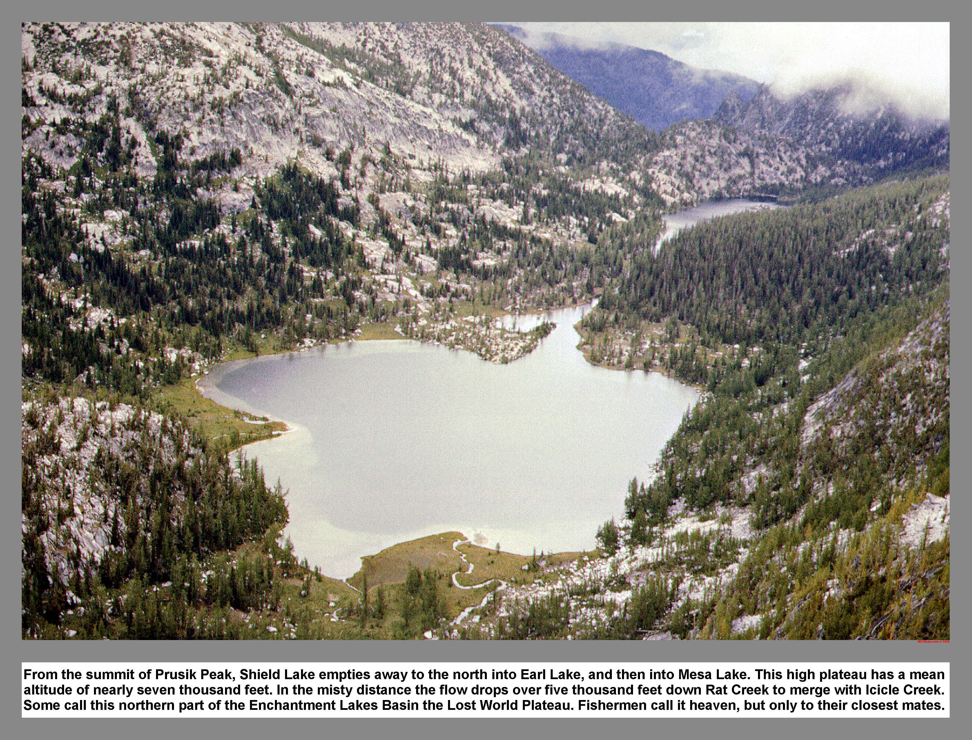
From the summit of Prusik Peak, Shield Lake empties away to the north into Earle Lake, and then into Mesa Lake. This high plateau has a mean altitude of nearly seven thousand feet. In the misty distance the flow drops over five thousand feet down Rat Creek to merge with Icicle Creek. Some call this northern part of the Enchantment Lakes Basin the Lost World Plateau. Fishermen call it heaven, but only to their closest mates.
04 138 Tokatie High Route Slabs Tony Rudi M
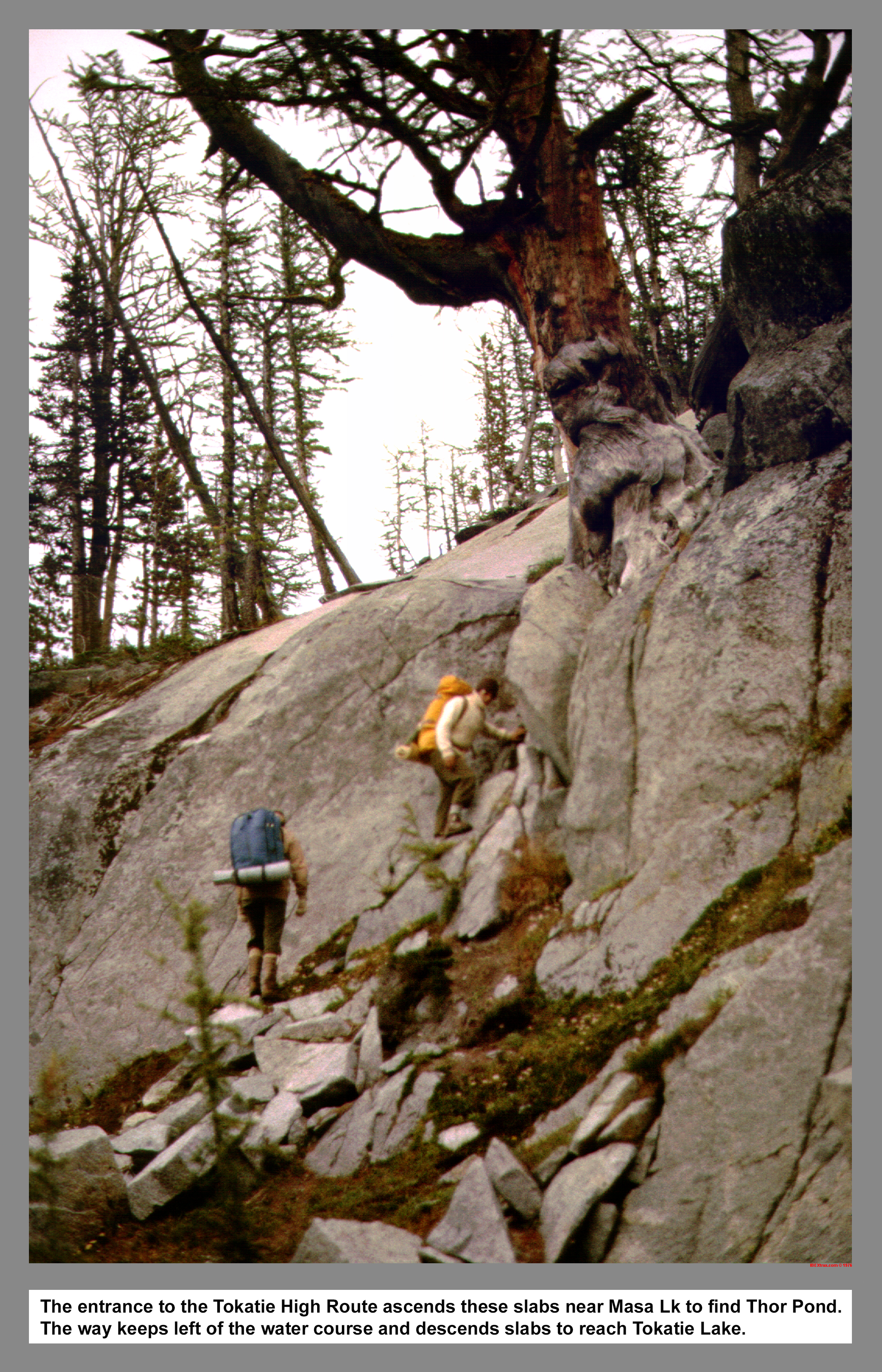
The entrance to the Tokatie High Route ascends these slabs near Masa Lake to find Thor Pond. The way keeps left of the water course and descends slabs to reach Tokatie Lake.
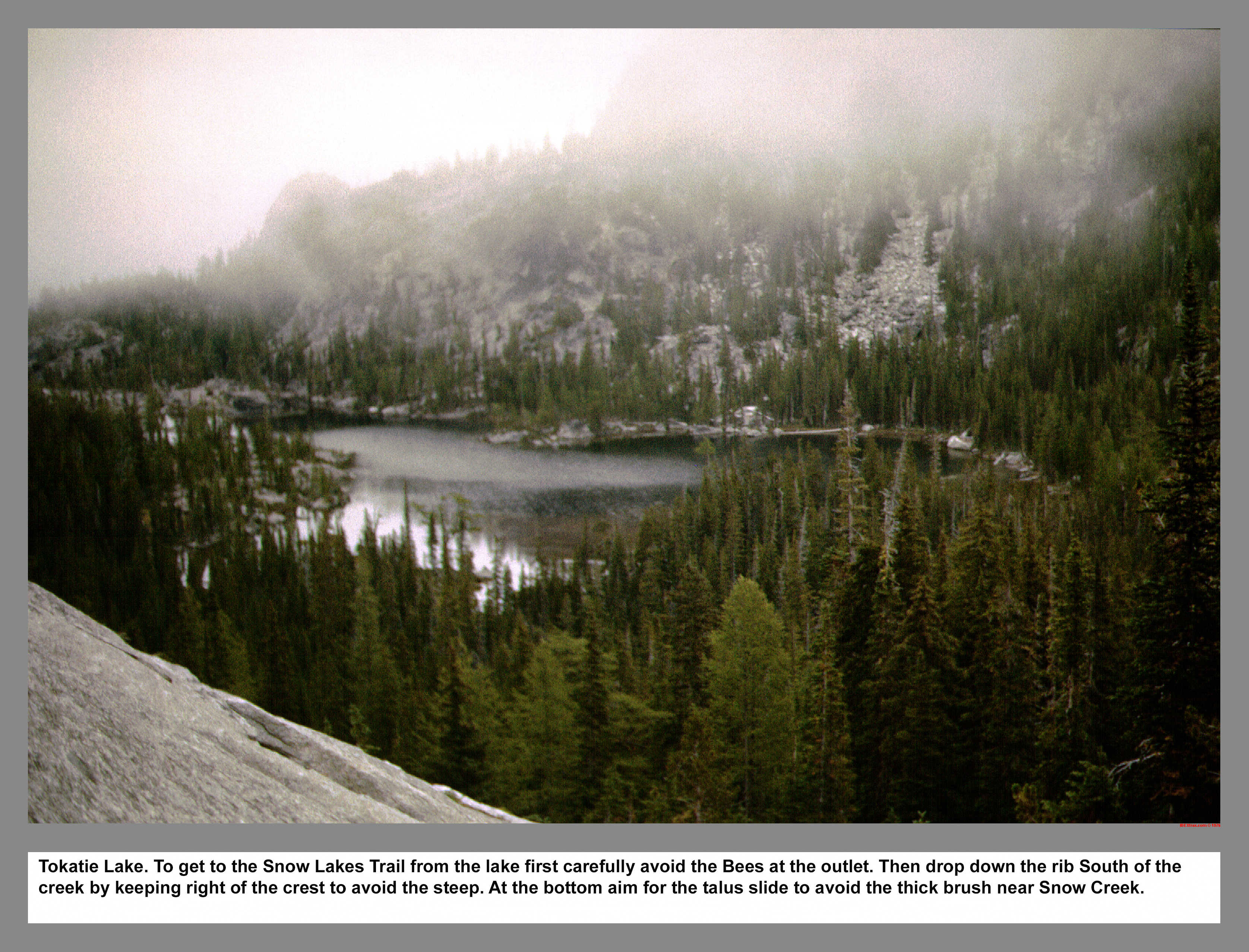
Tokatie Lake. To get to the Snow Lakes Trail from the lake first carefully avoid the Bees at the outlet. Then drop down the rib South of the creek by keeping right of the crest to avoid the steep. At the bottom aim for the talus slide to avoid the thick brush near Snow Creek.
04 140 Toketie Lk and Three Musketeers Ridge
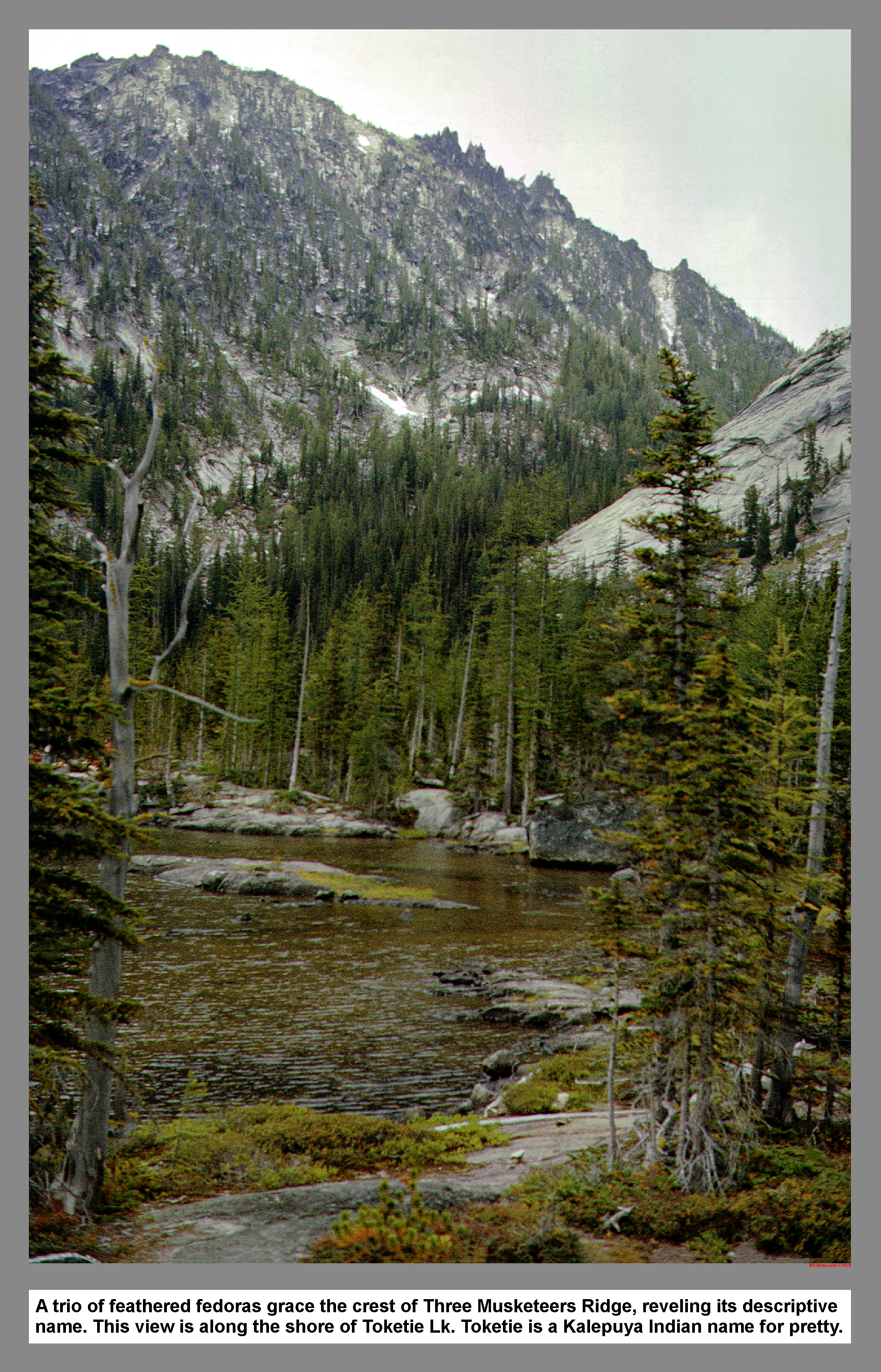
A trio of feathered fedoras grace the crest of Three Musketeers Ridge, reveling its descriptive name. This view is along the shore of Toketie Lk. Toketie is a Kalepuya Indian name for pretty.
04 140m Coney Lake Cannon Mountain Map
|
|
|
|
|
|
This site created and maintained by THE IBEX - Page last revised:
|
|