
|
|
IBEXtrax.com - Cascade Mountains of Washington StateNorth Cascades Park |
|
|
03 119 Looking south over Mount Ross NCNP 1975
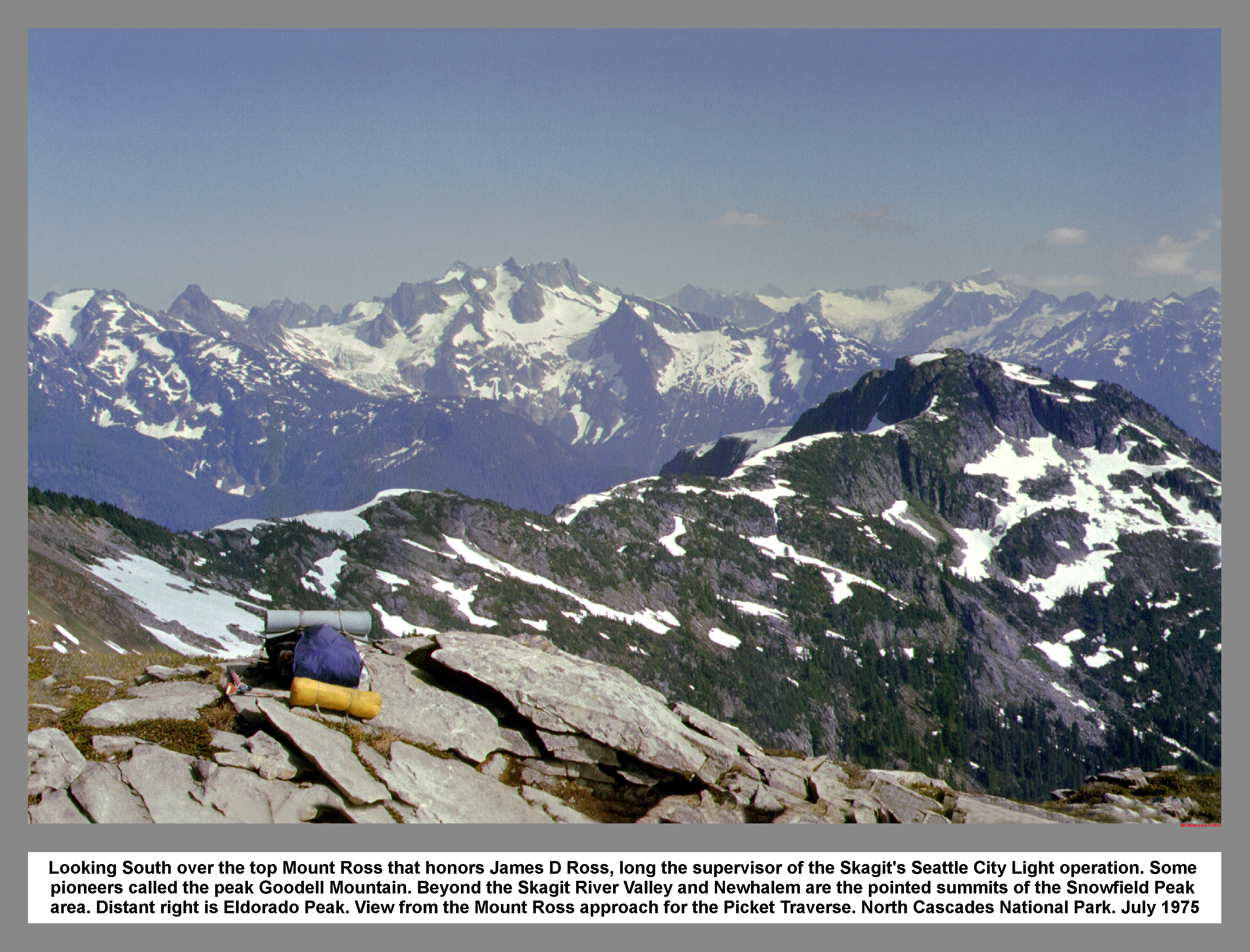
Looking South over the top Mount Ross that honors James D Ross, long the supervisor of the Skagit's Seattle City Light operation. Some pioneers called the peak Goodell Mountain. Beyond the Skagit River Valley and Newhalem are the pointed summits of the Snowfield Peak area. Distant right is Eldorado Peak. View from the Mount Ross approach for the Picket Traverse. North Cascades National Park. July 1975
03 120 Looking north on the Mt Ross approach
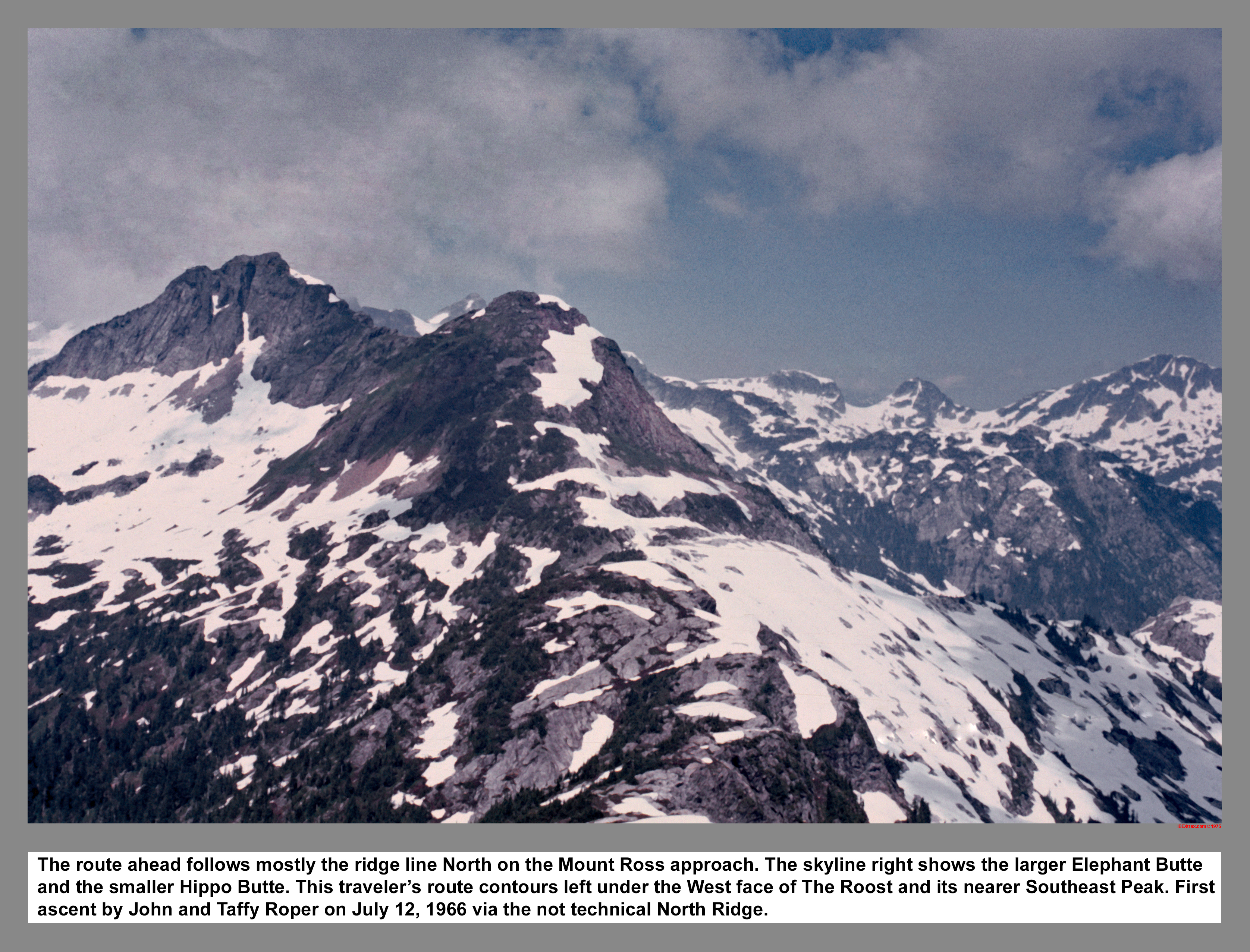
The route ahead follows mostly the ridge line North on the Mount Ross approach. The skyline right shows the larger Elephant Butte and the smaller Hippo Butte. This traveler's route contours left under the West face of The Roost and its nearer Southeast Peak. The main peak first ascent by John and Taffy Roper on July 12, 1966 via the not technical North Ridge.
03 121 Southern Picket Range is the Terror Group NCNP
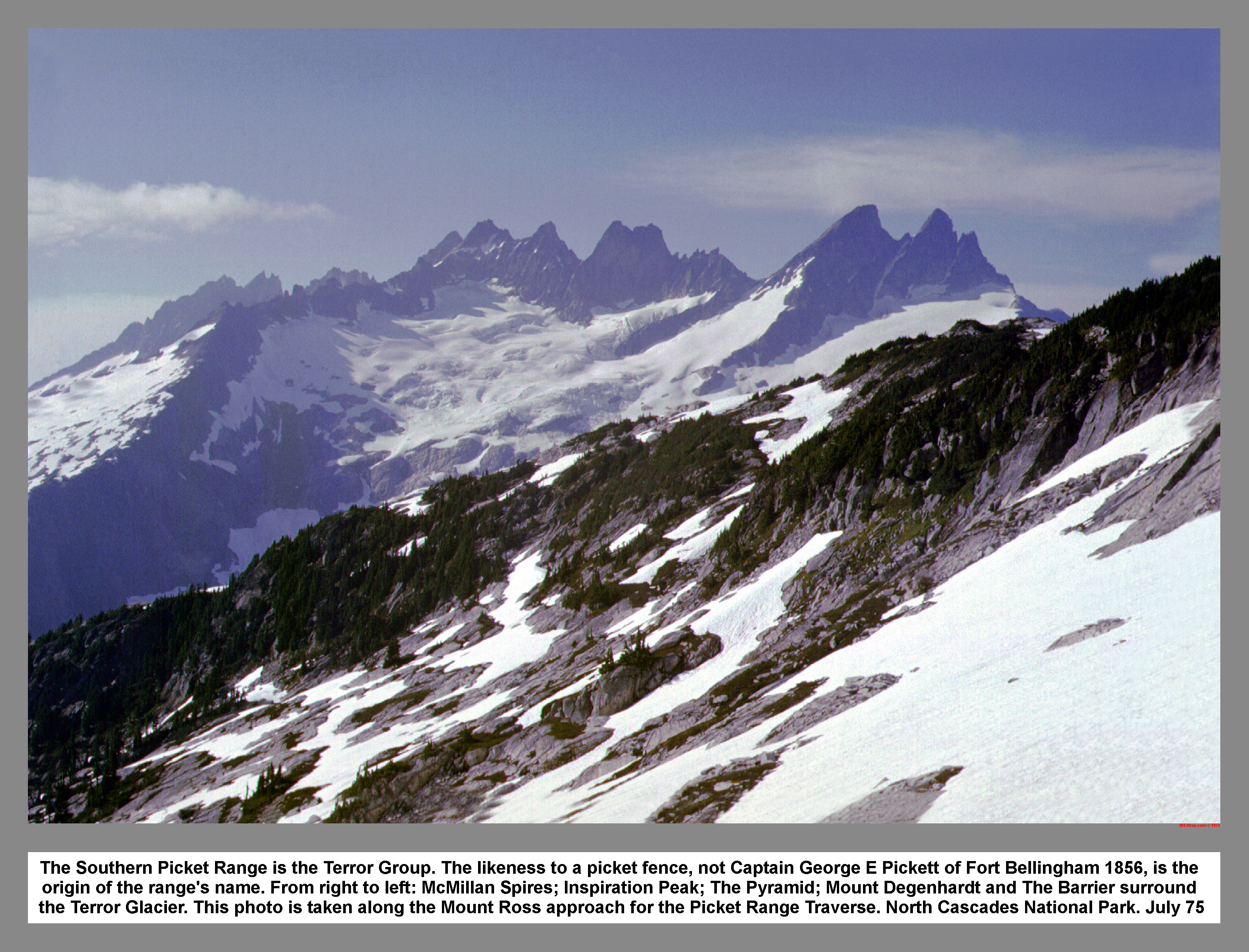
The Southern Picket Range is the Terror Group. The likeness to a picket fence, not Captain George E Pickett of Fort Bellingham 1856, is the origin of the range's name. From right to left: McMillan Spires; Inspiration Peak; The Pyramid; Mount Degenhardt and The Barrier surround the Terror Glacier. This photo is taken along the Mount Ross approach for the Picket Range Traverse. North Cascades National Park. July 75
03 122 Mount Triumph across Goodell Creek valley
Thornton Peak and Mount Triumph stands across the Goodell Creek drainage. The creek is named after N.E. Goodell, who built a roadhouse and trading post in 1879 at the confluence of Goodell Creek and the Skagit River (near present Newhalem). The first known alpine ascents in the Picket Range were made from Goodell Creek in 1931 by William Degenhardt and V. Standberg. North Cascades National Park. July 1975
03 123 Camp 2 on the Mt Ross approach Picket Traverse
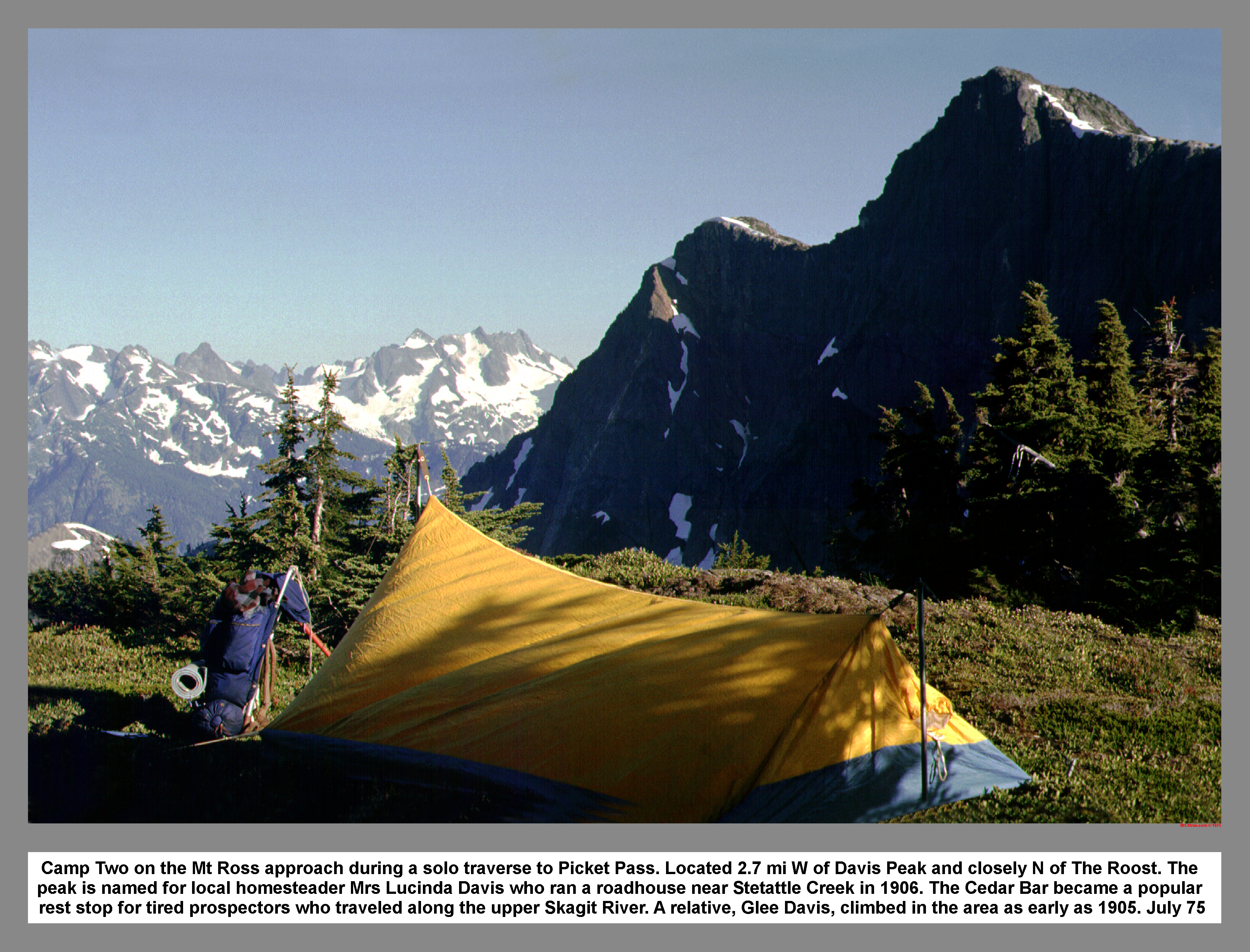
Camp Two on the Mt Ross approach during a solo traverse to Picket Pass. Located 2.7 mi W of Davis Peak and closely N of The Roost. The peak is named for local homesteader Mrs. Lucinda Davis who ran a roadhouse near Stetattle Creek in 1906. The Cedar Bar became a popular rest stop for tired prospectors who traveled along the upper Skagit River. A relative, Glee Davis, climbed in the area as early as 1905. July 75
03 124 Mt Despair Mt Baker & Mt Shuksan. Chopping Block
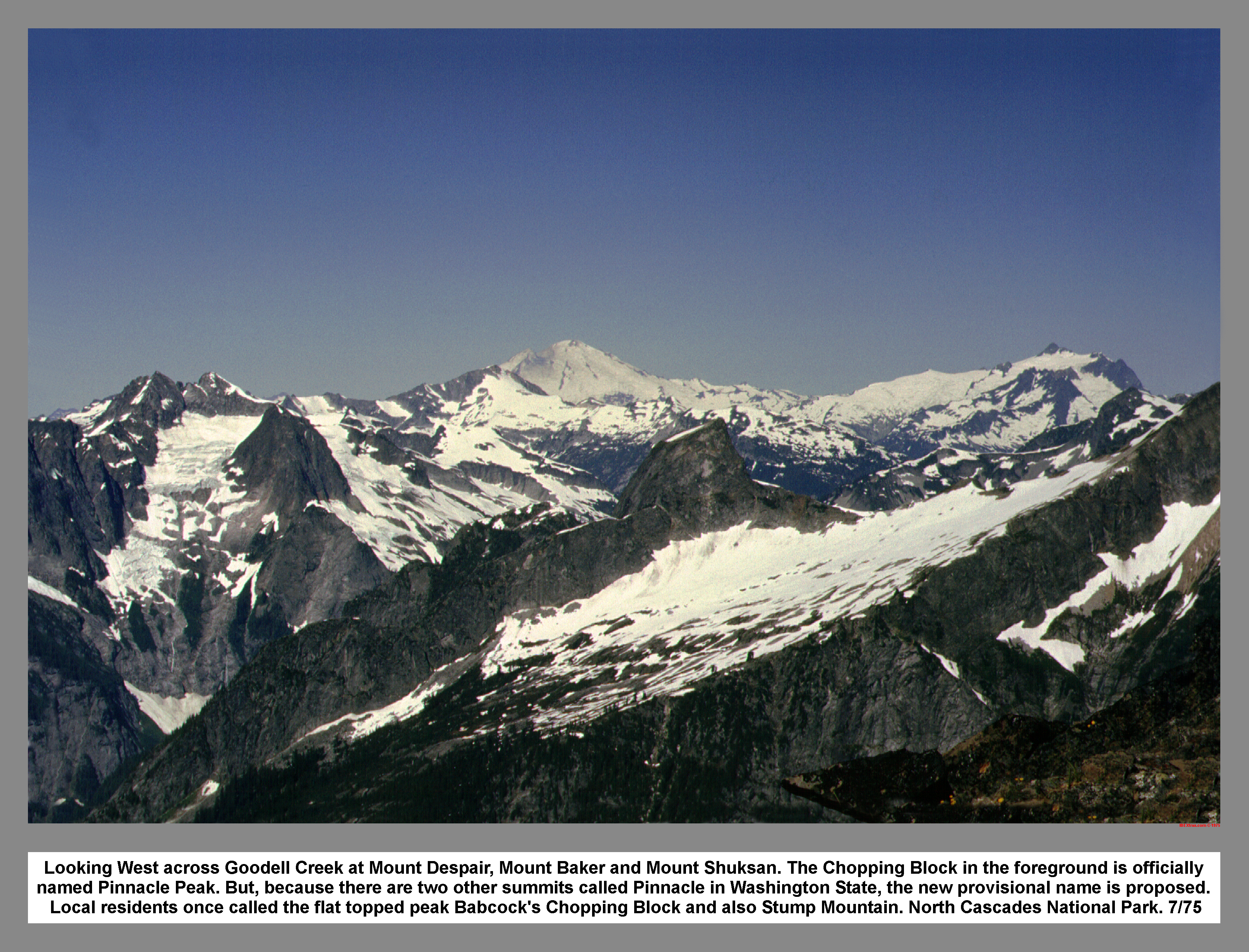
Looking West across Goodell Creek at Mount Despair, Mount Baker and Mount Shuksan. The Chopping Block in the foreground is officially named Pinnacle Peak. But, because there are two other summits called Pinnacle in Washington State, the new provisional name is proposed. Local residents once called the flat topped peak Babcock's Chopping Block and also Stump Mountain. North Cascades National Park. 7/75
03 125 McMillan Spires from P7000 Pickett Traverse
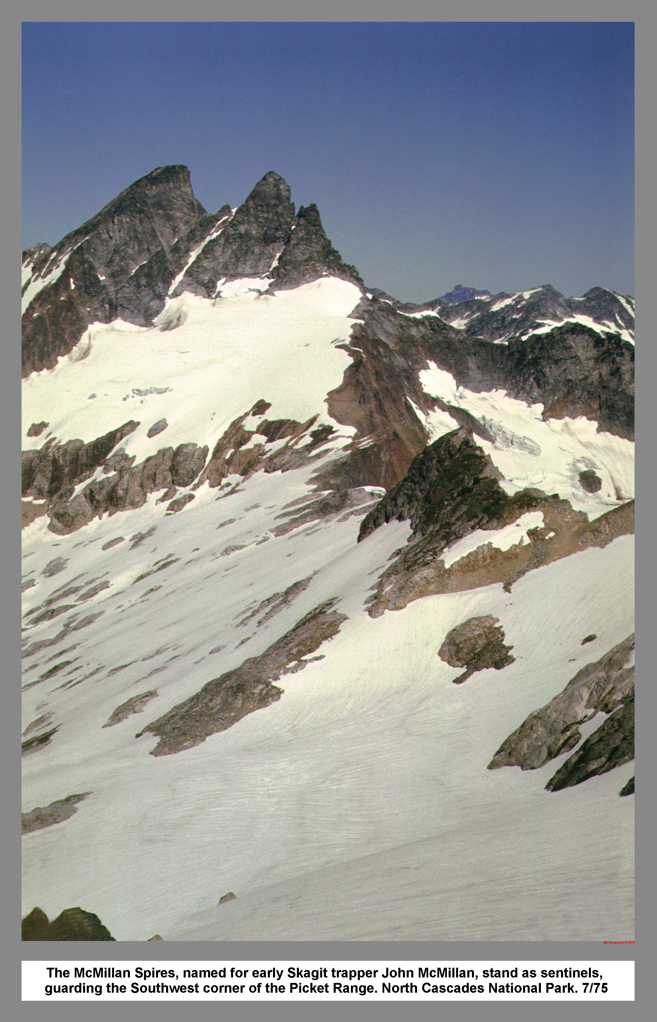
The McMillan Spires, named for early Skagit trapper John McMillan, stand as sentinels, guarding the Southwest corner of the Picket Range. North Cascades National Park. 7/75
03 126 Azure Lake from the Terror-Azure Col NCNP
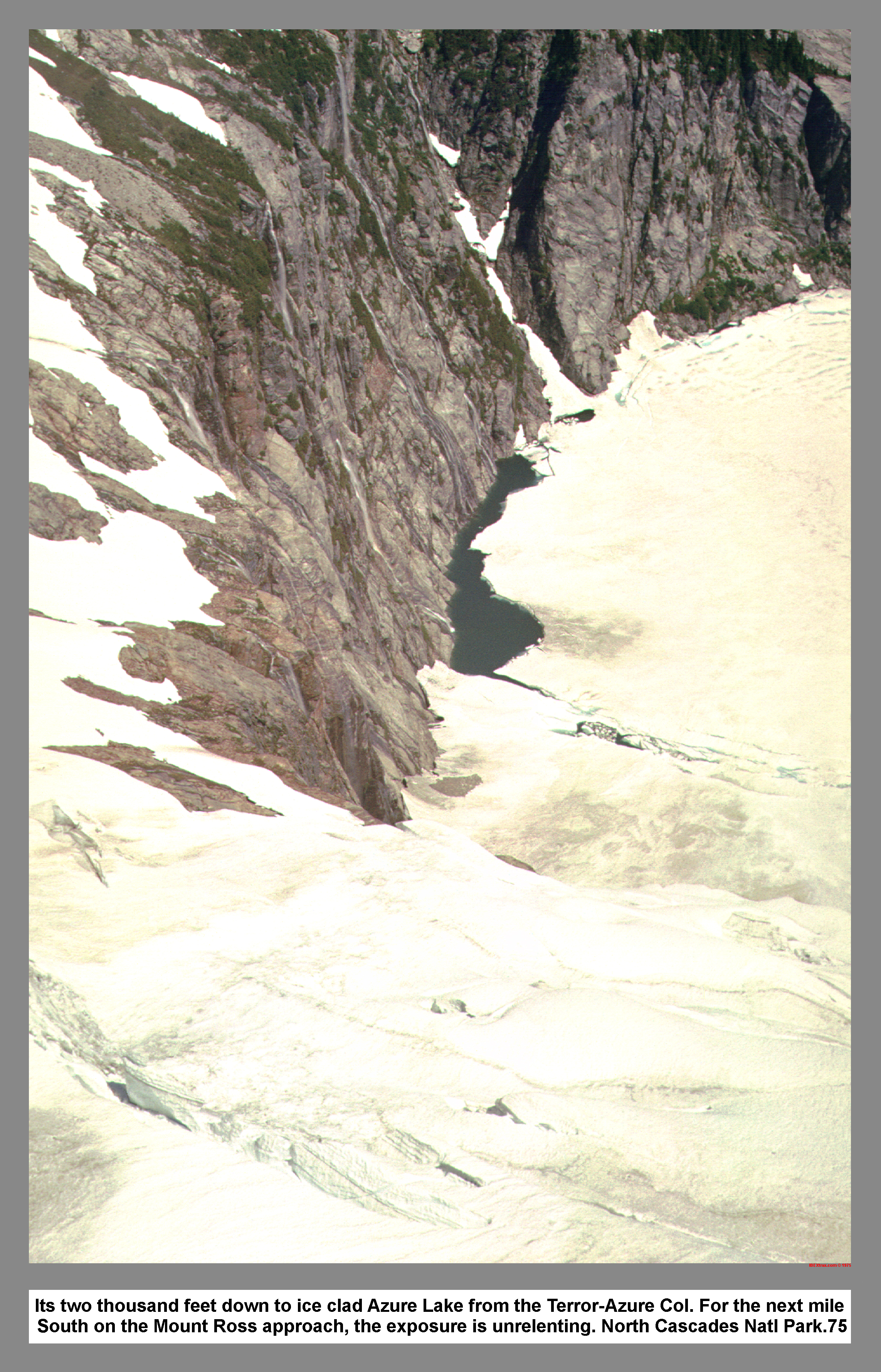
Its two thousand feet down to ice clad Azure Lake from the Terror-Azure Col. For the next mile north on the Mount Ross approach, the exposure is unrelenting. North Cascades Natl Park.75
03 127 The Hanging Ice of McMillan Cirque NCNP
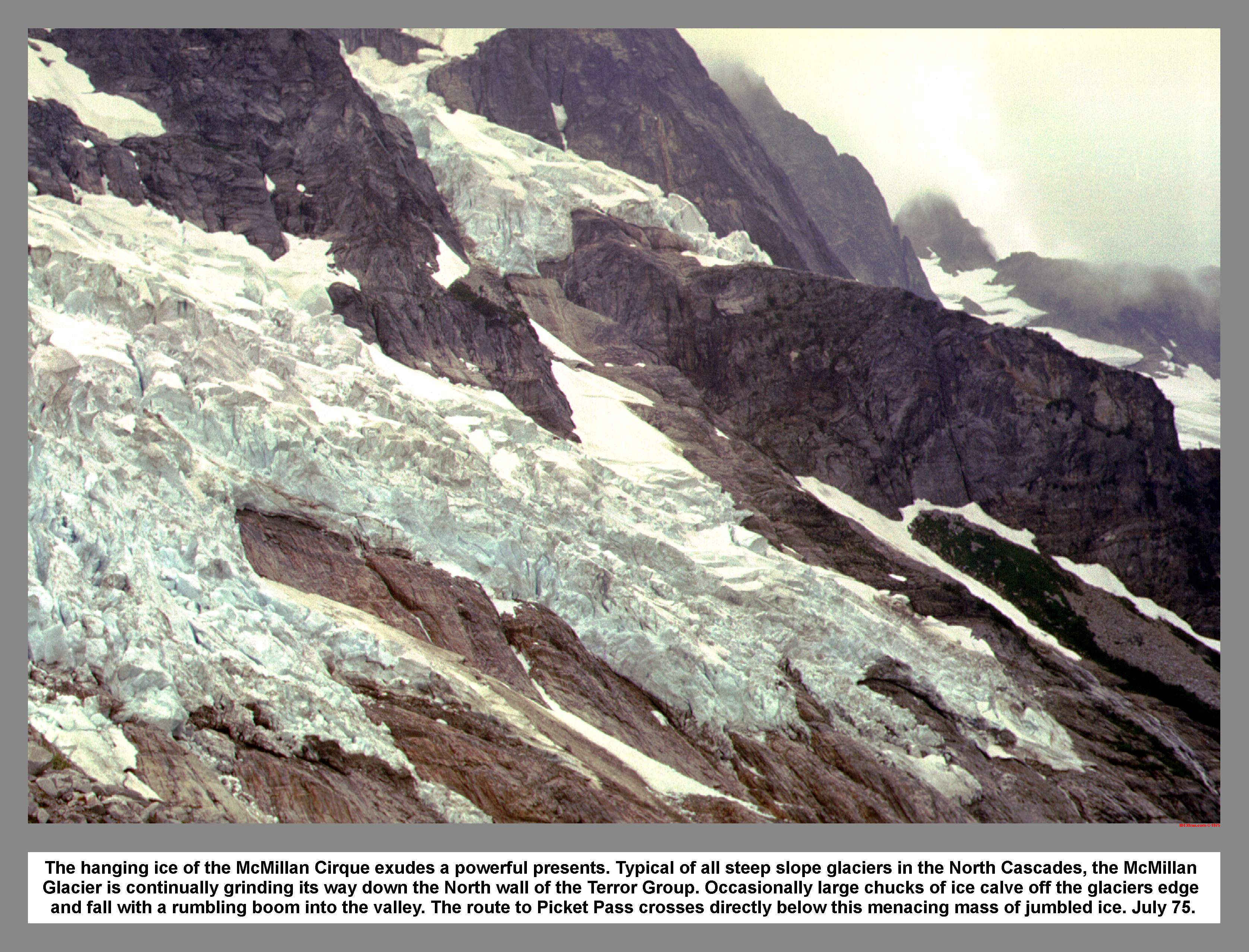
The hanging ice of the McMillan Cirque exudes a powerful presents. Typical of all steep slope glaciers in the North Cascades, the McMillan Glacier is continually grinding its way down the North wall of the Terror Group. Occasionally large chucks of ice calve off the glaciers edge and fall with a rumbling boom into the valley. The route to Picket Pass crosses directly below this menacing mass of jumbled ice. July 75.
03 128 McMillan Spires from Camp 3 Picket Traverse
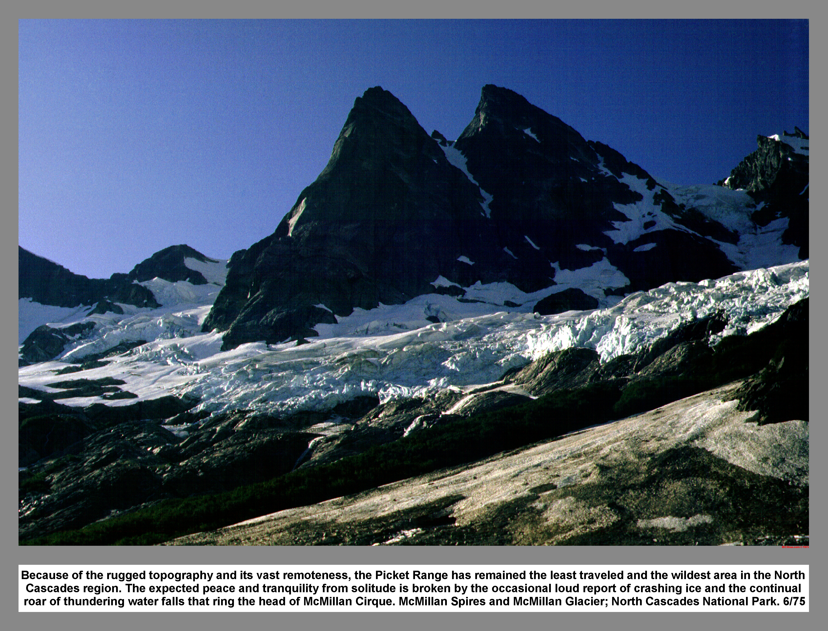
Because of the rugged topography and its vast remoteness, the Picket Range has remained the least traveled and the wildest area in the North Cascades region. The expected peace and tranquility from solitude is broken by the occasional loud report of crashing ice and the continual roar of thundering water falls that ring the head of McMillan Cirque. McMillan Spires and McMillan Glacier; North Cascades National Park. 6/75
03 129 Ribbon of Ice on Mt Terror from Picket Pass
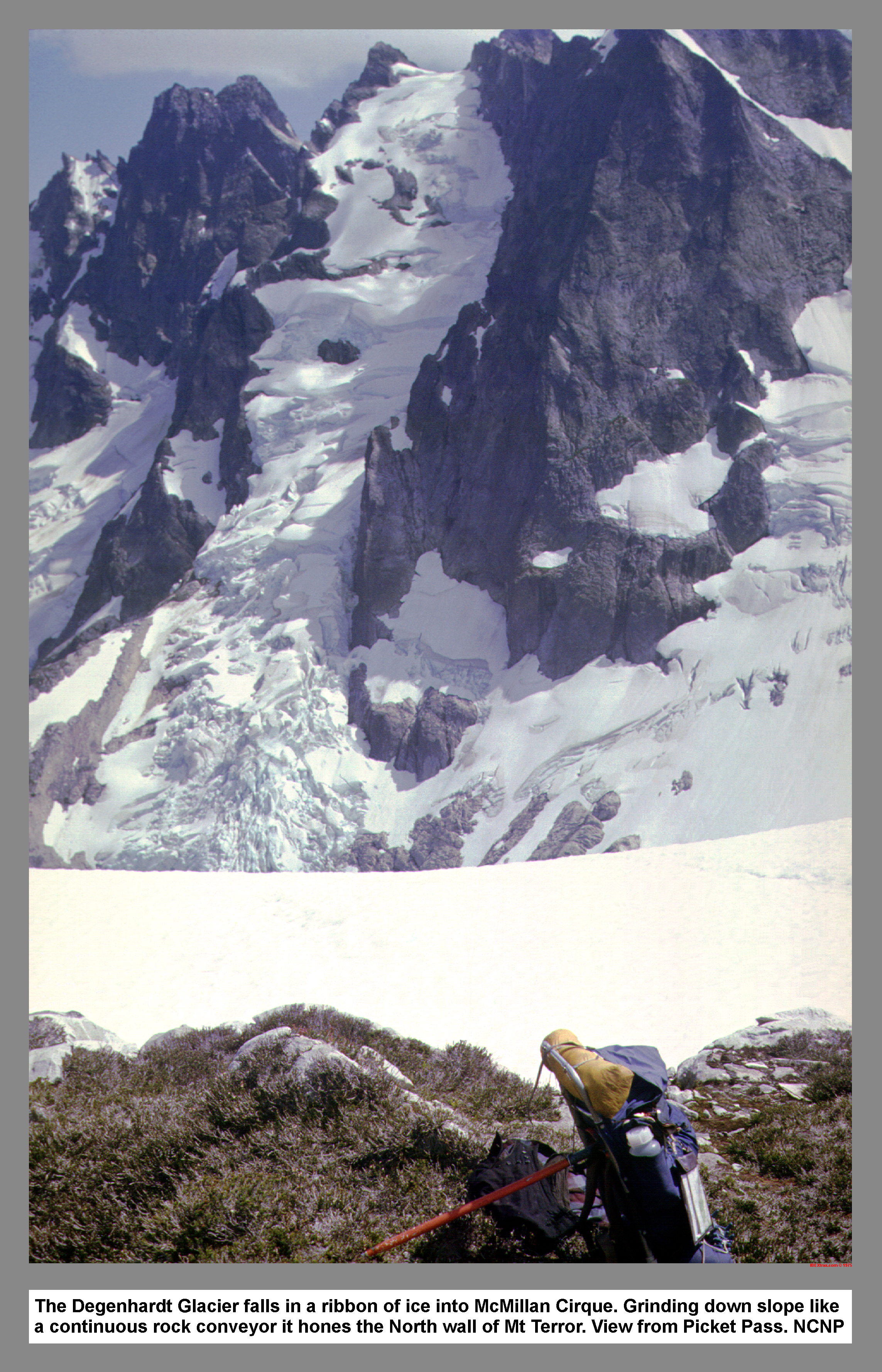
The Degenhardt Glacier falls in a ribbon of ice into McMillan Cirque. Grinding down slope like a continuous rock conveyor it hones the North wall of Mt Terror. View from Picket Pass. NCNP
03 130 Drippy Mist camp at Picket Pass
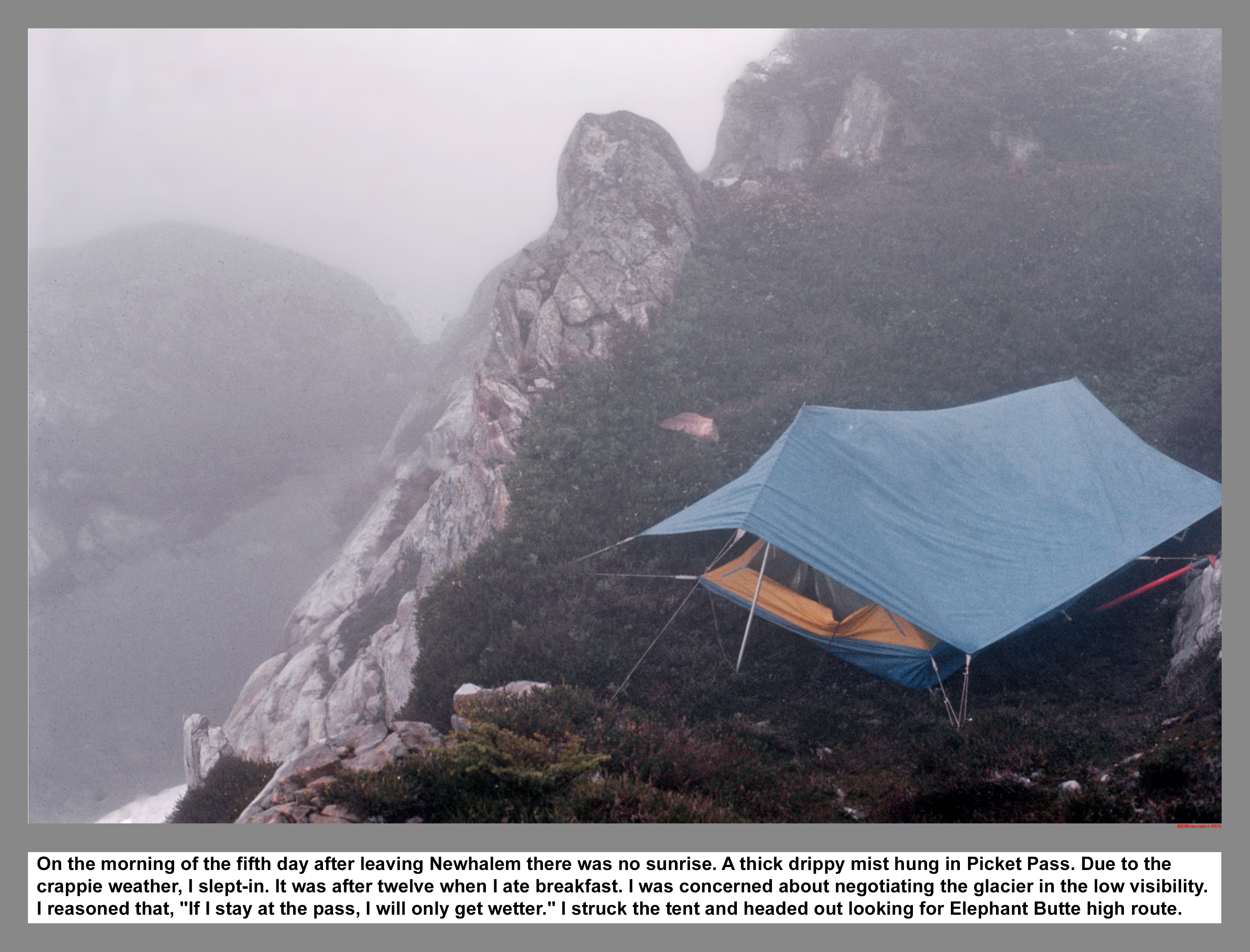
On the morning of the fifth day after leaving Newhalem there was no sunrise. A thick drippy mist hung in Picket Pass. Due to the crappie weather, I slept-in. It was after noon when I finally ate breakfast. I was concerned about negotiating the Mustard Glacier in the low visibility. Eventually I reasoned that, "If I stay at the pass, I will only get wetter." So, I packed-up, headed-down and retraced my steps into McMillan Cirque.
03 131 McMillan Cirque Route Picket Pass in the clouds
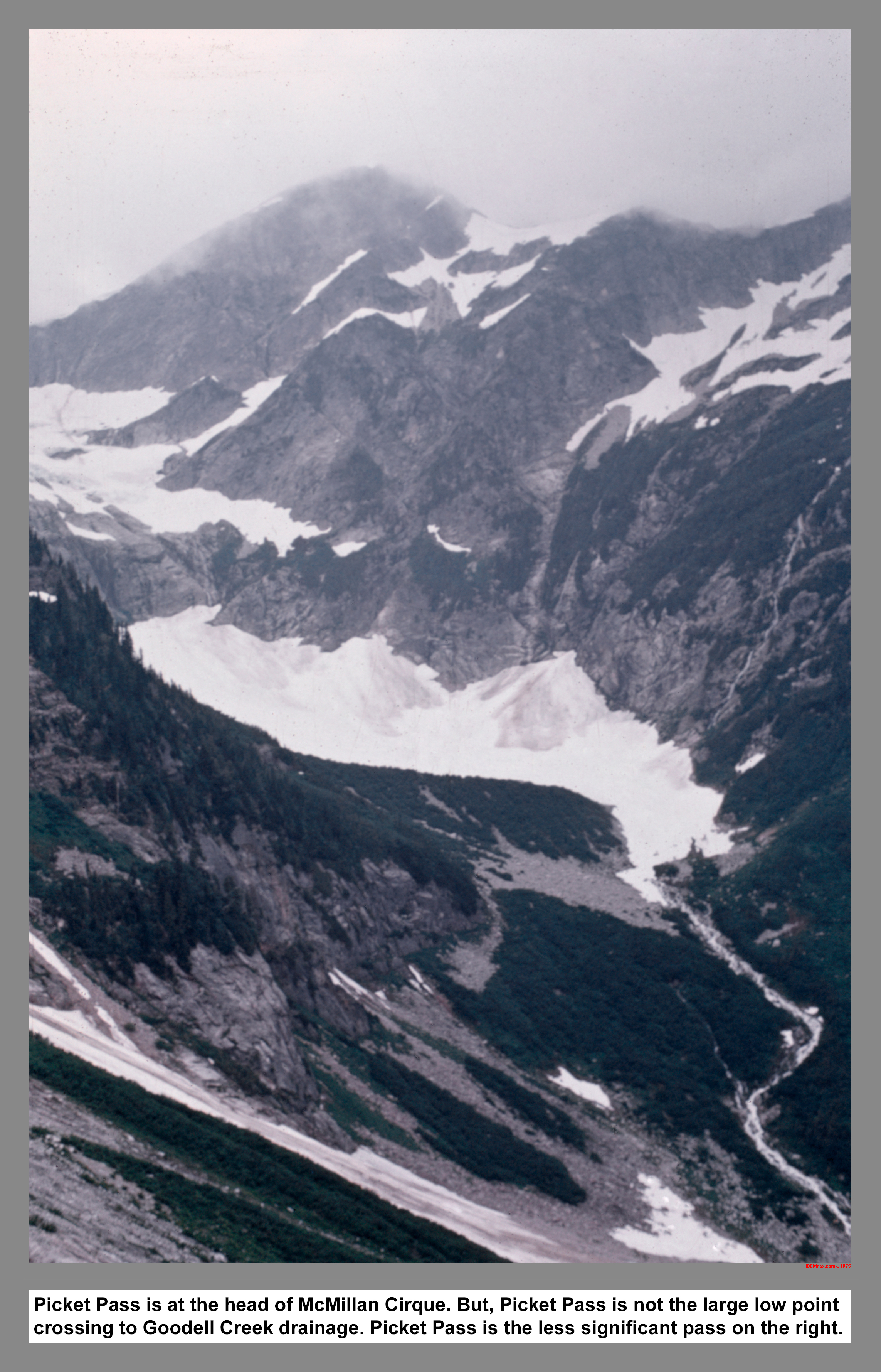
Picket Pass is at the head of McMillan Cirque. However, Picket Pass is not the large low point crossing to Goodell Creek drainage. Picket Pass is the less significant pass up and to the right of Picket Pass Peak* 6907T.
03 132 First camp on Elephant Butte Escape above Azure Lk
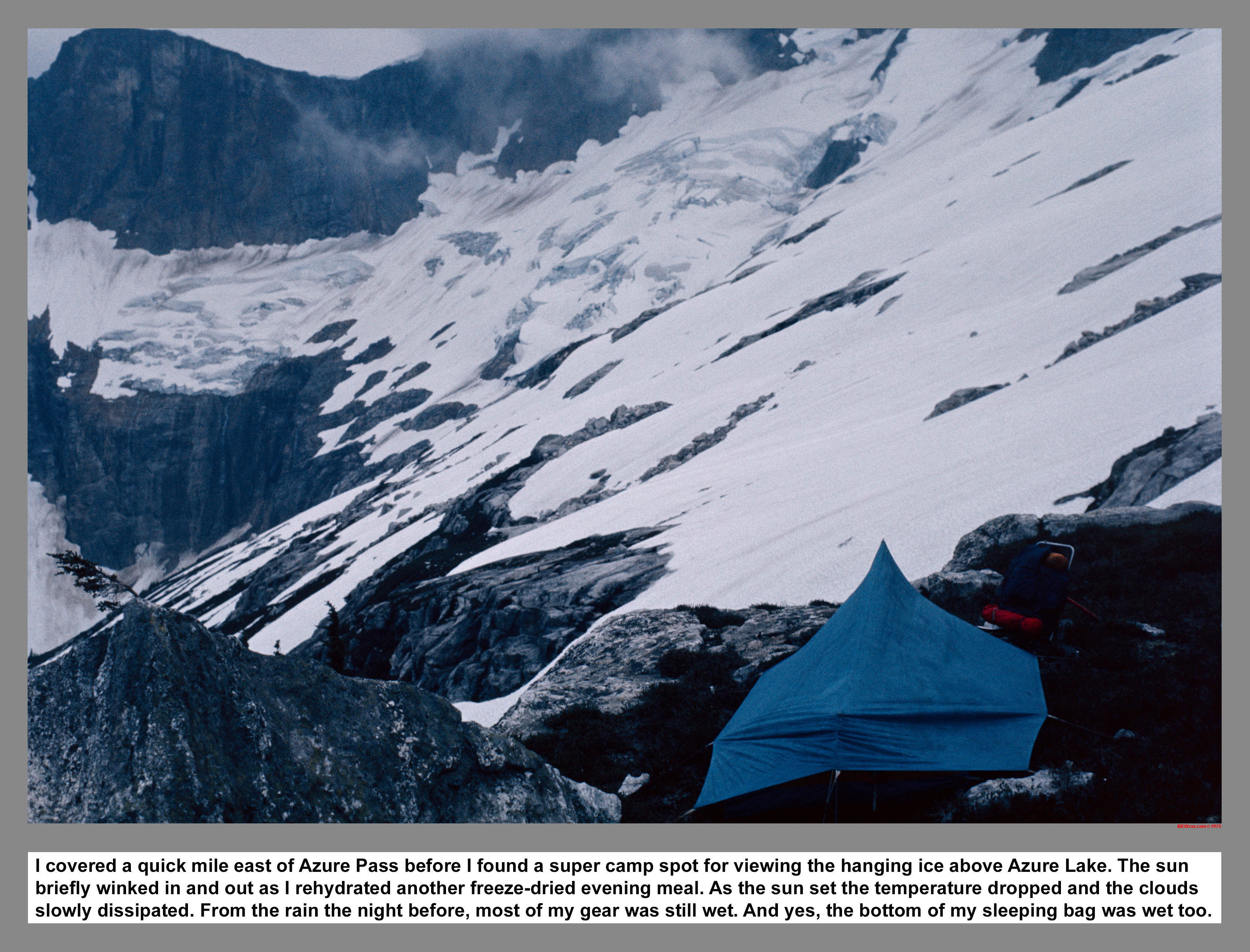
I covered a quick mile east of Azure-McMillan Pass before I found a super camp spot for viewing the hanging ice above Azure Lake. The sun briefly winked in and out as I rehydrated another freeze-dried evening meal. As the sun set the temperature dropped and the clouds slowly dissipated. From the rain the night before, most of my gear was still wet. And yes, the bottom of my sleeping bag was wet too.
03 133 Azure Lake from Elephant Butte Route
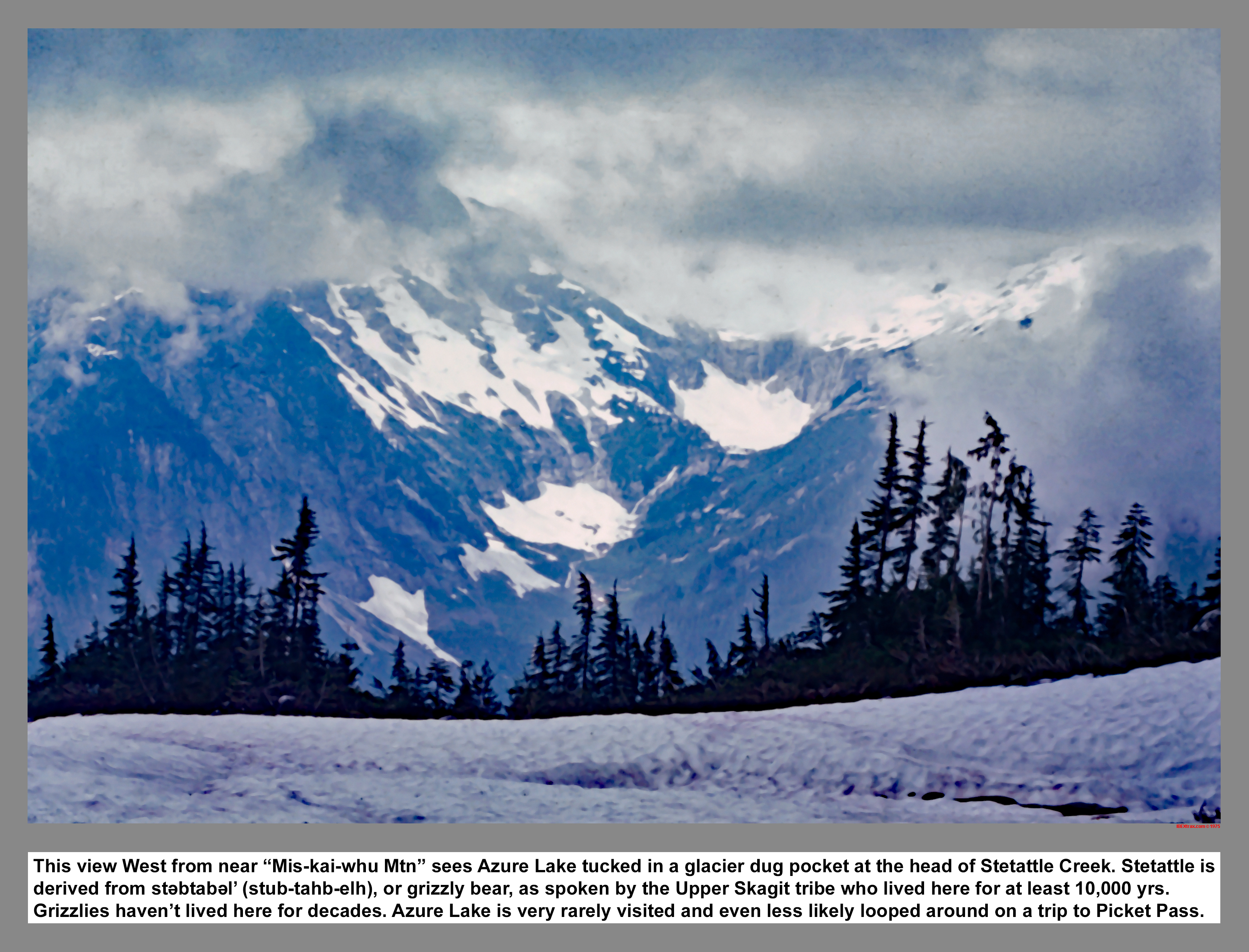
This view West from near "Mis-kai-whu Mountain*" sees Azure Lake tucked in a glacier dug pocket at the head of Stetattle Creek. Stetattle was derived from st?btab?l' (stub-tahb-elh), or grizzly bear, in the language spoken by the Upper Skagit tribe who lived here for at least 10,000 yrs. Grizzlies haven't lived here for decades. Azure Lake is very rarely visited and even less likely looped around on a trip to Picket Pass.
03 135 Thunder Arm on Diablo Lk from Sourdough Mtn
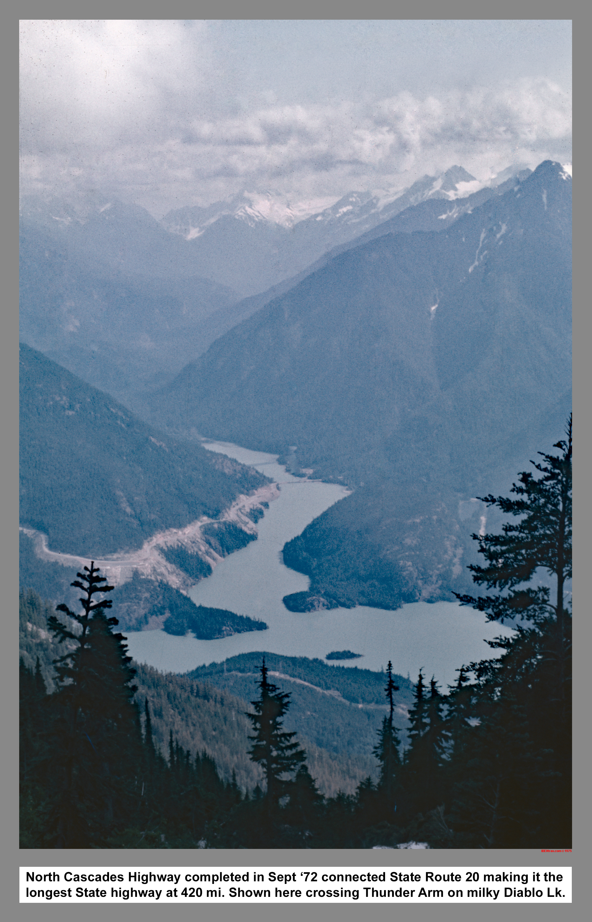
The North Cascades Highway completed in September 1972 connected State Route 20 making it the longest State highway in Washington (420 mi). Shown here crossing Thunder Arm on milky blue Diablo Lake.
|
|
|
|
|
|
This site created and maintained by THE IBEX - Page last revised:
|
|