
|
|
IBEXtrax.com - Cascade Mountains of Washington StateAlpine Lakes Wilderness |
|
|
03 078 Chris H Belays Rudi M at the Issaquah Quarry
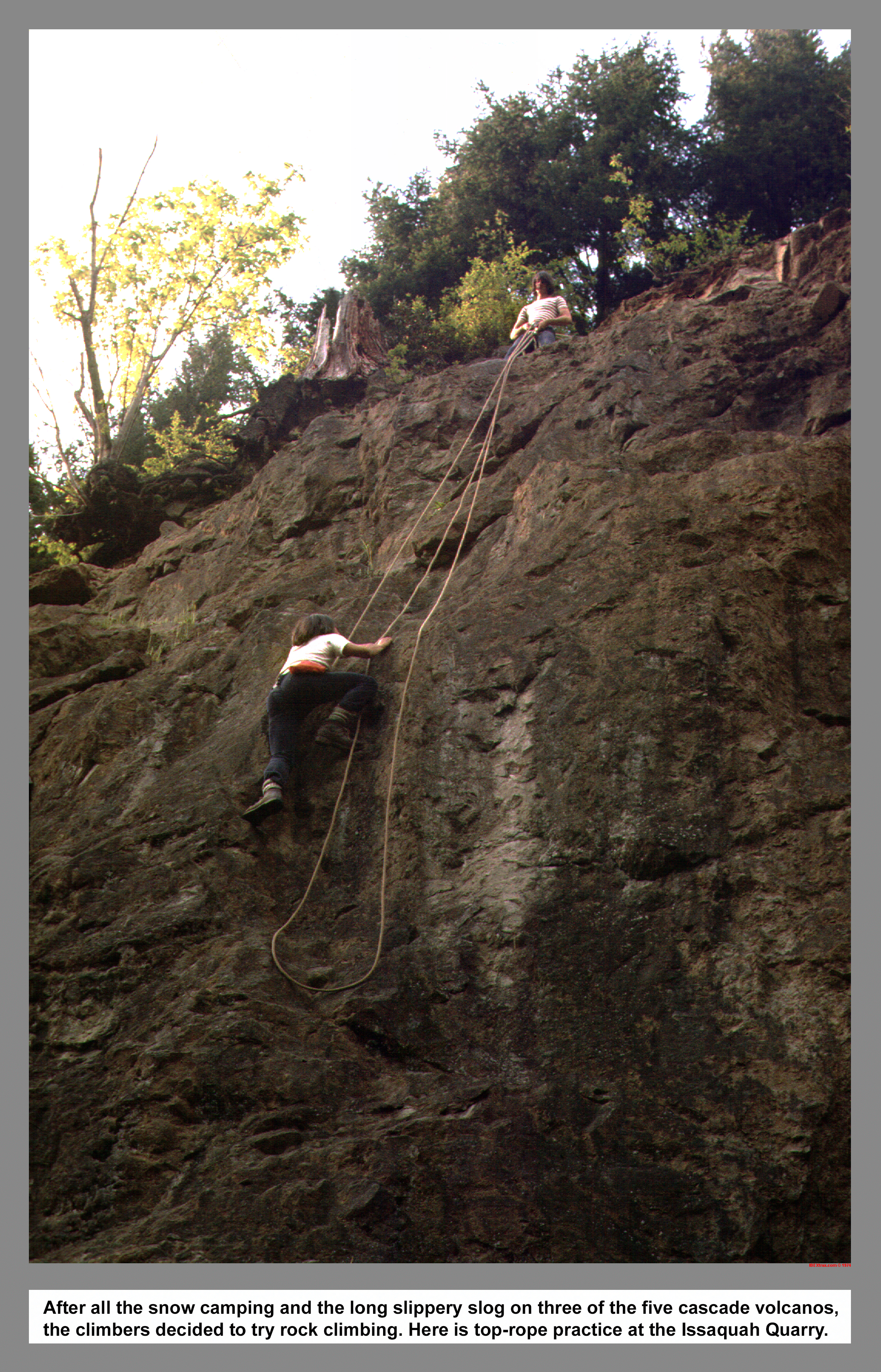
After all the snow camping and the long slippery slog on three of the five cascade volcanos, the climbers decided to try technical rock climbing. Shown here is top-rope practice at the Issaquah Quarry.
03 079 Frozen Chris H on Midway Crux Castle Rock
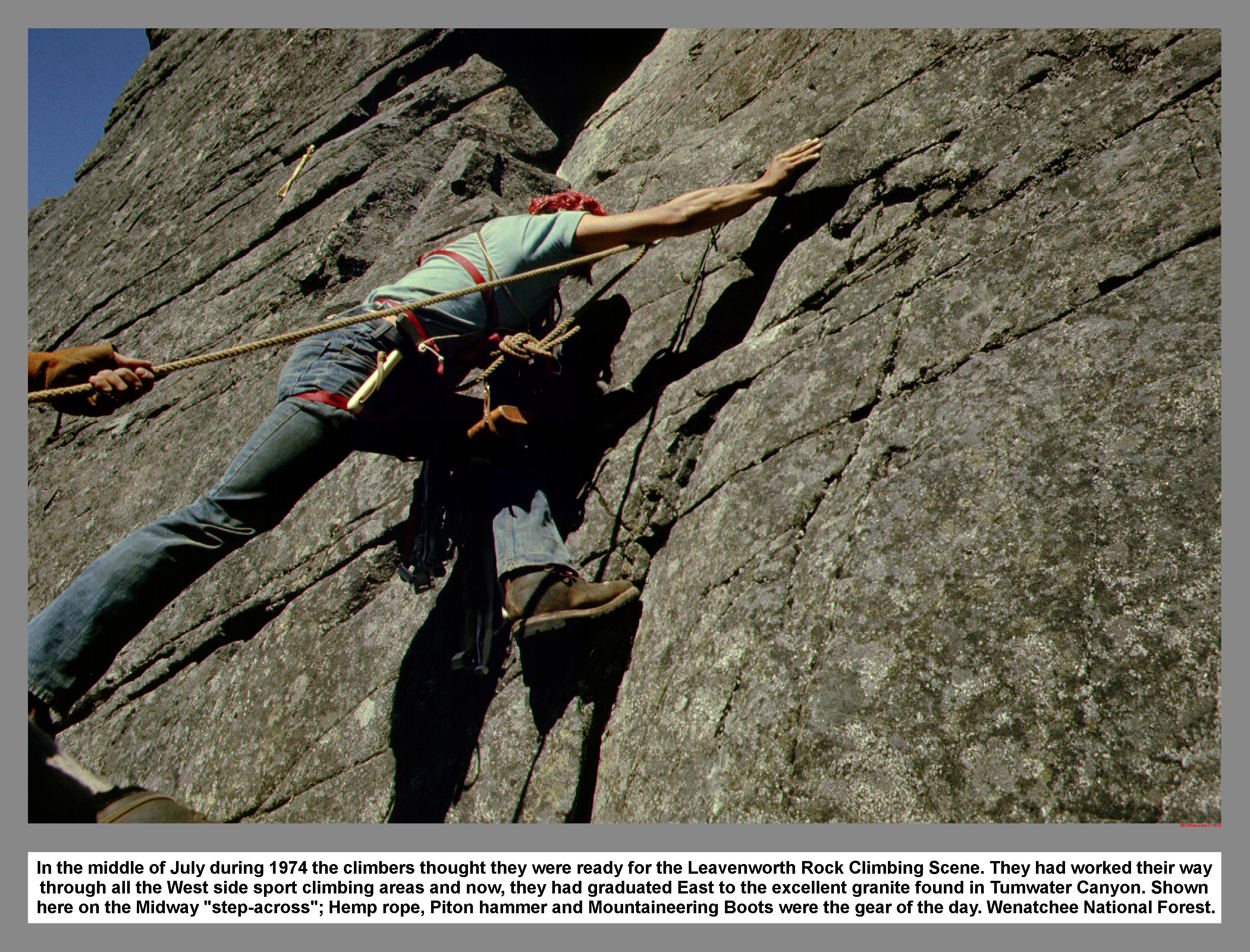
In the middle of July during 1974 the climbers thought they were ready for the Leavenworth Rock Climbing Scene. They had worked their way through all the West side sport climbing areas and now, they had graduated East to the excellent granite found in Tumwater Canyon. Shown here on the Midway "step-across"; Hemp rope, Piton hammer and Mountaineering Boots were the gear of the day. Wenatchee Forest.
03 081 Castle Rk and Wenatchee R in Tumwater Canyon
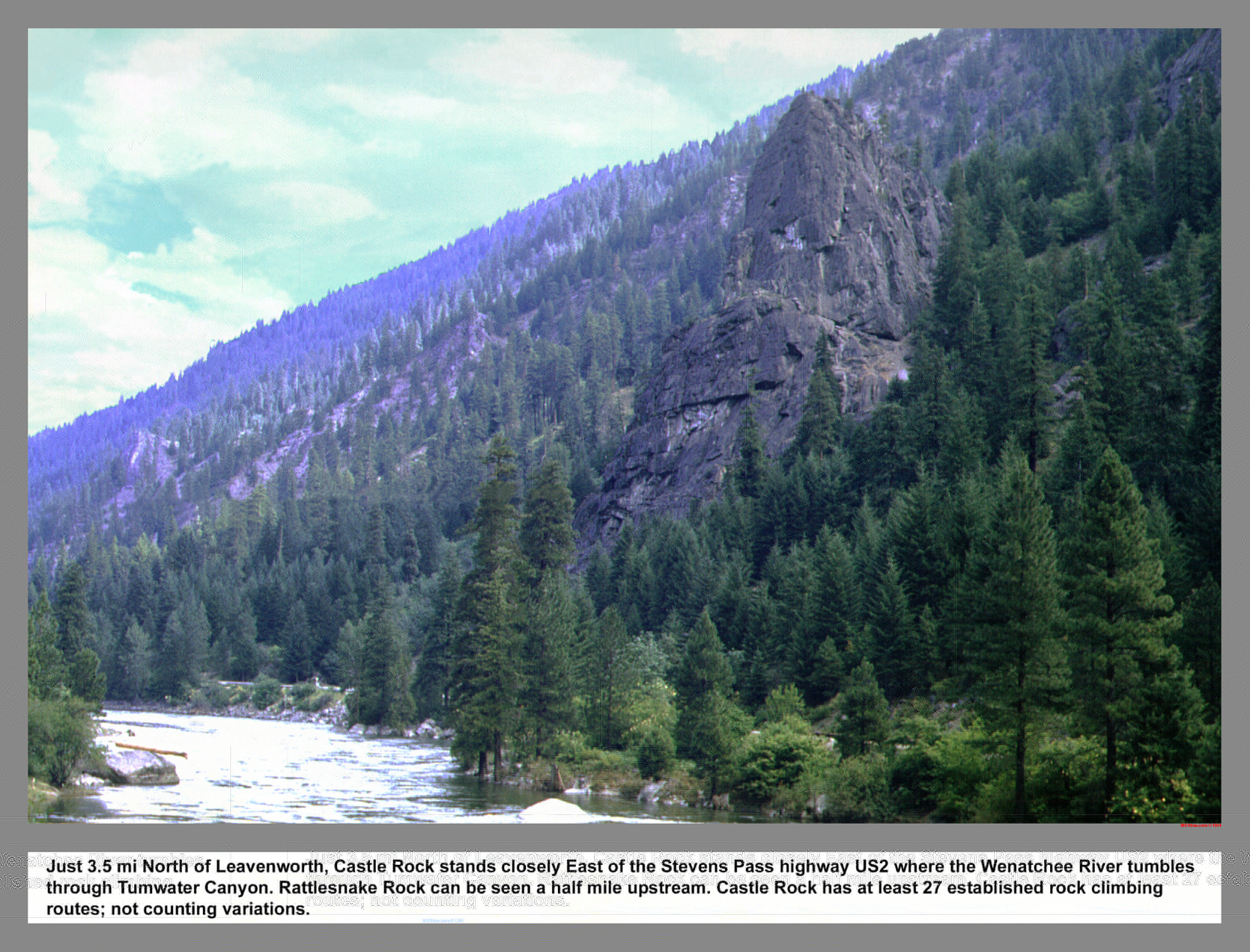
Just 3.5 mi North of Leavenworth, Castle Rock stands closely East of the Stevens Pass highway US2 where the Wenatchee River tumbles through Tumwater Canyon. Rattlesnake Rock can be seen a half mile upstream. Castle Rock has at least 27 established rock climbing routes; not counting variations.
03 082 Rudi M and Chris H do Classic Crack along Icicle Ck
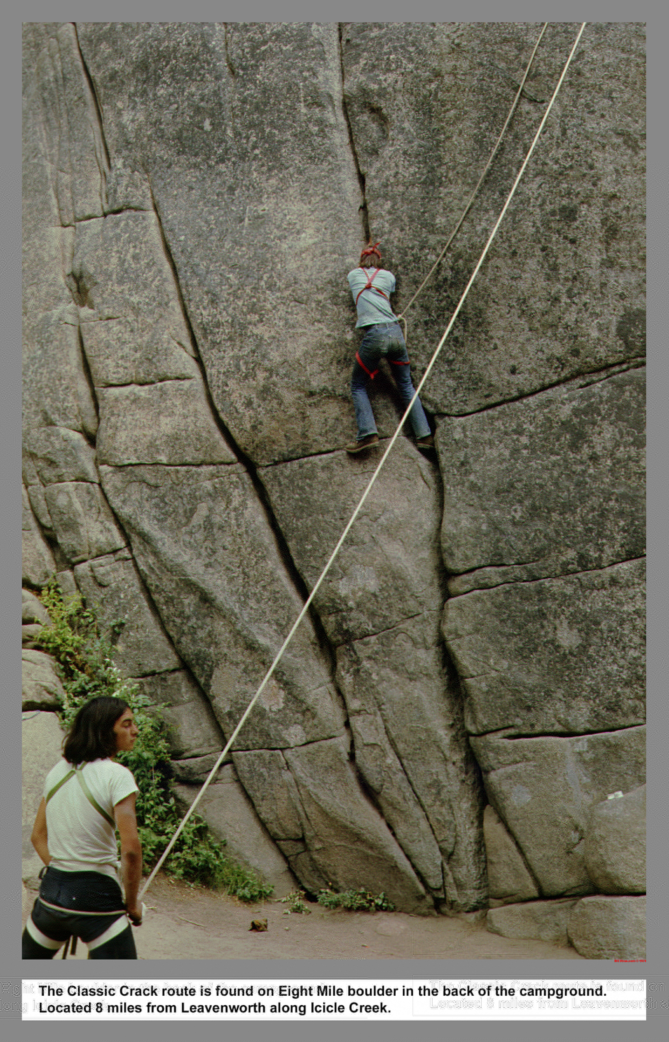
The Classic Crack route is found on Eight Mile boulder in the back of the campground. Located 8 miles from Leavenworth along Icicle Creek Road.
03 083 Trigger Finger Peshastin Pinnacles Warren
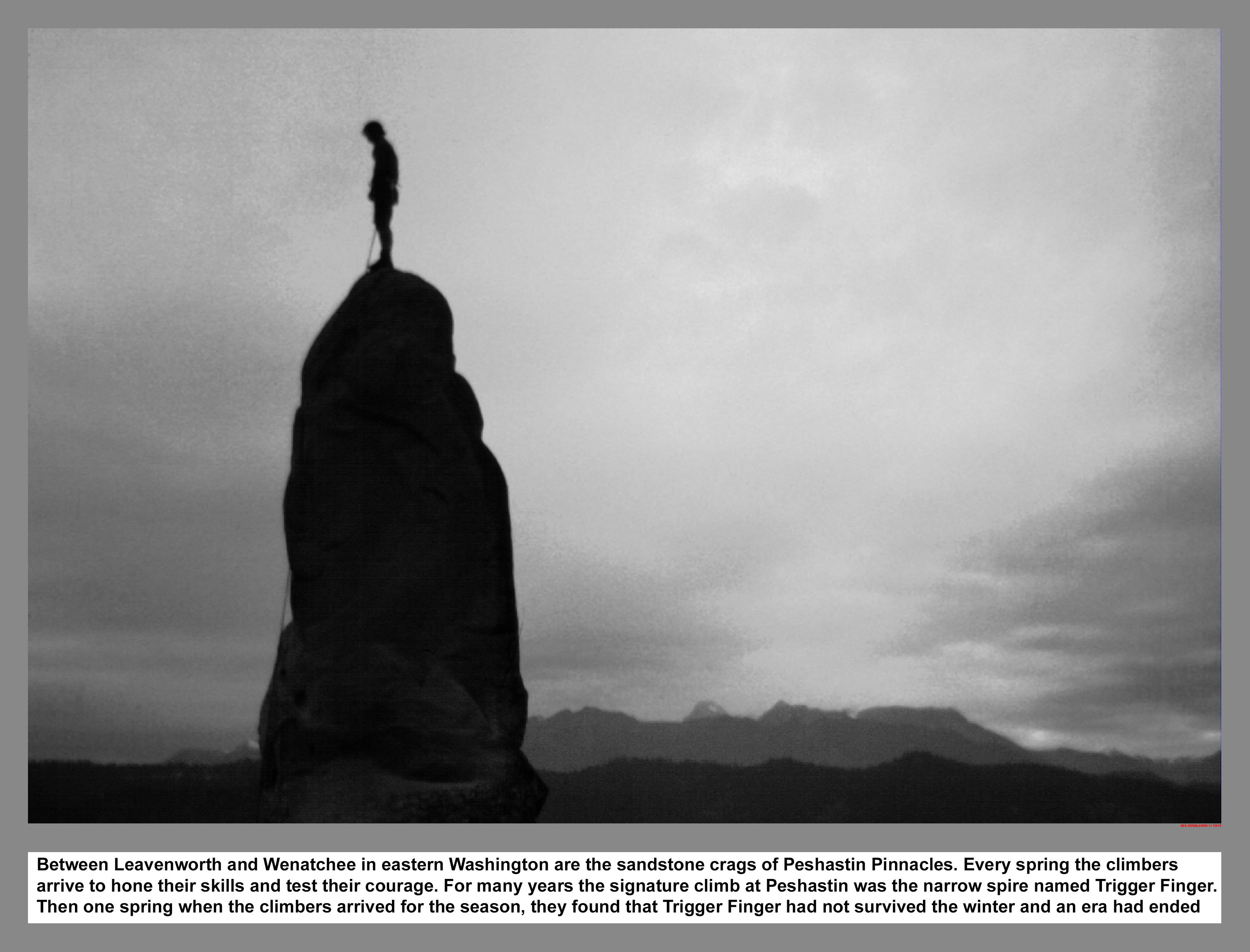
Between Leavenworth and Wenatchee in eastern Washington State are the sandstone crags of Peshastin Pinnacles. Every spring the climbers arrive to hone their skills and test their courage. For many years the signature climb at Peshastin was the narrow spire named Trigger Finger. Then one spring when the climbers arrived for the season, they found that Trigger Finger had not survived the winter and an era had ended.
03 085 Warren above Hart and Nada Lakes
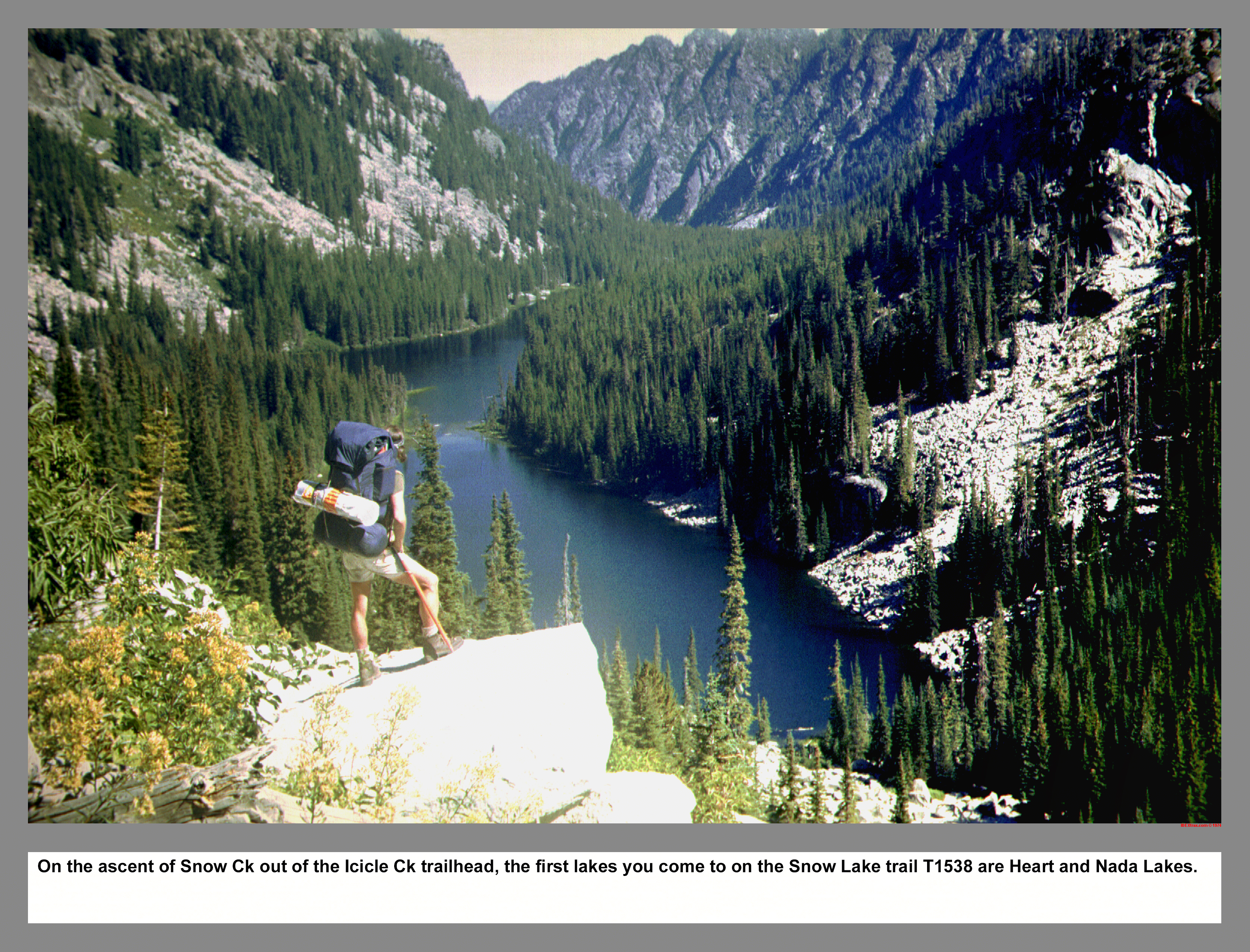
On the ascent of Snow Ck out of the Icicle Ck trailhead, the first lakes you come to on the Snow Lake trail T1538 are Heart and Nada Lakes.
03 085s Stark Enchantments Map
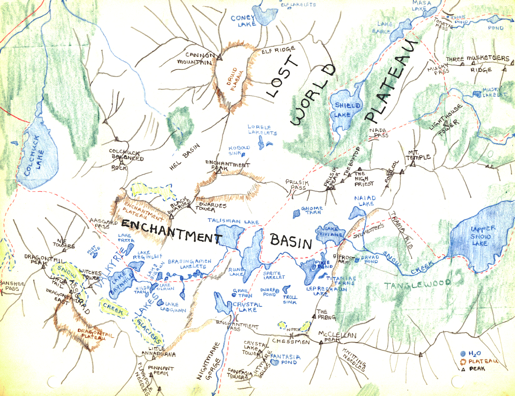
I was privileged enough to get a Stark Map in person from Bill and Peg the first time I walked over the dam at Snow Lakes. That was back in sixty something. By the third or forth hiking trip up Sylvester's High Route into the Enchantments, that poor map was in the final stages of disintegration. So I copied all the Stark Enchantment Theme names of the lakes and then updated with some of the Beckey crag handles.
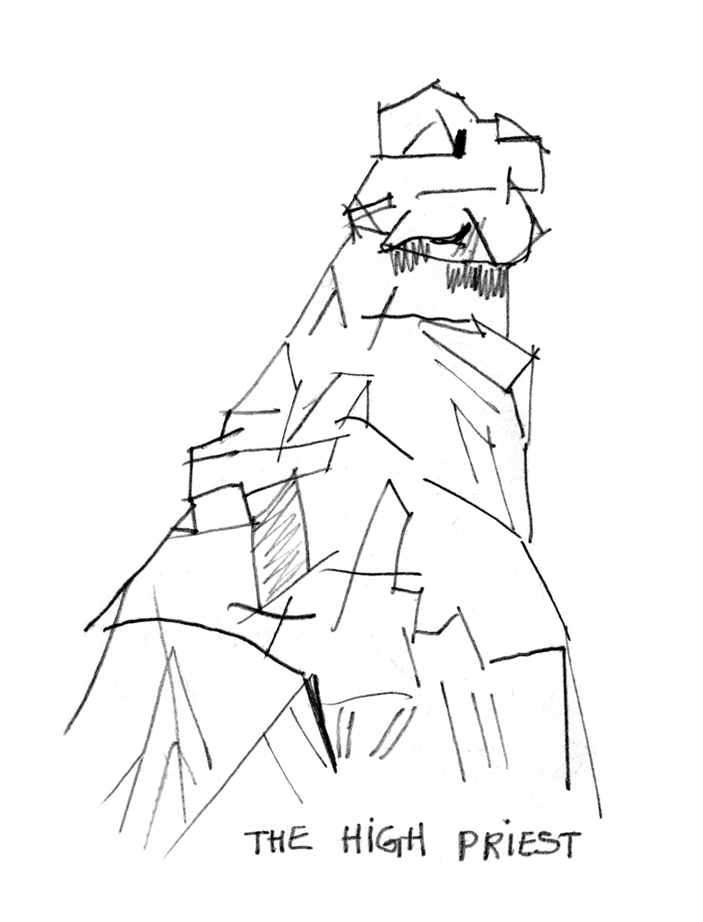
03 086 Snowy Enchantment basin from The High Priest
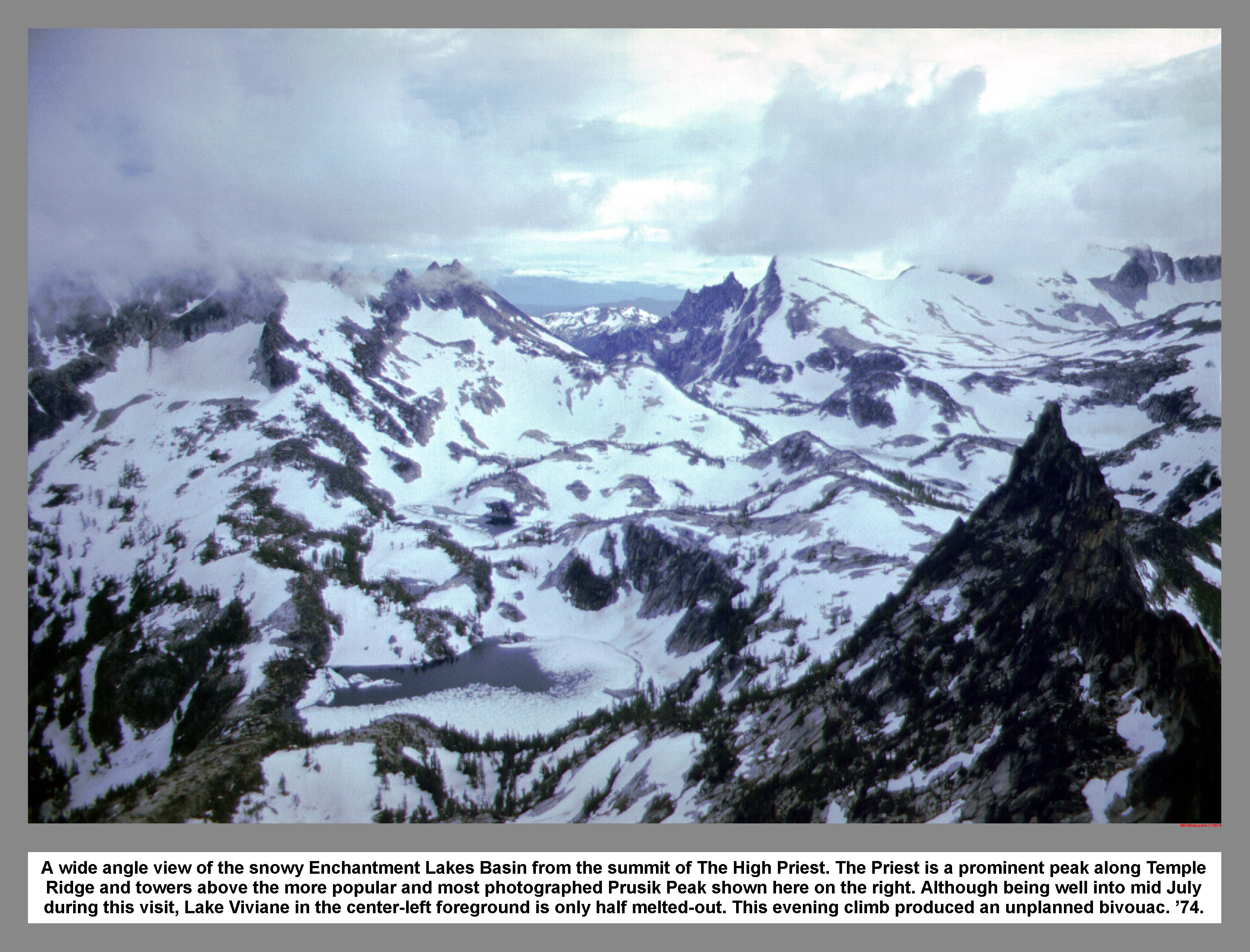
A wide angle view of the snowy Enchantment Lakes Basin from the summit of The High Priest. The Priest is a prominent peak along Temple Ridge and towers above the more popular and most photographed Prusik Peak shown here on the right. Although being well into mid July during this visit, Lake Viviane in the center-left foreground is only half melted-out. This evening climb produced an unplanned bivouac. '74.
03 087 Chris H on East Dragontail from Littletail
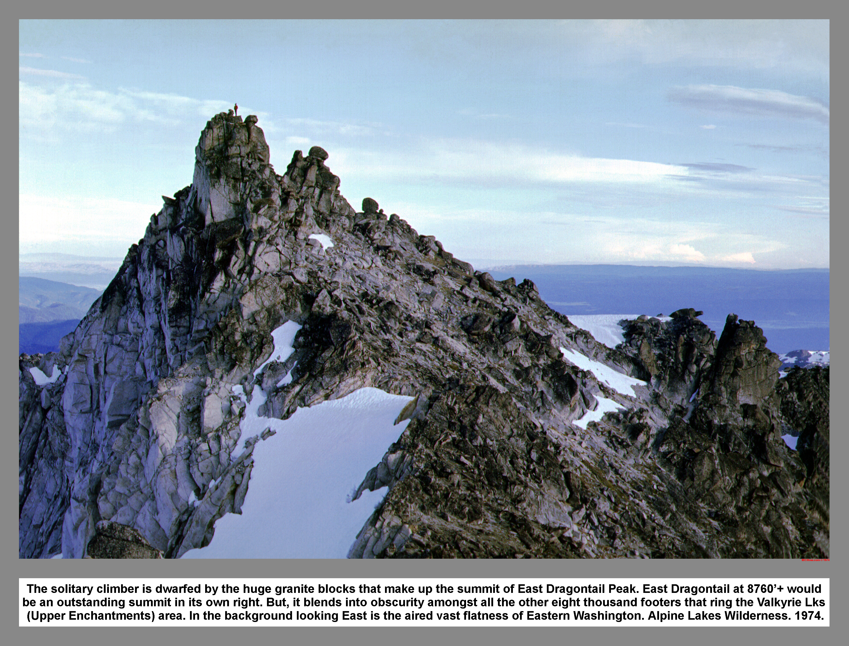
The solitary climber is dwarfed by the huge granite blocks that make up the summit of East Dragontail Peak. East Dragontail at 8760'+ would be an outstanding summit in its own right. But, it blends into obscurity amongst all the other eight thousand footers that ring the Valkyrie Lks (Upper Enchantments) area. In the background looking East is the aired vast flatness of Eastern Washington. Alpine Lakes Wilderness. 1974.
03 088 The Witches Tower with Temple Ridge beyond
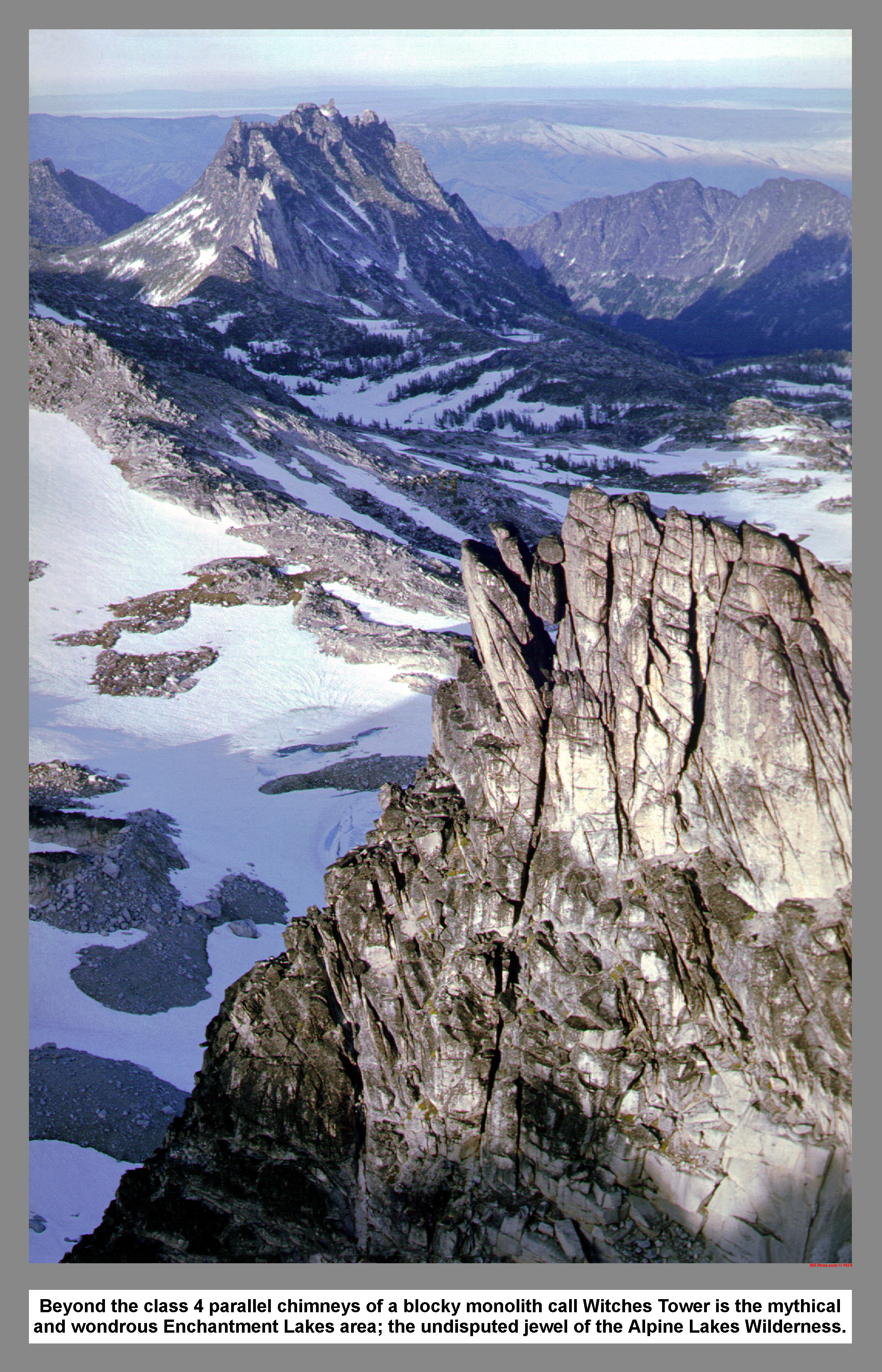
Beyond the class 4 parallel chimneys of the blocky monolith of Witches Tower is the mythical and wondrous Enchantment Lakes area; the undisputed jewel of the Alpine Lakes Wilderness.
03 089 Lost World Plateau from Enchantment Pk
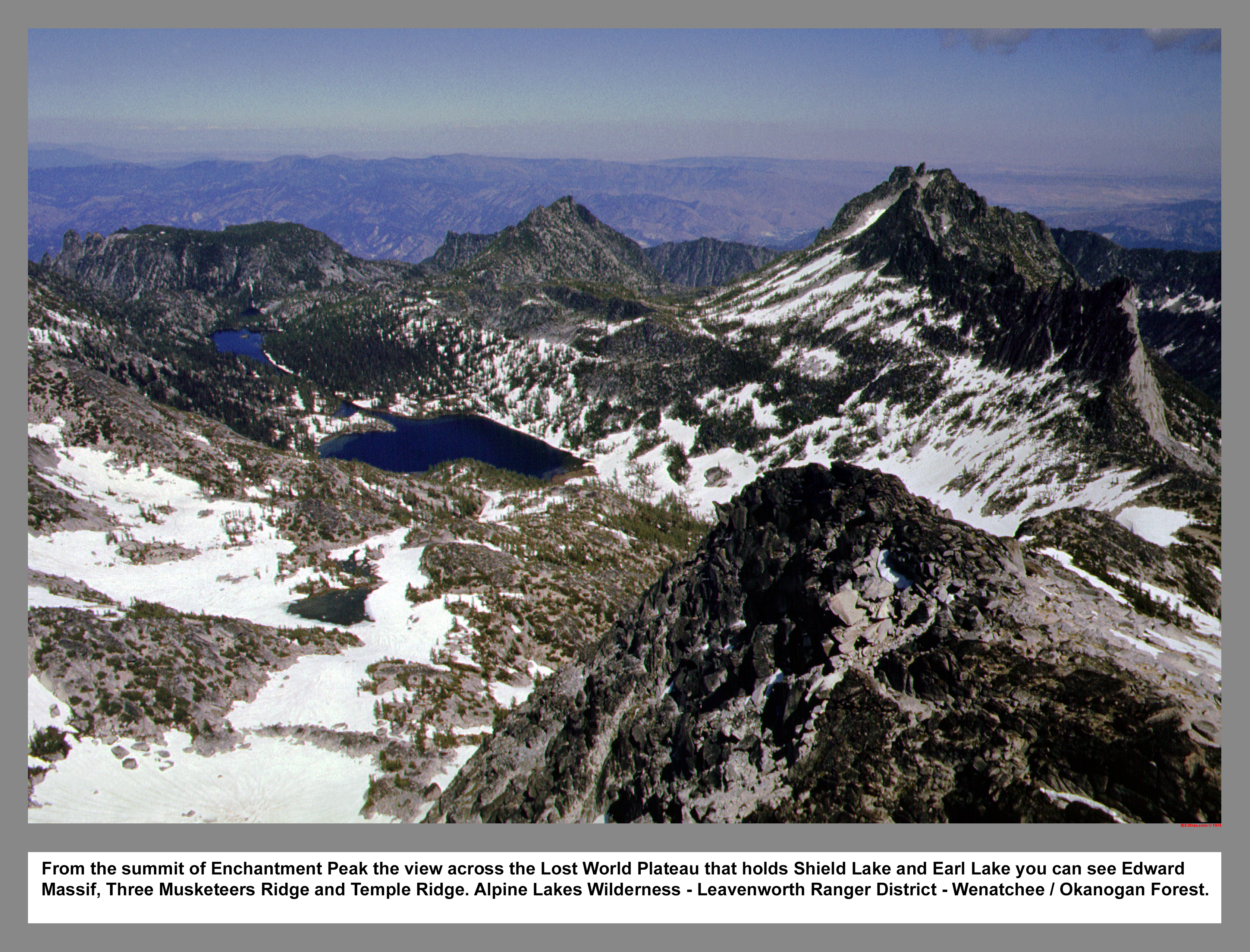
From the summit of Enchantment Peak the view across the Lost World Plateau that holds Shield Lake and Earl Lake you can see Edward Massif, Three Musketeers Ridge and Temple Ridge. Alpine Lakes Wilderness - Leavenworth Ranger District - Wenatchee / Okanogan forest.
03 090 Chessman Traverse Sketch
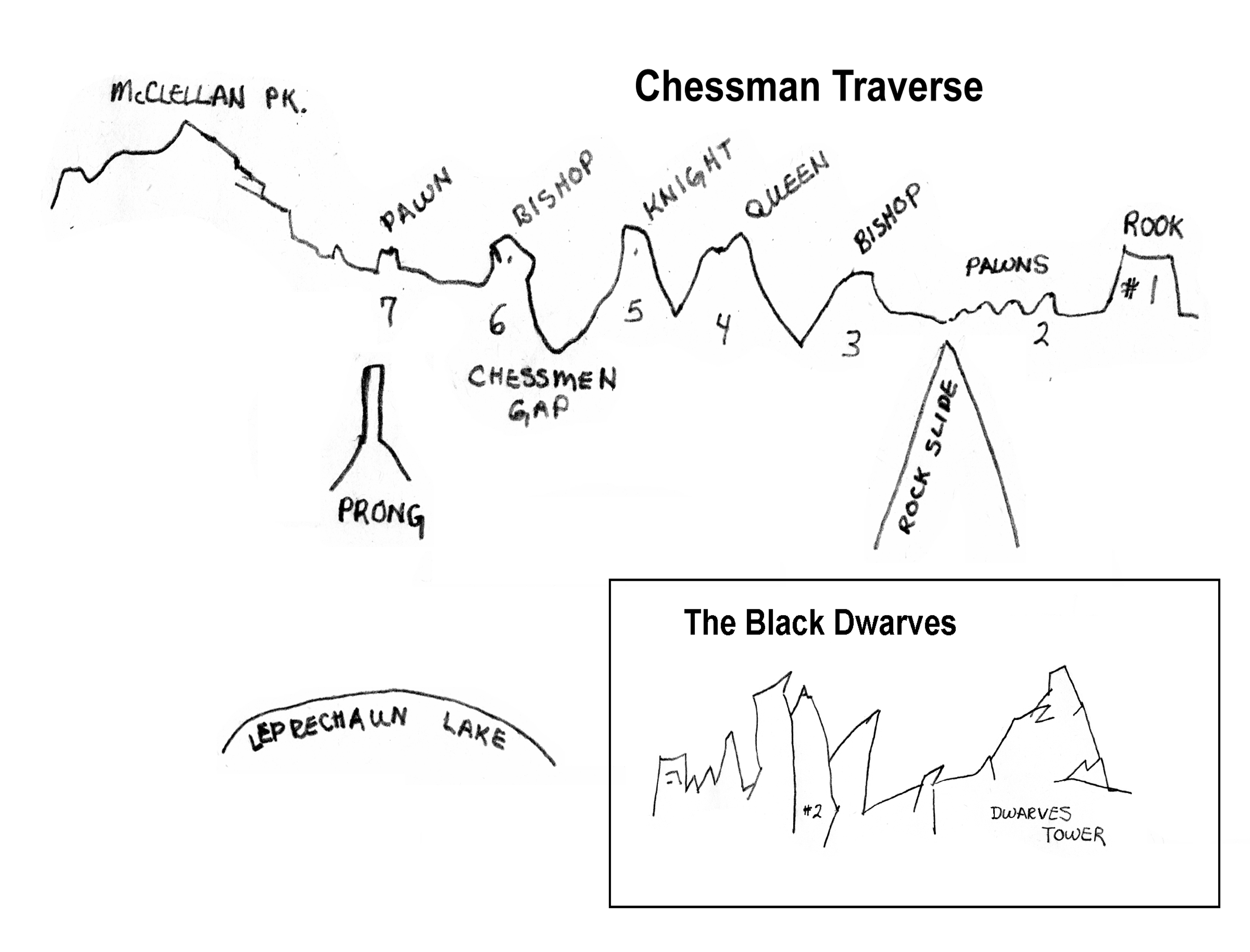
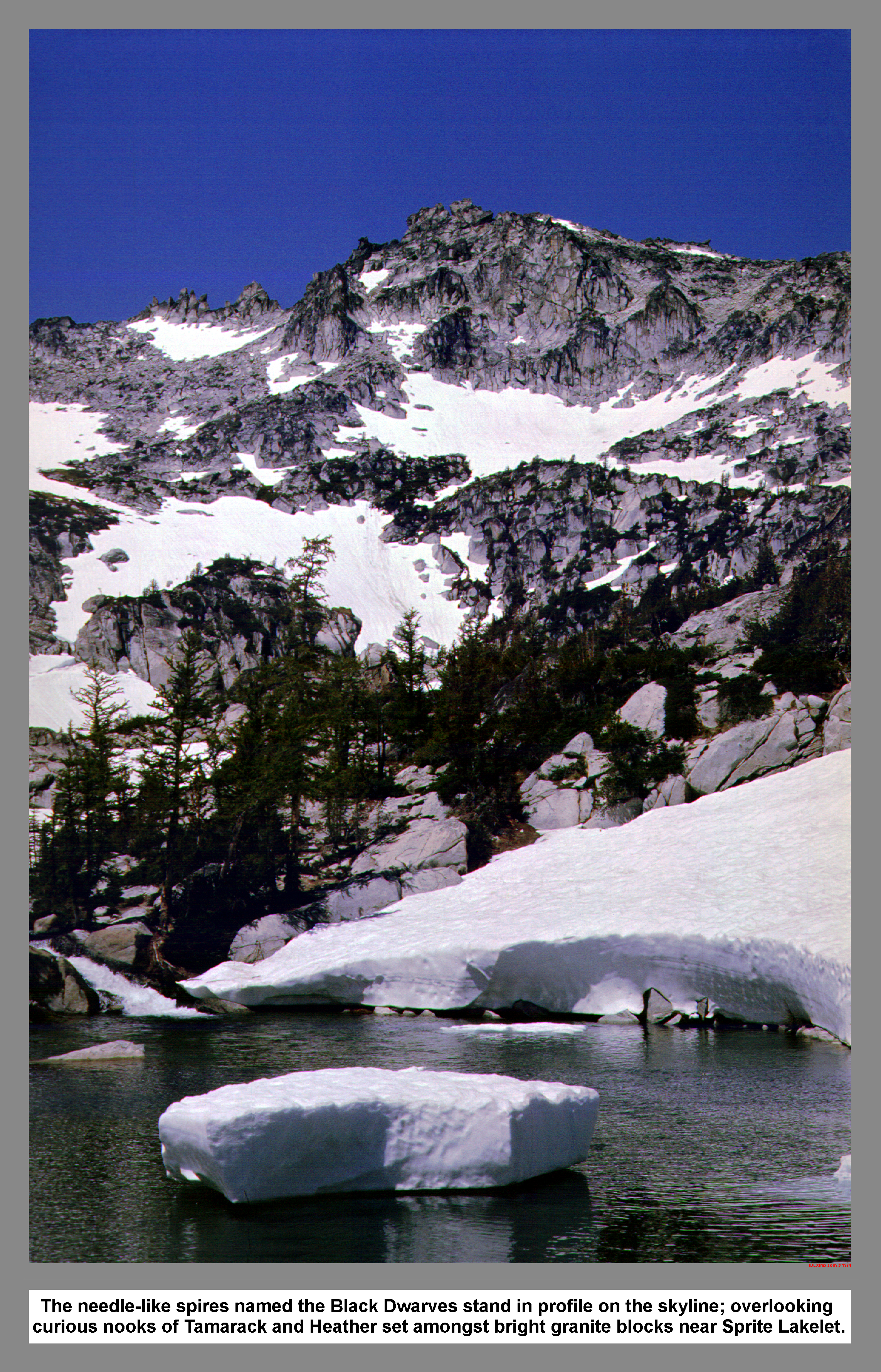
03 091 The Black Dwarves above Sprite Lakelet
![]()
The needle-like spires named the Black Dwarves stand in profile on the skyline; overlooking curious nooks of Tamarack and Heather set amongst bright granite blocks near Sprite Lakelet.
03 092 The Chessmen on McMillan Ridge Rudi M
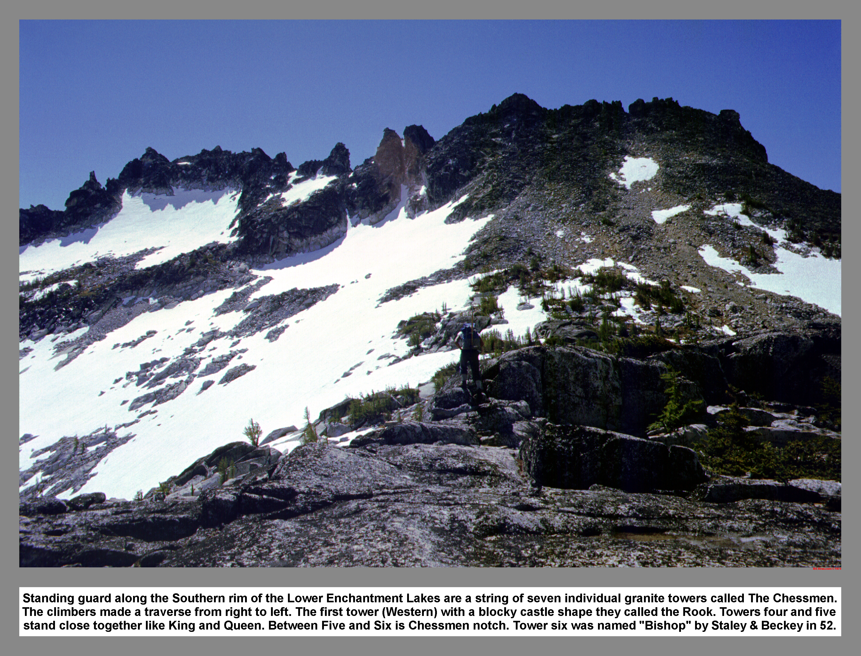
Standing guard along the Southern rim of the Lower Enchantment Lakes are a string of seven individual granite towers called The Chessmen. The climbers made a traverse from right to left. The first tower (Western) with a blocky castle shape they called the Rook. Towers four and five stand close together like King and Queen. Between Five and Six is Chessmen notch. Tower six was named "Bishop" by Staley and Beckey in 52.
03 093 Temple Ridge and the lower Enchantment Lakes

This wide-angle view from the gentle rib just above a small tarn called Troll Sink looks Northeast across the Lower Enchantment Lakes Basin toward the jagged crest of Temple Ridge. Noted 1940s climber Ralph Widrig, who compiled numerous first ascents in the "Cashmere Crags" area, described the pointed towers as "tall threatening spires that streak skyward like Dantesque flames". Wenatchee Forest. July 74.
03 094 Rainier Horizontal Spire the Flagpole Pennant Peak
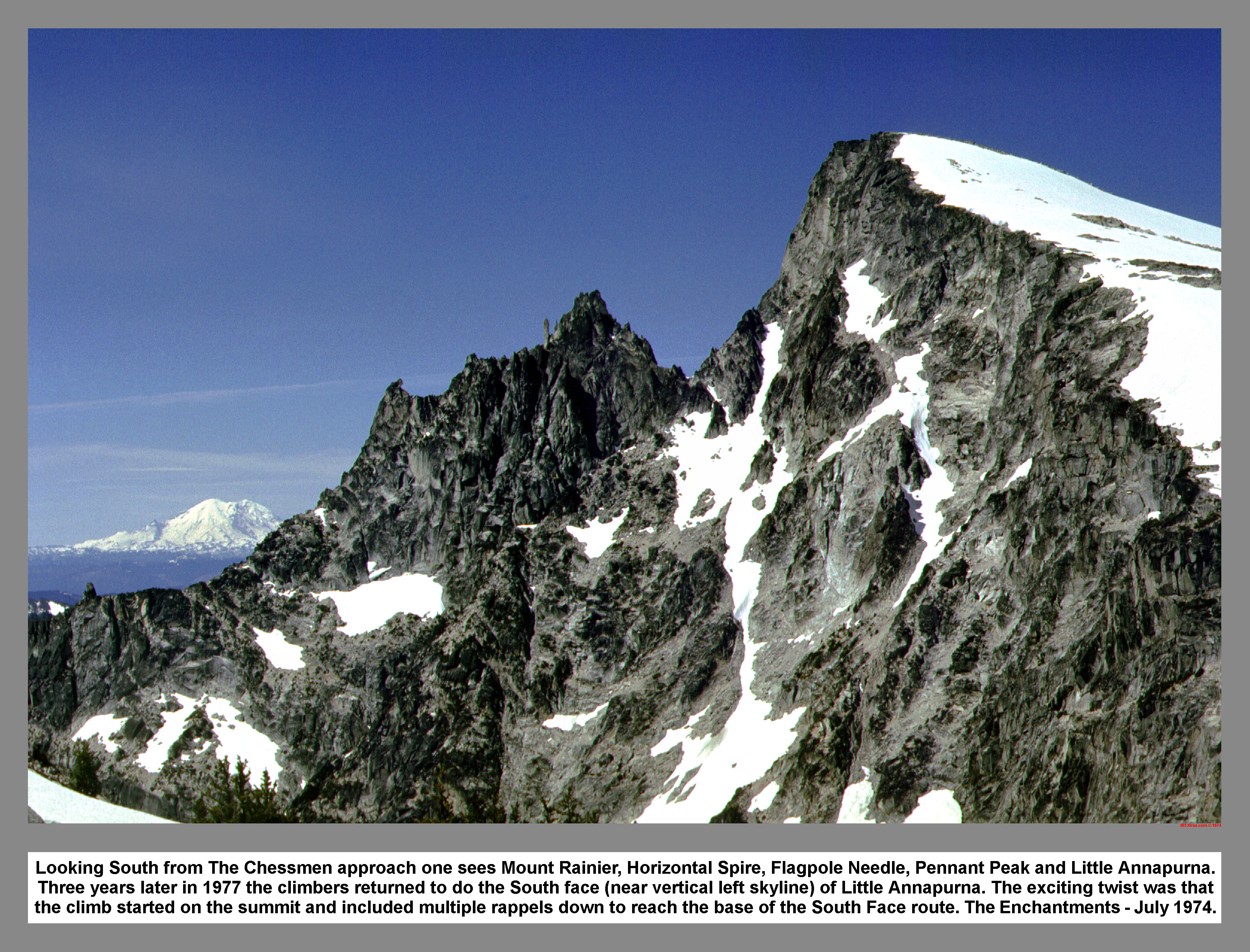
Looking South from The Chessmen approach one sees Mount Rainier, Horizontal Spire, Flagpole Needle, Pennant Peak and Little Annapurna. Three years later in 1977 the climbers returned to do the South face (near vertical left skyline) of Little Annapurna. The exciting twist was that the climb started on the summit and included multiple rappels down to reach the base of the South Face route. The Enchantments - July 1974.
03 095 Rudi M climbs on The Knight on Chessman traverse
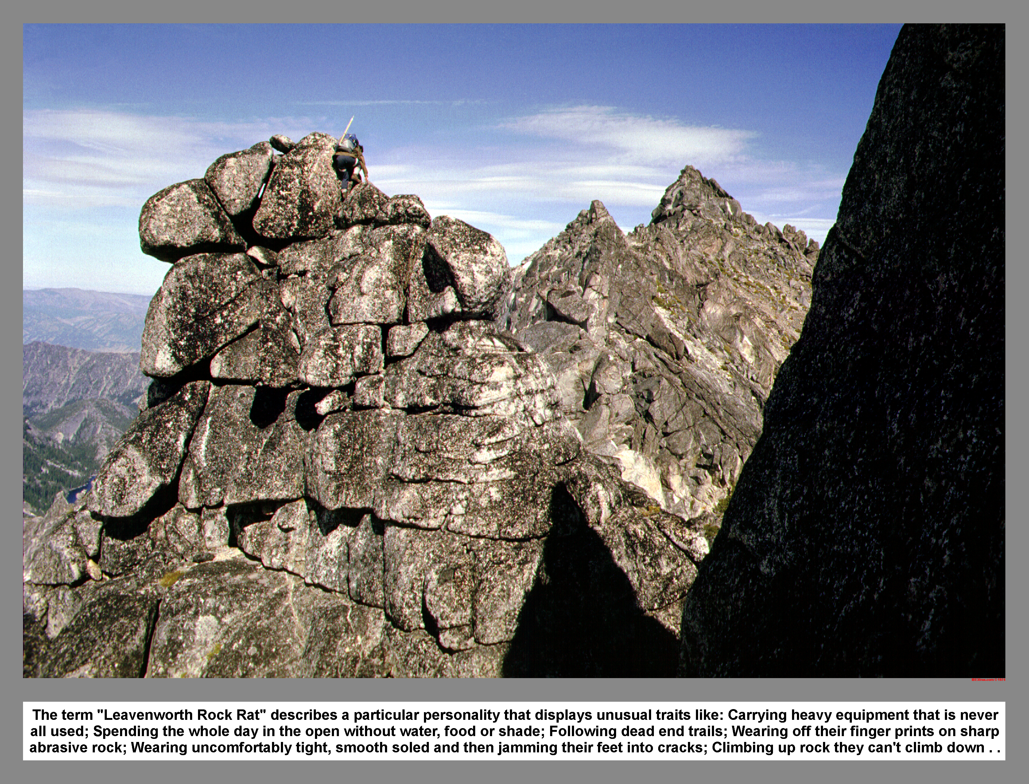
The term "Leavenworth Rock Rat" describes a particular personality that displays unusual traits like: Carrying heavy equipment that is never all used; Spending the whole day in the open without water, food or shade; Following dead end trails; Wearing off their finger prints on sharp abrasive rock; Wearing uncomfortably tight, smooth soled and then jamming their feet into cracks; Climbing up rock they can't climb down.
03 096 High Priest from Hepzibah Blop on Temple Ridge
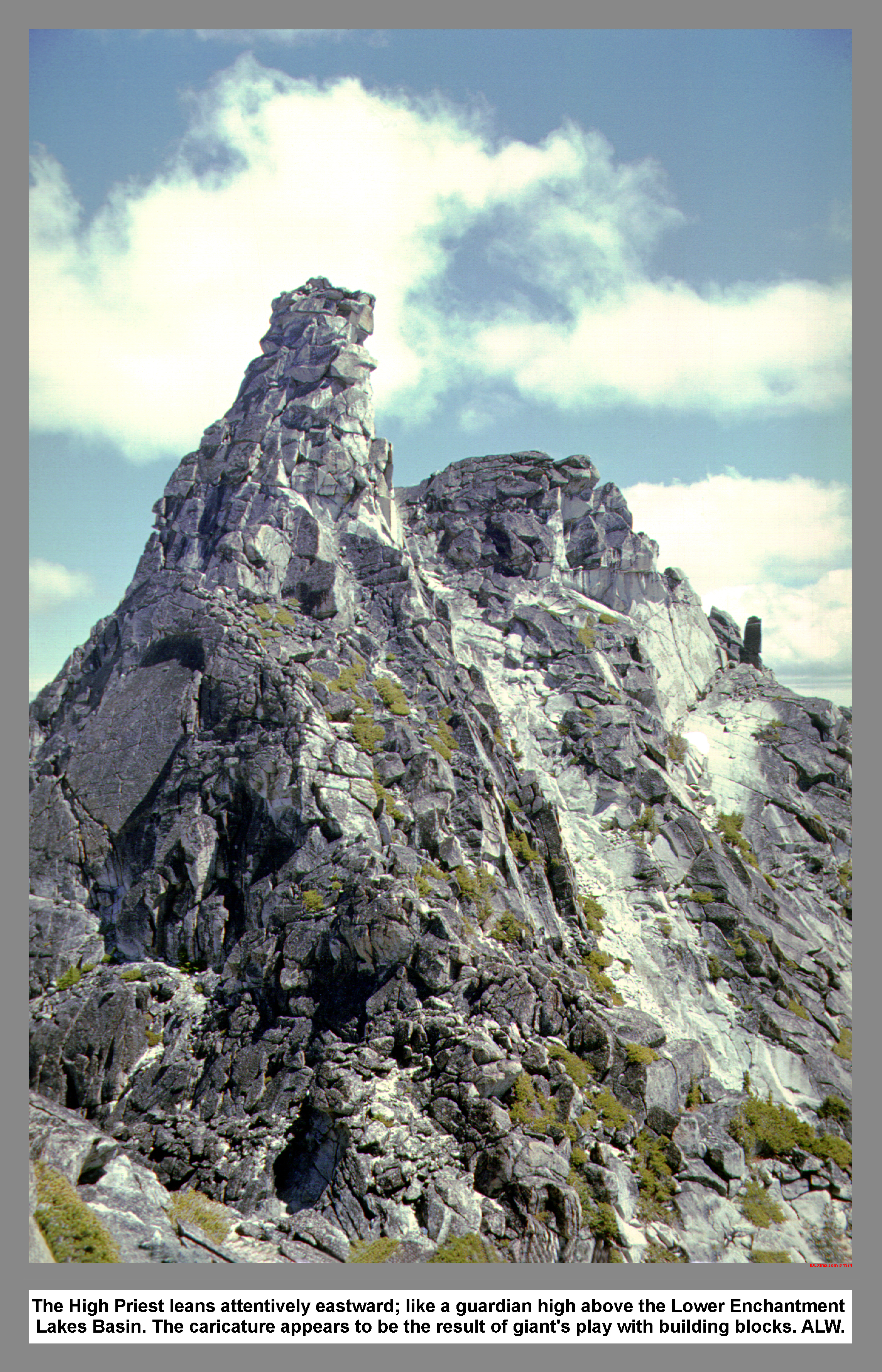
The High Priest leans attentively eastward; like a guardian high above the Lower Enchantment Lakes Basin. The caricature appears to be the result of giant's play with building blocks. ALW.
03 097 Flagpole Needles from Little Annapurna
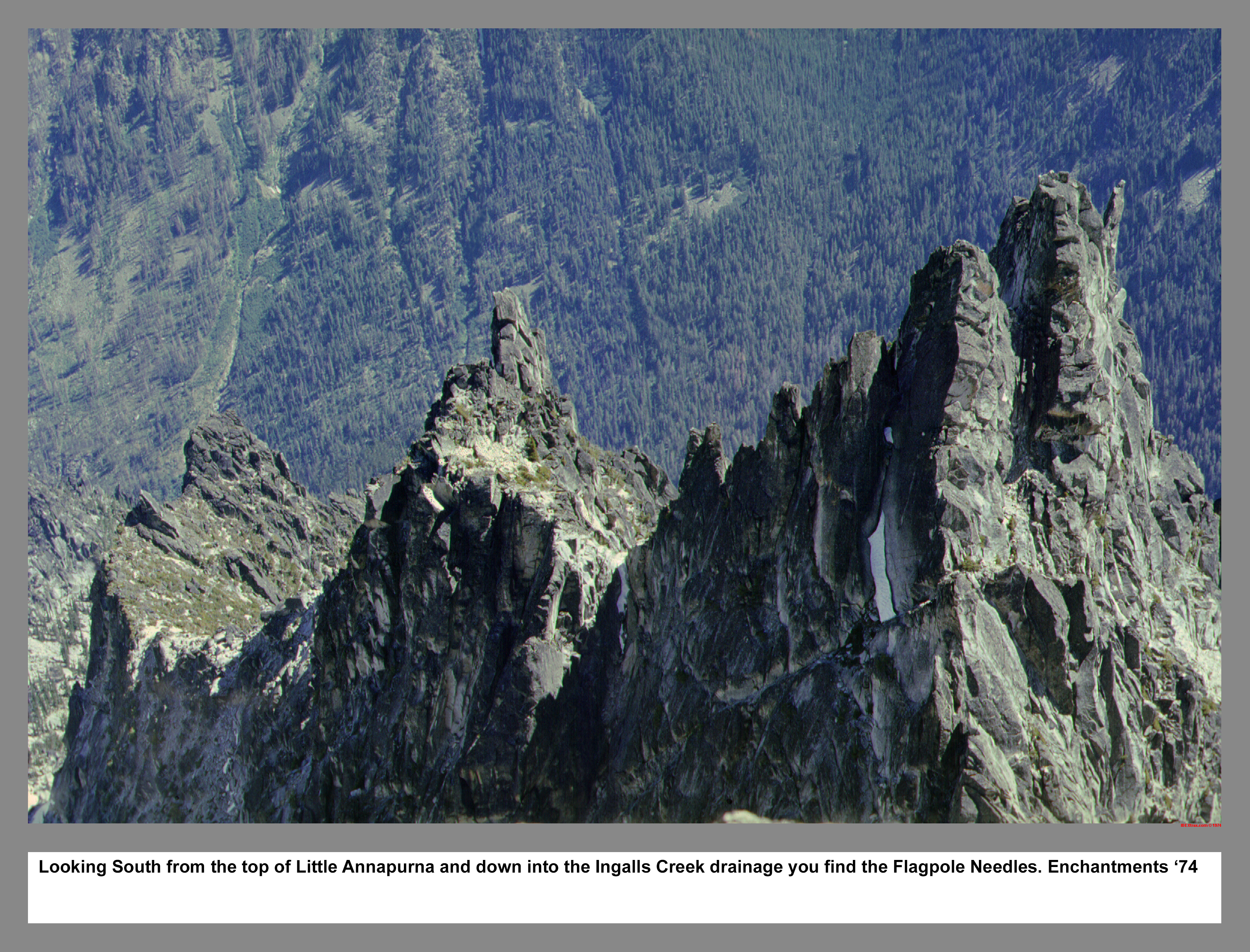
Looking South from the top of Little Annapurna and down into the Ingalls Creek drainage you find the Flagpole Needles. Enchantments '74
03 098 Temple Ridge from Little Annapurna
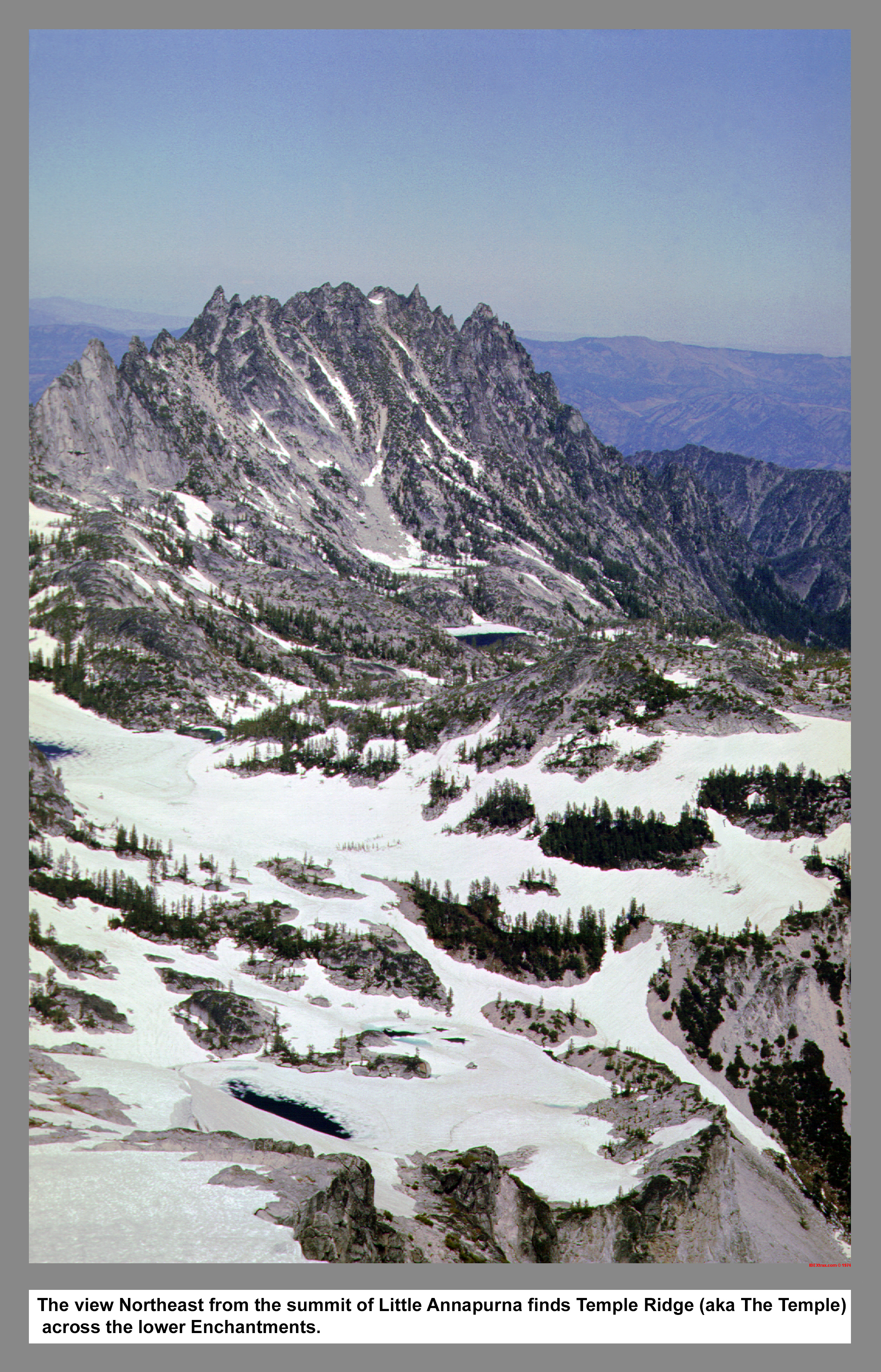
The view Northeast from the summit of Little Annapurna finds Temple Ridge (aka The Temple) across the lower Enchantments.
03 099 Mist Pond and Aasgard Pass from Witches Tower
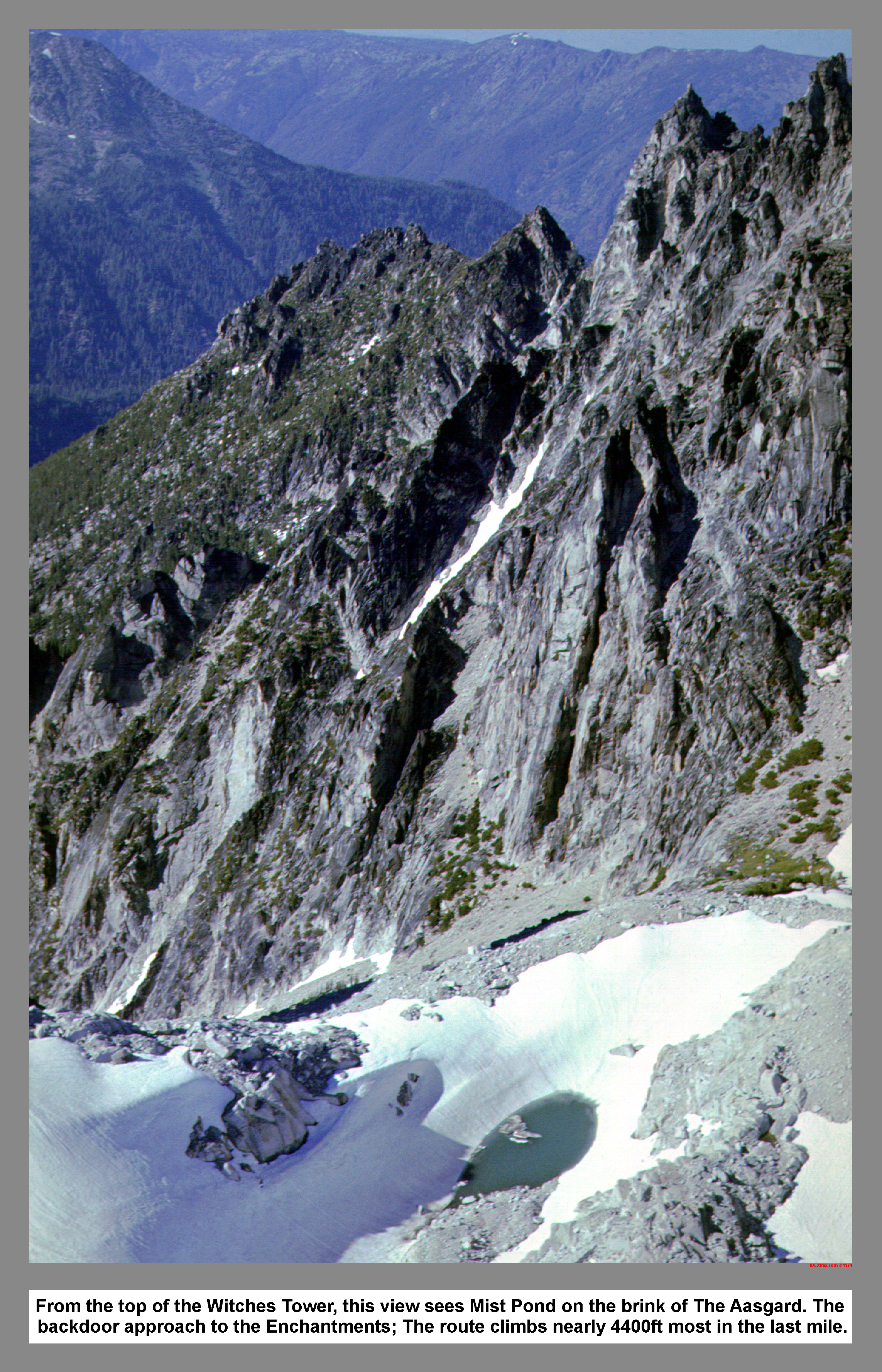
From the top of the Witches Tower, this view sees Mist Pond on the brink of The Aasgard. The backdoor approach to the Enchantments; The route climbs nearly 4400ft most in the last mile.
03 100 The Witches Tower from Aasgard Pass
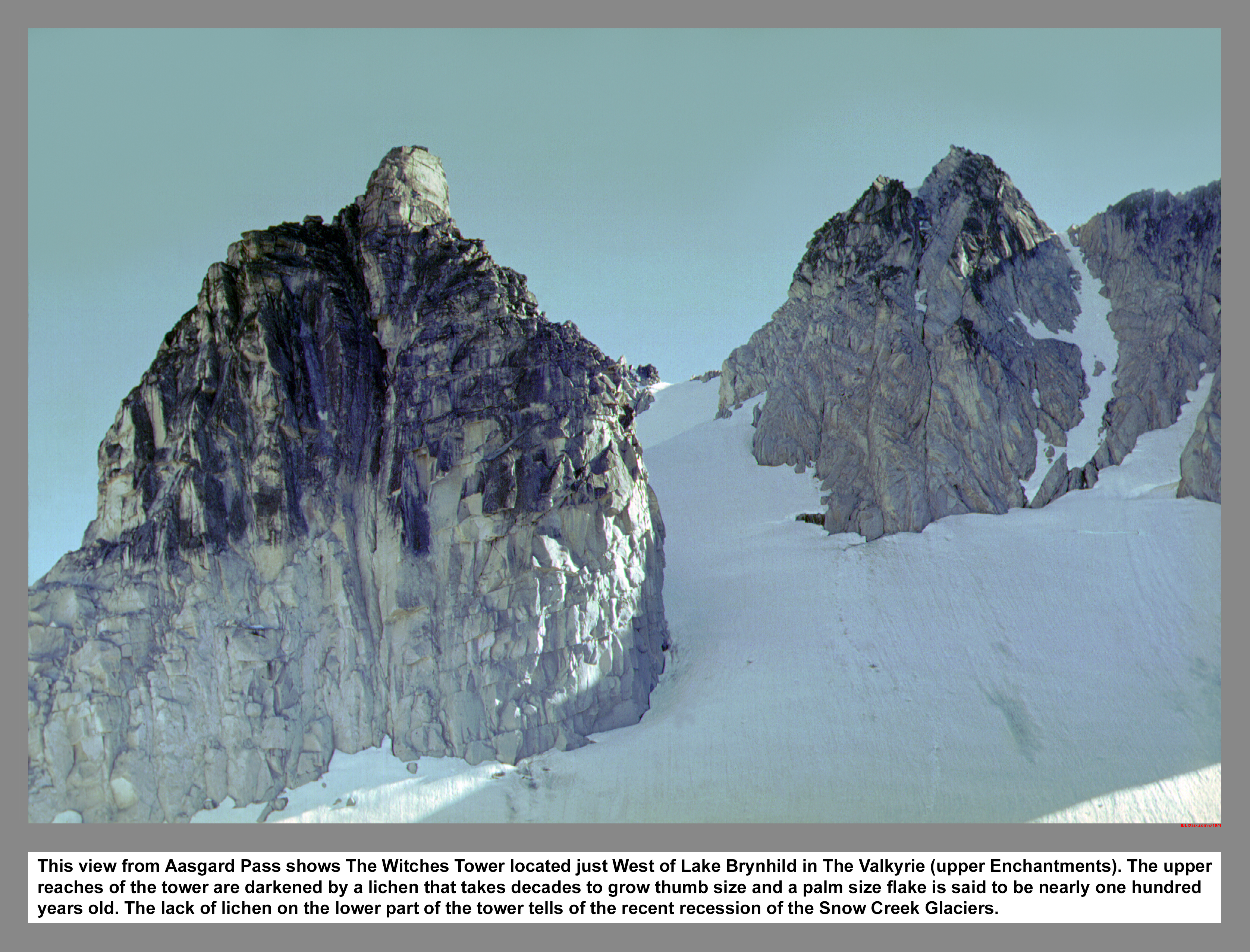
This view from Aasgard Pass shows The Witches Tower located just West of Lake Brynhild in The Valkyrie (upper Enchantments). The upper reaches of the tower are darkened by a lichen that takes decades to grow thumb size and a palm size flake is said to be nearly one hundred years old. The lack of lichen on the lower part of the tower tells of the recent recession of the Snow Creek Glaciers.
03 101 Colchuck Lk from Dragontail Peak
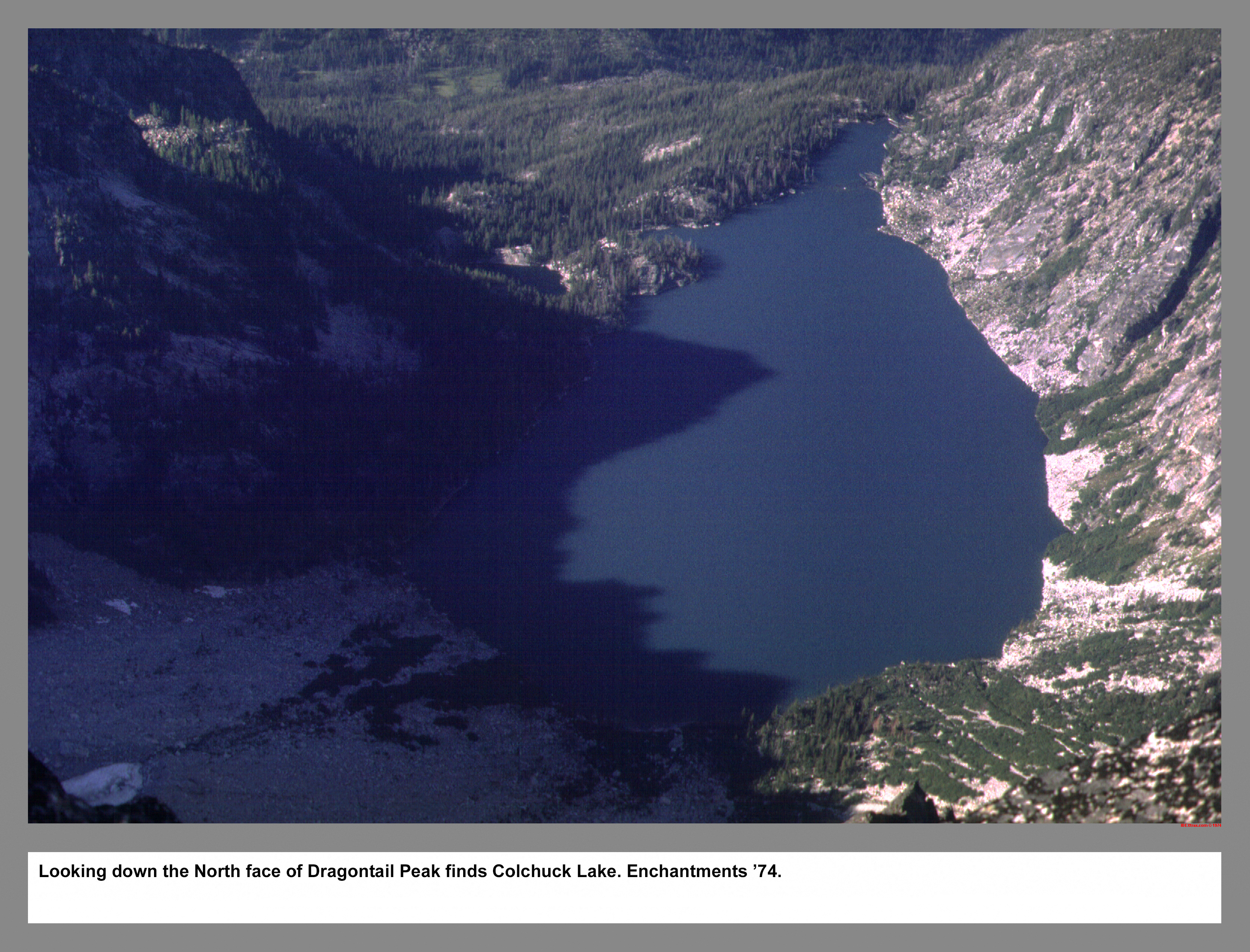
Looking down the North face of Dragontail Peak finds Colchuck Lake. Enchantments '74.
03 102 Langley Group at Leprechaun Lake
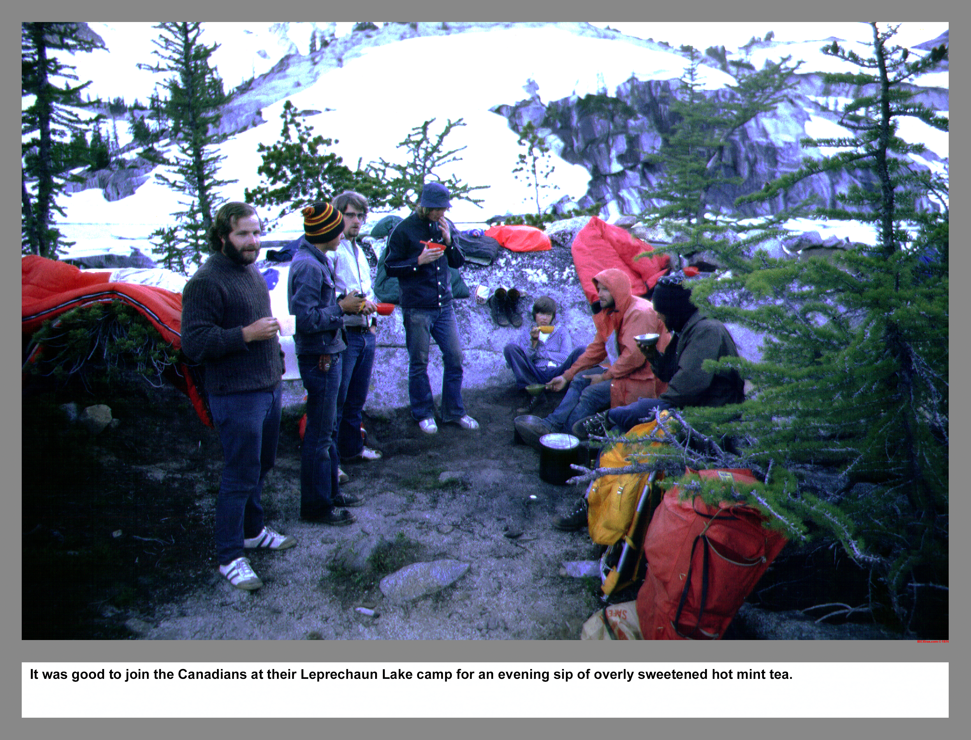
It was good to join the Canadians at their Leprechaun Lake camp for an evening sip of overly sweetened hot mint tea.
03 103 Prusik Pk W Ridge Route on Skyline Left
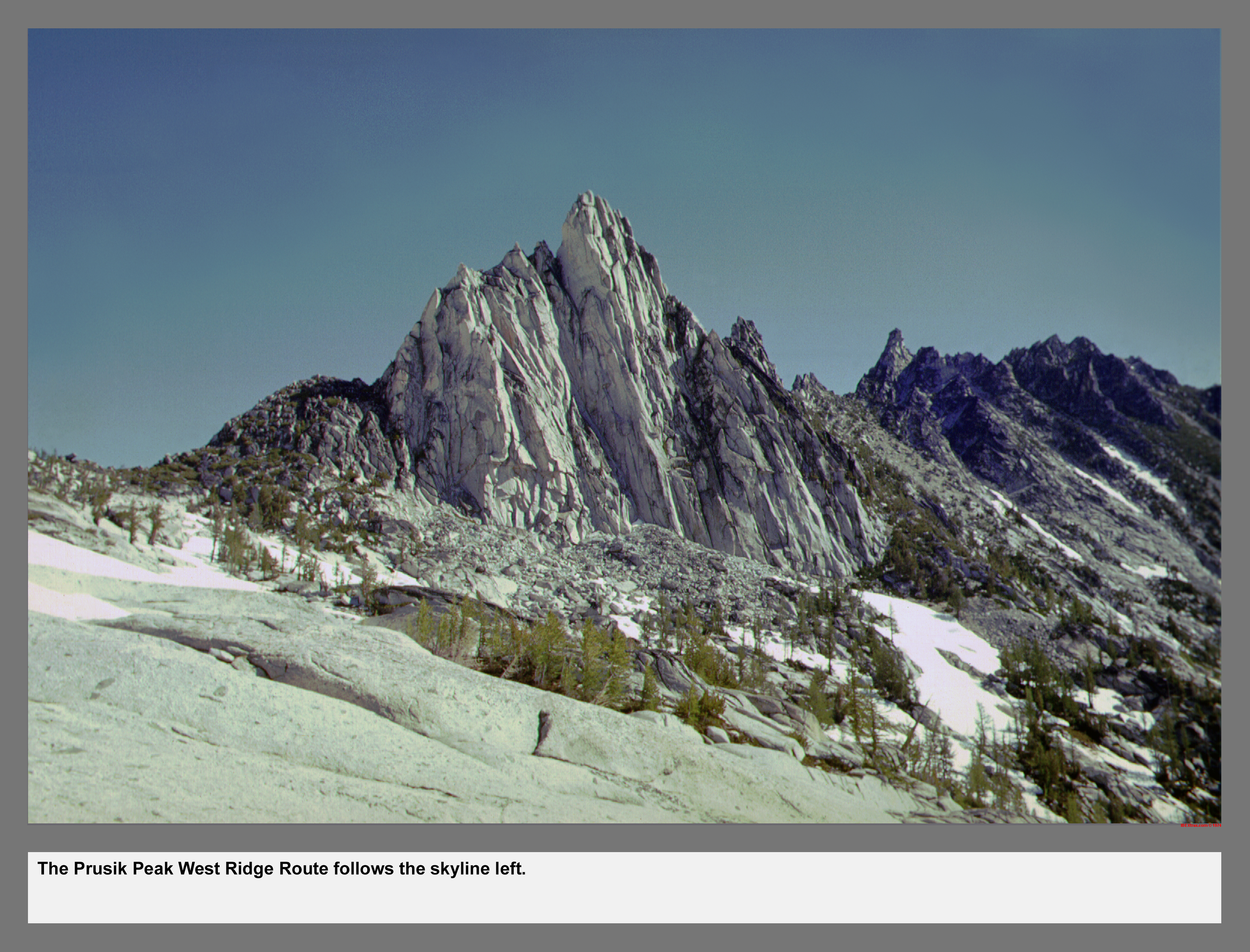
The Prusik Peak West Ridge Route follows the skyline left.
03 104 Chris H on W Ridge of Prusik Peak Enchantments
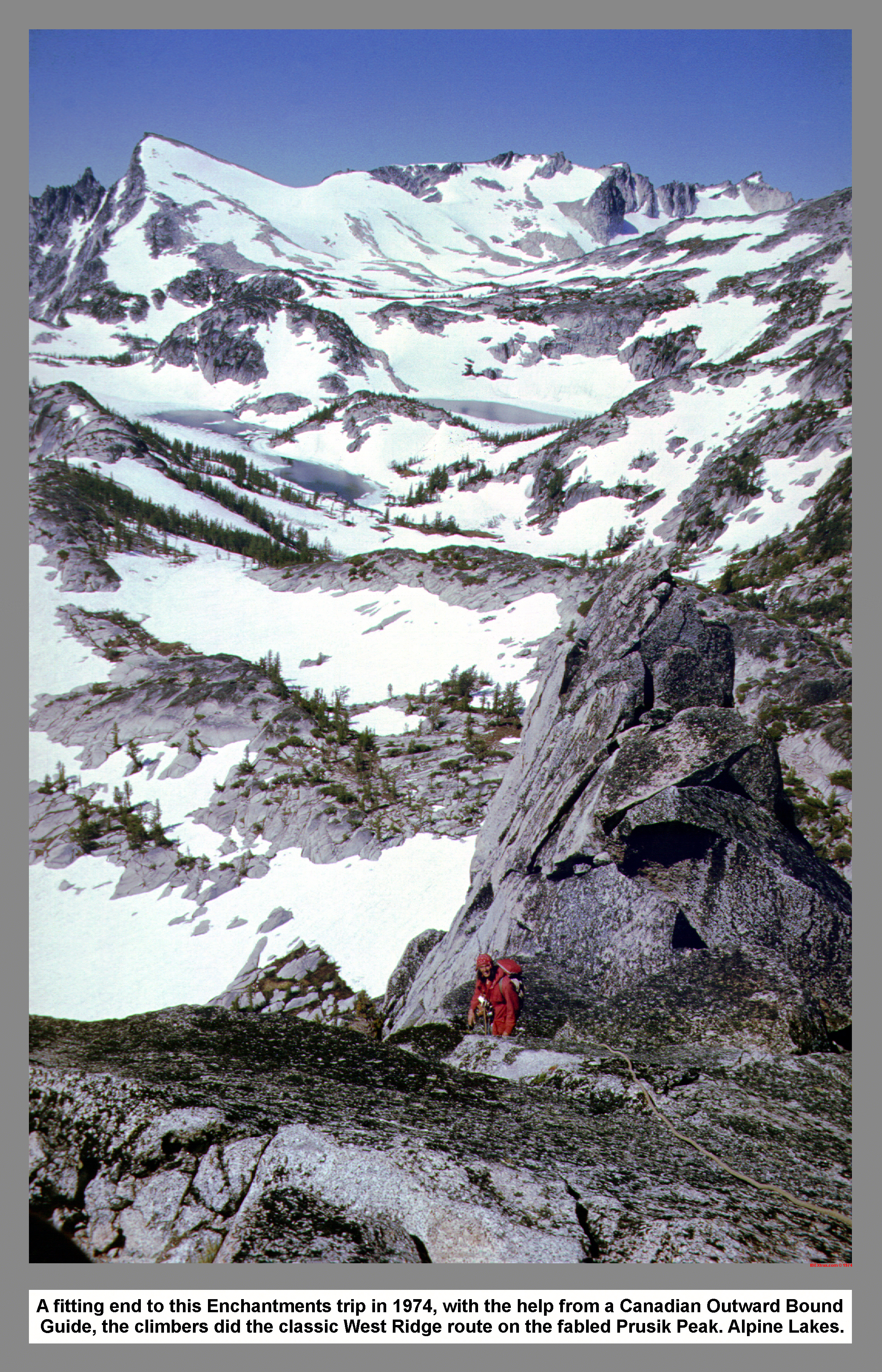
A fitting end to this Enchantments trip in 1974, with the help from a Canadian Outward Bound Guide, the climbers did the classic West Ridge route on the fabled Prusik Peak. Alpine Lakes.
03 105 Chris H Trying the Hard way on Prusik Peak
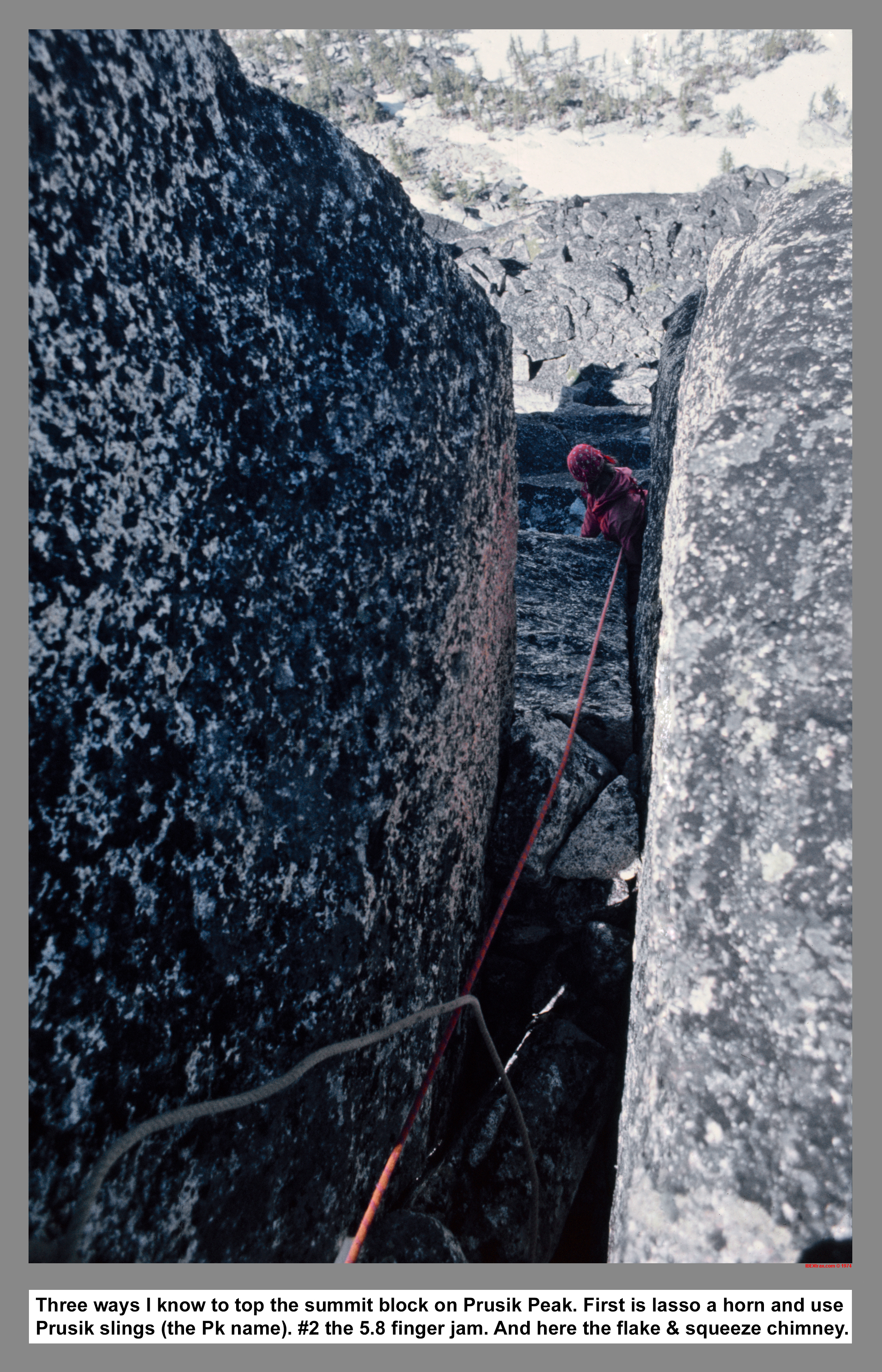
Three ways I know of to top the summit block on Prusik Peak. One is lasso a horn and use Prusik slings (hence the Pk name). Number Two the hardest is the 5.8 finger jam. And here the standard route up the crescent flake and squeeze chimney.
03 106 Lk Viviane and McClellan Ridge from Prusik Peak
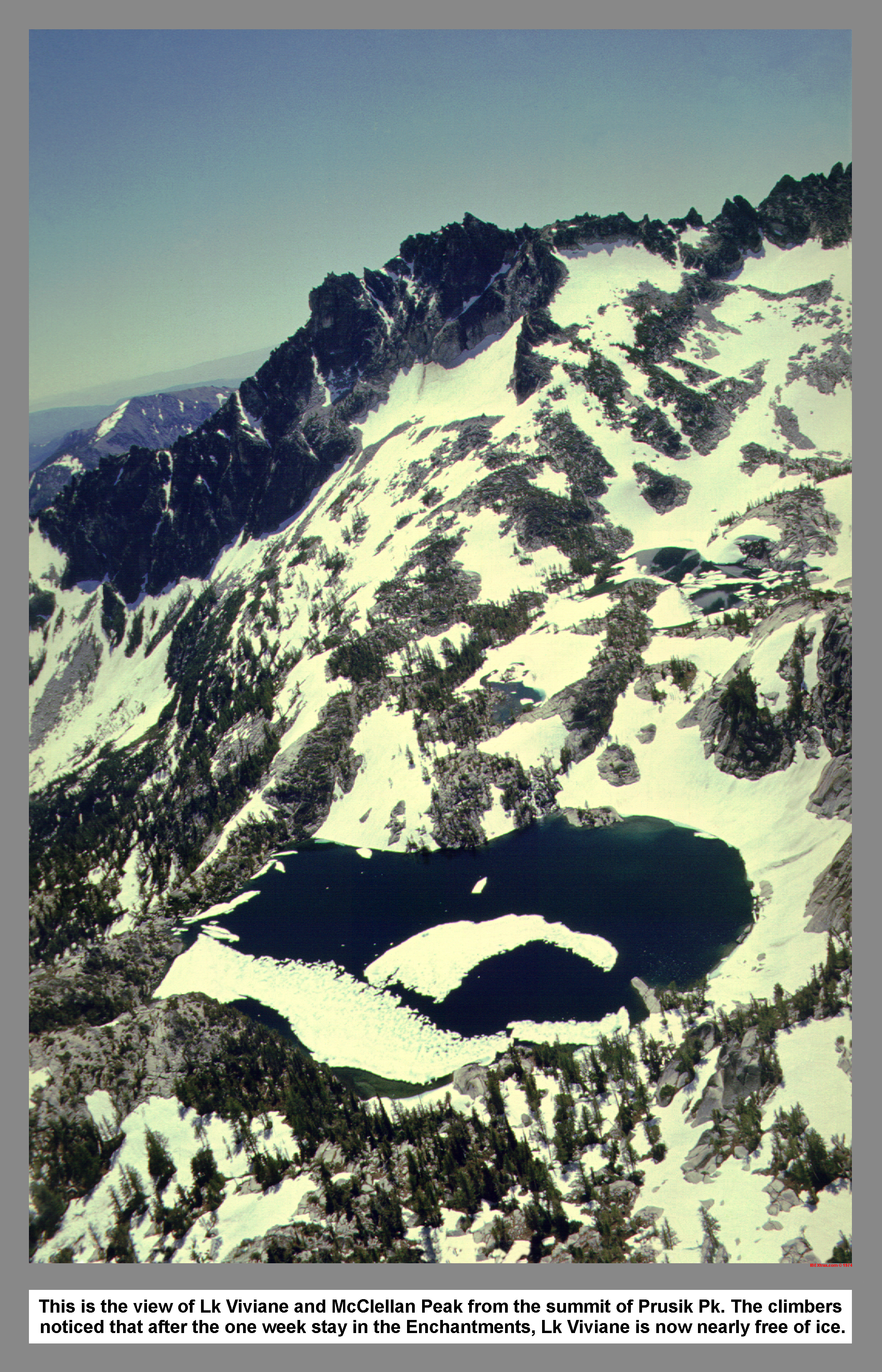
This is the view of Lk Viviane and McClellan Peak from the summit of Prusik Pk. The climbers noticed that after the one week stay in the Enchantments, Lk Viviane is now nearly free of ice.
03 107 Prusik Peak from near Gnome Tarn Sept 64
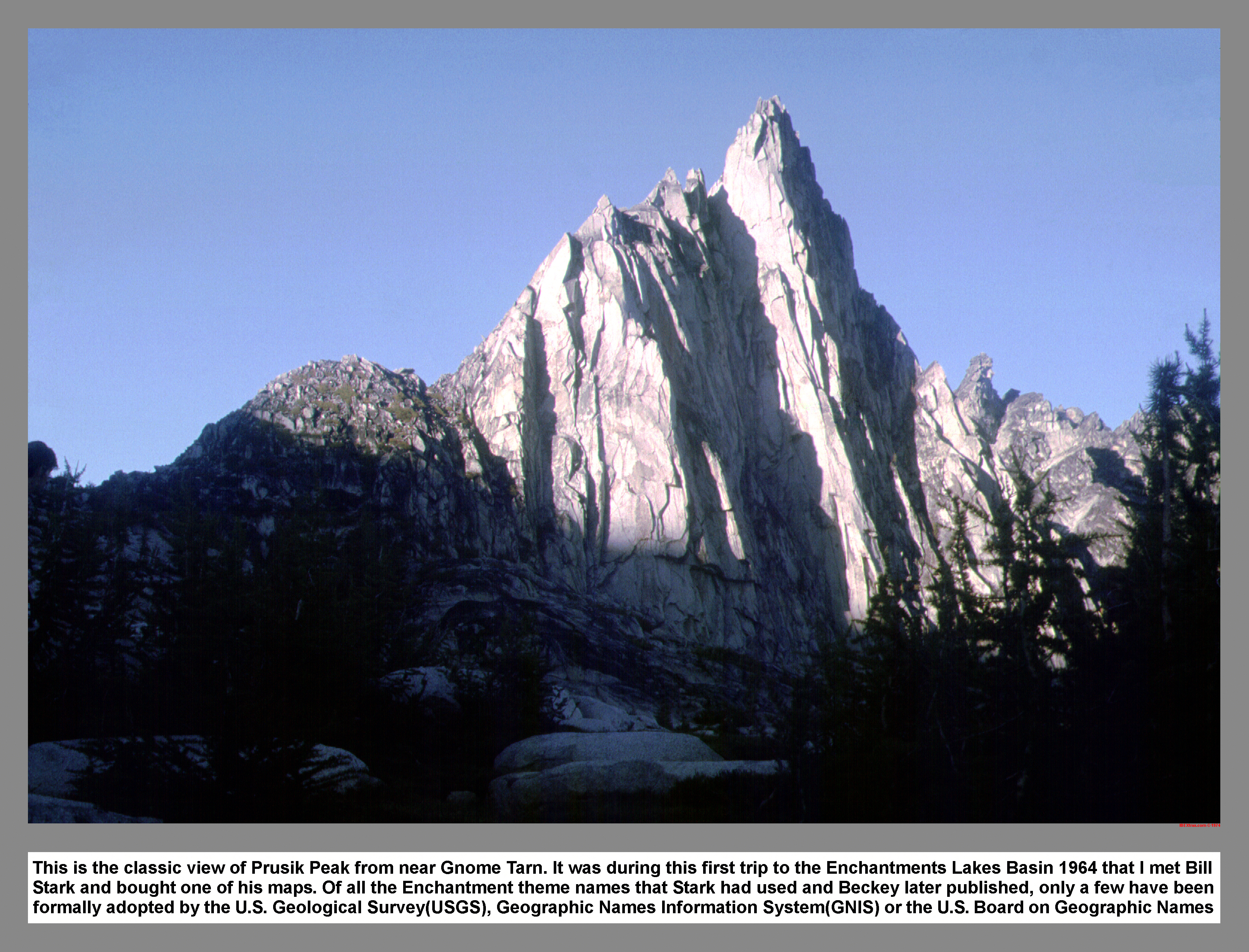
This is the classic view of Prusik Peak from near Gnome Tarn. It was during this first trip to the Enchantments Lakes Basin 1964 that I met Bill Stark and bought one of his maps. Of all the Enchantment theme names that Stark had used and Beckey later published, only a few have been formally adopted by the U.S. Geological Survey(USGS), Geographic Names Information System(GNIS) or the U.S. Board on Geographic Names
03 108 Prusik Peak from Lake Viviane June 74
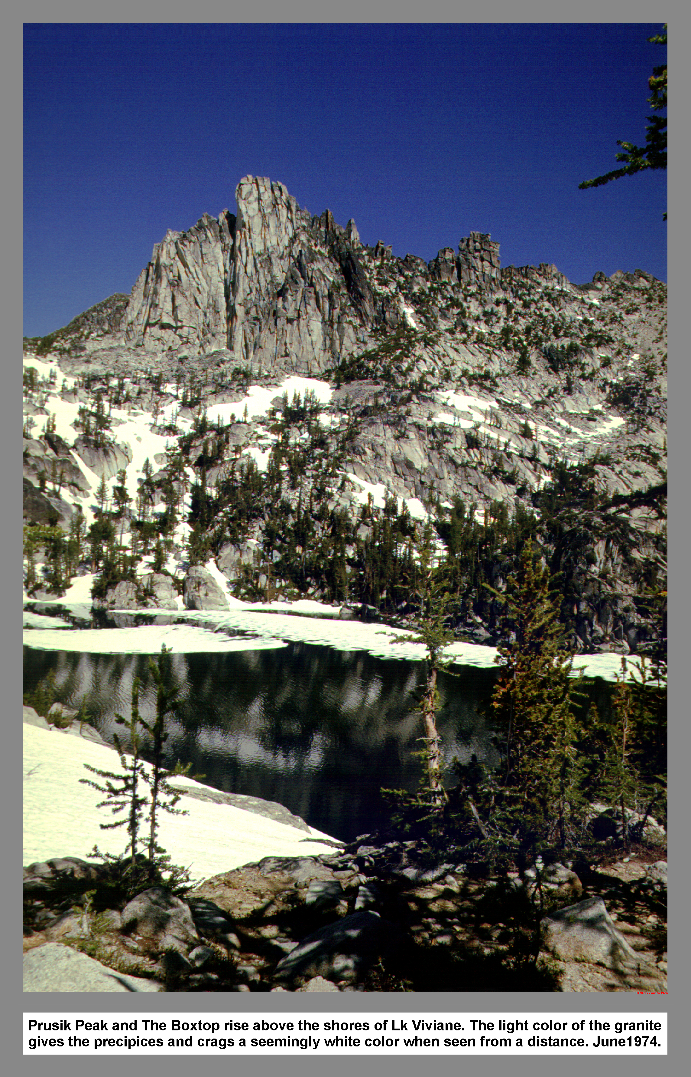
Prusik Peak and The Boxtop rise above the shores of Lk Viviane. The light color of the granite gives the precipices and crags a seemingly white color when seen from a distance. June1974.
03 109 Chris H hikes out Biforst Arm below Temple Ridge
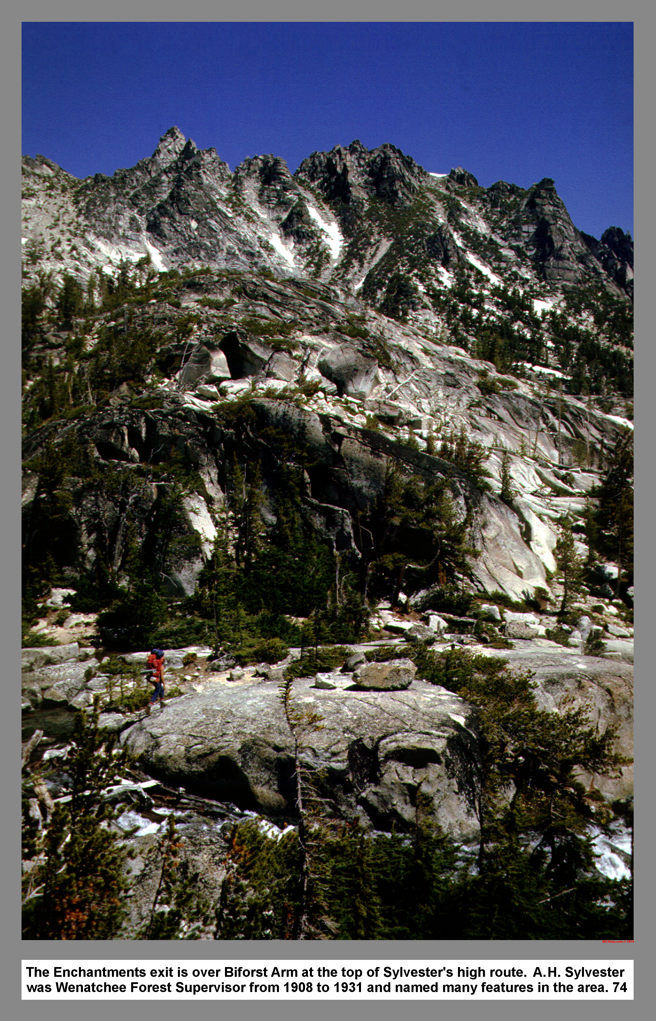
The Enchantments exit is over Biforst Arm at the top of Sylvester's high route. A. H. Sylvester was Wenatchee Forest Supervisor from 1908 to 1931 and named many features in the area. 74
|
|
|
|
|
|
This site created and maintained by THE IBEX - Page last revised:
|
|