
|
|
IBEXtrax.com - Cascade Mountains of Washington StateMount Rainier Park |
|
|
03 065 Tatoosh Range Sunrise from Paradise Camp
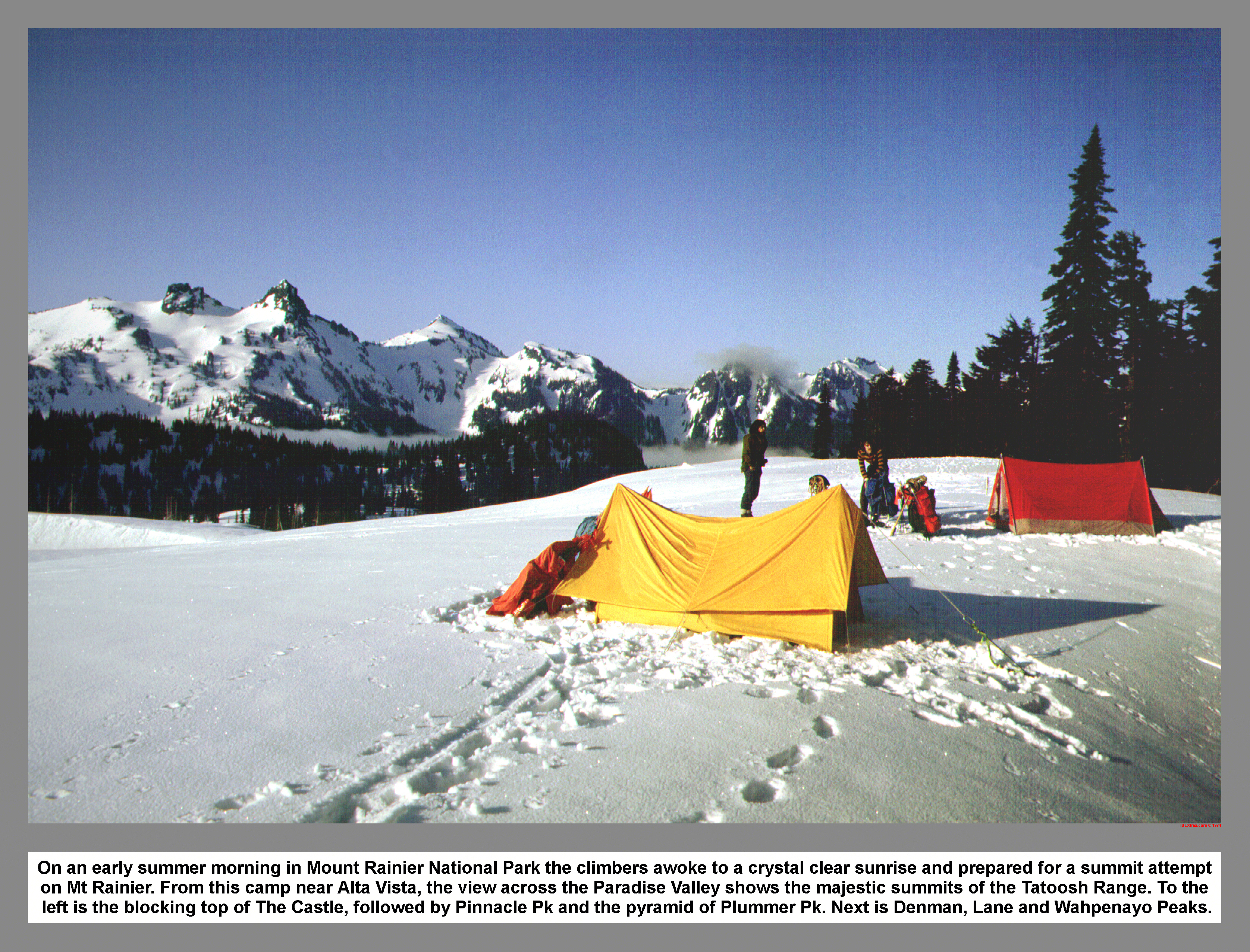
On an early summer morning in Mount Rainier National Park the climbers awoke to a crystal clear sunrise and prepared for a summit attempt on Mt Rainier. From this camp near Glacier Vista, the view across the Paradise Valley shows the majestic summits of the Tatoosh Range. To the left is the blocking top of The Castle, followed by Pinnacle Pk and the pyramid of Plummer Pk. Next is Denman, Lane and Wahpenayo Pks.
03 066 Rudi M ascends Wapowety Clever below the Castle
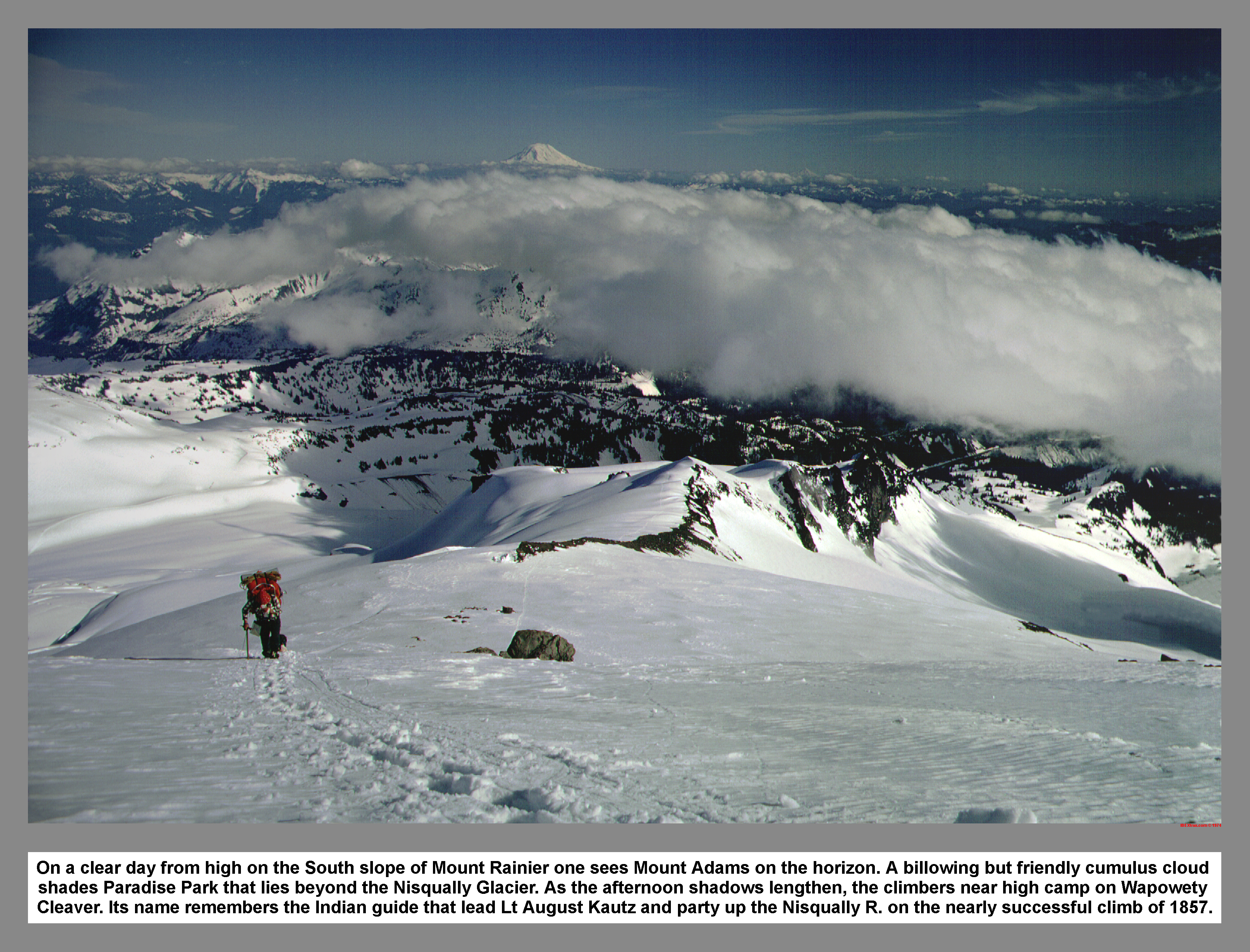
On a clear day from high on the South slope of Mount Rainier one sees Mount Adams on the horizon. A billowing but friendly cumulus cloud shades Paradise Park that lies beyond the Nisqually Glacier. As the afternoon shadows lengthen, the climbers near high camp on Wapowety Cleaver. Its name remembers the Indian guide that lead Lt August Kautz and party up the Nisqually R. on the nearly successful climb of 1857.
03 067 Castle Camp on Wapowety Clever 9500ft Jun74
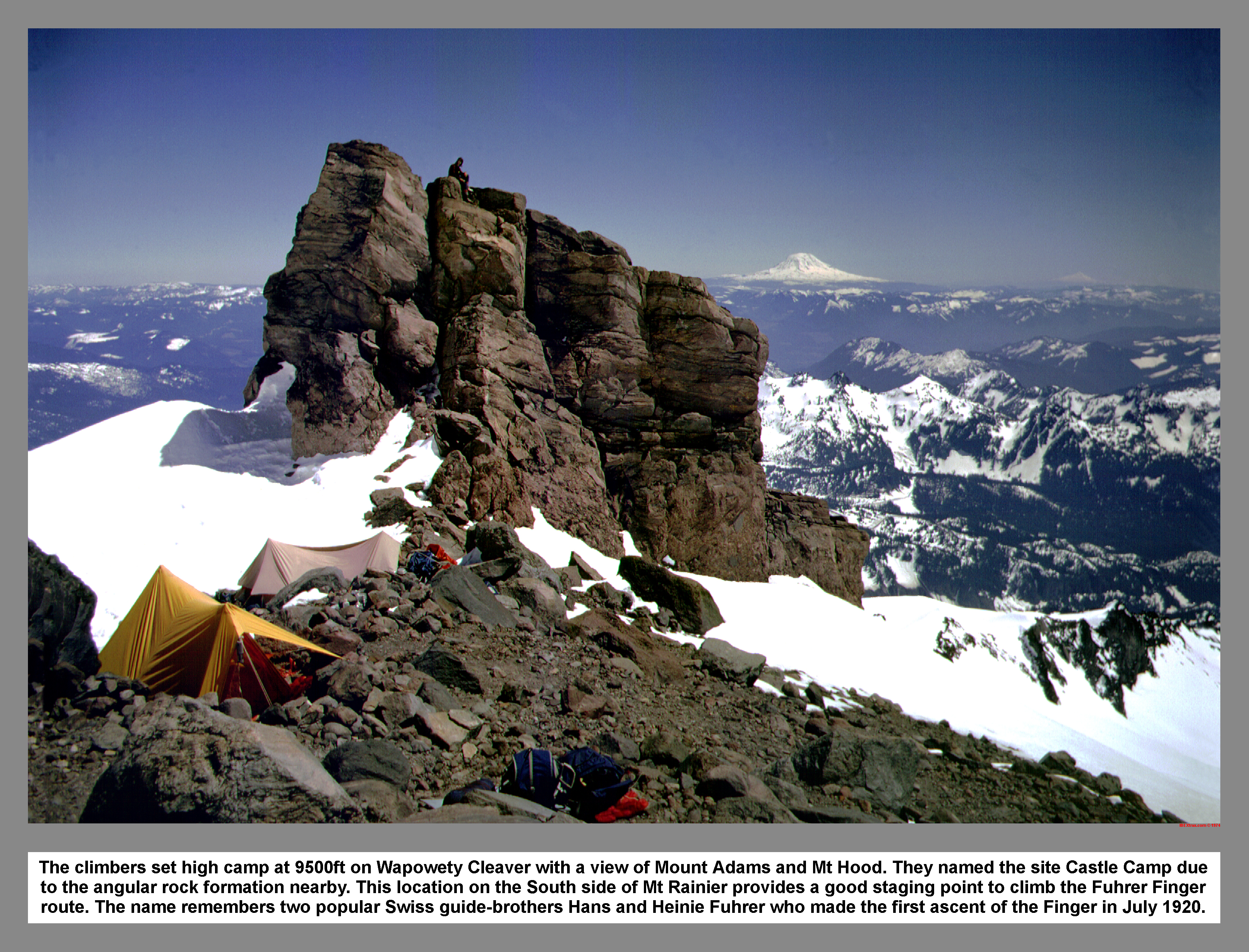
The climbers set high camp at 9500ft on Wapowety Cleaver with a view of Mount Adams and Mt Hood. They named the site Castle Camp due to the angular rock formation nearby. This location on the South side of Mt Rainier provides a good staging point to climb the Fuhrer Finger route. The name remembers two popular Swiss guide-brothers Hans and Heinie Fuhrer who made the first ascent of the Finger in July 1920.
03 068 View up Wapowety Clever on Mount Rainier
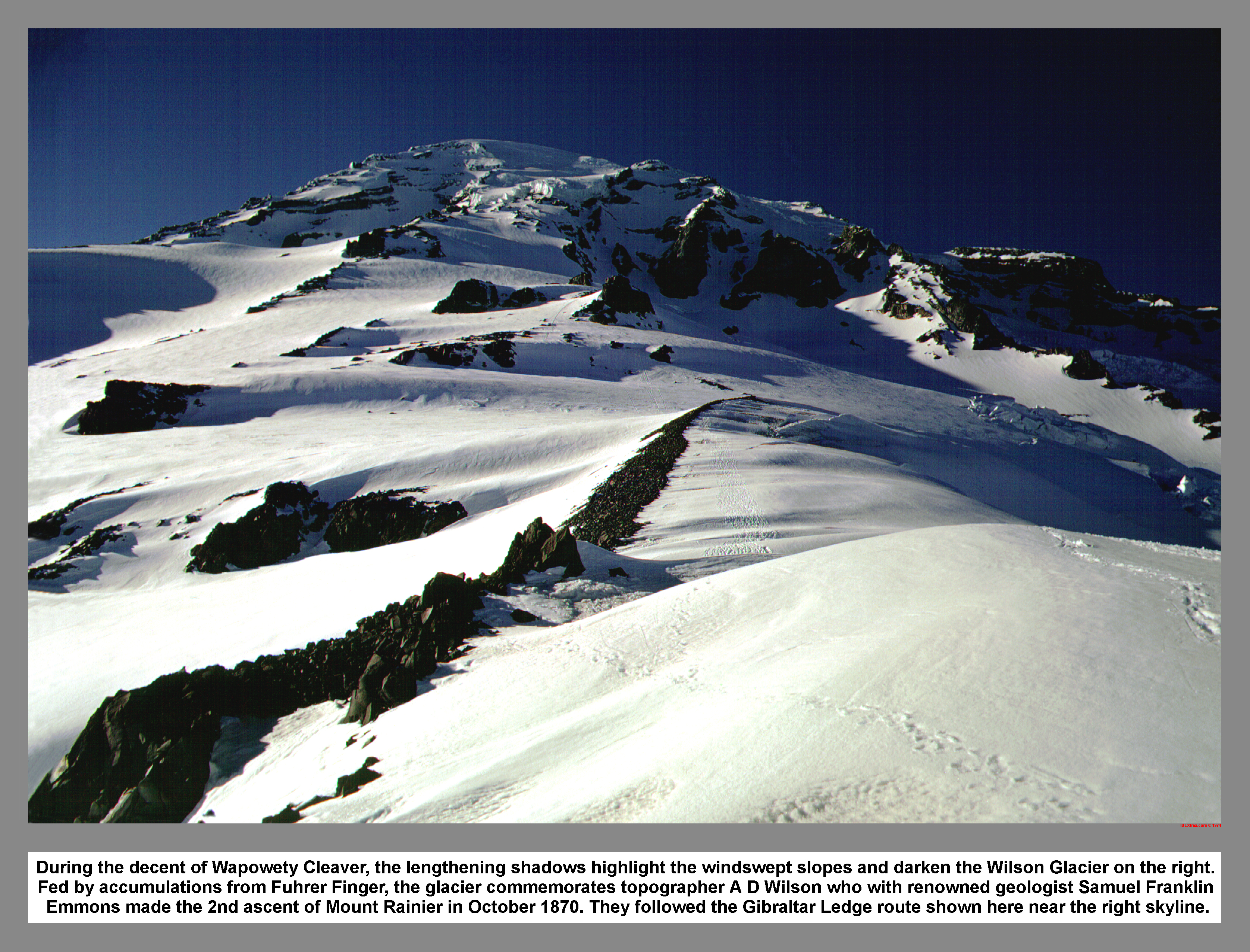
During the decent of Wapowety Cleaver, the lengthening shadows highlight the windswept slopes and darken the Wilson Glacier on the right. Fed by accumulations from Fuhrer Finger, the glacier commemorates topographer A D Wilson who with renowned geologist Samuel Franklin Emmons made the 2nd ascent of Mount Rainier in October 1870. They followed the Gibraltar Ledge route shown here near the right skyline.
03 064 Mount Rainier; Fuhrer Finger sketch
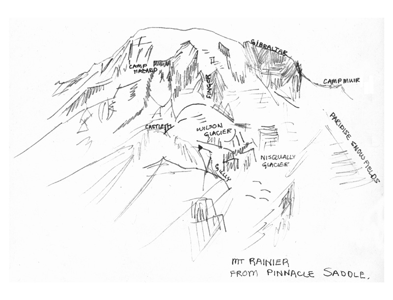
Fuhrer Finger is a narrow couloir named for Hans Fuhrer, the guide who led the first ascent on July 2, 1920. The route is the shortest to Rainier's summit as it climbs directly from the head of the Wilson Glacier to the upper crevasses of the Nisqually Glacier.
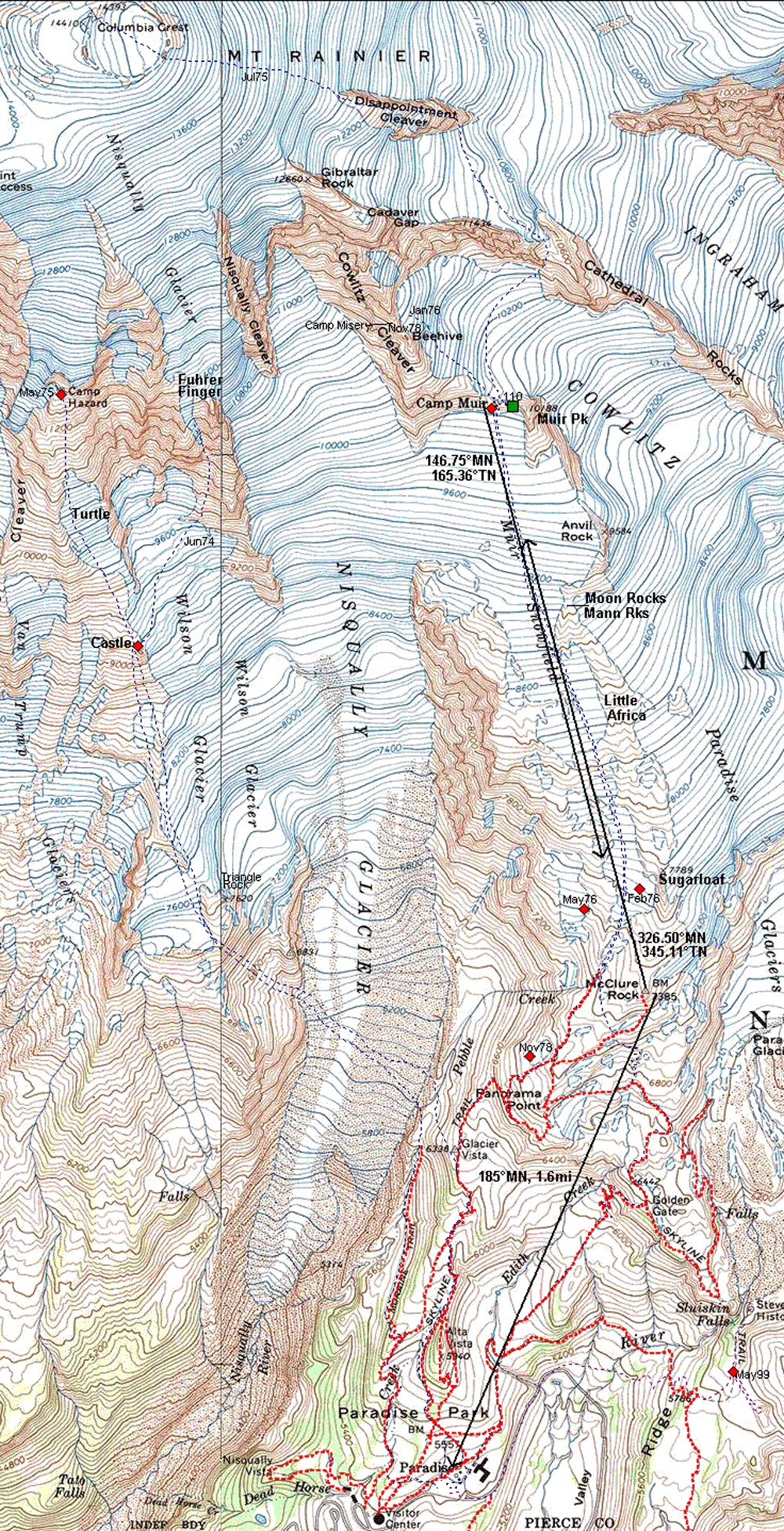
03 068m Mount Rainier South Side Map
|
|
|
|
|
|
This site created and maintained by THE IBEX - Page last revised:
|
|