
|
|
IBEXtrax.com - Cascade Mountains of Washington State
|
|
|
03 017 Red Mtn Pond camp above Commonwetitleh Basin
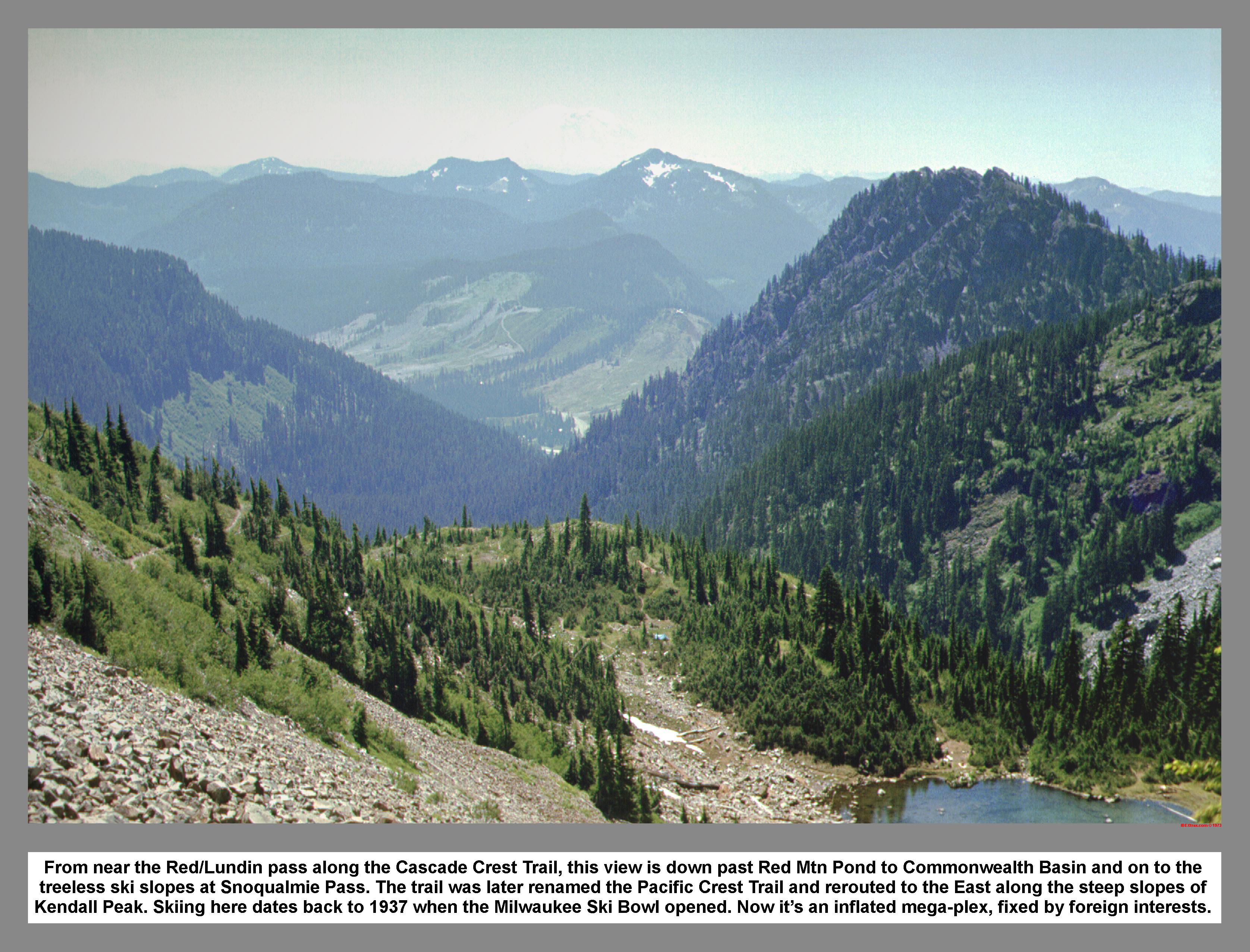
From near the Red/Lundin pass along the Cascade Crest Trail, this view is down past Red Mtn Pond to Commonwetitleh Basin and on to the treeless ski slopes at Snoqualmie Pass. The trail was later renamed the Pacific Crest Trail and rerouted to the East along the steep slopes of Kendall Peak. Skiing here dates back to 1937 when the Milwaukee Ski Bowl opened. Now it's an inflated mega-plex, fixed by foreign interests.
03 018 Mount Thompson above Gravel Lk from Red Mtn
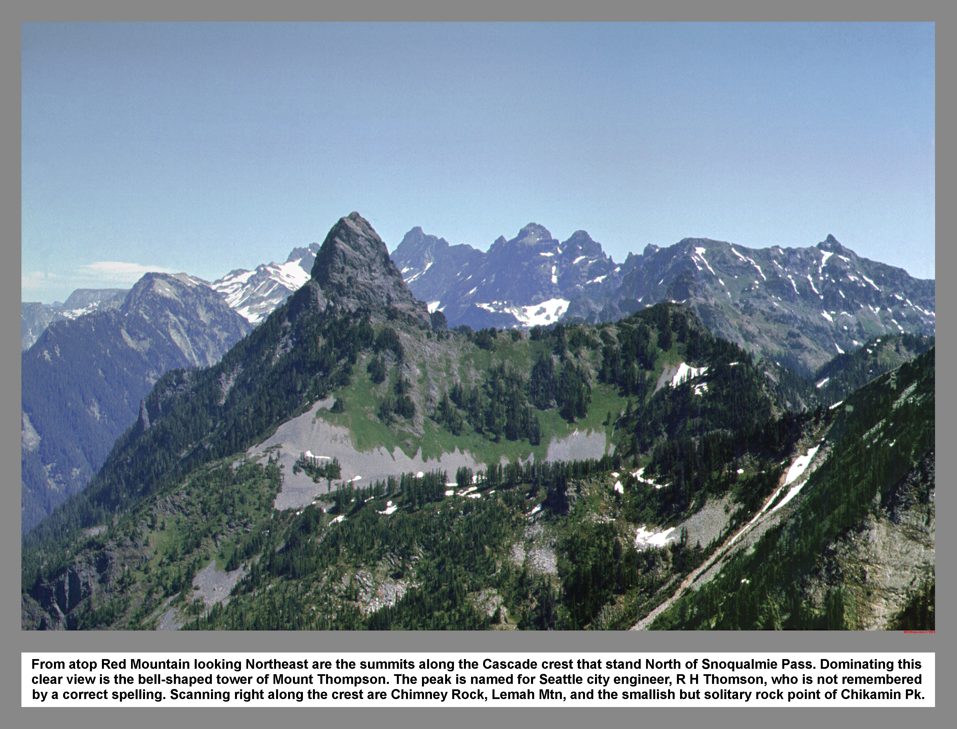
From atop Red Mountain looking Northeast are the summits along the Cascade crest that stand North of Snoqualmie Pass. Dominating this clear view is the bell-shaped tower of Mount Thompson. The peak is named for Seattle city engineer, R H Thomson, who is not remembered by a correct spelling. Scanning right along the crest are Chimney Rock, Lemah Mtn, and the smallish but solitary point of Chikamin Peak.
03 020 Lundin Peak and false summit on right

Beyond the false summit is the blocky top of Lundin Peak. The peak was once known as "Little Sister" (of Snoqualmie), then renamed to honor J. W. Lundin, one of the pioneer forest rangers of the district.
03 021 Snoqualmie Mtn Chair P Kaleetan P from Lundin Pk
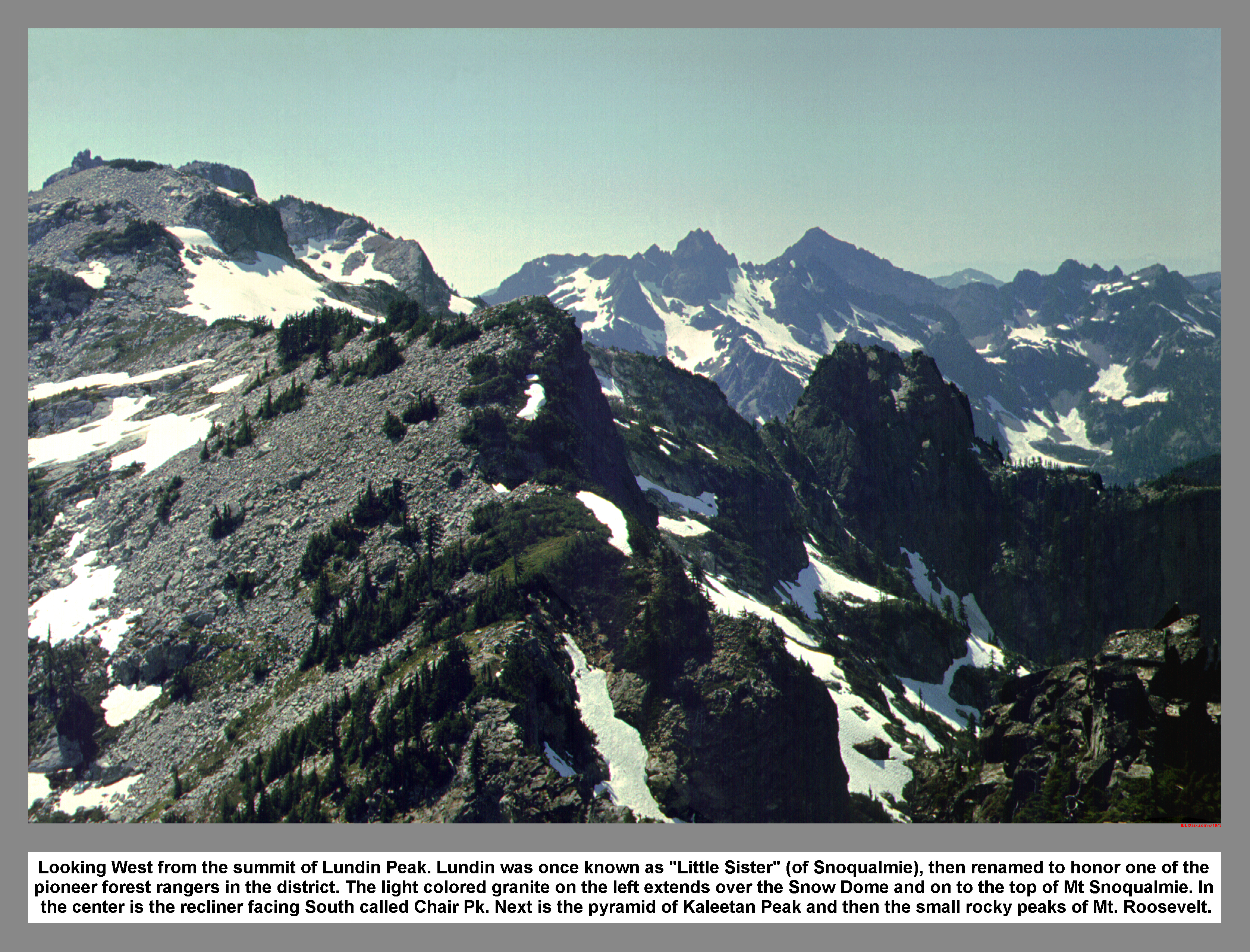
Looking West from the summit of Lundin Peak. Lundin was once known as "Little Sister" (of Snoqualmie), then renamed to honor one of the pioneer forest rangers in the district. The light colored granite on the left extends over the Snow Dome and on to the top of Mt Snoqualmie. In the center is the recliner facing South called Chair Pk. Next is the pyramid of Kaleetan Peak and then the small rocky peaks of Mt. Roosevelt.
03 022 Red Mtn Lundin Pk sketch
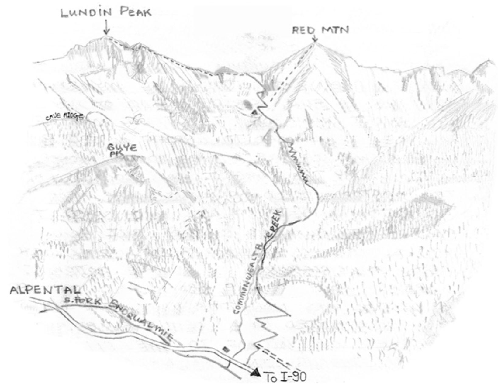
The Cascade crest trail once climbed out of Commonwealth Basin to cross Red Mtn Pass before dropping into the Middle Fork valley and going on to Dutch Miller Gap. This was all before the Kendell Katwalk was built.
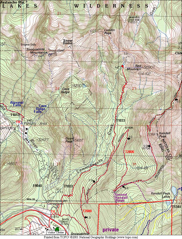
03 021m Commonwealth Basin Map
|
|
|
|
| This site created and maintained by THE IBEX - Page last revised:
|
|